Deltaic Coasts
What is a delta? How does the morphology of a delta reflect the processes acting to shape it? Why are deltas at risk?
Geologic and archeological evidence clearly indicates that a significant part of the rise of modern societies and culture can be attributed to the development of the modern world's deltas, which started forming during the slowed post-ice age sea level rise. Numerous lines of evidence indicate that well-developed societies were occupying deltas in the time frame of 4,000 to 7,000 years before present because of the many natural resources that deltaic environments generally contain. Resources such as shellfish, fish, furs, and plants were necessarily taken from the wild by our ancestors, and so many ancient societies began proximal to deltaic environments.
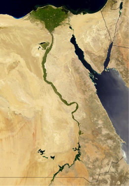
The term delta comes from Herodotus, a Greek historian, and philosopher who recognized the similarity of the upside-down Greek letter delta (Δ) and the shape of the Nile river delta when viewed from the south toward the north.
What is a delta?
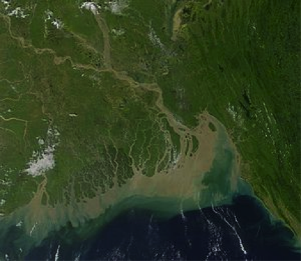
A delta is a subaerial and subaqueous volume of sediment that has accumulated at the mouth of a river as it enters into an open body of water. The largest deltas are the product of very large river systems that are transporting large quantities of sediment. The Ganges-Brahmaputra delta is one of the largest deltaic environments on the planet and carries vast amounts of sediment to the ocean. There, the sediment is reworked by strong tidal currents of the region to form inlets and sediment ridges.