
Estuary Formation
Different ways that estuaries can form include:
- Ria Estuaries: rising sea level fills an existing river valley, such as what happened to create a special case of Ria known as the Coastal Plain Chesapeake Bay Estuary of the eastern U.S.A.
- Tectonic Estuaries: tectonic deformation of the Earth’s crust, such as faulting, creates a localized depression that fills in with marine waters such as San Francisco Bay. Water depths in tectonic estuaries can be highly variable.
- Bar Built Estuaries: migrating barrier islands or spits extend across the mouth of a bay and restrict the amount of marine water entering the bay to create an estuary. They tend to be relatively shallow and typically less than 10m of water.
- Fjord Estuaries: glacially carved, U-shaped valleys that filled with marine water since the end of the last ice age. They can extend long distances 10s to 100s of kilometers and as deep as several hundred meters.
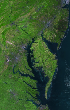
Satellite image of the coastal plain, Chesapeake Bay along the eastern U.S. The bay was formed by flooding of a river valley during the most recent post Ice Age rise in sea level during the last 10,000 years.
Credit: NASA
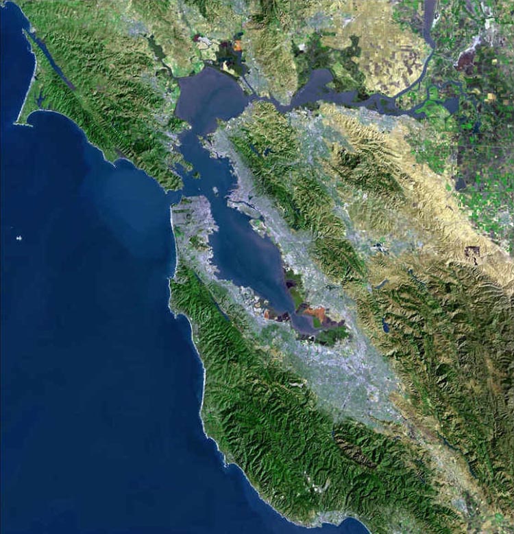
Satellite image of the tectonic San Francisco Bay Estuary, which was formed by the deformation and local subsidence of the Earth's crust.
Credit: San Francisco Bay Area courtesy of the U.S. Geological Survey via Wikimedia Commons (Public Domain)
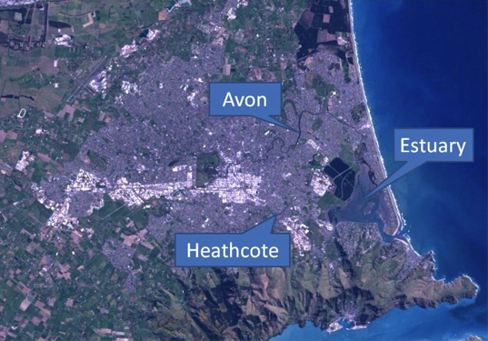
Satellite view of the bar-built Avon Heathcote Estuary New Zealand. A long barrier extends down along the front of the estuary thereby limiting the exchange of marine water into the estuary.
Credit: Christchurch, New_Zealand, NASA (author) derivative work: Wikipedia user: Schwede66. Public domain via Wikimedia Commons
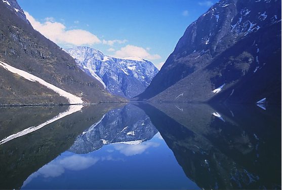
Down valley view of the Sognefjord of Norway, which is the largest fjord in Norway at 205 km and has a maximum depth of 1,300 m.
Credit: By en:User: Worldtraveller, GFDL or CC-BY-SA-3.0