
Case Study: New York City and Sea Level Rise Adaptation Planning
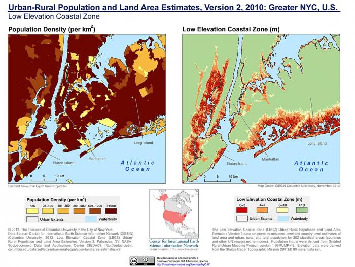
New York City has a high level of exposure to sea level rise due to its coastal location on the Hudson estuary and its barrier shoreline on the Atlantic Ocean, but its status as the most densely populated city in the U.S. makes it particularly vulnerable in comparison to other coastal cities with similar geographies. Hurricane Sandy shut down New York, cut power for days or weeks to hundreds of thousands of people, flooded homes and businesses in Manhattan, Staten Island, Queens, and many other areas, and caused $19 billion in damages and economic losses and at least 44 deaths of city residents. The New York Stock Exchange closed for two days, sending economic shockwaves worldwide. The Subway and all of the road tunnels connecting Manhattan island to the mainland were flooded and disabled. One thing Sandy also achieved was to focus public attention on the vulnerability to storm surges and sea level rise of the economic center of the U.S. In the years since Hurricane Sandy in 2012, a great deal of work has been done to address New York’s vulnerability to flooding from storm surge and sea level rise. There have been multiple proposals, plans, and strategies considered for increasing New York’s climate change resilience through adaptation.
Some of the major concerns that are being addressed in the planning process are:
- As sea levels rise the number of people living within 100-year (1% annual chance of flooding) flood zone areas will increase significantly. The number is estimated at 20 million by 2050. This will necessitate many more property buyouts such as those that took place after Hurricane Sandy.
- Water treatment plants (an estimated 40%) will be compromised by flooding, increasing the risk of contamination.
- Power plants (an estimated 60%) will need to be relocated, flood proofed, or elevated to avoid flooding, which would threaten the city’s power supply, especially during high water times.
- Transportation systems will need to be upgraded to avoid regular flooding. This includes highways, airports, bridges, tunnels, subways, and railroads.
Other areas of essential infrastructures, such as the Meadowlands in New Jersey, will flood. This area of warehouses, railroad yards, and other important commercial infrastructure is slated for conversion to a national park in the future.
Plans for addressing the increasing threats of flooding include:
- Designs for large barrier systems to protect the city by blocking the storm surges and from the Atlantic Ocean from entering New York Harbor;
- Designs for rethinking the land use of Manhattan and surrounding boroughs, returning some areas to green space.
- Increased number of property buyout projects. During the recovery period following Sandy New York state encouraged homeowners who qualified to participate in a property buy-out program, an example of managed retreat, as described in Module 9. Hundreds of homeowners, including those in Staten Island communities, chose to do so and move to safer locations and the neighborhoods where their houses once stood have been returned to nature, providing tidal flooding buffer zones.
Visit New York’s Fourth Regional Plan to read more details about how this planning process is playing out. This page addresses protecting coastal communities from storms and flooding. An important aspect included in the page linked here is ensuring that the planning process is equitable for all members of the communities it affects. The physical exposure and social exposure maps illustrate where socially at-risk communities are located in relation to the physical exposure to flooding. This consideration was discussed in Module 11 and will also be the focus of Module 13 lab. So where does New York City stand in terms of sea level rise adaptation policy after years of planning? All of the plans are at some stage in the process of becoming reality, but in many cases, they have not yet moved into implementation as the projects involve years of design and community input and are extremely expensive so full funding is hard to achieve. As outlined in the MIT Technology Review article The "mind-boggling" task of protecting New York City from rising seas, although New York is ahead of most coastal cities in climate change adaptation planning, none of the big ideas that were funded by the federal government as a result of the Rebuild by Design competition for Manhattan have actually begun construction, but we will see construction soon.
For residents of Manhattan, the focus has been on the plans to create a 10-mile perimeter of multi-use waterfront space around Lower Manhattan that includes a combination of flood protection and green space that can absorb flood waters when inundation occurs. This project began with the Rebuild by Design Competition where design companies were invited to submit proposals for flood resiliency plans for lower Manhattan. Proposals were chosen and teams formed to create the designs. The design firm Bjarke Ingels won the contract to develop the design and the proposed project became known as the “Big U”. Years of planning, design work, and community stakeholder input through facilitated workshops took place and the completed plan was presented to the city. As the video linked below outlines the city is now beginning the implementation of the plan, but with major changes, with which some of those involved in the complex planning process are not entirely happy. The video explains the steps and shows maps of the designs, which include a fringe green space around the lower part of the city, with elevated berms to hold back the water as well as lower elevations designed to flood at times of high water. Stakeholder input ensured that the needs of all sectors of the community were met. An emphasis was placed on public access so that the whole project provided recreational opportunities for city residents and visitors.
Video: The Big U | Going In With Brian Vines (9:52)
Laura Starr, Founder, Starr Whitehouse Landscape Architects, and Planners: After Hurricane Katrina, I think the entire United States was really surprised and could not believe what happened. And then when Hurricane Sandy hit the Northeast United States, I think that was a real turning point in realizing that our communities need to be built differently and we need to start building stronger.
So where we are now is the highest point of the park. And so from here, as the park slopes towards the west and towards the south and east, it starts to get lower and lower, and lower till it's really in the floodplain. When Sandy happened, maybe about 15 percent of this park was flooded and Starr White House has been working in this park for 22 years and we're very familiar with the park, its histor,y it's use and its topography. And so, you know, this became one of the many areas we focused on when we were first asked to get involved in the response to Hurricane Sandy effort.
A man speaking: Today we announced a plan unlike anything that has been done before in terms of its scope, in terms of its impact. This is a plan that will protect Lower Manhattan for the remainder of this century, all the way to 2100, and in fact beyond.
Jainey Bavishi, Director of the NYC Mayor's Office of Recovery and Resiliency: The mayor's office of resiliency is responsible for preparing the city for the unprecedented challenge of climate change and we're doing that in multiple ways. In Lower Manhattan, we have several major initiatives underway. One is the Eastside Coastal Resiliency Project which is a two and a half-mile project that runs from Montgomery Street up to East 25th Street. And then another major initiative is the Lower Manhattan Coastal Resiliency Initiative which includes four infrastructure projects that are in design, or completed, or will be moving into construction by the end of this administration, to protect 70% of lower Manhattan. And then we're also launching a master planning effort to extend the shoreline of the seaport and the financial district to protect the other 30% of Lower Manhattan. The original concept for these projects actually came from a proposal known as the Big U, which was developed by an independent design firm called the Bjakre Ingles Group. They submitted the concept to respond to the Rebuild by Design competition.
Amy Chester, Managing Director, Rebuild by Design: Rebuild by Design began after Hurricane Sandy as an initiative of HUD, which is a federal government, and President Obama's Hurricane Sandy Task Force. And the initial idea was that Rebuild by Design would be a collaborative way that communities can get together with local governments and designers, in a competition forum, to address the vulnerabilities that were exposed during Hurricane Sandy.
Laura Starr, Founder, Starr Whitehouse Landscape Architects, and Planners: If over time, we want to create this kind of higher ground along here, it's actually very complicated to figure out. How do you keep out the sea, while enabling this easy flow of people to enjoy the largest green space down here?
Amy Chester, Managing Director, Rebuild by Design: Architects and engineers and landscape architectures and scientists and academics and community specialists would come together, form teams, and compete. 148 applied and 10 were chosen.
Laura Starr, Founder, Starr Whitehouse Landscape Architects, and Planners: We were invited onto the team with Bjakre Ingles Group, with Big, to be part of their team. And the first part of the competition was to do research on different areas that had flooded, all the way from southern New Jersey to Connecticut. Quickly Lower Manhattan became the mission of the Big team. And then Big, who is so fantastic at branding, came up with The Big U to call this 10-mile u-shaped line of vulnerable areas around the shoreline of Lower Manhattan.
Amy Chester, Managing Director, Rebuild by Design: So each team then started working with specific local communities in that geography to further create what we call design opportunities.
Trevor Holland, Chair, Community Board 3, Parks and Waterfront Committee: Personally, I've been involved with Resiliency for Community birth three for almost seven years - going back actually before Sandy and after.
Man announcing: Alright everyone we are going to start the next meeting. Welcome to our Parks and Recreation (inaudible).
Trevor Holland, Chair, Community Board 3, Parks and Waterfront Committee: A lot of the work we do is to take the input from the community and sort of formulate resolutions based on the information we get. Since Sandy, we've been tasked with handling a variety of resiliency projects including the ESCR.
Laura Starr, Founder, Starr Whitehouse Landscape Architects, and Planners: Big has this huge model making operation. So we had this idea of taking the design studio to the community
Damaris Reyes, Executive Director, Good Old Lower East Side: Designers and other folks would come with preliminary designs, ask the community a bunch of questions. Then they would come back again and present, you know, how they sort of took that feedback and put it into the plan. And then ask even more questions.
Laura Starr, Founder, Starr Whitehouse Landscape Architects, and Planners: We ended up with a system of what we call integrated flood protection all along the waterfront, taking each segment and each neighborhood on its own terms.
Damaris Reyes, Executive Director, Good Old Lower East Side: Even if it was like we need to put the bike lane here, or we need to raise the berm over here, or this is the kind of programming we'd like to have, people saw that in the designs.
Amy Chester, Managing Director, Rebuild by Design: After the competition had awarded each of the projects different amounts, from ten million to three hundred and thirty five million, and the Big U got three hundred thirty-five million.
Laura Starr, Founder, Starr Whitehouse Landscape Architects, and Planners: Oh well what happened next was the city took the money and they put out a request for proposals to implement it. But they put the request for proposals out to one of the city agencies on-call engineering teams, which we were not on one of. So then now other people are working on the implementation. To have this much knowledge, and to spend this much time working on something, and to sort of, as Big calls me, the Midwife of the Big U, you know to have that role and then to be, you know, not able to work on it, it's a shame.
Woman, name unknown: I think it's important to realize that the Big U was a concept. The Big U inspired the eastside coastal resiliency project. The city has moved forward with planning and engineering analysis for that project, so this plan that were proposed, that we're presenting now, takes that conversation forward and proposes projects that we can actually implement.
Damaris Reyes, Executive Director, Good Old Lower East Side: We'd really gotten really far with finally working in partnership with some of the city agencies and other folks, seeing real dollars put behind our ideas, until the project was about to go into the city's uniform land-use review process. They were just about to start that process when everything stopped. And everything went quiet until September. And in September they came back with an entirely different design and everybody went crazy.
Man speaking (inaudible)
Diane Lake, Community Resident: The city and the community collaborated for about five years on a plan, a resiliency plan, that would be really effective, that would really keep the neighborhood safe. But then abruptly,with no warning, it was set aside and a new plan was put in place that calls for the complete closure of almost three miles of coastline and parkland. So all of that space will suddenly be unavailable, they're saying for three and a half years, but I think you're heard tonight that we're afraid it's gonna be more like six, seven, ten.
Damaris Reyes, Executive Director, Good Old Lower East Side: We have a very torn apart community behind this new design. They feel that trees are gonna be killed, species are gonna be killed.
Jainey Bavishi, Director of the NYC Mayor's Office of Recovery and Resiliency: We want to make sure that, you know, the community has a chance to shape exactly what that looks like and also provide input on what other benefits they would like to see as part of these projects. East Side Coastal Resiliency is a great example of this. Not only will the community get the flood protection that they really need, but also they'll have improved waterfront access. We're rebuilding several of the pedestrian bridges that go over the FDR into the East River Park and they'll have a new Park.
Trevor Holland, Chair, Community Board 3, Parks and Waterfront Committee: I think people need to examine, okay the city did flip the plan but is it actually a better plan? I think we've gotten to a point now where we still have problems with the way the city handled this, but we've looked at the plan and we've looked at the benefits of plan and said that with some mitigations, and some concessions, that it may actually be a better plan for the community.
Damaris Reyes, Executive Director, Good Old Lower East Side: So we were told a bunch of different reasons why it needed to be changed. The problem was that we were told after. We weren't consulted, we weren't included, and people felt very disrespected.
Diane Lake, Community Resident: We want them to listen to us about how important that open space is for us, particularly for our seniors and our kids, and work together with us to come up with a modification of this plan that looks out for those people, rather than just shoving this plan down our throats.\
Damaris Reyes, Executive Director, Good Old Lower East Side: You know I live right across the street from the highway in the East River and I saw the water come in and we were traumatized. So I know that there's no option for me that includes no flood protection. Like I cannot live with leave the park alone and don't do anything. I can't live through that again.
The video provides a good example of how adaptation planning with stakeholder participation works. The New York City government made some executive decisions after the planning process was completed that changed the plans significantly. The changes removed some of the components involving allowing flooding of park areas in times of high water, preferring elevated berms over intentional lower elevations and natural habitats. It will be interesting to see how the plans are finally implemented, how the public feels about the results, and how the project as a whole and its component parts perform when high water affects lower Manhattan, as a result of a storm surge or the inevitable higher tides in the upcoming years.