
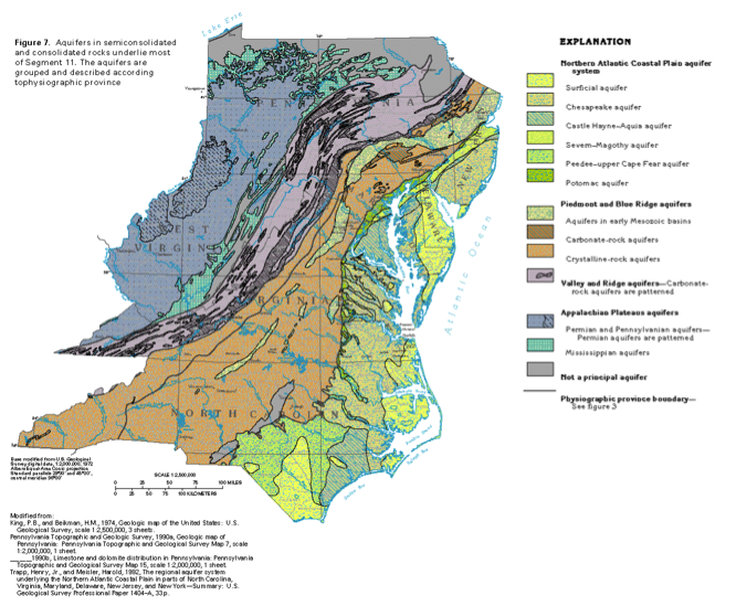
Valley and Ridge Aquifer System
The Valley and Ridge aquifer system extends SW-NE across Central PA, West VA, and VA (Figure 19, purple area), and is the main water supply for much of this region. It is composed of layered Paleozoic sedimentary strata (shales, sandstones, and limestones) that were folded and deformed by a series tectonic collisions over 200 million years ago. The modern valleys in the Valley and Ridge province have formed where limestone, which is most susceptible to erosion, was exposed in the core of anticlines, or upfolds (Figure 20). The more resistant sandstones and shales form the regional ridges, like Mt. Nittany and Bald Eagle Ridge.
The principal aquifer unit in this system is the fractured limestone that underlies the valleys. As noted above, because it is fractured, it recharges rapidly, has a high fracture permeability, and wells drilled along the fractures are highly productive (c.f. Figure 17). Recharge is focused on the flanks of the ridges, where runoff flows over the less permeable shale and sandstone units and enters the groundwater through fractures or sinkholes above the limestone at the valley edges. Groundwater flow is generally toward the center of the valleys, and springs commonly feed the surface water systems. The water is characterized by a high hardness (Mg and Ca content; we’ll cover this in more detail in Module 7), derived from limestone dissolution. Dissolution of the limestone has formed extensive karst features (caves, caverns, sinkholes) throughout the region.
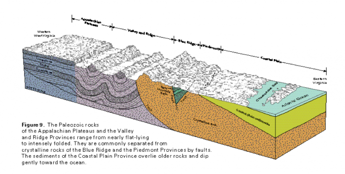
The Paleozoic rocks of the Appalachian Plateaus and the Valley and Ridge Provinces range from nearly flat-lying to intensely folded They are commonly separated from crystalline rocks of the Blue Ridge and the Piedmont Provinces by faults. The sediments of the Coastal Plain Province overlie older rocks and dip gently toward the ocean.