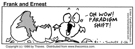
Lesson 2: The Giants of Science
Overview
In Lesson 1, we read a brief history of the basic research that led to the formulation of plate tectonics. In this lesson, research the life and scientific contributions of the scientist of your choice. The goal is to explain to your classmates how your scientist contributed to our modern view of the solid Earth.
I like the idea of starting this course with some exploration of the history of plate tectonics because it is such a young theory. In addition, if you probe a little farther you'll find that we knew a lot about the Earth before plate tectonics pulled it all together. I think it is pretty impressive to contemplate some of the observations made decades ago when scientists had nothing like the equipment capabilities for measurement and computation that we have available to us now.
I also think this is the perfect opportunity to get to know each other better by reading each other's work.
What will we learn in Lesson 2?
By the end of Lesson 2, you should be able to:
- edit a Web page in Canvas
- research the contribution to our knowledge of the solid Earth made by a particular scientist
- explain the technological advances that improved geological observations of plate motions
- describe the differences between the concepts of "continental drift," "sea-floor spreading," and "plate tectonics"
- define and explain the following terminology: plate, lithosphere, asthenosphere, crust, mantle
What is due for Lesson 2?
The table below provides an overview of the requirements for Lesson 2. For assignment details, refer to the lesson page noted.
Lesson 2 will take us two weeks to complete. 27 May - 9 Jun 2020
| Requirements | Submitted for Grading? | Due Date |
|---|---|---|
| Choose your scientist. | No | |
| Research your scientist. | No | |
| Create your Web page. | Yes - create content in Canvas. (Your content will be graded after you've had time to reflect on it and revise it.) | 2 Jun 2020 |
| Requirements | Submitted for Grading? | Due Date |
|---|---|---|
| Respond to the Web pages made by your classmates. | Yes - Use the Canvas Lesson 2 peer review discussion boards. Your thoughtful critique will be part of your grade. | multiple participation spanning 3 - 9 Jun 2020 |
| Revise your page in response to comments and reflections. | Yes - your final content will be graded. | 9 Jun 2020 |
Questions?
If you have any questions, please post them to our Questions? Discussion Forum (not e-mail). I will check that discussion forum daily to respond. While you are there, feel free to post your own responses if you, too, are able to help out a classmate.
Contracting Earth v. Continental Drift v. Plate Tectonics
Even though the point of this lesson is for you to create your own knowledge, I think it is worth me giving you the one-page summary as I see it of the history of plate tectonics. Your job is to focus on a scientist who contributed to our current knowledge of how the solid Earth works, but here I will give you a synopsis of how the prevailing wisdom changed gradually from about the time Wegener published "The Origin of the Continents and Oceans" in 1915 up until 1968 which is approximately when Plate Tectonics became the standard.
Contracting Earth theory (early 20th century)
In the early 20th century the prevailing wisdom regarding how mountain belts were formed and why the sea is deep was that the Earth started out as a molten blob and gradually cooled. When it cooled, heavier metals such as iron sank down and formed the core, while lighter metals such as aluminum stayed up in the crust. The cooling also caused contraction and the pressure produced by contraction caused some parts of the crust to buckle upwards, forming mountains. Other parts of the crust buckled downwards, creating ocean basins. Picture in your mind a grape turning into a raisin as it dries out.
Video: Contracting Earth Hypothesis (1:21)
Click here for transcript
Before Alfred Wegener came along and proposed continental drift, the prevailing wisdom of how the Earth’s topography was created was based on the hypothesis that the Earth had contracted from its original state as a molten blob. So you can kind of imagine a grape turning into a raisin and see how this raisin has some mountain belts and some deep valleys which could be like the ocean floor, maybe.
This model has 2 big predictions that we can test with observations, and one of them is that the crust can’t move horizontally, it can only move vertically. The pressure caused by contraction causes some places to uplift and some places to buckle downward, but they don’t move from side to side, right. And the other prediction which is a little more subtle, I think if you look at a handful of raisins you’ll see what I mean. And that is that all of the elevations are normally distributed about some mean elevation. So what I mean is that if you can picture all of the different elevations, high and low, on the surface of this raisin, there should be basically a bell curve of elevations and the middle of that bell curve would be the sort of average elevation.
And we can actually test both of these predictions and we’ll see why they don’t work. Ultimately that’s one of the reasons why the contracting Earth hypothesis has to be rejected.
Isostasy
The contracting Earth hypothesis was further refined by introducing isostasy. Isostasy is the concept that all elements in a system are in hydrodynamic equilibrium or trying to get there. For example, if you have a bathtub of water, a chunk of balsa wood floats higher than an ice cube because balsa wood is less dense than ice. If you were to push the balsa wood down, it would pop back up when you took your hand away. The popping back up is the balsa wood bringing itself back into equilibrium. It happens very fast because water has low viscosity. Now, what if you had a bathtub full of molasses instead of water? When you push the balsa wood down, it will indeed rise back up again after you take your hand away but it will happen more slowly because molasses is more viscous than water.
What does this have to do with the Earth? Well, the pre-continental drift idea went like this. Heavy parts of the crust sank down and lighter parts raised up not only due to the pressure of contraction but also due to isostatic adjustments. The interior of the Earth was thought to be a viscous fluid that could accommodate this sinking and rising. This was the proposed mechanism favored by paleontologists who thought the reason identical fossil species were found on continents separated by oceans was that there had been connecting land bridges that sank.
Now, in fact, it is true that isostasy does govern mountain elevations. In fact, most mountain belts have a "root" like the keel of a boat and over long timescales, the mantle, in fact, does flow viscously, but the mantle is solid rock, not a fluid. Land bridges did not sink down into the mantle. That part is wrong.
Video: Isostasy (1:25)
Click here for transcript
So this little schematic drawing kind of shows the parts of isostasy that are right and the parts that aren’t right at the same time. See how this is a cross-section of the Earth and here’s a continent and then this is the sea floor. And you can see that this mountain belt has a root underneath it. This is right. This is a pretty good cross section of what the crust looks like.
The idea for how you end up with ocean in between two continents for some people was, well, ok, you have this bit of continental crust and it sank down into the mantle, and now these two things are separated by ocean. But let’s remember that the contracting Earth hypothesis didn’t allow for any lateral motion of the crust, only vertical motion. So, it leaves you to wonder how this ocean crust could get here. Where did it come from? If you have this land that sinks down, and now you have some ocean crust that pops up, how could you do that if all you can have is vertical motion? Well, you can’t. It doesn’t work, and so this is one of the limitations of this hypothesis and it was mechanical problems like this that people just swept under the rug because they couldn’t explain them and so they just didn’t think about it anymore.
Enter Alfred Wegener
So, this is where Wegener comes in. He had a Ph.D. in astronomy but most of his scientific contributions were in meteorology. He became very well known in his own lifetime as an explorer of Greenland and as a meteorologist. In fact, he died in 1950 while leading an expedition across Greenland.
His interest in geology was basically a sidelight to his regular academic career and he had no training in geology. He assembled circumstantial evidence for his idea that the continents had once been joined. Let's examine that circumstantial evidence.
Jigsaw puzzle fit
Alfred Wegener was not the first person to notice that the continents fit together across the Atlantic Ocean. In fact, in the 1500s and 1600s when reliable maps of the east coasts of North and South America were produced, this feature was obvious. I've always thought that this piece of evidence has a little bit of Western ego attached to it. For example, if you look at a map centered on the Pacific Ocean, do you notice anything? No, not really, because there is a complete absence of anything that looks like a jigsaw puzzle fit there.
Rock types and geologic structures
If you fit the continents back together the way the "jigsaw puzzle fit" suggests you should do it, then you'll see that rock ages, rock types, and mountain belts match up across the boundaries between continents (sketch below). In fact, other scientists have likened this to taking two halves of a newspaper torn lengthwise and fitting it back together so the sentences can once more be read across the tear.

Fossil evidence
Fossils of terrestrial plants and animals identical to each other were found on continents now separated by water. Could seeds be dispersed across an ocean by wind, water, or animal activity? Could animals that don't look like swimmers (see the Lystrosaurus below for example) get across an ocean some other way? Some people suggested the sinking land bridge idea, but we've already discussed the mechanical problems with that model. Others suggested mats of vegetation that could have drifted across the ocean carrying plants and animals to a new continent.

Evidence of ancient climates
Under the assumption that the kinds of climates that would form particular rock types and structures are similar today as they were millions of years ago, we can infer the past climate of a locality from studying its geology. If, for example, you find evidence of glaciation in a place that is now temperate and not ice-covered (such as Southern Africa), you are left to infer that the climate of the whole world was different, or else that Southern Africa was a lot farther from the equator when that glaciation happened than it is today. Alfred Wegener made a lot of contributions to these types of observations since meteorology and glaciology were his fields. Upon fitting the continents together as he proposed (sketch below), glacial striations found on now-separated land masses even looked like they radiated out from a common source.

Statistical Analysis of Topography
Remember back at the top of the page when we were examining the raisin? I said that with a raisin, even though the surface of the raisin is all wrinkly, the highs and lows of the surface are likely to be normally distributed about some mean value. If the contracting Earth hypothesis were true, one observation it predicts is that Earth's topography would be normally distributed about some mean also. We can check this out! When we do, we find that Earth's topography is not normally distributed, which leads us to the important conclusion that continental crust and oceanic crust are fundamentally different from each other (see my screencast explanation below). The realization that oceanic and continental crusts are different from each other was a huge leap towards figuring out sea-floor spreading and plate tectonics.
Video: Analysis of Earth's Topography (1:14)
If the contracting earth hypothesis were true then what you would expect is a random distribution of elevations at the surface. So, on this plot, I’ve got elevation on the y-axis and the thick line represents sea level. I’ve got an arbitrary frequency on the x-axis. Here’s what a random distribution would look like. In fact, the mean elevation on Earth is actually at about 2km below sea level. If the contracting Earth hypothesis were right, this distribution is what we’d expect to find. But this isn’t the real distribution. The real distribution looks like this. It’s bimodal. There are two peaks. One is near sea level, which is the average elevation of continents. The other one is a peak at almost -5 kilometers that corresponds to the abyssal seafloor. Statistically what this tells you is that the process by which these elevations are distributed is not random. In fact, there are probably two different processes, one that makes continental crust and one that makes oceanic crust. Once you take that into account, you realize that the contracting Earth hypothesis doesn’t really work very well.
Lack of mechanism for continental drift
Circumstantial evidence is just not enough! Each piece of Wegener's evidence was dismissed at the time because he couldn't come up with a physical mechanism that would work to move continents laterally apart from each other. I also think no small part of it is that scientists don't necessarily love it when outsiders to the subdiscipline come in with a novel idea. (True 100 years ago, true today.) Since Wegener was trained as a meteorologist, many geophysicists were skeptical of his ideas right from the start.
Video: Lack of Mechanism for Continental Drift (1:50)
Wegener knew that the sinking land bridge idea would violate isostasy and so he thought the continents did actually move apart from each other. His mechanism for how this would work is shown in this little sketch here where you’ve got continents and some sea floor. He actually thought continents would plow through the sea floor because the mantle is viscous. The problem with this is that the frictional resistance that you’d encounter when pushing a giant continent over the ocean floor is enormous. Think about trying to push a carpet across your floor just by shoving on one end of it. It wouldn’t work. You’d never be able to do it. Not only that but his idea that solid Earth tides would drive this didn’t really work either because some of the geophysicists like Harold Jeffreys calculated that if solid Earth tides were strong enough to move continents then actually the Earth’s rotation would stop in less than a year and also some mountains would probably collapse under their own weight. So the geophysicists knew that his model wasn’t going to work but they basically just dismissed the fact that the contracting Earth hypothesis had a bunch of internal contradictions and it couldn’t work either. It’s a little bit surprising, actually, that nobody kept hammering at that actually. Arthur Holmes proposed around this same time that convection in the mantle would drive continents to move and that’s not so far wrong from our picture today but it’s interesting that nobody took that idea and ran with it back then.
Conceptual sketch of plate tectonics
Video: Conceptual Sketch of Plate Tectonics (1:14)
This sketch is much closer to our conception of how plate tectonics actually works. I make a distinction between plate tectonics and continental drift because I think continental drift specifically refers to Wegener’s hypothesis which didn’t have a mechanism and therefore you can’t really call it a valid theory because it wasn’t accepted by other scientists and it did have some things wrong with it. Plate tectonics is a theory. And it works to explain most of the rest of the phenomena that we’re going to talk about in this course. In this sketch the mantle’s down here, here’s a couple of continents, and the sea floor, but now you can notice that sea-floor spreading is the mechanism by which new crust is created, so there’s a big sea-floor spreading center in the middle of the ocean floor, for example, pushing the continents on either side of it away so the ocean gets bigger. The Earth remains the same size. That means if you create new crust, then crust has to be consumed somewhere else, and we take care of this with a subduction zone like the one shown here where sea floor goes down and gets recycled into the mantle. So this is just a sketch and we will flesh out more about how this works as this course progresses.
Why so slow?
I think it is interesting to consider how long the plate tectonics revolution took to unfold. Consider that Wegener published "Origin of the Continents and Oceans" in 1915 in which he laid out the circumstantial evidence that indicated the continents had once been joined, but plate tectonics was not accepted as a theory until about 1968. Let's put that length of time into human perspective:
Check Your Understanding - Question 1
How many US presidents were there between 1915 and 1968?
Click for answer
Nine: Wilson, Harding, Coolidge, Hoover, Roosevelt, Truman, Eisenhower, Kennedy, and Johnson.
Check Your Understanding - Question 2
How many times did the Yankees win the World Series between 1915 and 1968?
Click for answer
The Yankees won the World Series twenty times between 1915 and 1968: 1923, 1927, 1928, 1932, 1936, 1937, 1938, 1939, 1941, 1943, 1947, 1949, 1950, 1951, 1952, 1953, 1956, 1958, 1961, and 1962. Just in case any of you were under the false impression that it's only recently that the Yankees have been treating all the other Major League teams as their own personal farm system, nope; it's how they've always operated. : )
Check Your Understanding - Question 3
How long had Joe Paterno been coaching at Penn State by 1968?
Click for answer
JoePa was hired as an assistant coach here @ PSU in 1950. Yes, he coached 18 years before plate tectonics!
Choose your Scientist
Directions
-
First, you need to pick a scientist. I have made a list of scientists below, but you are not limited to this list. Once you have decided on one, go into the Canvas lesson 2 space and find the pages that are now titled "scientist 1","scientist 2", etc. Go in and edit one of them so that the name of your scientist and your own name appear at the top. Then I'll go in and change the page title. This way other students will know who has been picked already.
Pick me! Pick me! Some possible Scientists for Lesson 2:
- Don Anderson
Tanya Atwater- Brian Atwater
- Francis Bacon
- Markus Båth
Hugo Benioff- Bernard Bruhnes
- Teddy Bullard
- Allan Cox
- Brent Dalrymple
- Charles Darwin
- Arthur Day
- Robert Dietz
- Richard Doell
- Maurice Ewing
- Beno Gutenberg
- Edmond Halley
- Harry Hess
- Arthur Holmes
- Bryan Isacks
- Thomas Jaggar
- Harold Jeffreys
- Tom Jordan
- Brian Kennett
- Inge Lehmann
- Xavier le Pichon
- Drummond Matthews
- Motonori Matuyama
- Dan McKenzie
- Felix Andries Vening Meinesz
- Giuseppe Mercalli
- John Milne
- Andrija Mohorovičić
- W. Jason Morgan
- Lawrence Morley
- Richard Dixon Oldham
- Jack Oliver
- Fusakichi Omori
- Bob Parker
- Harry Reid
- Charles Richter
- Keith Runcorn
- Chris Scholz
- Eduard Suess
- Lynn Sykes
Marie Tharp- Alex du Toit
Frederick Vine- Kiyoo Wadati
- Alfred Wegener
John Tuzo Wilson- Peter Alfred Ziegler
-
Once you have chosen a scientist, you need to spend a little time researching the life and times of whoever you chose. Best practice is to find and read a paper they wrote. I can help you traverse the Penn State Library for this task if you need help.
-
Next, populate your page in Canvas with information and images. The editor is pretty user friendly; post to Questions? if you have trouble. Please include links and citations to all the places where you found borrowed graphics and other information. Check out some of the papers on the Additional Resources page of this lesson (penultimate page) for more background on plate tectonics or to get some inspiration for this assignment. If your chosen scientist is still among the living, feel free to contact him/her. Former students have had some wonderful correspondences with the scientists they chose. Geoscientists are a friendly bunch.
Submitting your work
This lesson is two weeks in length. You need to complete your Web page by the last day of this first week of this lesson (see the Overview page for the date). That will enable us to spend the next week (Week 2 of this lesson) reflecting, reviewing, and revising.
Grading criteria
Your grade for this activity will be based on both the quality of your site, as well as on your thoughtfulness during the discussion portion of this lesson.
Response, Reflection, and Revision
Peer Review
Directions
Now that you have completed your own Web page, I want you to read the Web pages of your classmates and post your comments or questions. To do that, go to Module 2 in Canvas. There you will see I have made n new discussions where n = number of students in Earth 520. The discussions are labeled with the names of the scientists you all chose. The comments and questions should include interesting insights you may have gained from your fellow students' presentations, questions you might like them to answer, or something you want them to clarify.
Submitting your work
This is a graded activity. I would like to see each of you, individually, post at least one thoughtful comment or question to each of the other students' Web pages.
You may (should!) revise your own page in response to the critiques of your classmates. The final due date for the completed Web pages is the last day of lesson 2 (see the Overview page).
Note:
Do NOT edit/change any part of another student's page. You can't get away with this even if you try, because as the course editor, I can see who has logged in and made revisions to any page :-)
Grading criteria
As with other online discussions in this course, you will be graded on the quality of your participation. See the grading rubric for specifics on how this assignment will be graded.
Resources
Here are some optional resources linked from our Canvas space. You may wish to skim these to get some details about the work done by the scientist you are researching.
- Like a Soup Plate on the Ground (1969). Nature 224, pp. 107-108.
- Hess, H. (1962). History of Ocean Basins. In Petrologic Studies: A Volume to Honor A. F. Buddington, pp. 599-620.
- Hallam, A. (1975). Alfred Wegener and the Hypothesis of Continental Drift. Scientific American 232, pp. 88-97.
- Chase, C. G., E. M. Herron,& W. R. Normark. (1975). Plate Tectonics: Commotion in the ocean and continental consequences. Annu Rev. Earth Planet Sci. 3, pp. 271-291.
Tell us about it!
Do you have another reading or Web site on these topics that you have found useful? Share it in the peer review discussions and cite it on your Web page!
Summary and Final Tasks
Hopefully we've all taught each other something new about the history of the plate tectonics revolution and some of the scientists involved. As an aside, I also hope that you've all become pretty familiar with the Web environment of this course.
Reminder - Complete all of the lesson tasks!
You have finished Lesson 2. Double-check the list of requirements on the Lesson 2 Overview page to make sure you have completed all of the activities listed there before beginning the next lesson.