Unit 5, Lesson 9: Landforms (2)
Lesson 9 Introduction
In the last lesson, you were introduced to the concept of the Critical Zone as a feed-through reactor (Anderson et al., 2007). As we move forward in this unit, I first want you to consider the relationship between the feed-through reactor and isostasy [1]. Imagine a mountainous setting in which active erosion constantly removes weathered material from the summits: the unloading of weathered material allows the underlying crust to readjust by uplift, thereby physically raising unweathered rock rapidly into the feed-through reactor. Eventually, the landscape may mature to one with low topography and little relief as the deep crustal root has been exposed, weathered, and brought toward isostatic equilibrium with the underlying mantle. Thick soil profiles develop and blanket underlying unweathered rock, slowing the rate at which the unweathered rock is processed through the reactor. Furthermore, recall from Lesson 2 (reading Brady and Weil, pp. 41–2 and 61–2) that topography is the configuration of the land surface described in terms of elevation, slope, and landscape position differences, and that topography can hasten or retard the effects of climate on parent material-weathering by creating a balance between erosion and pedogenesis.
Because topography often reflects the distribution of different parent materials in many landscapes, detailed soil maps can be useful for interpreting geology, and geological maps can in places be made directly from soil maps [Birkeland, P. W. (1999). Soils and Geomorphology (3rd ed.). New York: Oxford University Press, p. 31]. Mappable soil bodies typically display patterns of distribution based on underlying bedrock and landforms—to fully understand soils one must make an in-depth assessment of geomorphic settings (Birkeland, p. 49, p. 1).
Having considered the variables associated with bedrock type, the rock cycle, tectonic setting, weathering and erosion in the last lesson, now we will explore geomorphic environments and the processes that can move and shape them to learn about the links between landforms, soils, and the Critical Zone. I'll remind you here, as I did in Lesson 2, to consider the outstanding question in Critical Zone science learned in a Lesson 1 reading (Brantley et al., p. 11): Can a unified approach be developed to characterize environmental conditions and mechanisms that produce different soil types?
What will we learn about in Lesson 9?
- Geomorphology and the relationship between topography and soil formation
- Coastal processes and landforms
- Karst processes and landforms
- Glacial and periglacial processes and landforms
- Wind processes and landforms
- Fluvial processes and landforms
- Aerial photographic analysis of landforms
Learning Objectives
By the end of this lesson you should be able to:
- Discuss the notion of the Critical Zone as a feed-through reactor
- Describe a soil catena and the influence of slope and aspect on pedogenesis
- Define fluvial, eolian, periglacial and karst
- Describe and identify some features and processes characteristic of five generalized geomorphic environments
- Find remotely sensed imagery, specifically aerial photographs, for your study site
What is due for Lesson 9?
Lesson 9 will take us one week to complete. As you work your way through these online materials for Lesson 9, you will encounter additional reading assignments and hands-on exercises and activities. The chart below provides an overview of the requirements for Lesson 9. For assignment details, refer to the lesson page noted.
Please refer to the Calendar in Canvas for specific time frames and due dates.
| ACTIVITY | LOCATION | SUBMISSION INFORMATION |
|---|---|---|
| Report (1 page) on topography and feed-through reactor at your study site | page 2 | Post to the Lesson 9 - Catena dropbox in Canvas |
|
Respond to question on aerial photo availability in your state Report (1 page) on aerial photo analysis |
page 8 |
Email directly to Tim Post to the Lesson 9 - Aerial Photo dropbox in Canvas |
Questions?
If you have any questions, please post them to our Questions? discussion forum (not e-mail), located under the Discussions tab in Canvas. I will check that discussion forum daily to respond. While you are there, feel free to post your own responses if you, too, are able to help out a classmate.
Geomorphology
A remarkable aspect of Earth's surface is the seemingly infinite variety of landforms. However, some landforms possess certain characteristics that differentiate them from other landforms, a fact that is fundamental to geomorphology [2], the field-oriented study of landforms at the interface between geology and many other disciplines working to understand surface processes. The applications of geomorphic knowledge can range from engineering projects dealing with the physical properties of landforms to geological studies of the record of past climate change recorded by landforms. It is this overall lack of rigid philosophical boundaries that may be geomorphology's greatest attribute—interdisciplinarity (Ritter, D. et al., 2002, Process Geomorphology, 4th edition, p. 1–2).
Diversity in the Critical Zone is displayed by the distribution of soils across landforms, reflecting variable chemical and mechanical weathering processes as well as physical erosion and chemical denudation. These processes, in turn, control the internal structure of the Critical Zone, the feed-through reactor of Anderson et al. (2007), through which changes in surface area, flow paths, and material residence time impact element and nutrient weathering fluxes.
Activity
In succeeding sections 3 through 7 we will explore five classes of geomorphic environments and the processes that occur with them. Before we launch into this more detailed study, I want you to more fully understand basic concepts of topography, including the influence of slope orientation or aspect on pedogenesis, by completing the following activity.
Directions
NOTE:
For this assignment, you will need to record your work on a word processing document. Your work must be submitted in Word (.doc) or PDF (.pdf) format so I can open it. In addition, documents must be double-spaced and typed in 12 point Times Roman font.- Read the following book selection, which is available online through Library Reserves:
- Chapter 9 in Birkeland, P. W. (1999). Soils and Geomorphology (3rd ed.). New York: Oxford University Press.
You should leave the reading with a firm grasp of the soil catena concept. As you progress through the reading, consider the effects of topography on your soil study site. Also, think how the feed-through reactor and chemical weathering fluxes might operate in your soil study site and how it might vary between nearby environments.
- Chapter 9 in Birkeland, P. W. (1999). Soils and Geomorphology (3rd ed.). New York: Oxford University Press.
- Record your thoughts (from step 1) in the form of a one-page paper.
- Save your paper as either a Microsoft Word or PDF file in the following format:
L9_catena _AccessAccountID_LastName.doc (or .pdf).
For example, student Elvis Aaron Presley's file would be named "L9_catena _eap1_presley.doc"—this naming convention is important, as it will help me make sure I match each submission up with the right student!
Submitting your work
Upload your paper to the "Lesson 9 - Catena" dropbox in Canvas (see the Modules tab) by the due date indicated on our Canvas calendar.
Grading criteria
You will be graded on the quality of your writing. You should not simply write responses to the questions and submit them to me. Instead plan on writing a short stand-alone paragraph (or page or whatever you decide is necessary considering any constraints I might have placed on you) so that anyone can read what you've written and understood it. You should strive to be specific and complete in responding to the questions. Your answers should be analytic, thoughtful and insightful, and should provide an insightful connection between ideas. The writing should be tight and crisp with varied sentence structure and a serious, professional tone.
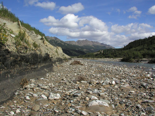
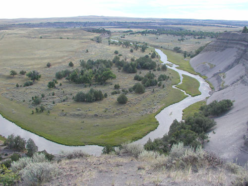
Fluvial Processes and Landforms
Reading assignment
Complete the following reading assignments:
- The ubiquity of streams makes fluvial action probably the most important geomorphic agent. The following hyperlink gives a good general overview of fluvial landforms and processes, beginning with what should be a reminder to you about the hydrologic cycle and surface runoff. The Web site then provides a characterization of the parts and types of rivers, drainage patterns, fluvial processes of erosion, deposition, saltation, solution, and suspension, and erosional and depositional landforms.
- The next hyperlink overlaps somewhat with the first one you visited. While studying this site, do not concern yourself with mentions of specific drainage basins unless they are of interest to you. You can peruse the section on river types and drainage basin patterns for more detail than is available at the first site. Do read the short sections on structure and tectonics and paleochannels. It is old and the pdf is relatively poor quality but there is useful information here.
- Good images of stream channel types and features can be viewed by following this hyperlink:
Wind Processes and Landforms
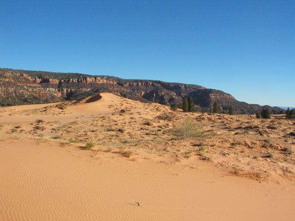
Wind can be an effective geomorphic agent. Obviously, the presence of regular and/or strong wind is required for a specific landscape to be dominated by wind erosion and deposition, but various physical properties are also important. For example, regions showing a paucity of vegetation or preponderance of unconsolidated sediment are more susceptible to wind erosion.
Reading assignment
Complete the following reading assignments:
- The adjective "eolian" is used to describe processes of wind erosion and deposition and the resultant deposits and landscapes. Please visit and study the following hyperlink to learn about eolian processes and landforms. Be sure to leave the site having grasped concepts covering the relationship between velocity, entrainment and transport, and the variety of erosional and depositional eolian landforms.
- For more detail and good imagery of dune fields check out Pattern Indicators in:
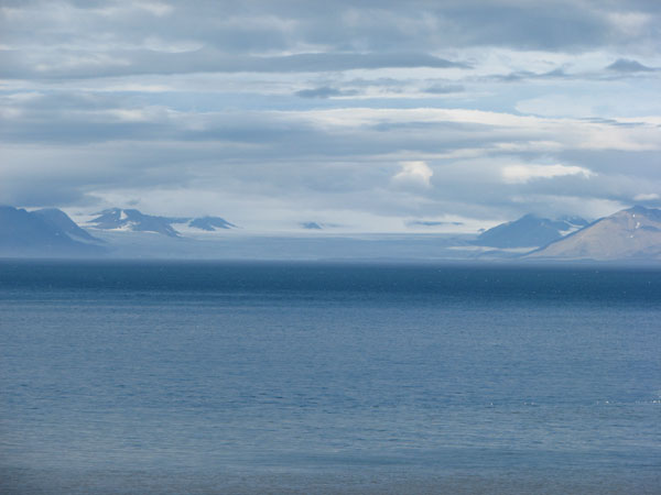
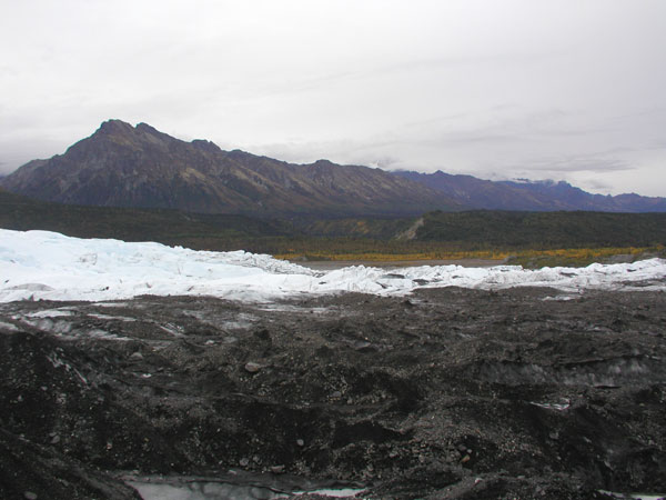
Glacial and Periglacial Processes and Landforms
In an activity in Lesson 4, you learned about the formation of glaciers and the role and effect of glaciers on climate. Now we turn our attention to some of the most spectacular landscapes on Earth—the result of glacial erosion and deposition. Understanding glacial motion, recorded in glacial landforms, is fundamental to current considerations of ice sheet meltback, sea level rise, and global climate change.
Reading assignment
Complete the following reading assignments:
- When you visit and study the following Web site, review the causes of glaciation and glacier motion that you learned about in Lesson 4. Then move on to learn about the anatomy of and types of glaciers, glacier erosion, sediment transport and deposition, and the resulting continental and alpine landforms.
- For additional information, mostly review but with nice imagery, follow this hyperlink:
- In cold regions often near glaciers, periglacial environments and processes are recognized. While permafrost has been a characteristic feature of these landscapes, climate change is slowly reducing its presence and creating challenges for human society. Permafrost, present during the Last Glacial Maximum, is at least partly responsible for much of the landscape of Pennsylvania and surrounding Appalachian states. Periglacial processes and landforms are described at the following web site focusing on permafrost, freeze-thaw weathering, ground ice, mass movement, and the erosive processes of nivation, wind, and flowing water.
Watch this!
Remember my visit to Bear Meadows in Lesson 3? You might want to re-watch that video to refresh your memory . . .
Video: A Trip to Bear Meadows (05:40)
Atmospheric Carbon & Organic Carbon Storage in the Critical Zone
TIM WHITE: I've traveled to Bear Meadows, a national natural landmark, about eight miles southeast of Penn State's main campus in central Pennsylvania. I've brought you here today to describe the relationship between atmospheric carbon dioxide content and organic carbon storage at the surface of the Earth within the critical zone. Let's go have a look at the bog.
Bear Meadows is a peat bog that began forming nearly 10,000 years ago, shortly after northwestern and northeastern Pennsylvania were covered by vast ice sheets that extended far to the north into the Hudson Bay region and Canada. The closest those ice sheets reached to State College and the Penn State campus here was northeast of Williamsport, nearly 30 miles away. One of the tasks I'd like to accomplish while we're here is to probe the peat in the bog and have a look at what it's made of, and so to do that I'm going to walk along the edge of the bog-- in the background you can see where I'm going to go-- and I'm going to get my soil auger so I have a way to probe and sample the peat.
Recall that plants use water, atmospheric carbon dioxide, and energy from the sun to build their organic framework through photosynthesis. Therefore, plants draw down atmospheric carbon dioxide as part of their life habit. When plants die, the organic matter is oxidized and carbon dioxide is returned to the atmosphere.
This wet, boggy setting is perfect for the preservation of organic matter and organic carbon. If you look beneath the water's surface, you can clearly see various organic constituents related to the plants that live around in the bog. I can see maple leaves and abundant roots associated with these grasses. If plants die and their various organic constituents are preserved, as is the case here in the bog, the original carbon in the atmospheric carbon dioxide that was photosynthesized by the living plant is also stored or preserved, rather than being returned to the atmosphere through decay. We call the site of such processes a carbon sink.
I'm probing the peat with an auger to see how deep I can get to the base of the bog to see if I can get a peat sample from the base of the bog here. You can see that I've penetrated over a meter of the peat and I've obtained a sample from the base of the bog. And you can see that the peat down there is made up of a fine organic muck, along with a number of roots and some grass leaves, similar to what you'd find right here at the surface.
Further out in the bog, there are places where 15 feet of peat have accumulated over the last 8,000 or so years. That means that 8,000 years ago, carbon was removed from the ancient atmosphere, stored here in the peat, and remains today.
One last thought before we leave, and that relates to the time scale of organic carbon storage in the critical zone, I've told you that organic matter has been accumulating here over the last 8,000 years, but this setting exists within the Appalachian Mountains and the fate of mountains ultimately is to be eroded, which is happening to these mountains today. So while this organic carbon remains stored here now, over long geologic time scales-- hundreds of thousands to millions of years-- this peat will be oxidized and that ancient organic carbon would be returned to our modern atmosphere.
Glacial geomorphology has proven quite useful to planetary geologists interested in understanding the evolution and history of the surface of nearby planets in our solar system. Visit the following hyperlink for a brief introduction to glacial geomorphology and Mars.
You may find the following resources useful in your classroom:
- Glacial Processes [12] This Powerpoint slide show covers processes of glacier formation, erosion, sediment transport and deposition, the difference between alpine and continental glaciers, and the recent glacial history of Earth.
Karst Processes and Landforms
Unique landforms and patterns of drainage called karst or karst topography primarily form in temperate to tropical regions, though they are found in arid and polar regions too. The common feature shared by all karst landscapes is that they are underlain by chemical sedimentary rocks particularly susceptible to dissolution, carbonates and/or evaporites. The landforms result mostly from chemical weathering of the host rock and the progressive integration of subsurface cavities, though collapse into solution cavities can also be important. Karst landscapes are often dominated by underground drainage networks that interrupt and capture surface water flow.
Reading assignment
For a relatively succinct definition of karst, from the Canadian perspective, follow this hyperlink:
- Karst Landform [13]
Of the karst-forming rocks, the carbonates (dolostone and limestone) are much more abundant than evaporites (mostly deposits of gypsum and anhydrite), therefore karst landscapes are most often found in regions underlain by carbonate rocks. The following Web site will help you learn more about limestone karst, including information on the relationship between lithology, porosity, permeability and karstification, the distribution of karst lands in the United States, the driving mechanics of karst processes, and links between surface water flow, aquifers, and groundwater.
- Karst Processes [14]
Watch this!
To learn about the distribution of karst landforms in central Pennsylvania, the relationship to lithology, and groundwater flow, watch the following video of my visit to Tussey Sink.
Video: A Visit to Tussey Sink (08:03)
TIM WHITE: We're now in that portion of the course where we're considering landforms and how critical zone processes differ on different parts of the landscape. Much information can be gleaned from the study of geologic maps. For example, in this geologic map of the eastern half of the United States, you can clearly see parallel, curving lines that highlight the Appalachian Mountains. Geologists recognize this map pattern as characteristic of folded and faulted strata, the valley and ridge province, similar to what you'd form if you compress and folded a floor rug.
In this lesson, we'll focus on limestone and dolomite, within the variety of rock types in the Appalachian Mountains. In the closeup map of Pennsylvania, you can clearly recognize parallel, curving lines similar to the ones we viewed in the Appalachian Mountains, but here those lines highlight regions underlain by limestone. Next, we'll make a site visit to take a closer look at landforms associated with limestone.
Introducing the Tussey Sink
Welcome to Tussey Sink. We've driven about 10 miles southeast of the geology building at Penn State, where we just looked at some geologic maps of the US and Pennsylvania. And now we have in front of us a much finer detail map, a 7 and 1/2 minute quadrangle map of the Centre Hall region. You can see in the upper left-hand portion in the map, there are a number of parallel lines. And in the lower right-hand portion of the map, similar parallel lines. Whereas in the central part of the map, there are a bunch of dots superimposed on those parallel lines. And it's these dots that are the focus of our lecture today because one of them sits behind us here, Tussey Sink.
Now let's think about this map in a little bit more detail. Here we are at Tussey Sink. And I want you to notice that we're on the edge of this zone that I earlier referred to as containing all the dots. In the upper left-hand corner of the map, where there are no dots, is Nittany Mountain, which you can see in the background. And in the lower right-hand corner, again where there are no dots, behind us, you can see Tussey Mountain.
It's important for you to understand that there are similarities between the bare portions in the map and that these two regions in the map are different from the portion that contains all the dots. The areas that are bare, that is the two ridges we pointed to earlier, are both underlain by shale and sandstone. Whereas this area covered by these dots is underlain by limestone.
Now let's take a walk into Tussey Sink and have a look at the rock types that are contained within it. We have walked about thirty feet from the car into the sinkhole, and we're beginning to descend towards the bottom of it. The first thing I'd like you to notice is that you can see water-- and I'm pointing off to my right, upstream-- that flows down off Tussey Mountain into this sinkhole feature. And if you look over here to my left, there is no more water. And there's a reason for that. That is, there's a reason for this dry stream bed. And that's visible, again over here to my right, where you can see that rock outcrop. That outcrop is limestone, which has a conduit in it, into which that stream disappears.
Conduits like this, and this entire sinkhole that we're within, are unique to limestone terrains. And so what is it about limestone that leads to the formation of these unique features? Well, as geologists, we use hydrochloric acid as a means of verifying whether or not a rock is limestone. And here you can see, when I put hydrochloric acid onto this rock, there's a very vigorous reaction that leads to the formation of carbon dioxide bubbles. This is unique to limestone. Over time, the reactions like this that naturally occur, from dilute carbonic acids formed in the atmosphere, cause the dissolution of limestone and the formation of these features.
We're looking at the water flowing into this hole, or conduit, in the limestone. And it's important for you to recognize that we're in the midst of a very dry fall here in central Pennsylvania. Under normal stream flows, this hole would not be able to accept all the water that flows down this stream channel. And the stream would continue down in the direction I'm pointing, into the dry area that you saw from above. Further downstream from there is the terminus of this sinkhole complex, into which even in the highest flood stages this stream disappears into the subsurface.
Now we're gazing down into the terminus of this sinkhole complex. And it's at this point that, even in the highest flood stages of the stream we were just looking at, it entirely flows into the subsurface here.
One Month Later
It's late November, and we've returned to Tussey Sink after substantial rainfall. You can see that the stream runoff into the sinkhole complex is much greater than earlier in the fall. We followed a leaf as it flowed down the stream and doubled back into the crevice we talked and spoke about earlier in the semester. You can see that the capacity of the crevice to receive the stream flow has been exceeded. Not just because of the limited size of the crevice, but also because it's clogged with leaves and twigs. And so the remaining stream flow is flowing down through the stream channel behind me and into the main sinkhole of the Tussey sinkhole complex.
Remember, we began this lesson by looking at the Centre Hall 7 and 1/2 minute quadrangle map. And on that map I showed you that there were regions in which there were no sinkholes developed, those were the ridges underlain by shale and sandstone, and then the valley where the limestone was, where we just came from. This is a small quarry within the shale that was excavated to build the road that we drove here on. But the important thing to understand is that shale is not subject to dissolution, and therefore, there are no sinkholes developed on the shale terrain.
Remember that earlier we talked about the capacity of different rock types to dissolve under the influence of acid. I'm going to do my acid test again. Let's see what happens.
No reaction. What does this mean? Well, this explains the reason why sinkholes form in limestone and not on shales. It also explains the distribution of the sinkholes within the map that we looked at. That is, the sinkholes exist within the limestone terrains but not in those parts of the map underlain by shale and sandstone.
Check this out . . .
Some basics of karst processes and landscapes focused on caves are presented at Teachers' Domain as "I [15]ntroduction to Caves and Karst." [16]
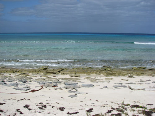
Coastal Processes and Landforms
Nearshore coastal environments host most of humanity, at the interface between the vast oceans that cover 70% of Earth and the continents, home to all our soil and the Critical Zone. The oceans possess energy that is transferred to and manipulates land through erosion and deposition. Humanity's land use has greatly strained coastal environments; therefore, a thorough understanding of coastal processes betters our chances of sustaining life and human endeavors in this very dynamic environment. Be aware that these concepts apply to shore lines along large lakes, too!
Reading assignment
To learn about shoreline processes and coastal evolution, wave refraction and erosion, sediment transport and deposition, and submergent and emergent coastlines through a series of schematic diagrams, follow this hyperlink:
More information on classification, with nice imagery, can be studied at:
The following two hyperlinks lead to other reviews of coastal processes and landforms, as well as wave refraction, erosion, and deposition, importantly with nice images:
Check it out . . .
To view a slide show covering coastal erosion, corrasion and corrosion, subaerial procesess, and coastal classification, including nice images of headlands and bays, wavecut notches and platforms, cliffs, sea caves, and arches, and the stages of coastal development, see:
Remote Sensing and Aerial Photography
While field studies are essential for understanding the geomorphic environment or setting of a region, remote sensing imagery—specifically easily obtained aerial photographs and satellite imagery—provides a broad overhead view, a context in which to place field observations. For this reason, in this section of the landform lesson, we will explore various online resources that provide overhead imagery. Before you begin the following activity, go to Fluvial/Deltaic/Coastal Landforms [22] and Karst/Lacustrine/Aeolian/Glacial Landforms [23] to view aerial photographs representative of the major geomorphic environments presented in sections 3 through 7 of this lesson.
Activity
Directions
NOTE:
For this assignment, you will need to record your work on a word processing document. Your work must be submitted in Word (.doc) or PDF (.pdf) format so I can open it. In addition, documents must be double-spaced and typed in 12 point Times Roman font.- The EROS Data Center [24] is the major government clearinghouse for aerial photographs and imagery in the United States. Follow the hyperlink to the EROS Data Center site, and click on the "Aerial" image gallery link. This will take you to the available Aerial Products. The first line in the table has information available through NAPP.
- Choose Find Data, then Aerial Photography under the Products & Data Available list.
- Scroll down to National Aerial Photography Program (NAPP) -- then Get Data from the header bar.
- Use USGS EarthExplorer -- input an address or use the clickable map to view aerial photographs of your study site.
- Return to the EROS Data Center - Find Data page and choose "Satellite Imagery" to view the available Satellite Products.
- Explore what is available for your study site. At a minimum, view the Landsat TM imagery through EarthExplorer. Alternatively, you may choose to access Landsat imagery through the LandsatLook viewer. [25] The imagery you find here should be included in your semester project report.
- You may also want to visit the Color Landform Atlas of the United States [26] and Flash Earth [27] to be sure you've covered all the bases! Google Earth too.
- Also, visit Principles in Remote Sensing [28] to learn more about remote sensing in general and some specifics about the various sensors and data.
- Aerial photographic coverage for Pennsylvania are archived and made accessible through Pennsylvania Spatial Data Access [29] (PASDA), which includes historical archives available for the state. Other state surveys do, too. Does the home state of your study site provide similar resources?
- TerraServer [30] is another Web site that provides access to aerial photographs of the United States. Visit the site to determine whether TerraServer provides additional resources beneficial to your semester project.
- While there, or using Google Earth, use the coordinates tab (;at/long - decimal) to view the sites listed below (longitude, latitude). Note that negative longitude values indicate west. TerraServer is a commercial company that recently opted to brand the photography so you cannot simply screen capture the imagery, thus it may be a little challenging to see past the name - try anyway, or use Google Earth.
- -105.57229, 37.78748
- -101.64845, 41.82330
- -91.47299, 30.65249
- -146.95036, 64.34985
- -66.88306, 18.43125
- -81.92303, 29.35791
- -76.65703, 42.99389
- -77.02833, 42.52195
- -75.51855, 35.22025
- -124.20464, 43.92189
- For each site, record a few sentences describing what you see and classifying the site using one of the five geomorphic settings discussed in sections 3 through 7. Consider whether zooming in or out will help your classification effort.
- While there, or using Google Earth, use the coordinates tab (;at/long - decimal) to view the sites listed below (longitude, latitude). Note that negative longitude values indicate west. TerraServer is a commercial company that recently opted to brand the photography so you cannot simply screen capture the imagery, thus it may be a little challenging to see past the name - try anyway, or use Google Earth.
- Write a one-page report that contains the following:
- A statement regarding whether the home state of your study site provides similar resources to Penn Pilot (Step 3).
- Your descriptions and classifications for each site listed in Step 4.
- Save your report as either a Microsoft Word or PDF file in the following format:
L9_remotesensing_AccessAccountID_LastName.doc (or .pdf).
For example, student Elvis Aaron Presley's file would be named "L9_remotesensing_eap1_presley.doc"—this naming convention is important, as it will help me make sure I match each submission up with the right student!
Submitting your work
Upload your report to the "Lesson 9 - Remote Sensing Report" dropbox in Canvas (in the lesson under the Modules tab) by the due date indicated on our Canvas calendar.
Grading criteria
You will be graded on the quality of your writing. You should not simply write responses to the questions and submit them to me. Instead plan on writing a short stand-alone paragraph (or page or whatever you decide is necessary considering any constraints I might have placed on you) so that anyone can read what you've written and understood it. You should strive to be specific and complete in responding to the questions. Your answers should be analytic, thoughtful and insightful, and should provide an insightful connection between ideas. The writing should be tight and crisp with varied sentence structure and a serious, professional tone.
Check this out . . .
Go to the NASA website and view the learning module Blue Marble Matches [31] - you may find it to be something to introduce into your classroom!
Summary and Final Tasks
In this unit, we have focused our attention on the lithosphere and explored a number of aspects of geology and geomorphology, mostly focused on parent material and topography factors in soil formation. It should be clear to you that Earth's surface is covered by landscape elements that can be classified according to processes and landforms unique to those processes. You should also know that while geomorphology and geology are field-oriented sciences, the study of remotely sensed imagery can greatly enhance our understanding of a landscape and the processes that formed it. Considering the resources you've been introduced to in this lesson, you should also now know how to obtain such imagery for your own use.
Reminder—Complete all of the lesson tasks!
You have finished Lesson 9. Double-check the list of requirements on the Lesson 9 Overview page to make sure you have completed all of the activities listed there before beginning the next lesson.
Tell us about it!
If you have anything you'd like to comment on or add to, the lesson materials, feel free to share your thoughts with Tim. For example, what did you have the most trouble with in this lesson? Was there anything useful here that you'd like to try in your own classroom?
Links
[1] http://en.wikipedia.org/wiki/Isostasy
[2] http://en.wikipedia.org/wiki/Geomorphology
[3] http://en.wikipedia.org/wiki/Fluvial
[4] https://ntrs.nasa.gov/archive/nasa/casi.ntrs.nasa.gov/19870008706.pdf
[5] http://www.physicalgeography.net/fundamentals/10z.html
[6] http://www.physicalgeography.net/fundamentals/10ah.html
[7] http://www.dtic.mil/cgi-bin/GetTRDoc?AD=ADA244855&Location=U2&doc=GetTRDoc.pdf
[8] http://www.earthonlinemedia.com/ebooks/tpe_3e/glacial_systems/outline.html
[9] http://www.revisionworld.co.uk/a2-us-grades-11-12/geography/glacial-environments/glacial-processes-landforms
[10] https://editors.eol.org/eoearth/wiki/Periglacial_processes_and_landforms
[11] https://en.wikipedia.org/wiki/Glaciers_on_Mars
[12] http://www.elcamino.edu/faculty/mreed/physical/101%20Powerpoint/glaciers.ppt
[13] http://www.thecanadianencyclopedia.ca/en/article/karst-landform/
[14] http://www4.uwsp.edu/geo/faculty/lemke/geomorphology/lectures/07_karst.html
[15] http://www.teachersdomain.org/ext/ess05_int_caveintro/index.htm
[16] http://www.pbslearningmedia.org/resource/ess05.sci.ess.earthsys.caveintro/caves-and-karst/
[17] http://www.tulane.edu/%7Egeol113/COASTAL-PROCESSES-1a.htm
[18] http://geobytesgcse.blogspot.com/2007/08/coastal-erosion-landforms-features-and.html
[19] http://www.physicalgeography.net/fundamentals/10ac.html
[20] http://www.physicalgeography.net/fundamentals/10ac_2.html
[21] http://www.scribd.com/doc/305249/Coastal-Erosion-Processes-and-Landforms
[22] http://priede.bf.lu.lv/GIS/.Descriptions/RST/Sect17/nicktutor_17-4.shtml
[23] http://geoinfo.amu.edu.pl/wpk/rst/rst/Sect17/Sect17_5.html
[24] http://eros.usgs.gov/
[25] http://landsatlook.usgs.gov/
[26] http://fermi.jhuapl.edu/states/states.html
[27] http://www.flashearth.com/
[28] http://www.ssec.wisc.edu/sose/pirs_activity.html
[29] https://www.pasda.psu.edu/
[30] http://www.terraserver.com/
[31] http://www.nasa.gov/audience/foreducators/topnav/materials/listbytype/Blue_Marble_Matches.html