Overlaying the Grid with the Weather
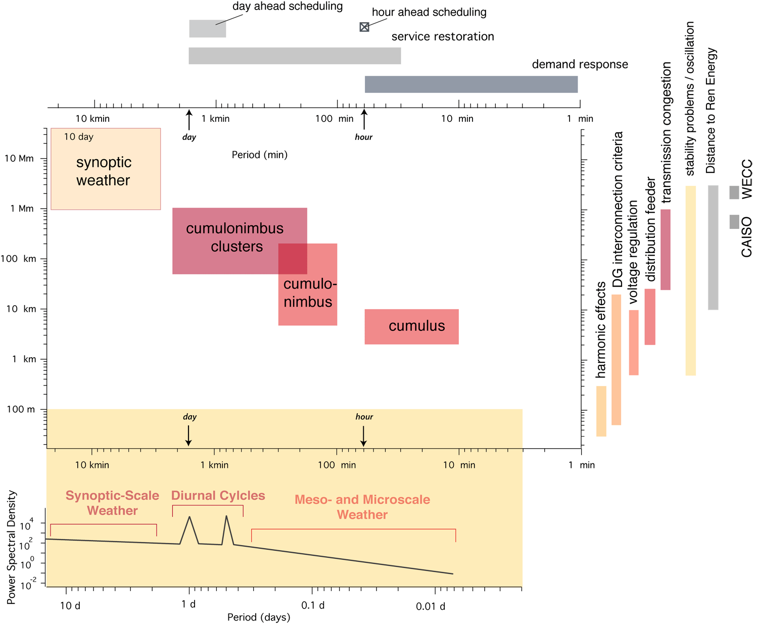
Now that we know a few things about the scales of time and space for the power grid (using CAISO and WECC for scale), we can compare it with the weather scales. Look to the top and right for the von Meier scales, and the core diagram in the center for the Fujita scales. The diagram on the lower portion shows us a rough sketch of the power spectral density for the meteorological spans of synoptic, mesoscale, and microscale weather.
By applying the average meteorological advection speed of , (which we are calling the FRYB relation for the class), we can convert an example spatial scales of variability associated with transmission congestion (red vertical bar on the right) from distances of 25-1000 km into a time horizon. The relevant time scales for meteorological phenomena exist within 25 minutes to 16 hours (involving events from cumulus, cumulonimbus, and cumulonimbus clusters interfering with the Sun's irradiation).
Alternately, we observe that the harmonic effects propagating within the grid along distances of 30-300 meters would be relevant for meteorological phenomena spanning 1.8-18 seconds. This scale of events is too small to be incorporated into the presented meteorological phenomena.