Instructors:
- Spring 2 2024 (Feb-May) - Jan Oliver Wallgrün
Panagiotis Giannakis
2217 EES Building
The Pennsylvania State University,
University Park, PA 16802
Email: Please use the course e-mail system (it ensures your emails don't get caught up in any spam filters). I check e-mail regularly and will do my best to respond to questions at least once per weekday and once on weekends unless I notify you otherwise. If Canvas is down you can try pmg5371@psu.edu.
Office hours: By appointment.
Welcome to the course!
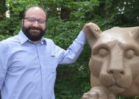
Hello everyone. My name is Panagiotis Giannakis and I will be your instructor for this course. Before joining the Department of Geography at Penn State, I was working at the University of Arkansas, where I also received my PhD. I have been involved with online geospatial certificate programs (administrating, authoring, and teaching) for the last 5 years. I have experience teaching multiple courses such as Python, Geodatabases, Geospatial Analysis, and Geospatial Statistics. During the 2019-2020 academic year I will be responsible teaching apart from the GEOG 485: Programming and Software development, the GEOG 479: Spatial Data Science for Cyber and Human Social Networks, the GEOG 583 Geospatial System Analysis and Design, and the GEOG 585: Open Web Mapping.
I am really excited working with all of you over the next ten weeks as we go through all the material of the course.
Meet Panagiotis Giannakis, one of the instructors of this course (1:06 minutes).
Hello everyone. My name is Panagiotis Giannakis but everyone around here knows me and calls me Panos. I am a faculty member in the Geography Department at the Pennsylvania State University, and I did several online courses including Database Development, GIS Programming, and Open Web Mapping.
The road that led me to State College and the Penn State has been a rather long one. I grew up in Greece. I came in 2013 in the United States in order to study and get my Ph.D. from the University of Arkansas. I spent more or less all my life inside academic institutions studying, working, and teaching, so when I got the opportunity to come here to Penn State, I was more than excited. As a geographer I truly love traveling and exploring new places and so far, I have managed to visit more than 20 countries. While in the United States, the goal that me and my wife have set is to visit all 50 states and we're already more than halfway done.
I honestly think that this is a wonderful program and I really hope that I will see you in one of my classes in the future.
Introductions for Spring 1 2024
Now it’s your turn to introduce yourself (you don't have to post pictures!). Please return to Canvas and post a brief introductory message to 'The Lounge' discussion forum describing:
- Your name and current occupation
- Any experience with Python (remember, none is required for this course)
- Any experience with other programming languages (none is required for this course)
- Any questions or concerns you have about Python or this course (optional)
Jan Oliver Wallgrün
Email: Please use the course e-mail system (it ensures your emails don't get caught up in any spam filters). I check e-mail regularly and will do my best to respond to questions at least once per weekday and once on weekends unless I notify you otherwise. If Canvas is down you can try wallgrun@psu.edu.
Office hours: By appointment.
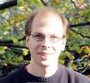 I have been working as a researcher and instructor at the Penn State Geography department, but a few years ago moved back to Germany where I am originally from. I am a computer scientist by training with my master and Ph.D. both being in Informatics. However, I have been working in the areas of GIS and GIScience for a decade now. In my residential courses at Penn State, I have been teaching introductory courses to GIS and GIScience, geospatial data management and spatial databases, and object-oriented programming for GIScience. I am still conducting research in affiliation with the Penn State focusing on problems of spatial and spatio-temporal modeling and reasoning, as well as the interpretation and processing of human descriptions of spatial knowledge such as natural language descriptions or sketch maps. I am also interested in algorithmic problems of spatial data integration, matching, and query processing as a basis to build "intelligent" spatial retrieval and assistance systems. My most recent work also involves the application of immersive technologies (virtual and augmented reality) for spatial data analysis and GIScience education.
Introductions for Spring 2 2024
Now it’s your turn to introduce yourself (you don't have to post pictures!). Please return to Canvas and post a brief introductory message to "The Lounge" discussion forum describing:
- Your name and current occupation
- Any experience with Python (remember, none is required for this course)
- Any experience with other programming languages (none is required for this course)
- Any questions or concerns you have about Python or this course (optional)
Meet Jan Oliver Wallgrün, an instructor of this course (2:07 minutes)
Jan Oliver Wallgrün: Hello, my name is Jan Oliver Wallgrun. And I know that name tends to be a bit difficult to pronounce, or non-Germans so I also simply go by the name Joe. My way into the realms of spatial data and spatial algorithms started in the late 1990s when I, as a master and then PhD student in informatics, worked on building some rather weird-looking autonomous mobile robots that used lidar data and cameras to learn to navigate. And that was basically using methods that these days we find in robot vacuum cleaners or self-driving cars, for example. I quickly became interested in applying these methods for merging and matching data to geographic data. And then, over time, I turned into what I would call myself today, namely a geoscience researcher and teacher working at the interface between spatial algorithms and human spatial cognition, and more recently also the application of immersive technologies.
I always enjoyed teaching and working with students, but I quickly realized that teaching in our online program is a particularly rewarding experience simply because of how motivated and eager to learn our students are. And well, frankly, there's nothing more motivating and rewarding for me then when students, after the class, write to me and tell me they were able to immediately apply what they learned in their job or for their research. So when I had to leave Penn State and returned to Germany, well, I basically did everything I could to remain an instructor in the program. And fortunately, that worked out rather well. I'm now here living next to Hamburg, and that is six hours ahead of U.S. East Coast time. So that means when students in the U.S. get up in the morning, I typically already had a couple of hours to go through e-mails and forum posts and answer any questions. Alright, thank you for your interest. And if you have any questions about any of my courses, please don't hesitate to contact me.