Terrain as a Basemap
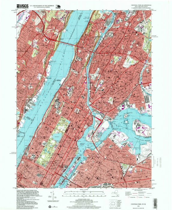
Though terrain layers can be used to make fun and interesting map designs, terrain is rarely the sole element on a map. USGS topographic maps, for example, depict much more than just contour lines across the landscape—they also include political boundaries, streets, water features, and more. This is particularly challenging in urban areas, as demonstrated by the map in Figure 6.6.1, located in Manhattan, NY.
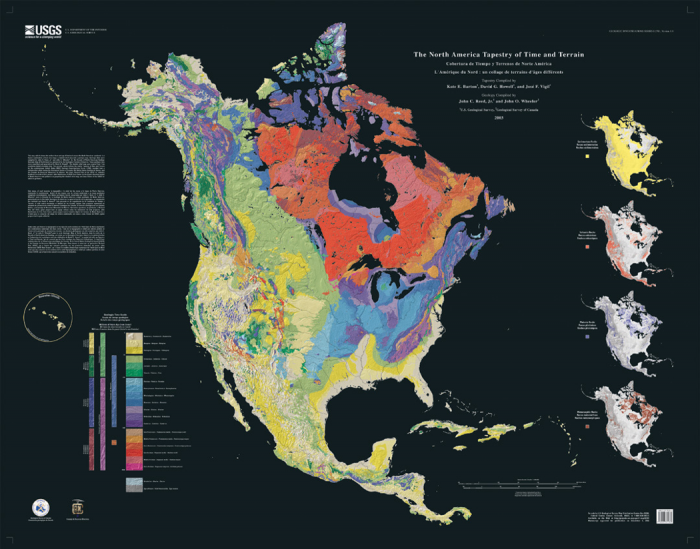
Even when terrain is the main feature of interest, such as in the thematic map in Figure 6.6 2 below, design adjustments must be made to ensure the terrain is visualized appropriately given the map’s projection, level of detail, other visual variables (here, color), and background.
Some types of maps more frequently contain depictions of terrain than others. As designing a good terrain base layer typically involves significant effort—and makes map symbol design more complicated—terrain is typically left off of maps when it is considered irrelevant, such as in thematic maps of political or social data. In some maps however, (e.g., maps of ski trails), terrain visualization is essential. Most maps fall somewhere in between.
Whether or not you decide to depict your location’s terrain—and how detailed that design will be—will depend, as with most design decisions, on your map’s intended audience, medium, and purpose. You will likely also need to take other constraints into consideration (e.g., availability of data and time).
Student Reflection
Google maps (maps.google.com) offers users the option of replacing the default Google basemap with a map that visualizes terrain. What use cases can you imagine for routing over such a basemap, rather than the simpler standard map?
Recommended Reading
- Chapter 2: Basemap Basics. Brewer, Cynthia A. 2015. Designing Better Maps: A Guide for GIS Users. Second. Redlands: Esri Press.
- Chapter 14: Interplay of Elements. Imhof, Eduard. 2007. Cartographic Relief Presentation. Redlands: Esri Press.