Lessons
Lesson 1: Foundations of Cultural Geography
The links below provide an outline of the material for this lesson. Be sure to carefully read through the entire lesson before returning to Canvas to submit your assignments.
Note: You can print the entire lesson by clicking on the "Print" link above.
1.1 Overview
Introduction
The world is a complex network of nodes and connections. Ideas, goods (tangible or intangible), money, matériel, and (dis)information move between people and across space. Sometimes people carry these with them from place to place; other times they move through cyberspace. While it is tempting to focus solely on the way these things flow, it is imperative also to recognize the importance of where things originate and where they culminate. The conditions at either end of a connection — that is, what it is like at the place where something emerges or where it goes — provide context that is crucial for understanding and predicting political and social movements, insurgency, and the needs of people before, during, and after emergencies.
Place, connection, flow — all of these are geographic concerns.
This lesson is designed to introduce you to geography (and specifically cultural geography) as a discipline. As a foundational lesson, it focuses on three core concepts in geography (space, place, and scale) that will enable you to understand and develop a geographic perspective. It will also discuss what we mean by culture, and how culture and geography are related.
Finally, this lesson also introduces you to ArcGIS Online and StoryMaps, two powerful visual-spatial tools that are useful for analyzing and presenting information to a wide range of audiences. You will use this technology to complete an exercise that will demonstrate the importance of scale as an analytical framework for understanding a complex real-world issue, using real data.
We encourage you to carefully read the examples and do the other exercises strewn throughout the lesson, as they will reinforce your understanding of the concepts and enable you to use them to assess, critique, and predict phenomena in the world.
Learning Goals and Objectives:
Upon completion of this lesson, you will be able to:
- Evaluate the role and importance of space and place in everyday life.
- Assess the role and function of scale in analyzing real-world phenomena.
- Appraise culture as a factor in lived experience.
- Produce a simple visual to present spatial information.
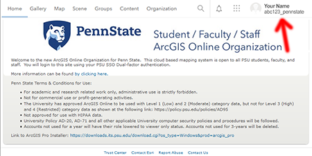
Note: You might have already seen the following message in the orientation material. If you have already successfully logged into our ArcGIS Online Organization, you can proceed to the next page.
Special Task
At the end of this lesson, you will complete a StoryMap exercise using Penn State's ArcGIS Online Organization. Please make sure you have access to the system by using the following link, Penn State's ArcGIS Online Organization [1], and logging in with your Penn State UserID (abc123@psu.edu [2]) and password.
After successfully logging in, you should see the following page with your name and ID in the upper right corner.
Contact the instructor if you have any problems logging in.
Note: Please log into the ArcGIS Online system as soon as you can so we can give you access to the files you will need for the first mapping exercise.
Questions?
If you have any questions now or at any point during this week, please feel free to post them to the GEOG 571 - General Discussion Forum. (That forum can be accessed at any time in Canvas by opening the Lesson 0: Welcome to GEOG 571 module in Canvas.)
1.2 Checklist
This lesson is one week in length. Please refer to the Calendar in Canvas for specific time frames and due dates. To finish this lesson, you must complete the activities listed below. You may find it useful to print this page out first so that you can follow along with the directions.
| Step | Activity | Access/Directions |
|---|---|---|
| 1 | Read the Lesson 1 online lecture notes. | The lecture notes can be accessed by clicking on the Lesson 1: Foundations of Cultural Geography link in the Lessons menu on this page. |
| 2 | Required Reading |
Cresswell, T. (2004). Introduction: Defining place. In Place: A short introduction (pp. 1-14). Blackwell. Massey, D. (1991). A global sense of place. In Space, place, and gender (pp. 146-156). University of Minnesota Press. Mitchell, D. (1995). There's no such thing as culture: Towards a reconceptualization of the idea of culture in geography. Transactions of the Institute of British Geographers, 20(1), 102-116. Thrift, N. (2003). Space: The fundamental stuff of geography. In S. Holloway, S. P. Rice, and G. Valentie (Eds.), Key concepts in geography (pp. 95-107). Sage. Note: Registered students can access the readings in Canvas by clicking on the Library Resources link.** ** The list of the Lesson 1 readings might not be available on the Library Resources page during the Orientation week. |
| 3 | Optional Reading |
Cresswell, T. (2004). Place: A short introduction. Blackwell. Herod, A. (2009). Scale: The global and the local. In N. J. Clifford, S. L. Holloway, S. P. Rice, and G. Valentine (Eds.), Key concepts in geography (2nd ed., pp. 215-235). Sage. Marston, S. A, Jones, J. P., III, and Woodward, K. (2005). Human geography without scale. Transactions of the Institute of British Geographers, 30 (4), 416-432. U.S. Geological Survey. (2002). Map scales: U.S. Geological Survey Fact Sheet 015–02 [3]. Available only online from the USGS website. Note: Penn State students should be able to access the optional readings though the Penn State Libraries. (Penn State Access ID login required.) |
| 4 | Submit your ArcGIS Online Login screen capture. | Submit a screen capture of your Penn State ArcGIS Online home page to the Lesson 1 ArcGIS Online Login dropbox in Canvas. Instructions can be found on the 1.10 Introduction to ArcGIS Online and StoryMaps [4] page of this lesson. |
| 5 | Complete the Lesson 1 Discussion Forum. |
Post your answer to the Lesson 1 Discussion Forum in Canvas and comment on classmates' responses. You can find the prompt for the assignment in the Lesson 1 Discussion Forum in the Lesson 1: Foundations of Cultural Geography module in Canvas. Your original post is due Sunday night and your appraisal of your classmates' posts is due by the following Tuesday night. |
| 6 | Complete the Lesson 1 StoryMaps Exercise. |
Instructions for the StoryMaps Exercise can be found on the 1.11 ArcGIS Online StoryMap Exercise [5] page of this lesson. Submit your assignment to the Lesson 1 StoryMaps Exercise dropbox in the Lesson 1: Foundations of Cultural Geography module in Canvas. |
Note: Please refer to the Calendar in Canvas for specific time frames and due dates.
1.3 Geography: Developing a Spatial Perspective
Geography can be a challenging field to introduce (or reintroduce) students to. As academic disciplines go, it is among the widest in scope and among the most integrative in approach. It is also one of the oldest academic disciplines, with writings that date back to thinkers such as Eratosthenes and Strabo in ancient Greece, and the unnamed authors of the Shujing in ancient China. The word "geography" derives from the Greek geo- (earth) and -graphia (writing); to study geography is, quite literally, to describe or write about the land.
Ancient geographers wrote about everything from the physical topography of the world, to the distribution of raw resources, to the rituals and beliefs of people in different regions. This incredible breadth is still evident in contemporary geography, though today’s geographers tend to specialize in one of geography’s many subdisciplines. Broadly speaking, those subdisciplines fall into one of four main fields: physical geography, human geography, nature-society or human-environment geography, and geographic information science.
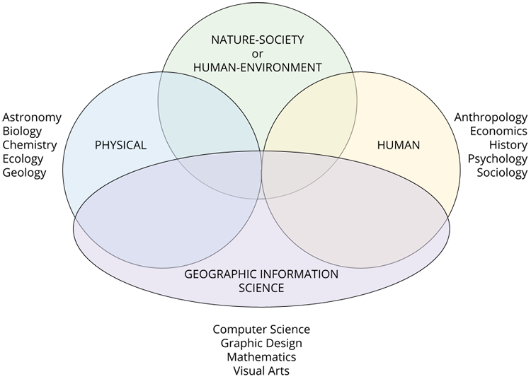
Physical geography - If you have ever looked out the window of a car or plane at the landscape outside and considered the movement of water across its surface, or the shift in tree species as you travel, you are engaging with physical geography.
Human geography - If you have ever visited another place and wondered how it developed its unique architecture, economy, history, or cultural practices, or wondered at what makes it feel different from other places, you are engaging with human geography.
Nature-society or human-environment geography - If you have ever gone to a national park and wondered what kind of fire management practices are being used and why, or if you have ever considered the ways that federal agencies respond to hurricanes, you are engaging with nature-society geography.
Geographic information science - If you have ever used an online mapping site or a GPS device to find directions to your destination, or if you have ever considered the ways that data can be presented on maps, you are engaging with geographic information science.
What unifies this vast discipline is not a specific set of texts, theories, or concepts, but rather a perspective and a basic set of questions. That is, regardless of their subdiscipline, all geographers share a spatial perspective. By this, we mean a view of the world that prioritizes the relationships between places in terms of distance or proximity, flows or movement, and connectivity. This perspective leads geographers to ask similar types of questions, namely:
- Where is this happening?
- Why is it happening there (and why—or why not—in some other place)?
- How is it happening differently there?
- Why does it share similarities (or why doesn’t it) with the same thing elsewhere?
These are the kinds of questions that all geographers tend to ask, regardless of whether our focus is on physical processes, human interactions with the environment, economic practices, or the analysis of spatial data.
Any course in geography that you take should encourage you to further develop your understanding of this spatial perspective. Ultimately, that perspective serves as a means of understanding the spatial complexities of the world. Geography’s breadth as a discipline means that there is no clear canon of texts with which all geographers are familiar. However, there are some concepts that are central to geographic inquiry. Among these are space, place, and scale. (We could expand this list to include region or connectivity or flow, but for our purposes we will stick with these three.) The remaining sections of this lesson will discuss these three concepts, as well as culture and cultural geography in conjunction with your readings for the week.
1.4 Space
Space is the primary concept used in geography. To define it briefly, it is “an areal extent on the earth's surface, in and around which all humans exist and their activities occur” (Fellmann et al., 2013, p. 487). Thrift (2009) posits an admittedly rough typology of space—with the caveat that space is far more complex than this typology suggests—that consists of empirical space, flow space, image space, and place space.
While flow space, image space, and place space are important, empirical space is perhaps the most fundamental form of space. Empirical space is the measurable, volumetric construction of space that we invoke when we measure distances between points on a map, estimate how much paint we need to cover the walls of a room, or what size truck we should rent to haul our possessions to a new home.
Conceptually, empirical space enables us to talk about the spatial distribution of phenomena in the world. In human geography, this means that we are generally concerned with the distribution of people, but we may also be concerned with resources, human activity, beliefs or ideas, businesses, and so on. We can think of spatial distribution as having three qualities: density, concentration, and pattern.
Density is the frequency with which something occurs in space; measured in terms of how many things (e.g., people, houses, trees, etc.) appear per unit of area (e.g., square miles, square kilometers, acres, etc.).

Example
New York City has a population density of roughly 27,755 people per square mile, while Minneapolis has a population density of roughly 7,956 people per square mile; thus New York City has a greater population density than Minneapolis.
Concentration is the extent of a feature's spread over space. Things can be close together (clustered) or far apart (dispersed).
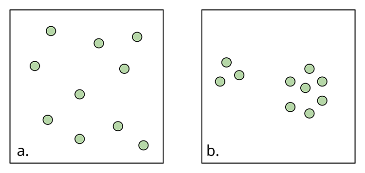
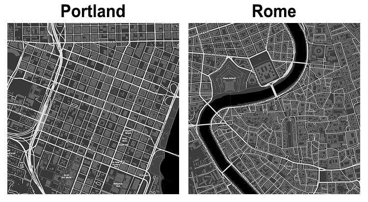
Finally, pattern is the arrangement of objects in space. Patterns can be regular (geometric) or irregular.
Example
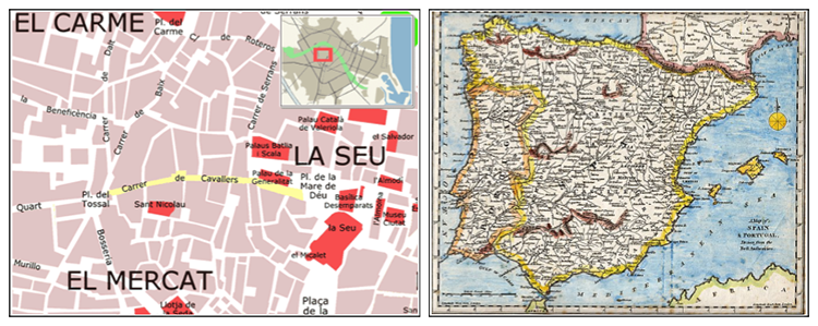
Compare sections of the street plans for Portland, Oregon, United States, and Rome, Italy. Although not perfectly regular, we can easily characterize sections of Portland as following a grid pattern. Rome, by contrast, appears to be a mix of canted grids on the periphery and irregular and meandering streets in the center. The consistency of Portland’s street plan reflects its more recent creation; the mixed approach in Rome reflects several centuries of changing urban planning practices.
Read:
Note: Registered students can access the readings in Canvas by clicking on the Library Resources link.**
** The list of the Lesson 1 readings might not be available on the Library Resources page during the Orientation week.
References:
1.5 Place
While Thrift (2009) qualifies place as one construction of space, other human geographers often conceptualize place as something that is embedded in space and has spatial qualities, but also as something that is conceptually distinct from space. In its simplest form, we can think of places as meaningful, material locations in space. Yet the same caveat applies here as with space: this is a crude simplification of place that downplays its incredible complexity.
What makes place, like space, so complex is that people (and other creatures) construct places through their daily activities within them. Over time, places take on significance—be it personal, historical, economic, political, or some other form. And here, too, significance is complex, and it is experienced across a range of intensities. Consider, for example, various people regarding the statue of Giuseppe Garibaldi in Washington Square Park, in New York City. One may be moved by it, citing Garibaldi’s role as a founder of the Italian state. Another may find it interesting for its artistic style. A third might have fond memories of the monument because of a first kiss that took place by its base. A fourth might find it distasteful or un-American. A fifth be aware of its existence but be completely uninterested in it—and so on.
Cresswell (2004) provides a concise but thorough discussion of the nature of place. One particularly important thing to bear in mind in discussion of place is that although geographers have historically written about place as static or unchanging, it is actually quite dynamic—and this is one of the factors that makes place difficult to pin down, but also such a rich subject to study.
That dynamism becomes most visible in periods of economic growth or decline in a place. For example, cities that are experiencing considerable gentrification may lose some aspect of what once made them unique as locally-owned small businesses are replaced by high-end boutiques, or as neighborhood demographics change with an influx of wealth. Likewise, if a major employer leaves a place and there are no other employers who can offer jobs at comparable rates, the resulting economic decline may result in deteriorating houses as people have less disposable income to put into maintenance, or crumbling infrastructure as the city’s tax revenues decline. Long-term residents of a place that has undergone significant change over the years might point out the locations of businesses or other institutions that have disappeared, or buildings that stand on what was once undeveloped land; in either case, the location might be the same, but the place and the way that people think or feel about it will have changed.
Read:
Note: Registered students can access the readings in Canvas by clicking on the Library Resources link.**
** The list of the Lesson 1 readings might not be available on the Library Resources page during the Orientation week.
References:
Cresswell, T. (2004). Place: A short introduction. Blackwell.
Thrift, N. (2003). Space: The fundamental stuff of geography. In S. Holloway, S. P. Rice, and G. Valentine, (Eds.), Key concepts in geography, (pp. 95-107). Sage.
1.6 Scale
In light of our discussion of space and place, it may seem like space is boundless, or like place is inherently small, yet this is not necessarily the case. To fully understand the complexity of these concepts, it is important to have an understanding of scale. Scale is essential to developing a spatial perspective because it enables us to organize how we think and talk about space and place.
We can begin by thinking of scale in what is probably its most familiar form: map applications like Google Maps, MapQuest, or OpenStreetMap. All of these applications allow the user to choose a point and either zoom into that point, or zoom out from it. Just to see how this works, choose whichever map application you prefer and pan the map to some part of the world that interests you.
Once you have the map centered as you like it, zoom in using the plus (+) icon. Click several times until you can’t zoom in anymore. (You may have to recenter the map to keep your point of interest on the screen.) As you zoom in, the part of the map that is visible on the screen covers a smaller area. The features—bodies of water, streets, and so on—appear larger and in greater detail. If you zoom in far enough, the outlines of buildings may appear. Now, zoom out using the minus (–) icon. Again, click several times until you can’t zoom out anymore. You will notice that the view becomes less detailed, the shapes of features like water bodies or cities lose their details and become more generalized, and some features disappear altogether.
When you zoom in or out of the map, you are changing the map’s scale. When you zoomed in and the application is displaying a smaller area with greater detail, you are looking at a large-scale map. When you zoom out and the application is displaying a greater area with less detail, you are looking at a small-scale map. We refer to this as cartographic scale, and the designations ‘large’ and ‘small’ here refer to the ratio of the area on the map to the equivalent area that it covers on the ground. A map with a scale of 1:10 would therefore be a map where one inch (or centimeter) on the map represents ten inches (or centimeters) on the ground. A map with a scale of 1:1 would have a perfect correlation (one inch on the map represents one inch on the ground). Both of these would be considered large-scale maps. A map with a scale of 1:250,000 would, by contrast, be a small-scale map. (For more on cartographic scales, see the USGS report listed in the references.)
Small-scale map of Spain and Portugal Creative Commons [9] CC0 1.0 Universal Public Domain Dedication [11].
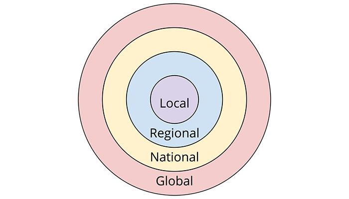
Research in human geography often relies on a different rendering of scale. In this version, scale refers to the extent of the area at which phenomena happen, or the extent of the area at which we can perceive certain phenomena. We refer to this as organizational scale: a relative hierarchy of areal extents that traditionally include local, regional, national, and global scales, and may include additional designations such as the scale of the body or the extra-state regional scale.
As Herod (2009) discusses, there has been considerable debate in human geography about the nature of scale. Some argue that scale is an inherent, material property of the world, while others argue that it is purely socially constructed. Beyond this, human geographers use various metaphors of scale that reflect different theoretical orientations.
Several popular metaphors for scale include ladders, concentric circles, Russian nesting dolls, and tree roots. For our purposes, the concentric circles and tree roots metaphors will likely be the most useful. The concentric circles metaphor suggests a couple of things: first, that scales have clear boundaries; second, that things that happen at narrower scales are set within the context of things that happen at broader scales (e.g., the laws of a city in the US can be unique to that city but they have to be legal within the broader framework of the state’s legal system, which in turn have to meet certain federal standards). In this metaphor, narrower scales are contained by broader scales.
© Penn State University is licensed under CC BY-NC-SA 4.0 [7].
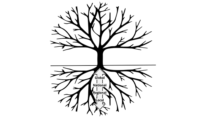
By contrast, the tree root metaphor suggests that phenomena occur in relation to one another across a network of space. This metaphor is less totalizing than concentric circles imply; rather than assuming that all local-scale phenomena are subject to precisely the same external forces, it allows for some particularity: the thick bands of global influence extend downwards to smaller localities, but in some cases in different ways and with different outcomes. Likewise, this metaphor operates on the assumption that scales do not always have clear, identifiable boundaries, and indeed that they cannot always be considered as separate spaces.
© Penn State University is licensed under CC BY-NC-SA 4.0 [7].
The reading from Massey gets to the heart of this issue, underscoring the ways that globalization has compressed space and time, and how the technologies of our globalized world have linked distant places through flows of information, goods, and money—and changed the scale at which we think of place.
Read:
Note: Registered students can access the readings in Canvas by clicking on the Library Resources link.**
** The list of the Lesson 1 readings might not be available on the Library Resources page during the Orientation week.
References:
Herod, A. (2009). Scale: The global and the local. In N. J. Clifford, S. L. Holloway, S. P. Rice, and G. Valentine (Eds.), Key concepts in geography (2nd ed., pp. 215-235). Sage.
Marston, S. A, Jones, J. P., III, and Woodward, K. (2005). Human geography without scale. Transactions of the Institute of British Geographers, 30(4), 416-432.
U.S. Geological Survey. (2002). Map scales: U.S. Geological Survey Fact Sheet 015–02 [3].
Available only online from the USGS.
1.7 Space, Place, and Scale: Putting Them Together
With this basic understanding of space, place, and scale, we turn now to a brief discussion of how these concepts are related.
First and foremost (and as we discussed above), places are located within space, and they have space within them. For example, we can situate University Park, Pennsylvania with a set of coordinates that mark its location in space, and we can also measure its area in square miles using that spatial data. For many people, the most familiar place they can think of is one where they regularly sleep, and they may have spatial concerns about that place (does it have enough closet space? Is there enough space for a bed, a dresser, and a bookshelf? Is there enough space for the dog to sleep on the bed too?).
Likewise, we can consider the space of place: when terrorists brought down the World Trade Center, it impacted the entire United States (and, arguably, much of the rest of the world as well). In the immediate aftermath, the entire city of New York shut down, and people across the United States felt some emotional impact from the news as they watched the images of the towers falling. In that moment and for some time afterward, a highly localized place (which we now refer to as Ground Zero), which was thought to be bounded by the block on which the World Trade Center was located, extended to encompass the whole of New York City in some ways, and in other ways, its space radiated outwards to the rest of the United States: that is, in a particular moment, New York stood symbolically for the US. (The same could be said for the Pentagon; we focus on the Twin Towers here because of their status as an icon within civil America.)
The extending outwards of a site of collective trauma from its origin point to the rest of the country is not just an expansion of space: it is also a kind of upscaling of a phenomenon. We can scale place and space upward or downward even without such extraordinary circumstances: consider, for example, presidential election maps. Many of the maps that we see during presidential elections display each state within the US in a single, solid color, with the implication that one candidate won the votes of the entire state. Yet if we were to scale downward to look at a narrower scale, such as each county, we find that most states are a patchwork of red and blue. Scale even further inward to each district, and we find that, even within counties, there is quite a bit of variation in voting. When election results are presented at the scale of the state, it is effectively an upward scaling of more localized voting habits.
Example:
Refer to these maps presented by the New York Times [13] after the 2012 election. Click on States, then click on Counties to compare the results at two scales. Notice that some states (e.g., Oregon and Washington) show large areas that voted Republican; the denser populations within major cities account for the Democratic wins in these states.
This leads us to one of the most important relationships between space, place, and scale: varying the scale at which we observe phenomena may reveal clues about spatial distribution. In turn, what we see with regard to density, concentration, and pattern may lead us to a greater understanding of how places form, how people experience them, and how people perceive them.
1.8 Culture and Cultural Geography
The subject of our course, cultural geography, is one of the many subdisciplines of human geography. It focuses on the relationships between human culture, space, and place.
Culture is a notoriously difficult term to define—in part because we use it in casual speech. There is a long history of debate about the meaning of the term and its utility (see the reading by Mitchell for more on this). For our purposes, we will follow Rubenstein’s simplified definition of culture: “the body of customary beliefs, social forms, and material traits that together constitute a group’s distinct tradition” (2019, p. 365).
In everyday life, we see culture manifest in both material and nonmaterial forms. Culture is reflected in things like which language we speak and how we use it; the clothing we are expected to wear and the clothing we choose to wear; the foods we eat and the utensils we use to eat it; the holidays we celebrate and the symbols that represent them; the way people greet one another, both formally and informally; the expectations we carry regarding age and gender; what constitutes responsibility or respectful versus disrespectful behavior; and so on. Culture also appears in things like architectural style and the materials we use for constructing buildings; modes of transportation and the rules (explicit or tacit) surrounding them; the way we dance, the music we listen to, and the television or movies we watch; and even things like the size of a roll of toilet paper and how many of those rolls are sold in a single package.
Although we often think of culture as something that exists somewhere else, we live within, use, argue with, and push back against culture every day. Given the incredible breadth of culture (it encompasses, to some degree, everything within the realm of human activity), it becomes normalized in everyday life, and thus operates in ways that are often invisible to people—until they find themselves at odds with it, encounter a new culture, or find themselves returning to their home culture from some other cultural environment.
At this point you may be wondering what a spatial perspective brings to an understanding of culture. A core aspect of cultural geography is the examination of how culture manifests across and through space, how it coalesces in place, how it is (or becomes) spatialized, and how it changes within places. For example, in recent years cultural geographers have studied things like: lived experiences of insecurity among refugees and asylum seekers in Britain as a result of precarious labor situations (Waite, Valentine, and Lewis, 2014), the way daily rhythms in a Toronto neighborhood have changed as a result of gentrification (Kern, 2016), and even the spatial origins and odyssey of an antique car during the process of its restoration (DeLyser and Greenstein, 2015).
Read:
Note: Registered students can access the readings in Canvas by clicking on the Library Resources link.**
** The list of the Lesson 1 readings might not be available on the Library Resources page during the Orientation week.
References:
DeLyser, D. and Greenstein, P. (2015). “Follow that car!” Mobilities of enthusiasm in a rare car's restoration. The Professional Geographer, 67(2), 255-268.
Kern, L. (2016). Rhythms of gentrification: Eventfulness and slow violence in a happening neighbourhood. Cultural Geographies, 23(3), 441-457.
Rubenstein, J. M. (2019). Contemporary human geography (4th ed.). Pearson.
Waite, L., Valentine, G., and Lewis, H. (2014). Multiply vulnerable populations: Mobilising a politics of compassion from the ‘capacity to hurt.’ Social & Cultural Geography, 15(3), 313-331.
1.9 Why Study Cultural Geography
There are countless ways a person can approach their profession, and every academic discipline will bring its own perspective to bear on the issues that are the focus of that profession. Cultural geography is no different. The aim of our discipline, and of this course, is to help you develop a critical spatial perspective that enables you to understand, analyze, and evaluate the many complicated cultural factors at play in issues of human security and intelligence analysis. For human security and intelligence analysis alike, it is crucial to understand the ways that places are made, experienced, perceived, and impacted by various actors. Yet places are inherently cultural constructions; accordingly, cultural geography is uniquely attuned to these issues. Lesson 2 of this course will delve deeper into the significance of cultural geography and its relationship to both human security and intelligence analysis.
Course Design
This week we provided you with the foundations of cultural geography, and lenses or tools that cultural geographers use to frame our understanding of the world: space, place, and scale. These are concepts we will revisit throughout the course.
In the remainder of this course, we continue to build a foundation in cultural (and political) geography relative to issues of intelligence analysis and homeland security. The lecture notes you read here will provide the conceptual and theoretical footing, and assigned articles and other media will give you case studies that use these concepts or that give you data that you can analyze using the concepts. It is important that you read the lecture notes fully; we recommend that you take some notes to help you process the lecture notes and understand the concepts. (And if you’re ever stuck, reach out to us with questions!)
Here is what you can expect to learn about over the rest of this term: In lesson 2 we address some of the ethical aspects of applying human geographic concepts to intelligence operations. One assignment during this lesson is a team debate in which you argue either for or against incorporating human geographic concepts in intelligence.
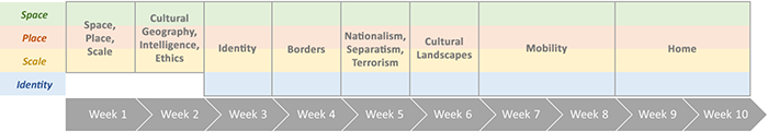
In lessons 3 through 5, we turn toward a key component of cultural geography: identity. Lesson 3 provides a conceptual introduction to identity at the scale of the individual, and a person’s identity relative to space and place. Lesson 4 addresses the importance of borders and boundaries at the international scale, how we identify places as belonging to particular states, and how borders and identity are related to conflict. Lesson 5 extends and combines the content of lessons 3 and 4 with a hard look at nationalism, separatism, and terrorism.
With lesson 6 we turn our attention to the physical world around us, in the form of cultural landscapes. Here we consider what the actual landscape can tell us about the people who inhabit it, and how we can read issues of human security on the landscape.
In lessons 7 and 8 we consider mobility and migration. Lesson 7 introduces these concepts and discusses their spatiality, while lesson 8 focuses more specifically on the experiences of refugees and asylum seekers and the challenges of human security that arise from the displacement of people due to conflict.
Finally, in lessons 9 and 10 we take a look at two concepts that effectively combine everything else we have laid out: home and peace. Lesson 9 introduces and critiques the concept of home at the scale of individual experience, while lesson 10 scales home upward to homeland and asks you to consider the endgame of human security and intelligence: the desire for peace in one’s homeland—not just as the absence of conflict, but as something more.
To get the most out of this course, we recommend (again!) that you read the lecture notes carefully and take notes as you do. Notice how throughout the course we rely on the previous weeks to inform our understanding of the weeks going forward. Concepts like space, place, scale, and identity recur throughout the course as ways of informing our understanding. We expect that you will apply these concepts in assignments throughout the course.
Finally, remember that the assigned readings and other media are meant to be understood within the context of the lecture notes. During most lessons you will have discussions with your classmates; your posts should use the concepts introduced in the lecture notes to analyze the assigned readings/media, and should engage with your classmates’ ideas and interpretations in a meaningful way, though we also encourage you to bring in any relevant experiences of your own that dovetail with the discussion.
1.10 Introduction to ArcGIS Online and StoryMaps
Esri is best known for the ArcGIS suite of software that has proliferated the spatial analysis world since the 1980s (Esri). Esri launched ArcGIS Online in 2012, which has continued to expand its capabilities and make spatial analysis more collaborative, easy to use, and easier to disseminate. This comes with some positives and negatives; however, it is beyond the scope of this class to discuss those nuances.
This course will utilize ArcGIS Online and ArcGIS StoryMaps as a mechanism for interrogating and understanding issues relating to cultural geography and intelligence analysis, as well as for disseminating and conveying your results and findings.
ArcGIS Online has several components for interrogating and conveying spatial information. ArcGIS Online’s basic features allow you to create and share maps and create web applications from those maps. Your first exercise, on the next page of this lesson, will have you create and share your first web map.
As a Penn State student in this class, you have access to an ArcGIS Online account, which you will use to complete several of the assignments for this course .
Here are the steps to access your ArcGIS Online account:
- Use the following link to access Penn State’s ArcGIS Online Organization [1]
- Log in with your PSU username and password
- If you don't see the Penn State login page, you might have to click the “Penn State WebAccess” link.
Deliverable:
You must submit a screen capture of your Penn State ArcGIS Online home page (worth 5 points) to the Lesson 1 ArcGIS Online dropbox in Canvas. The screen capture should be similar to the image below and must include your name and student ID. Instructions for submitting the screen capture can be found on the Lesson 1 ArcGIS Login page in the Lesson 1 Module in Canvas.
Note: If you do not successfully complete the ArcGIS login, your instructor will not be able to give you access to the files you will need to complete the Lesson 1 mapping exercise (45 points).
Please check the Canvas Syllabus or Calendar for specific time frames and due dates.
One key item to remember for future projects:
- The ArcGIS Online sharing features are key to your success. The default sharing settings are to keep your work “private,” so that nobody else can see your maps while you are working on them. When you are getting ready to turn in your work, especially complex work that may include multiple maps, please ensure that the sharing settings for all of your content is set to 'Organization'.
Getting Started with ArcGIS Online:
Use the link to preview Esri's Get started with ArcGIS Online [14] lesson.
- Notes about the Getting started with ArcGIS Online lesson:
StoryMaps
One additional capability within ArcGIS Online are the StoryMaps. StoryMaps allow users to convey their content in a story format, integrating many of the components ArcGIS Online has to offer.
Use the link to preview Esri's Get started with ArcGIS StoryMaps [15] lesson.
- Notes about the Get started with ArcGIS StoryMaps lesson:
- Lesson duration: 30 minutes
- Cost: Free
- As a Penn State student, you already have access to Penn State's ArcGIS Online Organization.
Gaining familiarity with the technology you will be using to convey your information is important, but it is equally important to recognize the power one has when one is conveying and disseminating information. Choosing what content to convey and which mechanisms to use are integral to ensuring that you are presenting your information effectively for the greatest number of readers possible. The next training module explores storytelling in ArcGIS Online:
Use the link to preview Esri's Telling Stories with GIS Maps [16] lesson.
- Notes about Telling Stories with GIS Maps:
- Lesson duration: 1 hour
- Cost: Free
- When Launching the course, you may select 'Access Anonymously.'
- We will not be tracking any training records.
Other potential resources:
- ArcGIS StoryMaps: An Introduction [17] - Esri Training Video (28 min)
- Anatomy of a Story [19] - StoryMap (5 minutes)
- Getting Started with ArcGIS StoryMaps [20] - StoryMap
1.11 ArcGIS Online StoryMap Exercise
Introduction:
Scale is very important in societal perceptions of phenomena. One such phenomenon that is subject to significant scale differences in relation to its perception is gun violence. Global perception is that gun violence and gun related homicide is prevalent throughout the United States, with statistics being shown in media outlets like the BBC. Using ArcGIS Online and media sources, this exercise will allow you to examine global, state, and county data related to firearm-related fatalities to examine and interrogate the impact of scale on the perception of firearm-related fatalities.
All the data you need for the assignment is uploaded to the ArcGIS Online Group that we set up for this course. To gain access to the group:
- Log into Penn State’s ArcGIS Online organization [1].
- Go to your Groups page by clicking on the 'Groups' link in the menu at the top of the page.
- Look for the GEOG 571 Group:
- Dr. Livecchi's students should use the GEOG 571 T1-Livecchi group.
- Dr. Sulewski's students should use the GEOG 571 T2-Sulewski group.
- Dr. Gaertner's students should use the GEOG 571 - Gaertner group.
- If you do not already have access to the group, please contact your instructor to request membership.
Overall Task:
Using the data and sources provided in the ArcGIS Online group, utilize ArcGIS Online and ArcGIS StoryMaps to explain the role of scale in understanding (or misunderstanding) the prevalence of homicides committed by firearms.
Choropleth Map
In this exercise, we will be creating choropleth maps to help visualize the data.
A choropleth map is a type of map that uses quantitative (numerical) data to categorize enumeration units (such as countries, states, and counties) into a series of groups. Different colors or shading for each group of data are used to differentiate between groups.
Take, for instance, the choropleth map of July 2012 unemployment rates below. This map has six classes, and each class is represented by a different shade of red. Each state is then assigned to a class and corresponding color depending on the unemployment rate for that state.
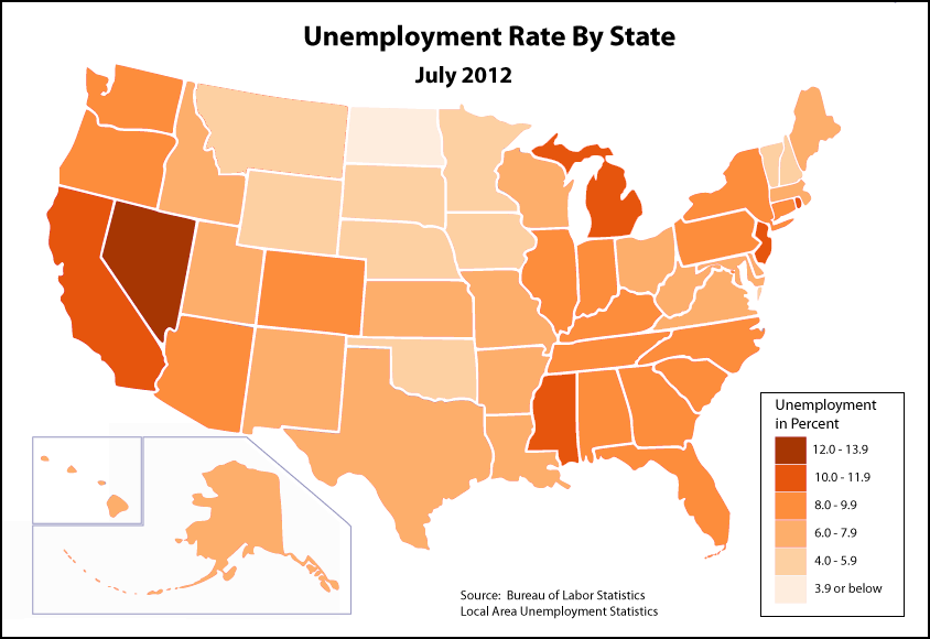
| State | Unemployment (%) |
|---|---|
| Alabama | 8.9 |
| Alaska | 7.2 |
| Arizona | 8.7 |
| Arkansas | 7.8 |
| California | 10.9 |
| Colorado | 8.3 |
| Connecticut | 9.3 |
| Delaware | 7.1 |
| District of Columbia | 9.1 |
| Florida | 9.4 |
| Georgia | 9.5 |
| Hawaii | 6.3 |
| Idaho | 6.9 |
| Illinois | 9.3 |
| Indiana | 8.3 |
| Iowa | 5.1 |
| Kansas | 6.7 |
| Kentucky | 8.5 |
| Louisiana | 7.9 |
| Maine | 7.4 |
| Maryland | 7.1 |
| Massachusetts | 6.6 |
| Michigan | 10.3 |
| Minnesota | 5.9 |
| Mississippi | 10.2 |
| Missouri | 7.6 |
| Montana | 5.9 |
| Nebraska | 4.3 |
| Nevada | 12.5 |
| New Hampshire | 5.7 |
| New Jersey | 10.1 |
| New Mexico | 7.4 |
| New York | 9.1 |
| North Carolina | 9.9 |
| North Dakota | 2.9 |
| Ohio | 7.4 |
| Oklahoma | 5.2 |
| Oregon | 8.8 |
| Pennsylvania | 8.4 |
| Rhode Island | 11.2 |
| South Carolina | 9.7 |
| South Dakota | 4.4 |
| Tennessee | 8.7 |
| Texas | 7.5 |
| Utah | 6.2 |
| Vermont | 5.3 |
| Virginia | 6.1 |
| Washington | 8.4 |
| West Virginia | 7.2 |
| Wisconsin | 7.4 |
| Wyoming | 5.3 |
Metadata
When you are working on exercises in ArcGIS Online, we will provide you with several data sets. It is important for you to know about the metadata for those data sets.
Metadata is simply data about your data. It explains some of the nuances about your data, including but not limited to: how it was collected, how it should be used, when it was collected, etc. This information is incredibly useful, and should always be viewed. It will help you gain a greater appreciation for the data you are using and understand its uses and limitations. In spatial data, if this information is present, it is often attached to the data. In the ArcGIS Suite, there is a special place for it in the “Catalog” part of the Suite.
ArcGIS Online also has a space for metadata. If you go into the GEOG 571 group space for this class, you will see several thumbnails that include data and anything that has been shared with the group. In the blue bar running across the top, you’ll see the group’s name on the left and several options on the right side. One option is “Content.” As you and your classmates work through the variety of exercises throughout the course, this content will increase in quantity.
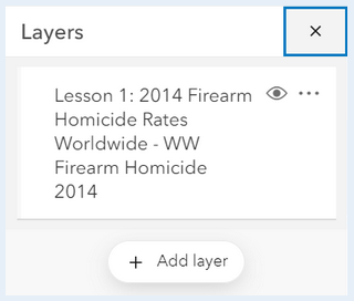
On the left side of the Content page, you have several options to filter the content. Under “Item Type” choose “Layers.” This will minimize the content just to the layers available. If you click on the name of the layer “Lesson 1: 2014 Firearm Homicide Rates Worldwide,” a new page will open up with all of the metadata [23] that has been populated for that layer. Each dataset you will use in this class should have some level of metadata associated with it to help you understand it. It is recommended that you view the metadata for the datasets before using them.
Rate
All of the data you’ll be dealing with in this exercise are “rates.” How exactly do we define rate? The Merriam-Webster Dictionary definition of rate is “a quantity, amount, or degree of something measured per unit of something else.” At its heart, rate is a normalized value. The raw value is measured against another value. As the metadata demonstrates for the World Firearm Homicide rates, the values are the number of deaths per 100,000 people. Each of the datasets you will use in this exercise will use a similar rate, so be sure to check the metadata!
Global Patterns:
A data set for 2014 global Firearm Homicide Rates can be found in the ArcGIS Online group. It is labeled Lesson 1: 2014 Firearm Homicide Rates Worldwide:
- Beginning from your 'My Groups' page:
- Dr. Livecchi's students should click on the GEOG 571 T1-Livecchi group.
- Dr. Sulewski's students should click on the GEOG 571 T2-Sulewski group.
- Dr. Gaertner's students should use the GEOG 571 - Gaertner group.
- Click on the three dots below the Lesson 1: 2014 Firearm Homicide Rates Worldwide link and click on the 'Open in Map Viewer.’
- The data will load automatically and you will see a map that is zoomed in on the Unites States. You can zoom in and out using your mouse or the '+' and '-' buttons on the map.
- When the map opens in the viewer, all of the countries are one color. We need to symbolize the countries based on the Firearm Homicide rates for 2014.
- If a Layers pane is not visible, click the 'Layers' button.
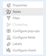
- In the left Layers pane, you’ll see your dataset. To change the symbology for your dataset, make sure that you select the dataset (if it is selected, a blue vertical bar will appear on the left side of the name of the layer). If the layer is selected, a series of options will be enabled on the right side of your map. Select 'Styles.'
- To the left of this dialog, options for styles appear. Click on the button to add a field:

The attribute you will choose is: FAHR_2014
- Once you choose the attribute, new drawing styles will appear to help you symbolize your data. We are generating a choropleth map. Under 'Counts and Amounts,' click the 'Style options' button. By clicking on 'Symbol Style' you can choose a different color ramp. Ensure the color ramp you have chosen depicts low values with a lighter color and high values with a darker color.
- Just below the color ramp/histogram, there will be a slider bar for 'Classify Data.' Slide the bar to the right to enable classifying data. Continue scrolling down on the pane. This is where you will see options to change your classification scheme (keep the default: 'Natural Breaks') and change the number of classes (for now, keep the default: 4).
- Once you complete your amending this dataset, click 'Done' and 'Done' again.
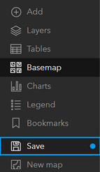
- Once you’re done, you can save your map by clicking the Save button in the far left menu. Add a title, tags, and description. In the title of the map, at the end have your last name.
- Make sure to add tags, as they are required to save the map.
- Please include your last name as part of the title of your map. (e.g. Map Title - LastName )
Review the results of your map:
What spatial patterns are you seeing in the data? Where are the highest rates of firearm-related homicides? Where are the lowest?
Read the following articles:
- America's gun culture in charts [24]
- Gun Violence Deaths: How The U.S. Compares With The Rest Of The World [25]
How do these articles' portrayals of gun violence and firearm-related homicides compare to your observations of the 2014 spatial patterns?
Record your observations and comparisons. They will be used in your final compiled StoryMap.
United States Patterns:
The overall perception from media reports may be that gun violence and firearm-related homicides are widespread throughout the United States. Is that really true? Or are there spatial patterns to where there are higher rates of firearm-related homicides?
- To add the United States data to the map, click the 'Add Layers' button at the bottom of the layers pane.
- Change the search options from 'My Content' to 'My Groups.'

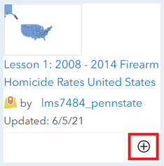
- Search for this dataset:
Lesson 1: 2008 - 2014 Firearm Homicide Rates United States
- Click on the plus sign at the bottom of the dataset:
- Follow the same procedure for symbolizing the United States data as you did for the global dataset.
- The field you will use to generate the choropleth map is called:
FHR_08_14
Reminder: When you save your map, be sure to include your last name at the end of it.
Review the following articles:
Review the results of your map:
What spatial patterns are you seeing in the data? Are there variations in the crude rates of firearm-related homicides across the United States or is it more evenly distributed?
What does this say about the considerations of scale when thinking about perceptions of firearm-related homicides for a whole country?
Record your observations and comparisons. They will be used in your final compiled StoryMap.
Missouri Patterns:
Media articles about firearm-related fatalities in the United States often cite Missouri as a state with high rates, as likely evidenced in your review of spatial patterns in the United States data. You will now review firearm-related fatalities from 2015 through 2019 to see if there are variations in the fatality rates across the state.
Follow the same procedures for creating a Missouri map as you did for the global and United States map.
The dataset is called:
Lesson 1: 2015 - 2019 Firearm Fatality Rates Missouri
Important note about the Missouri data:
Unlike the other datasets in this assignment, the Missouri data include all firearm fatalities, not just homicides. The reason for this is the relative lack of comparable county-level, firearm homicide-specific data (we have to work with what's available). The availability or lack of data is something you may encounter in professional settings, and as the analyst, it is part of your job to consider this in your work. As you look at the data, you may find it worth discussing these differences and their impact on your analysis in your StoryMap.
The field you will use to generate the choropleth map is called:
FAF_15_19
Important Note:
Your map may default to using graduated symbols for your data (varying sizes of circles, with small circles representing smaller values and larger circles representing larger values). To change your symbolization to a choropleth style, scroll down through the 'Try a drawing style' options, select 'Counts and Amounts (color).' The process is now the same as the previous sections.
Review the following article:
Review the results of your map:
What spatial patterns are you seeing in the data? Are there variations in the crude rates of firearm-related fatalities across Missouri, or is it more evenly distributed?
Record your observations and comparisons. They will be used in your final compiled StoryMap.
Creating Your StoryMap:
To access StoryMaps in ArcGIS Online, click the square of nine circles in the upper right corner of the ArcGIS Online webpage, next to your name and user ID. You will see a series of Esri ArcGIS online 'Apps.' Scroll down and select StoryMaps.
Using the maps you have created throughout this exercise, create a StoryMap describing your observations with regards to firearm-related fatalities across the three scales we investigated: global, national, and state. Be sure to include the information listed in the StoryMap checklist below.
StoryMap Checklist:
Ensure your StoryMap includes the following:
-
Contains the three web maps for all three scales of interest,
-
Answers to the questions you were asked to engage with for each map,
-
Ensure your answers also incorporate the media sources you were asked to read,
-
Synthesizes your observations between all three maps and illustrates how scale is important in understanding human-related spatial phenomena. Your synthesis should include answers to the following questions:
-
How does scale impact the perception of firearm-related fatalities?
-
Why is it important to consider scale when discussing phenomena such as firearm-related fatalities?
-
Deliverable:
When you have finished compiling your StoryMap for this assignment and your StoryMap has been 'Published', save the URL for your StoryMap.
The URL for your StoryMap should look something like this:
- https://storymaps.arcgis.com/stories/223f1885402c44626ad614e5b844c2b4
To submit the URL for your StoryMap exercise, return to the Lesson 1: Foundations of Cultural Geography module in Canvas and look for the Lesson 1 StoryMap Exercise dropbox. The dropbox has instructions for submitting the assignment.
Please check the Canvas Syllabus or Calendar for specific time frames and due dates.
Sharing your data and maps in ArcGIS Online groups:
Make sure your StoryMap is shared with the PSU organization and with the GEOG 571 group. Go to your 'My Content' page, and click on your StoryMap. On the page for your map, there will be a series of buttons on the right side of the browser for opening in a Map Viewer, opening in ArcGIS, opening in Field Maps, creating a presentation, creating a web app, and finally, sharing.
- Ensure your StoryMap or data is shared to the course’s ArcGIS Online Group:
- Go to the metadata page for your story.
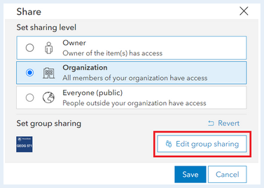
- On the right side click the button 'Share'.
- Set the share level to 'Organization' and Set the group settings to the course’s group by clicking 'Edit Group Sharing.' make sure there is a check mark next to the course’s group.
1.12 Summary and Final Tasks
Summary
This lesson provided you with a brief introduction to geography and cultural geography, with an emphasis on the importance of space, place, and scale as analytical concepts. It also introduced you to ArcGIS Online and StoryMaps as tools for analyzing and presenting data; we will use these again at various points in the term. The concepts and exercises in this lesson are designed to foster a spatial perspective that you will continue to develop and use.
Deliverable:
Please return to the Lesson 1 module in Canvas where you will see the Lesson 1 Discussion Forum which contains the discussion prompt and specific instructions for the assignment.
Please check the Canvas Syllabus or Calendar for specific time frames and due dates.
Final Tasks
Complete all of the Lesson 1 tasks!
You have reached the end of Lesson 1! Double-check the to-do list on the Lesson 1 Checklist page [29] to make sure you have completed all of the activities listed there before you begin Lesson 2.
Questions?
If you have any questions now or at any point during this week, please feel free to post them to the GEOG 571 - General Discussion Forum. (That forum can be accessed at any time in Canvas by opening the Lesson 0: Welcome to GEOG 571 module in Canvas.)
Lesson 2: Cultural Geography, Intelligence, and Security
The links below provide an outline of the material for this lesson. Be sure to carefully read through the entire lesson before returning to Canvas to submit your assignments.
Note: You can print the entire lesson by clicking on the "Print" link above.
2.1 Overview
Introduction
Cultural geography has been applied in a number of different disciplines, and none without so much controversy as within intelligence and military contexts. This lesson is designed to introduce you to the evolution of the use of cultural geography in military and intelligence disciplines, as well as to the value it brings to those disciplines. It will also introduce you to the controversies that have surrounded the inclusion of cultural geographic concepts at a variety of different scales. Finally, this lesson challenges you to consider the ethical dilemmas that surround this academic discipline’s inclusion in military and intelligence operations, and how to potentially ameliorate those dilemmas so these disciplines can complement each other in relative harmony.
Learning Goals and Objectives:
Upon completion of this lesson you should be able to:
- Evaluate cultural geography's importance to intelligence and security.
- Assess ethical issues in gathering cultural geographic intelligence.
- Argue the impacts of ethical lapses in the use of cultural geographic concepts in intelligence.
- Critique the use of cultural geographic intelligence in issues of security.
Questions?
If you have any questions now or at any point during this week, please feel free to post them to the GEOG 571 - General Discussion Forum. (That forum can be accessed at any time in Canvas by opening the Lesson 0: Welcome to GEOG 571 module in Canvas.)
2.2 Checklist
This lesson is one week in length. Please refer to the Calendar in Canvas for specific time frames and due dates. To finish this lesson, you must complete the activities listed below. You may find it useful to print this page out first so that you can follow along with the directions.
| Step | Activity | Access/Directions |
|---|---|---|
| 1 | Read the Lesson 2 online lecture notes. | The lecture notes can be accessed by clicking on the Lesson 2: Cultural Geography, Intelligence, and Security link in the Lessons menu on this page. |
|
2 |
Required Reading |
Medina, R. M. (2016). From anthropology to human geography: Human terrain and the evolution of operational sociocultural understanding. Intelligence and National Security, 31(2), 137-153. Pawinski, M. (2018). Going beyond Human Terrain System: Exploring ethical dilemmas. Journal of Military Ethics, 17(2-3), 122-139. Price, B. R. (2017). Human terrain at the crossroads. Joint Force Quarterly, 87(4), 69-75. Wainwright, J. D. (2016). The U.S. military and human geography: Reflections on our conjuncture. Annals of the American Association of Geographers, 106(2), 513-520. Meyerle, J., Katt, M., and Gavrilis, J. (2012). Vignette 2: U.S. Marine Battalion, Nawa, Helmand 2009. In J. Meyerle, M. Katt, and J. Gavrilis (Eds.), On the ground in Afghanistan: Counterinsurgency in practice (pp. 37-51). Marine Corps University Press. Note: Registered students can access the readings in Canvas by clicking on the Library Resources link. |
| 3 | Complete the Lesson 2 Team Debate. | Instructions for the team debate can be found on the 2.8 Team Debate Exercise [31] page of this lesson. You can find the prompt for the Lesson 2 Team Debate in the Lesson 2: Cultural Geography, Intelligence, and Security module in Canvas. |
| 4 | Complete your Research Project Topic. | Submit your research project proposal and associated information to the Lesson 2 Research Project Topic dropbox in the Lesson 2: Cultural Geography, Intelligence, and Security module in Canvas. The dropbox contains the information you will need to complete the assignment. |
Note: Please refer to the Calendar in Canvas for specific time frames and due dates.
2.3 Intelligence Analysis Process
While this course is academic in nature, it will use the intelligence process and its components as a framework to help introduce the importance of cultural geographical concepts to human security and intelligence analysis. Throughout the course, we will refer back to some of these components to help aid in your understanding of where cultural geography may be most helpful and applicable within the Intelligence Process Framework.
Intelligence Analysis Process Components
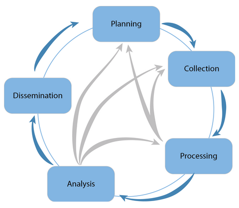
There are five major components to the intelligence analysis process. While a variety of different terms are used to describe each component, generally they are: planning, collection, processing, analysis, and dissemination.
The planning component of the process often begins with some request for information or a need. Once that need has been expressed, a plan to complete the request is devised. This plan may include analytic techniques required and collection strategies to collect the information needed to conduct the analysis.
The collection component deals with the gathering of information. This information can often be gathered from a number of different intelligence sources. In this course, we’ll mostly be focusing on GEOINT (geospatial intelligence), but there are a variety of different intelligence disciplines for places from which information can be derived, including OSINT (open source intelligence) and HUMINT (human intelligence) (Clark, 2011).
The processing component is where analysts take the results from your collections strategies, which is often raw information, and create usable information. An example of this is exploiting imagery, translating an article, or evaluating information for its reliability (Intelligence Careers, n.d.).
The analysis component takes the information that results from the processing component and synthesizes this information to formulate assessments and judgements.
Finally, the dissemination component is where the results of the analysis are put into a form that is conveyed to customers. While this can take a variety of forms, we’ll introduce you to one form of dissemination: the written brief.
Comparison with Academic Research Process
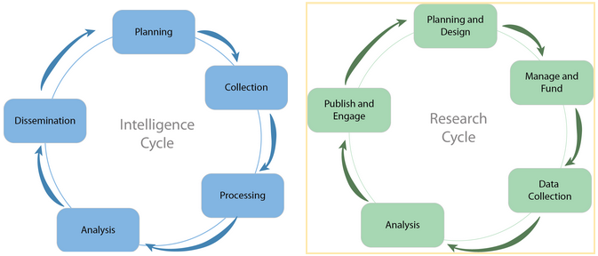
In many classes, the intelligence process is referred to as a cycle, similar to the research process or cycle. In fact, if you put the two side by side, they in many ways mirror each other. In Figure 2.1, we can see that many of the components of the “intelligence cycle” mirror that of the research cycle. Both often begin with planning and designing. In research you need to figure out how to manage and fund your research, and while this is a concern in the intelligence process, it’s not often included in the process. Collection in the intelligence cycle is part of the “search” phase in the research cycle. “Processing and Exploitation” is also part of the search and analyze process; however, in the intelligence cycle, analysis and exploitation are treated separately. Finally, all of these result in some level of sharing of your research or analysis: “dissemination.”
© Penn State University is licensed under CC BY-NC-SA 4.0 [7]
A Cycle? …
The intelligence process is often considered to be a cycle. In many ways it is. It can be initiated by some requirement, resulting in some level of dissemination, which may in turn result in additional taskings and requirements.
But, rarely does the cycle pan out as simply as often conveyed. The same is true of academic research. Rarely are these “cycles” as simple as progressing from one step to the next without having to reassess, recollect data, reanalyze, etc. Each component is related to the next, and, while there is a general progression, there are times when you as a researcher or analyst need to know when to go back to another component to produce the most rigorous analysis possible. You may collect the information and process it, only to find that you need to collect more information. Or, you may make it all the way to the analysis phase and realize you need to collect more information. In fact, you may make it to the analysis phase and realize you need to go back to the planning stage. Much like academic research, intelligence analysis is rarely cut-and-dried. Figure 2.2 depicts the complicated nature of the intelligence process.
Many scholars have discussed the general conceptual issues with the “Intelligence Cycle.” Some scholars, like Hulnick (2006), dissect many of the individual components, raising the issues that may be overlooked by simplifying intelligence with this conceptual diagram. Other researchers seek to move the intelligence framework forward, including research such as Gill and Phythian (2013) who propose a framework that is less like a cycle and more like a web, trying to capture the complicated nature of intelligence analysis. While it is beyond the scope of this class to assess these various frameworks, it is important to know that while the intelligence cycle is an excellent starting point for understanding intelligence analysis, it is an extremely simplified construct.
Optional Readings:
Gill, P. & Phythian, M. (2013). From Intelligence Cycle to web of intelligence: complexity and the conceptualization of intelligence. In M. Phythian (Ed.), Understanding the Intelligence cycle (pp. 21-42). Taylor & Francis Group.
Hulnick, A. S. (2006). What’s wrong with the Intelligence Cycle. Intelligence and National Security, 21(6), 959-979.
References:
Charles Sturt University Library [33] (2021). For researchers.
Clark, R. M. (2011). The Technical Collection of Intelligence. CQ Press.
Gill, P. & Phythian, M. (2013). From Intelligence Cycle to web of intelligence: complexity and the conceptualization of intelligence. In M. Phythian (Ed.), Understanding the Intelligence cycle (pp. 21-42). Taylor & Francis Group.
Hulnick, A. S. (2006). What’s wrong with the Intelligence Cycle. Intelligence and National Security, 21(6), 959-979.
How Intelligence Works. (n.d.). U.S. Intelligence Careers. Retrieved December 16, 2021, from
2.4 A Discipline by Any Other Name...
A discipline by any other name is still Cultural Geography in nature. Cultural Geography and its concepts have been a core part of intelligence and military operations since the formal beginnings of Geography as an academic discipline. Recognizing the utility of understanding the landscape, countries engaged in military operations as early as the 1870s often used geography and cartography to aid in their endeavors (Forsyth, 2019). The terms used to describe the incorporation of cultural geographic concepts in intelligence have evolved, as have the ethical issues surrounding it. Do the benefits of incorporating these concepts outweigh the ethical issues? This lesson will help you navigate the minefield of this aspect of cultural geography.
References:
2.5 Evolution of the Inclusion of Cultural Geography in Military Geography and Intelligence
The geographic discipline has always had a nexus in military and intelligence operations. The use of maps and cartography to understand the landscape and devise effective military strategies in operations has been employed since at least the 1870s (Forsyth, 2019). Cartography was not the only aspect of the discipline that governments found useful in their endeavors: they also relied upon the discipline’s ability to provide spatial context to political and economic issues, which have their basis in cultural geography (Forsyth, 2019).
After the quantitative revolution of the 1950s, the 1960s saw the geographic discipline take a more humanistic approach, distancing itself from the military nexus and focusing more heavily on social issues (Forsyth, 2019; Rech et al., 2015). This was accompanied by a methodological shift in which human geographers, concerned with positivism’s tendency to dehumanize its subject in an era of increasing civil unrest, turned away from quantitative methods and toward social theory and phenomenology as lenses with which to approach their research. This is not to say that social science was not still incorporated into intelligence; however, it was not as prevalent or overt. Intelligence and military failures, such as those from the Vietnam War (1955-1975), also helped demonstrate the need for better and more comprehensive sociocultural understandings of the places where military and intelligence actions were taking place. While there are multiple aspects that led to the ultimate failure of the Vietnam War, the lack of sociocultural understanding played a significant role. For example, in 1962, US forces began relocating South Vietnamese families from their homes into “strategic hamlets” where they were kept under the control of US forces to prevent the Vietcong from hiding amongst them (British Broadcasting Company, n.d.). This however, removed these people from their ancestral lands, and demonstrated a lack of sociocultural understanding on the part of US forces about the importance of those lands to the rural populations in South Vietnam and perhaps even led to mistrust between the US forces and the local population.
The military operations in Iraq and Afghanistan in the early 2000s has also helped to reinvigorate the relationship between human geography and military-intelligence contexts (Rech et al., 2015). In 2006, Lieutenant General David Petraeus specifically referenced the need for human geographical considerations in military and intelligence operations when he provided 14 observations from Iraq. Almost every one of these observations has a cultural geographic nexus; however, observation nine, “Cultural awareness is a force multiplier,” is the most overt (Petraeus, 2006). Petraeus makes the key observation that, without knowledge and understanding of the people, their culture, and their history, any operations will be difficult, if not impossible. These 2006 observations reinvigorated the conversations about integrating Human Geography and sociocultural understanding into military and intelligence operations. Many argue that these observations, spurred by experiences in Iraq and Afghanistan, inspired the popularization of analyzing “human terrain” (Wainwright, 2016).
Despite its resurgence between 2005 and 2007, the term "human terrain" was first used in 1968 (Medina, 2016; Wainwright, 2016). While human terrain is, by its nature, multi- and interdisciplinary, it draws in large part from key foundational concepts of cultural anthropology and human geography. The Human Terrain System (HTS) was developed after 9/11 when people realized the importance of a sociocultural understanding. HTS became popularized in 2005, and it emphasizes a very micro-level, ethnographic, and anthropological perspective (Medina, 2016; Pawinski, 2018). Beginning in around 2007, anthropologists began to be deployed with the Army in Iraq and Afghanistan as part of Human Terrain Teams (HTT). These deployed and deployable HTTs often encompassed at least five individuals who interfaced with local populations, including a team leader, social scientist, research manager, and two Human Terrain Analysts (Pawinski, 2018). HTTs were slowly rolled out in Iraq in 2012 and Afghanistan in 2013 (Price, 2017). Not long after the installment of HTTs in Iraq and Afghanistan, controversy emerged amongst the academic anthropological community about ethical issues surrounding the discipline’s role in HTTs and its synthesis with the military (Medina, 2016; Pawinski, 2018).
While the program drew down, the utility of sociocultural understanding to military and intelligence operations did not wane. After 2010, a shift away from anthropology and towards human geography occurred in many branches of the military and intelligence, including the National Geospatial-Intelligence Agency (Wainwright, 2016; Medina, 2016). This shift also signified a change in the scale of sociocultural understanding: from a micro-scale to a more strategic macro-scale. Medina (2016) characterizes this shift as also a shift away from the face-to-face interactions integral to anthropologic understanding to a more “systematic” approach, including a greater presence of Geographic Information Systems. To this end, in 2011, the World-Wide Human Geography Data (WWHGD) Working Group was established as a mechanism for discussing and organizing Human Geography-related data to meet the needs that were unveiled by the investigation of natural and technical disasters: the Human Security Taxonomy (Medina, 2016; WWHGD). The WWHGD Working Group established 13 themes described in the Human Security Taxonomy, including: communication, demographics, economy, education, ethnicity, groups (civil, political, and ideological), land, language, medical, religion, significant events, transportation, and climate.
What does the shift in scale from micro-scale anthropologic focus to a more macro-scale, strategic, human/cultural geographic focus portend for sociocultural understanding in military and intelligence studies? Does this more macro-scale focus mean a lack of face-to-face interactions, as Medina (2016) postulates? How will that impact sociocultural understanding? Whatever the military-intelligence complex decides to call it, the importance of sociocultural understanding in intelligence analysis is here to stay. What inception it takes may evolve overtime; however, the inclusion of human and cultural geographic principles will be closely intertwined, as well as the interdisciplinary nature of understanding people and places.
Read:
Medina, R.M. (2016). From anthropology to human geography: Human terrain and the evolution of operational sociocultural understanding. Intelligence and National Security, 31(2), 137-153.
Pawinski, M. (2018). Going beyond human terrain system: Exploring ethical dilemmas. Journal of Military Ethics, 17(2-3), 122-139.
Price, B. R. (2017). Human terrain at the crossroads. Joint Force Quarterly, 87(4), 69-75.
Wainwright, J. D. (2016). The U.S. military and human geography: Reflections on our conjuncture. Annals of the American Association of Geographers, 106(2), 513-520.
References:
Forsyth, I. (2019). A genealogy of military geographies: Complicities, entanglements, and legacies. Geography Compass, 13(3), e12422.
Medina, R.M. (2016). From anthropology to human geography: Human terrain and the evolution of operational sociocultural understanding. Intelligence and National Security, 31(2), 137-153.
British Broadcasting Company. n.d. The Vietnam War. Reasons for US failure in defeating the Vietcong [34].
Pawinski, M. (2018). Going beyond human terrain system: Exploring ethical dilemmas. Journal of Military Ethics, 17(2-3), 122-139.
Petraeus, D. H. (2006). Learning counterinsurgency: Observations from soldiering in Iraq. Military Review, 45-55.
Price, B. R. (2017). Human terrain at the crossroads. Joint Force Quarterly, 87(4), 69-75.
Rech, M., Bos, D., Jenkings, K. N., Williams, A., and Woodward, R. (2015). Geography, military geography, and critical military studies. Critical Military Studies, 1(1), 47-60.
2.6 Cultural Geography in Intelligence Analysis: Successes and Failures
Most of the time, when we hear about the use of human and cultural geography in intelligence analysis and military operations, it is because it wasn’t factored in and led to an intelligence or military failure. That said, there are times when human and cultural geographic analyses and information have been used to the success of missions and analyses. One such example comes from American and British success in Nawa, Afghanistan.
A Success Story
Understanding human and cultural geography, as well as anthropological understanding, are often imperative to success when interacting and interfacing with other cultures and geographic regions. One major success story of intertwining sociocultural understanding with military operations was the stabilizing operational success of the Marines in Nawa, Afghanistan in 20019 (Medina, 2016; Meyerle et al., 2012). After defeating the Taliban, who controlled the area and forced the community to close their schools and businesses, the Marines who were stationed in Nawa worked to rebuild the infrastructure and build trust with the locals. Their sociocultural understanding and continued efforts to build that understanding is what helped those operations become successful. By not dropping bombs and protecting the civilians and communicating with those living in Nawa and with their leadership, the Marines were able to build trust. Patrols included frequent meetings with locals and leaders, leading to discussions of the concerns of the district. In many ways, the Marines deployed to Nawa used their sociocultural understanding and continued to build on that understanding in order to help this district stabilize and transition power peacefully to the local government. The military used what they understood about culture, space, and place to be successful and stabilize this region.
Read:
Before completing the Lesson 2 Discussion assignment, read the vignette about the Marines’ time in Nawa from On the Ground in Afghanistan: Counterinsurgency in Practice (Meyerle et al., 2012).
Failures
More often than not, it is the failures that are publicized over the successes. As such, there are many examples of failures to use human and cultural geographic understanding causing failures in military and intelligence operations. One such example was presented earlier discussing failures in Vietnam. More recent examples can be brought forward from the many commission reports that have been published. One such example is The Commission on the Intelligence Capabilities of the United States Regarding Weapons of Mass Destruction (2005) report, where the recognition that geographical context is important to understanding intelligence challenges is highlighted. The importance of understanding the world, its cultures, economies, people, and how they interact was a key takeaway from this report. While the words “human geography” or “cultural geography” were not used, it is indeed clear that the discipline that can help shed the most light in these areas.
References:
Meyerle J., Katt, M., and Gavrilis, J. (2012). On the ground in Afghanistan: Counterinsurgency in practice. Marine Corps University Press.
2.7 Ethical Considerations
Any discipline’s interaction with the military, intelligence, and conflict often undergoes intense scrutiny by its members. This dialogue is important for ensuring the ethical use of the information gained by the fusion of a discipline into the military-intelligence nexus. Due to the “secretive” nature of the military-intelligence nexus, there is often a perception of less-than-virtuous motives; however, that isn’t always the case (Medina, 2016; Pawinski, 2018). Below are some beginning thoughts for and against the inclusion of human geographical, cultural geographical, and anthropological researchers and concepts into the military and intelligence fields. It is by no stretch an all-inclusive list, but a beginning for you to consider as you formulate your arguments for your discussion post.
| For Inclusion | Against Inclusion |
|---|---|
| The inclusion of sociocultural understanding can help reduce kinetic operations and reduce casualties (Price, 2017). |
Historic misuse of the social sciences in conflict zones causing researchers to have ethical concerns that the information may be used to harm individuals (Pawinski, 2018). |
| Researcher’s participation can help ensure ethical practices are maintained (Pawinski, 2018). |
Financial support may cause others to question the objectivity of the research (Pawinski, 2018). |
| More positive interactions with local populations and leaders (Bartholf, 2011; Price, 2017). |
Classification issues leading to research not developing the discipline in academia (Pawinski, 2018). |
References:
Bartholf, M. C. (2011). The requirement for sociocultural understanding in full spectrum operations. Military Intelligence Professional Bulletin, 37(4), 4-10.
Medina, R. M. (2016). From anthropology to human geography: Human terrain and the evolution of operational sociocultural understanding. Intelligence and National Security, 31(2), 137-153.
Pawinski, M. (2018). Going beyond human terrain system: Exploring ethical dilemmas. Journal of Military Ethics, 17(2-3), 122-139.
Price, B. R. (2017). Human terrain at the crossroads. Joint Force Quarterly, 87(4), 69-75.
2.8 Where Do We Go from Here?
As history has shown us, the intersection of the entire geographic discipline, to include human and cultural geography, have been intertwined with the military and intelligence disciplines. The success or failure of military and intelligence operations, as well as peacekeeping missions, has often rested on how well these concepts have been understood and used. Ethical issues have arisen and been debated between academics and intelligence/military analysts; however, the utility and need for this sociocultural understanding in order to succeed has not been debated.
How can these two intertwined disciplines co-exist and complement each other? Is it possible? Many researchers and practitioners have presented options and suggestions to help the two disciplines work together (Pawinski, 2018; Price, 2017; Medina, 2016).
References:
Pawinski, M. (2018). Going beyond human terrain system: Exploring ethical dilemmas. Journal of Military Ethics, 17(2-3), 122-139.
Price, B. R. (2017). Human terrain at the crossroads. Joint Force Quarterly, 87(4): 69-75.
2.9 Team Debate Exercise
For this week, you have been assigned to a Canvas team to argue either for or against the inclusions of cultural and human geographic concepts in military and intelligence analysis and operations. Each group should work together to prepare a collaborative Group Position Statement (1,000 ± 100 words). Each student is then responsible for reading the opposing Group Position Statements and then preparing an Individual Rebuttal (300 to 500 words).
Deliverable:
Please return to the Lesson 2 module in Canvas where you will see the Lesson 2 Team Debate which contains specific instructions for the assignment.
Please check the Canvas Syllabus or Calendar for specific time frames and due dates.
2.10 Research Project Proposal
A central part of earning a master's degree is demonstrating the ability to conduct research and to analyze real-world phenomena. The value of doing research and analysis is not limited to academia; these are skills that have immense practical value in both personal and professional spheres, especially within the fields of intelligence and human security, where analysis is the heart of the work. It takes training and practice to learn and refine research and analysis skills; this is why the successful completion of a well-written and well-documented research project is one of the requirements to pass GEOG 571. This research project is worth 200 points total.
For more information about the research project, please review the Research Project information pages [35]. A link to the Research Project information pages is also available in the Lessons menu.
The Research Project Guidelines page contains a list of broad research project questions to get you started, and some examples of specific research questions used by previous students. You are encouraged to develop your own specific research question that falls within those guidelines.
Deliverable:
Your submission for this week should contain the following:
- The primary (i.e., specific) research question, which will be the focus of your project
- Justification for your question, explaining the merits of this project
- A list of three potential scholarly sources (see this video if you need a refresher on what constitutes a scholarly source [36])
- A list of three to five keywords or search terms that you will use to find additional sources
- The format you would like to use to deliver your project
- Not required, but you may also list any concerns, challenges, or roadblocks you foresee while conducting your research
When you are ready to submit your research project proposal and related information, please return to Canvas and open the Lesson 2 Research Project Proposal dropbox in the Lesson 2: Cultural Geography, Intelligence, and Security module.
2.11 Summary and Final Tasks
Summary
This lesson introduced you to the intersection of cultural geography, intelligence, and the military, with regards to both its successes and its failures. It has challenged you to see both sides in the debate for and against cultural geography's inclusion in intelligence and military analyses and operations. The concepts you have considered in this lesson will be applied throughout the course as you consider the variety of applications of cultural geography within the intelligence discipline.
Final Tasks
Complete all of the Lesson 2 tasks!
You have reached the end of Lesson 2! Double-check the to-do list on the Lesson 2 Checklist page [37] to make sure you have completed all of the activities listed there before you begin Lesson 3.
Note: Please refer to the Calendar in Canvas for specific time frames and due dates.
Questions?
If you have any questions now or at any point during this week, please feel free to post them to the GEOG 571 - General Discussion Forum. (That forum can be accessed at any time in Canvas by opening the Lesson 0: Welcome to GEOG 571 module in Canvas.)
Lesson 3: Identity I - Foundations
The links below provide an outline of the material for this lesson. Be sure to carefully read through the entire lesson before returning to Canvas to submit your assignments.
Note: You can print the entire lesson by clicking on the "Print" link above.
3.1 Overview
Introduction
In the previous two lessons, we introduced you to human geography and cultural geography, and to the intersections of human geography with intelligence and military operations, which have implications also for human security. In this lesson, we will begin diving into some of the theoretical concepts used in cultural geography that have particular significance to issues of intelligence and human security.
This lesson and the two that follow focus on identity. In this lesson, we lay out the theoretical foundation for how identity is conceptualized and used in cultural geography, which we will expand on in lessons 4 and 5.
Warning: this lesson has some of the heaviest and longest lecture notes that you will encounter this term. We strongly recommend that you pace yourself accordingly. It also includes several exercises intended to get you thinking about the material. We expect that you will do them as you read the content. They are not graded, and you do not need to turn them in.
Learning Goals and Objectives:
Upon completion of this lesson, you will be able to:
- Evaluate the intersections of identity categories.
- Analyze and categorize spaces with regard to scale.
- Assess the relationship between scale and identity.
- Appraise spaces to determine how they are coded with respect to who is implicitly included or excluded from them.
Questions?
If you have any questions now or at any point during this week, please feel free to post them to the GEOG 571 - General Discussion Forum. (That forum can be accessed at any time in Canvas by opening the Lesson 0: Welcome to GEOG 571 module in Canvas.)
3.2 Checklist
This lesson is one week in length. Please refer to the Calendar in Canvas for specific time frames and due dates. To finish this lesson, you must complete the activities listed below. You may find it useful to print this page out first so that you can follow along with the directions.
| Step | Activity | Access/Directions |
|---|---|---|
| 1 | Read the Lesson 3 online lecture notes. | The lecture notes can be accessed by clicking on the Lesson 3: Identity I - Foundations link in the Lessons menu on this page. |
| 2 |
Required |
Ehrkamp, P. (2008). Risking publicity: Masculinities and the racialization of public neighborhood space. Social & Cultural Geography, 9(2),117-132. Hopkins, P., Botterill, K., Sanghera, G., and Arshad, R. (2017). Encountering misrecognition: Being mistaken for being Muslim. Annals of the American Association of Geographers, 107(4), 934-948. Note: Registered students can access the readings above in Canvas by clicking on the Library Resources link. Krogstad, J. M. (2014, March 24). Census Bureau explores new Middle East/North Africa ethnic category [38]. Pew Research Center. Wang, H. L. (2018, January 29). No Middle Eastern or North African category on 2020 census, bureau says [39]. NPR. |
| 3 | Optional Reading |
Dowling, R. and McKinnon, K. (2014). Identities. In R. Lee, N. Castree, R. Kitchin, V. Lawson, A. Paasi, S. Radcliffe, and C. W. J Withers (Eds.), The Sage handbook of human geography (pp. 627-648). Sage. Foucault, M. (1995). Discipline and punish: The birth of the prison. New York: Vintage Books. Note: Penn State students should be able to access the optional readings though the Penn State Librareis. (Penn State Access ID login required.) |
| 4 | Complete the Lesson 3 Discussion Forum. | Post your answer to the Lesson 3 Discussion Forum in Canvas and comment on classmates' responses. You can find the prompt for the assignment in the Lesson 3 Discussion Forum in the Lesson 3: Identity I - Foundations module in Canvas. |
| 5 | Submit the Lesson 3 Written Brief Assignment. | Instructions for the assignment can be found on page 3.10 [40] of this lesson. Submit your written assignment to the Lesson 3 Written Brief assignment dropbox in the Lesson 3: Identity I - Foundations module in Canvas. |
3.3 Identity: An Introduction
Much like culture, identity is a slippery concept. In its most basic form, we think of identity as answering the question “Who are you?” — but this is a far more complicated question than it first seems.
Exercise 1:
Consider the question “Who are you?” Set a timer for 30 seconds. Use that time to list as many answers for yourself to that question as you can. Don’t think about your answers as you list them; just go with whatever comes to mind during the time allowed. Do not move on to the next exercise until you have completed this one.
Exercise 2:
After finishing the exercise above, consider your response. How many answers did you come up with? Did you run out of time, or were there more answers you could have provided? Are there commonalities or patterns that you notice within your answers? Do you give equal weight to all of your answers? If not, which ones do you prioritize? Do you think your answers would stay the same regardless of who was asking? Do you think your answers would stay the same regardless of where you were when you were asked? For both of these last two questions: why or why not?
As you may have discovered in the exercises above, it is difficult to pin a person’s identity to a single answer. If you were to compare your answers with other students, you might find that there are several different ways that people respond to the question.
Perhaps because of this complexity, the question of identity is a thread that has wound its way through the humanities and social sciences. A substantial corpus of scholarship has developed around identity in a number of disciplines, including philosophy (luminaries such as Plato, Descartes, Locke, Leibniz, and Kant are just a starting point; see also the work of Jacques Lacan, Michel Foucault and Daniel Dennett for vastly different perspectives), psychology (see, e.g., the work of Freud, Erikson, or Tajfel), anthropology (see, e.g., the work of Anthony Cohen, Nigel Rapoport, or Martin Sökefeld), and sociology (from Erving Goffman to Sheldon Stryker). More recently, fields such as cognitive science and neuroscience have taken up identity as an area of research (see, e.g., Bechtel, 1988; Clark, 2000; Pickersgill et al., 2011; or Sheepers & Derks, 2016).
There is no clear consensus on what identity means or what about it is worthy of studying: a philosopher might be concerned with identity as some essential quality, or with the sameness of a thing to itself (does a person remain identical over the course of life?); a psychologist might define it as a person’s sense of self that emerges during adolescence; and a sociologist might emphasize a distinction between personal identity and group or collective identity.
Given the wide array of perspectives on identity, there has been considerable debate about its effectiveness as an analytical tool. Just as we saw with culture, some theorists argue that identity is a meaningless or analytically useless concept because it accounts for too much of human experience, and suggest that it should be jettisoned entirely in favor of other, more precisely defined terms such as “self-understanding,” or more processual terms like “identification” (see, e.g., Brubaker & Cooper, 2000). Despite the theoretical critiques leveled at identity, it remains an important concept within human geography, particularly within the subfields of cultural geography and political geography.
Identity in human geography
Geographers borrow from sociologists and social theorists, including the late cultural theorist Stuart Hall, whose later publications provided a major theoretical framework for the ways that human geographers think about identity. Hall combined strands of discourse theory and psychoanalytic theory to argue that identity is multiple, contingent, and always in a process of becoming rather than a state of being. Yet while Hall is a prominent figure, some geographers overlook serious theoretical discussions of identity and instead rely on looser, less-articulated notions that come from a wide variety of theoretical perspectives (see Dowling & McKinnon, 2014 for a deeper discussion).
Despite this eclectic approach, we generally agree on a couple basics: first, that identities are relational (that is, they are based on the positions we occupy in various social categories); amd second, that they are also complex and socially constructed (that is, they depend in part on dynamic external factors). Geographers rarely talk about the formation of identity (this is better situated within the domain of psychology), but many would argue that identity results from both internal and external processes (i.e., self-identity and categorization, respectively). The remainder of this lesson will explore these aspects of identity in greater detail. The final section of this lesson will consider the role of place in identity.
Recommended Reading:
Dowling, R. and McKinnon, K. (2014). Identities. In R. Lee, N. Castree, R. Kitchin, V. Lawson, A. Paasi, S. Radcliffe, and C. W. J. Withers (Eds.), The Sage handbook of human geography (pp. 627-648). Sage.
Additional References:
Bechtel, W. (1988). Philosophy of mind: An overview for cognitive science. Erlbaum.
Brubaker, R., and Cooper, F. (2000). Beyond “identity.” Theory and Society, 29(1), 1-47.
Clark, A. (2000). Mindware: An introduction to the philosophy of cognitive science. Oxford University Press.
Dowling, R. and McKinnon, K. (2014). Identities. In R. Lee, N. Castree, R. Kitchin, V. Lawson, A. Paasi, S. Radcliffe, and C. W. J. Withers (Eds.), The Sage handbook of human geography (pp. 627-648). Sage.
Pickersgill, M., Cunningham-Burley, S., and Martin, P. (2011). Constituting neurologic subjects: Neuroscience, subjectivity and the mundane significance of the brain. Subjectivity, 4(3), 346-365.
Scheepers, D., and Derks, B. (2016). Revisiting social identity theory from a neuroscience perspective. Current Opinion in Psychology, 11, 74-78.
3.4 Relational and Complex
At its heart, identity has to do with what makes us unique as well as what makes us similar to others; and, by extension, what makes us individuals and what makes us belong to larger collectives (see Jenkins, 2008). The apparent paradox suggested here is resolved if you think about identification as a process by which we determine the ways that we relate to other people — how we balance the qualities we share with others and the differences between ourselves and others.
In this regard, identity is neither essential nor necessarily stable. As Dowling and McKinnon argue, identity is
something that changes with time, something we construct, something that is closely connected with operations of power in the contemporary world, whether at the level of global politics or that of the politics of everyday life. Here, scholarship is more likely to think about identity in the plural and imagine how human beings inhabit multiple identities in the course of daily life. (2014, p. 628)
Human geographers work with various theoretical approaches toward identity (including, to name a few, feminist, Marxist, post-structuralist, and psychoanalytic theory). Many human geographers borrow loosely from social theorists and sociologists, theorizing identity as relational and socially constructed. We’ll focus on the second part of this description in the next section of this lesson; for now we turn our attention to what it means for identity to be relational.
Relational
To say that identity (or, as we will see, identities, plural) is relational is to argue that identity is not founded on some unchanging, essential kernel of selfhood, but rather on people’s social positions relative to one another. This happens through a careful balancing act in which we recognize what differentiates ourselves from others, as well as what creates commonalities between us. Following Hall (1996), we might argue that identity forms through processes that force us, often unconsciously, to reconcile our social positions relative to others—and these processes create social spaces of inclusion and exclusion.
Consequently, in discussions of identity we often hear or see lists of traits that might describe a person. Consider, for example, the designations on forms given out by human resources departments, doctors' offices, or even the US Census Bureau. On any one of these, people might be asked if they are male, female, or intersex; Black, White, Asian, Latino, Native American, or Middle Eastern; man, woman, transgender, or nonbinary; Christian, Jewish, Muslim, Buddhist, Hindu, Wiccan, agnostic, or atheist; abled or disabled; working class, middle class, upper-middle class, or upper class; straight, gay or lesbian, bisexual, pansexual, or asexual; elderly, middle-aged, a young adult, teenager, tween, or preschooler—and this list is far from exhaustive.
Yet notice that each of these sets of traits coalesce around some broader social category. That is, each of the items above reflects some aspect of sex, race, gender, religion, dis/ability, class or socioeconomic status, sexuality, or age. We could add other broad categories such as ethnicity (e.g., Italian American, Pakistani British, etc.) or nationality (i.e., the state in which one claims the right of citizenship), among others.
The point here is that, given a list of categories, anyone can tick off a series of boxes that theoretically indicates some aspect of their identities. How strongly we feel about any of these descriptors may change depending on any number of things—for example, who is in the room, the event or circumstances under which these descriptors are relevant, whatever is happening in the world at large, and so on. For some categories, we might not feel that any of the available options reflect who we are. Finally, how relevant one’s particular position is at any given moment is affected by several factors, many of which are beyond our control. We will revisit this point in the next section of this lesson.
Complex
Further complicating our identities is the fact that they are complex and multilayered. Think back to the first exercise in this lesson: was any single answer that you provided sufficient to fully identify you? Chances are, your immediate response is something like, no, it is the collection of those things that makes me who I am.
Consider the various categories (e.g., sex, race, age, religion) presented above. In any given moment we all occupy some position within each of those categories. A person might be simultaneously -- and among other things — Asian (race), Christian (religion), queer (sexuality), a woman (gender), American (nationality), and middle-aged (age). Someone else might be White, Jewish, straight, nonbinary, Israeli, and a teenager. A third might be White, agnostic, straight, a woman, and middle-aged. All three of these individuals are complex people whose life experiences may differ — or be similar — in part as a result of their relative social positions.
One important point to bear in mind is that we can in no case reduce anyone to a single aspect of their identity (no one is ever just a man, just Black, just an atheist, and so on). As Hall puts it, identities “are never unified and, in late modern times, increasingly fragmented and fractured; never singular but multiply constructed across different, often intersecting and antagonistic discourses, practices and positions” (1996, p. 4). And as we will see in the next section, we cannot say definitively what any given identity means because identity is neither natural nor essential.
References:
Dowling, R. and McKinnon, K. (2014). Identities. In R. Lee, N. Castree, R. Kitchin, V. Lawson, A. Paasi, S. Radcliffe, and C. W. J. Withers (Eds.), The Sage handbook of human geography (pp. 627-648). Sage.
Hall, S. (1996). Introduction: Who needs “identity”? In S. Hall and P. Du Gay (Eds.), Questions of cultural identity (pp. 1-17). Sage.
3.5 Socially and Discursively Constructed
So far, we’ve considered the ways that identities are relational and complex. We have determined that people identify in multiple ways simultaneously, that the process of identification creates relationships (in the most basic sense of the word) of inclusion and exclusion, and that our emotional engagement with identity may vary. Now we turn our attention to what it means for something (and in particular, for identity) to be socially constructed.
Social construction
As discussed in the Dictionary of Human Geography, social construction can be briefly defined thus:
The idea that the social context of individuals and groups constructs the reality that they know, rather than an independent material world. Knowledge is always relative to the social setting of the inquirers, the outcome of an ongoing, dynamic process of fabrication. (Gregory et al. 2009, p. 690).
In other words, to say that things are socially constructed is to say that they “are real if people think they are” (Jenkins, 2008, p. 45). On first glance, this is an unsettling idea; students are quick to argue that it suggests that all of reality is based only on people’s opinions, and thus it follows that everyone is right about everything and there is no objective reality. This response, common as it is, is a misunderstanding of what social construction means.
To say that something is socially constructed is to say that the forces or structures within our environment — the social and cultural context in which we live — have identified it as something meaningful or worthy of note, and that there is broad enough social and cultural consensus about the thing that people accept the thing as real, and have agreed on what that thing means, and how to perceive, discuss, or engage with that thing. A couple of examples will help illustrate what we mean here.
First, consider money. No one would dispute that the $5 bill one might use to buy a cup of coffee exists. Yet there is nothing inherently valuable about a $5 bill. We generally agree that we can exchange it for goods or services, but objectively speaking, it is nothing more than a piece of paper with some symbols on it, and while we can use it freely within the United States, no one outside the US is required to accept it as legal tender (though we might exchange it for euros, yen, pesos, lira, etc., depending on where we are). One might argue that it is inherently valuable because the US government says it is — but here’s the catch: there’s nothing inherently valuable in it if our entire ability to use it is predicated on some human collective’s decision that it’s valuable. The fact that the power of a $5 bill to buy things fluctuates over time as prices increase or decrease is an indicator that there is nothing objective about its value. That value — and, indeed, the concept of money itself — is socially constructed.
Second, consider the Olympic Games. The games exist only because a group of people decided to hold them, yet there is no single, canonical list of sports that belong in the Olympics, nor is there a single location where they take place, nor is there a natural ordering of events within the Olympics; these are all decided by the International Olympic Committee. While no one would dispute the prestige that countries take when their athletes medal in Olympic events, that prestige exists only because people collectively agree that medaling is a desirable and prestigious thing. The Olympics as an event, the games that take place during the Olympics, and the social, cultural, and political capital associated with winning — all of these are socially constructed.
To reiterate: no one taking a social constructionist view would argue that money or the Olympics are fictional or nonexistent. On the contrary, they would agree that these things are very real, and that they have real uses, meanings, or consequences for people (and nations). Likewise, a social constructionist would not hesitate to agree that features on the landscape (e.g., rivers, mountains, etc.) are real — but that person would remind us that the thresholds that determine which bodies of water are rivers (as opposed to creeks or streams) and what constitutes a mountain (as opposed to a hill) are somewhat arbitrary and socially constructed.
Identity, social construction, and discourse
Just as money, the Olympics, and features on the landscape are socially constructed, so are identities. Both the broad categories that we use (e.g., age, religion, race) are socially constructed, as are the relative positions within those categories (e.g., Black, White, Asian, Middle Eastern, etc.). To illustrate how these are socially constructed, consider, for example, how we determine what constitutes religion as opposed to myth or philosophy. Or, as in the exercise below, consider how we think about race.
Exercise 3:
Use the following link (or click on the image below) to examine this interactive timeline [41] from the Pew Research Center.
 [42]
[42]
On it, you can trace the racial identities included in the decennial census since 1790. Compare the various racial designations that appeared on the census in the past to those on the 2020 census. How have these racial designations changed? Which designations have been consistent, and how consistent have they been? There are some that are no longer used today; do you recognize these as racial categories?
What this tells us about social constructs is that, while they are meaningful and consequential, they are not natural, but are instead contingent on some external factors. You might be wondering who determines, for example, what constitutes a social category that’s worthy of recognizing? And who determines, again, which positionalities exist within that category?
There are a number of forces and agents that create structure and define various constructs within society and what they mean for us. These guide the construction of some of the most pervasive and fundamental social constructs in society. We trace this idea to Michael Foucault, a French philosopher and historian who developed a theory of discourse. Writing from structuralist and post-structuralist traditions, Foucault’s major works — including Madness and Civilization: A History of Insanity In the Age of Reason (originally published in 1961), Discipline and Punish: The Birth of the Prison (originally published in 1975), and The History of Sexuality (originally published in five volumes between 1976 and 1984) — laid out a historically-grounded explanation for the ways that institutions such as government, law, medicine, and education use their power to create and shape social constructs through the strategic use of language and terminology.
For example, in Madness and Civilization, Foucault follows the historical treatment of people who were constructed as ‘mad’ or ‘insane’ by European societies, noting they were regarded as a source of wisdom during the Renaissance, as morally-corrupt outcasts in need of confinement during the Enlightenment, and as sick people who might be cured during the Modern era. The changing social construction of mental illness, he argues, was brought about by institutional shifts that entailed new terminologies, institutional attitudes, legal constructions, and social beliefs about mental health (see Foucault, 1995). In fact, my very use of the terms ‘mental health’ and ‘mental illness’ reflect what Foucault might describe as our contemporary discourses of ‘madness’: discourses that codify diagnoses of ‘mental disorders’ in documents like the ICD-10 and the DSM-V, and that entail treatment such as medications, therapy, or short-term hospitalization (as opposed to earlier discourses that might have revolved, instead, around the marginalization and imprisonment of people with mental health issues).
Just as identities are socially constructed through a critical mass of everyday activity that creates new positionalities through activism and visibility via popular culture and social media, identities are also discursively constructed. We have seen this already in the example of racial designations in the US Census. The Census Bureau, as an arm of the government, has the ability to determine which positionalities count as legitimate through its use of language and terminology. As we see in the readings by Krogstad (2014) and Wang (2018), discussion about whether to include Middle Eastern and North African (MENA) as a racial category in the census provides an excellent example of discursive processes that have taken place within the last decade.
It is crucial to recognize here that both social and discursive constructions of phenomena (especially identity positions) vary from culture to culture. This is in large measure due to differences in things like migration histories, the presence of different minority populations, and institutional policies that determine which groups of people should be recognized for protection or persecution. That is, social constructions (and discursive constructions) are rarely universal. Even if the same designations exist in two different cultures, the policies, beliefs, and expectations surrounding those designations may vary drastically.
Normalization
As a final note about both the social and discursive constructions of identities, it is important to be aware that some identity designations or positions become normalized through the processes of construction. That is, certain designations take on the connotation of being ‘normal’ and are assumed to be the standard, neutral, or ‘unmarked’ (see Tannen, 1993 and Brekhus, 1998) positions — and because of this, these positions are sometimes left as undefined or are presumed to be self-evident, and thus unworthy of inquiry. These positions are typically dominant within a particular culture; those positions that are considered different or other are given new terms.
We can see a clear example of this at work in the US Census Bureau’s racial designations that you explored in the exercise above. Notice that the designation ‘White’ barely changes throughout the entire history of the census. In the earliest years, the designation is “Free white males and free white females,” which changes to “White” for the 1850 census and remains unchanged from that point forward. Contrast this with the very visible and more rapidly changing racial designators for everyone else. This is an indicator (along with its status at the top of the list) that “White” is the dominant, unmarked racial designator.
It is important to bear in mind that normalized identities still qualify as identities, even if they are dominant. They may be less obvious because of their dominance, but this does not make them any less effective or important an identity than any other designation.
Read:
Krogstad, J. M. (2014, March 24). Census Bureau explores new Middle East/North Africa ethnic category [38]. Pew Research Center.
Wang, H. L. (2018, January 29). No Middle Eastern or North African category on 2020 census, bureau says [39]. NPR.
Recommended:
Foucault, M. (1995). Discipline and punish: The birth of the prison. Vintage Books.
Additional References:
Brekhus, W. (1998). A Sociology of the unmarked: Redirecting our focus. Sociological Theory, 16(1), 34-51.
Foucault, M. (1995). Discipline and punish: The birth of the prison. Vintage Books.
Foucault, M. (1973). Madness and civilization: A history of insanity in the age of reason. Vintage Books.
Gregory, D., Johnston, R., Pratt, G., Watts, M. J., and Whatmore, S. (Eds.). (2009). The dictionary of human geography. Wiley-Blackwell.
Jenkins, R. (2008). Social identity. London: Routledge.
Tannen, D. (1993, June 20). There is no unmarked woman. The New York Times Magazine.
3.6 Intersectionality
We have seen that any individual’s identity is complex and multilayered, and also that some identities become normalized while others are marked (or deemed other). Although these may seem like unrelated aspects of identity, one of the potential consequences of this is that people become marginalized because of a particular combination of identities. This complex interaction between structures of power and people’s multilayered identities is referred to as intersectionality.
Lawyer and legal scholar Kimberlé Crenshaw presented the idea of intersectionality in a landmark paper in 1989, in which she reviewed three court cases that demonstrated the complexity of discrimination that Black women often face in the workplace. In the first of these, a Black woman sued an employer who refused to hire her, arguing that she had been discriminated against for being a Black woman. The judge dismissed the case, arguing that the company did hire women and did hire Black people — overlooking the fact that the company did not hire Black women.
In her review, Crenshaw argues:
…Black women can experience discrimination in ways that are both similar to and different from those experienced by white women and Black men. Black women sometimes experience discrimination in ways similar to white women's experiences; sometimes they share very similar experiences with Black men. Yet often they experience double-discrimination-the combined effects of practices which discriminate on the basis of race, and on the basis of sex. And sometimes, they experience discrimination as Black women — not the sum of race and sex discrimination, but as Black women. (1989, p. 149)
What is significant about the cases Crenshaw discusses is that the courts treated the women in question as either women or as Black with regard to discrimination. Yet identity is multilayered, and the plaintiffs in these cases were both Black and women simultaneously, and it was that overlapping (or intersection) of gender and race that rendered them legally marginal in both the workplace and the courtroom. Crenshaw’s work presents an interesting and clear case study of the ways that legal discourses (in this case, the failure to recognize intersectionality) may have significant consequences for individuals and social groups alike.
Cultural geographers working in identity are keenly aware of intersectionality as a factor that casts individuals vis-a-vis their identities into complicated relational and spatial networks with others. For example, Dwyer (1999) considers the intersections of sex, ethnicity, and religion for Muslim women in Britain; Schroeder (2014) addresses intersections of religion, sexuality, and class in the transformation of LGBT neighborhoods in Toledo, Ohio; and Eaves (2017) examines intersections of race, sexuality, and, to a lesser extent, religion in the American South.
References:
Crenshaw, K. (1989). Demarginalizing the intersection of race and sex: A Black feminist critique of antidiscrimination doctrine, feminist theory and antiracist politics. University of Chicago Legal Forum, 1989(1), 139-167.
Dwyer, C. (1999). Veiled Meanings: Young British Muslim women and the negotiation of differences. Gender, Place and Culture, 6(1), 5-26.
Eaves, L. (2017). Black geographic possibilities: On a queer Black South. Southeastern Geographer, 57(1), 80-95.
Schroeder, C. G. (2014). (Un)holy Toledo: Intersectionality, Interdependence, and Neighborhood (Trans)formation in Toledo, Ohio. Annals of the Association of American Geographers, 104(1), 166-181.
3.7 Internal and External
So far, we have discussed identity as though it is something that is socially and discursively constructed, but we have also noted that the intensity with which people identify may vary. This suggests that identification as a process is something that people choose to do.
To some extent, this is correct: people do in many cases adopt various social identity designations. Yet this is not always the case. Identification is not a singular process, but one that takes place both internally and externally. Consequently, our identities are something that we might feel or express — but also something that, in some cases, might be imposed upon us. Some theorists conceptualize this as a dichotomy between self-identification and categorization, respectively (see Jenkins, 2008).
Exercise 4:
Try to think of at least one situation in which someone other than you imposed an identity on you. How accurate was this imposed identity? What, if any, impacts did it have on your sense of who you are? What, if any, consequences did it have for you in your everyday life?
In order to understand how identity operates in any given culture, it is important to understand the different ways that self-identification and categorization work. A person might self-identify in some way and not be fully satisfied with what that means for them in society. Yet identities that are imposed upon people are another matter altogether; as Jenkins puts it, “identification by others has consequences” (2008, p. 43). For example, a person who is identified by a doctor as being mentally ill may be at risk of being involuntarily hospitalized; likewise, someone who is identified as an “at-risk youth” might face increased scrutiny by teachers or other authority figures — or they might be shuttled into programs intended to prevent criminal activity or provide job training. Identification, especially by social structures that hold some real power within a culture, can have real and significant impacts on people’s lives.
References:
Jenkins, R. (2008). Social identity. Routledge.
3.8 Space, Place, and Identity
We have spent considerable space here laying out a theoretical foundation for identity — what it is, what forms it takes, and how it operates within the framework of a given culture or society. At this point you may be wondering what any of this has to do with geography (or maybe you already have some ideas about how identity and geography are related). We conclude this lesson with a more direct discussion of that relationship, with special attention to place identity, and the spatial implications of identity.
Place identity
It is a common experience that, when encountering someone new, one of the first questions we often ask is, “Where are you from?” This seemingly simple question gets at an aspect of identity that is often overlooked in identity research.
Exercise 5:
If someone were to ask you where you are from, how would you answer? How simple is that answer? How consistently do you tend to answer this question? If you have more than one answer, what factors impact which answer you choose to give? How strongly do you feel about your answer(s) to this question — is it a source of pride, a source of embarrassment, are you neutral about it? What, if anything, do you think your answer reveals about you?
Conceptually, place identity refers to an aspect of a person’s self-identity as it is related to, and impacted by, the place(s) where that person has lived, with the understanding that the environment in which we live impacts how we relate to the world. It filtered into human geography from environmental psychology in the 1970s and 1980s (see, e.g., Proshansky et al., 1983) when it was adopted by humanist geographers.
Research into place identity demonstrates first, that people feel significant attachments to places, and second, that the scale of attachment varies from intimate (e.g., one’s apartment) to distant (e.g., the region) (see Cuba & Hummon, 1993; Gustafson, 2001; and Hidalgo & Hernández, 2001). Significantly, it turns out that the scale at which people conceptualize place identity seems to depend on who is doing the identifying (Gustafson, 2001). When describing their own place identities, people tend to identify at relatively narrow scales such as the city or neighborhood — yet when they conceptualize other people’s place identities, they tend to do so at broader scales such as the region or country.
Spatial implications
To backtrack a bit, recall that both self-identification and classification of others creates spaces of inclusion and exclusion (Jenkins, 2008). When it comes to place identity, this can become a point of contention between people. In some cases, the question of place identity is used to determine a person’s ethnicity or national origin — and when phrased as “where are you really from?” it can call into question a person’s credibility as a citizen, effectively imposing upon them an outsider status (see, e.g., Cheryan & Monin, 2005).
Place identity is not the only site of interaction between identity and geography. Consider, for example, the ways that identities are encoded in spaces. There are the obvious examples — public restrooms are often marked as spaces designated exclusively for men, women, or families; and religious establishments such as churches, synagogues, or mosques proclaim their religious affiliations to attract adherents. Yet there are other, subtler ways that spaces are designated for specific identities with the result that they include some, exclude others, and that complicate interactions between people by setting culturally mediated and tacitly accepted expectations on our behavior.
For example, classrooms can be broken down into spaces that ‘belong’ to the teacher or to the students. Similarly, the spaces within a restaurant are socially constructed such that patrons are expected to stay out of the kitchen and are prohibited from stepping behind the bar, and restaurant staff have their own domains: cooks are expected to limit their time on the dining floor or behind the bar, bartenders are given priority over the space behind the bar, servers may be responsible for serving tables in specific areas of the dining floor, and servers and bartenders may be warned not to go “behind the line” in the kitchen.
Entire establishments may be socially constructed in ways that make their spaces more accommodating to some people than others based on their cultural expectations. For example, in the United States, women may find themselves the recipients of skepticism or of unwanted or unnecessary advice from associates at a hardware store, while men are often assumed to know exactly what they are looking for (even if they don’t). Likewise, neighborhoods that have sizeable populations of visible ethnic or racial minorities, queer people, or people with low incomes may be perceived by people outside those groups as unwelcoming or unsafe (even if they have low crime rates).
The following readings provide case studies that delve into the relationships between space, place, and identity.
Read:
Ehrkamp, P. (2008). Risking publicity: Masculinities and the racialization of public neighborhood space. Social & Cultural Geography, 9(2),117-132.
Hopkins, P., Botterill, K., Sanghera, G. and Arshad, R. (2017). Encountering misrecognition: Being mistaken for being Muslim. Annals of the American Association of Geographers, 107(4), 934-948.
Note: Registered students can access the readings in Canvas by clicking on the Library Resources link.
References:
Cheryan, S. and Monin, B. (2005). “Where are you really from?”: Asian Americans and identity denial. Journal of Personality and Social Psychology, 89(5), 717-730.
Cuba, L., and Hummon, D. M. (1993). A place to call home: Identification with dwelling, community, and region. The Sociological Quarterly, 34(1), 111-131.
Gustafson, P. (2001). Meanings of place: Everyday experience and theoretical conceptualizations. Journal of Environmental Psychology, 21(1), 5-16.
Hidalgo, M. C., and Hernández, B. (2001). Place attachment: Conceptual and empirical questions. Journal of Environmental Psychology, 21(3), 273-281.
Jenkins, R. (2008). Social identity. Routledge.
Proshansky, H. M., Fabian, A. K., and Kaminoff, R. (1983). Place-identity: Physical world socialization of the self. Journal of Environmental Psychology, 3(1), 57-83.
3.9 Writing a Brief
Differences Between Writing an Academic Paper and a Brief
Throughout your academic life, you’ve been told to start with a broad concept and work your way to more specificity about your research and topic. You’re expected to write eloquently, sometimes for many pages at a time. The traditional academic paper is written more like an hourglass: you introduce your topic and hypothesis, provide an overview of relevant literature, discuss your methods, then get to your results, and finally your conclusions and implications. A reader must read all the way to the bottom in order to gain your insights and conclusions.
When writing a brief, you want to forget that construct. Remove it from your brain. Do the opposite.
I know, easier said than done.
The purpose of a written brief is to be…well…brief. You need to be able to convey the most important information to your customer as quickly, concisely, and clearly as possible. The key here is knowing who your customer is, what they need to know to do their job, and putting your bottom line up front. Many refer to this style of writing as the “inverted pyramid,” where your conclusions are actually the first sentence of your paragraph (Brown, 2020) (Figure 3.1). This can be difficult for academically trained analysts to wrap their minds around.
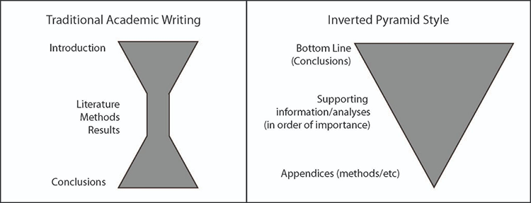
Important Aspects of a Written Brief:
According to the Analyst's Style Manual (Welch, 2008), there are six rules to intelligence writing:
- Put your bottom line, main message, or most important conclusion first
- Write short paragraphs
- Use the active voice
- Avoid verbose language
- Write short sentences
- Pay attention to your credibility:
- Spelling and grammar are important to building your credibility.
- Make sure your arguments are based in fact and logic.
- Use citations.
Examples of Written Briefs
Spoiler alert, if you haven’t watched the Avengers Infinity War and plan to, I’m so sorry. This is merely for illustration purposes only. The example briefs below are each about 120 words, your briefs will need to be more robust.
A Good Brief:
The Avengers were victorious over the evil villain Thanos and saved the universe, but not without the loss of Tony Stark (aka Iron Man) and Natasha (aka Black Widow). During the final battle, Tony Stark was able to get all of the Infinity Stones from Thanos and used them to get rid of Thanos and his army. Previously, Thanos acquired the Infinity Stones, wishing to get rid of half of the life in the universe, including many of the Avengers team, including but not limited to Star Lord, Scarlet Witch, T’Challa,and Groot. The Avengers used time magic to retrieve all of the stones from the past to help undo Thano’s previous wish, allowing them to battle Thanos and his army.
What this brief does well:
- Bottom line is up front: tells you what you need to know
- Gives you the most relevant details following the bottom line
- Follow up with ancillary information.
A Bad Brief:
After acquiring the Infinity Stones, the evil villain Thanos wished to get rid of half of the life in the universe. This included many of the Avengers team, including but not limited to Star Lord, Scarlet Witch, T’Challa, and Groot. The Avengers then used time magic to retrieve all of the stones from the past to help undo Thano’s previous wish, allowing them to battle Thanos and his army. During the final battle, Tony Stark was able to get all of the Infinity Stones from Thanos and used them to get rid of Thanos and his army. Ultimately, the Avengers were victorious over the evil villain Thanos and saved the universe, but not without the loss of Tony Stark (aka Iron Man) and Natasha (aka Black Widow).
What this brief does poorly:
- The point of the brief is at the bottom. Your customer will have to read the entire brief to know what you want them to know.
- Reads more like a story.
Elements of a Successful Brief
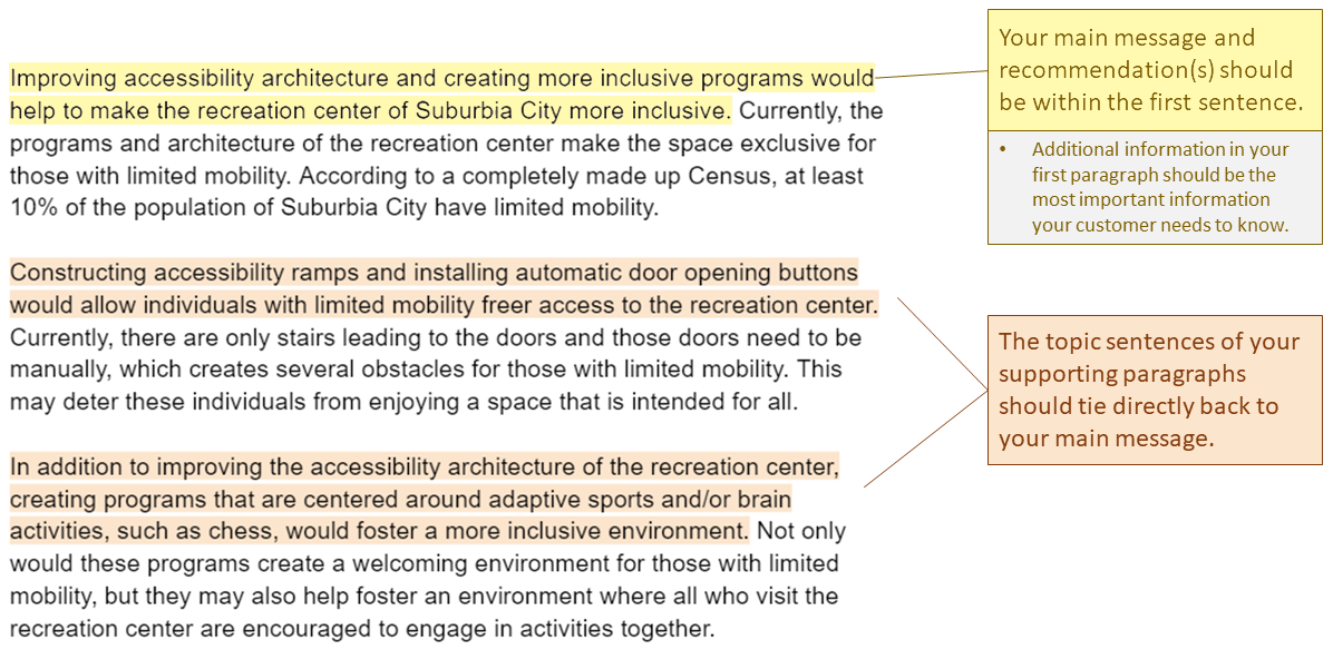
Improving accessibility architecture and creating more inclusive programs would help to make the recreation center of Suburbia City more inclusive. Currently, the programs and architecture of the recreation center make the space exclusive for those with limited mobility. According to a completely made up Census, at least 10% of the population of Suburbia City have limited mobility.
- Your main message and recommendation(s) should be within the first sentence.
- Additional information in your first paragraph should be the most important information your customer needs to know.
Constructing accessibility ramps and installing automatic door opening buttons would allow individuals with limited mobility freer access to the recreation center. Currently, there are only stairs leading to the doors and those doors need to be manually, which creates several obstacles for those with limited mobility. This may deter these individuals from enjoying a space that is intended for all.
In addition to improving the accessibility architecture of the recreation center, creating programs that are centered around adaptive sports and/or brain activities, such as chess, would foster a more inclusive environment. Not only would these programs create a welcoming environment for those with limited mobility, but they may also help foster an environment where all who visit the recreation center are encouraged to engage in activities together.
- The topic sentences of your supporting paragraphs should tie directly back to your main message.
References
Brown, Z. T. (2020, July 16). How you can write like an intelligence analyst [43]. Zachery Tyson Brown.
Welch, B. (2008). The Analyst’s Style Manual [44]. Mercyhurst College Institute for Intelligence Studies Press.
3.10 Written Brief Assignment
You are providing recommendations to your city council to make a public space more inclusive. Frame your recommendations around your experiences of inclusion and exclusion in various spaces and places, and the role that identity played in those.
Example: There is a city-owned skate park that is dominated by teenage boys, almost all of them white. Parents of younger kids, particularly elementary-school-age girls who want to skate there, have complained that their kids are frequently excluded from the space.
Using this example as a guide, develop a situation that might occur in a space you are intimately familiar with.
Assignment Requirements:
- Clearly stated recommendations.
- State the location you are referring to. This location must include the public space, the city, and the state (if in the US) or country (if outside of the US).
- Using the readings and lesson material, explain why your recommendations would make this space more inclusive.
- Using the readings and lesson material, explain why this space was previously perceived as a zone of exclusion.
Your brief should:
- Be no longer than two pages (300-500 words,) not including any ancillary graphs, maps, and figures.
- Follow the basic rules for written briefs provided in the “Writing a Brief [45]” section of this lesson, including putting your bottom line up front.
- Hint: Your main point should be the first sentence of your first paragraph. All of the information that follows should support that main point, in decreasing order of importance.
- Include citations.
Deliverable:
When you have completed your written brief, return to the Lesson 3: Identity I - Foundations module in Canvas and look for the Lesson 3 Written Brief dropbox. The dropbox has instructions for submitting the assignment.
Please check the Canvas Syllabus or Calendar for specific time frames and due dates.
3.11 Summary and Final Tasks
Lesson 3 Summary
In this lesson, we laid out the conceptual underpinnings of identity. We demonstrated that identity is relational, complex and multilayered, socially and discursively constructed, and is both internally and externally determined. We discussed the ways that identities can interact with social structures of power in ways that marginalize individuals and groups of people, as well as the ways that dominant identities become normalized. Finally, we looked more closely at the ways that identities are related to place, space, and scale through place identity, and the ways that spaces are constructed to be inclusive or exclusive along lines of identity.
Deliverable:
Please return to the Lesson 3 module in Canvas where you will find the Lesson 3 Discussion Forum which contains the discussion prompt and specific instructions for the assignment.
Please check the Canvas Syllabus or Calendar for specific time frames and due dates.
Final Tasks
Complete all of the Lesson 3 tasks!
You have reached the end of Lesson 3! Double-check the to-do list on the Lesson 3 Checklist page [46] to make sure you have completed all of the activities listed there before you begin Lesson 4.
Lesson 4: Identity II - Boundaries and Identity
The links below provide an outline of the material for this lesson. Be sure to carefully read through the entire lesson befor returning to Canvas to submit your assignments.
Note: You can print the entire lesson by clicking on the "Print" link above.
4.1 Overview
Introduction
The previous lesson focused on introducing the concept and theory behind identity. This lesson will focus on introducing borders and boundaries and how these constructs are intertwined with identity, with both being shaped by identity and shaping identity. This lesson also reinforces how borders and boundaries are influenced by scale, as evidenced by many of the concepts we have discussed in previous lessons. The lesson will conclude with a discussion of the potential role of Geographic Information Systems in border and boundary conflict and negotiations, and challenge you via a group exercise to delineate your own boundaries and negotiate with others to help resolve a conflict.
Objectives
Upon completion of this lesson, you will be able to:
- Assess the relationship between borders/boundaries and identity.
- Appraise the role of socially-constructed national borders in conflict.
- Evaluate and critique the cartographic representation of disputed areas.
- Critique the impact of the imposition of borders/boundaries on populations with respect to identity.
Questions?
If you have any questions now or at any point during this week, please feel free to post them to the GEOG 571 - General Discussion Forum. (That forum can be accessed at any time in Canvas by opening the Lesson 0: Welcome to GEOG 571 module in Canvas.)
4.2 Checklist
This lesson is one week in length. Please refer to the Calendar in Canvas for specific time frames and due dates. To finish this lesson, you must complete the activities listed below. You may find it useful to print this page out first so that you can follow along with the directions.
| Step | Activity | Access/Directions |
|---|---|---|
| 1 | Read the Lesson 4 online lecture notes. | The lecture notes can be accessed by clicking on the Lesson 4: Identity II - Boundaries and Identity link in the Lessons menu on this page. |
| 2 | Required Reading |
Szary, A-l. A.. (2017). Boundaries and borders. In J. Agnew, V. Mamadouh, A. J. Secor, and J. Sharp (Eds.), The Wiley Blackwell Companion to Political Geography (pp. 13-25). John Wiley & Sons, Ltd. Medzini, A. (2017). The role of geographical maps in territorial disputes between Japan and Korea. European Journal of Geography, 8(1), 44-60. Wubneh, M. (2015). This land is my land: The Ethio-Sudan boundary and the need to rectify arbitrary colonial boundaries. Journal of Contemporary African Studies, 33(4), 441-466. Note: Registered students can access the readings in Canvas by clicking on the Library Resources link. |
| 3 | Complete the Lesson 4 ArcGIS Online Group Exercise | Each group will submit the assignment to the Lesson 4 ArcGIS Online Group Exercise dropbox in the Lesson 4: Identity II - Boundaries and Identity module in Canvas. |
| 4 | Take the Lesson 4 Quiz. | You can find the Lesson 4 Quiz in the Lesson 4: Identity II - Boundaries and Identity module in Canvas. |
| 5 | Complete your Research Project Outline and Annotated Bibliography. | Submit your research project outline and annotated bibliography to the Lesson 4 Research Project Outline and Annotated Bibliography dropbox in the Lesson 4: Identity II - Boundaries and Identity module in Canvas. |
4.3 Borders and Boundaries Defined
The United States. Germany. Australia. North Carolina. California. Bavaria. Tasmania. “Chinatown.” “Little Italy.” “Little Poland.” These are all different ways that space has been carved up and segmented, whether at a local scale within a city, or at internationally recognized national borders, to separate people. These separations, often denoted in terms of lines and areas on a map, serve to create spaces of inclusion and exclusion (as discussed in the previous lesson), whether perceived or actual, and have significant impacts on our individual and community identities (Jenkins, 2008).
The terms “boundary” and “border” are often used interchangeably in literature. Borders and boundaries are loosely some sort of line that separates space (National Geographic). This is an incredibly oversimplified definition of those words, but it is an important starting point in our discussion of them. The roots of the words "boundary" and "border" often stem from a military connection: a front (just as a military front) or place of “friction” (Szary, 2015). Szary (2015) also indicates that borders in terms of territorial limits were created with the signing of the Treaties of Westphalia to help create stability. This idea of borders as territorial limits and possession is just one inception of what borders are. Context is important to understanding boundaries, as well as the role those boundaries take (Popescu, 2012).
Borders can be political limits of territory, an assertion of power and influence over a certain space. Borders and boundaries can also be symbolic, cultural, or economic. They can be delineated as a complex interaction between these areas. These borders can separate one group from another: separating familiar versus unfamiliar, forming zones of “inclusion” (those within territory) and “exclusion” (those outside of a given space) (Popescu, 2012). These borders and boundaries in addition to separating territory and people, provide points of contact and an opportunity for interactions between borders. The borders can be porous or rigid.
Borders are not static, and they are constantly evolving. Boundaries in their inception today will almost certainly be different years from now. Globalization is changing the way boundaries are understood and studied. Some researchers believe that, with globalization, boundaries and borders as we know it will disappear, while others believe that globalization may actually reinforce national and cultural identities that borders generate (Popescu, 2012).
Borders and boundaries are complicated.
References:
Jenkins, R. (2008). Social identity. Routledge.
National Geographic (2011). Encyclopedia entry for the term Border [47].
Popescu, G. (2012). Bordering and ordering the twenty-first century. Rowman & Littlefield.
Szary, A-l. A. (2015). Boundaries and borders. In J. Agnew, V. Mamadouh, A. J. Secor, and J. Sharp (Eds.), The Wiley Blackwell Companion to Political Geography (13-25). John Wiley & Sons, Ltd.
4.4 Borders, Boundaries, and Scaling Identity
When people think of borders, they often think of international boundaries or internal boundaries within national boundaries. Obviously these boundaries and borders can be created by or impact a person or group’s identity. When thinking about national boundaries these identities can often take the form of nationalistic and separatist sentiments, movements, and identities, which will be covered extensively in the next lesson.
International and internal political boundaries, however, are not the only scales by which identity can manifest and/or create boundaries. Think about the United States and the regional divisions that cross state lines: there are cultural, dialectical, and even culinary differences between these regions. When you think about grits, hush puppies, barbeque, and the word “y'all,” where do you think of? Anecdotally, when I was younger, I moved from New England to the South. Driving along the way, we stopped at a McDonald’s in southern Virginia for a burger, and I discovered that mustard was included on the burger as a standard. In New England, this was not the case, it was only ketchup. While distinct border lines are difficult to draw, as it tends to be a gradual shift, many Americans’ identities are shaped by these regional differences.
These types of identities also occur in much more localized settings. Think of the neighborhoods within a city: Little Italy, Chinatown, Koreatown, and the list continues, where different ethnic groups cluster together and create bounded areas of familiarity that are recognized not only by the community they include but by others as well. Wen et al. (2009) lay out the premise for these ethnic neighborhoods, especially in the United States, as related to immigrant circumstances upon arrival in the United States: often they didn’t speak English and did not have a job. Due to these circumstances, immigrant communities often formed enclaves where language, culture, and other characteristics were similar and provided a sense of identity and belonging. While this phenomenon is still present in many large cities, like New York, Los Angeles, and Houston, Wen et al. (2009) also provide evidence for the establishment of ethnic communities and “ethnoburbs” outside of large metropolitan areas, providing another avenue for the solidification of ethnic identities outside of city centers. Research of this kind at a more localized scale is often difficult, as data is often sparse and not collected at the scale required for such an analysis. Logan et al. (2011) was able to test three methods of delineating neighborhood boundaries from point data from the 1880 census, using GIS to delineate potential neighborhood boundaries. Their methods allowed for both discrete delineations and transitional delineations; however, there were no assessment mechanisms to determine which method is correct. More data and research in this vein would be very useful in understanding ethnic neighborhoods in both urban and suburban environments, as ethnic boundaries serve to help create a sense of community and identity for ethnic groups and demonstrate that boundaries occur at a variety of different scales, depending on the context.
References:
Logan, J. R., Spielman, S., Xu, H. and Klein, P. (2011). Identifying and bounding ethnic neighborhoods. Urban Geography, 32(3), 334-359.
Wen, M., Lauderdale, D. S., and Kandula, N. R. (2009). Ethnic neighborhoods in multi-ethnic America, 1990-2000: Resurgent ethnicity in the ethnoburbs? Social Forces, 88(1), 425-460.
4.5 Borders, Boundaries, Identity, and Conflict
Borders separate people, and those separations sometimes cause conflict. Borders and boundaries that are delineated by physiographic features that shift, such as the changing courses of rivers, may be one source of conflict, as the changing course of the river that delineated the boundary may cause one group to lose territory and another to gain (Biger, 2020). In addition, borders and boundaries can change through the amalgamation of adjacent territory. Other groups may also attempt to acquire territory that is geographically distant from them. This geographic and cultural disconnect often causes conflict, especially when these geographically distant people create borders without taking into account the local population.
One illustrative example of territorial powers creating boundaries and causing conflict is the “Scramble for Africa.” Between the 1880s and culminating 1900s, European powers began to claim the resources and territory of the African continent. By 1914, the continent had been divided amongst the colonial powers of France, Great Britain, Belgium, Spain, Italy, Germany, and Portugal, with only Ethiopia remaining independent. Many times these regions would be divided with straight lines, with little regard to the ethnic, tribal, and linguistic makeup of the inhabitants of the continent or the existing conflicts between those peoples. These colonial boundaries often split up ethnic groups, who had, and continued to maintain after border delineation, a shared identity (Michalopoulos and Papaioannou, 2017). This arbitrary delineation of an entire continent left long-lasting effects. Upon independence, many nations retained their colonial boundaries, not wanting to relinquish territory even if it would be in favor of more harmonious international boundaries that reflect the cultural nuances of the continent. The effects of these arbitrary boundaries continue to be felt in the conflicts that are seen throughout the continent, especially in the post-colonial wars that have taken place in Sudan, South Sudan, Nigeria, Liberia, Angola, Mozambique, and others (Prah, 2004). This is exemplified in your reading of Wubneh’s (2015) article about the Ethio-Sudan boundary issues. While this article was written in 2015, the border dispute is still quite active, as evidenced in the Peace and Security Council (PSC) report [48] in March of 2021.
The examples from the African continent are just one example of colonial legacy boundaries spurring conflict globally. Some of the issues in Asia and the Middle East have their roots in colonial rule. The Sykes-Picot Agreement, also known as the Asia Minor Agreement, created spheres of influence for the British and the French in the Middle East in 1916, and has influenced many of the conflicts that surge in that region. You’ll learn more about the Sykes-Picot Agreement and its long lasting consequences in your group exercise this week.
There are many other types of border conflicts spanning the entire globe, each with their own unique nuances, oftentimes embedded in the identities of those nations and their peoples. The below map of Border Disputes in 2017 from Statista with data from Metrocosm demonstrates how pervasive border disputes and conflicts are globally. While this map is map is from 2017, it shows that there are very few areas of the globe not experiencing some level of border dispute.
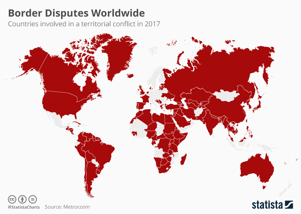
References:
Biger, G. (2020). Historical geography and international boundaries. European Review, 29(1), 69-77.
Michalopoulos, S. and Papaioannou, E. (2017). The contemporary shadow of the Scramble for Africa. In S. Michalopoulos and E. Papaioannou (Eds.), The long economic and political shadow of history, volume 2 (50-65). CEPR Press.
Prah, K. K. (2004). African Wars and Ethnic Conflict - Rebuilding Failed States [50]. Human Development Report Office Occasional Paper.
Wubneh, M. (2015). This land is my land: The Ethio-Sudan boundary and the need to rectify arbitrary colonial boundaries. Journal of Contemporary African Studies, 33(4), 441-466.
4.6 Potential Role of Geographic Information Systems and Cartography in Border and Boundary Conflict and Negotiations
Speaking to the interdisciplinary nature of geography, the formalization of borders as territorial limits and their linear nature also surfaced around the time of more accurate maps to draw these borders on (Szary, 2015). Maps are often viewed as truth, as an authority, as infallible. In the geographic discipline, we know this is not true, as maps are representations of the world as cartographers see it: their biases, beliefs, identities, and all. This geographic truth is not necessarily understood by those viewing maps, and the psychology behind the perceived truth of maps is well-studied (Von Reumont, 2021; Monmonier, 2018; Wright, 1942). This makes maps a powerful tool to convey identity.
Depictions of Contested and Conflict Areas in Digital/Web Cartography
In the past, it was rather easy for sovereign entities to regulate paper maps; however — with the rise of the internet, digital cartography, and volunteered geographic information — the content of maps, including their borders, are becoming more difficult to regulate. After Google Earth’s launch in 2005, many governments, including South Korea, Thailand, Australia, and India, expressed concerns over the high-resolution imagery that was available through the platform and the security implications for groups getting imagery for sensitive areas (Kumar, 2010). The high-resolution imagery wasn’t the only controversy Google Earth had to face: boundary representation was also an issue. Boundary representation issues included the Israeli-Palestinian border, where Google was accused of having an anti-Israeli slant; the Morocco-Western Sahara border; and the India-Pakistan border, especially with regards to Kashmir (Kumar, 2010; Von Reumont, 2021). The India-Pakistan dispute with Google was resolved by Google using differently-colored boundaries to denote the differences and disputes; however, these examples really illustrate how representations for national boundaries are controversial and speak to national identity.
In addition to boundary placement, place names have also become a point of contention in digital/web cartographic applications. Place names help convey a national identity and pride, and often symbolize territorial claims (Medzini, 2017). Different countries, languages, and cultures often have different names for different geographic features. Take, for instance, what we know in the United States as “Mount Everest.” In Nepali and Sanskrit, this mountain is referred to as Sagarmatha. In Tibetan it is referred to as Chomolungma. There are even different names for it in Chinese (Hunt 2021). While this example is less controversial than other examples, it definitely illustrates how multiple names can be used to reference one geographic feature. More controversial examples include the East Sea/Sea of Japan and Dokdo/Takeshima Islands disputes between South Korea and Japan, respectively (Medzini, 2017). Medzini (2017) illustrates that the ways digital and web maps decide to label these disputed areas can lend credence to one side over the other; however, even their compromises in an effort to remain neutral are often met with resistance. For example, in regard to the Dokdo/Takeshima Islands dispute, Google users in Korea will see the islands labeled as “Dokdo,” while Japanese users will see “Takeshima’ (Medzini, 2017). Other international Google users will see the name “Laincourt Rocks,” which is considered a more neutral name as it doesn’t indicate which country has territorial control over the area; however, this solution was not seen as satisfactory to either country (Medzini, 2017).
Use of GIS in Border Negotiations
Just as digital cartography and Web GIS have contributed to the disputes and territorial conflicts worldwide, it also has the ability to help in negotiations to resolve these conflicts. The emergence of GIS came with a slew of capabilities that could be useful in border negotiations, including but not limited to the ability to layer and overlay quickly and efficiently (and also remove those layers); greater flexibility; increased accuracy; the ability to edit on the fly, make rapid changes, and make calculations based off those changes; and the ability to concurrently show multiple different options (Branch, 2017). In addition, the emergence of three-dimensional GIS and high-resolution imagery has added a sense of realism to these cartographic inceptions that make them easier to imagine for the parties in a negotiation (Branch, 2017). While these capabilities of GIS and Web GIS have clear utility in negotiations, many of these capabilities are a double-edged sword, providing benefits to negotiators as well as creating some problems. Consider, for a moment, this conundrum and how these capabilities may help as well as hinder negotiations.
References:
Branch, J. (2017). Territorial conflict in the digital age: Mapping technologies and negotiation. International Studies Quarterly, 61(3), 557-569.
Britannica. (2021, May 13). Mount Everest [51].
Kumar, S. (2010). Google Earth and the nation state: Sovereignty in the age of new media. Global Media and Communication, 6(2), 154-176.
Medzini, A. (2017). The role of geographical maps in territorial disputes between Japan and Korea. European Journal of Geography, 8(1), 44-60.
Monmonier, M. (2018). How to lie with maps, 3rd ed. University of Chicago Press.
Szary, A-l. (2015). Boundaries and borders. In J. Agnew, V. Mamadouh, A. J. Secor, and J. Sharp (Eds.), The Wiley Blackwell Companion to Political Geography (pp. 13-25). John Wiley & Sons, Ltd.
Von Reumont, F. (2017). Taking the battle to cyberspace: Delineating borders and mapping identities in Western Sahara. In A. Strohmaier and A. Krewani (Eds.), Media and Mapping Practices in the Middle East and North Africa (pp. 13-25). Amsterdam University Press.
Wright, J. K. (1942). Map makers are human: Comments on the subjective in maps. Geographical Review, 32(4), 527-544.
4.7 ArcGIS Online Small Group Exercise: Delineating Borders for Kurdistan
Introduction:
National borders often shift over time, in response to a variety of different motivations, including military conquest, quest for resources, and resolving conflicts. At times, the borders that are delineated are not representative of the populations that reside in the areas being partitioned. This is true with regards to the present-day borders in the Middle East and the movement to develop a Kurdish State: Kurdistan.
Overall Task:
Individually, you will read the provided resources and assess the data provided to you in the ArcGIS Online Group for this class. You will then delineate borders to the best of your ability to create a Kurdistan that would cause the least amount of conflict.
After completing this task individually, you will share your borders with your small group, and together you must negotiate amongst yourselves to develop borders for Kurdistan that each group member agrees with. When the group map is finished, the group members will work together to answer the four questions at the end of the exercise.
Understanding the History:
Why do the Kurdish populations want a sovereign state? To understand the answer to this question, you need to dive into the group’s history. This stateless nation shares an identity and language that dates back to the Middle Ages, even though some Kurds differ in terms of their religious beliefs (Blakemore 2019). We will not deep-dive into the history of the Kurds too far, but understand that they share an ethnic identity that ties them, which feeds their desire for their own sovereign state.
To understand more about what happened, please read the following article about the Sykes-Picot Agreement [52] and its lasting impacts on the Middle East, especially with regards to its impact on the Kurdish population.
The splitting of the formerly continuous Kurdish population amongst several countries has been seen as problematic. This minority population within several countries (including Turkey, Iraq, Syria, and Iran) have often faced difficulties in expressing their cultural identity. There have often been conflicts within Turkey, Iraq, Syria, and Iran with regards to the Kurdish populations. Please view the following video to help demonstrate some of the conflicts within Turkey, Iraq, and Syria.
Investigating Previous Proposals for the Kurdistan State and Ethnic Boundaries:
While Kurdistan has never actually been formalized as a nation, the geographic expanse of Kurdish populations has ebbed and flowed over time, as do many other ethnic groups. If you’re interested in the various changes to this ethnic population over time, consider viewing the following website (note that you are not required to view the site in order to complete the exercise):
-
The Kurdish Question on the Map [54] (This website, while potentially biased, also provides some context for the delineation of Kurdistan.)
While this website goes into greater depth, this exercise will focus on the delineation of a potential present day Kurdistan. Understanding the people’s history is integral to this delineation, and this exercise will have you compare the Kurdistan delineation proposed in 1920, the Kurdistan delineation proposed in 1945, and the currently-understood geographic spread of areas that are predominantly ethnically Kurdish.
Reference:
Blakemore, E. (2019, August 16). Today, the Kurds are spread across four nations. Who are they? [55] National Geographic.
Task 1:
Compare the Kurdistan delineation proposed in 1920, the Kurdistan delineation proposed in 1945, and the currently-understood geographic spread of areas that are predominantly ethnically Kurdish.
- Using your Penn State credentials, sign into ArcGIS online, and open a new Map viewer.
- Add the following Layers to your map:
- Lesson 4: Kurdistan_1920
- Lesson 4: Kurdistan_1945
- Ethnicity_Middle East
- For the proposed boundaries for Kurdistan in 1920 and 1945, change the colors to something that is easy to compare, and adjust the transparencies. Refer to Lesson 1’s exercise if you need a refresher on how to do this.
- For the Ethnicity_Middle East layer, we want to extract out the Kurdish areas:
- Click on the layer in the contents pane on the left to activate the right-side options.
- Select “Filter” or click the funnel button:

- Click “+ Add Expression”
- Set your expression as follows:
- To do this you will have to replace “statename” with the “group_” field. Then, select “Replace.”
- Then type “Kurds” in the next dialog.
- Before clicking “Save,” note that the area delineating the “Kurds” is a different color than the other ethnicities. Take a moment to click the area where the “Kurds” ethnicity is located. A pop-up will generate, and depending on where you click, there may be multiple options:
Click the arrows to the right and left at the bottom right of the dialog to determine which ethnic groups are collocated with the Kurds in these areas. (Keep this in mind when you're delineating your boundaries — just because there are areas of Kurdish minorities does not mean there are no other ethnic groups in that area as well.) - Click “Save” at the bottom of the expression pane. Your map should now only display the areas delineated as Kurds.
- Using what you learned in Lesson 1, change the color and transparency to make it easier to compare to the other layers.
Recommendation:
Play with the order of the layers in your map. If one of the smaller areas is “on top” of a larger area, consider changing the layer order by clicking on the layer, holding the left click button, and dragging it to the top.
Questions to consider:
- How do the 1920 proposed boundaries compare to those proposed at the 1945 Conference of San Francisco? What do you think impacted the change in the proposed boundaries?
- How do these proposed boundaries compare to the geographic distribution of predominantly Kurd areas?
Task 2:
Delineating boundaries for a new country is often rife with controversy. To create a new country means taking territory from existing countries, which many countries do not take kindly to. Thus, as described in the Lesson 4 content, the delineation of borders is delicate business, and many considerations must be made before lines are drawn. Will the delineations be adequate for the country being created? Will it mitigate any potential conflicts with countries that territory will be taken from? What concessions can be made to the countries losing territory?
This is your task: taking into account what you know about the region, the Kurds, and the surrounding countries, delineate the borders for Kurdistan.
Recommendations:
- In addition, you may want to add another copy of the Ethnicity layer to your map. This may help you in delineating your boundaries and taking into account areas where there are multiple ethnic groups, not just the "Kurd" ethnicity.
- Take into account not just what the Kurds want, but also consider some of the geopolitical complexities you learned about in the first part of the exercise.
Steps:
- In your ArcGIS online map, add your personal Kurdistan delineation Feature Layer. This layer will say “Kurdistan_[insert your last name here].” Please only use the one that has your last name. If you do not see one that has your last name, please let your instructor know, so they can create a Feature Layer for you. This is the layer you will edit.
- Make sure to click on your Kurdistan layer to activate the tools associated with it. If your right-side toolbar is collapsed, click the two carrots on the bottom right to open the menu.

- Under the “Search” option, please select “More.”

- Select “Edit.”
- The editor toolbar will appear, with two options: Edit Feature or Add Feature. You want to “Add Feature.” Please click on “Add feature.”
- Follow the prompts in the dialog and begin drawing your boundaries for Kurdistan.
- Double Click when you’re finished.
- It will ask you for an “ID” attribute. Please enter any integer (non-decimal) number.
- Be sure to save your changes using the left-hand menu. If your menu is collapsed, please click the carrots on the bottom left of the menu (just as on the right-hand menu) to expand your options. Click “Save and Open” and save your map.
Questions:
- What considerations did you make in the delineation of these borders? Why did you draw them the way you did?
- What potential conflicts do you foresee in the delineation of your borders? If you were negotiating these borders, how would you mollify these conflicts?
Group Task:
Once you’ve created your individual delineations, post them to your group’s discussion board. Come together, discuss the differences between your delineations, and create one delineation that you all can agree on.
Following the same procedure you did for your individual exercise, use your group’s Kurdistan feature layer (Named: Kurdistan_Group[your group’s number]) to delineate your agreed upon borders.
Group Questions:
- How different were the borders amongst the group?
- How did your group resolve differences if they existed?
- How did your group rationalize your choices with regard to the new borders, individually and collectively?
- What factors did your group prioritize in determining where to set the borders?
Deliverable:
When you have completed the tasks 1 and 2, you should work with your group members to complete the Group Task and answer the Group Questions above. The final submission for this assignment should include the following:
- A screen capture of the group's final map.
- Answers to the Group Questions.
- I am expecting just a paragraph or two to answer each question.
- A description of the division of labor for the assignment including member names and tasks.
When you have completed the assignment, select one group member to submit your document to the Lesson 4 ArcGIS Online Group Exercise dropbox.
The assignment should be submitted to the Lesson 4 ArcGIS Online Group Exercise dropbox, which contains specific instructions for submitting the assignment. I am expecting just one submission per group.
Please check the Canvas Syllabus or Calendar for specific time frames and due dates.
4.8 Research Project Outline and Annotated Bibliography
This week you will have an outline for your research project and an annotated bibliography due.
Research Project Outline
The research project outline should provide an overall framework for your research project:
- How is it structured?
- What are important sub-topics related to your research project?
- What points do you intend to make related to your research? (With the understanding that this part is developing as you work on the project.)
Your outline should contain enough information that someone reading it can understand how you are thinking through the project and how your analysis is shaping up. Please review the Hunter College Guidelines for Outlining [56] and follow the conventions described there in our outline. We strongly encourage you to use a sentence outline rather than a topic outline.
While this framework/outline may change a little as you progress through your research, it should serve as the guiding force throughout your research project.
Annotated Bibliography
Your annotated bibliography is a brief synopsis of the literature you have been reading in reference to your research project. At this point, your annotated bibliography should have at least ten entries.
Each entry should be no more than 2 to 5 sentences in addition to the citation. Important aspects of annotated bibliography entries include:
- Literature citation in APA format,
- Brief synopsis of the literature,
- Brief assessment and reflection on the relevance (or lack of relevance) to your subject.
- Note: Keeping track of articles that do not pertain to your research project is just as important as keeping track of those articles that are pertinent. These articles can provide you with search terms that you may want to avoid, etc.
An annotated bibliography is not the literature’s abstract.
Resources
Cornell University’s Library provides excellent examples of annotated bibliographies [58] to be emulated for your assignment.
Deliverable:
When you are ready to submit your research project Outline and Annotated Bibliography, please return to Canvas and open the 4.8 Research Project Outline and Annotated Bibliography dropbox in the Lesson 4: Identity II - Boundaries and Identity module.
4.9 Summary and Final Tasks
Summary
In this lesson we introduced the concept of boundaries and borders and their relationship with what you learned about identity in lesson 3. We discussed how borders, boundaries, and identity are impacted by scale and how they can influence conflicts around the globe. Finally, we evaluated the role GIS can play in conflicts, both as a perpetrator and a negotiator for peace.
Deliverable:
Please take the Lesson 4 Quiz. Return to the Lesson 4 module in Canvas where you will find the quiz.
Please check the Canvas Syllabus or Calendar for specific time frames and due dates.
Final Tasks
Complete all of the Lesson 4 tasks
You have reached the end of Lesson 4! Double-check the to-do list on the Lesson 4 Checklist page [59] to make sure you have completed all of the activities listed there before you begin Lesson 5.
Questions?
If you have any questions now or at any point during this week, please feel free to post them to the GEOG 571 - General Discussion Forum. (That forum can be accessed at any time in Canvas by opening the Lesson 0: Welcome to GEOG 571 module in Canvas.)
Lesson 5: Identity III - Nationalism, Separatism, and Terrorism
The links below provide an outline of the material for this lesson. Be sure to carefully read through the entire lesson before returning to Canvas to submit your assignments.
Note: You can print the entire lesson by clicking on the "Print" link above.
5.1 Overview
Introduction
In the previous two lessons, you read about the nature of identity as it is conceptualized within geography; lived experiences of identity and being misidentified; and about the ways that borders and identity interact, with an emphasis on geopolitical consequences of drawing and representing borders and labeling disputed territory. In this lesson, we focus our attention on the ways that group identities in the form of nations are territorialized and politicized through nationalism.
Objectives
Upon completion of this lesson, you will be able to:
- Compare nationalism and terrorism in foreign and domestic contexts.
- Evaluate the ways that states, separatist groups, and terrorist organizations use nationalist rhetoric in staking claims to territory.
- Critique the appearance and use of banal nationalism in everyday life.
- Evaluate the ways that ideologies become territorialized.
Questions?
If you have any questions now or at any point during this week, please feel free to post them to the GEOG 571 - General Discussion Forum. (That forum can be accessed at any time in Canvas by opening the Lesson 0: Welcome to GEOG 571 module in Canvas.)
5.2 Checklist
This lesson is one week in length. Please refer to the Calendar in Canvas for specific time frames and due dates. To finish this lesson, you must complete the activities listed below. You may find it useful to print this page out first so that you can follow along with the directions.
| Step | Activity | Access/Directions |
|---|---|---|
| 1 | Read the Lesson 5 online lecture notes. | The lecture notes can be accessed by clicking on the Lesson 5: Identity III - Nationalism, Separatism, and Terrorism link in the Lessons menu on this page. |
| 2 | Required Reading |
Antonsich, M. (2017). Nation and nationalism. In J. Agnew, V. Madouh, A. J. Secour, and J. Sharp (Eds.), The Wiley Blackwell companion to political geography (pp. 297-310). Wiley Blackwell. Jabareen, Y. (2015). The emerging Islamic State: Terror, territoriality, and the agenda of social transformation. Geoforum, 58, 51-55. Pokalova, E. (2010). Framing separatism as terrorism: Lessons from Kosovo. Studies in Conflict & Terrorism, 33(5), 429-447. Reinares, F. (2005). Nationalist separatism and terrorism in comparative perspective. In T. Bjørgo (Ed.), Root causes of terrorism: Myths, reality, and ways forward (pp. 119-130). Routledge. Note: Registered students can access the readings in Canvas by clicking on the Library Resources link. |
| 3 | Optional Reading |
Caló, B., Malet, D., Howie, L, and Lentini, P. (2020). Islamic Caliphate or nation state? Investigating the Islamic State of Iraq and the Levant's imagined Community. Nations and Nationalism, 26(3), 727-742. Pamir, P. (1997). Nationalism, ethnicity and democracy: Contemporary manifestations. International Journal of Peace Studies, 2(2), 3-19. Note: Penn State students should be able to access the optional readings though the Penn State Libraries. (Penn State Access ID login required.) |
| 5 | Complete the Lesson 5 Discussion Forum. | Post your answer to the Lesson 5 Discussion Forum in Canvas and comment on classmates' responses. You can find the prompt for the assignment in the Lesson 5 Discussion Forum in the Lesson 5: Identity III - Nationalism, Separatism, and Terrorism module in Canvas. |
| 4 | Complete the Lesson 5 ArcGIS Online Exercise. | Instructions for the Map Exercise can be found on the 5.6 ArcGIS Exercise - How Ideologies Territorialize [60] page of this lesson. Submit your assignment to the Lesson 5 ArcGIS Online Exercise dropbox in the Lesson 5: Identity III - Nationalism, Separatism, and Terrorism module in Canvas. |
5.3 Nations, States, Cultures, and Identity
In order to understand how nations and nationalism operate, it is important to distinguish between nation, state, and ethnicity — all of which are key ideas that are important to understanding nationalism. To ensure that we’re all on the same page, we offer the following general definitions, with the caveat that the borders between some of these categories are sometimes fuzzy and mutable.
State
Of these concepts, state is perhaps the easiest to define, though there is no single, canonical definition, and different scholars emphasize different things. Storey, for example, thinks of states as “agencies with power over citizens within demarcated territory” (2012, p. 70) while Knight describes them as “a legal and physical entity, with an effective system of government, [and] is a bounded container for the contents of a particular area, which includes the people, resources, and a means for communication and movement” (1982, p. 517).
The Dictionary of Human Geography provides perhaps the most succinct definition when it defines a state as a “centralized set of institutions facilitating coercive power and governing capabilities over a defined territory” (Gregory et al., 2009, p. 722). Ultimately, following Mann (1984) and as summarized by Jones, Jones, and Wood, states consist of:
- a set of institutions and their related personnel;
- a degree of centrality, with political decisions emanating from this centerpoint;
- a defined boundary that demarcates the territorial limits of the state;
- a monopoly of coercive power and law-making ability. (2004, p. 20)
Nation
In contrast to states, which are legal entities consisting of both institutions and territory, nations consist of people, and it is difficult to pin down exactly what constitutes a nation. Again, without a single, canonical definition, we turn to a few sources, who characterize nations varyingly as “social collectives with an attachment to a certain territory” (Storey, 2012, p. 70); as a “product of nationalism” that is “treated by nationalists as the naturalized geo-historical foundation for national community” (Gregory et al., 2009, pp. 486-487); or, in the words of Benedict Anderson (1991), as socially constructed “imagined communities” of people who share a sense of belonging to a broader group even though they recognize that they will never meet everyone within it.
As Antonsich (2017) explains, there are longstanding debates regarding how and when nations formed. There are two major sets of stances with regard to the development of nations: primordial or essentialist stances, and modernist stances. While we see the merits of both positions, we embrace a modernist position, arguing that nations are constructed through discourses of nationalism generated and reproduced by states.
Ethnicity
It is likely that the term ethnicity is familiar to you in some way, especially if you are from the United States and know your family’s history of immigration. Like nation, ethnicity is difficult to define clearly; nation and ethnicity are sometimes used interchangeably, and there may be considerable overlap between them. We often use ethnicity to refer to a person’s ethnic origins — i.e., the cultural affiliations of one’s ancestors, which typically reflect the language(s), customs, religion(s), cuisine(s), and practices that they associate with a particular place, and which have been passed down through generations. This is particularly the case in the United States, where, due to waves of immigration over centuries, many people claim an American nationality but an ethnic heritage that is something else and which may be expressed in a hyphenated fashion (e.g., Irish-American, Syrian-American, Chinese-American, African-American, etc.).
Distinguishing between nation and ethnicity
For our purposes, we will distinguish between nation and ethnicity thus: we will consider the nation a primarily political identity (with cultural elements), and ethnicity a primarily cultural identity (though one that can be politicized). That is, to bear a national identity may be to have citizenship in the state associated with that nation, or to desire self-determination (as is the case with stateless nations like Kurdistan). National identities are implicated in the desire for control over territory.
By contrast, to bear an ethnic identity is to claim a connection to a particular culture and the place of its origin, but not necessarily to the state in which that culture is dominant (if indeed there is one). While there may be an attachment to a place that is associated with a given ethnicity, that attachment may be more cultural and historical than actively political — that is, even while representations of that territory may be culturally or symbolically significant, there might not be a desire to inhabit or participate in the political control of that territory.
Nations, states, culture, and identity
It is tempting to think of nations as collectives that change little over time, as groups that consistently identify with a clearly bounded territory. Yet from a modernist standpoint, nations are a relatively recent and politically charged construction that developed alongside the states. And states themselves are dynamic; borders change, internal conditions — both physical and social — change, and interaction between states (e.g., conflict, trade partnerships, etc.) can lead individuals to migrate to other places.
Transnational migrants provide an important example of how nations can become spatially fragmented or diasporic — and consequently give us reason to question the essentiality of identity. People who migrate across borders take their national and cultural identities with them, creating networks between places in the process. For individuals who retain citizenship in their home country, living abroad may reinforce their national identity (even if they don’t necessarily approve of aspects of their home country’s government). Migrants who have a limited or exceptional legal status (e.g., a Green Card in the case of the US) may find themselves regularly reminded of their national identity by the legal requirements of their host state.
A diaspora is:
A scattering of people over space and transnational connections between people and places. The term was first used to describe the forced dispersal of the Jews from Palestine in the sixth century BCE, and often continues to refer to forced migration and exile. More recently, and particularly since the 1990s, diaspora studies have come to encompass wider notions of transnational migration, resettlement, connection and attachment, often closely associated with post-colonial and ‘new ethnicities’ research. (Gregory et al., 2009, pp. 158-159)
It is through diaspora and transnational migration that we recognize that people’s national (and ethnic) identities may not be “pure.” The networks that transnational migrants create between places can also reflect the development of hybridity within identity — that is, “a blending of one’s old identity along with a newer identity imposed or resulting from a major move” (Kaplan & Chacko, 2015, p. 134). Hybrid identities suggest an internal, individual-scaled tension between one’s attachments to homeland and host state, and this tension suggests a fluidity of identity.
The implication here is that, although it is tempting to consider national identity as monolithic and unchanging at the scale of the nation itself, there is nothing inherently stable about national identity at the scale of the individual.
Read:
Antonsich, M. (2017). Nation and nationalism. In J. Agnew, V. Madouh, A. J. Secour, and J. Sharp (Eds.), The Wiley Blackwell companion to political geography (pp. 297-310). Wiley Blackwell.
Additional References:
Anderson, B. (1991). Imagined communities: Reflections on the origin and spread of nationalism. (2nd ed). Verso.
Gregory, D., Johnston, R., Pratt, G., Watts, M. J., and Whatmore, S. (2009). The dictionary of human geography. Wiley-Blackwell.
Jones, M., Jones, R., and Woods, M. (2004). An introduction to political geography: Space, place and politics. Routledge.
Kaplan, D. H., and Chacko, E. (2015). Placing immigrant identities. Journal of Cultural Geography, 32(1), 129-138.
Knight, D. B. (1982). Identity and territory: Geographical perspectives on nationalism and regionalism. Annals of the Association of American Geographers, 72(4), 514-431.
Mann, M. (1984). The autonomous power of the state: Its origins, mechanisms and results. European Journal of Sociology, 25(2), 185-213.
Storey, D. (2012). Territories: The claiming of space. Routledge.
5.4 Nationalism
Our purpose in distinguishing between nation, state, and ethnicity in the previous section stems from our interest here in nationalism. As you will likely have already suspected, there is no single, clear definition of nationalism (we’re certain you’re shaking your head at the recurring theme; we should have just provided this as a blanket statement on day one, as this is a consequence of the nature of messy and constantly evolving disciplines like geography), though we can offer several dovetailing descriptions.
Defining Nationalism
At its most basic, we can think of nationalism as a strong sense of identification with one’s nation — strong enough that it goes beyond the chest-swelling pride of patriotism in its ability to mobilize individuals to risk their lives for the perceived (or constructed) good of the nation (though often this is done at the behest of the state). Place and identity are intertwined in nationalism, as Gregory and company point out when they define it as
the modern social and political formations that draw together feelings of belonging, solidarity and identification between national citizens and the territory imagined as their collective national homeland. (2009, p. 488)
Storey’s conceptualization underscores the connection between nationalism and place, in the form of territory. He describes it thus:
a territorial ideology reflecting an affinity to a particular space and one which, in its more ‘active’ form, seeks to maintain or to attain political independence (and in some cases dominance) for the nation and, hence, for its territory. (Storey, 2012, p. 88)
Knight gets at an important scalar aspect of nationalism when he describes it as “a whole complex of ideas, attitudes, events, and political movements” the main function of which is “the transference of loyalty from kinship groups or local and regional levels to the larger national group” (1982, p. 521). That is, nationalism is the means by which people’s loyalties are scaled upward from the family to Anderson’s (1991) imagined community of the nation.
The Work of Nationalism
We often associate nationalism with conflict — with territorial aggression, border disputes, ideological wars (e.g., the Cold War) and so on. And while this association between nationalism and conflict is accurate, it is not the only function that nationalism performs. In fact, one might argue that the kind of “hot” nationalism that accompanies conflict is an extreme form that can only come about as the result of more generalized forms of nationalism.
Nationalism in its less violent form serves to reproduce the identity — that is, the traits, values, desires, and so on that people collectively imagine as characteristic of the nation — to reinforce people’s sense of belonging within it. Nationalism can also be deployed to smooth over political differences within the nation. This is particularly true of democratic states, as Calhoun argues:
nationalism is integral to much of modern democracy. Nationalist discourse is integral to constructions of “we the people.” A sense of common national membership is integral to acceptances of different opinions and even electoral losses. And beyond democracy, a sense of belonging to a common nation has underwritten many modern projects of economic redistribution and social welfare. The National Health Service has its name for a reason. (2017, p. 26)
Likewise, several authors (including Calhoun, 2017 and Pamir, 1997) note that some multi-ethnic states have used nationalism to unify diverse populations. In fact, this use of nationalism has a relatively long history that parallels the emergence of the modern state:
Eighteenth and nineteenth century European nationalism was a unifying force which brought together people of diverse backgrounds at the price of subordinating their ethnic identities to the larger territorial unit dominated by the secular state. (Pamir, 1997, p. 4)
This was also the case for the Russian, Austro-Hungarian, and Ottoman empires, all of which were multi-ethnic (Pamir, 1997). However, it is important to note that this approach does not always bode well for ethnic minorities; in an effort to promote the existence of a ‘single’ nation, states sometimes force ethnic minorities to assimilate — and while this may diminish differences among groups before the state, it does so at the cost of ethnic identity and cultural practices (see, e.g., Pokalova, 2010).
However, states are not the sole parties that deploy nationalism to their own ends. Ethnic minorities within states (and particularly those who have ancestral ties to the territory occupied by the state) sometimes use nationalism to oppose the state, often in response to “factors such as denial of cultural identity, political discrimination, repression, or economic deprivation” (Pamir, 1997, p. 3).
Ethnic and Civic Nationalism
Traditionally, scholars have distinguished between two forms of nationalism — ethnic and civic that reflect different actors and interests. Ethnic nationalism, as we suggested above, often exists in opposition to the state. With ancestral claims to territory and shared ethnicity as its justification, it may use cultural heritage or tradition to appeal to those who identify with the nation. By contrast, civic nationalism, often deployed by the state, relies on a shared belief in the state’s political and legal structures. The distinction between these two modes of nationalism is not always clear; as Antonsich points out, state nationalism typically combines both of these to some degree.
Banal Nationalism
As we noted above, nationalism isn’t always aggressive or violent. It shows up not only in fiery rhetoric justifying actions on the world stage, but also in national holidays, the presence or use of visual symbols, mottos, and flags. Likewise, just as nationalism is not necessarily aggressive, it is not necessarily overt. Social psychologist Michael Billig (1995) undertook a close study of these less obvious forms of nationalism in his landmark book Banal Nationalism. In it, he introduced the concept of banal nationalism — everyday forms of nationalism that we take for granted and barely notice. These reproduce a sense of nationalism in subliminal ways, reinforcing the existence of the nation in people’s minds. Calhoun (2017) argues that for Billig, banal nationalism is what makes “hot” nationalism possible.
Banal nationalism appears not only in material forms such as flags or coins, but also in linguistic conventions. For example, the use of “my” or “our” soccer team to refer to a national team competing for the World Cup reinforces a multiple sense of belonging between the individual, the team, and the broader, imagined community of the nation itself. As you may have suspected, state institutions habitually use banal nationalism — but so do individuals, again, often in unconscious ways. Banal nationalism is often so subtle that we fail to recognize it when we encounter it — but it may be more visible when visiting other countries.
Exercise:
Think of three examples of banal nationalism that you’ve encountered in the last week. In what contexts did they appear? What form did they take? Who produced them? Did you notice at the time? Why or why not?
Recommended:
Pamir, P. (1997). Nationalism, ethnicity and democracy: Contemporary manifestations. International Journal of Peace Studies, 2(2), 3-19.
Additional References:
Anderson, B. (1991). Imagined communities: Reflections on the origin and spread of nationalism. (2nd ed). Verso.
Billig, M. (1995). Banal nationalism. Sage.
Calhoun, C. (2017). The rhetoric of nationalism. In M. Skey and M. Antonsich (Eds.), Everyday nationhood: Theorising culture, identity and belonging after banal nationalism (pp. 17-30). Palgrave Macmillan.
Knight, D. B. (1982). Identity and territory: Geographical perspectives on nationalism and regionalism. Annals of the Association of American Geographers, 72(4), 514-431.
Pokalova, E. (2010). Framing separatism as terrorism: Lessons from Kosovo. Studies in Conflict & Terrorism, 33(5), 429-447.
Storey, D. (2012). Territories: The claiming of space. Routledge.
5.5 Nationalism, Separatism, and Terrorism
We have so far presented an overview of nationalism and briefly discussed its uses and how it operates. Nationalism clearly has implications for human security, as it may serve as a foundation or mobilizing force for separatism or terrorism.
Separatism is the desire for independence and self-determination by national or ethnic groups; this usually entails a claim to specific territory and the intent to secede from a larger state. There are several well-known examples of separatist movements throughout the world, including Kurdish separatism in Turkey, Iraq, Iran, and Syria; Tamil separatism in Sri Lanka; Tuareg separatism in Mali and Niger; Quebecois separatism in Canada; Basque separatism in Spain; and so on.
Terrorism is “organized violence that deliberately targets civilians and that is intended to sow fear among a population for political purposes” (Gregory et al., 2009, p. 747), though other definitions broaden this definition somewhat. For example, Borum defines terrorism as “acts of violence (as opposed to threats or more general coercion) intentionally perpetrated on civilian non-combatants with the goal of furthering some ideological, religious or political objective” (2004, p. 4). There are debates among scholars as to whether terrorism is, by definition, perpetrated only by non-state actors, or whether states can engage in terrorism (see also English, 2019).
It is absolutely crucial to bear in mind that states exert a significant amount of control over discourses of terrorism. States have the power to construct groups as terrorist in nature through rhetoric and the selective release of information. Consequently, it is important to keep a critical perspective on what does and does not constitute terrorism, bearing in mind that what is framed as a terrorist organization by one authority may be framed as freedom-fighters by another. The lines are not always clear, thus it is important to ask why a given group is (or is not) deemed a terrorist organization by a given state.
Understanding the relationships between nationalism, separatism, and terrorism
To some degree, nationalism, separatism, and terrorism are universes unto themselves. Yet we can consider these three phenomena as both coexisting and overlapping, as in a Venn diagram: some nationalist movements are also separatist; some terrorist movements are nationalist; some separatist movements are driven by terrorist organizations; and sometimes an organization or movement can embody all three of these.
Before we continue, we want to offer the following caveats. First, it is imperative to remember that not all nationalism leads to separatism and not all separatism is nationalist in orientation. As an example of the latter, consider narrow-scale separatist religious communities like the Old Order Amish, who purposefully maintain a geographic separation from broader US society by creating rural settlements that Stump refers to as “rural colonies” (2008, p. 24) — this is a form of separatism that is neither nationalist in orientation nor seeks to create an independent state.
Likewise, not all nationlist or separatist movements resort to terrorism, and not all terrorism is linked to nationalism or separatism (consider, for example, anti-abortion bombings, or the environmentally-motivated violence perpetrated by Ted Kaczynski — both of which are/were acts of domestic terrorism). Finally, not all violence is terrorism — an armed uprising by a mass of civilians is a socially, politically, and geographically different event than a planned and targeted bombing by an individual or organization.
With these caveats in mind, we want to emphasize a few specific points here about the relationships between nationalism, separatism, and terrorism.
First, many separatist movements are rooted in nationalism, and often use nationalist rhetoric as a means of mobilizing support for their causes (Ryabinin, p. 2017). While some separatist movements resort to violence (and sometimes terrorism) to achieve their goals, not all do.
Separatist movements are complex with respect to their relationship to terrorism; a single separatist movement may have several factions that differ on political and strategic grounds (see, e.g., the variety of Kurdish political parties in Iran, Iraq, Syria, and Turkey as described in Hevian, 2013); some factions might favor violent action to achieve their goals while others rely on nonviolent strategies (e.g., forming political parties that try to operate within the existing state system). As we noted above, not all separatist movements resort to violence or terrorism — but states sometimes discursively construct peaceful separatist movements as terrorist movements (Pokalova, 2010).
While separatist movements are largely driven by nationalism, the converse is not necessarily the case. That is, nationalist movements do not necessarily seek the establishment of a separate, independent state. For example, the current increase in nationalist movements throughout Europe is in many cases a reaction to immigration and economic conditions; these movements are led by groups that seek to push immigrants out rather than to break away from existing states (see BBC News, 2019).
Like separatism, nationalism more broadly has a complex relationship with terrorism (see Reinares 2005). On the one hand, nationalism can be used as a means of rationalizing terrorist activity, often in the cases of religious and ethnic nationalism. This has certainly been the case for the Irish Republican Army in North Ireland, and for the Basque separatist group ETA in Spain (Sànchez-Cuenca, 2007). On the other, nationalism can also be used to try to curb terrorism. This has been the case with Saudi Arabia’s plan to counter violent extremism in the last two decades, as noted in the 2019 Country Reports on Terrorism from the US Department of State’s Bureau of Counterterrorism (emphasis added):
To promote a more comprehensive, collaborative, and proactive approach to CVE, Saudi activities focused on identifying pathways to terrorist radicalization and recruitment; and countering these by government messaging that emphasized nationalism, rejected intolerant ideologies, including those based on religious interpretations, and cultivated appreciation for Saudi culture and heritage as the basis for national identity. (US Dept of State, 2019)
As part of this plan, the Saudi Ministry of Education has implemented programs in schools that “seek to educate students about the dangers of terrorism and aim to promote nationalism,” and which Saudi officials compare to drug awareness and milk consumption programs in American classrooms (Boucek, 2008).
Read:
Jabareen, Y. (2015). The emerging Islamic State: Terror, territoriality, and the agenda of social transformation. Geoforum, 58, 51-55.
Pokalova, E. (2010). Framing separatism as terrorism: Lessons from Kosovo. Studies in Conflict & Terrorism, 33(5), 429-447.
Reinares, F. (2005). Nationalist separatism and terrorism in comparative perspective. In T. Bjørgo (Ed.), Root causes of terrorism: Myths, reality, and ways forward (pp. 119-130). Routledge.
Recommended:
Caló, B., Malet, D., Howie, L, and Lentini, P. (2020). Islamic Caliphate or nation state? Investigating the Islamic State of Iraq and the Levant's imagined Community. Nations and Nationalism, 26(3), 727-742.
Additional References:
BBC News. (2019, November 13). Europe and right-wing nationalism: A country-by-country guide [61].
Borum, R. (2004). Psychology of terrorism. University of South Florida.
Boucek, C. (2008). Report: Saudi Arabia’s “soft” counterterrorism strategy: Prevention, rehabilitation, and aftercare. Carnegie Endowment for International Peace.
English, R. (2019). Nationalism and terrorism. In E. Chenoweth, R. English, S. Kalyvas, and A. Gofas (Eds.), The Oxford handbook of terrorism (pp. 268-282). Oxford University Press.
Gregory, D., Johnston, R., Pratt, G., Watts, M. J, and Whatmore, S. (2009). The dictionary of human geography. Wiley-Blackwell.
Hevian, R., (2013). The main Kurdish political parties in Iran, Iraq, Syria, and Turkey: A research guide. Middle East Review of International Affairs, 17(2), 94-112.
Ryabinin, Y. (2017), The basic causes of the contemporary separatism, Journal of Geography, Politics and Society, 7(1), 5-9.
Sànchez-Cuenca, I. (2007). The dynamics of nationalist terrorism: ETA and the IRA. Terrorism and Political Violence, 19(3), 289-306.
Stump, R. (2008). The geography of religion: Faith, place, and space. Rowman & Littlefield.
United States Department of State. (2019). U.S. Department of State Country Reports on Terrorism 2019 [62]. Retrieved from the Department of State, Bureau of Counterterrorism.
5.6 ArcGIS Exercise - How Ideologies Territorialize
Introduction
In this lesson you’ve read about nationalism as an aspect of identity, and about the complicated relationship between nationalism, separatism, and terrorism. As indicated in the lesson content, nationalism is inherently territorialized, as it involves an attachment to (and claim over) some particular territory. In this assignment, we will investigate that territoriality more directly.
We can debate the nature of the Islamic State (do they constitute a nationalist group? If so, how so? Is this a case of religious nationalism or is it something else?), but what is clear is that the ideology driving their activity has a significant territorial component to it. In this lesson, we’re going to look at the territory that the Islamic State controlled over various points in time. As you complete this assignment, consider what the territorial goals were of the Islamic State, why they chose this particular territory, and how they acquired it.
Overall Task
Using the various layers in ArcGIS Online depicting the Islamic State in Syria and Iraq’s general territory between 2014 and 2019, consider what it means for an ideology or an ideological group to “control” territory across international borders. Upon a visual inspection of the territorial claims of the Islamic State during those time periods and the violent acts that are still ongoing, you will write a two page paper evaluating the territorialization of an ideology and what it means even once the territory is deemed to have been reclaimed. Use the questions posed throughout the exercise as a guide.
Introduction to the Islamic State in Syria and Iraq
The Islamic State in Syria and Iraq has been called by several names including ISIS, and ISIL, Daesh, but the group originated from al Qaeda in Iraq, which dissipated in 2007, only to resurface in 2011, changing its name to the Islamic State of Iraq and Syria (ISIS) in 2013.
Please read the following Timeline: the Rise, Spread, and Fall of the Islamic State [63]
Analyzing the Changing Territory of ISIS (2015-2019)
The caliphate was at its height of territorial control in 2014. At the end of 2014, airstrikes against ISIS in Iraq began to be conducted, and also marked a turning point in the control ISIS had over the landscape. Using ArcGIS Online, evaluate the approximate areas of control for ISIS in January 2015, October 2016, July 2017, and March 2019. Please note that the area of control for March 2019 is exaggerated for visualization purposes.
- Using your Penn State credentials, sign into ArcGIS online, and open a new Map viewer.
- Add the following Layers to your map:
- Lesson 5: ISIS_AOC_Jan2015_
- Lesson 5: ISIS_AOC_Oct2016_
- Lesson 5: ISIS_AOC_Jul2017_
- Lesson 5: ISIS_AOC_Mar2019
- Rearrange the layers so that they are in descending temporal order, starting with the most recent (March 2019) first. Using the techniques you learned in previous lessons, also change the colors so it is easier to visualize.
- Evaluate the changes in ISIS territory over time. You may choose to turn different layers on and off or adjust the transparencies to make the changes more apparent.
Consider the following questions
- How does ISIS territory change over time?
- How does an ideological or extremist group that is a non-state actor such as ISIS gain and maintain territory?
Islamic State Attacks After the Fall of the Caliphate
After March 2019, area of control maps for the Islamic State in Iraq and Syria are next to non-existent. Does that mean that ISIS is no longer a threat?
- In the same map where you were investigating the changing boundaries of the areas of control for ISIS, add the following layer to your map:
- Lesson 5: ACLED Islamic State in Iraq and Syria 2020 2021
Deliverable
This weeks assignment is to answer the following questions in a 2 page paper (300 to 500 words)
- How different are the locations of the violent acts, shown in the ACLED data, to the approximate locations of the areas of control for ISIS over time?
- Areas of control maps for ISIS since 2019 have been non-existent. Given the ACLED data of the violent acts continuing to be perpetrated by ISIS, what does the lack of an area of control map potentially signal? If we create areas of control for an ideology and place them on a map, does it give the group legitimacy or prominence? Explain why or why not, and justify your response.
- Based on the ACLED data provided, do you believe that ISIS still has “areas of control” in Syria and Iraq? Explain why or why not. If so, where would you consider placing the areas of control?
When you are ready to submit your assigment, please ruturn to the Lesson 5 module in Canvas where you will find the Lesson 5 ArcGIS Online Exercise dropbox which contains specific instructions for submitting the assignment.
Please check the Canvas Syllabus or Calendar for specific time frames and due dates.
5.7 Summary and Final Tasks
Summary
In this lesson, we approached identity from the perspective of nationalism. Nationalism appears in the world as a broad-scale phenomenon, but people’s lived experiences of it filters down to everyday manifestations which they often overlook. With an understanding of how identity operates at the broad scale of the nation, we considered its relationships to separatism and terrorism, noting the non-exclusive overlaps between them.
Deliverable:
Please return to the Lesson 5 module in Canvas where you will find the Lesson 5 Discussion Forum which contains the discussion prompt and specific instructions for the assignment.
Please check the Canvas Syllabus or Calendar for specific time frames and due dates.
Final Tasks
Complete all of the Lesson 5 tasks
You have reached the end of Lesson 5! Double-check the to-do list on the Lesson 5 Checklist page [64] to make sure you have completed all of the activities listed there before you begin Lesson 6.
Questions?
If you have any questions now or at any point during this week, please feel free to post them to the GEOG 571 - General Discussion Forum. (That forum can be accessed at any time in Canvas by opening the Lesson 0: Welcome to GEOG 571 module in Canvas.)
Lesson 6: Cultural Landscapes
The links below provide an outline of the material for this lesson. Be sure to carefully read through the entire lesson before returning to Canvas to submit your assignments.
Note: You can print the entire lesson by clicking on the "Print" link above.
6.1 Overview
Introduction
Our discussion of nationalism took place primarily at broad scales (though it filtered down to the individual). In this lesson, we are going to zoom in a bit and examine a phenomenon that we experience on an everyday level: cultural landscapes.
Cultural landscapes are, we would argue, the primary physical manifestation of culture and human activity in space. They are both messy and symbolic, consisting of multiple layers that interlock, erode, reference and interrupt one another. But most of all, they are tangible and ubiquitous — and thus they can be an excellent primary source for understanding a place.
Objectives
Upon completion of this lesson, you will be able to:
- Evaluate cultural landscapes to determine local cultural and subcultural significance.
- Evaluate cultural landscapes to determine identity-based accessibility to spaces.
- Assess cultural landscapes to identify cultural and subcultural expectations for behavior based on identity and insider/outsider status.
- Critique the impact of new policies on cultural landscapes.
- Generate a spatio-cultural analysis of a landscape from anthropological data.
Questions?
If you have any questions now or at any point during this week, please feel free to post them to the GEOG 571 - General Discussion Forum. (That forum can be accessed at any time in Canvas by opening the Lesson 0: Welcome to GEOG 571 module in Canvas.)
6.2 Checklist
This lesson is one week in length. Please refer to the Calendar in Canvas for specific time frames and due dates. To finish this lesson, you must complete the activities listed below. You may find it useful to print this page out first so that you can follow along with the directions.
| Step | Activity | Access/Directions |
|---|---|---|
| 1 | Read the Lesson 6 online lecture notes. |
The lecture notes can be accessed by clicking on the Lesson 6: Cultural Landscapes link in the Lessons menu on this page. |
| 2a |
Required Reading |
Duncan, J. and Duncan, N. (1988). (Re)reading the landscape. Environment & Planning D: Society and Space, 6(2), 117-126. Till, K. (2004). Political landscapes. In J. S. Duncan, N. C. Johnson, and R. H. Schein (Eds.), A companion to cultural geography (pp. 347-364). Blackwell. Note: Registered students can access the readings in Canvas by clicking on the Library Resources link. |
| 2b | Required Listen |
Davis, C. and Mars, R. (2018, August 14). It’s Chinatown [65]. 99% Invisible. Podcast audio. [listen to the first story; 23 minutes] |
| 3 | Optional Reading |
Chakraborty, D. (2016, April 18). When Times Square was sleazy [66]. The 80s. CNN. Norton, A. and Mars, R. (2013, January 23). In and out of LOVE [67]. 99% Invisible. Podcast audio. Schein, R. (1997). The place of landscape: A conceptual framework for interpreting an American scene. Annals of the Association of American Geographers, 87(4), 660-680. Stilgoe, J. (1998). Outside lies magic. Walker and Company. Note: Penn State students should be able to access the optional readings though the Penn State Librareis. (Penn State Access ID login required.) |
| 4 | Complete the Lesson 6 Discussion Forum. | Post your answer to the Lesson 6 Discussion Forum in Canvas and comment on classmates' responses. You can find the prompt for the assignment in the Lesson 6 Discussion Forum in the Lesson 6: Cultural Landscapes module in Canvas. |
| 5 | Complete the Lesson 6 SoryMap exercise. | Submit you Lesson 6 StoryMap exercise to the Lesson 6 StoryMap Exercise dropbox in the Lesson 6: Cultural Landscapes module in Canvas. |
6.3 Cultural landscapes
When you think of the word ‘landscape,’ what is the first thing that comes to mind? For many of you, it might be something like this:
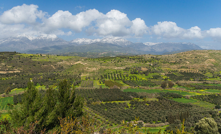
is licensed under CC0 1.0 Universal Public Domain Dedication [11]
For others, it might be something like this:
(Public Domain [72])
Although these two images are separated by over three centuries and thousands of miles, and were created using vastly different technologies, they both fall into the category of landscape imagery. Both images represent some view of Earth’s surface as seen from some other point on the surface (as opposed to the birds-eye view we would get from a balloon, airplane, or satellite). Furthermore, as innocuous as they seem, both of these images reveal important and useful information about the cultural and economic practices of the places they represent. Or, in more technical language, these images communicate something about the cultural landscape.
We can think of landscape simply as a visible portion of Earth’s surface. We can further divide it conceptually between natural landscapes and cultural landscapes. Natural landscapes are simply landscapes as they exist without the intervention of human activity. By contrast, cultural landscapes are landscapes that have been shaped by human activity; you might also hear cultural landscapes referred to as the built environment.
While our instinctive ideas about landscape as an idyllic and picturesque scene that brings pleasure to the viewer is accurate within an art historical framework, within geography, cultural landscapes get at some of the messy interactions of everyday life. Cultural landscapes include more than scenes of rolling pasturelands, tranquil villages, and lush valleys protected by looming mountains and dominated by greenery. They also consist of things like street plans, monuments, architecture, and shops — and all manner of infrastructure such as sidewalks, streetlamps, traffic signs, and telephone poles.
Over the rest of this lesson we will quickly see that landscape is not just a nice view, but a nuanced aspect of our geography that can provide clues as to what is happening in a given place.
6.4 Sites of tension
While we often conceptualize landscapes through still or static images, landscapes themselves are inherently dynamic. They change over time — sometimes dramatically within a short period, as anyone who has witnessed economic and demographic shifts in the place where they live can attest. Topography is altered by hand or heavy equipment; trees, bushes, and flowers are removed or planted; buildings are raised or razed; old businesses close and new ones take their places, sometimes changing the facades of buildings. For example, the landscape of Times Square in New York City changed drastically during the 1990s, when a large-scale revitalization transformed from a seedy red-light district full of peep shows and porn shops into a thriving theatre district and tourist destination (for more on the history or to see photos before and after the transformation, see Chakraborty, 2016 or McMenamin, 2015).
Similarly, while landscapes may look settled, they embody a set of conceptual and material tensions. As Wylie argues at the outset, “landscapes are tension” (2007, p. 1). He lays out four sets of tensions that permeate landscapes: proximity vs distance (are we in the landscape or do we only observe it from a distance?), observation vs inhabitation (do we observe the landscape or do we live in it?), eye vs land (is it a way of perceiving the world as we find in art, or is it a tangible thing?), and culture vs nature (is landscape a human expression or are they produced by physical processes?).
Exercise:
Take a moment and revisit the two images in section 6.3. Consider the tensions identified by Wylie as you look at them. How do these tensions manifest in the images?
The answer to all of the questions prompted by Wylie, of course, is yes. We are both close to and distant from the landscape; we both observe and live in it. Likewise, it is both a tangible, material object and an artistic and aesthetic way of looking at that object — and that object is something that both humans and natural processes have active hands in shaping. Thus landscape exists in several contemporaneous states of tension that describe its formation, the ways we perceive and think about it, and our interactions with it.
Tensions made manifest
Here we want to flesh out Wylie’s points with three assertions. First, as landscape is both a tangible thing and a way of seeing, it is also a symbolic object. By symbolic here, we mean that landscape performs a kind of symbolic labor; that is, any given landscape symbolizes something. What it symbolizes is culturally constructed, both at the broad scale of the nation and at the narrower scale of various political and subcultural groups (see also Till, 2004).
For example, an image of family-run farms dotting a rolling, green countryside might variously symbolize the stewardship of the land, Christian values, the vast and only semi-visible network of food production, a simpler life, or a tradition that is disappearing with the rise of corporate farming. All of these interpretations are valid within the cultural context of the United States. They can be strategically deployed (e.g., projected among a series of other images during the National Anthem to provoke a sense of nationalism), but the results will vary with the audience. That is, landscape imagery does not have a uniform significance or symbolism, even within a given culture. A person’s socioeconomic status, political leanings, place identity, occupation, or knowledge of the processes that go into creating that particular landscape, inevitably impact how they receive a given landscape image. We will reiterate this point throughout the lesson.
Second, as landscapes are physical objects, they are produced by various forces and actors in the world. The natural landscape exists prior to human activity, and it is inherently unstable to begin with. Gradual forces such as weathering, erosion, and deposition create a slowly-changing canvas which more sudden events such as earthquakes, floods, and wildfires can alter radically in the course of weeks, days, or hours. Human activity has equally broad-scale consequences for the landscape: we habitually change the landscape through agriculture, infrastructure, settlement, and urbanization — as well as through resource extraction in places we don’t think of as habitats (e.g., mining and forestry). Even our attempts to preserve the natural landscape lend a human element, as with the shift away from fire suppression to controlled burns in national parks.
And just as landscapes are produced, they are also consumed by people. We have already noted that landscape performs a symbolic function. Consider, for example, the song “America the Beautiful,” which begins:
O beautiful for spacious skies,
For amber waves of grain,
For purple mountain majesties
Above the fruited plain!
In fact, the song is bookended by descriptions of the landscape — the last verse mentions the country’s gleaming “alabaster cities” and the chorus uses landscape imagery to situate the extent of the state “from sea to shining sea.” In this case, the beauty of both natural and cultural landscapes (and the fecundity of the former) is presented as a central feature of America’s appeal. The descriptions of these landscapes are meant to instill a sense of patriotism in the listener, while also claiming specific territory and demarcating the boundaries of the state.
Yet these symbolic uses of landscapes are not the only ways that people consume them. We habitually consume and analyze landscapes in order to gain information about the world around us. Whether we are looking through the window of an airplane, train, or car as we travel across long distances or we are scanning the streets and storefronts of an unfamiliar city or neighborhood, we are looking to the landscape to give us clues about the place in which it exists. In this regard, we can think of landscapes as texts that we read (see Duncan & Duncan, 1988). We will return to this more extensively in section 6.6.
Finally, landscapes are both controlled and contested. To address the first part of this statement, landscapes are things that landowners (be they public or private, collectives or individuals) control. To what degree they control them varies — from a vacant parcel overgrown with brush and vines or the crumbling facade of a brick rowhouse to a carefully manicured golf course or a stately mansion with a new roof and a perfectly weeded flower garden — and this may indicate how invested the landowner is in caring for the space.
It should also be noted that control does not necessarily equate to authenticity or innocence. Having control over the landscape, to some extent, means controlling the visual language of that landscape. For example, homeowner associations and historic districts can create policies that force homeowners to conform to certain architectural standards including paint colors, vegetation, and lawn maintenance standards.
Having control can also mean exaggerating certain of the landscape’s features, including its inhabitants. The pagodas of San Francisco’s Chinatown, for example, were carefully designed to heighten visibility of the presence of the Chinese community through highly exoticized and atypical uses of traditional architectural features (Davis & Mars, 2018). Similarly, the preservation of traditional architecture in Bhutan is part of the government’s Gross National Happiness development strategy. In this context, cultural preservation serves to reinforce the unique identity of the Bhutanese people; preserving the traditional characteristics of the built environment is thought to reinforce a national identity and to promote happiness through a strong sense of identity tied to, and reflected by, the landscape (Chimi, 2019).

Yet that control can give way to other actors as people contest a given landscape. That is, landscapes can be altered by people who lack the legal authority to change them. This can be destructive, as in the case of graffiti or vandalism.
![The image shows a US Postal Service Priority Mail sticker on which someone has drawn a cartoonish figure of a wolf wearing a skirt. To the right of the drawing are several lines of handwritten text which read, “Jon [sic] Faso is an asshole” and “Uncle Susan is a wolf.” The sticker has been affixed to the side of a parking meter.](/geog571/sites/www.e-education.psu.edu.geog571/files/images/L06/landscape-fig4x.jpg)
Yet illicit changes to the landscape are not necessarily destructive. Consider, for example, flowers sneakily planted on public land by guerrilla gardeners to beautify otherwise desolate urban landscapes. Or yarn bombing, in which people wrap objects in the landscape with knitted or crocheted coverings.

It is important to remember that landscapes also contain moving elements, including cars, people, and animals. These, too, can constitute or disrupt the landscape as they flow through (or refuse to flow through) the space. Parades and protests alike thus contribute to our experiences and understanding of landscape.
Read:
Duncan, J. and Duncan, N. (1988). (Re)reading the landscape. Environment & Planning D: Society and Space, 6(2), 117-126.
Till, K. (2004). Political landscapes. In J. S. Duncan, N. C. Johnson, and R. H. Schein (Eds.), A companion to cultural geography (pp. 347-364). Blackwell.
Recommended:
Chakraborty, D. (2016, April 18). When Times Square was sleazy [66]. The 80s. CNN.
Additional References:
Chimi. (2019). Architecture and Gross National Happiness in Bhutan. American Journal of Civil Engineering and Architecture, 7(3), 135-140.
McMenamin, M. (2015, July 24). “From dazzling to dirty and back again: A brief history of Times Square [73].” MCNY Blog: New York Stories (blog), Museum of the City of New York.
Wylie, J. (2007). Landscape. Routledge.
6.5 Reading cultural landscapes
In the previous section, we argued that landscapes are not only produced, but also consumed. More specifically, following Duncan and Duncan (1988), we took the position that landscapes can be thought of as texts that we can read. In this section, we turn to this idea in more detail.
Foundations
Before we can talk about how to read landscapes, it’s helpful to understand what purpose this exercise serves, and what its limits are. A cultural landscape in its current form is always the product of a long series of overlapping choices made by people (collectively or individually), and mediated by the culture in which it exists. Careful reading can thus produce a wealth of information that extends from the present backwards in history.
It is also important to understand the difference between actively and passively reading the landscape. For many of us, the landscapes we see every day are so familiar that we have internalized their elements and hardly think about them. When navigating somewhere, we might actively seek a particular feature on the landscape (e.g., a specific building number, street sign, or landmark), but when we do so, we tend to disregard the rest. Some features, such as markings for lanes or parking spaces, or street signs, we use in a referential way, but their visual aspects are generally unremarkable unless something about them has changed (or unless we go to a place where the markings are stylistically different. This kind of engagement with the landscape is passive, and it is likely only to reveal the most obvious information.
Actively reading the landscape is a process that requires both an attention to detail and the ability to understand the specific collection of features as a whole. For example, focusing on a single element of a landscape, as in figure 6.7a below, tells us only that there is a Shake Shack somewhere in the world.
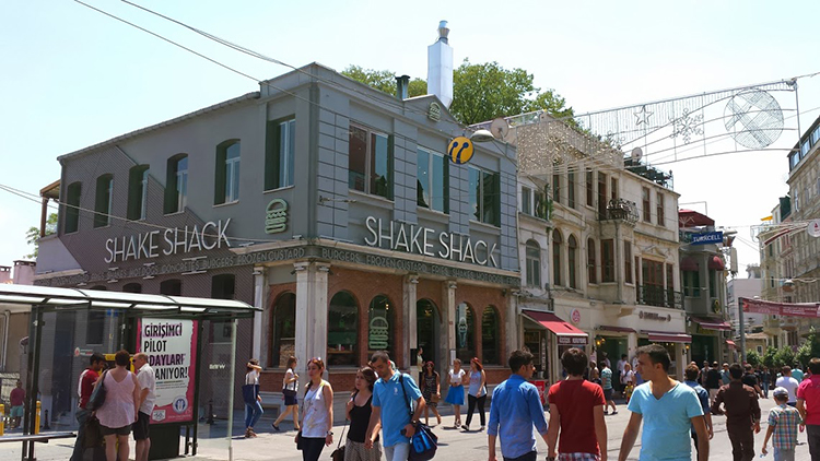
Yet, as figure 6.7b shows us, when we consider that single element with regard to other elements in the landscape, we are better able to situate it. In this case, the presence of signage in Turkish and the Turkcell banner in the upper right hand corner indicate that this is part of the Turkish landscape. Yet the elements in isolation tell us little; when we (actively) synthesize those elements, we might notice first, that there is a US-based fast food restaurant in this neighborhood, and second, that it belongs to one of the smaller American fast food chains. This might suggest to us first that this is a tourism-dependent area, and second, that there are American tourist dollars flowing into this landscape. (This was a Shake Shack that Dr. Livecchi encountered on İstiklal Caddesi during a visit to Istanbul in 2016. To the best of his knowledge, that Shake Shack is gone, but others have sprung up in the city.)
The rest of this lesson will address what the landscape can tell us, and presumes an active reading of the landscape. Note that while identifying the visual elements is an integral part of reading the landscape, an in-depth landscape analysis typically involves observation of individuals within the space, and often entails additional research to fully appreciate the history and social significance of the space.
NOTE:
Many of the examples that follow come from Kingston, New York, where Dr. Livecchi currently lives. We’re using these as examples in part due to ease of data collection (it’s easier to provide photos that display the relevant information), and in part because it affords a fair amount of diversity in its landscapes, and thus can provide a variety of examples.
Whose culture?
First and foremost, the cultural landscape gives us some indication of the dominant culture, as well as the economic circumstances of the place. For example, compare the images below.

is licensed under (CC0 1.0 Universal Public Domain Dedication [11])
The architectural styles, signage, width of the streets, and infrastructure in these landscapes give us hints as to where they are. Although these landscapes may share some similarities, the visible qualities of each set them apart from one another. Even if we cannot readily identify the locations of these landscapes, we can be certain that they were produced within different cultural contexts. These images were chosen because they provide relatively clear indicators of location; it is important to remember that in some cases the differences may be small enough that they require close attention to detail — street lane markings, curb cuts, sidewalk and crosswalk design, and the (in)visibility of things like telephone or electrical lines are all indicators that observers often overlook because they are either meant to be overlooked or they are so familiar that we only passively recognize them.
All of these landscapes are situated in tourist areas of different cities. The differences in architecture, street design, and visible infrastructure (e.g., street lights, signage, bike racks, etc.) offer some idea as to where they were taken; they also suggest the histories of the places. The types of structures and decorative flourishes tell us that these are spaces where people either congregate or intend to spend money — and the condition of the structures indicates that someone (or several someones) has invested money into upkeep, presumably to maintain an inviting space that welcomes tourists.
Form follows function, sometimes
Second, the landscape can tell us something about the intended function of the space, and for whom the space is intended. For example, consider the landscapes in figures 6.12 and 6.13.
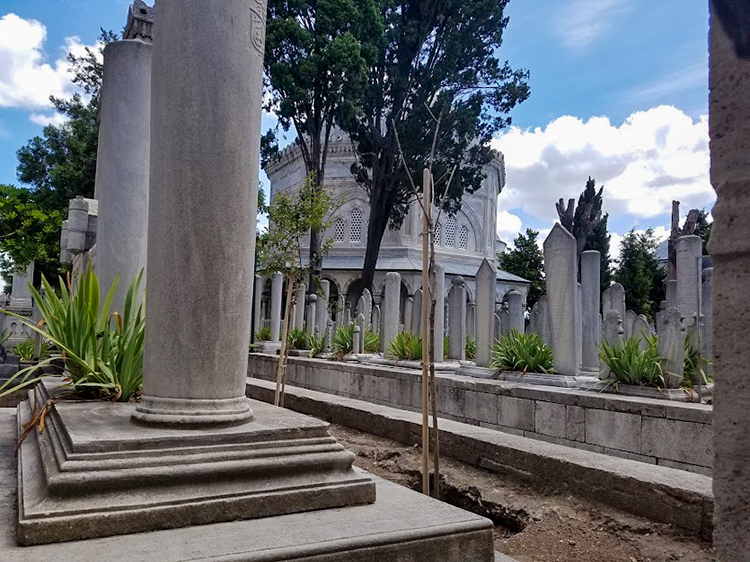

The landscape in figure 6.13 will be familiar to anyone who has visited a rural cemetery in the United States. Even without knowing the location, the language used on the stones, or the visual culture associated with the landscape in figure 6.12, even a casual observer would recognize it as a cemetery (despite the obvious differences with regard to density and groundcover). In both of these images, the kinds of features and their arrangement give us information as to these landscapes’ functions.
In some cases, function also entails some assumptions about for whom the landscape was designed. Figures 6.14 and 6.15 below provide two contrasting examples.
is licensed under (Attribution-Share Alike 4.0 International [77]).
is licensed under Attribution 2.0 Generic [80]
These two landscapes physically express their intended functions and audiences. The playground is sized for children, and surrounded by apartment buildings. The red-light district relies on an established visual signal (red lights) to denote the availability of sex workers. Although the playground landscape is deserted, we would expect to see children playing. Adults without children might seem out of place and suspect. Likewise, the notable absence of children in the red-light district is in line with our expectations; their presence might be puzzling or concerning, as they might seem out of place.
As a corollary to this, elements on the landscape sometimes broadcast not only who is expected within them, but who is welcome within them. Consider, for example, the Old Dutch Church in Kingston, New York.
Even casual observers familiar with the United States will instantly recognize the building as a Christian church (and as an old church, given the presence of the churchyard and the stone and style of the headstones); we can surmise without real question that the space has a religious function and that members of some Christian denomination are welcome there. What stands out, however, is the flagpole, from which four flags fly: the American flag, a Black Lives Matter flag, a Pride flag, and a Transgender Pride flag. These symbols on the landscape are a visible means by which the church proclaims its identity as both American and as welcoming to members of social groups who have historically been marginalized.
Resistance
Third, landscapes can tell us a little about resistance to the local social order or to local conventions. Some activity leaves traces that indicate a use other than what was intended. For example, municipal officials may install benches in public spaces with the intent that people will sit on them — yet those same benches might also be used by homeless populations as somewhere to sleep. Likewise, skateboarders find particular joy in sliding across benches and low walls of concrete or granite. The presence of hostile or defensive architectural features such as spikes (figure 6.17), or less obvious features such as extra rails on benches (figure 6.18) visibly indicate the contested nature of some landscapes.

is licensed under CC BY-NC-ND 2.0 [83]

is licensed under Attribution-Share Alike 4.0 International [77].
What matters most?
Fourth, the landscape can tell us what is important to a particular community — both in terms of what a community claims is important in an official capacity, and in terms of resistance to that official line by smaller subgroups within that community. With regard to the former, things like monuments and street signs are visible, physical markers that reflect the values officially embraced by the community (discursively constructed or mediated by people in power). Choosing to commemorate individuals by naming or renaming streets after them is an established practice. Consider, for example, streets in cities with which you are familiar that were named for former political leaders such as presidents, governors, or mayors — or streets that are given secondary names to honor individuals, especially those fallen in combat. Later renaming of streets and alterations or removals of monuments can reflect cultural changes, as with the removal of Confederate monuments or the names of Confederate generals from military bases. Till (2004) captures this dovetailing of culture, politics, and space in the ways that landscapes are manipulated to political ends on both national and local scales.
It is perhaps easy to overlook street signs; we are accustomed to using them as references for navigation and to ignoring them at other times. Monuments, by contrast, are designed to stand out on the landscape. Their placement, size, and construction provide some indication of their importance to a given community. The Ulster County Courthouse in Kingston, New York (fig 6.19) provides an interesting example here.
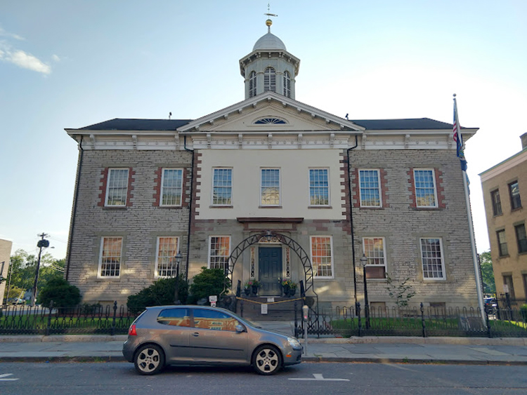
On the courthouse grounds stand two monuments. One of these (figure 6.20) is just visible just beyond the fence, near the base of the flagpole. The other (figure 6.21) stands just beyond the left edge of figure 6.19.
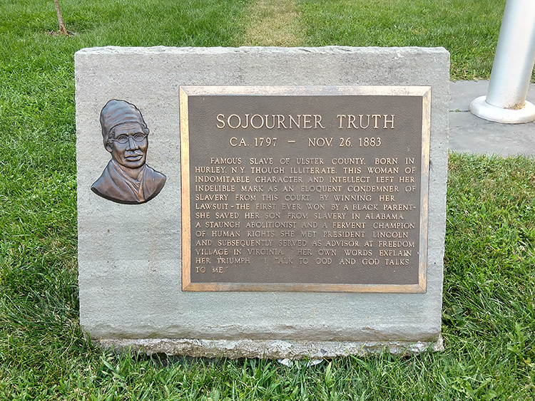
The text of this monument reads:
“SOJOURNER TRUTH
CA 1797 - NOV 26, 1883
FAMOUS SLAVE OF ULSTER COUNTY, BORN IN HURLEY, N.Y. THOUGH ILLITERATE, THIS WOMAN OF INDOMITABLE CHARACTER AND INTELLECT LEFT HER INDELIBLE MARK AS AN ELOQUENT CONDEMNER OF SLAVERY. FROM THIS COURT, BY WINNING HER LAWSUIT - THE FIRST EVER WON BY A BLACK PARENT - SHE SAVED HER SON FROM SLAVERY IN ALABAMA. A STAUNCH ABOLITIONIST AND A FERVENT CHAMPION OF HUMAN RIGHTS, SHE MET PRESIDENT LINCOLN AND SUBSEQUENTLY SERVED AS ADVISOR AT FREEDOM VILLAGE IN VIRGINIA. HER OWN WORDS EXPLAIN HER TRIUMPH: “I TALK TO GOD AND GOD TALKS TO ME.”
The text of this monument reads:
“THE SOCIETY OF THE COLONIAL DAMES OF AMERICA PLACE THIS TABLET TO MARK THE SPOT WHEREUPON WAS SET IN MOTION THE COMMONWEALTH OF THE STATE OF NEW YORK ON THE THIRTIETH DAY OF JULY IN THE YEAR OF OUR LORD ONE THOUSAND SEVEN HUNDRED AND SEVENTY SEVEN BY THE INAUGURATION AS GOVERNOR IN THE PRESENCE OF THE COUNCIL OF STATE OF MAJOR GENERAL GEORGE CLINTON OF ULSTER SEVEN TIMES GOVERNOR OF NEW YORK AND TWICE VICE PRESIDENT OF THE UNITED STATES.”
Both monuments stand on the grounds of this historic courthouse — one to commemorate the founding of the State of New York (relying on the image of President Washington to establish its connection to the nascent United States), and one to commemorate the legal success of a Black woman abolitionist from the region. Both commemorate events that took place here, and both events are significant to the region’s history — though for vastly different reasons. These elements on the landscape symbolically represent some value or idea that officials were trying to communicate publicly at the time the monuments were erected.
Landscapes with monuments such as these are often the sites of celebrations — and protests. Event organizers and speakers frequently make reference to the symbols visible in the landscape around them in order to appeal to the emotions of the onlookers, whether to instill a sense of pride or to inspire them to protest.
One final example will help illustrate this point. There is a park in Kingston, New York, called Academy Green. The park is a large triangle of grass bounded by Clinton Avenue, Albany Avenue, and Maiden Lane. This space is situated in a liminal part of Kingston, outside the historic Stockade District and on the edge of a residential neighborhood, with a major thoroughfare (Albany Avenue) defining its longest side.
On the green are three 11-foot-tall bronze statues on plinths, all of historic figures: Peter Stuyvesant (the director general of the New Netherland colony before it was given to the British in the mid-17th century), George Clinton (first governor of New York State, and still not the funk musician), and Henry Hudson (English explorer who navigated up what is now the Hudson River). Cast in 1898, the statues were initially part of a set adorning a bank building in New York City, and were rescued from a junkyard by an individual in 1943, who donated them to Ulster County (Schwarz, 2018).
The park generally functions during the day as a space of socialization for adults within Kingston’s Black community. Given its visibility along Albany Avenue and its position relative to other neighborhoods, it also serves as one of several active sites of protest within Kingston. In 2020 and 2021, the park has seen nonviolent protests against police brutality (particularly in the wake of George Floyd’s death in Minneapolis), hosted weekly walks for Black lives, and has served as the rallying point for a protest and march against the sale of Chiz’s Heart Street — a large group home for mentally ill people — to a wealthy hotel developer (a common theme; Kingston is experiencing a wave of pandemic-enhanced gentrification as affluent New Yorkers leave Manhattan and Brooklyn for the Mid-Hudson Valley).
In 2020, Kingston-based community organizer Frances Cathryn began a project to point out the historically racist actions of the figures commemorated by the statues in the park. In an op-ed piece, she notes that there is an inherent irony as “local activists of color and young Black students gather at Academy Green and call for the acknowledgment of their basic civil rights in front of an enslaver” (Cathryn, 2020). Yet perhaps it’s not an innocent irony: event organizers or participants who are aware of the landscape might use those features as references to stir up stronger emotions among participants.
Landscape is not something that simply exists in the background. An understanding of the landscape can enable individuals and groups to deploy symbolically across a wide range of readings, and to make a variety of different public statements.
Read/Listen:
Davis, C. and Mars, R. (2018, August 14). It’s Chinatown [65]. 99% Invisible. Podcast audio. [listen to the first story; 23 minutes]
Recommended:
Norton, A. and Mars, R. (2013, January 23). In and out of LOVE [67]. 99% Invisible. Podcast audio.
Schein, R. (1997). The place of landscape: A conceptual framework for interpreting an American scene. Annals of the Association of American Geographers, 87(4), 660-680.
Stilgoe, J. (1998). Outside lies magic. Walker and Company.
Additional References:
Cathryn, F. (2020). The Kingston Monument Project: A community organizer on replacing the monuments in our public spaces [86]. Chronogram.
Duncan, J. and Duncan, N. (1988). (Re)reading the landscape. Environment & Planning D: Society and Space, 6(2), 117-126.
Schwarz, A. (2018, September 12). An appreciation of Academy Green’s statues [87]. Hudson Valley One.
Till, K. (2004). Political landscapes. In J. S. Duncan, N. C. Johnson, and R. H. Schein (Eds.), A companion to cultural geography (pp. 347-364). Blackwell.
6.6 Caveats and limitations
Reading the landscape can be an informative exercise, but it comes with some caveats. First, it is important to bear in mind that while specific features of any given cultural landscape may be the result of a single individual’s decisions, landscapes in general are the accumulation of long histories of building, policy, zoning, and active use by humans.
We can think of landscapes, therefore, as similar to palimpsests — ancient manuscripts on which the original writing has been scraped away and the base material has been reused; traces of the original writing remain.

We often overlook traces of older landscape features — electrical boxes that once controlled stop lights that are no longer there, altered brickwork or stonework where windows or doors have been added or removed, random paving stones leading to empty lots, or inscriptions that reflect a building’s original use (as in figure 6.24 below). Yet these are clues to the site’s history.
Second, it is imperative to understand any given landscape within the broader context of the place. Each landscape is part of a broader system, and it is useful to understand how that landscape reflects or differs from other parts of the place in which it is situated. For example, Academy Green’s situation in the liminal space between neighborhoods makes it one that is less frequently policed than other parts of the city, and its proximity to major streets that connect City Hall and the Ulster County administrative offices make it a strategic rallying point.
Consequently, while we may look to particular features as clues to some aspect of the landscape, we always have to consider that landscape within its broader cultural, geographical, and historical context (see Schein, 1997). An in-depth analysis of the landscape accepts the visual reading as both an initial assessment and a starting point for further research.
Third, not everything that is important to a location is visible within the landscape — in fact, whether by policy or by design, some landscapes have been painstakingly altered to conceal or minimize the visibility of certain features, such as sprinkler systems, phone lines, electrical lines, or their own construction. What’s visible is important, but it doesn’t always provide the whole story.
Fourth, all readings of the landscape are subjective, and individuals may emphasize different aspects of the landscape — in part, because their experiences and identities may have made them more attuned to noticing, identifying, or understanding certain features. Using the World Trade Center as an example, Morin demonstrates how a single landscape can be interpreted in a number of differing ways:
The attacks on the World Trade Center in New York City in September 2001 highlighted the vastly different meanings that that corporate landscape represented for observers at numerous scales and locations, both before and after the attacks: as emblem of technological ingenuity, modernity, progress, the success of global capitalism and democratic government, and certainly a new wave of American patriotism; to more decentred understandings — US political and economic vulnerability, anti-capitalism, a holy war waged against the USA, just desserts or a wake-up call for unjust American foreign policy and hegemony, and mourning and loss of loved ones and livelihoods in the New York area. The fact that these meanings and interpretations all co-existed simultaneously forced a recognition that not only could the same landscape carry vastly different meanings to different observers, but that the landscape itself was also a reference to a much larger set of social relationships, domestic and global, that required attention and contextualization. (2009, pp. 289-290)
Subjectivity in reading the landscape happens not only among individuals, but also within groups. Duncan and Duncan (1988) note the existence of “textual communities” — groups of people who share a reading or understanding of a given text; we might argue that identity groups, to some extent, can act as textual communities (bearing in mind, however, the multilayered nature of identity).
References:
Duncan, J. and Duncan, N. (1988). (Re)reading the landscape. Environment & Planning D: Society and Space, 6(2), 117-126.
Morin, K. M. (2009). Landscape: Representing and interpreting the world. In N. J. Clifford, S. L. Holloway, S. P. Rice, and G. Valentine (Eds.), Key concepts in geography (pp. 286-299). Sage.
6.7 Cultural Landscapes and Human Security
In the previous sections we introduced the idea of cultural landscapes and discussed their significance and to read them. Our approach so far has been to talk about cultural landscapes as a combination of setting, reflection, and co-constructor of our everyday actions and interactions. Most of the images in the previous sections depicted relatively clean and orderly spaces that many of you may find pleasant.
Yet, as we hinted at in section 6.4, many of the landscapes we interact with (in some cases, on a regular basis) show signs of what sociologists and criminologists refer to as disorder: untended lawns or medians, graffiti, cracked or broken sidewalks or curbs, houses with missing or boarded-up windows, litter strewn across the ground, streets riddled with potholes, buildings with peeling or flaking paint, vandalism, rotting woodwork and rusty ironwork—and the list goes on. In addition, you might sometimes observe activity in the landscape that suggests disorder: loitering, panhandling, public drinking or drug use, or groups of unsupervised youth wandering about.


These signs of physical and social disorder on the landscape may lead people to perceive the landscape as unsafe. As Chappell and company argue, “some research indicates that neighborhood disorder…is a better predictor of fear than serious crime” (2011, p. 522). We can reinterpret this statement from a geographical perspective thus: people read landscapes as part of their daily habits (often without realizing it); landscapes with visible signs of disinvestment are disorderly; and disorderly landscapes are often perceived as dangerous, regardless of whether or not they are actual sites of crime.
The presence of physical and social disorder in the landscape have led to at least two important (and related) theoretical interventions in criminal justice: crime prevention through environmental design (CPTED) and broken windows.
Crime Prevention Through Environmental Design
CPTED emerged in the early 1970s when criminologist C. Ray Jeffrey and architect and urban planner Oscar Newman independently published books that pointed to the environment as a contributing factor of crime. Their work rested in part on a foundation created by urbanist Jane Jacobs. In her book 1961 Death and Life of Great American Cities (which is still widely read today), argued that in order for cities to feel vibrant, it is necessary to have a clear delineation between public and private space, to have “eyes on the street”—everyday people whose presence constitutes community but also surveillance, and an environment that is built to facilitate that surveillance.
Building on these ideas, Newman proposed the idea of defensible space—a space that is designed to enable individuals to contribute to their own safety through four design elements:
- Territoriality (using both real and symbolic barriers that indicate ownership of space)
- Surveillance (enabling people to observe and surveil one another through windows, entrances, etc.)
- Image (influencing the perception of space through design)
- Geographical juxtaposition (the ability of adjacent space to influence the security of one another
Together, these elements theoretically create a sense of ownership, community, and responsibility for spaces (Cozens & Love, 2015). The argument goes that in well-designed (or defensible) spaces, people who are there for legitimate reasons feel safe, while people who are inclined to commit crimes feel uncomfortable doing so.
CPTED has been championed by architects and urban planners, and has been refined over the years to promote a holistic approach to designing the built environment in ways that promote community inclusion. Contemporary CPTED models incorporate additional elements and contextualize them in broader social systems. Principles of CPTED have diffused from the US throughout North America, and have been embraced by government agencies in Europe, Australia, Asia, and South Africa, among other places (Cozens & Love, 2015).
Given the increasing complexity of CPTED, it is difficult to fully assess its effectiveness in crime prevention (Cozens & Love, 2015), yet the results are promising. A meta-analysis of CPTED (Ceccato, 2020) has found considerable support for the efficacy of its design elements. In particular, attention to lighting, the use of surveillance cameras, and maintenance of spaces seem to promote increased use of public spaces, reduced fear of crime, and reduced incidents of crime. This is evident in MacDonald and Branas’s (2019) Philadelphia LandCare case study [90], a project in Philadelphia’s Kensington neighborhood that converted vacant lots into pocket parks. The investigators found significant reductions across gun assaults, shootings, and nuisance crimes, with particularly strong results in neighborhoods below the poverty line.
Broken Windows
In 1982, political scientist James Q. Wilson and criminologist George Kelling presented this idea as the basis for their theory of broken windows in an article in The Atlantic. Their idea, in brief, was that untended social and physical disorder on the landscape would cause the informal social controls that keep communities safe (i.e., through social cohesion) to diminish. As people begin to see a landscape as disorderly, they are less likely to engage with others in the landscape, leading to a spiral of fear and social disinvestment:
At this point it is not inevitable that serious crime will flourish or violent attacks on strangers will occur. But many residents will think that crime, especially violent crime, is on the rise, and they will modify their behavior accordingly. They will use the streets less often, and when on the streets will stay apart from their fellows, moving with averted eyes, silent lips, and hurried steps. (Wilson & Kelling, 1982, p. 31)
From there, they argue, the landscape becomes open to crime—that, in effect, perception becomes reality.
All of this may sound academic, but it had real-world implications. Wilson and Kelling’s article was the catalyst for a new direction in policing: disorder policing. In its harshest form, disorder policing manifests as the kind of ‘zero-tolerance’ that was first instituted in New York City in the 1990s during the Guiliani administration and has since been exported to cities in Iraq, Brazil, Norway, Australia, and Colombia among others (for more on the history of its implementation, see Mitchell, 2010). This style of policing targeted ‘quality of life’ infractions such as loitering, littering, vandalism, and other low-stakes behaviors.
Disorder policing, and zero-tolerance policing in particular, is controversial, and its effectiveness is mixed at best. A decrease in crime through the 1990s and into the 2000s led some policymakers to hail zero-tolerance policing in New York City as a success, though several scholars have pointed out a number of other factors, such as a reduction in the use of crack cocaine, economic growth, and changes in age structure may also account for the decline in crime rates (Braga et al., 2015; Diniz & Stafford, 2021). Others point out that it is difficult to tell which successes are the result of disorder policing as opposed to community-based approaches, as many policing strategies informed by broken windows theory also tend to include problem-solving, place-oriented, or deterrence components (Weisburd et al., 2015).
Part of the problem with measuring the effectiveness of disorder policing is that it’s not clear which kinds of disorder are good indicators of the development of crime. For example, Diniz and Stafford (2021) found that graffiti (a common measure of physical disorder) had no clear spatial relationship to a variety of crimes (personal crimes, property crimes, sex crimes, gun violence, or drug trafficking) in downtown Belo Horizonte, Brazil, despite an aggressive zero-tolerance policing campaign in the city.
Some scholars note that there have been too few studies on disorder policing to support the claims of success (see, e.g., Weisburd et al., 2015), and existing studies provide a mixed bag of results. In a meta-analysis of 30 tests of disorder policing, Braga and colleagues found that “disorder policing strategies generate noteworthy crime control gains” (2015, p. 580) across various measures of crime—but that the type of strategy matters. They found overall that aggressive zero-tolerance approaches that respond to specific behaviors were not effective, while place-based and community problem-solving approaches did significantly reduce crime.
Yet Wilson and Kelling’s (1982) theory is not a theory of crime reduction. It is a theory that uses elements of cultural landscapes to prevent a place from becoming a site of crime by preventing the fear that leads to the erosion of informal social controls, rather than a theory of how to respond to existing crime hotspots. Taking a closer look at the studies reviewed by Braga and colleagues (2015), Weisburd and company (2015) found that all but one focused on crime reduction rather than fear reduction—and the one that did focus on fear reduction found that disorder policing did not significantly reduce fear. They further note that the model suggested by Wilson and Kelling may take years to develop, and it is unclear just how much time it would take for disorder in the landscape to translate to the kinds of effects they predict.
Regardless, people’s perceptions of the landscape do impact their perceptions of safety and security. Chappell and colleagues (2011) found that when accounting for both social and physical disorder, social disorder has no significant impact on quality of life—but physical disorder does, even though it is not necessarily an indicator of crime. These perceptions can impact our daily activities, including the routes we choose to take and the destinations we visit, as well as the routes and places we avoid due to fear.
Landscapes and Security, Revisited
With all of this in mind, it is important to take stock of interactions of landscape and security:
- We read danger into the landscape through disorder.
- We often perceive disorderly landscapes as dangerous even if they aren’t.
- Policymakers often might turn to landscape-oriented interventions such as CPTED and models based on Broken Windows theory to address fear and crime in public spaces.
- Though they are both landscape-oriented models, interventions based on these two approaches are implemented very differently and have varying results.
In short, the ways that we perceive cultural landscapes has an impact on quality of life, and policymakers are aware of this. Interventions that target human security based on landscape factors merit careful consideration.
Further Exploration:
Vedantam, S. (Host). (2016, November 16). Broken windows [91] (No. 50) [Audio podcast episode]. In Hidden Brain. Hidden Brain Media.
References:
Braga, A. A., Welsh, B. C., and Schnell, C. (2015). Can policing disorder reduce crime? A systematic review and meta-analysis. Journal of Research in Crime and Delinquency, 54(4), 567-588.
Ceccato, V. (2020). The architecture of crime and fear of crime: Research evidence on lighting, CCTV and CPTED features. In V. Ceccato and M. K. Nalla (Eds.), Crime and fear in public places: Towards safe, inclusive and sustainable cities (pp. 38-71). Routledge.
Chappell, A. T., Monk-Turner, E., and Payne, B. K. (2011). Broken windows or window breakers: The influence of physical and social disorder on quality of life. Justice Quarterly, 28(3), 522-540.
Cozens, P., and Love, T. (2015). A review and current status of crime prevention through environmental design [92] (CPTED). Journal of Planning Literature, 30(4), 393-412.
Diniz, A. M. A., and Stafford, M. C. (2021). Graffiti and crime in Belo Horizonte, Brazil: The broken promises of broken windows theory [93]. Applied Geography, 131, Article 102459.
MacDonald, J. M., and Branas, C. C. (2019, September 25). Cleaning up vacant lots can curb urban crime [90]. Manhattan Institute.
Mitchell, K. (2010). Ungoverned space: Global security and the geopolitics of broken windows. Political Geography, 29, 289-297.
Weisburd, D., Hinkle, J. C., Braga, A. A., and Wooditch, A. (2015). Understanding the mechanisms underlying broken windows policing: The need for evaluation evidence. Journal of Research in Crime and Delinquency, 52(4), 589-608.
Wilson, J. Q., and Kelling, G. L., (1982, March). Broken windows: The police and neighborhood safety. The Atlantic Monthly, 249(3), 29-38.
6.8 Introduction to Google MyMaps
Introduction
So far this course has focused predominantly on Esri’s ArcGIS Online platform to conduct exercises relevant to the coursework. As part of your StoryMap exercise in generating a spatio-cultural analysis of a cultural landscape, you may want to include a map of those landscapes. In addition to using ArcGIS Online’s Map Viewers, it may be easier to create a Google MyMap to embed into your story map. This brief tutorial will introduce you to the basic functionality of Google MyMaps.
Google MyMap Basics
- You’ll need a Google account. You can either use your existing Google account, or you can create an account for this course.
- Go to the Google MyMaps page [94].
- From the Google MyMaps main page, select “Get Started”:
- To create a new map, click the “Create New Map” button at the top left:

- This will open a blank map called “Untitled Map.” Left click on the words “Untitled Map” to change the name and provide a description.
- Using the search bar to the right, you can type in coordinates, addresses, or search for the name of a place you wish to include on your map.
- When you click enter or the search button, the possible results will populate the map and the left layers area.
- To add this point to the map, click on the “Add to Map” button.
- It adds it to an “Untitled Layer.” We’ll address how to change this next, but first, let’s change the marker for Penn State. To change the symbol, click on the little paint bucket at the bottom. This will allow you to change both the color and the style of the icon.
- I changed the icon from the standard pin to this graduation cap:

- I changed the icon from the standard pin to this graduation cap:
- The pencil next to the paint bucket allows you to change the name in the popup, as well as add a description.

- The camera allows you to add a photograph in case you’d like to showcase some photos of the landscape you are describing.
- To change the name of the Layer, left click on the three dots to the right of the layer, and click “Rename Layer”
- You can also change your basemap clicking on the arrow to the left of “Basemap” and making a selection
- Once you’ve added all of the places you want, make sure to enable link sharing to your map. To do so, click “Share”
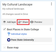
- Then make sure the settings in the 'Share map' window are set to 'Anyone with this link can view' and then close the window.
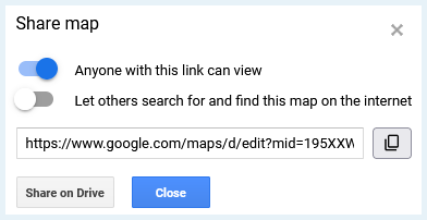
- Once you have made all of your selection for your map and are ready to embed it in your StoryMap, click the three dots to the right of your Map’s Name and select “Embed on my Site”
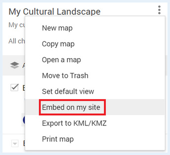
- This will generate a popup with some code. Copy this code.
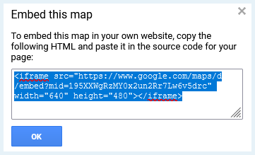
You will now switch to the ArcGIS Online Portal:
- Sign into Penn State’s ArcGIS Online Portal [1] with your Penn State credentials.
- Click on the square with nine dots to the left of your Name at the top right of window:

- Select StoryMaps from the list of options

- Select “New story” towards the upper right of the webpage.

- In your ArcGIS StoryMap, click the plus button to add content. Under the “Media” subheading, click on Embed.
- Paste the code you copied from the 'Embed on my site' step above into the gray box and select “Add”
Your Google MyMap should now be added to your StoryMap.
6.9 Spatio-cultural Analysis Exercise
Introduction
This week’s lesson focuses on reading cultural landscapes. This is not just a theoretical pursuit; it is a means of both collecting and analyzing real-world data that enables one to understand the everyday use of places and the significance that places may hold for people. Individual buildings are tied together by the landscape; the landscape itself is the setting for our daily interactions within a place. Reading the landscape can provide information crucial to a range of intelligence and human security concerns, whether your interest is in determining how to prepare a vulnerable neighborhood for a major hurricane or discover the base of operations of a terrorist cell.
It is also a skill that requires practice in order to fully appreciate what it can reveal about a place. With this assignment, you will choose a landscape, observe it, analyze it in terms of its use and vulnerabilities, and present your findings using StoryMaps as a medium. This assignment is broken down into three parts: fieldwork, analysis, and presentation.
Make sure you read the assignment from start to finish before you begin. You might want to print it and keep it handy as you complete it.
Fieldwork
- Choose a landscape.
Before you begin, choose a landscape to which you have easy enough access that you can spend considerable time observing it. You can choose one with which you are very familiar, one you know in passing, or one that is totally unfamiliar (note that you will notice different things depending on how well you know the area). It can be any kind of landscape — residential, commercial, agricultural; urban, suburban, rural; historic, new, redeveloped — anything is fair game as long as it is a cultural landscape.
Remember that a landscape is a visible portion of Earth’s surface. For the purposes of this assignment, your chosen landscape is not an entire city or neighborhood. Rather, it should be a limited part of these larger places. It should be small enough that you can either:
a) see most of it from a single vantage point, or
b) see it in its entirety in the span of a walk no greater than 10 minutes in length.
Note: Choose a landscape that you can observe at various points during the day (you can — and are encouraged to — do this over several days if necessary). Expect to take photographs and notes as you do your fieldwork.
- Visit and observe.
Visit your chosen landscape three times, for 30-60 minutes each time. Find a good vantage point and use this to observe it. If your landscape requires you to walk through it to fully observe it, take several walks. Try to do this over several days and at different times of day. As you do, jot down some of your field observations. Your observations should incorporate physical, social, and political aspects of the landscape. Below, you will find a list of questions to help focus your observations.
Physical aspects
- What is visible within the landscape? Include things you normally take for granted, such as the style and age of infrastructure, road markings, architectural styles, graffiti, etc.
- What is the condition of the physical features of the landscape? Are they pristine or in disrepair, or somewhere in between? Are there indications that someone is working to take care of the landscape?
Social aspects
- Who is present within the landscape? Consider things like age, gender, race and/or ethnicity, class, and other markers of identity such as clothing styles; pay attention to the languages spoken, the kinds of conversations you overhear, etc.
- What kinds of activities are taking place within the landscape and who is engaging in them?
- How do people, vehicles, and animals move through the landscape? Pay attention to direction and speed of travel, and whether movements are aimless or purposeful.
- Where and why do people pause in the landscape?
Political aspects
- Who is expected to be in this landscape? Consider things like age, race, class, etc. What indicators on the landscape tell you who is expected to be there — e.g., signage, the presence of other people of this group, etc?
- How are people expected to behave in this landscape?
- Do people adhere to, flout, or subvert those expectations? If people flout or subvert the expectations, in what ways? If they tend to adhere, why do they seem to do so?
These last few points, which get at the expectations and social boundaries of the landscape, are sometimes obvious and sometimes not. More obvious indicators include signage barring or granting access to spaces or prohibiting certain behaviors. Be aware that some indicators are less direct, more subtle, or more dynamic (e.g., is there a police presence that keeps out people who appear to be intoxicated? Is everyone so well dressed that someone in casual clothes would stand out? Are there specific groups of people who seem to dominate the space, or groups who are visibly marginal here?).
During your visits, take photos that you think are representative of what you see on the landscape. You may also find it useful to take a notebook and jot down some of your observations.
Analysis
After completing your fieldwork, review your observations. Start developing a profile of the landscape: identify its primary function(s), the kinds of features it includes, and a general description of who uses the landscape and how they use it, and what vulnerabilities are present within the landscape.
In terms of security vulnerabilities, use the following questions to guide your analysis:
- What, if any, threats to human security are relevant to this landscape? Think beyond terrorsim here; you might also consider, for example, whether the infrastructure is vulnerable to things like natural disasters, whether the spatial arrangement facilitates the spread of disease or fire, or makes it easier to hide organized crime.
- What populations, if any, would be at risk from those threats?
- Are there any features on this landscape that have some symbolic value that might be potential targets or foci for security threats?
- If this landscape seems to you to be totally free from threat, why do you think so?
Presentation
Using Google MyMaps and the instructions provided on page 6.7 Introduction to Google MyMaps [95] of this lesson, identify your chosen landscape on a map. Add at least three features that you found significant or interesting.
Create a StoryMap to present your findings. It should include the elements below, logically and coherently organized.
- Embed your Google MyMap depicting the landscape into your StoryMap. Add at least three points of significance to your map with placemarks and label them accordingly.
- At least one photo for each point of significance above.
- At least one photo that provides an overview of the landscape.
- General descriptions of the physical, social, and political aspects of the landscape based on your field observations and the questions posed above.
- An assessment of any security vulnerabilities you find relevant to this landscape, per the analysis instructions above.
Your text should be well-written, logically organized (with appropriate headings), and free from grammatical errors. If you want the practice, you may organize it like you would a written brief. Your text should be no longer than 1,000 words.
Submit your completed StoryMap
When you have completed your StoryMap including all of the associated elements, you need to share your StoryMap. The following steps match the instructions we used in Lesson 1 to share your first StoryMap.
Ensure your StoryMap or Data is shared to the course’s ArcGIS Online Group:
- Go to the metadata page for your story
- On the right side click the button 'Share'
- Set the share level to 'Organization' and Set the group settings to the course’s group by clicking 'Edit Group Sharing.' make sure there is a check mark next to the course’s group.
Deliverable:
When you have finished compiling your StoryMap for this assignment and your StoryMap has been 'Published', save the URL for your StoryMap.
The URL for your StoryMap should look something like this:
- https://storymaps.arcgis.com/stories/223f1885402c44626ad614e5b844c2b4
To submit the URL for your StoryMap exercise, return to the Lesson 6: Cultural Landscapes module in Canvas and look for the Lesson 6 StoryMap Exercise dropbox. The dropbox has instructions for submitting the assignment.
6.10 Summary and Final Tasks
Summary
In this lesson, we discussed at length (and with admittedly ridiculous numbers of images) what cultural landscapes are, what they can tell us, what it means to read them, and some limitations inherent in reading them. Given the length of this lesson, we will briefly recap some major points here.
Actively reading cultural landscapes involves paying attention to things like signage, street names, street plans, infrastructure, monuments, architecture, and the placement of symbolic elements. Successful readings of a given landscape will consider these elements with respect to one another, and will consider the landscape within its broader historical, cultural, social, economic, and political contexts.
Cultural landscapes (or built environments) reflect the local culture, and give us clues as to how they are intended to be used, as well as who is expected to use them. Some features, such as slide or grind marks on rails or benches, or spikes on window ledges, suggest both uses of the space that resist or differ from the official expectations, as well as potential marginalization of certain populations (e.g., homeless people). Landscapes reveal the (historical) values of a given community, though those values may be a better reflection of those embraced by the state or municipal government than by the community itself.
When we read landscapes, it is imperative to remember that all readings are subjective: they reflect our own attunements relative to our individual experiences as well as our memberships within different textual communities. Finally, while cultural landscapes can reveal a great deal about a place, they are sometimes constructed to conceal aspects of the place.
Bearing in mind these caveats, reading the landscape can be productive and informative.
Deliverable:
Please return to the Lesson 6 module in Canvas where you will find the Lesson 6 Discussion Forum which contains the discussion prompt and specific instructions for the assignment.
Please check the Canvas Syllabus or Calendar for specific time frames and due dates.
Final Tasks
Complete all of the Lesson 6 tasks
You have reached the end of Lesson 6! Double-check the to-do list on the Lesson 6 Checklist page [96] to make sure you have completed all of the activities listed there before you begin Lesson 7.
Questions?
If you have any questions now or at any point during this week, please feel free to post them to the GEOG 571 - General Discussion Forum. (That forum can be accessed at any time in Canvas by opening the Lesson 0: Welcome to GEOG 571 module in Canvas.)
Lesson 7: Mobility I - Access, Movement, and Borders
The links below provide an outline of the material for this lesson. Be sure to carefully read through the entire lesson before returning to Canvas to submit your assignments.
Note: You can print the entire lesson by clicking on the "Print" link above.
7.1 Overview
Introduction
Over the last six lessons, we’ve established a strong foundation in basic cultural geographic themes, especially identity and landscapes, and how those themes tie into intelligence. In this lesson we will combine all you’ve learned and apply it to movement and how people move about the world, or don’t as the case may be. In this lesson we will define mobility and migration. We’ll identify motivations for migration, as well as how that migration can impact identity. From there, we’ll discuss potential security implications that may result from this movement.
Upon completion of this lesson, you will be able to:
- Compare the experiences of international migrants with those of internal migrants.
- Evaluate the impact of identity on mobility.
- Assess the barriers to and conduits of mobility.
- Critique the security implications of internal migrations against those of international migrants for receiving countries or areas.
Questions?
If you have any questions now or at any point during this week, please feel free to post them to the GEOG 571 - General Discussion Forum. (That forum can be accessed at any time in Canvas by opening the Lesson 0: Welcome to GEOG 571 module in Canvas.)
7.2 Checklist
This lesson is one week in length. Please refer to the Calendar in Canvas for specific time frames and due dates. To finish this lesson, you must complete the activities listed below. You may find it useful to print this page out first so that you can follow along with the directions.
| Step | Activity | Access/Directions |
|---|---|---|
| 1 | Read the Lesson 7 online lecture notes. | The lecture notes can be accessed by clicking on the Lesson 7: Mobility I - Access, Movement, and Borders link in the Lessons menu on this page. |
| 2 | Required Reading |
Mobility: Migration Motivations: Internal Migrants and Security: Givens, T. E. (2010). Immigration and national security: Comparing the US and Europe. The Whitehead Journal of Diplomacy and International Relations, 11(1), 79-88. Note: Registered students can access the readings in Canvas by clicking on the Library Resources link. |
| 3 | Complete your rough draft of the Research project. | Submit a rough draft of your research project to the Lesson 7 Research Project Rough Draft dropbox in the Lesson 7: Mobility I - Access, Movement, and Borders module in Canvas. |
| 4 | Take the Lesson 7 Quiz. | You can find the Lesson 7 Quiz in the Lesson 7: Mobility I - Access, Movement, and Borders module in Canvas. |
7.3 Mobility and Migration Defined
While mobility and migration are words that are heard in everyday speech, let's look at these words through a more critical, theoretical lens. These words are intimately intertwined, with mobility informing an individual or a group’s ability to migrate. Thus, migration is considered a subdiscipline of mobility. Here, we’ll work to define them separately, while still paying close attention to their interdependencies.
Mobility
The term mobility has meaning in a variety of different disciplines, not just Geography. Recall Cresswell’s (2006) discussion of the changing viewpoints of mobility as scientists discovered more about the human body. As with much of what we have discussed, a singular, comprehensive definition of mobility is hard to pin down. Merriam-Webster defines mobility as:
“The ability or capacity to move.”
You can see how such a general definition could apply to many different disciplines. While this definition is a good basis for discussion, keep in mind that mobility researchers are not only interested in the ability of people to move, but also in the flow of goods through space and time. Think about the Suez Canal blockage in March of 2021 and what that meant for the movements of goods and how that impacted services globally [97].
Exercise:
When you think about mobility in your own life, what do you think of? How do you get to work? To school? To the grocery store? What factors play a role in your decision making? What modes of transportation are available to you?
Think about your answers to these questions. Also think about how your answers may differ from those of your classmates. These answers likely have to do with who you are: your identity. What about how they differ from individuals in different geographic areas, say Germany, or Tanzania, or Japan. Kraemer et al. (2020) performed a study taking locational data from Google to ascertain spatio-temporal global mobility patterns, and they found some pretty interesting results when defining “mobility” in terms of distances traveled. One of the findings was that lower income countries tend to travel shorter distances than higher income countries (Kraemer et al., 2020). Cross-border movement is even more interesting, with smaller countries experiencing greater cross border mobility, but also those countries experiencing a variety of different crises, which makes mobility patterns fluid and situation dependent (Kraemer et al., 2020). While this data and research is admittedly skewed to subjects who have access both to smart phones and a mobile network, it is a good quantitative methodology for understanding global mobility. It would be interesting to consider how these global mobility patterns change or stay the same at different scales of analysis.
Mobility considerations obviously have to do with movement--but yet another aspect of mobility is the absence or limitations of movement as well and the factors that play in an individual, group, or material’s immobility. What makes one individual, group, or material more mobile than others? Are they characteristics of the individual, group, or material, characteristics of the landscape, or some combination of the two?
Another aspect of mobility of great interest to mobility researchers is (Can you guess? Hint: It’s a common theme of this course!) scale! As history has progressed, so too has the ability to move about and traverse the land-and water-scapes, changing with it potential geographic scales of mobility of people, goods, and services (Cresswell, 2010). Examples include: walking, biking, horse, boat, train, car, motorcycle, airplanes, and so many more. The modes available may also change with the scale of the unit you’re traveling with: just yourself, your family, a work unit, etc. It may be too expensive for you to travel by air with your entire family, but driving may be a viable option. Thus, one’s (or one’s group’s) mobility may be impacted by other factors.
These are just a fraction of the topics and questions that are of interest to mobility researchers. As the world changes around us, especially in terms of technology and connectivity, so too will the field of mobility change and evolve. What do you think is the future of mobility research?
Migration

As mentioned previously, migration is often considered a subdiscipline of mobility, focused on movement from point A to point B. Let’s look at the Oxford Dictionary of Geography, which defines migration as:
“The movement of people from one place to another.”
That definition checks out, but, like the mobility definition, this definition is another that is very general, where many different meanings can be inferred. One of the critiques of migration research is that it often focuses on origins and destinations, and with little consideration to what occurs in between: modes of travel, the experience of that travel, the route taken, any intermediary stops, conduits, barriers, etc. (Cresswell, 2010). Often this is where mobility research can often step in and fill in the gaps; however, that is not to say that migration research should ignore these important facets of migration, the migration experience, and its impacts on the individual or group experiencing them.
As with mobility, migration can happen at a variety of different scales. You can migrate across town. You can migrate to another state. You can migrate to another country. Maybe one day you can even migrate to another planet! As such, there are several different types of migration that can be defined and studied. Different types include but are not limited to internal migration, international migration, voluntary migration, forced migration, return migration, seasonal migration, and chain migration. We’ll only discuss a few in this section and deep dive more fully into forced migration in the next lesson. Know, however, that these are not representative of the entirety of the different forms of migration.
Here are the definitions for some of the types of migration:
- International Migration:
Moving from one country to a different country (also referred to as immigration). An example of international migration is moving from Genoa in Italy to Paris in France (See Figure 7.2).
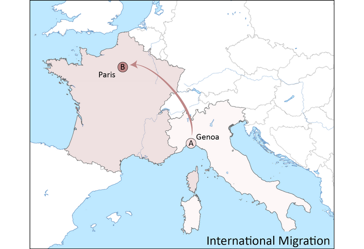
- Internal Migration:
Moving within a country, such as moving from Genoa in northern Italy to Rome in central Italy (see Figure 7.3).
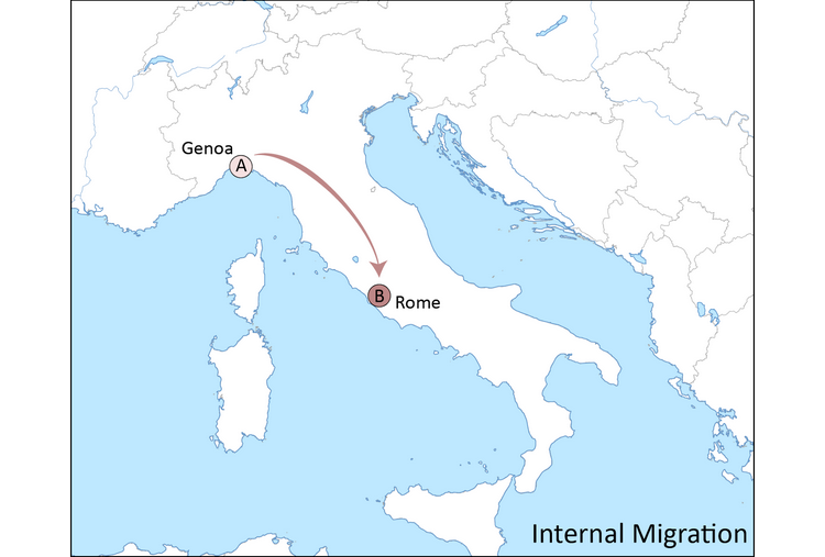
- Forced Migration:
The European Commission defines forced migration as movement “in which an element of coercion exists.” This is an incredibly general definition, and thus could encapsulate a variety of different types of movement. This migration could be within a country or to other countries (refugees). These events could be natural or as a result of conflict. An example of forced migration includes the 2010 Haitian earthquake, which left over a million Haitians without housing, forcing these individuals to find homes elsewhere.
- Return Migration:
Movement back to one’s home country or previous place of residence (their “origin” or point “A”). The return may be voluntary or forced. An example of forced return migration may include deportation.
- Seasonal Migration:
Movement from a place of origin for part of the year, usually for employment, and includes a return back to the place of origin upon conclusion. This type of migration is a common agricultural practice.
- Chain Migration:
Movement that is built upon networks, where people or families follow to the destination from the origin (Rush, 2018). In some ways, the initial migrants overcome obstacles (barriers, discussed later) to enable those back at the origin to migrate more easily.
References:
Cresswell, T. (2010). Mobilities I: Catching up. Progress in Human Geography, 35(4), 550-558.
Cresswell, T. (2006). On the move: Mobility in the modern Western world. Routledge.
Kraemer, M. U. G., Sailek, A., Zhang, Q., Marchal, N. A., Tuli, G., Cohn, E. L., Hswen, Y., Perkins, T. A., Smith, D. L. Reiner Jr., R. C., and Brownstein, J. S. (2020). Mapping global variation in human mobility. Nature Human Behavior, 4(8), 800-810.
Rush, N. (2018). Chain migration explained by scholars [98]. Center for Immigration Studies.
7.4. Migration Motivations and Impacts on Identity
As Cresswell points out in Chapter 1 of his book, the term “mobility” has evolved over time. Early on in its history, being “mobile” had certain stigmas associated with it. To be stable and have “roots” was seen as more beneficial than to be moving through space. However, with the advent of technological innovations in transportation and communication, mobility is at times seen as a privilege and as a sign of freedom, especially with consideration to tourism. This positive view of mobility; however, may change depending on the type of migration. Stigmas may still surround some migrants, such as refugees, internally displaced persons, asylum seekers, or employment seekers. The evolution of the term “mobility” has influenced migration and its motivations, as well as the impacts that migrant mobility has had on individual and group identities.
Migration Motivations
The motivations for migration are as varied as there are migration types and individuals; however, researchers have created a variety of conceptual frameworks to explain the rationale for migration. It’s easy to try to pinpoint one reason for a person or group’s decision to migrate: employment opportunities, educational opportunities, conflict, environmental disaster, etc. The reality is significantly more complex and relies on the interplay between individual characteristics and macro characteristics, and how those interact at a variety of different scales (global, regional, local, etc) (Piche, 2013). The accumulation of this research differentiates the variety of scales where motivations lie, as well as characterize them in terms of push and pull factors, to describe migration as “multifactorial” and “multidimensional” (Piche, 2013).
Attempts to identify rationale for migration began at the individual, identity level looking at the costs and benefits to an individual for migrating, the push and pull factors (Piche, 2013: Sjaastad, 1962; Lee, 1966). The conditions at the origin could influence (or push) a person to want to migrate: poor employment or educational opportunities, lack of access to resources, etc. While at the destination there are factors that influence a person’s desire to migrate there (or pull them there), such as the perceived notion of plentiful jobs, greater income, or a more stable environment if they’re coming from a war torn area. Pull factors often have an inherently geographic nature, as the migrant chooses to migrate to a specific place. This choice is often based on the perception of this place and the opportunities it presents, or the comforts. For example, if a person is faced with leaving their home in Syria due to the conflict, they may be “pulled” to Lebanon or Turkey because of language, familial ties, employment opportunities, etc. In addition to considering the individual costs, benefits and desires, a potential migrant must have the means to make the journey, whether large or small: transportation options, money, a social network to rely on at the destination and intermediate locations, etc. They must also have the means to overcome potential obstacles that may arise throughout the journey and at the destination.
Which leads to another important aspect of the migration progress: conduits and barriers. Conduits are factors that help migrants in the process of migration. Barriers are factors that limit their mobility. Barriers and conduits can manifest themselves in a variety of different ways, including but not limited to: individual characteristics, characteristics of the physical landscape, and socio-political factors. Examples of conduits could include permissive border policies allowing free transit, well-maintained routes and travel routes, extensive social networks along the route, and inexpensive travel options. Examples of barriers may include restrictive entry and exit policies, lack of financial means, and few travel options.
These individual factors are simply one piece of a complicated pie. There are also what Piche (2013) refers to as macro-structural factors to consider as well, seeking to explain migration from a different scale from the individual scale. Piche (2013) identifies the work of Akin Mabogunje (1970) as a seminal work in trying to understand migration as a “system” not independent of the individual characteristics but in concert with all of the factors at the structural level that interplay with them including technology and political factors. Piche’s (2013) conceptual framework diagram attempts to integrate all of these components and many others, such as gender, for a more holistic understanding of migration motivations and processes. Please pay close attention to the diagram on page 156 for a visual explanation of this framework (Piche, 2013).
Impacts of Migration on Identity
Just as the motivations for migration and mobility vary by the individual, so too do the impacts of migration on one’s identity. One thing is for certain: one’s identity is impacted in some way shape or form through the migration process. Recall from Lesson 3 that identity is a process, and everything a person encounters and experiences has an impact on their identity. Migration is no different. In no way is this discussion meant to encapsulate all the possibilities with reference to the impacts of migration on identity, but instead to present a snapshot of some possibilities to get you thinking about the impacts migration can have on identity.
In the process of migration, one leaves behind many of the facets of their identity, including but not limited to “social status, family, and social networks” (La Barbera, 2015). In some migrants, this loss may manifest itself in feelings of loneliness and anxiety, in an unfamiliar place, potentially forcing them to reimagine, rebuild, or rewrite (or some combination of these) their identity to gain acceptance in their new locale (La Barbera, 2015; Ramelli et al., 2013). Some migrants may also be more or less likely to engage with locals when they arrive, potentially seeking instead to connect with anybody who may have also migrated from their origin (Berry, 1997).
In addition to reimagining their identity in a new place, migrants also may also reimagine their expression of their identity as they seek to adapt to a culture that may be different from their point of origin. Consider a migrant moving from a predominantly Muslim country to a predominantly Christian one. How they self-represent may lead to misunderstandings. La Barbera (2015) uses the example of female migrants in a non-Muslim country wearing hijab. To the female migrant, this may be an expression of her religion and a source of comfort for her in an unknown place. To others, however, they may view her hijab as a “symbol of oppression.” This is not just true in religious contexts, this is also true when thinking about one’s self-representation and expression of their identities in terms of gender, sexuality, and ethnicity, among many other facets (La Barbera, 2015). Migrants in these cases may feel compelled to alter their expression of their identities to seek acceptance in their destination location.
The manifestations of the identity process may also differ with respect to the type of migration the individual is experiencing. An internal migration will face different situations than an international migrant, where language and culture for the international migrant could be significantly different from their point of origin. A forced migrant may have different sentiments towards the destination than a migrant seeking greater employment opportunities. These different experiences will also likely impact the identity process.
In many cases the identity process includes a hybrid mixture of elements of an individual’s identity that are manifestations of their identity at their point of origin and at their destination. All of the experiences go into their identity and their expression of that identity. La Barbera (2015) summarizes the literature on migrant patterns of identification as varying, “...ranging from identification with one’s country of origin, religion or mother tongue to [the] receiving country, neither or both.”
References:
Berry, J. W. (1997). Immigration, acculturation, and adaptation. Applied Psychology: An International Review, 46(1), 5-34.
Cresswell, T. (2006). On the move: Mobility in the modern Western world. Routledge.
La Barbera, M. (2015). Chapter 1: Identity and migration: An introduction. In M. C. La Barbera (Ed.), Identity and migration in Europe: Multidisciplinary perspectives (pp. 1-13). Springer International Publishing.
Lee, E. (1966). A theory of migration. Demography, 3(1), 47-57.
Piche, V. (2013). Contemporary migration theories as reflected in their founding texts. Population, 68(1), 141-164.
Ramelli, M., Florack, A., Kosic, A, and Rohmann A. (2013). Being prepared for acculturation: On the importance of the first months after immigrants enter a new culture. International Journal of Psychology, 48(3), 363-373.
Sjaastad, L. A. (1962). The costs and returns of human migration. Journal of Political Economy, 70(5), 80-93.
7.5. Security and Migration
Migration in all forms brings with it opportunities, but it also brings with it potential institutional challenges that are often unique to the areas where the migration is occurring, as well as by the type of migration. One set of challenges are potential security challenges posed by migration in both the international and internal contexts. These security challenges can manifest themselves where the migrants continue to experience human and resource-related security issues, but also where a fraction of migrants may cause physical security issues. This is not to say that all migrants represent some level of security issue or challenge, but the point is merely to highlight potential security challenges that may arise through and as a result of the migration process. These challenges may also arise from the intersection of different situations (Tsardanidis & Guerra, 2000). While literature regarding internal migration and security is not as plentiful as that regarding international migration and security, it too provides valuable insights into the similarities and differences in the experiences of these migrants.
Internal Migrants and Security
Research on potential security issues revolving around internal migration are not as abundant as those discussing international migration and security. This is likely due in part to a general lack of data availability on internal migration trends in various parts of the world (Bell et al., 2020; Petrova, 2021; Charles-Edwards et al., 2016). Despite the general dearth of literature available, there are many potential security issues surrounding, whether it deals with physical security, or other types of security such as health, food, and other forms of security.
Most research deals with security challenges that could arise from internal migration from a theoretical, qualitative perspective, describing the identity struggle internal migrants face when moving from their origins where they have a social network to a destination where they likely do not have that network (Awasthi, 2021). This is often discussed in the context of rural-urban migration, which dominates much of the literature on internal migration globally (Awasthi, 2021; Charles-Edwards et al., 2016). Rural-urban migrants are often seeking employment opportunities; however, they have no definitive employment prospects upon arrival, leaving their economic security uncertain. Awasthi (2021) identifies that rural-urban migrants in Delhi often settle on the urban periphery and potentially in slums, where access to resources is often scarce and can potentially influence individuals to become involved in criminal enterprises leading to physical security concerns within the city. This concern has been highlighted even in smaller countries in Asia that also experience rural-urban migration, such as Bhutan (Gosai & Sulewski, 2020).
There have been some quantitative approaches as well. Petrova (2021) while trying to identify any potential linkages between natural disaster-based internal migration and protest found that higher numbers of internal migration is related to a greater number of protests in Bangladesh; however, found little evidence of natural-disaster based internal migrants being related to an increase in protests in receiving districts.
There are also pockets of literature tackling internal migration due conflict, specifically addressing internally displaced persons (IDPs). According to the United Nations Office for the Coordination of Humanitarian Affairs [99] (OCHA), IDPs are:
"people who are forced to flee their homes due to armed conflict, generalized violence, violations of human rights, or natural or human-made disasters, but who remain within their own country."
Their location in their own country differentiates them from refugees, who seek refuge in another country and will be examined in greater depth in the next lesson. The consideration of IDPs as internal migrants encourages a look at the security threats to internal migrants, not necessarily as proponents or sources of security threats. Though, IDPs may be susceptible to non-state actors encouraging them to become involved in internal conflicts, which is a similar plight that refugees face (Adamson, 2006). However, many IDPs face greater human security threats including lack of access to resources, including housing, food, and water, in addition to difficulty finding accommodations (Adewale, 2016).
International Migrants and Security
While some of the same concerns arise with international migration as with internal migration (such as potential conflicts caused by strain on resources of the receiving area), there are some unique security concerns brought about through international migration. Some of these concerns have to do with the physical security of a nation, others deal with resource security, economic security, and human security of the immigrants among a few examples.
Many have made the connection between migration and terrorism, especially in the aftermath of the events of September 11, 2001 and the European bombings that were in the years following (Adamson, 2006). This often brings to light a nation’s ability to control their borders and the entry and exit of individuals through them, as porous borders can enable terrorists and others to enter unabated. After the events of September 11th, many technological and institutional changes, such as the creation of the Department of Homeland Security (DHS), increased funding to various border security entities, and the increased adoption of biometrics at border control sites across the globe (Popescu, 2012; Adamson, 2006). Even with all of these increased security measures, people who migrate illegally may still find gaps in the security measures to enter a nation and potentially pose security threats. Adamson (2006) maintains that terrorists view immigration policy from a “strategic” perspective either to use it with the aim of committing a terrorist attack or of creating sleeper cells. Additionally, migrants may also become involved in criminal enterprises that are not necessarily terrorism related. Tsardanidis and Guerra (2000) identify the use of immigrants to conduct criminal acts by Italian criminal organizations.
The use of international migration policy to commit terrorist and other criminal acts- is certainly the exception, and not the aim of all migrants; however, this rhetoric could potentially cause anti-immigrant views in the country of origin. Anti-immigrant sentimentality, racism, and other forms of discrimination could lead to conflicts between individuals in the destination countries and immigrants, potentially leading to violence against immigrants (Tsardanidis & Guerra, 2000). Other areas for conflicts between immigrants and local populations at the destination country include strains on resources (such as food, water, and other commodities) and perceived reduction of employment opportunities that sometimes come with increased migrant flows (whether international or internal) (Tsardanidis & Guerra, 2000). Conflicts of this nature are often location dependent and depend on the policies and rhetoric that are promulgated at the national, regional, and local levels.
Policy Implications for Migration-Security Nexus
Our consideration of the security issues surrounding internal and international migrants certainly presented some interesting challenges and opportunities for policy internationally. There’s an interesting balancing act in recognizing that migrants on the whole are opportunity seekers, who do not seek to be security threats or conduct acts of terrorism, and that only a very small percentage of migrants have nefarious goals. How do countries balance the protection of their citizens with participating in this increasingly globalized world?
This is certainly not an easy question to answer, and different countries and supranational organizations take different approaches, as evidenced by Givens’ (2010) comparison between the United States and Europe’s immigration policies. Should countries increasingly “police” mobility to ensure their security? Are permissive or restrictive immigration policies more advantageous? Should countries encourage multiculturalism vice assimilation? With technological advances making it both easier to travel and easier to communicate globally, it is much easier than in the past for migrants to remain connected with their native cultures and languages (Adamson, 2006). Would advocating multiculturalism nationally, regionally, and locally help reduce the security threat by reducing the “us” versus “them” sentimentalities? Are the practices of the past still applicable in today’s globalized community?
In addition to the obvious policy implications for the migration-security nexus, there are some additional less obvious connections between migration and security. One example of such a connection is that migrants can influence policy decisions of their destination countries with regards to their country of origin and/or send money or other resources back to their home countries that may increase instability (Tsardanidis & Guerra, 2000). An example of this influence includes the Kurdish population in Germany’s influence over relations with Turkey, specifically with Germany criticizing Turkey’s movement into Kurdish parts of northern Syria (Heine, 2020).
References:
Adamson, F. B. (2006). Crossing borders: International migration and national security. International Security, 31(1), 165-199.
Adewale, S. (2016). Internally displaced persons and the challenges of survival in Abuja. African Security Review, 25(2), 176-192.
Awasthi, S. (2021). ‘Hyper’-urbanisation and migration: A security threat. Cities, 108, 1-5.
Bell, M., Bernard, A., Charles-Ewards, E, and Ke, W. (2020). Comparative measures of internal migration. In M. Bell, A. Bernard, E. Charles-Edwards, and Y. Zhu (Eds.), International migration in the countries of Asia (pp. 229-247). Springer.
Charles-Edwards, E., Muhidin, S., Bell, M., and Zhu, Y. (2016). Migration in Asia. In M. J. White (Ed.), International handbook of migration and population distribution (pp. 269-284). Springer.
Givens, T. E. (2010). Immigration and national security: Comparing the US and Europe. The Whitehead Journal of Diplomacy and International Relations, 11(1), 79-88.
Gosai, M. and Sulewski, L. (2020). Internal migration in Bhutan. In M. Bell, A. Bernard, E. Charles-Edwards, and Y. Zhu (Eds.), International Migration in the Countries of Asia (pp. 229-247). Springer.
Heine, H. (2010). German government criticises Turkey’s Syria invasion [100]. Euractiv.
Petrova, K. (2021). Natural hazards, internal migration and protests in Bangladesh. Journal of Peace Research, 58(1), 33-49.
Popescu, G. (2012). Bordering and ordering the twenty-first century. Rowman & Littlefield.
Tsardanidis, C. and Guerra, S. (2000). The EU Mediterranean states, the migration issue and the ‘threat’ from the south. In R. King, G. Lazaridis, and C. Tsardanidis (Eds.), Eldorado or fortress? Migration in Southern Europe (pp. 321-344). St. Martin’s Press.
7.6 Research Project Rough Draft
We are now in week 7 of this course, and you have decided on a research project, medium, outline, and continued sifting through research. This week, we will ask you to submit a rough draft of your research project. This will allow your instructor to provide feedback on your progress and allow you enough time to course correct in case things are straying too far afield.
For this week, your rough draft should include:
- At least 75% completed final project in the medium you have chosen. If you have chosen a paper, your rough draft should be at least 9 pages in length.
- For any sections that are incomplete, there should be a rough outline sketching out how you think the written section will flow.
- Graphs and figures should be appropriately cited and referenced in your project. If you envision graphs and figures that are not in your rough draft currently, be sure to include a placeholder and description of what that figure/map/chart will include.
- In-text citations based on your literature review should be present and in APA format.
- A reference section should be included for all sources that were included as in-text citations. The reference section should be in APA format. As a rough guideline: for a graduate-level research project of this length, you should use at least 15-20 sources, and more if necessary.
Note for students submitting podcasts: your podcast must be accompanied by two things:
- either a script or transcript (some students have had good luck with Welder’s free audio-to-text transcriptions [101], though you will have to edit the output for spelling and format)
- a separate document containing your works cited, properly formatted in APA style.
Reminder: you are expected to incorporate citations in the podcast itself (e.g., by conversationally stating the author and year of a study). If you are not sure how best to do this, contact your instructor.
Please look over the grading rubric for the Lesson 7 Research Project Rough Draft in Canvas, where you can view the grading criteria for this assignment.
Deliverable:
When you are ready to submit your research project rough draft, please return to Canvas and open the Lesson 7 Research Project Rough Draft dropbox in the Lesson 7: Mobility I - Access, Movement, and Borders module.
7.7 Summary and Final Tasks
Summary
In this lesson we defined the fairly ubiquitous terms of mobility and migration within the context of human geographical research. We discussed the potential motivations for migration, but also the fact that migration is a system that incorporates a variety of different factors including macro-structural factors, as well as intervening barriers and conduits. While realizing that the majority of migrants do not have nefarious intentions, we examine potential security issues that may arise around internal and international migration, as well as potential policy implications.
Deliverable:
Please return to the Lesson 7: Mobility I - Access, Movement, and Borders module in Canvas where you will find the Lesson 7 Quiz. The quiz will asses your understanding of the Lesson 7 content and associated readings.
Please check the Canvas Syllabus or Calendar for specific time frames and due dates.
Final Tasks
Complete all of the Lesson 7 tasks
You have reached the end of Lesson 7! Double-check the to-do list on the Lesson 7 Checklist page [102] to make sure you have completed all of the activities listed there before you begin Lesson 8.
Questions?
If you have any questions now or at any point during this week, please feel free to post them to the GEOG 571 - General Discussion Forum. (That forum can be accessed at any time in Canvas by opening the Lesson 0: Welcome to GEOG 571 module in Canvas.)
Lesson 8: Mobility II - Refugees and Asylum Seekers
The links below provide an outline of the material for this lesson. Be sure to carefully read through the entire lesson before returning to Canvas to submit your assignments.
Note: You can print the entire lesson by clicking on the "Print" link above.
8.1 Overview
Introduction
In the previous lesson we focused specifically on mobility and migration. In this lesson we spend some time considering a particular group of migrants: refugees and asylum seekers. You will be challenged to compare and contrast refugees, asylum seekers, and other migrants, while also considering how flexible or rigid the definition of “refugee” should be. You will also examine a series of maps of refugee locations and be asked to determine any trends in the refugee numbers, as well as any spatial patterns you might see, and the potential policy implications of those trends and patterns.
Objectives
Upon completion of this lesson, you will:
- Compare the experiences of refugee and asylum seekers with those of other types of migrants.
- Evaluate the social and political position of refugees and asylum seekers within host states with regard to mobility.
- Evaluate the differences between environment- and conflict-driven forms of migration for refugees and asylum seekers with regard to host, intermediary, and destination states.
- Critique the presumed security implications of countries receiving refugees and asylum seekers against actualized security issues.
Questions?
If you have any questions now or at any point during this week, please feel free to post them to the GEOG 571 - General Discussion Forum. (That forum can be accessed at any time in Canvas by opening the Lesson 0: Welcome to GEOG 571 module in Canvas.)
8.2 Checklist
This lesson is one week in length. Please refer to the Calendar in Canvas for specific time frames and due dates. To finish this lesson, you must complete the activities listed below. You may find it useful to print this page out first so that you can follow along with the directions.
| Step | Activity | Access/Directions |
|---|---|---|
| 1 |
Read |
The lecture notes can be accessed by clicking on the Lesson 8: Mobility II - Refugees and Asylum Seekers link in the Lessons menu on this page. |
| 2 |
Required |
Berchin, I. I., Balduga, I. B., Garcia, J., Baltazar Salgueirinho Osorio de Andrade Guerra, J. (2017). Climate change and forced migrations: An effort towards recognizing climate refugees. Geoforum, 84, 147-150. Mence, V. and Parrinder, A. (2017). Environmentally related international migration: Policy challenges. In M. McAuliffe and K. Koser (Eds.), A long way to go: Irregular migration patterns, processes, drivers and decision-making (pp. 317-342). Australian National University Press. Zetter, R. (2007). More labels, fewer refugees: Remaking the refugee label in the era of globalization. Journal of Refugee Studies, 20(2), 172-192. Note: Registered students can access the readings in Canvas by clicking on the Library Resources link. |
| 3 | Complete the Lesson 8 Discussion Forum. | Post your response to the Lesson 8 Discussion Forum in Canvas and comment on classmates' responses. You can find the prompt for the assignment in the Lesson 8 Discussion Forum in the Lesson 8: Mobility II - Refugees and Asylum Seekers module in Canvas. |
| 4 | Submit your written brief. | Submit your written brief to the Lesson 8 Written Brief dropbox in the Lesson 8: Mobility II - Refugees and Asylum Seekers module in Canvas. |
8.3 Refugees and Asylum Seekers - Defined
In the previous lesson we spent a great deal of time discussing migrants and the different types of migration. We specifically discussed “forced migration,” where individuals are coerced to migrate, which includes asylum seekers and refugees. As evidenced by the title of this lesson, asylum seekers and refugees will be the focus of this week. First, we should begin with how these two categories of migrants are defined and how they are related to each other.
The definitions of who refugees and asylum seekers are should be relatively cut and dry; however, you’ll find that like with much of what we discuss, this is not the case (even though this is probably one time it really should be quite easy). Generally speaking, both refugees and asylum seekers are persons who are leaving their country of origin and seeking residence in a destination country due to persecution of some kind, violation of human rights, natural disasters, etc. The major difference between asylum seekers and refugees is that asylum seekers are waiting for legal recognition of their refugee status (Amnesty International, 2021).
Refugee status does come with certain legal protections under the 1951 Convention and 1967 Optional Protocol relating to the status of refugees. The 1951 Convention defines a refugee as a person “who is outside his or her country of nationality or habitual residence who is unable or unwilling to return due to a well-founded fear of persecution based on his or her race, religion, nationality, political opinion, or membership in a particular social group” (International Justice Resource Center, n.d.). While the Convention and Protocol provide legal for refugees and the rights afforded to them, it does not indicate how a state determines who is a refugee, which has led to differences in how countries determine who is a refugee (International Justice Resource Center, n.d.; Zetter 2007). That said, according to the United Nations High Commissioner for Refugees (UNHCR), 146 countries signed the 1951 Convention and 146 signed the 1967 Protocol. The number of countries that signed one or both is 149 and are depicted in Figure 1. South Sudan, the world’s youngest nation, gained independence in 2011, and ratified the 1951 convention in 2018. Don’t let the years fool you, though the Refugee Convention and Protocol were written in 1951 and 1967, respectively, countries continue to ratify the contents.
| Country | Convention | Protocol |
|---|---|---|
| Afghanistan | 30 Aug 2005 a | 30 Aug 2005 a |
| Albania | 18 Aug 1992 a | 18 Aug 1992 a |
| Algeria | 21 Feb 1963 d | 08 Nov 1967 a |
| Angola | 23 Jun 1981 a | 23 Jun 1981 a |
| Antigua and Barbuda | 07 Sep 1995 a | 07 Sep 1995 a |
| Argentina | 15 Nov 1961 a | 06 Dec 1967 a |
| Armenia | 06 Jul 1993 a | 06 Jul 1993 a |
| Australia | 22 Jan 1954 a | 13 Dec 1973 a |
| Austria | 01 Nov 1954 r | 05 Sep 1973 a |
| Azerbaijan | 12 Feb 1993 a | 12 Feb 1993 a |
| Bahamas (the) | 15 Sep 1993 a | 15 Sep 1993 a |
| Belarus | 23 Aug 2001 a | 23 Aug 2001 a |
| Belgium | 22 Jul 1953 r | 08 Apr 1969 a |
| Belize | 27 Jun 1990 a | 27 Jun 1990 a |
| Benin | 04 Apr 1962 d | 06 Jul 1970 a |
| Bolivia (Plurinational State of) | 09 Feb 1982 a | 09 Feb 1982 a |
| Bosnia and Herzegovina | 01 Sep 1993 d | 01 Sep 1993 d |
| Botswana | 06 Jan 1969 a | 06 Jan 1969 a |
| Brazil | 16 Nov 1960 r | 07 Apr 1972 a |
| Bulgaria | 12 May 1993 a | 12 May 1993 a |
| Burkina Faso | 18 Jun 1980 a | 18 Jun 1980 a |
| Burundi | 19 Jul 1963 a | 15 Mar 1971 a |
| Cabo Verde | 09 Jul 1987 a | |
| Cambodia | 15 Oct 1992 a | 15 Oct 1992 a |
| Cameroon | 23 Oct 1961 d | 19 Sep 1967 a |
| Canada | 04 Jun 1969 a | 04 Jun 1969 a |
| Central African Republic (the) | 04 Sep 1962 d | 30 Aug 1967 a |
| Chad | 19 Aug 1981 a 19 | Aug 1981 a |
| Chile | 28 Jan 1972 a | 178983378.8 |
| China | 24 Sep 1982 a | 24 Sep 1982 a |
| Colombia | 10 Oct 1961 r | 04 Mar 1980 a |
| Congo (the) | 15 Oct 1962 d | 10 Jul 1970 a |
| Costa Rica | 28 Mar 1978 a | 28 Mar 1978 a |
| Côte d'Ivoire | 08 Dec 1961 d | 16 Feb 1970 a |
| Croatia | 12 Oct 1992 d | 12 Oct 1992 d |
| Cyprus (the) | 16 May 1963 d | 09 Jul 1968 a |
| Czech Republic (the) | 11 May 1993 d | 11 May 1993 d |
| Denmark | 04 Dec 1952 r | 29 Jan 1968 a |
| Democratic Republic of the Congo (the) | 19 July 1965 a | 13 Jan 1975 a |
| Djibouti | 09 Aug 1977 d | 09 Aug 1977 d |
| Dominica | 17 Feb 1994 a | 17 Feb 1994 a |
| Dominican Republic (the) | 04 Jan 1978 a | 04 Jan 1978 a |
| Ecuador | 17 Aug 1955 a | 06 Mar 1969 a |
| Egypt | 22 May 1981 a | 22 May 1981 a |
| El Salvador | 28 Apr 1983 a | 28 Apr 1983 a |
| Equatorial Guinea | 07 Feb 1986 a | 07 Feb 1986 a |
| Estonia | 10 Apr 1997 a | 10 Apr 1997 a |
| Ethiopia | 10 Nov 1969 a | 10 Nov 1969 a |
| Fiji | 12 Jun 1972 d | 12 Jun 1972 d |
| Finland | 10 Oct 1968 a | 10 Oct 1968 a |
| France | 23 Jun 1954 r | 03 Feb 1971 a |
| Gabon | 27 Apr 1964 a | 28 Aug 1973 a |
| Gambia (the) | 07 Sep 1966 d | 29 Sep 1967 a |
| Georgia | 09 Aug 1999 a | 09 Aug 1999 a |
| Germany | 01 Dec 1953 r | 05 Nov 1969 a |
| Ghana | 18 Mar 1963 a | 30 Aug 1968 a |
| Greece | 05 Apr 1960 r | 07 Aug 1968 a |
| Guatemala | 22 Sep 1983 a | 22 Sep 1983 a |
| Guinea | 28 Dec 1965 d | 16 May 1968 a |
| Guinea-Bissau | 11 Feb 1976 a | 11 Feb 1976 a |
| Haiti | 25 Sep 1984 a | 25 Sep 1984 a |
| Holy See | 15 Mar 1956 r | 08 Jun 1967 a |
| Honduras | 23 Mar 1992 a | 23 Mar 1992 a |
| Hungary | 14 Mar 1989 a | 14 Mar 1989 a |
| Iceland | 30 Nov 1955 a | 26 Apr 1968 a |
| Iran (Islamic Republic of) | 28 Jul 1976 a | 28 Jul 1976 a |
| Ireland | 29 Nov 1956 a | 06 Nov 1968 a |
| Israel | 01 Oct 1954 r | 14 Jun 1968 a |
| Italy | 15 Nov 1954 r | 26 Jan 1972 a |
| Jamaica | 30 Jul 1964 d | 30 Oct 1980 a |
| Japan | 03 Oct 1981 a | 01 Jan 1982 a |
| Kazakhstan | 15 Jan 1999 a | 15 Jan 1999 a |
| Kenya | 16 May 1966 a | 13 Nov 1981 a |
| Kyrgyzstan | 08 Oct 1996 a | 08 Oct 1996 a |
| Latvia | 31 Jul 1997 a | 31 Jul 1997 a |
| Lesotho | 14 May 1981 a | 14 May 1981 a |
| Liberia | 15 Oct 1964 a | 27 Feb 1980 a |
| Liechtenstein | 08 Mar 1957 r | 20 May 1968 a |
| Lithuania | 28 Apr 1997 a | 28 Apr 1997 a |
| Luxembourg | 23 Jul 1953 r | 22 Apr 1971 a |
| Madagascar | 18 Dec 1967 a | |
| Malawi | 10 Dec 1987 a | 10 Dec 1987 a |
| Mali | 02 Feb 1973 d | 02 Feb 1973 a |
| Malta | 17 Jun 1971 a | 15 Sep 1971 a |
| Mauritania | 05 May 1987 a | 05 May 1987 a |
| Mexico | 07 Jun 2000 a | 07 Jun 2000 a |
| Monaco | 18 May 1954 a | 16 June 2010 a |
| Montenegro | 10 Oct 2006 d | 10 Oct 2006 d |
| Morocco | 07 Nov 1956 d | 20 Apr 1971 a |
| Mozambique | 16 Dec 1983 a | 01 May 1989 a |
| Namibia | 17 Feb 1995 a | 17 Feb 1995 a |
| Nauru | 17 Jun 2011 a | 17 Jun 2011 a |
| Netherlands (the) | 03 May 1956 r | 29 Nov 1968 a |
| New Zealand | 30 Jun 1960 a | 06 Aug 1973 a |
| Nicaragua | 28 Mar 1980 a | 178986270.8 |
| Niger (the) | 25 Aug 1961 d | 02 Feb 1970 a |
| Nigeria | 23 Oct 1967 a | 02 May 1968 a |
| Norway | 23 Mar 1953 r | 28 Nov 1967 a |
| Panama | 02 Aug 1978 a | 02 Aug 1978 a |
| Papua New Guinea | 17 Jul 1986 a | 17 Jul 1986 a |
| Paraguay | 01 Apr 1970 a | 01 Apr 1970 a |
| Peru | 21 Dec 1964 a | 15 Sep 1983 a |
| Philippines (the) | 22 Jul 1981 a | 22 Jul 1981 a |
| Poland | 27 Sep 1991 a | 27 Sep 1991 a |
| Portugal | 22 Dec 1960 a | 13 Jul 1976 a |
| Republic of Korea (the) | 03 Dec 1992 a | 03 Dec 1992 a |
| Republic of Moldova | 31 Jan 2002 a | 31 Jan 2002 a |
| Romania | 07 Aug 1991 a | 07 Aug 1991 a |
| Russian Federation (the) | 02 Feb 1993 a | 02 Feb 1993 a |
| Rwanda | 03 Jan 1980 a | 03 Jan 1980 a |
| Saint Kitts and Nevis | 01 Feb 2002 a | |
| Saint Vincent and the Grenadines | 03 Nov 1993 a | 03 Nov 2003 a |
| Samoa | 21 Sep 1988 a | 29 Nov 1994 a |
| Sao Tome and Principe | 01 Feb 1978 a | 01 Feb 1978 a |
| Senegal | 02 May 1963 d | 03 Oct 1967 a |
| Serbia | 12 Mar 2001 d | 12 Mar 2001 d |
| Seychelles | 23 Apr 1980 a | 23 Apr 1980 a |
| Sierra Leone | 22 May 1981 a | 22 May 1981 a |
| Slovakia | 04 Feb 1993 d | 04 Feb 1993 d |
| Slovenia | 06 Jul 1992 d | 06 Jul 1992 d |
| Solomon Islands | 28 Feb 1995 a | 12 Apr 1995 a |
| Somalia | 10 Oct 1978 a | 10 Oct 1978 a |
| South Africa | 12 Jan 1996 a | 12 Jan 1996 a |
| Spain | 14 Aug 1978 a | 14 Aug 1978 a |
| South Sudan | 01 Oct 2018 a | 01 Oct 2018 a |
| Sudan (the) | 22 Feb 1974 a | 23 May 1974 a |
| Suriname | 29 Nov 1978 d | 29 Nov 1978 d |
| Swaziland | 14 Feb 2000 a | 28 Jan 1969 a |
| Sweden | 26 Oct 1954 r | 04 Oct 1967 a |
| Switzerland | 21 Jan 1955 r | 20 May 1968 a |
| Tajikistan | 07 Dec 1993 a | 07 Dec 1993 a |
| The former Yugoslav Republic of Macedonia | 18 Jan 1994 d | 18 Jan 1994 d |
| Timor-Leste | 07 May 2003 a | 07 May 2003 a |
| Togo | 27 Feb 1962 d | 01 Dec 1969 a |
| Trinidad and Tobago | 10 Nov 2000 a | 10 Nov 2000 a |
| Tunisia | 24 Oct 1957 d | 16 Oct 1968 a |
| Turkey | 03 Mar 1962 r | 31 Jul 1968 a |
| Turkmenistan | 02 Mar 1998 a | 02 Mar 1998 a |
| Tuvalu | 07 Mar 1986 d | 07 Mar 1986 d |
| Uganda | 27 Sep 1976 a | 27 Sep 1976 a |
| Ukraine | 10 Jun 2002 a | 04 Apr 2002 a |
| United Kingdom of Great Britain and Northern Ireland (the) | 11 Mar 1954 r | 04 Sep 1968 a |
| United Republic of Tanzania (the) | 12 May 1964 a | 04 Sep 1968 a |
| United States of America (the) | 01 Nov 1968 a | |
| Uruguay | 22 Sep 1970 a | 22 Sep 1970 a |
| Venezuela (Bolivarian Republic of) | 19 Sep 1986 a | |
| Yemen | 18 Jan 1980 a | 18 Jan 1980 a |
| Zambia | 24 Sep 1969 d | 24 Sep 1969 a |
| Zimbabwe | 25 Aug 1981 a | 25 Aug 1981 a |
| Note: Ratification (r), Accession (a), Succession (d) | ||
Required Reading
Zetter, R. (2007). More labels, fewer refugees: Remaking the refugee label in the era of globalization. Journal of Refugee Studies, 20(2), 172-192.
Note: Registered students can access the readings in Canvas by clicking on the Library Resources link.
Environmental/Climate-Driven Migration
When most think about refugees and asylum seekers, they immediately think of those who are fleeing conflict areas, areas that are war torn, or have particular discriminatory policies. However, with the increasing research surrounding the effects of global climate change, environmental and climatic refugees are becoming a burgeoning and important group of refugees. The relationship between environmental drivers and migration began to be explored in the 1980s by the scholars El-Hinnawi and Jacobson (Berchin et al., 2017; Mence & Parrinder, 2017). The policy issues surrounding climate refugees were not considered widely until around 2006, when the Maldives government drew attention to this group by calling a meeting (Biermann & Boas, 2008). Currently there are no legal avenues for climate refugees to achieve refugee status as there are for other types of refugees, and they are not protected by the 1951 Convention. Here again, as in Zetter’s (2007) research, labels and the perception of those labels become important: the implications of “refugee” versus “displaced person” (Berchin et al., 2017; Mence & Parrinder, 2017).
Many researchers highlight that there have not been many instances where climate change was the only reason for a refugee to migrate, and highlights a few examples from Pacific Islands (Podesta, 2019; Mence & Parrinder, 2017). The fact that environmental and climate change related migration, like with all types of migration, likely will have multiple causes makes the attempts to define it all the more difficult, and thus complicates the potential applications to policy. How do environmental migrants differ from climate change migrants? Should one group be considered “refugees” over the other?
Required Reading
Berchin, I. I., Balduga, I. B., Garcia, J., Baltazar Salgueirinho Osorio de Andrade Guerra, J. (2017). Climate change and forced migrations: An effort towards recognizing climate refugees. Geoforum, 84, 147-150.
Mence, V. and Parrinder, A. (2017). Environmentally related international migration: Policy challenges. In M. McAuliffe and K. Koser (Eds.), A long way to go: Irregular migration patterns, processes, drivers and decision-making (pp. 317-342). Australian National University Press.
Note: Registered students can access the readings in Canvas by clicking on the Library Resources link.
References
Amnesty International. (2021). Refugees, asylum-seekers, and migrants [103].
Berchin, I. I., Balduga, I. B., Garcia, J., and Baltazar Salgueirinho Osorio de Andrade Guerra, J. (2017). Climate change and forced migrations: An effort towards recognizing climate refugees. Geoforum, 84, 147-150.
Biermann, F., and Boas, I. (2008). Protecting climate refugees: The case for a global protocol. Environment: Science and Policy for Sustainable Development, 50(6), 8-17.
International Justice Resource Center. (n.d.). Asylum and the rights of refugees [104].
Mence, V. and Parrinder, A. (2017). Environmentally related international migration: Policy challenges. In M. McAuliffe and K. Koser (Eds.), A long way to go: Irregular migration patterns, processes, drivers and decision-making (pp. 317-342). Australian National University Press.
Podesta, J. (2019, July 25). The climate crisis, migration, and refugees [105]. Brookings.
Zetter, R. (2007). More labels, fewer refugees: Remaking the refugee label in the era of globalization. Journal of Refugee Studies, 20(2), 172-192.
8.4 Mobility and Decision Making
Refugees and asylum seekers are often faced with the same factors and decisions as other migrants when deciding if, when, and where to migrate. As with any decision to leave a place, it is multi-faceted and complex and deals with a combination of push and pull factors at their origin, destination, and intermediary locations (Czaika, 2016; McAuliffe, 2017; Hatton & Monoley, 2017). While this section cannot enumerate all of the many facets of the decision making process that refugees and asylum seekers go through, this lesson hopes to provide a cross section of research to allow you to begin to think critically about the multi-faceted decisions of these migrants.
Czaika (2016) reminds us that in addition to taking into account the current situation, potential refugees and asylum seekers must also take into account “...other social and economic aspects as well as the ‘opportunity costs’ of leaving behind and potentially losing their belongings...and beloved ones.” While refugees and asylum seekers in Australia often cited a combination of security and non-security related issues contributing to their decision to migrate, migrants also left in search of better educational facilities, better health service, and more economic opportunities, and chose Australia because of Australia’s reputation for good hospitality towards asylum seekers (McAuliffe, 2017). Other cited attributes of desirable locations for asylum seekers include a peaceful locale, higher incomes, and employment opportunities (Hatton and Moloney, 2017). An interesting point McAuliffe's (2017) research notes is that asylum seekers in Australia cited “a significant security threat or incident triggered their departure.” Those who are younger and perhaps of working age may also be more inclined to migrate (Czaika, 2016).
As with international migrants, Czaika (2016) also finds that networks are also important in decision making and can make the decision to move easier, especially in helping to decide where to migrate. Social media has increased the ability to create networks that provide information on host nations and experiences of other migrants to help inform refugee and asylum seeker decisions, though access to this social media networking capability varies geographically with some African migrants possibly having a reduced access to such capabilities (Merisalo & Jauhiainen, 2021; Dekker et al., 2018). Those with access; however, identified that social media and smartphones were helpful in route planning, learning about access to countries, choosing a destination, and keeping in touch with those at a country of origin (Dekker et al., 2018). This, however, is a rosy view of social media and smartphones—it does have its pitfalls, as it can be rife with misinformation and an ability to be tracked, they also require internet connection (or mobile service), a battery, and a mechanism for charging said battery (Dekker et al., 2018). Despite the pitfalls, social media, the internet, and smartphones do influence refugee and asylum seekers before and during their travel about where they should go and how to get where they are going. Recall that different countries have different procedures for determining whether or not an asylum seeker meets the definition of a refugee, and these networks help provide insight into which countries may be more or less stringent, potentially influencing decision making.
Distance is also a factor in a migrant’s decision making, especially if there is an intention to return home. Thus, neighboring countries often receive many refugees and often “shoulder a disproportionate burden” over other nations (Czaika, 2016). That, however, isn’t to say that this is always the case. Some migrants use these neighboring countries as springboards to locations further away, as evidenced Ludwig’s (2013) work with Liberian refugees in the United States, who sometimes used refugee camps in neighboring countries as an intermediate location to gain refugee status elsewhere. In addition, refugees may also choose a host nation based on the presence of a social network: friends, family, etc. At times, these migrants may choose to remain in a transit location because of the presence of known family and friends who can help support (Simich et al., 2003). The decisions these refugees make throughout their journey also can help speak to their experiences in their host nation, which is the focus of the next section.
References
Czaika, M. (2016). Refugee movements. In J. Stone, R. M. Dennis, P. S. Rizova, A. D. Smith, and X. Hou (Eds.), The Wiley Blackwell encyclopedia of race, ethnicity, and nationalism (pp. 1-5). John Wiley & Sons, Ltd.
Dekker, R., Engbersen, G., Klaver, J., and Vonk, H. (2018). Smart refugees: How Syrian asylum migrants use social media information in migration decision-making. Social Media and Society, 4(1), 1-11.
Hatton, T. and Moloney, J. (2017). Applications for asylum in the developed world: Modeling asylum claims by origin and destination. In M. McAuliffe and K. Koser (Eds.), A long way to go: Irregular migration patterns, processes, drivers and decision-making (pp. 227-254). Australian National University Press.
Ludwig, B. (2013). “Wiping the refugee dust from my feet”: Advantages and burdens of refugee status and the refugee label. International Migration, 54(1), 5-18.
McAuliffe, M. (2017). Seeking the views of irregular migrants: Decision-making, drivers and migration journeys. In M. McAuliffe and K. Koser (Eds.), A long way to go: Irregular migration patterns, processes, drivers and decision-making (pp. 103-140). Australian National University Press.
Merisalo, M. and Jauhianinen, J. S. (2021). Asylum-related migrants’ social-media use, mobility decisions, and resilience. Journal of Immigrant and Refugee Studies, 19(2), 184-198.
Simich, L., Beiser, M., and Mawani, F. N. (2003). Social support and the significance of shared experience in refugee migration and resettlement. Western Journal of Nursing Research, 25(7), 872-891.
8.5 Refugee and Asylum Seeker Experiences in their Host Country
Refugees and Asylum Seekers for better or worse have made the decision to leave their country of origin and move to their destination country (whether this is a distant destination or a neighboring country, and includes settling in refugee camps). This decision brings with it a variety of experiences, and these experiences are often unique to the individual and unique to their host nation. Perceptions of experiences in host nations are often included in the decision making process above. This section does not wish to diminish the individuality of those refugee and asylum seeker experiences, but merely to provide some insight into general experiences of these individuals and provide a cross section of the multidisciplinary research that has been conducted in this vein.
As we have discussed extensively in this course, discourse and labels matter, and the terms “refugee” and “asylum seeker” bring with it benefits and drawbacks both to an individual’s identity and their experiences in their host countries. The benefits of the legal term “refugee” include that the individual cannot be returned to their country of origin if their life is in danger, and in the United States many refugees have access to national programs, such as food stamps and worker’s permit, to help them get settled (Ludwig, 2013).
Refugees and asylum seekers are typically already under stress; however, they also experience “anxiety and depression” (Strang & Quinn, 2019). While these stressors differ from other immigrants, some may be similar, such as the potential of difficulty communicating due to different language or culture. Even the label “refugee” can be difficult, due to the unintended drawbacks that come with the label's status. Refugees can be stigmatized at times, especially as they can be viewed as “helpless,” “dependent,” and possibly a “resource drain” (Ludwig, 2013). Ludwig (2013), however, recognizes that this stigma may differ by a refugee’s country of origin, finding that “Liberians and other Black” refugees are often seen as an “economic burden.” This intolerance is not unique to Liberians and other Black refugees in the United States, but has also been found with Syrian Refugees in Lebanon, who experienced “multilevel intolerance,” including but not limited to perceived prejudice, stereotypes, perceived discrimination, and scapegoating (Kheireddine et al., 2020; Strang & Quinn, 2019). The label of “refugee” can also make it difficult to integrate into their host country’s society from a variety of perspectives: socially and economically. They struggle with the question: When is it ok to stop being called a refugee? (Ludwig, 2013) Which also begs the question: Is this only the decision of the refugee?
These generalized trends of the experiences of refugees and asylum seekers does not take into account that these experiences often also differ by gender. While this strand of refugee experiences has not been widely researched, the research that has been conducted does indicate that more research should be conducted. Strang and Quinn (2019) researched the experiences of single Afghan and Iranian men in Scotland. Their research, complementing Robertshaw et al.’s (2017) research demonstrating that female refugees were able to share their emotions more freely with friends; while the male refugees in Strang and Quinn’s (2019) research had to redefine their identity to allow them to emotionally connect.
These labels the refugees and asylum seekers are given, are not just present to them, but also to immigrants: both authorized and unauthorized. Media (including social media and news programs) often play a part in how members of the host nation view these groups. Murray and Marx (2013) noted in their research from participants along the U.S.-Mexico border region that there are differences in how individuals in host nations view threats associated with an immigrant based on the label they are provided, with unauthorized immigrants being seen as being a larger perceived threat to overall welfare than authorized immigrants. While threat perception towards authorized and unauthorized immigrants was impacted by generational differences, this effect does not appear in attitudes towards refugees, where participants were overall positive about refugee resettlement programs (Murray & Marx, 2013).
This positivity that Murry and Marx (2013) found in the United States towards refugees and asylum seekers is not shared worldwide, with researchers finding that nations in the European Union are generally less positive (Crawley et al., 2019). A poll from 2016 shows that many people in European Union countries believe that refugees will increase terrorism and be a burden on the country (Wike et al., 2016). In addition, scale (there’s that word again) is also important here. Variations in attitudes also can vary regionally and even between rural and urban areas, as evidenced by Crawley et al.’s (2019) work denoting regional differences in attitudes towards asylum seekers in the United Kingdom, as well as more positive attitudes in urban versus rural areas of the UK.
Much of the research surrounding host nation attitudes towards refugees and asylum seekers, as with other immigrants, identifies the importance of “intergroup contact” and “reciprocity” to create positive interactions and attitudes, where individuals from the host nation and refugees meet and interact (Crawley et al., 2019; Strang & Quinn, 2019). While this “intergroup contact” can be helpful in attitudes towards refugees in their host nations, it is also important to keep in mind the refugee’s network: friends, family, and/or the existence of communities with cultural similarities, as they can be an incredibly important source of support for refugees. If refugees are placed in areas where they have no support, they may make the decision to take on additional hardships and move to another place, possibly even within the host country, where they would have access to such a support network. This was found to be true of refugees in Canada, who even chose to stay in transit locations or migrate again to be closer to a support network (Simich et al., 2003). While there may be factors that compel a refugee or asylum seeker to stay in a transit point, there are also factors that may compel refugees to continue their journey to secondary destinations. One such study looking at Eritrean asylum seekers in Italy found that asylum seekers may decide to continue to secondary destinations due to “National differences in the quality of the reception system, in welfare policies, and in labour market opportunities” (Brekke & Brochmann, 2014).
Moral of the research review: the experiences of asylum seekers and refugees are varied and complex. They vary by the individual, by the group, by the origin, by the destination, by the individuals and groups in the destination, by the policies of the destination, and the list could go on forever. However, as evidenced by this section, there is a large body of research into the experiences of refugees and asylum seekers, how to potentially improve their experiences, and what policies influence those experiences.
References
Brekke, J., and Brochmann, G. (2014). Stuck in transit: Secondary migration of asylum seekers in Europe, national differences, and the Dublin Regulation. Journal of Refugee Studies, 28(2), 145-162.
Crawley, H., Drinkwater, S., and Kausar, R. (2019). Attitudes towards asylum seekers: Understanding differences between rural and urban areas. Journal of Rural Studies, 71, 104-113.
Kheireddine, B. J., Soares, A. M., and Rodrigues, R. G. (2020). Understanding (in)tolerance between hosts and refugees in Lebanon. Journal of Refugee Studies, 34(1), 397-421.
Ludwig, B. (2013). “Wiping the refugee dust from my feet”: Advantages and burdens of refugee status and the refugee label. International Migration, 54(1), 5-18.
Murray, K. E., and Marx, D. M. (2013). Attitudes toward unauthorized immigrants, authorized immigrants, and refugees. Cultural Diversity and Ethnic Minority Psychology, 19(3), 332-341.
Robertshaw, L., Dhesi, S., and Jones, L. L. (2017). Challenges and facilitators for health professionals providing primary healthcare for refugees and asylum seekers in high-income countries: A systematic review and thematic synthesis of qualitative research. BMJ Open, 7(8), e015981.
Simich, L., Beiser, M., and Mawani, F. N. (2003). Social support and the significance of shared experience in refugee migration and resettlement. Western Journal of Nursing Research, 25(7), 872-891.
Strang, A. B., and Quinn, N. (2019). Integration or isolation? Refugees’ social connections and wellbeing. Journal of Refugee Studies, 34(1), 328-353.
Wilke, R., Stokes, B., and Simmons, K. (2016). Europeans fear wave of refugees will mean more terrorism, fewer jobs [106]. Pew Research Center.
8.6 Security Implications of and for Refugee and Asylum Seekers
In the previous lesson, we investigated security issues surrounding migrants: internal and international. While refugees and asylum seekers are considered international migrants as well, there are some unique considerations that surround refugees and asylum seekers, especially given the conditions surrounding their migration and the legal protections afforded them upon successful completion of the refugee process. This section is not meant to be an all encompassing review of the literature surrounding security and refugees and asylum seekers, but a snapshot.
Security Threats to Refugee and Asylum Seekers
Refugees and asylum seekers are facing real threats in their points of origin that directly threaten their lives and livelihoods. They are often faced with a variety of security threats while they are leaving their points of origin, while in transit, and even at times when they reach their destinations. We discussed in the previous sections the decisions of refugees and asylum seekers to seek a secondary destination to find better support, which also includes better security support and safety (Loescher, 2002). Some refugees face sexual abuse, robbery, resource availability, and possibly death among many threats (Loescher, 2002). These security threats are rarely discussed, especially in countries that neighbor the states refugees and asylum seekers are fleeing from; more often than not, what is reported are the potential/alleged security threats generated by refugees and asylum seekers (Loescher, 2002)
“Security Threats” of Refugee and Asylum Seekers
The term security threats was placed in quotations in the title of this section purposefully. That is not to say that there are no security threats caused by the presence of refugees and asylum seekers, but in some cases they are exaggerated.
Loescher (2002) identifies direct and indirect threats and perceived threats of refugees and asylum seekers. There are some direct security threats that destination countries may face by accepting refugees and asylum seekers into their countries; however, a lot of these threats are felt by countries that neighbor or are in close proximity to the countries of origin. Loescher (2002) discusses “spillover conflict,” where conflicts do not stop at the border but follow the refugees to their destinations and the use of refugee camps by “combatants” posing as refugees. There are also perceived indirect threats that Loescher (2002) indicates, such as the fear of potential ethnic conflict due to protracted refugee presence and the thought that refugees and asylum seekers bring threats of terrorism with them. Alderman (2002) however notes that “...there is virtually no evidence linking global terrorism with refugees,” especially in the context of refugees seeking acceptance in Canada and the United states. What Alderman (2002) means is that terrorists are not likely to use the refugee process, as it requires providing a significant amount of information, increasing the risk of exposing terrorists.
References
Adelman, H. (2002). Refugees and border security post-September 11. Refuge, 20(4), 5-14.
Loescher, G. (2002). Blaming the victim: Refugees and global security. Bulletin of the Atomic Scientists, 58(6), 46-53.
8.7 Written Brief Assignment
Scenario
You are a humanitarian analyst covering the ongoing conflicts surrounding Uganda. You are provided with the following three maps:
- Refugees and asylum seekers - Uganda as of 01 July 2016 [107] (PDF)
- Refugees and asylum seekers - Uganda as of 01 April 2017 [108] (PDF)
- Refugees and asylum seekers - Uganda as of 31 July 2021 [109] (PDF)
and the following article:
- Uganda stands out in refugees hospitality - Africa Renewal [110] (PDF) with some basic information on Uganda’s refugee policies.
Registered students can use the following link to access an interactive set of the Refugee and Asylum Seekers maps [111].
| July 1, 2016 | April 1, 2017 | July 31, 2021 | ||||
|---|---|---|---|---|---|---|
| City: Adjumani |
138,471 |
City: Adjumani |
223,739 |
City: Adjumani |
230,134 |
% of Total |
| Country of Origin: |
Rank: |
Country of Origin: |
Rank: |
Country of Origin: |
Number: |
% of Total: |
| South Sudan | 1 | South Sudan | 1 | South Sudan | 229,780 | 99.9% |
| Sudan | 236 | 0.1% | ||||
| Democratic Republic of Congo |
68 |
0.0% |
||||
| Eritrea | 6 | 0.0% | ||||
| Ethiopia | 4 | 0.0% | ||||
| Burundi | 3 | 0.0% | ||||
| Kenya | 2 | 0.0% | ||||
| Rwanda | 2 | 0.0% | ||||
| July 1, 2016 | April 1, 2017 | |||||
| City: Arusa / Koboko |
33,377 |
City: Aruso |
144,054 |
|||
| Country of Origin: |
Rank: |
Country of Origin: |
Rank: |
|||
| South Sudan | 1 | South Sudan | 1 | |||
| Democratic Republic of Congo |
2 |
|||||
| July 31, 2021 | ||||||
| City: Bidibidi |
239,141 |
% of Total |
||||
| Country of Origin: |
Number: |
% of Total: |
||||
| South Sudan | 238,977 | 99.9% | ||||
| Sudan | 103 | 0.0% | ||||
| Democratic Republic of Congo |
66 |
0.0% |
||||
| Burundi | 1 | 0.0% | ||||
| Congo, Republic of the | 1 |
0.0% |
||||
| July 31, 2021 | ||||||
| |
City: Imvepi |
70,183 |
% of Total |
|||
| |
Country of Origin: |
Number: |
% of Total: |
|||
| South Sudan | 68,751 | 98.0% | ||||
| Democratic Republic of Congo |
1,422 |
2.0% |
||||
| Sudan | 23 | 0.0% | ||||
| Central African Republic |
1 |
0.0% |
||||
| Chad | 1 | 0.0% | ||||
| Senegal | 1 | 0.0% | ||||
| United Republic of Tanzania |
1 |
0.0% |
||||
| July 1, 2016 | April 1, 2017 | July 31, 2021 | ||||
| City: Kampala |
75,233 |
City: Kampala |
93,445 |
City: Kampala |
93,179 |
% of Total |
| Country of Origin: |
Rank: |
Country of Origin: |
Rank: |
Country of Origin: |
Number: |
% of Total: |
| Democratic Republic of Congo |
1 |
Democratic Republic of Congo |
1 |
Somalia | 33,705 | 37.0% |
| Somalia | 2 | Somalia | Tied - 2 | Democratic Republic of Congo |
26,177 |
28.7% |
| Other Nationalities |
3 |
Other Nationalities |
Tied - 2 |
Eritrea | 15,899 | 17.4% |
| South Sudan | 4 | South Sudan | 3 | South Sudan | 6,150 | 6.7% |
| Burundi | 5 | Burundi | 4 | Burundi | 4,675 | 5.1% |
| Rwanda | 6 | Rwanda | 5 | Ethiopia | 2,521 | 2.8% |
| Rwanda | 2,053 | 2.3% | ||||
| July 1, 2016 | April 1, 2017 | July 31, 2021 | ||||
| City: Kiryandongo |
53,238 |
City: Kiryandongo |
51,052 |
City: Kiryandongo |
72,279 |
% of Total |
| Country of Origin: |
Rank: |
Country of Origin: |
Rank: |
Country of Origin: |
Number: |
% of Total: |
| South Sudan | 1 | South Sudan | 1 | South Sudan | 71,517 | 99.0% |
| Democratic Republic of Congo |
312 |
0.4% |
||||
| Sudan | 226 | 0.3% | ||||
| Kenya | 152 | 0.2% | ||||
| Burundi | 38 | 0.1% | ||||
| Rwanda | 26 | 0.0% | ||||
| Somalia | 3 | 0.0% | ||||
| April 1, 2017 | ||||||
| City: Kisoro |
304 |
|||||
| Country of Origin: |
Rank: |
|||||
| Democratic Republic of Congo |
1 |
|||||
| July 1, 2016 | April 1, 2017 | July 31, 2021 | ||||
| City: Kyaka II |
27,651 |
City: Kyaka II |
24,612 |
City: Kyaka II |
125,431 |
% of Total |
| Country of Origin: |
Rank: |
Country of Origin: |
Rank: |
Country of Origin: |
Number: |
% of Total: |
| Democratic Republic of Congo |
1 |
Democratic Republic of Congo |
1 |
Democratic Republic of Congo |
119,367 |
95.2% |
| Rwanda | 2 | Burundi | 2 | Burundi | 3,601 | 2.9% |
| Burundi | 3 | Rwanda | 3 | Rwanda | 2,397 | 1.9% |
| South Sudan | 27 | 0.0% | ||||
| Kenya | 15 | 0.0% | ||||
| Ethiopia | 11 | 0.0% | ||||
| Somalia | 9 | 0.0% | ||||
| July 1, 2016 | April 1, 2017 | July 31, 2021 | ||||
| City: Kyangwali |
43,312 |
City: Kyangwali |
45,805 |
City: Kyangwali |
127,908 |
% of Total |
| Country of Origin: |
Rank: |
Country of Origin: |
Rank: |
Country of Origin: |
Number: |
% of Total: |
| Democratic Republic of Congo |
1 |
Democratic Republic of Congo |
1 |
Democratic Republic of Congo |
123,837 |
96.7% |
| South Sudan | 2 | South Sudan | 2 | South Sudan | 3,497 | 2.7% |
| Rwanda | 578 | 0.5% | ||||
| Burundi | 104 | 0.1% | ||||
| Kenya | 11 | 0.0% | ||||
| Somalia | 7 | 0.0% | ||||
| Sudan | 2 | 0.0% | ||||
| July 31, 2021 | ||||||
| City: Lobule |
5,758 |
% of Total |
||||
| Country of Origin: |
Number: |
% of Total: |
||||
| Democratic Republic of Congo |
5,755 |
99.9% |
||||
| South Sudan | 3 | 0.0% | ||||
| April 1, 2017 | ||||||
| City: Moyo |
148,598 |
|||||
| Country of Origin: |
Rank: |
|||||
| South Sudan | 1 | |||||
| July 1, 2016 | April 1, 2017 | July 31, 2021 | ||||
| City: Nakivale |
113,039 |
City: Nakivale |
125,540 |
City: Nakivale |
139,821 |
% of Total |
| Country of Origin: |
Rank: |
Country of Origin: |
Rank: |
Country of Origin: |
Number: |
% of Total: |
| Democratic Republic of Congo |
1 |
Democratic Republic of Congo |
1 |
Democratic Republic of Congo |
71,788 |
51.4% |
| Burundi | 2 | Burundi | 2 | Burundi | 40,751 | 29.2% |
| Somalia | 3 | Somalia | 3 | Somalia | 13,908 | 9.9% |
| Rwanda | 4 | Rwanda | 4 | Rwanda | 10,439 | 7.5% |
| Other Nationalities |
5 |
Other Nationalities |
5 |
Eritrea | 1,745 | 1.2% |
| Ethiopia | 936 | 0.7% | ||||
| South Sudan | 224 | 0.2% | ||||
| July 1, 2016 | April 1, 2017 | July 31, 2021 | ||||
| City: Oruchinga |
7,252 |
City: Oruchinga |
5,483 |
City: Oruchinga |
8,266 |
% of Total |
| Country of Origin: |
Rank: |
Country of Origin: |
Rank: |
Country of Origin: |
Number: |
% of Total: |
| Democratic Republic of Congo |
1 |
Democratic Republic of Congo |
1 |
Democratic Republic of Congo |
4,443 |
53.8% |
| Rwanda | Tied - 2 | Rwanda | 2 | Rwanda | 1,981 | 24.0% |
| Burundi | Tied - 2 | Burundi | 3 | Burundi | 1,811 | 21.9% |
| South Sudan | 31 | 0.4% | ||||
| July 31, 2021 | ||||||
| City: Palabek |
57,408 |
% of Total |
||||
| Country of Origin: |
Number: |
% of Total: |
||||
| South Sudan | 125,775 | 98.9% | ||||
| Sudan | 275 | 0.4% | ||||
| Democratic Republic of Congo |
64 |
0.1% |
||||
| July 31, 2021 | ||||||
| City: Palorinya |
125,641 |
% of Total |
||||
| Country of Origin: |
Number: |
% of Total: |
||||
| South Sudan | 125,536 | 99.9% | ||||
| Democratic Republic of Congo |
61 |
0.0% |
||||
| Sudan | 34 | 0.0% | ||||
| July 31, 2021 | ||||||
| City: Rhino |
127,574 |
% of Total |
||||
| Country of Origin: |
Number: |
% of Total: |
||||
| South Sudan | 122,137 | 96.6% | ||||
| Democratic Republic of Congo |
3,389 |
2.7% |
||||
| Sudan | 838 | 0.7% | ||||
| Rwanda | 49 | 0.0% | ||||
| Burundi | 27 | 0.0% | ||||
| Central African Republic |
12 |
0.0% |
||||
| Kenya | 10 | 0.0% | ||||
| July 1, 2016 | April 1, 2017 | July 31, 2021 | ||||
| City: Rwamwanja |
53,8111 |
City: Rwamwanja |
64,256 |
City: Rwamwanja |
76,844 |
% of Total |
| Country of Origin: |
Rank: |
Country of Origin: |
Rank: |
Country of Origin: |
Number: |
% of Total: |
| Democratic Republic of Congo |
1 |
Democratic Republic of Congo |
1 |
Democratic Republic of Congo |
76,398 |
99.4% |
| Rwanda | 225 | 0.3% | ||||
| South Sudan | 160 | 0.2% | ||||
| Burundi | 55 | 0.1% | ||||
| Kenya | 7 | 0.0% | ||||
| Central African Republic |
3 |
0.0% |
||||
| United Republic of Tanzania |
2 |
0.0% |
||||
| April 1, 2017 | ||||||
| City: Yumbe |
272,163 |
|||||
| Country of Origin: |
Rank: |
|||||
| South Sudan | 1 | |||||
Using the three maps and the article provided above, you must write a written brief for a person going to Uganda to make assessments on what support if any your organization can provide to help the Uganda refugee response efforts.
Assignment Requirements
Within your written brief, you must provide the deployer with:
- What area of Uganda you think would benefit most from additional support, if any. This assessment should be supported by your assessments of:
- How the Refugee situation has changed in Uganda over time (in terms of total numbers, spatial distribution, and source countries).
- Any spatial patterns to refugee settlement within Uganda.
- Your understanding of the refugee situation in Uganda.
Your brief should:
- Be no longer than two pages (250-500 words,) not including any ancillary graphs, maps, and figures.
- Follow the basic rules for written briefs provided in the “Writing a Brief [45]” section of lesson 3, including putting your bottom line up front.
- Hint: Your main point should be the first sentence of your first paragraph. All of the information that follows should support that main point, in decreasing order of importance.
- Include citations
Deliverable:
When you have completed your written brief, return to the Lesson 8: Mobility II - Refugees and Asylum Seekers module in Canvas and look for the Lesson 8 Written Brief dropbox. The dropbox has instructions for submitting the assignment.
8.8 Summary and Final Tasks
Summary
In this lesson we continued our discussion on mobility by discussing a particular group of migrants: refugees and asylum seekers. In addition to diving into the particular definitions of these migrants and whether or not these definitions of these migrants should be adaptable to global changes, we consider their mobility and decision making during their journeys, as well as their experiences in their host nations. Finally, we close by considering the security threats to refugees and asylum seekers and potentially posed by.
Deliverable:
Please return to the Lesson 8 module in Canvas where you will find the Lesson 8 Discussion Forum which contains the discussion prompt and specific instructions for the assignment.
Please check the Canvas Syllabus or Calendar for specific time frames and due dates.
Final Tasks
Complete all of the Lesson 8 tasks
You have reached the end of Lesson 8! Double-check the to-do list on the Lesson 8 Checklist page [113] to make sure you have completed all of the activities listed there before you begin Lesson 9.
Questions?
If you have any questions now or at any point during this week, please feel free to post them to the GEOG 571 - General Discussion Forum. (That forum can be accessed at any time in Canvas by opening the Lesson 0: Welcome to GEOG 571 module in Canvas.)
Lesson 9: Home I - Dynamics of Home
The links below provide an outline of the material for this lesson. Be sure to carefully read through the entire lesson befor returning to Canvas to submit your assignments.
Note: You can print the entire lesson by clicking on the "Print" link above.
9.1 Overview
Introduction
Over the last few weeks, we’ve looked at nationalism as an extension of identity, mobility and migration, and the experiences of refugees and asylum seekers. Now we turn toward a theme that connects all of these: home. In this lesson, you will consider the nature of home, see some critiques of traditional concepts of home, and see how these play out for people who have been displaced.
Upon completion of this lesson, you will be able to:
- Compare traditional and critical conceptualizations of home.
- Assess narratives of home for spatial and culturally unique characteristics.
- Critique home as a contested concept within a given culture.
- Evaluate conceptualizations of home across cultures.
Questions?
If you have any questions now or at any point during this week, please feel free to post them to the GEOG 571 - General Discussion Forum. (That forum can be accessed at any time in Canvas by opening the Lesson 0: Welcome to GEOG 571 module in Canvas.)
9.2 Checklist
This lesson is one week in length. Please refer to the Calendar in Canvas for specific time frames and due dates. To finish this lesson, you must complete the activities listed below. You may find it useful to print this page out first so that you can follow along with the directions.
| Step | Activity | Access/Directions |
|---|---|---|
| 1 | Read | The lecture notes can be accessed by clicking on the Lesson 9: Home I - Dynamics of Home link in the Lessons menu on this page. |
| 2 |
Required |
Morrice, S. (2013). Heartache and Hurricane Katrina: Recognizing the influence of emotion in post-disaster return decisions. Area, 45(1): 33-39. Tete, S. Y. A. (2012). ‘Any place could be home’: Embedding refugees’ voices into displacement resolution and state refugee policy. Geoforum, 43(1), 106-115. |
| 3 | Submit the final draft of your research project. | Submit the final draft of your research project to the Lesson 9 Research Project dropbox in the Lesson 9: Home I - Dynamics of Home module in Canvas. |
| 4 | Take the Lesson 9 Quiz | You can find the Lesson 9 Quiz in the Lesson 9: Home I - Dynamics of Home module in Canvas. |
| 5 | Submit your Executive Summary of your research project. | Submit the executive summary of your research project to the Lesson 9 Exectutive Summary dropbox in the Lesson 9: Home I - Dynamics of Home module in Canvas. |
9.3 Where the Heart Is
We’re going to begin this lesson with an exercise. Get a piece of paper and a pen or pencil, or pull up a new document where you can make some notes before you read the prompt. Your answers will be incorporated into the discussion for this week.
Exercise
Part 1:
When you hear the word home, what immediately comes to mind? Don’t think about it; just write down the first five things that come to mind. These can be words, phrases, descriptions of mental images, memories, etc. — whatever comes to mind when you hear the word “home.”
Part 2:
Review the list that you made. Do you notice any patterns in how you think about home? What overall qualities do you ascribe to it, based on your list?
Traditionally, home is presented as 1) a place, that is 2) safe, 3) secure, and 4) a space of belonging. In the United States, it’s an image we see throughout both folk and popular culture. For example, the song “Home, Sweet Home” begins:
Mid pleasures and palaces though we may roam
Be it ever so humble, there's no place like home
A charm from the skies seems to hallow us there
Which seek thro' the world, is ne'er met elsewhere
Home! Home!
Sweet, sweet home!
There's no place like home
There's no place like home!
Ads from organizations such as the National Association of Realtors and mortgage lenders regularly rely on similar visions of home, such as this ad from Citi (see video below), which is aimed at Black Americans, who historically have lower rates of homeownership than White Americans (Collins & Margo, 2011); the gap between Black and White homeownership is currently the widest it has been in fifty years (Choi, 2020).
The idea of home as a familiar and comfortable place associated with family was a major theme for humanistic geographers working in the 1970s. Drawing on phenomenology (a branch of philosophy), they worked on the assumption that home is not just emotionally significant, but also a starting point or focal point for everyday life. This passage from Ted Relph’s book Place and Placelessness provides a clear example of this line of thought:
Home is the foundation of our identity as individuals and as members of a community, the dwelling-place of being. Home is not just the house you happen to live in, it is not something that can be anywhere, that can be exchanged, but an irreplaceable center of significance. (1976, p. 39)
A passage from Yi-Fu Tuan’s landmark book Space and Place shows this conceptualization of home in action:
Consider the routine of going to work in the morning and returning home at night… In the morning the office lies ahead, in one's future… At the end of the day the office worker puts on his coat and prepares to return home. Home is now in his future in the sense that it takes time to get there, but he is not likely to feel that the return journey is a forward movement in time. He returns—tracing his steps back in space and going back in time—to the familiar haven of the home. Familiarity is a characteristic of the past. The home provides an image of the past. Moreover in an ideal sense home lies at the center of one's life, and center (we have seen) connotes origin and beginning. (Tuan, 1977, pp. 127-128; emphasis added)
Return now to the list you made for the exercise above. Do the ideas of Relph and Tuan resonate with your own? For some of you, perhaps they do; for others perhaps they don’t. As we will see in the next section, geographers in the 1990s and 2000s started to question this approach to home.
References
Choi, J. H. (2020, February 21). Breaking down the Black-White homeownership gap [115]. Urban Wire.
Collins, W. J, and Margo, R. A. (2011). Race and home ownership from the end of the Civil War to the present. The American Economic Review, 101(3), 355-359.
Relph, T. (1976). Place and placelessness. Pion.
Tuan, Y.-F. (1977). Space and place: The perspective of experience. University of Minnesota Press.
9.4 Be it Ever So Humble…
In the previous section we introduced the idea of home as a place that is both comfortable and comforting, and that is associated with family, personal history, and belonging. While this idea has long been present in American culture and was held as a basic assumption by humanistic geographers, it has also undergone considerable scrutiny — both within popular culture and in academic contexts.
Horror and home
The popular culture that we see in books, films, music, and other media is an excellent gauge of a culture’s values and expectations. By analyzing popular culture, we can understand not only the underlying expectations of the culture, but also the ways those expectations are contested or even disregarded by various groups or subcultures within it.
The notion that home is a safe place is a frequent target of horror movies. The horror of Wes Craven’s 1991 satirical film The People Under the Stairs hinges on the extreme mistreatment of children by “Mommy” and “Daddy” (who, it turns out, are siblings) in what is ostensibly a reputable home; here, a literal house of horrors masquerades for a site of family. In Stephen King’s book Misery (1987) and the film adaptation (1990) of the same name, writer Paul Sheldon is rescued from a car accident by Annie Wilkes, a fan and former nurse who takes him into her home, sets him up in her guest room, and proceeds to torture him when she learns that he has killed off the protagonist of his popular romance series in the most recent installment. In this instance, Annie’s home should be a safe site of convalescence and caretaking, but it is instead warped into a site of danger and harm. Conversely, the family home of Rose Armitage in Jordan Peele’s 2017 film Get Out is an eerily welcoming place for her boyfriend, protagonist Chris Washington, who fears that her family won’t accept him because he is Black. Yet they do — and their instant acceptance and warm welcome disguise the horrors to come.
In the previous examples, the safety of home is subverted by people who live within it. Yet in haunted house stories, all of the occupants are at risk. Consider, for example, Tobe Hooper’s 1982 film Poltergeist, in which the house itself — built on top of a cemetery whose graves were never relocated — seems to become possessed, manifesting strange and increasingly aggressive supernatural phenomena, and ultimately abducting the youngest child in the family. In this instance, the house’s safety is not the only thing that is troubled; the sense of familiarity and comfort that comes with living in it is slowly eroded over the course of the film by the paranormal happenings — a chair sliding from one point to another on its own, turning around to find that the kitchen chairs have all been stacked neatly but precariously on the kitchen table, and so on.
(In the kitchen scene, you can see the emotion play across the face of Diane Freeling as she asks her daughter Carol Ann about the chairs; she is experiencing the uncanny — the horrifying feeling that something is both familiar and unfamiliar at the same time.)
It may be tempting to dismiss these examples as mere entertainment, but this would be shortsighted. In each of the examples above, home and our basic cultural assumptions about what it is supposed to be like are called into question. These examples operate on the premise of shattering our expectations of home — they resonate as terrifying because they take ideas that are deeply ingrained in our psyches by years of immersion in subtle (and not-so-subtle) discourses that tell us what home should be, and they distort or invert those ideas.
9.5 ...There’s No Place Like Home?
In the previous section, we presented examples of the ways that American popular media critiques traditional (and perhaps mythical) ideas about home that are embedded in US culture. Popular culture does not provide the only critique of home; in the 1990s and early 2000s academics in a variety of disciplines began to pick the concept apart (for extensive reviews, see Mallett, 2004 and Blunt, 2005). These efforts culminated in the 2006 publication of the book Home by Alison Blunt and Robyn Dowling, which quickly became one of the central texts on the topic.
In brief, critical work on home during this period revealed a number of ways that traditional ideas about home fail to reflect the realities of people’s lived experiences. The resulting critiques fall into two broad categories: questions about the nature of home, and responses to nostalgic representations of home.
The place of home
As Mallett points out, scholars rely on varying ideas of what ‘home’ means, and are prone to conflating it with other things: “Is home (a) place(s), (a) space(s), feeling(s), practices, and/or an active state of being in the world? Home is variously described as conflated with or related to house, family, haven, self, gender, and journeying” (2004, p. 65). And although she notes these conflations throughout her review, most scholars work on the general assumption that home is a place.
If home is indeed a place, we must remember, as Massey (1994) argued, that places are not static entities, but instead are dynamic. The meanings of places shift over time, and places are interconnected via networks through which goods, capital, ideas, people, etc. flow. Home, if it is a place, is no different; following Massey’s lead, Blunt and Dowling argue that home is “a spatial imaginary: a set of intersecting and variable ideas and feelings, which are related to context, and which construct places, extend across spaces and scales, and connect places” (2006, p. 2).
A few, however, go beyond the assumption that home is a place, presenting it as either a space of significance that does not necessarily have a fixed location, or as something that is more than place. Key among these is Douglas’s description of home as space:
Home is “here,” or it is “not here.” The question is not “How?” nor “Who?” nor “When?” but “Where is your home?” It is always a localizable idea. Home is located in space, but it is not necessarily a fixed space. It does not need bricks and mortar, it can be a wagon, a caravan, a boat, or a tent. It need not be a large space, but space there must be, for home starts by bringing some space under control. Having shelter is not having a home, nor is having a house, nor is home the same as household. (Douglas, 1991, p. 289)
In this description, home is not a fixed or static place, but rather a process of turning space into place.
Among those who see home as more than place, Saunders and Williams argue that home “is a crucial ‘locale' in the sense that it is the setting through which basic forms of social relations and social institutions are constituted and reproduced” (1988, p. 82). That is, home is a space where we create, practice, and pass down our understandings of what social relationships are supposed to be like — and this informs how we are in the world. This is no small order.
Bowlby, Gregorie, and McKie (1997) offer a less grandiose and more intimate picture of home. While they assume that home is typically centered on a place, they argue that it is defined in part through daily practices that happen within it. In her review, Mallett describes this practice-centered idea of home as “a physical space that is lived” (2004, p. 80).
Unhomely homes
The second set of critiques focuses on the traditional ideas of home as a safe, secure, private site of family and belonging. In another critical review, Blunt (2005) turns to literature on domestic violence, homelessness, and transnational migrants to demonstrate how home can also be dangerous, precarious, alienating, and unsettled — for individuals and families alike.
Troubled or complicated experiences of home can have lasting impacts on individuals. Experiences of home that involve loss, conflict, or trauma have significant impacts on people’s identities, in terms of both how one’s identity forms and the personal sense of identity one carries (Manzo 2005). Likewise, continual disruptions of living situations and family relationships, as is often the case for foster children, can coalesce in what Samuels (2009) calls “an ambiguous loss of home.”
And for transnational migrants and refugees alike, home is complicated by experiences of displacement — of leaving (temporarily or permanently), resettling, reception, and acculturation (or, in some cases, assimilation). For the young New Zealanders that Wiles (2008) interviewed, migration between New Zealand and London prompted an unsettling reflection on home. While living in London, her subjects expressed traditional ideas of home, often associating it with family and familiarity, with easy access to their own possessions, and with places and landscapes that enabled familiar daily practices and lifestyles. Yet, on returning to New Zealand, many of them found that their wistful memories of home in New Zealand no longer seemed to fit them; their experiences had changed them:
What turns out to be disconcerting for those who return is that they cannot in fact return to that ‘home’ because as their sense of self and as a group changes so too do their relationships to home and their processes of meaning making. For many in this group, the return home and attempts to resettle ultimately lead to some of the most difficult changes in their sense of identity and exploration of difference. The actual return home abruptly challenges the idealistic and sometimes simplistic vision of New Zealand as home that structured their lives in London. (Wiles, 2008, p. 134)
We wish to close this section with two final critiques. First, traditional conceptualizations of home are highly localized (usually to a place of residence) — but as Blunt and Dowling (2006) among others point out, home is a multiscalar phenomenon. We will address this point in greater detail in Lesson 10.
Second, just as spaces we think of as ‘homely’ can be experienced in ‘unhomely’ ways — that is, supposedly ‘safe’ houses can be violated by burglary or domestic violence — people sometimes find (or create) home in unlikely spaces or ‘unhomely homes’ (see Blunt & Dowling, 2006). Because we perceive residences such as jails, school dormitories, squatter settlements, and refugee camps as temporary, uncomfortable, and distant from the familiar, we don’t think of them as home-like or ‘homely’ spaces. And while people sometimes actively resist designating or producing a sense of home in temporary residential spaces (see, e.g, Parrott, 2005), in some cases people do find home in these and similar spaces (see, e.g., Kenyon, 1999).
References
Blunt, A. (2005). Cultural geography: Cultural geographies of home. Progress In Human Geography, 29(4), 505-515.
Blunt, A., and Dowling, R. (2006). Home. Routledge.
Bowlby, S., Gregory, S., and McKie, L. (1997). “Doing home”: Patriarchy, caring, and space. Women's Studies International Forum, 20(3), 343-350.
Douglas, M. (1991). The idea of home: A kind of space. Social Research, 58(1), 287-307.
Kenyon, L. (1999). A home from home: students’ transitional experience of home. In T. Chapman, and J. L. Hockey (Eds.), Ideal homes? Social change and domestic life (pp. 84-95). Routledge.
Mallett, S. (2004). Understanding home: A critical review of the literature. The Sociological Review, 52(1), 62-89.
Manzo, L. C. (2005). For better or worse: Exploring multiple dimensions of place meaning. Journal of Environmental Psychology, 25(1), 67-86.
Massey, D. (1994). Space, place, and gender. University of Minnesota Press.
Parrott, F. R. (2005). ‘It’s not forever’: The material culture of hope. Journal of Material Culture, 10(3), 245-262.
Samuels, G. M. (2009) Ambiguous loss of home: The experience of familial (im)permanence among young adults with foster care backgrounds. Children and Youth Services Review, 31(12), 1229-1239.
Wiles, J. (2008). Sense of home in a transnational social space: New Zealanders in London. Global Networks, 8(1): 116-137.
9.6 You Can’t Go Back Again
It is clear, then, that home is a messy concept at best: it’s hard to define, and the ways that people experience home sometimes stand in complete opposition to the ideal images of home quietly instilled in us through discourse and social construction. With this in mind, we are left wondering: what can we take from all of this?
First, home is not just a place, but something that people create, experience, live, reflect upon, and modify — and it can be multiple rather than singular (for example, many students make a distinction between ‘school-home’ and ‘home-home’). Second, no matter how far away from the ideal it may be, home — whether it’s something a person has, something they’ve lost, something that has been damaged, or something they want — is meaningful for people at the psychological scale. Third, although some homes come close to our culturally-mediated ideals, many do not, and the reasons for this vary in intensity and form (e.g., apartments offer less permanence than owner-occupied houses, while home structures that are deteriorating are unsafe; one’s sense of home may be unsettled by something as commonly experienced as feeling like one doesn’t fit in with family members, but also by the dangers of domestic violence; the list goes on). Fourth, as we see in popular culture, people are aware that culturally-mediated ideals of home are not only elusive, but also troubled and in some respects mythical.
That home is both fundamental to our everyday lives (witness the ready availability of cliches that we used for the titles for this lesson) and also such a troubled/troubling thing makes it deeply relevant to issues of human security. The readings for this week consider home from opposite experiences: establishing home as a refugee, and returning to home after disaster. In both cases, the authors present the experiences of individuals as factors that should influence policy decisions. In these articles, we see that even in cases where people have highly troubled and unsettled experiences of home, home acts as a strong emotional force that binds, drives, and pierces people’s lives.
Required Reading:
Morrice, S. (2013). Heartache and Hurricane Katrina: Recognizing the influence of emotion in post-disaster return decisions. Area, 45(1): 33-39.
Tete, S. Y. A. (2012). ‘Any place could be home’: Embedding refugees’ voices into displacement resolution and state refugee policy. Geoforum, 43(1), 106-115.
Note: Registered students can access the readings in Canvas by clicking on the Library Resources link.
9.7 Research Project Final Draft
Throughout the course to date, you’ve had several mini-assignments culminating in the completion of your final project, which is due this week. These mini-assignments have allowed your instructor to provide you with constructive feedback on the direction of your assignment.
Please review again the guidelines for the final research project [116]. Make sure that your final project meets all of these guidelines. Also review the Research Project Grading Rubric [117].
As a brief reminder, your final project should:
- Be the equivalent of 12 to 15 pages (not including title, reference, graphics, or figures)
- Have citations that are in APA format
- Your project should have an academic research focus (this should have been established in week two)
- Your project should have a clear thesis statement
Format Reminders:
- If you’re writing a paper, please make sure it is double spaced using 12 point font
- If you’re submitting a podcast, make sure it is accompanied by an updated script or transcript, and a separate document containing your works cited in APA format
Deliverable:
When you are ready to submit your final research project, please return to Canvas and open the Lesson 9 Research Project Final Draft dropbox in the Lesson 9: Home I - Dynamics of Home module.
9.8 Executive Summary
Part of disseminating research is being able to clearly and concisely discuss your research. This so-called “elevator speech” is especially important for conveying the purpose and importance of your research to people who may not be familiar with your field of study. This may be used in the industry to convey key findings of a longer report, allowing customers the ability to get the most important information from that report without having to read the whole report — almost like the “Cliffs Notes” version of a report.
As part of your final research project, you will be required to submit an Executive Summary of your overall findings. This executive summary should be written in the style of the written brief, which you’ve been practicing throughout the term. Please refer to the “Writing a Brief [45]” portion of the lesson material for a refresher.
The Executive Summary should be:
- Be no longer than two pages (300-500 words,) not including any ancillary graphs, maps, and figures.
- Follow the basic rules for written briefs provided in the “Writing a Brief [45]” section of lesson 3, including putting your bottom line up front.
- Your overall findings should be clear and concisely stated in the first sentence.
- Important supporting evidence and information should follow (but be concise).
Deliverable:
When you have completed your executive summary, return to the Lesson 9: Home I - Dynamics of Home module in Canvas and look for the Lesson 9 Executive Summary dropbox. The dropbox has instructions for submitting the assignment.
9.9 Summary and Final Tasks
Summary
In this lesson we looked at the concept of home as a place of extreme significance — one with sometimes mythical qualities. We reviewed some critiques of home and saw how home can be troubled or ruptured through loss, trauma, and other painful experiences. With the readings, we placed these concerns in human security contexts, looking at the experiences of refugees forced to leave home, and post-disaster returns to home. In the next lesson, we will revisit the idea of home as existing across scales as we tie up several of the themes we presented throughout the course.
Deliverable:
Please return to the Lesson 9: Home I - Dynamics of Home module in Canvas where you will find the Lesson 9 Quiz. The quiz will asses your understanding of the Lesson 9 content and associated readings.
Please check the Canvas Syllabus or Calendar for specific time frames and due dates.
Final Tasks
Complete all of the Lesson 9 tasks
You have reached the end of Lesson 9! Double-check the to-do list on the Lesson 9 Checklist page [118] to make sure you have completed all of the activities listed there before you begin Lesson 10.
Questions?
If you have any questions now or at any point during this week, please feel free to post them to the GEOG 571 - General Discussion Forum. (That forum can be accessed at any time in Canvas by opening the Lesson 0: Welcome to GEOG 571 module in Canvas.)
Lesson 10: Home II - Scaling Home
The links below provide an outline of the material for this lesson. Be sure to carefully read through the entire lesson befor returning to Canvas to submit your assignments.
Note: You can print the entire lesson by clicking on the "Print" link above.
10.1 Overview
Introduction
During this course, we have introduced you to a variety of geographical concepts that have some bearing on intelligence, military operations, and human security. We started with foundational human geographic concepts such as space, place, and scale, then applied these to identity, nationalism, cultural landscapes, mobility, and migration.
We want to end this course by examining two things. First, we will examine how place and scale interact in the concept of home — by emphasizing its multiscalar nature, and by discussing domicide. In this part of the lesson, you might notice that all of the concepts that we’ve been working with so far become interwoven in a complex tapestry of space and meaning. Second, we want to consider what it means for home (at the broader scales) to be peaceful. To that end, we introduce geographies of peace. We examine different ways of characterizing peace and its presence or absence in the national curriculum in several nations worldwide.
Upon completion of this lesson, you will be able to:
- Critique the discursive and scalar use of home by geopolitical agents during conflict.
- Evaluate scaled expressions of lived experiences of home by people in conflict.
- Contrast discourses of home by major geopolitical agents and civilian lived experiences of home.
- Evaluate geopolitical discourses of home that are intended to promote peace.
Questions?
If you have any questions now or at any point during this week, please feel free to post them to the GEOG 571 - General Discussion Forum. (That forum can be accessed at any time in Canvas by opening the Lesson 0: Welcome to GEOG 571 module in Canvas.)
10.2 Checklist
This lesson is one week in length. Please refer to the Calendar in Canvas for specific time frames and due dates. To finish this lesson, you must complete the activities listed below. You may find it useful to print this page out first so that you can follow along with the directions.
| Step | Activity | Access/Directions |
|---|---|---|
| 1 | Read | The lecture notes can be accessed by clicking on the Lesson 10: Home II -Scaling Home link in the Lessons menu on this page. |
| 2 | Required Reading |
Ó Tuathail, G., and Dahlman, C. (2006). Post-domicide Bosnia and Herzegovina: Homes, homelands and one million returns. International Peacekeeping, 13 (2), 242-260. Institute for Economics and Peace. (2021). Positive Peace Report 2020: Analysing the factors that sustain peace [119]. 17-27. Note: Registered students can access the unlinked readings in Canvas by clicking on the Library Resources link. |
| 2 | Recommended Reading |
Bell-Fialkoff, A. (1993). A brief history of ethnic cleansing. Foreign Affairs, 72 (3), 110-121. Black, R. (2002). Conceptions of ‘home’ and the political geography of refugee repatriation: Between assumption and contested reality in Bosnia-Herzegovina. Applied Geography, 22 (2), 123-138. Sells, M. A. (1996). The bridge betrayed: Religion and genocide in Bosnia. University of California Press. Note: Penn State students can access the optional readings through the Penn State Libraries. |
| 4 | Complete the Lesson 10 Discussion Forum. | Post your response to the Lesson 10 Discussion Forum in Canvas and comment on classmates' responses. You can find the prompt for the assignment in the Lesson 10 Discussion Forum in the Lesson 10: Home II -Scaling Home module in Canvas. |
| 5 | Complete the Lesson 10 Written Brief. | Submit your written brief to the Lesson 10 Written Brief dropbox in the Lesson 10: Home II -Scaling Home module in Canvas. |
10.3 From home to homeland
As we noted in lesson 9 (section 5), one of the important developments that has emerged from critical inquiries of home is the understanding that home is not limited to the highly localized scale of the dwelling or household.
In your own experience, you might refer to a neighborhood, community, municipality, state, sub-national region, or country as home. For example, when traveling or being stationed overseas, you might broadly think about the United States as home; the cultural elements shared by states that are otherwise quite different (for example, Texas and New York) might be enough to evoke a sense of familiarity or homeliness. Or, when you’re visiting friends in another state or region within the United States, you might think of the state or region (e.g., the Midwest) where you live, broadly, as home. Within a state, you might consider a particular city home. Even within a city, you might consider a particular neighborhood as home, noting some important difference between ‘your’ neighborhood and other parts of town.
As you can see, even in our everyday lived experiences, home exists at multiple scales. We actively rescale our sense of home based on the circumstances in which we find ourselves relative to other people and places. When in conversation with others, it seems, the more common geographic ground we have with our conversation partner, the finer the scale at which we think about home. The reverse seems to hold for people who have less familiarity with our places: we tend to refer to home in broader ways.
But this — that is, individuals recasting home at a different scale in moments of self-identification — isn’t the only way that home is scaled or rescaled. Home can also be discursively rescaled by powerful actors such as governments, mass media, national or international organizations, or suprastate organizations (e.g., the European Union). We see rescalings of home in academic, professional, legal, political, artistic and governmental discourses alike.
For example, Blunt and Dowling (2006) present two pieces of 19th-century art depicting England as home. The first, a painting by George Elgar Hicks, is titled “The Sinews of Old England.” The image presents an idyllic and idealized portrait of domestic life in which the husband/father is clearly associated with things beyond the frame of the painting, while the wife/mother is focused on him. Behind her, the door to the cottage is open and items of daily use — cups, plates, and trays — are visibly displayed on the wall, marking the interior of the space as the wife/mother’s responsibility. The title of the painting and the scene depicted within it actively link the home to the nation. This painting provides an excellent example of Kaplan’s observation that the word domestic (in contrast to the word foreign) “has a double meaning that links the space of the familial household to that of the nation, by imagining both in opposition to everything outside the geographic and conceptual border of the home” (2003, p. 86).


.jpg)
_Amsterdam.jpg)
_12.jpg)
The second, also from 1857, is a wood engraving titled “English Homes in India,” which was originally published in Harper’s Weekly on 21 November of that year. You can see the wood engraving by visiting the Sarmaya Collections page [122] or the Granger Historical Picture Archive [123] (you can click on the image to zoom in and pan around to see it in better detail). In the image, we see what looks like a sitting room in a Victorian English home, in which a woman sits on a divan, suckling an infant while a child sits beside her, reading an alphabet book. On the left side of the image, two swarthy men enter, one carrying a sword dripping blood and the other holding a blazing torch. Both bear menacing expressions. The image is a depiction of the Indian Mutiny of 1857-1858, which was an early rebellion by Indians against their colonizers. The image, as Blunt and Dowling argue, “depicts the vulnerability of English homes and families in the midst of a violent uprising” (2006, p. 142). It is not just the home itself, however, that is threatened here, but England’s colonial rule — and (from a nationalist perspective), England itself.
In both of the examples presented above, we see home upscaled in artistic depictions that reflect nationalist discourses: England-as-home is an idealized site of traditional gender roles; in this context, home without the presence of men is constructed as vulnerable to violent (and foreign) intrusion (that this “foreign” intrusion takes place in a colonial setting should is an irony that needs to be recognized here)
In this way, rhetoric or messaging that upscales home to the nation or country can be a rallying cry for nationalist expansion or a motivator for defense. Consider, for example, the litany of books dealing with international politics or homeland security that have the phrase “at home and abroad” in the title:
- Thwarting enemies at home and abroad: How to be a counterintelligence officer (by William R. Johnson, 1987)
- Terrorism: Political violence at home and abroad (by Ron Fridell, 2001)
- Patriotism, democracy, and common sense: Restoring America's promise at home and abroad (edited by Alan Cutis, 2004)
- Understanding anti-Americanism: Its origins and impact at home and abroad (edited by Paul Hollander, 2004)
- The future of freedom: Illiberal democracy at home and abroad (by Fareed Zakaria, 2007)
- State responses to human security at home and abroad (edited by Courtney Hillebrecht, Tyler R. White, and Patrice C. McMahon, 2014)
- Undaunted: My fight against America's enemies, at home and abroad (by former CIA director John O. Brennan, 2020)
- At home and abroad: The politics of American religion (edited by Elizabeth Shakman Hurd and Winnifred Fallers Sullivan, 2021)
We see similar upscalings, with similar implications, in geopolitical discourses. Consider, for example, the creation of the United States Department of Homeland Security, which was founded in the wake of the 9/11 terror attacks. The department’s mission statement reads: “With honor and integrity, we will safeguard the American people, our homeland, and our values.” Notice here the use of homeland. This is an intentional upscaling: in conjunction with the rest of the statement, the term “homeland” combines the emotional force of home that you read about in Lesson 9 with the shared identity of the nation. The mission statement scales home upward to encompass both the nation (the American people) and the territory of the state.
Sources
Blunt, A., and Dowling, R. (2006). Home. Routledge.
Kaplan, A. (2003). Homeland insecurities: Some reflections on language and space. Radical History Review, 85, 82-93.
10.4 Domicide
We’ve established how home can exist at multiple scales, and we’ve seen several examples of how home can be upscaled to refer to the nation (e.g., “at home” vs. “abroad,” and the use of homeland in geopolitical contexts). Now we want to turn our attention to the concept of domicide.
Coined by Porteous and Smith in their book Domicide: The global destruction of home, they define domicide as
the deliberate destruction of home by human agency in pursuit of specified goals, which causes suffering to the victims. In addition, we specify that the human agency is usually external to the home area, that some form of planning is often involved, and that the rhetoric of public interest or common good is frequently used by the perpetrators. (Porteous & Smith, 2001, p. 12)
So, domicide involves the deliberate and planned destruction of one or more homes to cause suffering to people in a move that is often presented as being for the common good.
Domicide is so effective, they argue, because “place is meaningful to people, and that the place called home is the most meaningful of all” (Porteous & Smith, 2001, p. 6). What’s more, Porteous and Smith recognize from the outset that home is multiscalar: “home is not simply one’s dwelling, but can also be one’s homeland or native region” (Porteous & Smith, 2001, p. 6).
They note that while domicide often happens in the course of war, it can also happen in everyday contexts, though often at a more localized scale. Initiatives that carry the weight of the law (or the right of eminent domain) behind them, such as urban redevelopment, economic restructuring, the creation of new infrastructure such as roads and airports (but also dams, reservoirs, or Olympic stadiums), and even the creation of national parks, can result in domicide. This may be a less violent or extreme form of domicide than what we see in wartime contexts, but it is domicide all the same.
The effects of domicide can be devastating. Beyond depriving someone of a place to live, domicide has a variety of potential consequences that strike at the intangible and psychological:
the destruction of a place of attachment and refuge; loss of security and ownership; restrictions on freedom; partial loss of identity; and a radical de-centring from place, family, and community. There may be a loss of historical connection; a weakening of roots; and partial erasure of the sources of memory, dreams, nostalgia, and ideals. If home has multiple, complex meanings that are interwoven, then so does domicide. (Porteous & Smith, 2001, p. 63)
Thus domicide can be a powerful tool, or a powerful weapon — one that knows no geographic limits. There have been examples of domicide throughout the world, from the destruction of separatist Eritrean villages in the early 1960s in Ethiopia, to the redevelopment of Shanghai between the late 1980s and the early 2000s. The United States itself is no stranger to domicide, especially for marginalized communities. Fullilove (2004) documents case studies in Black neighborhoods in three US cities where urban renewal resulted in domicide (though she never uses the term), and domicide via the mass removal of Native Americans from their ancestral lands to reservations in the 19th century is a major part of US history (see, e.g., Porteous & Smith, 2001, pp. 77-80).
As you can imagine, like home, domicide is something that can unfold at a range of scales — from a single dwelling to an entire ethnic homeland. Think back to the two pieces of art we mentioned in section 10.3. In the second (“English Homes in India”), we see an example where the threat of domicide for a single home can be interpreted as a threat against the nation itself.
In the reading by Ó Tuathail and Dahlman (2006), we see domicide as a central part of the ethnic cleansing perpetrated against Bosnian Muslims during the Bosnian War in the 1990s. In their assessment of domicide, they note that the destruction of home extended beyond houses and into communities. In this context, the destruction of home was linked directly to the desire to create a pure ethnoreligious homeland; there is a kind of twisted scalar inversion in which the attempt to create a (broad-scale) homeland meant destroying other’s homes at the scale of the building and the community.
Yet this is just one interpretation with regard to home and scale in an instance of domicide. The Bosnian War and the centuries of history that preceded it are intricate and complex, and the post-domicide results have proven to be equally so. As you read Ó Tuathail and Dahlman, pay close attention to the ways that home and scale interact — but also to the ways that cultural landscapes, identity, nationalism, and mobility tie into these for both pre- and post-domicide Bosnia and Herzegovina.
Read:
Ó Tuathail, G., and Dahlman, C. (2006). Post-domicide Bosnia and Herzegovina: Homes, homelands and one million returns. International Peacekeeping, 13(2), 242-260.
Recommended:
Bell-Fialkoff, A. (1993). A brief history of ethnic cleansing. Foreign Affairs, 72(3), 110-121.
Black, R. (2002). Conceptions of ‘home’ and the political geography of refugee repatriation: Between assumption and contested reality in Bosnia-Herzegovina. Applied Geography, 22(2), 123-138.
Sells, M. A. (1996). The bridge betrayed: Religion and genocide in Bosnia. University of California Press.
References:
Porteous, D., and Smith, S. E. (2001). Domicide: The global destruction of home. McGill-Queen's University Press, 2001.
Fullilove, M. T. (2004). Root shock: How tearing up city neighborhoods hurts America, and what we can do about it. One World.
10.5 Peace Defined
We spend a lot of time in this course discussing conflict, security, and the military. And to be fair, the focus of many disciplines, including but not limited to communication, history, and geography, are often focused on a more violent or war-driven rhetoric, paying little attention to nonviolence and peaceful rhetoric. Megoran (2011) specifically states that “geography is better at studying war than peace.” History books tend to focus on wars and conquest, and not peace. Often, peace is discussed as a result or the conclusions of those wars. Is this a self-fulfilling prophecy? Is it because the majority of our academic and media-based experiences are filled with these images that they become the norm and peace or nonviolence is the exception?
While this is the predominant rhetoric, I’m certain at least a few individuals who promote a more peaceful rhetoric come to mind, including (but certainly not limited to) the likes of Mahatma Gandhi, Reverend Doctor Martin Luther King, Jr., and His Holiness the Dalai Lama.
But, before deep diving into this dichotomy and what it means, we must start with the simple question: what does peace even mean? If we go back to the Merriam-Webster dictionary, peace is:
“A state of tranquility or quiet”
This tranquility; however, should not simply be seen as the absence of war or violence as is often insinuated. Peace can be both positive and negative in nature (Institute for Economics and Peace, 2021; Megoran, 2011). This absence of war or violence is “negative peace.” Positive peace, on the other hand, is more about cooperation and “the integration of human society” (Galtung, 1964). The Institute for Economics and Peace (2021) describe eight aspects of positive peace, which include:
- well-functioning government,
- sound business environment,
- acceptance of the rights of others,
- good relations with neighbors,
- free flow of information,
- high levels of human capital,
- low levels of corruption, and
- equitable distribution of resources.
Thus peace isn't as simple as describing the lack of war or violence. Megoran (2011) maintains peace as a process, fragile, ever changing, and potentially easily broken. It is something that must be maintained and continuously worked towards, as enumerated in Megoran’s article. These notions of a definition of peace beyond the lack of war are not often discussed or researched, and thus is perhaps a research area that geographers should invest more heavily in.
Read:
Institute for Economics and Peace. (2021). Positive Peace Report 2020: Analysing the factors that sustain peace [119]. 17-27.
References:
Institute for Economics and Peace. (2021). Positive Peace Report 2020: Analysing the factors that sustain peace [119].
Megoran, N. (2021). War and peace? An agenda for peace research and practice in geography. Political Geography, 30, 178-189.
10.6 Global Peace Index
Attempts to quantify peace often fall into the negative peace category: “peace as a lack of war or violence.” One such quantification attempt is the Global Peace Index (GPI), which is maintained by the Institute for Economics and Peace (IEP), and does ascribe to that definition. The GPI takes into account 23 weighted indicators based on this concept of negative peace. The 23 indicators fall into three broad categories, which include ongoing domestic and international conflict, societal safety and security, and militarization. For an exhaustive list of the indicators and their weights, please feel free to review the methodology appendix of the report [124].
| Rank | Country |
|---|---|
| 1 | Iceland |
| 2 | New Zealand |
| 3 | Denmark |
| 4 | Portugal |
| 5 | Slovenia |
| 6 | Austria |
| 7 | Switzerland |
| 8 | Ireland |
| 9 | Czech Republic |
| 10 | Canada |
| Rank | Country |
|---|---|
| 163 | Afghanistan |
| 162 | Yemen |
| 161 | Syria |
| 160 | South Sudan |
| 159 | Iraq |
| 158 | Somalia |
| 157 | Democratic Republic of the Congo |
| 156 | Libya |
| 155 | Central African Republic |
| 154 | Russia |
While the preponderance of the GPI takes into account negative peace, IEP also calculates a Positive Peace Index (PPI). The PPI empirically takes into account what IEP deems the eight pillars of positive peace discussed above. While the IEP doesn’t enumerate the country rankings explicitly for PPI as it does for GPI, one of the interesting aspects is the comparison of the ranks of GPI to the PPI to help predict potential violence in countries. The IEP categories countries with either a positive peace deficit, a positive peace surplus, or stable. If a country is 20 places higher in GPI than PPI, it is considered to have a positive peace deficit. If the converse is true, the countries are considered to have a positive peace surplus. Countries are considered stable if they have a difference of less than 20 places between the GPI and PPI rankings. The IEP (2021) maintains that the peace experienced by countries with a positive peace deficit generally will not last (though there are some exceptions to this). These indices are certainly an interesting quantification of peace and the interplay between positive and negative peace constructs.
One interesting example is the case of Norway. Norway is often seen as a “peace nation,” as evidenced by Skanland (2010) deep dive into Norway’s peace discourse, engagements, and national identity. When looking at the IEP’s 2021 GPI, this moniker would not be apparent, with Norway’s ranking being 14, behind several other nations. However, when you consider the 2020 PPI rankings, Norway’s ranking is 1. When compared, the difference between GPI and PPI rankings for Norway is 13, placing it in IEP’s “stable” category. While even in terms of GPI Norway is considered to be one of the top nations, it is also important to consider its ranking in terms of positive peace as well. These nuances are important to consider when thinking about peace.
What do you think is lost in the attempts of the IEP to quantify positive and negative peace?
What do you think this approach does well? What do you think it does poorly?
In your exercise for this lesson, you’ll examine the role of scale in some of the quantifications. So be thinking about how these indices can change with scale.
References:
Institute for Economics and Peace. (2021). Global Peace Index 2021: Measuring peace in a complex world [124].
Skanland, O. H. (2010). ‘Norway is a peace nation’: A discourse analytic reading of Norwegian peace engagement. Cooperation and Conflict, 45(1), 34-54.
10.7 National Curriculum
While we recognize that peace and peace studies are often absent from or make up small portions of curriculum, is this true globally? Education and curriculum writ large often serve to convey to a new generation societal norms and beliefs, but how much of that is geared towards peace? Standish and colleagues have attempted to analyze this for primary and secondary education using a mixed methods approach in a project called Peace Education Curriculum Analysis Project (2014-2017). This project focuses on national level curriculums and determining to what extent these curriculum delve into peace education. Several studies have been conducted and published in peer reviewed journals, including analyses of New Zealand, Sweden, Scotland, and Mexico (Kertyzia and Standish, 2019; Standish and Nygren, 2018; Standish and Joyce, 2016; Standish, 2016). On their project’s website, they also post “report cards” for countries that they have analyzed, as well as a description of that score. The highest score of the ten countries with report cards is a C+, which for any student is probably a pretty disappointing grade. That said, it is telling that even the countries that score relatively high on GPI and PPI by IEP standards may still be lacking in the inclusion of peace-driven curriculum at the national level. That said, it doesn’t mean that countries are not attempting to incorporate topics that they feel will reduce violence into their curriculum. Recall from Lesson 5 that the Saudi Ministry of Education has implemented programs in schools that “seek to educate students about the dangers of terrorism and aim to promote nationalism” (Boucek, 2008). The integration of a more peace-related curriculum may be highly beneficial world-wide.
Higher education is not exempt from these critiques either, including the discipline of Geography. Megoran (2011) encourages geographers to find examples of geographies of peace, study them, provide lessons learned, and devise methods to apply them to current situations. This includes peace geographies at a variety of scales (a common theme throughout this course).
While this section is not intended to be a comprehensive review of the literature related to peace education, it is certainly an interesting cross section. Megoran (2011) also reminds readers that peace is a process that needs constant work and can be quite fragile. As a process that needs constant work, world-wide education from early childhood education to secondary education to the collegiate level could likely benefit from a greater integration of peace-related curriculum. This is certainly an area that could benefit from a greater research emphasis.
References:
Kertyzia, H., and Standish, K. (2019). Looking for peace in the national curriculum of Mexico. International Journal of Development Education and Global Learning, 11(1), 50-67.
Megoran, N. (2021). War and peace? An agenda for peace research and practice in geography. Political Geography, 30, 178-189.
Standish, K., and Nygren, T. (2018). Looking for peace in the Swedish National Curricula. Nordic Journal of Studies in Educational Policy, 4(2), 92-106.
Standish, K., and Joyce, J. (2016) Looking for peace in the National Curriculum of Scotland. Peace Research, 48(1-2): 67-90.
Standish, K. (2016). Looking for peace in national curriculum: the PECA Project in New Zealand. Journal of Peace Education, 13(1): 18-40.
10.8 Written Brief Assignment
Scenario:
You are an analyst at a non-governmental organization (NGO). You are tasked with analyzing the Global Peace Index (GPI), comparing where the United States ranks in relation to other nations. You are also tasked at analyzing the role of scale in the index by assessing the spatial patterns within the United States Peace Index. What are the spatial patterns? What role does scale play? Using what you have learned about peace, what are some strategies the United States can employ to improve their GPI ranking and have more equitable Peace Index scores in the 50 states?
Assignment Requirements:
Remember the elements of a written brief introduced to you in Lesson 8.
Review the Global Peace Index map and rankings [125] on the Vision of Humanity website.
Note: you can change the year by clicking on the “Year.” If you click on the country, you can see a country’s overall ranking, index score, and scoring on individual components.
Review the United States Peace Index map and rankings [126] on the Vision of Humanity website.
Note: The map interface is similar to that of the GPI. Notice that the latest data for the US is from 2010. Consider comparing it to the GPI for the United States in 2010.
Within your written brief, you must provide:
- A strategy for improving United States GPI ranking and having more equitable Peace Index scores across the states.
- Compare the US ranks to other states.
- Discuss the potential role of scale with regards to these rankings
- Discuss the spatial patterns within the United States and Globally.
Your brief should:
- Be no longer than 350-600 words, not including any ancillary graphs, maps, and figures.
- Follow the basic rules for written briefs provided in the “Writing a Brief [45]” section of lesson 3, including putting your bottom line up front.
- Hint: Your main point should be the first sentence of your first paragraph. All of the information that follows should support that main point, in decreasing order of importance.
- Include citations
Deliverable:
When you have completed your written brief, return to the Lesson 10: Home II - Scaling Home module in Canvas and look for the Lesson 10 Written Brief dropbox. The dropbox has instructions for submitting the assignment.
10.9 Summary and Final Tasks
Summary
This week synthesized many of the concepts we’ve discussed throughout the course to discuss the multiscalar nature of home. In this way we examine domicide and its effects. While this and many of the topics of the course have a very conflict-centric focus, we wanted to end the course thinking about the discourse surrounding peace and home. While there has been a general dearth of literature on the topic, we examine the different definitions of peace, how it is potentially quantified, and how it is reflected in national curricula globally. We hope that our discussion of peace will challenge you to think about how to incorporate more peace-oriented analysis into intelligence analysis.
Deliverable:
Please return to the Lesson 10 module in Canvas where you will find the Lesson 10 Discussion Forum which contains the discussion prompt and specific instructions for the assignment.
Please check the Canvas Syllabus or Calendar for specific time frames and due dates.
Final Tasks
Complete all of the Lesson 10 tasks
You have reached the end of Lesson 10! Double-check the to-do list on the Lesson 10 Checklist page [127] to make sure you have completed all of the activities listed.
Questions?
If you have any questions now or at any point during this week, please feel free to post them to the GEOG 571 - General Discussion Forum. (That forum can be accessed at any time in Canvas by opening the Lesson 0: Welcome to GEOG 571 module in Canvas.)
Research Project
The links below provide information for the research project you will be completing for this course.
Research Project Guidelines
A central part of earning a master's degree is demonstrating the ability to conduct research and to analyze real-world phenomena. The value of doing research and analysis is not limited to academia; these are skills that have immense practical value in both personal and professional spheres, especially within the fields of intelligence and human security, where analysis is the heart of the work. It takes training and practice to learn and refine research and analysis skills. This is why the successful completion of a well-written and well-documented research project is one of the requirements to pass GEOG 571. This research project is worth 230 points total.
What Is a Research Project?
We want to make an important distinction between research projects and reports.
A report is a project where a student chooses a topic, consults relevant sources from which they collect and collate facts about that topic, composes a carefully organized summary or discussion of those facts, and delivers all of this as a paper or presentation.
By contrast, a research project is a project in which a student formulates a central question, consults relevant sources from which they collect and collate information (which can include basic facts, quantitative data, and qualitative data) relating to that question, analyzes and interprets the information they have found, and develops a defensible argument that supports their interpretation. The argument is usually presented in its most basic form as a thesis statement, which appears in the introduction to the completed project, and the completed project is often delivered as a paper or presentation.
Reports and research projects have some things in common: they require a student to identify a question or topic worthy of study; identify, vet, and consult a number and variety of relevant sources; synthesize information from those sources; and compose some kind of deliverable that presents their work. Yet there are a couple of crucial differences that we want to highlight here.
First, while a report centers on a topic, a research project centers on a question. Second, while a report presents a synthesis of information on its topic, a research project makes an argument based on the researcher’s analysis of the information. Both a report and a research project can be a lot of work — but the difference in approach up front (i.e., choosing a question rather than a topic) means that a research project entails a level of critical thinking and analytical skills that a report does not.
Ultimately, where a report simply presents existing knowledge, the goal of a research project is to present new knowledge (or a new interpretation) about something. This is what makes research projects common requirements of graduate-level courses — including this one.
Project Medium:
Research projects are traditionally delivered as research papers. Yet we now have technology that enables us to present research effectively across a variety of media. For this course, you may choose one of the following options for presenting your research:
- a traditional research paper
- ArcGIS Online StoryMap
- podcast
You may also suggest another medium. If you choose to present your project in a medium other than a research paper, please make sure to discuss your vision with your instructor.
Make sure that you choose a medium that is appropriate to your project. Certain kinds of projects lend themselves better to some formats than others. If your evidence is best presented in a set of interactive maps, or if your project includes lots of visuals (still or video), StoryMaps is a good option. If your project revolves around interviews that you are conducting, or if there is a significant audio component, a podcast might be appropriate. If your project is purely or primarily text-driven (possibly with a map or table or two), you should present it as a traditional research paper.
Regardless of the medium, the research project must result in the equivalent of 12 to 15 pages of text (not including title, reference, graphics, or figures). Note that for podcasts, this translates to 20 to 30 minutes of airtime. The project must also be documented with the APA citation guidelines [128]. Please visit the Penn State University Libraries APA Quick Citation Guide to make sure you are using the proper citations.
Note for students submitting podcasts: your podcast must be accompanied by two things:
- either a script or transcript (some students have had good luck with Welder’s free audio-to-text transcriptions [101], though you will have to edit the output for spelling and format)
- a separate document containing your works cited, properly formatted in APA style.
Reminder: you are expected to incorporate citations in the podcast itself (e.g., by conversationally stating the author and year of a study). If you are not sure how best to do this, contact your instructor.
If you choose to present your project as a paper, it must use these formatting guidelines:
- 12 point font
- double-spaced
- 1” margins on all sides
Research Project Deliverables:
- Week 2 - Project Proposal [129] (20 points)
Students will submit via Canvas a primary research question that will be the focal point of their project. In addition to this, students will provide a statement justifying the merits of completing this research, a list of three potential sources, a set of keywords or search terms they will use to search for additional sources, and the medium they intend to use to convey their research. Note that the medium is not set in stone and can be changed later. - Week 4 - Project Outline and Annotated Bibliography [130] (50 points)
Students will submit an outline that includes the main topic areas of their research project along with an annotated bibliography. - Week 7 - Rough Draft [131] (30 points)
Students will submit a draft of the project. - Week 9 - Final Draft [132] (130 points)
Students will submit the final project (130 points.)
Note: In addition to the final draft, a one-page Executive Summary [133] of the project (worth 75 points) is due as part of Lesson 9.
Choosing a Research Question:
The key to completing a successful research project is identifying and constructing a good research question. For a research question to be good, it needs to fulfill some basic criteria (the following bullet points come from the George Mason University Writing Center website):
- clear: it provides enough specifics that one’s audience can easily understand its purpose without needing additional explanation.
- focused: it is narrow enough that it can be answered thoroughly in the space the writing task allows.
- concise: it is expressed in the fewest possible words.
- complex: it is not answerable with a simple “yes” or “no,” but rather requires synthesis and analysis of ideas and sources prior to composition of an answer.
- arguable: its potential answers are open to debate rather than accepted facts.
All of these points are important for generating a good research question. Given that this is a graduate level course, we want to emphasize the last two points here. The topics and concepts that we use in this course are complex, and your research is meant to generate new knowledge or a new interpretation of existing knowledge. Be mindful of this as you generate your research question. If you can answer your research question with an unqualified “yes” or “no” after a few minutes’ research, or if your sources provide you with a clear-cut answer to your question, it means that your question is not deep enough to merit a research project.
Your research project should sit at the nexus of cultural/political geography and intelligence or human security. That is, your project should consider an issue related to intelligence or human security from a geographical perspective. We encourage you to develop your primary research question around your professional interests; we expect you to take a geographical approach to answering that question.
Your research project should be focused on one or more specific places or regions within the world, and on a specific issue with respect to intelligence or human security. Below are some examples of general research questions that you can use as a starting point to build a more specific question tailored to your interests:
- How does the creation of border walls impact conflict?
- What role do GIS and cartography play in the geographic separation of people?
- What role(s) does ethnicity play in the development of separatist movements?
- How well do disaster relief policies accommodate people’s attachments to their homes?
- How well do refugee resettlement programs handle cultural differences between local and refugee populations?
- What practices or policies can be established to mitigate ethical differences between the disciplines of human geography and intelligence?
- How are geography, immigration, and marginalization related with regard to radicalization?
- How does the distribution of natural resources impact conflict?
- How does the distribution of natural resources impact migration?
- How are territorial control and the geographic distribution of terrorist attacks related in conflict zones?
Remember: the questions above are meant to get you thinking. Many of the questions posed above are far too broad for you to conduct a research project within the scope of this assignment. You will likely need to hone one of these questions to focus on a more specific question. Note that many of these could be designed to focus on a single place, or to present two or more case studies in comparison. Bear in mind that any research question that you propose should be as specific as possible with regard to place or region, actors, conflict, and other relevant factors.
To help you understand what we mean by “specific,” here are some examples of research questions around which students in other terms have based their research projects:
- What role has ethnic identity played in the ongoing conflict in the Donbas region of Ukraine?
- How have place identity and human geography shaped support for paramilitary organizations in Northern Ireland?
- Do incidents of domestic terrorism and international terrorism display different geographic patterns? [This project presented and compared several case studies.]
- What was the relationship between nationalism and religion in the Northern Ireland Conflict?
- How have the PLO and Hamas differed in their approach to Palestinian identity, and what are the geopolitical impacts of these differences?
- What is the significance of natural resources in the conflict over the Grand Ethiopian Renaissance Dam?
- How do geography and identity influence radicalization among ethnic minorities? [This project presented and compared several case studies.]
A Note on Sources:
A good project will incorporate at least 16-20 vetted sources. These should be primarily scholarly sources, though some projects will also rely on gray literature. Projects that use GIS data should list all data sources in their works cited, but only two of these will count toward the source minimum. Students should not use Britannica, Wikipedia, or other general tertiary sources (though it is okay to use specialized encyclopedias such as the Dictionary of Human Geography). See below for more information.
Grading:
Projects will be graded on strength and sophistication of analysis, clarity of presentation, logic, reliance on accurate information and facts, integration of reading materials (including online lectures), and attention to detail. The grading rubric is provided in the assignment dropbox.
The grade will not be based upon the position taken relative to the issue, but instead will rest upon the accuracy and effectiveness of applying geographic thought. Simply arguing that you "feel" a certain way about something is not a reasonable defense of your position. Instead, you will need to cite relevant sources to support your assertions, with the majority of these sources being scholarly sources. The following video from the University of South Australia describes which sources are considered scholarly.
Intelligence Writing
Rules for Intelligence Writing
Used with permission from "Intelligence and Crime Analysis: Critical Thinking through Writing," (2012) p. 18.
Writing is thinking on paper. When you write you give the reader a glimpse of your thinking abilities-you are saying something about yourself. Like it or not, people form images about you based on how you write. If there are a number of spelling or grammar mistakes what are you saying about yourself-that you are careless, not well educated, lack pride? Writing can be easy if you will remember a few simple rules:
Rule One:
Think before you write. Know what you want to say before you put pen to paper or fingers to keyboard.
Rule Two:
Organize your thoughts. If you are writing a longer paper or memorandum, take time to organize your thought so you can present a logical argument.
Rule Three:
Use simple sentences wherever possible-in the active voice.
Rule Four:
Pick your words carefully. Use shorter English words based on the Anglo-Saxon roots of the language. Usually these words are clear and void of nuance and innuendo.
Rule Five:
Pursue economy of language. Make each word count and use familiar terms.
Rule Six:
Make the majority of your sentences short and to the point.
Rule Seven:
Self-edit and proofread.
The Intelligence Style is expository writing. It is plain talk, straightforward and matter-of-fact communication. Expository writing efficiently conveys ideas, requires precision, and stresses clarity. A major goal of expository writing is to never make the reader wonder what the main point is in the paper or paragraph. Expository writing emphasizes the use of the active voice, although the passive voice is not wrong and should be used at times in your writing.
Basic Principles of Analytic Writing
Used with permission from "Intelligence and Crime Analysis: Critical Thinking through Writing," (2012) pp. 87-88.
- Put your conclusion(s) first. If the reader reads nothing else, he or she will know from the topic sentence of the first paragraph the main intelligence point or conclusion you want to make.
- Organize your analysis by your topic sentences. Make sure the topic sentences of each succeeding paragraph ties to, explains, or advances your analysis.
- Know the formats your intelligence organization uses and know when to use them.
- Be precise: pick your words carefully so that you are sure you are conveying the right message.
- Be economical in your use of words-avoid adjectives and adverbs.
- Clarity trumps all else in intelligence writing. Your intelligence analysis must not leave the reader wondering what you mean or why you decided to write.
- Know when to use the active voice and when to use the passive voice.
- Self-edit and then welcome the editorial review of others.
- Know the reader’s needs-know why the reader needs to take the time to read what you have written.
Common Mistakes in Intelligence Writing
Used with permission from "Intelligence and Crime Analysis: Critical Thinking through Writing," (2012) p. 41.
Six mistakes are common to all new intelligence analysts, mistakes that must be corrected to have a career in intelligence analysis:
- Breaking away from the more verbose academic writing style. The simple truth is, if you cannot write in the tighter intelligence style, you do not have a career.
- Being content with throwing down numbers and facts and not making judgments. These analysts do not identify gaps in knowledge, nor do they identify opportunities. In the case of new law enforcement analysts, they do not make recommendations.
- When new analysts do make judgments, they do not give their strongest evidence to support their analysis.
- When they write, they often write something that is very interesting, but their draft is not intelligence-it does not address an intelligence problem or question.
- They do not conceptualize their main point at the outset, and their drafts do not have an angle. If the intelligence is not clear, if there is no indication as to why a policy-maker should take his or her time to read their product, they have lost the reader.
- They overuse adjectives and colorful language; their goal seems to be to elicit an emotional response. The net result is sensationalism. This emotionalism undercuts the objectivity and credibility of the intelligence.
Research Preparation and Format
Research Project Grading Rubric
| Criteria | Ratings | Points | ||||
|---|---|---|---|---|---|---|
| Geospatial insight Geographic thought is included leading to significant and unique insights with respect to the evidence, analysis, and synthesis. |
Exemplary (20 pts) The reader gains insights through geospatial analysis. The project is directed towards and meets the needs of a defined audience ( is persuasive, argumentative or informational). Provides compelling supporting arguments, evidence, examples and details. |
Proficient (15 pts) Shows some originality, creativity, or genuine engagement with issues at hand. Is directed towards and meets the needs of a defined audience (is persuasive, argumentative or informational). Provides adequate supporting arguments, evidence, examples and details. |
Marginal (10 pts) Geospatial analysis is basic or general. The purpose is not always clear. Completes rather than engages in the assignment. Does not provide adequate supporting arguments, evidence, examples and details. |
Unacceptable (5 pts) Analysis is vague or not evident. The project has no rhetorical position. The project does not provide adequate supporting arguments, evidence, examples and details. |
Missing (0 pts) Not submitted. |
20 pts |
| Content Demonstrated mastery of the subject matter: Support for thesis is complex, complete, and in-depth. Writer involved with subject, not merely doing an assignment. Very interesting to read. |
Exemplary (20 pts) Responds fully to the assignment. Information clearly and effectively supports a central purpose or thesis and displays a thoughtful, in-depth analysis of a sufficiently limited topic. The use of supporting detail is embedded in a context of discussion. |
Proficient (15 pts) Responds in a competent manner to the assignment. Information provides firm support for a central purpose or thesis and displays -evidence of a basic analysis of a sufficient limited topic. Demonstrates overall competency. The use of supporting detail is embedded in a context of discussion. |
Marginal (10 pts) Responds adequately to the assignment. Information supports thesis at times. The rhetorical position of the project (either persuasive, argumentative or informational) is not clear. |
Unacceptable (5 pts) The project does not adequately respond to the assignment. The project does not successfully identify thesis. Paragraphs may "string together" quotations without a context of discussion. |
Missing (0 pts) Not submitted. |
20 pts |
| Format Reliance on accurate information and facts: Reliable sources cited in addition to course material. Properly gives credit to other researchers and acknowledges their ideas. |
Exemplary (20 pts) Research depth exceeds expectations. Correctly acknowledges and documents sources in APA style in text citations and works cited pages. |
Proficient (15 pts) Sufficient information provided to support topics. Correctly acknowledges and documents sources in APA style in-text citations and works cited pages. |
Marginal (10 pts) Incorrectly or partially acknowledges and documents sources in APA style in-text citations and works cited pages. Although occasional references are provided, the writer relies on unsubstantiated statements. |
Unacceptable (5 pts) Fails to acknowledges and document sources in APA style in-text citations and works cited pages. Writer relies on unsubstantiated statements. The reader is confused about the source of ideas. |
Missing (0 pts) Not submitted. |
20 pts |
| Style Clarity of thought and presentation: Structure of paragraphs clear and easy to follow. Flow of ideas fluid and logical. Organization transparent, logical, and helpful. A pleasure to read. |
Exemplary (20 pts) The project is well organized and unified with ideas and sentences that relate to the main topic. The ideas are arranged logically to support the thesis. Uses appropriate, direct language: the writing is compelling; the sentences are well phrased and varied in length and structure. Paragraphs are well-structured, excellent use of headings, organization and flow. |
Proficient (15 pts) The ideas are arranged logically to support the thesis. Paragraphs are well-structured, excellent use of headings, organization and flow. The sentences are well-phrased and varied in length and structure. There are occasional violations in the writing, but they do not represent a major distraction or obscure meaning. |
Marginal (10 pts) Has partial or inadequate introduction and conclusion The writing is not organized logically. Ideas fail to make sense and are not expressed clearly. Some sentences are awkwardly constructed, and represent an occasional distraction for the reader. Paragraphs are unstructured, lacks general organization, and flow. |
Unacceptable (5 pts) The project has an inadequate introduction and conclusion. The writing is not arranged logically. Frequently, ideas fail to make sense and are not expressed clearly. Reader cannot identify a line of reasoning. Errors in sentence structure represent a major distraction to the reader. Paragraphs are unstructured, headings are missing, lacks general organization and flow. |
Missing (0 pts) Not submitted. |
20 pts |
| Mechanics Consistent and appropriate voice. Sophisticated and precise word choice. Almost no spelling errors, errors in agreement, tense, punctuation or capitalization. |
Exemplary (20 pts) Free of errors in grammar, punctuation, word choice, spelling, and format. |
Proficient (15 pts) Few minimal errors in grammar, punctuation, word choice, spelling and format. |
Marginal (10 pts) Writing has numerous errors in grammar, punctuation, word choice, spelling, and format and distracts the reader. |
Unacceptable (5 pts) Errors in grammar, punctuation, word choice, spelling, and format are so numerous that they obscure the meaning of the passage. The reader is confused and stops reading. |
Missing (0 pts) Not submitted. |
20 pts |
| Incorporated Feedback | Exemplary (20 pts) Final draft thoroughly incorporates professor's feedback from the rough draft, answering questions, fleshing out details, adding citations, etc. where appropriate. |
Proficient (15 pts) Final draft incorporates most of the professor's feedback from the rough draft, answering questions, fleshing out details, adding citations, etc. where appropriate. |
Marginal (10 pts) Final draft incorporates some of the professor's feedback from the rough draft, answering questions, fleshing out details, adding citations, etc. where appropriate. |
Unacceptable (5 pts) Final draft incorporates a little of the professor's feedback from the rough draft, answering questions, fleshing out details, adding citations, etc. where appropriate. |
Missing (0 pts) Missing, no submission, or final draft incorporates none of the professor's feedback from the rough draft. |
20 pts |
| Number of Sources | Exemplary (10 pts) Research project has 16 or more sources. |
Proficient (8 pts) Research project has 11-15 sources. |
Marginal (6 pts) Research project has 6-10 sources. |
Unacceptable (4 pts) Research project has 1-5 sources. |
Missing (0 pts) Missing, no submission, or research project has 0 sources. |
10 pts |
| Total Points: 130 | ||||||