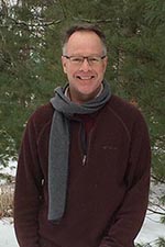
Bradley Doorn (Spring 2)

Dr. Doorn is the Program Manager for Water Resources in the Applied Science Program of the Earth Science Division of NASA. With over 35 years of experience in applying remote sensing data to earth application issues, Dr. Doorn now manages over 20 applied research projects led by investigators across the U.S. He also serves as the Applied Sciences Project Scientist for Agriculture-related initiatives and serves on multiple satellite mission support teams and national committees. Previously, Dr. Doorn was the Division Director of the International Production Assessment Division in the Office of Global Analysis, Foreign Agricultural Service (FAS), USDA.
He also spent nearly 10 years on active duty as a Topographic Engineer for the U.S. Army. Dr. Doorn spent five years in private industry as a manager and specialist in remote sensing, GIS, and mapping for numerous engineering and environmental projects. He is a long time member and officer (including President) of the American Society for Photogrammetry and Remote Sensing (ASPRS). Dr. Doorn received his doctorate and master’s degrees from The Ohio State University in Geodetic Science and Surveying and his bachelor’s degree in Geological Engineering from South Dakota School of Mines and Technology.
Program Scientist/Manager
Water Resources and Agriculture Program
NASA/Earth Science Division
Washington, D.C.
- Email: bxd84@psu.edu
You can learn more about Dr. Doorn by watching the following 1:13 minute video.
BRAD DOORN: Hi. My name is Brad Doorn. I teach remote sensing for the Penn State Geospatial online program. The first thing I'd like you to know about me is that I really, really love what I do in my field of study, and I want to share that with you.
Ironically, I got involved in this by chance. I was in the Army, and they chose to send me to graduate school. My first choice was geochemistry. They picked my second choice, and it was Geodetic Science, that is, mapping the earth. And since then I've been sort of developing in this field, including remote sensing from USDA, where we've monitored the global crops around the world for commodity markets and for food security issues.
My latest stop has been at NASA, where I help run the Water Resources Program and the Agriculture Programs there. I have been blessed my whole career with all these great missions. It all started by sort of a fluke, the Army picking a job for me, and I'd like to share that with you and share it with young professionals. And I hope I can see you in the class soon.