Sulawesi, Indonesia Earthquake and Tsunami
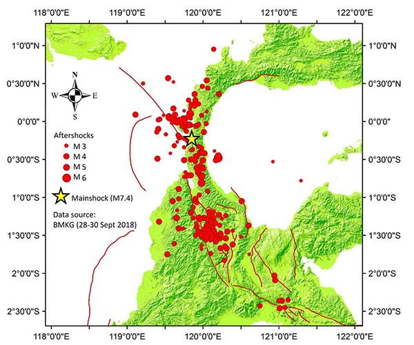
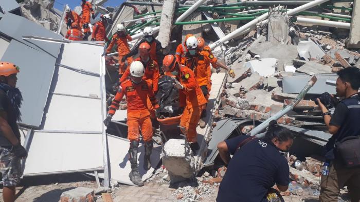
On September 28, 2018, at 6:02 PM local time, a 7.5 magnitude earthquake struck in central Sulawesi, Indonesia. The quake triggered a tsunami with a maximum height of 4-7 meters (13-23 feet) causing massive destruction. There was also widespread destruction due to soil liquefaction, landslides, flooding, and aftershocks (see below). There have been over 2,100 confirmed dead, 10,679 injured, and over 5000 still missing. There was mass disruption to transportation links which delayed response and recovery efforts.
The earthquake occurred in a part of Indonesia that is diverse both in terms of human settlement patterns and environmental factors. It contains relatively large settlements such as Palu (population 335,297 in 2010) as well as small and remote rural settlements. The triple impact of the earthquake, tsunami and land movement made it extremely difficult to locate people in need and deliver food and medical assistance. The recovery effort has also been challenging.
Putting Yourself There
To get a sense for what this all looked like on the ground, please consider the following:
- Review: Catastrophe in Sulawesi – The Straits Times (Oct 2, 2018)
- Visit: BNPB Geospatial (Use Google Translate)
- Listen to the 3:51 minute audio report from NPR or read the transcript