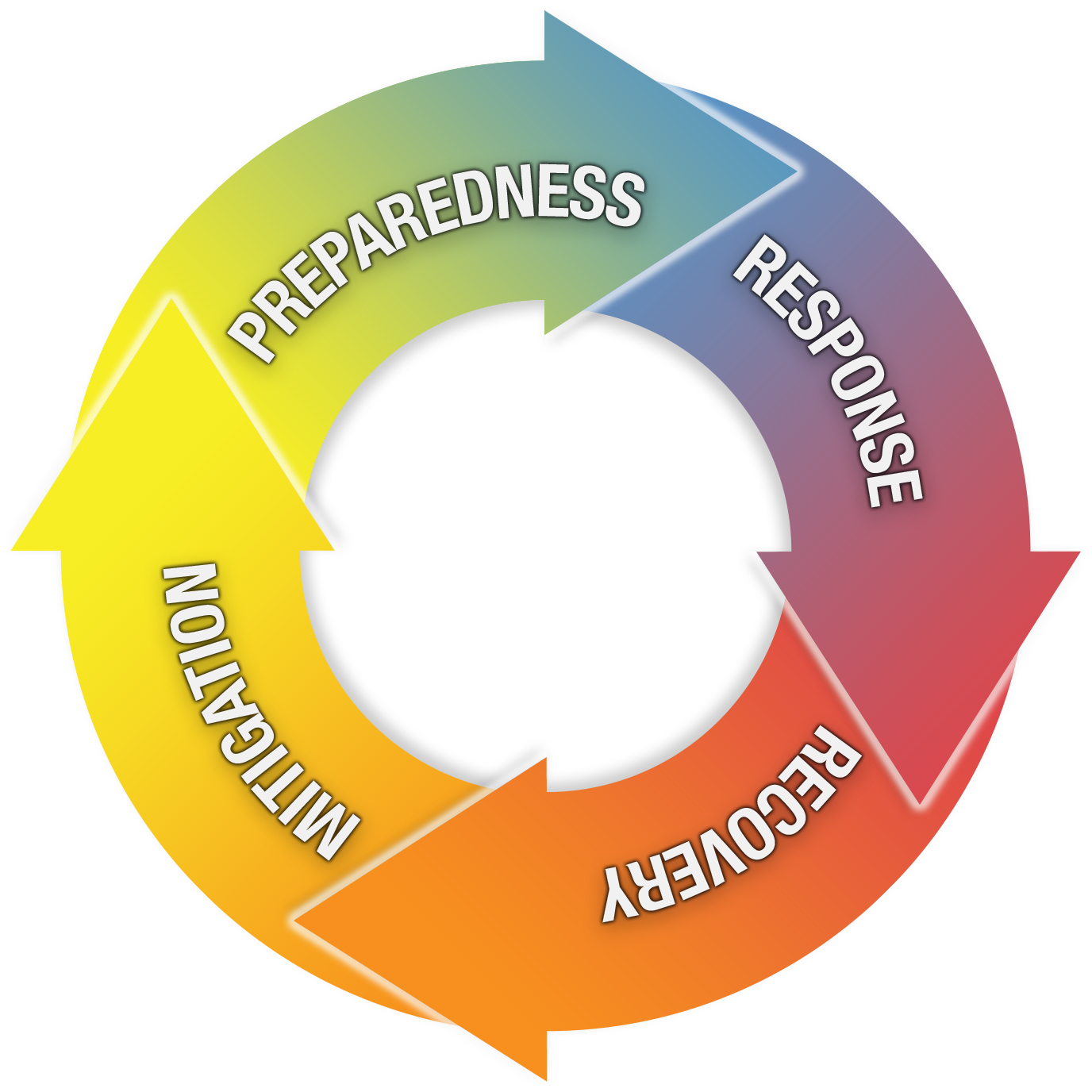
The Four Stages of Emergency Management
The improvement of the built and social environment in order to reduce, withstand or prevent disaster impacts.
- Hazard Analysis
- Vulnerability Assessment
- Scenario Development
- Community Engagement and Education
- Planning and Infrastructure Work
Actions taken prior to a disaster with the intent of ensuring a better event response
- Planning
- Training and Exercises
- Logistics
- Technology infrastructure
- Agency and stakeholder coordination
- Provide information and tools to citizens
Actions taken immediately before, during and after an event to alleviate suffering and prepare for recovery
- Establish Situational Awareness
- Evacuations and Shelters
- Respond to remaining hazard
- Search and Rescue
- Mass Care
- Logistics response
- Initiate Recovery
The rebuilding or improvement of disaster-affected areas
- Debris Management
- Return essential services
- Food and water
- Temporary housing
- Economic assistance
- Insurance claims and rebuilding
- Business aid
Definitions from the Tomaszewski (2014) textbook
It is generally agreed upon that there are four key stages of emergency management problems.
- Planning & Mitigation
- Preparedness
- Response
- Recovery
You can probably imagine a wide array of possible geospatial applications that would make sense for each of these stages of emergency management. Lesson 2 in this class will talk about hazards more generally, and then, in Lessons 3-6, we'll start a deep dive into how geospatial perspectives and technologies can be used in these four stages. In Lessons 7-9, we'll explore scenarios and cover a few case studies to see how geospatial analysis has been used in real-world emergency situations.
Here are brief definitions for each stage of emergency management:
Planning & Mitigation: Evaluation of the potential types of disasters and the development of plans for reducing their probability or their impact on life & resources.
Preparedness: Actions undertaken when mitigation efforts have not prevented or are unable to prevent a disaster from taking place.
Response: Activities that occur in the wake of a disaster that are intended to identify and assist victims and stabilize the overall disaster situation.
Recovery: Actions following a disaster that aim to restore human and environmental systems back to normal.