Overview & Checklist
Overview
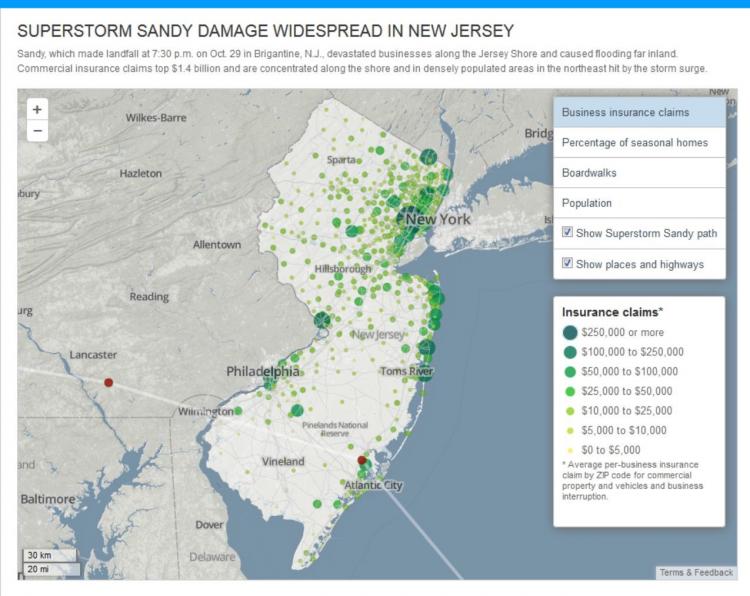
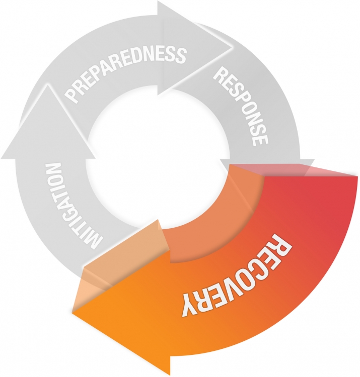
This week, we will focus on how geospatial approaches and technologies can support the final phase of emergency management - recovery. After response efforts have ended, recovery efforts can begin in earnest. GIS and related geospatial tools can be used to plan near-term infrastructure repairs and to identify candidate organizations and communities to receive long-term aid and assistance through grants and infrastructure projects. Recovery projects frequently involve close interaction with disaster victims who want to rebuild and return to 'life as usual." This poses challenges and opportunities for geospatial practitioners and those who consume information from geospatial analyses. We will discuss these topics and others throughout this lesson.
CC BY-NC-SA 4.0 [1]
Recovery
The rebuilding or improvement of disaster-affected areas
- Debris Management
- Return essential services
- Food and water
- Temporary housing
- Economic assistance
- Insurance claims and rebuilding
- Business aid
What You Will Learn
By the successful completion of this lesson, you should be able to:
- explain and compare multiple ways in which geospatial analysis can be applied to disaster recovery efforts;
- identify strengths and weaknesses in current geospatial approaches to disaster recovery;
- evaluate, describe, and discuss trends and advances in cloud and mobile computing and how they are impacting geospatial systems for emergency management;
- develop a solid first draft of your term project.
What You Will Do
Lesson 6 is one week in length. To finish this lesson, you must complete the activities listed below.
| To Read |
|
|---|---|
| To Do |
|
Please refer to the Course Calendar for specific due dates.
Questions?
If you have questions about the content or lesson activities, please post them to the General Questions and Discussion forum in Canvas. While you are there, feel free to post your own responses if you, too, are able to help a classmate. If your question is of a personal nature, please email me directly through Canvas.