LESSONS
Unit 1: Science!
Welcome to Unit 1 - Science!
Welcome to Unit 1 - Science!
Did you complete the Course Orientation?
... when people thought the Earth was flat, they were wrong. When people thought the Earth was spherical they were wrong. But if you think that thinking the Earth is spherical is just as wrong as thinking the Earth is flat, then your view is wronger than both of them put together.
–Isaac Asimov,The Relativity of Wrong, Kensington Books, New York, 1996, p 226. (Note that the Earth bulges a little around the equator in response to the planet’s rotation, but the Earth is still much closer to being spherical than to being flat!)
Before delving too much into the world of geology (broadly, the study of the Earth), this first unit will focus on a larger question that is a more fundamental issue for most people; namely, what is science? Why pay for it? Why do it? Why trust it? Why learn it? Why bother?
Unit 1, SCIENCE!!, will introduce you to this issue, and help you develop the perspectives to answer these questions. This unit will also introduce you, very briefly, to the field of geology, giving you an overview of what it's about, why it's important, and how it benefits people. And finally, Unit 1 is our entry point to the magnificent environmental legacy that is our National Parks—a system of parks and monuments that lets us enjoy today, and preserve for the future, so many of our society's geological, biological, cultural, and historical records and artifacts.
Learning Objectives
- Define science as a valid endeavor that is constantly evolving to change and improve, that relies on continual testing and keeps track of what works and what doesn’t, and identifies ideas that scientists can’t disprove.
- Recognize the origins of the national parks system and its dilemma surrounding enjoyment and conservation.
- Identify geologists as people who practice their science in four key areas.
- Acknowledge the Big Bang Theory, its timing, and the age and formation of the Earth.
- Describe atoms and their essential parts.
- Recognize the validity of information published in refereed scientific literature.
- Recall that the Earth has a crust, outer core, and inner core.
What to do for Unit 1?
You will have one week to complete Unit 1. See the course calendar for specific due dates.
As you work your way through these online materials for Unit 1, you will encounter a video lecture, additional reading assignments, a practice quiz, a "RockOn" quiz, and a "StudentsSpeak" Survey. The chart below provides an overview of the requirements for this unit.
| REQUIREMENTS | SUBMITTED FOR GRADING? |
|---|---|
|
Read/view all of the instructional materials |
No, but you will be tested on all of the materials. |
| Begin Exercise #1: Scientific Literature | Yes, this is the first of 6 Exercises and is worth 5% of your total grade. |
| Take the Unit 1 "RockOn" quiz | Yes, this is the first of 12 end-of-unit RockOn quizzes and is worth 4.5% of your total grade. |
| Complete the "StudentsSpeak #2" survey | Yes, this is the second of 12 weekly surveys and is worth 1% of your total grade. |
So, What is Science?
Science is the most successful way humans have developed to learn how things work, and to use that knowledge to do and predict things.
Science is not a magic bullet to the ultimate truth; science is humans keeping track of what works and what doesn't, and trying not to fool themselves in the process. The "scientific method" is just common sense, dressed up with fancy words and expensive machines. Science doesn't tell us what we should do or why we're here, but it makes us a lot healthier and more comfortable while we try to figure out those really big issues.
Questions?
If you have any questions, please feel free to email "All Teachers" and "All Teaching Assistants" through Canvas conversations.
Keep Reading!
On the following pages, you will find all of the information you need to successfully complete Unit 1 - including the online textbook, a video lecture, a supplemental enrichment article, and two supplemental Virtual Trips (vTrips).
Students who register for this Penn State course gain access to assignments and instructor feedback and earn academic credit. Information about registering for this course is available from the Office of the University Registrar.
Main Topics: Unit 1
Welcome to Unit 1 - Science!
Unit 1: Science!
- is a human activity—it isn’t Truth, but it works;
- is the best way we have to answer many questions (How does something work? How can we use that information to cure disease or find clean water or otherwise help us?);
- cannot answer many questions (What should we do? Why are we here?).
Scientific Method:
- Get a new idea (hypothesis) from somewhere (genius?).
- See if a new idea beats an old idea in predicting what will happen (experiment).
- If yes (after many tests), use the new idea; if no, still use the old one.
- Repeat—there’s always more to learn.
- Ideas that work better may be True, Close, or Lucky, so science is never sure.
- Science can prove ideas wrong, but cannot prove them correct.
- But, if we act as if science finds truth, we succeed in doing many things...
- IF we follow the scientific method.
Why National Parks?
- US idea, Yellowstone first (1870).
- Take a quick visit to Yellowstone, and imagine it as a power plant or cola ad.
- Problem: parks for “conservation unimpaired for future generations” but “enjoyment” for this generation.
- Doing both is not easy.
Why Geology?
- Find valuable things (oil, water, gems).
- Avoid hazards (earthquakes, volcanoes, landslides).
- Learn how Earth works to keep it and us happy and healthy.
- Have fun (Why are the parks so pretty? What were dinosaurs like?).
Some Geological Background
- We WILL cover evidence during the semester, but we have to start somewhere.
- Earth is 4.6 billion years old, and pieces from space fell together under gravity.
- Heated as it formed (natural radioactivity, and the heat from stopping those falling pieces—think of a hot-brake smell after stopping a truck on a steep hill).
- Heating melted Earth and allowed it to separate into layers (think of car-bottom clump on a snowy day—ice and rocks and dead-squirrel parts all lumped together, but separate when they melt in the garage).
- Layers are iron-rich core, iron-silica mantle, and more-silica/less-iron crust (refer to Chemistry Sidebar if this seems unfamiliar).
Textbook: Science, Geology, and National Parks
Your Geosc10 instructional team is made of people who love Science, Geology, and National Parks. We hope you, do, too, and if not, we'll try to show you why we do. These “big-picture” questions are probably more important than anything else covered in this class.
We humans have always had a love-hate relationship with our “tools.” Cars are great, but getting run over by one isn’t. Televisions are great, until you really want to have a heart-to-heart discussion with someone who is deeply engrossed in a playoff game. Science collects the wisdom of the world’s peoples, their experiences and insights, and then tests that wisdom repeatedly, revising and improving, to help us learn to do things we want. This may be humanity's greatest tool... but that also means that occasionally someone may not like it.
Sometimes, a person becomes unhappy when their idea loses to a better one. In the early 1600s, when Galileo advocated the idea that the Earth orbits the sun, Pope Urban VIII saw conflict with certain verses in the Bible (e.g., Psalm 93, “The world will surely stand in place, never to be moved”, or Psalm 104, “You fixed the earth on its foundation, never to be moved”; both quoted here from the New American Bible, although Urban VIII would have read them in Latin.) Some religious authorities of the time did not see any necessary conflict between these verses and Galileo’s ideas, and the Pope initially had been at least somewhat open to Galileo’s ideas. But, the Pope eventually turned Galileo over to the Inquisition over this supposed heresy, and the Inquisition forced Galileo to recant, sentenced him to house arrest, and banned his book and future publications. (It is an interesting question whether the problem was really Galileo’s sun-centered view, or whether the Pope got mad because Galileo's book featured a dialogue with the Pope's favored views spoken by the "loser.")
The papacy subsequently decided that the reality of the Earth orbiting the sun did not undermine scripture, and astronomers could do their job while the religious leaders did theirs. Indeed, rather interesting scientific discussions have been hosted by subsequent popes.
It remains that sometimes conflict arises between some members of some religious or other groups and some aspects of science. In 2005, for example, the state school board in Kansas changed their definition of science, apparently to enable teaching in science classes of ideas that repeatedly have been rejected as being nonscientific by courts and scientific organizations. After another election that changed membership, in 2007, the board restored to their definition that science is a search for natural explanations for what we observe in the world around us. We will have a chance to discuss these ideas later in the course, because Kansas and other states have continued to fight over the issues.
So, let’s look a little more carefully at what science is, and isn’t.
Why Science?
The reason for science is clear—tightly coupled to engineering and technology, science really works. The products of scientists and engineers are tested in the real world every day. Oil companies hire new geologists, geophysicists, and petroleum engineers when the old ones retire because those scientists and engineers really do find oil and make money for the oil companies. Congress funds biomedical research because it keeps lengthening our lives and curing diseases. You read this on a computer, designed using the principles of quantum mechanics, and using the remarkable discoveries of materials scientists and engineers.
High school teachers like to expound on the scientific method. Scientists do have a method of sorts, and it helps them achieve their results. But lots of people—astrologers, palm readers, telephone “psychics”—have methods that don’t get funded by industry and Congress. The typical industrial officer could not possibly care less how a scientist achieves a result, but only that the result is achieved.
Across campus, scientists are sometimes viewed as just another group for the sociologists to study. Scientists have their own tribes, mating rituals (!), and other social interactions. Scientists seek fame and fortune, lie, steal, and violate their mating rituals in much the same way that other humans do. The extremists in sociology have gone so far as to argue that science is only a social construct, one of many possible ones. This, however, is the kind of intellectual exercise that gets academics in trouble with the real world. Anyone with a little common sense knows that it is possible to have a cruise missile deliver a small exploding device to a selected building in another continent using some clever applications of Newtonian physics, and that no other human social construct can make a similar claim. Mere social constructs do not design new antibiotics that save millions of lives, either.
Science differs from other human endeavors in that its disputes are appealed to nature. In art, you cannot judge whether Picasso or Rembrandt was a “better” painter. You can study the brush work, perspective, social context, or whatever, and learn a tremendous amount about art from the discussion, but you cannot reach an objective decision on who is better. But if asked whether Aristotle’s or Newton’s physics work better, we can answer the question.
This is where the scientific method comes in. We study Aristotle’s ideas and Newton’s ideas until we figure out some way that they differ. This allows us to propose an experiment: if we do A, Aristotle expects B to happen, and Newton expects C. Then, we do A, and see what happens. If it comes out C, Aristotle is wrong. In reality, one test is never definitive—the fans of Aristotle might claim that the experiments were rigged, or the experimenters didn't really understand Aristotle's ideas and so did the wrong test. But after many tests, the answer becomes obvious. Science has then progressed—we’ve gotten rid of something that was wrong.
Science remains an exercise in uncertainty. If Newton “beats” Aristotle, that means Aristotle is wrong, but it doesn’t mean that Newton is right—maybe he’s just lucky, or pretty close, but not quite right. As it turns out, Newton’s ideas fail for things that are really small, really large, or moving really fast, and we have to turn to quantum mechanics and relativity. (But all that fancy physics reduces almost exactly to Newton’s description for things of size and speed that we usually deal with—bigger than atoms, smaller than galaxies, and much slower than the speed of light—so, Newton was and is useful.) Science thus cannot give the ultimate answers to anything, because we’re never sure whether we’re right, close, or lucky. We can only say that, if we act as if the scientific results are true, we succeed (in curing diseases, finding oil, etc.).
Science is an expensive way of learning about the world. Suppose you’re a farmer and you’re trying to feed yourself. You try an idea (say, burying fish heads with your corn seeds, or planting during the dark of the moon), and the corn grows well. So you do that every year. If it works, great. If it doesn’t work but doesn’t hurt, no big problem. If it actually makes things worse, well, you might starve, but not many other people are bothered.
Now, suppose you’re a modern farmer trying to feed 100 people. If you try something that actually makes things worse, many people may starve, and some of them may get really mad at you before they do. So, you start asking whether the fish-head works, and whether two fish-heads would work better, or whether other parts of the fish would be better, and so on. One test doesn’t do it—crops grow well most of the time, so most things you test (such as planting in the dark of the moon) will seem to work even if they really don’t help.
The modern solution is to have a scientist helping the farmer, trying things carefully, and trying them many, many times, figuring out which ones really work better, and communicating those results to others who are interested. All that testing takes a lot of effort, but it is cheaper in the long run for important things. Rather than 100 people each trying to feed themselves, and some failing and starving, we have a scientist, a farmer, a tractor manufacturer, a trucker and a grocer feed all hundred, freeing 95 to do something else. (Enjoy! You probably don’t have to spend the summer hoeing corn to keep from starving over the winter.) So, although science is expensive, for important things it is cheaper than ignorance. For unimportant things, living with a little more uncertainty may be easier.
Science has been wildly successful on simple questions: If I drop a rock, how fast will it fall? If I put a lot of a certain isotope of uranium in a small area, what will happen? If I use steel beams this big, in this pattern, how heavy a truck can drive over the bridge without breaking it? Most of physics, much of chemistry, and some of medicine fall in this “simple question” part of the world.
Science is gaining ground on some harder questions. Predicting weather or earthquakes, understanding and curing cancer, understanding and managing ecosystems and biodiversity—these are more complex, involve more interactions, and may have limits on predictability (chaos), but real, useful progress is being made. The research frontiers lie in these complex systems. Much of geology lies in complex systems, and we are in the midst of some great advances in geology.
Science has a ways to go on really hard questions, such as predicting how various actions will impact the working of society and the health and happiness of people. And science cannot address many questions—“How should society work?” is a value judgment, not a question of reality, and is not part of science.
Science is restricted to the search for natural explanations of the world around us. This does not mean that science opposes religion or claims that there is no God. (Some scientists may do such things, but many other scientists don’t.) Quite simply, no experimenter knows how to guarantee the cooperation of an omnipotent deity. A miracle, by definition, cannot be repeated reliably by anyone in any lab anywhere in the world, and so must fall outside of science.
In short, science is a human social activity but differs from other human social activities in that the ideas of science must be tested against reality. Science enjoys a special place in society because science is so successful. Science shows which ideas are wrong, and also identifies ideas that scientists cannot disprove. If we act as if these not-yet-disproven ideas are true, we are successful in doing things. These not-yet-disproven ideas remain conditional because we might find better ideas in the future. Science keeps track of what works and what doesn’t, to save future workers trouble. Science is a meritocracy—good ideas tend to rise to the top, no matter who originated those ideas. (This may take a while because scientists are human with human failings, but the triumph of merit is more likely and faster in science than in most human activities.) Science tests the structure of knowledge continually—a good scientist does not tiptoe around the tower of knowledge put up by earlier scientists, but tries to tear that tower down. Only those ideas sturdy enough to survive such attacks are saved, so the scientific edifice is exceptionally sturdy.
Why National Parks?
Societies have tried many different ways to deal with private versus group ownership. Private ownership often raises ethical questions—did you really come by that piece of land fairly? Can you claim for your king some land that was already occupied by other peoples? Do other species have land rights? Public ownership often raises the “tragedy of the commons”—if I can sneak a few more of my sheep onto the public green, I’ll gain in the short term, even if, in the long term, we all lose because the extra sheep kill the grass.
The US tradition has focused on private ownership, but we’ve also recognized the benefits of public ownership. The idea of a National Park—taking the really choice pieces of the country and placing them under public control—is a US idea, developed by the Washburn expedition to Yellowstone in 1870 and eventually enacted by Congress in 1872.
Since then, the idea of national parks has spread across the nation and worldwide. This is surely one of the great ideas of the modern world, to save key scenic environments in the public domain.
However, the national parks of the United States, and the world, face a grave dilemma. The act establishing Yellowstone and the concept of national parks specified “conservation... unimpaired for...future generations” and “to provide for the enjoyment” of the parks. Saving a wild region for the future while having it enjoyed by millions of visitors each year is perhaps the largest of many difficulties facing the parks today.
Most of the national parks were founded to preserve geologic features—the geysers of Yellowstone, Crater Lake, the Grand Canyon, the Badlands, etc. Many national parks were founded when they were, biologically, small pieces of a vast, unbroken range of similar habitats. Today, the parks are often becoming islands of natural environment in a sea of human-controlled and human-altered land. Thus, much focus on the parks today involves biodiversity. We will revisit the questions of biodiversity and island biogeography later. (Yes, this is a geology course, but some things are too important to pass up just because they belong in a different department.)
What is Geology?
Geology, broadly, is the study of the Earth. Geologists and friends—geophysicists, geochemists, geobiologists—study the rocks that make up the Earth, the history of the Earth as recorded in those rocks, and the processes that change those rocks. This includes oil and ores, landslides and volcanoes, dinosaurs and meteorites, and much more. Most geologists are involved in one of four areas: i) finding valuable things in the Earth (gold and silver, diamonds, oil, building stone, sand, and gravel, clean water, etc.); ii) warning of geological hazards (volcanic explosions, earthquakes, landslides, groundwater pollution, etc.); iii) building an operators' manual for the Earth (Earth System Science); and iv) informing/entertaining (What killed the dinosaurs? How has the Earth changed over time?).
Historically, most geologists have worked at finding valuable things. These geologists have been truly successful, too successful for their own good, in fact. Some of the things we extract from the ground are very cheap today (after you subtract off inflation and taxes), so there have been fewer jobs for geologists with mining companies than in years gone by. Oil prices have gone up recently, and oil companies have started a hiring boom (talk with any of us in case you're interested in a career move). The US used to spend a lot more money on cleaning up groundwater pollution than we have recently, but it turns out that an immense amount of that money was spent on lawyers arguing about paying for cleanup rather than on scientists and engineers cleaning up. A lot of geologists are not happy with this situation and hope that finding and restoring clean water will be more vigorously pursued in the future.
Warning of geological hazards is also a growing field. As more and more humans build houses on floodplains, debris-flow deposits, and other indicators of past disaster, these people become more dependent on someone to tell them if and when the trouble will return. Many geologists favor a different approach—find out where the dangers are, and then don’t build in those places—but real estate developers often don’t listen. (In the spring of 2012, a bill was introduced to the North Carolina legislature—although not passed in its original form—to make it illegal to use the best science to tell coastal people the regions that might be attacked by the sea. This echoed efforts a century before by developers in San Francisco to discredit scientists who correctly argued that the earthquake that had just devastated the city meant that additional earthquakes were possible.)
The disaster of Hurricane Katrina in New Orleans and surroundings in 2005 really showed the dangers of building in harm's way. With over 1800 dead, and over $100 billion in damages (that is $300 for every person in the US!), Hurricane Katrina definitely caught the attention of many people. Interestingly, geologists had known of the impending disaster, and warned of it, for decades, as the city slowly sank beneath river-level and sea-level. Thousands of Geosciences 10 students had studied this issue in the years before the storm struck (and you’ll get to look into the issue soon).
The operators’ manual for Earth is a new idea. It may be the most important thing geologists can do for the future of humans. We humans are everywhere today—living on every continent, tilling more and more of the land, claiming as our own more and more of the productivity of the planet. We have changed the forests, changed the soils, changed the atmosphere, changed the waters—nowhere on Earth remains free of our imprint. Credible estimates indicate that we and our close friends—cows and corn and chickens and house-cats and Chihuahuas—are using roughly half of everything made available by the planet. We are managing to support roughly 5 billion people pretty well (out of the 7-plus billion of us here), with population projected to reach 9 or 10 billion in a few decades, so we are planning on doubling the number of people we support well.
Given that we are doing this, and we will continue to do so, many thinkers believe that it would be wise to have a better idea of how all of this works and what we are doing. You would not try to repair a fine watch without knowing how it works—take a few pieces out and you may never get it running well again. We are doing precisely that to the planet, changing a lot of things we don’t understand. Earth System Science is the attempt to understand the planet, its water, air, ice, rock, and life, well enough to learn the consequences of our actions so that we can make wise decisions. Earth System Science is in its infancy, and we do not even know whether we will ultimately succeed, but many of us believe that it is an incredibly important effort.
And, there is always education and entertainment. Some people really like to know things, and geologists have some of the most interesting stories to tell. Perhaps you will find some of the stories here to be interesting.
A Brief Overview of Geology
This text will try to show you not only what geologists learn, but how we learn it. For the first few chapters, however, we ask you to take our word for some things. You will see statements such as “The Earth is 4.6 billion years old.” Before we’re done, you will also see where that number comes from, how good it is and much more about it. But we can’t do everything at once.
Anyway, we believe that the universe started in a “Big Bang” about 14 billion years ago. The Earth is “only” about 4.6 billion years old. We live in a second-generation solar system because the planets and the sun contain abundant chemicals such as iron that was first formed during the death of older stars. So, there were some stars, and they exploded and generated gases and dust, and something (another nearby star exploding?) caused that gas and dust cloud to be compressed a little. Once the dust and gas started falling together, gravity took over. Eventually, most of the mass went to form the sun, which was squeezed enough under gravity that the sun’s hydrogen began fusing to form helium, in the process releasing energy—sunlight! Some of the gas and dust collected into planets.
Assembly of the Earth involved falling together of lots of big and little chunks. The largest chunk was probably about the size of Mars. It hit the Earth after most of the assembly was finished and blasted enough material off the Earth to make the moon. (Note that there is still a little rumbling in the scientific literature about this Mars-sized moon-forming collision, so stay tuned...)
The falling-together of pieces makes heat. That heat partially or completely melted the planet. The melting allowed the planet to differentiate, or become layered. The denser material sank to make a core, mostly of iron, with some nickel and a few other elements. The lowest-density material rose to the top to form a silicate scum, or crust, floating on a vast mantle of denser silicate (see the sidebar on chemistry). The Earth is hottest in the middle, coldest on the outside. Heat favors melting, but higher pressure tends to make most liquids turn solid. These two effects compete in the Earth, so you find both solid and liquid down there. Going down in the Earth, the crust and the upper part of the mantle are solid (together forming the lithosphere) except in special places where volcanoes occur; the deeper part of the mantle is solid but soft, and has a zone about 100 km (60 miles) down in which a little melting occurs. The soft zone in the mantle is the asthenosphere--we won't learn a huge number of new words in this class, but we do get a few great ones! The core has two layers, a solid inner core and a liquid outer core.
Some of the Earth’s heat is left over from when the planet formed, and a lot comes from the decay of naturally radioactive materials in the Earth. As the early heat has escaped and the radioactive materials have decayed, the Earth has slowly been cooling off, but plenty of heat remains to drive geologic processes. The Earth has developed an atmosphere, oceans, and life, and a rich sedimentary history of how those developed. The atmosphere and oceans spend their time wearing down mountains, but the heat of the Earth keeps driving processes that build mountains up, so there is a near-balance. And all of this should become clear as we tour the national parks.
Sidebar: A Very Brief Chemistry Lesson
Most students reaching the university have taken a chemistry course somewhere along the way, but a few of you haven’t. Here is a BRIEF summary of chemistry, as a refresher for those who have had a chemistry course and as a teaser for those who have not. We do not use a lot of chemistry in this course, but it comes up often enough that you may find a summary to be helpful.
If we pick up anything around us (water, chewing gum, rocks, whatever) and try to divide it into smaller and smaller pieces, we will find that it changes as it is divided. A tree becomes a log as soon as we cut it down. If we dry the log before burning it, we find that it contained lots of water, plus other things that are not water. If we then use fire to break the log into smaller pieces, we find that we can do so, while releasing energy. Using tools and energy levels that are easily available to us, we will find that we can continue dividing something until we get to elements, but that we cannot divide the elements.
The “unit” of an element is called an atom. There are 93 naturally occurring elements, plus others that humans have produced. If we use even higher energies, such as those achieved in nuclear accelerators, we find that we can take atoms apart.
Each atom proves to have a dense nucleus, surrounded by one or more levels where electrons are found. It may prove helpful to think of electrons circling a nucleus the way planets orbit the sun, although this simplified model doesn't capture all the features of an atom.
The nucleus contains smaller particles called protons and neutrons. Protons have a characteristic that we call positive charge, electrons have an equal-but-opposite negative charge, and neutrons are uncharged or neutral. A neutral atom of an element contains some number of protons and the same number of electrons, with their positive and negative charges just balancing each other.
The type of atom, or element, is determined by the number of protons; add one proton to a nitrogen atom, for example, and it becomes an oxygen atom. (Breathing nitrogen without oxygen would cause you to die quickly; they are different!) The positively charged protons packed tightly in a nucleus tend to repel each other, but the neutrons act to stabilize the nucleus.
Some elements come in different “flavors,” called isotopes, which have different numbers of neutrons and so different weights. Slight differences in the behavior of isotopes allow us to use them to learn much about certain processes on Earth, as we’ll see later. All atoms of an isotope are identical, and all atoms of an element are nearly identical.
Chemistry includes all of those processes by which plants grow, we grow, wood burns in a fireplace, etc. Chemistry involves changes in how electrons are associated with atoms. An atom may give one or more electrons to another, and then the two will stick together (be bonded) by static electricity, the attraction of the positive charge of the electron-loser for the negative charge of the electron-gainer. An atom that gains or loses one or more electrons is then called an ion. Atoms may also share electrons, forming even stronger bonds and making larger things called molecules.
Most Earth materials are made of arrays of ions, although some are made of arrays of molecules. The ions or molecules usually form regular, repeating patterns. For example, in table salt, a lot of sodium atoms have given one electron each to a lot of chlorine atoms, making sodium and chloride ions. Then these stick together. One finds a line of sodium, chloride, sodium, chloride, sodium, chloride, and so on, and a line next to it of chloride, sodium, chloride, sodium, ..., and above each sodium there is a chloride, and above each chloride a sodium, in a cubic array. A grain of salt from your salt shaker will be a few million sodiums and chlorides long, and a few million high, and a few million deep.
The properties of the grain of salt—how it tastes, and dissolves, and breaks, and looks, etc.—are determined by the chemicals in it and how they are arranged. We call such an ordered, repeating, “erector-set” construction a mineral. Almost all of the materials in the Earth are minerals. Liquid water is not a mineral because the water molecules are free to move relative to each other, but liquid water becomes a mineral when freezing makes ice.
When the Earth formed, we received a few elements in abundance and only traces of the other naturally occurring elements. More than half of the crust and mantle is composed of two elements–oxygen and silicon. Most minerals and rocks thus are based on oxygen and silicon, and we call these rocks silicates. In silicates, the silicon and oxygen stick together electrically, with each little silicon surrounded by four oxygens. Silicon, oxygen, and six others–aluminum, iron, calcium, sodium, potassium, and magnesium–total more than 98% of the crust and mantle. Geology students used to be required to memorize the common elements, and their abundance, in order; for our purposes here, know that only a few are common, and we’ll come back to them later.
The silicon-oxygen groups form minerals either by sticking to each other by sharing oxygens, or by sticking to iron, magnesium, or other ions. Minerals that contain a lot of iron and magnesium are said to be low in silica, even though they may still contain more silicon and oxygen than iron or magnesium. In general, minerals high in silica are light-colored, low-density, have a low melting point, often contain a little water, and occur mostly in continents; minerals that are lower in silica usually are dark-colored, high-density, melt at high temperature, and occur on the sea floor or in the mantle more often than in continents. You may hear “basaltic” used for low-silica, because basalt is the commonest low-silica rock at the Earth's surface; similarly, “granitic” means high-silica because granite is a common high-silica rock.
This Course
It would be fun to take a tour of all the national parks, learning a little about each. But Penn State would not award you General Education credit for such a course—you are supposed to be taking a tour of a field of knowledge, in this case, geology.
So, we will take a tour of geologic ideas. But, some of the best geological features of the world are enshrined in the US (and other!) national parks. We will use national parks as illustrations, delving into park history and culture when we can, but concentrating on those things that illustrate how the Earth works.
Scientific Literature—An Intro to Exercise 1
Scientists communicate in a lot of ways, but the most important is through the refereed scientific literature. Any scientific paper is first submitted to a learned journal, and the editor sends the paper out for peer review. In this, several recognized world experts read the paper and make sure it is “good.” Are the methods described well? Are uncertainties given? Is proper credit assigned to other sources? Do the equations make sense? Are substantive conclusions reached? If there are obvious errors, then the paper is sent back to the author or authors for revision. If the paper is unclear, or can’t be read well, or information is omitted, or if unsubstantiated claims are made, or anything else is wrong, the paper is sent back for revision. Only when the paper clearly and logically presents new results will it be published.
Peer review takes a lot of time and effort. Peer review also slows down publication of important results. (The papers authored by Drs. Alley and Anandakrishnan that have been of greatest use to other people were also the ones that had the hardest time gaining approval from reviewers, who check especially carefully on the big stuff.) And, there is no guarantee that the reviewers will get everything right; errors do sneak by. But peer review really raises the quality of the scientific literature above the quality of other sources that are available to you.
You can find information in many places—books, magazines, newspapers, the Web, speeches by public officials, graffiti in restrooms, etc. Some of this information is more reliable than others. In general, the more permanent a publication is, and the more expensive it is to get you the information, the better the information. (So the Web, which is cheap and has a huge turnover in websites, includes an immense amount of nonsense as well as some good stuff.) But, there are surely exceptions to this “rule.”
If something really matters, the refereed scientific literature, with its long traditions, its focus on accuracy, and its appeal to nature to test ideas, is the most reliable source available. Textbooks, lectures by professors, and other ways we give you information aren’t bad, but the refereed scientific literature is still better. You’ll have the opportunity to explore this in Exercise 1.
Virtual Field Trips
Join Dr. Alley and the Geosc10 team for "virtual tours" of National Parks and other locations that illustrate some of the key ideas and concepts being covered. For the rest of the course, the VTrips will present important material that may show up on the quizzes. In general, the slide shows start with pretty pictures to introduce you to a park, and end with pictures focused on scientific ideas. The more scientific, the more likely to be on a quiz! Here, mostly for your enjoyment, are pictures of two gloriously beautiful places, the world's oldest national park (Yellowstone) and the world's largest national park (Northeast Greenland). Have fun!
Virtual Field Trip #1: Yellowstone, the Premiere Park
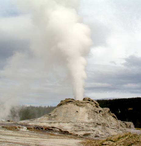

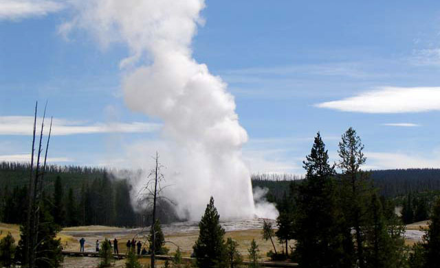
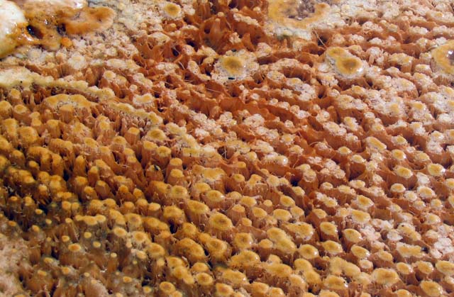
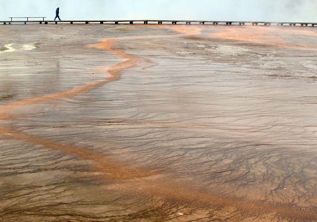
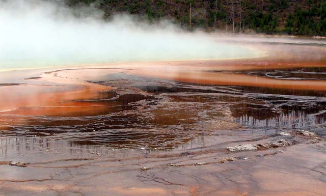
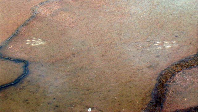
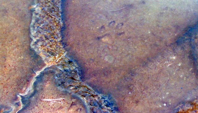
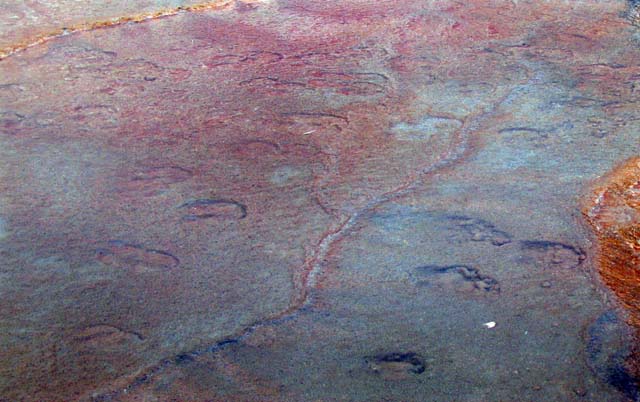
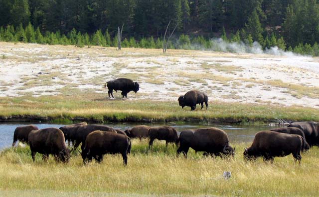
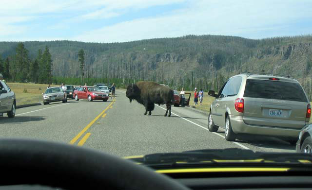
Image 1: Photo of Monument Geyser. Yellowstone: the Premier Park. Yellowstone, the world’s first national park, may be the most famous and the best--it is an incredible wonderland of geology and biology. The pictures in this show are all by R. Alley. This one shows Monument Geyser, in the Upper Geyser Basin, not far from Old Faithful.
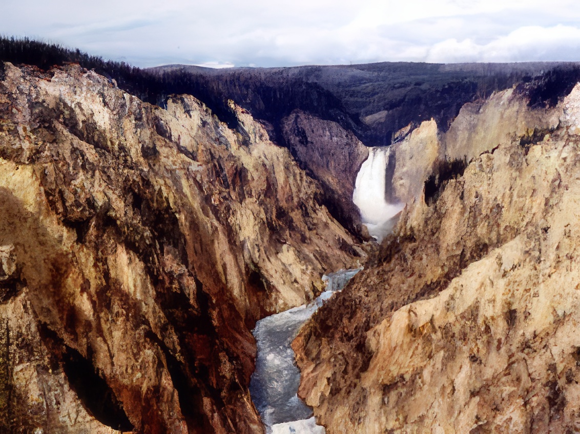
Image 2: Photo of Lower Falls of the Yellowstone River. Yellowstone was the world’s first national park. The Washburn Expedition of 1870, which included government officials and important citizens of the Montana Territory, envisioned holding land for the common good. The 1871 Hayden Expedition, led by the director of the United States Geological Survey and including the incomparable artist Thomas Moran and the great photographer W.H. Jackson, provided information that convinced Congress to establish the park in 1872. The Lower Falls of the Yellowstone River, shown here, is one of the icons of the national parks.
Image 3: Photo of Old Faithful. Yellowstone has more than half of the world’s geysers, including Old Faithful, shown above. In proper rocks, with volcanic heat and lots of water, deep water is heated but held down by the cold water above. Finally, a little deep boiling pushes the cold water aside, the pressure on the deep water is reduced, and it flashes to steam, causing an eruption.
Image 4: Photo of Mats of Microbes in the hot runoff from a spring near Old Faithful. Many interesting and important things can be found in Yellowstone. These are mats of microbes living in the hot runoff from a spring near Old Faithful. Hot-water creatures have special enzymes, cell-wall chemicals, etc. to allow life in water that would burn you, and humans are learning how the bugs do it so we can copy them. Biological industries worth billions of dollars per year are based on the polymerase chain reaction (PCR), which is based on a Yellowstone microbe.
Image 5: Photo of Terraces in Midway Geyser Basin. Runoff from hot springs often forms terraces. Where water flows a little faster over a steeper spot, cooling and loss of dissolved gases cause precipitation of minerals dissolved in the hot, sulfurous (stinky) water, making a little ledge. Hot-water-loving microbes colonize the surfaces, with bugs of different colors preferring water of different temperatures. These terraces in Midway Geyser Basin, below the Grand Prismatic Spring, are classic.
Image 6: Photo of Grand Prismatic Spring. Here is the Grand Prismatic Spring. Rainwater and snowmelt moving down through cracks in the rocks are warmed by the volcanic heat of the Yellowstone Hot Spot, and then rise to the surface in springs as well as geysers. The next three pictures show animal tracks in the microbial mats on the terraces in the lower part of this picture.
Image 7: Photo of mountain lion tracks. Yellowstone is known for its wildlife. Animals have died when they broke through thin crusts over hot pools, but such events are rare. Elk often use the vegetation-free upper surface of Mammoth Hot Springs as a retreat from mosquitoes and other bugs, and many creatures enjoy the warm waters of the park during the winter. Here, the tracks of a mountain lion show white where the animal broke the bacterial mat. Lions are four-toed, but often put their hind feet where their front feet were, complicating the appearance of the tracks, as seen here.
Image 8: Photo of Coyote Tracks in spring deposit. Yellowstone now has a healthy population of wolves, and many coyotes, including the one that made the track shown here. The national parks were usually established for geological reasons, when the park boundaries separated wilderness containing amazing geological features from wilderness containing slightly-less-amazing geological features. Now that humans are using so much of the country and the world, the parks are becoming islands of nature in a human-dominated world, and so the parks are critical for maintaining biodiversity.
Image 9: Photo of Bison tracks in spring deposit. Bison (or, informally, buffalo) once thundered across the Great Plains of the U.S. in uncounted numbers. Uncontrolled shooting nearly exterminated the bison, but those protected in Yellowstone persisted and helped preserve the species. Here are bison tracks, in the same spring deposit.
Image 10: Photo of grazing bison. And, here are the bison, just down the road along the Firehole River. Hot springs in the river bed may have been behind the tall tale attributed to Jim Bridger, that the Firehole River ran so fast that friction made it hot on the bottom.
Image 11: Photo of Bison on the road creating a traffic jam. And here is a bison jam. The national parks must conserve for future generations, but also provide enjoyment for the current generation of people. Sometimes, doing both isn’t easy. This picture was taken in September, after the crowds had returned home; in midsummer, this really would have been a traffic jam.
Virtual Field Trip #2: Northeast Greenland National Park
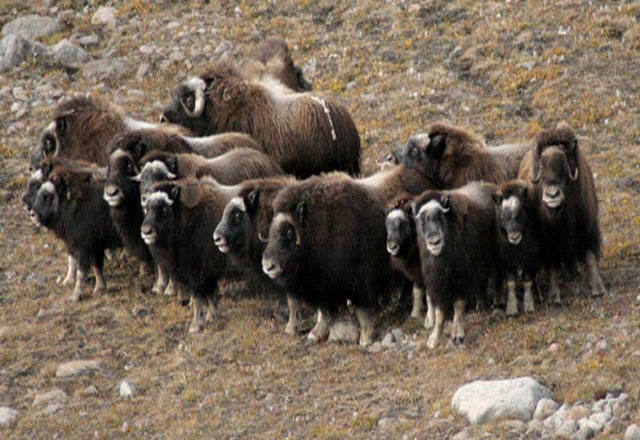
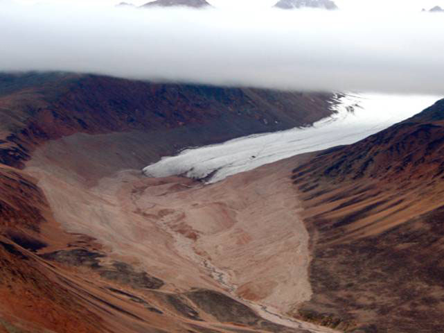
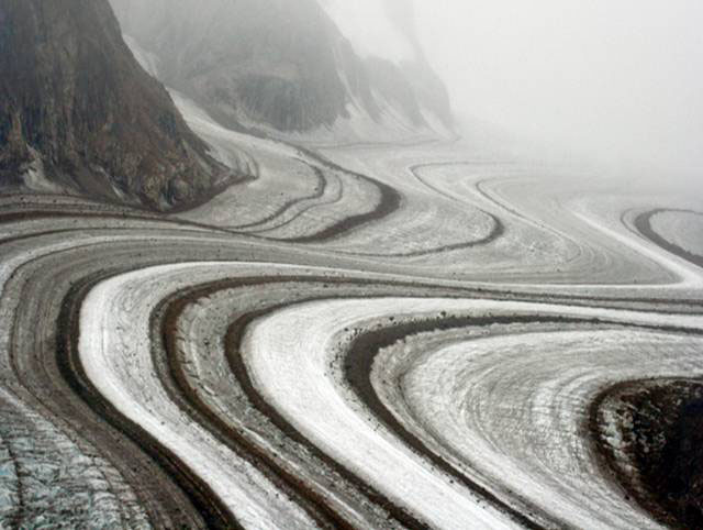
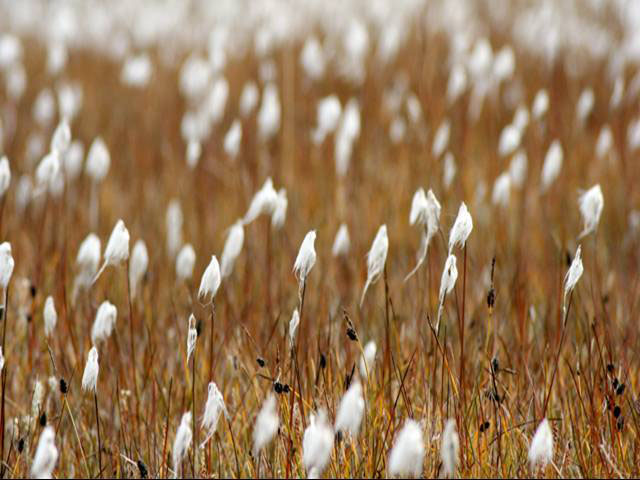
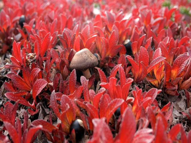
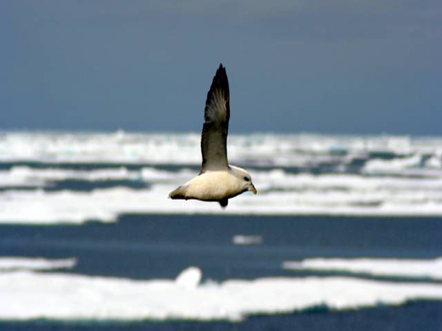
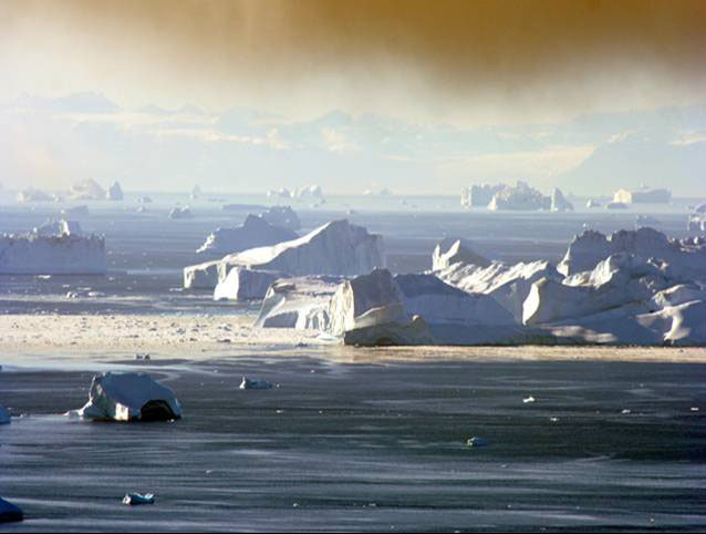
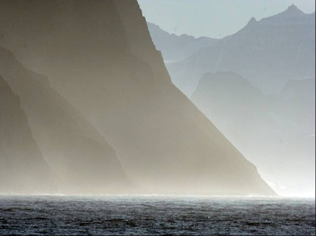
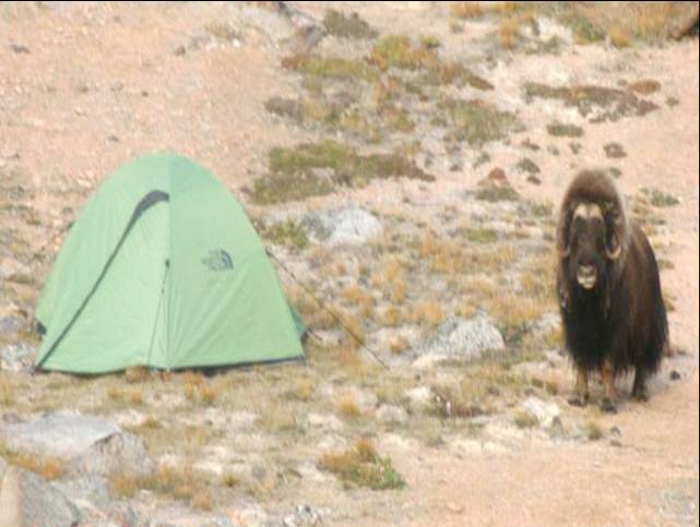
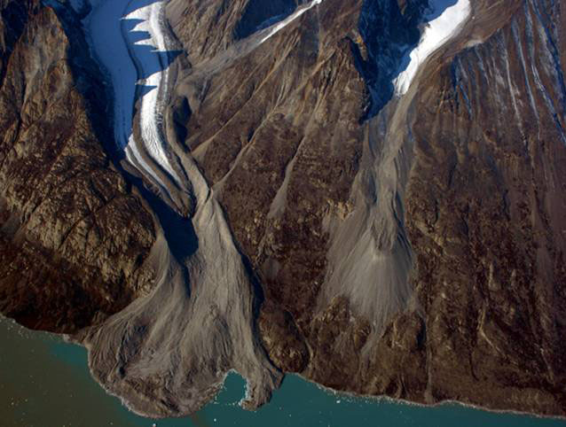
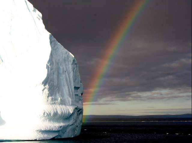
Image 1, Picture of musk ox on the tundra in North East Greenland National Park. Preserving the best of the landscape in national parks is a U.S. invention that much of the world has adopted. The largest national park, Northeast Greenland National Park, is in NE Greenland and was founded in 1974. Both Dr. Anandakrishnan and Dr. Alley have conducted research in it. The pictures here were taken by Richard Alley in or just outside of the national park, during a research expedition to Scoresby Sund in the autumn of 2005. Enjoy!
Image 2, Picture of a glacier. Most of the park is on the Inland Ice, the great, two-mile-thick ice sheet that covers most of the island of Greenland, and one that could raise global sea levels about 23 feet (7 m) if melted. However, some of the park includes spectacular coastal mountains and the rich adjacent seas. This glacier has melted back over the last century from the light-colored regions around it. The mountain peaks from which the glacier flows are barely visible above the clouds.
Image 3, Picture of Corridoren Glacier. Corridoren Glacier. The great Inland Ice of Greenland is thick and extensive, but many smaller glaciers exist in the coastal mountains. The black stripes on Corridoren are medial moraines—each is a band of rocks that were picked up by the ice, or that fell on the ice, from a ridge that separated two tributary glaciers. The picture was taken from a helicopter flying just below a low cloud deck, looking west into the interior of Milne Land.
Image 4, Picture of cotton grass on the tundra. Cotton Grass. The tundra is one of the most beautiful, and least appreciated, landscapes on earth. Cotton grass, shown here, grows in wet places, and produces seeds that are carried on the wind. The picture was taken in Kjove Land, just north of Scoresby Sund.
Image 5, Picture of a mushroom nestled in bearberry. Bearberry provides the most spectacular fall colors on the tundra. Here, a mushroom nestles amid the fruit and leaves of the tundra plant. The fruit is edible, but not especially tasty.
Image 6, Picture of a Fulmar (a bird similar to the albatross) flying over the sea ice. Fulmar and Sea Ice. Fulmars are akin to small albatross, true sea birds with the special glands along their noses that allow them to excrete the salt from salt water, so that there is no need for the birds to go find fresh water. Fulmars often “surf” the wind around boats, or skim low over the water. Behind this fulmar is sea ice, frozen ocean water. Freezing the ocean is not as easy as freezing freshwater, both because salty water freezes at a lower temperature, and because seawater becomes denser as it cools all the way to the freezing point, and may sink to great depths in the ocean, allowing warmer water to flow in and replace it.
Image 7, Picture of icebergs in Scoresby Sund. Icebergs, Scoresby Sund. A lot of snow falls on Greenland—enough each year to make a layer about 1/25 inch (1 mm) over the whole ocean. About half of Greenland’s snow melts and runs into the ocean. The other half flows to the coast and breaks off as icebergs, as seen here. Recent warming has increased Greenland’s loss of meltwater and icebergs; the ice sheet and surrounding mountain glaciers are shrinking and helping raise sea level. This is freshening the North Atlantic, favoring winter freezing; the future may see warmer summers but colder winters from this strange situation.
Image 8, Picture of Scoresby Sund. Kap Brewster. The south side of the great fjord of Scoresby Sund is guarded by the bird cliffs of Kap Brewster. Huge flocks of sea birds nest high on the rocks and feed in the rich ocean nearby. The steep slopes were carved by the glaciers that once filled Scoresby Sund.
Image 9, Picture of a musk ox next to a tent. Musk Ox, Schuchert Dal (Valley). The dramatic Schuchert Valley spreads north from Scoresby Sund, and is well-populated by musk oxen. With about the same size, shape and speed as minivans (not really, but not that far off!), musk oxen are beautiful denizens of the tundra. More closely related to mountain goats than to bison, the musk oxen form defensive circles around their young if threatened, as shown in the first slide of this show. Here, a bull has wandered into our research camp. The best way to handle musk oxen is to leave them alone; although typically peaceful, they have sharp and potentially lethal horns, and they are a lot faster and bigger than you are.
Image 10, Picture of Alpefjord. Alpefjord, a major tributary to Kong Oscar Fjord, north of Scoresby Sund. The glaciers flow from the high ground at the top of the picture toward the sea at the bottom. The glaciers now end about where the white ends, but extended much farther in the recent past, as shown by the piles of rock and rubble, called moraines, that surround the ice. Almost every mountain glacier on Earth for which we have data has shrunk over the last century or so. Mountain glaciers have enough frozen water to raise sea level globally by about 1 foot (just under 1/3 m) if all melted.
Image 11, Picture of an arete. An arete (a knife-edge ridge left when two glaciers erode into a highland, one from each side) sits above glaciers in the Stauning Alps of the Northeast Greenland National Park. Many knowledgeable people consider the Stauning Alps to be the most spectacular alpine scenery on the planet. There is no objective way to pick a “winner”, but the Stauning Alps are truly stunning.
Image 12, Picture of an Rainbow and an icerberg. Rainbow and iceberg, Scoresby Sund. The warmest summertime weather is well below freezing at the top of the ice cap, but temperatures in the 50s Fahrenheit are common along the coast, where the limited summertime precipitation often comes as rain.
Word Document of Unit 1 V-trips
Video Lecture
Please watch the 34-minute Unit 1 lecture featuring Dr. Richard Alley.
Hello, and welcome to Geosciences 10, the Geology of the National Parks. I'm Richard Alley, and with Sridhar Anandakrishnan, my very good colleague, we will be taking you on a tour of some of the most interesting ideas about how the world works and how it affects you, and some of the most interesting and beautiful places on the planet. I think we'll have a lot of fun. I think we'll learn some very interesting things before we get done. And I am looking forward to the tour.
I'd like to start with a little bit of look at our national parks. Just so you know, national parks are an invention of the United States. The first national park was Yellowstone. You see the glorious lower falls of the Yellowstone River here, the coloration of the rocks giving rise to the name of the place.
Of course, Yellowstone is famous for the geysers. There's a giant pot of hot rock down underneath there of melted rock that erupts occasionally and causes big trouble. And between, it heats things and makes it wonderfully beautiful.
This is a geology class, but don't worry too much. We take a fairly broad view of what constitutes geology. We will look at biodiversity. We will look at climate, at living on the planet.
Here you actually see the tracks of a mountain lion walking across the deposits of a hot spring in Yellowstone. Mountain lions often put one foot on top of the other and give interesting looking tracks, and so you can see them there. And here you see the tracks of the bison that are famous in Yellowstone and other places.
Bison came very close to not making it. Yellowstone was important in their survival. Yellowstone was a little island in which no one could shoot them. No one could disrupt their habitat. And so, the existence of these owe something to the foresight of the people who said, let us save this piece of the world for the public.
These things are valuable. This is a picture of a hot spring mat that is sitting right below Old Faithful Geyser.
People are prospecting in these, looking for interesting chemicals that will help us. There are biotechnology industries that are founded on things that were discovered in Yellowstone. A bug that has learned to live and do things in really, really hot water has ways of doing things that are useful to us. And so, we save this as a beautiful place to go see canyons and geysers, but it's turning out to be a place to save lives and make money as well.
The Park Service has a very interesting difficulty. They have to preserve and protect, they also have to allow us to enjoy things. And sometimes these meet in interesting ways. And so, here you see a bison jam. If you go to Yellowstone, you will also see bear jams, and elk jams, and moose jams, and coyote jams. It's the way the world works.
But the bison are beautiful. The Fire Hole River here, behind the bison, was described by the mountain men as flowing so fast it gets hot on the bottom. Well, no, there's hot springs under there. But it's a beautiful place.
Now, I am a geoscientist, a geologist, a glaciologist. I'm one of the luckier people in the world. I get to go to incredibly beautiful places, and people pay me to do things that matter.
I'm a happily married person. I have two wonderful daughters. And you see us here in front of a glacier in Alaska on a trip we took with Penn State at one point.
And I am trained in rocks first, and then in climate and ice and other sorts of things. I studied at Ohio State, and then I finished my studies at Wisconsin, and then I moved to Penn Stat, and been at Penn State since 1988. So, I've been around a little bit now at this point.
I have the usual sort of accoutrements of someone who hangs around a place like Penn State for a while. I've got a good bicycle. I play a little soccer reasonably badly. I have, as I said, a wonderful family, a nice gardens, an interesting collection of critters. Prancer there is about 22 pounds. He's quite a beast.
But I do. I get to go to great places. These next few pictures are going to be from the world's largest national park. This is Northeastern Greenland.
I study ice sheets, the history of climate that's contained in ice sheets, and whether the ice sheets will fall in the ocean and flood the coasts. And so we get to go to neat places to do this. And so, here you can see Korridoren Glacier in East Greenland flowing out from Milne Land towards you, the stripes or rocks that it carries along and dumps into the ocean. And I hope you get the vague idea that this thing might actually be moving.
If you were to go out on that glacier and put markers out, you'd fall in a crevasse, so don't do that. But if you did and came back and surveyed them later, you actually would see that they are moving. If you do you ever get to go to the world's largest national park, the tundra is beautiful in the fall. It's an amazing place to go to.
There are glaciers. There's a huge ice sheet in the middle of Greenland and then little glaciers on the side. Those glaciers are actually shrinking now, as is the big ice sheet.
And if you see these little red lines, the big outer loop there is where the glacier was 100 years ago, and now you can see the glacier has backed up. It is slowly melting away. Why? We'll get there before we're done.
OK, this is the tundra in the fall, a little mushroom and some bearberries there looking at you. The colors do turn. They're very pretty.
This is a fulmar. It's sort of a little albatross. It can stay at sea. It doesn't need to come in for fresh water because it can drink seawater because it has a fancy gland in its nose to exclude the salt. And its flying over the ocean, and the ocean in cold places gets interesting.
The marker there on the white, that's frozen ocean water. That's sea ice, and the ocean really can freeze. And between that and the open water, where that circle is, you can see into the ocean through the sea ice.
It gets warmer. The sea ice tends to melt. The ocean soaks up more heat, and that makes it warmer still. So, there's some interesting things we will get to chat about in a little bit.
These are icebergs coming off of Greenland. A glorious fall day, a little fog hanging around up above there, and the sun breaking through. It's just such a great place. It's such a great— and this is a musk ox.
Musk ox is the same size and shape as a bison, or a minivan. Either is fairly similar. It probably has a better acceleration and cornering than a minivan does. They're actually more related to mountain goats than they are to bison. But this is the Northeast Greenland National Park equivalent of our buffalo or bison here.
OK, in a marker of goodwill, we will see some beautiful things. We will have some fun before we get out of here. My colleague Sridhar and I have had some wonderful opportunities in the way of putting together this course, and you will see some very interesting things that we did, along with Eric Spielvogel from Penn State's e-Education Institute and others.
We had the opportunity to get a really wonderful group of advanced students and then go out and tour some of the national parks with the students carrying cameras. And so, you will get to see pictures they took. You will get to see experiences they had as part of our cause, adventure in the great west.
Here's Sridhar in Arches National Park, and these are some of the things that we got to do with the Arches people. We did, indeed, walk through arches. Why are there arches? It will come.
We went to Canyon de Chelly. What happened to the ancestral Puebloans who lived there? We will get to see that before we're done. This is Eric Spielvogel, who put a lot of this together, getting a really good picture for you. And so, we got a lot of nice things that came out of this.
We took our crew to the bottom of the Grand Canyon. We hiked down. We had this glorious moonlit night. If you ever get the chance, you got your headlights, so you're not going to fall over the cliff and the fall into the river. And the moon is out. And oh, what an opportunity to go with Stephanie, and Dave, and the rest of the crew, and wander through the depths of the canyon and the glorious moonlight that we saw there.
When you get up in the morning and you're at the bottom of this mile deep hole, and the flowers are blooming, and the hummingbirds are humming by, and it's-- and there's a lot of geology. If you look into this picture, you'll see flat layers, and then you'll see them bend. Why do they bend? This will come. We'll get to that.
Again, we do sneak up on biodiversity whenever we get the chance. And so, it's not just the— most parks were built for geology, but they're increasingly islands of biodiversity in a human- controlled world. And we really do rely on the parks to keep things alive for us.
So, more of our happy campers on the way up out of the canyon. It is, indeed, somewhat slower coming out of the canyon than it is going in, a little hotter. We zipped by Glen Canyon. We looked at the lake.
Behind Samir, here, you can see this huge white wall, and then it turns orange at the top. That white was fairly recently flooded. The lake is really low. Why is the lake low? The climate has changed a little bit, and humans are using more of the water.
What does this mean for downstream? What does this mean for the things in the canyon? What does it mean for the Colorado? We will get there before we're finished.
OK, and here's our crew. We're rafting the Colorado below the dam. That dam changed everything on the river. What did it change? We will get to wander through that a little bit and see what it means.
Again, you will see film clips, items, pictures, excitement that our crew generated for you. You'll get to meet them. You'll get to learn from them from Amish and others, here, as we wander through. Here Amish is at Canyonlands, filming something about the river before it gets to the dam.
Here's a crew, really excited. We were down on the slick rock in Canyonlands in the early morning here, waiting for the sunrise to get off and see pretty things. And here's our crew up in Hidden Canyon in Zion. You walk up this cliff, and you hang on to the chain to get around the corners. And that chain is wearing grooves in the rock, and so you will see a little film clip that they made for you when we get that far, and some fun things coming there.
Here are ancestral Puebloan sites, Wupatki, up there with Dave Witmer and Laney and Irene down in Mesa Verde, and then Kim over there filming just outside of Bryce, actually. Stephanie has gone off to work in parks doing some very interesting things now, here with Ranger Jan Stock at Bryce. Here we are looking at a geologic feature. And fairly soon we will get to these.
You look at the picture there above Dave Janesco, and you see that one side is orange, and the other side is black. The orange are rocks from a lake. The black is rocks from a volcano. And that line where they meet is a giant earthquake fault.
What's a giant earthquake fault doing there? Well, Dave is explaining it to you. And you will get to see this before we get finished.
A couple more interesting people in glorious places, very, very glorious places. These are the wild flowers outside of Canyonlands on the drive in. We can show pictures for the whole semester because it's cool. And it's so fun. But we're not allowed to do that.
The university actually believes that you're taking a science course, and the university is typically much more interested that you know something about science than that you focus on a particular science, such as my science, 'cause this is stuff that I really care about. And so, we do have to chat a little bit about science. We will actually throw up some facts before we get done. And we will do so.
So, I want you to hark back in your memory for a moment to, say, taking the SAT, or the ACT, or the PSATNMSQT, or the CAT, or the— what, ETC, or whatever you took. OK, hearken back. When I was a student, lo these many years ago, they used to give us questions that involved lists. And they'd— so you'd be down to about question 243, and they'd say, OK, I'm going to give you a list of things. What would come next in the list?
I think they have gotten rid of these questions, but you may have run into one that's something like this. Here's question 243. What would come next in this list? You got two. You got four.
well, what could come next there? You add 2 to get to 4, maybe you had 2 and you get to 6. That would be a perfectly possible answer.
But no, no, wait a minute. You multiply by 2 to go from 2 to 4, and if you multiply by 2, well, you'd get 8. That would be a perfectly fine answer.
But maybe you multiply 2 by itself to get to 4, and you'd multiply 4 by itself. And that would give you 16. And so you'd sit here and go, hey, this was a lousy question. This is a piece of dookey. OK, get rid of that one.
OK, now suppose that they gave you something that was actually a somewhat better question. So, you give you 2, 4, 6, 8. What comes next? Now, that one looks very easy. You say, oh, yes, you're gonna add 2 and you're gonna get 10.
When I was much younger, I played Little League. We were really serious about Little League. And you can't believe it. We'd have lawsuits over Little League. We had coaches yelling at each other. At any rate, I played Little League. It was very interesting undertaking.
And the coaches used to be really big on having us out there doing infield chatter. Now, we were not out there chattering uplifting and morally relevant statements. We weren't saying, batter, do your best for your team and country.
We were out there saying, hey, batter, your shoes untied. Hey, batter, you're ugly. Hey batter, hey batter, hey batter, swing! Two, four, six, eight, the batter's got a bellyache.
OK, so, it could have been 10. We would never out there go 2, 4, 6, 8, 10, 12 in the Little League. We were out there saying, 2, 4, 6, 8, the batter's got a bellyache.
Now, this actually might be relevant to something. If you were sitting there saying, two, four, six, what comes next— eight— you get it right. And you sit there and two, four, six, eight, what comes next? And you say 10, you get it right. You say, I know what's going on.
But if you're out there playing Little League and you're saying 2, 4, 6, 8, 10, you got it wrong. Your ability to see two, four, six and fill in eight doesn't prove that you know what's going on, because if you thought you were taking the SAT and you're really playing Little League, you got eight right, but you got the next one wrong. You're sitting there, 2, 4, 6, 8, 10, 12.
And the batter— that might have worked, actually. The batter looks at you, says what's wrong with you? And the pitch goes right by. But that is not the way one does it.
OK, this does feed back into science. This is relevant to science. And let's look at how this works. What is science?
It's humans. It's humans doing human activity. There is no crank that you turn that spits out knowledge.
Science is done by humans. They are humans who have foibles and failings. They are humans who have mistakes. They cheat, and lie, and steal. They have mating rituals. They're just like everybody else.
But science has a very loose set of rules that allows it to do better at some things than other human activities. It's very limited. It does certain things well, and it doesn't do other things at all. But the things that it does, it actually works on.
So, what is science? The first thing in science that you do is you find something interesting. You gotta care about it. It has to matter, people. You go out and look at things and you find something interesting. OK, this is cool. I could learn about this.
What you then do is ask, what do we know about this something? There are many people in the world. There have been many people in the world. Your ancestors were smart. Lots of people around the world in lots of places were smart. You will never in your life reinvent everything they did.
So, first of all, you go and find out what they did. You could call this research. You could call this going to library. You can go and talk to people. There's other ways to do it. But if you're interested in something, you're really stupid if you don't find out what other people knew. They may have your answer for you already.
OK, so you find out what's known. Then you say, OK, they were really bright people. They did really good things. But they were human.
They might not have put together everything. They might not have had the ideas that I have. I, as a new human standing on their shoulders looking out, may be able to improve things.
So you take what you know and you say, how can I move forward? How can I go beyond them? Where can I get a new idea?
This is the fun stuff. No one has any idea where new ideas come from. It may come from dreams. It may come from traditional knowledge. It may come from brainstorming.
I take hot baths. I get really good ideas while taking hot baths. I don't know why, but it works.
OK, so you look for a new idea. You get a new idea. And then, you can't stop. If you just stop, there's some other human activities. You got new idea. You write your novel and you're there.
But in science, you actually have to ask, is my new idea really a step forward? Have I gotten somewhere that those people before me did not get? And so you actually have to go test your new idea, and you have to test your new idea against nature, against the real world. You have to see if your new idea is better than what other people had done.
And the way this is done— and this is a very, very strict rule in science, and this is what sets science apart from other human activities— you have to find a situation in which you predict something, and the old ideas predict something else. If you always agree, then you have just found a new way to restate the old idea. You actually have to find a place where you say, tomorrow, the sky will be purple, and the other one says no, it will be blue, where you say, if I do this, that will happen, and the other idea says no, if you do this, the other thing will happen.
You find a way that they differ, that you make different predictions. And you have to predict it. You're not allowed to just explain it. You have to predict what's going to happen. Then you set up the situation. You see what happens.
you can call this making hypotheses and doing experiments. There's lots of terms that you probably learned in fifth grade. This is a list of terms of the scientific method. But this is really the scientific method.
Get interested. Learn. Get a new idea. Test it. But you have to test it by making predictions, and then you have to say see what happens.
If your idea repeatedly fails— one time, yeah, nature might be fooling you, there's lots of things can go wrong in an experiment— your new idea just keeps— pff, it fails. Pff. It fails. Pff. It fails. OK, throw it away. You were wrong.
Even if you loved it, even if you desperately thought it was a beautiful idea, if it fails, you gotta throw it away. You're wrong. If it succeeds— OK— if it succeeds, are you right?
And this is the point where we go back to playing Little League and two, four, six, eight. If your idea succeeds, you make the prediction correctly over, and over, and over again, it is possible that it is true. You have Truth with a capital T. You've nailed it. It's there. There's choir singing, and everybody's giving you— you might have it right.
You might have been close. Isaac Newton came up with rules of physics. Isaac Newton is really, really accurate for a lot of things. Scientists started to say, well, Newton is truth. We're done. All we have to do is estimate things better. Newton's got it nailed.
We still teach Newton in physics because it's still very useful. But Newton— if you go to really big things, you got to really small things, you go to really fast things, Newton is wrong, and you need Einstein, and you need quantum, and so on. Now, really big is a solar system or a galaxy, and really small is an atom, and really fast is 90% of the speed of light.
So, Newton's really good for the world we live in today. When people build buildings, they don't actually worry too much about quantum. They use Newton's laws. But Newton is not right. He's not true in any way, shape, or form. He was just close. He's useful.
The other option, of course, is that you got it right, but you were just lucky. And this is where you're sitting there and saying, two, four, six, what comes next, eight. And you say, 2, 4, 6, 8, what comes next, 10, and you're playing Little League. You got eight right because you were lucky, not because you knew what was going on.
And so, there's three options. If you make your predictions right, you may be true. You may be close. You may be lucky. No one ever actually tells you, you are now playing Little League. Nor do they tell you, you are now taking the SAT in the real world.
And so you never will know. So science is not really about Truth with a capital T. In fact, if there's one thing that we do know that comes very close to Truth with a capital T, it's that eventually, as a professor, the students always show us up. The students learn something we don't know. The students find some mistake that we made. And so the experience of every professor in history is to watch students go blazing by at full speed, which in turn says that the professors did not know everything, and there was not Truth with any capital T.
And so, science is not really Truth with a capital T. What science is is building. Our ideas will we be revised.
It's getting better. It's getting closer to being really good, to having it really right, and keeping on doing this. Get a new idea. Test it.
If it's better than the old one, keep it. Get a new idea. Test it. If it's better than the old one, keep it. Accumulate the knowledge. Accumulate the wisdom of the brightest people in the world over generation after generation, always testing it against nature to make sure that it works, and pull this together.
Now, we will all occasionally trip over some questions that are very interesting to people. There are people who say, look. The world is no older than Britain history. I have a sacred book, and the story in this goes back 6,000 years and that's it. And I know this. This is revealed truth.
And the scientists said, well, no, it doesn't look that way. I have counted more tree rings than that, and we know trees put down annual layers. So, we will come to interesting questions like this.
We will come to questions of evolution and other sorts of things. And when we do, we should chat about them a little more. These are things that matter to people.
They're things that matter in politics. They stir up a lot of fervor and fever on many sides, and it's not just both sides. There's all sorts of interesting ideas floating around out there.
When we get there, just remember what science is. It's subject to revision. It is not Truth with a capital T. What it is, though, and I think that everybody knows this— if we pretend that science is true, we are successful.
I did not die in second grade of a really virulent fever because somebody had antibiotics that were generated by science. I walked in this building and I did not worry that this huge open space, with these heavy things over my head, that it was going to come crashing down on me and kill me. I'm speaking to you through the wonders of a cup of sand, a cup of oil, a little bit of red rock, and an amazing amount of intelligence in science that turned them into computers, and fiber optics, and other sorts of things, so that we can actually chat this way.
If you were to get lots of different groups of people around— get the volleyball team, and the knitting circle, and the bridge club, and whatever else— get a whole bunch of different groups of people, and give each group a cup of the right red rocks, a cup of sand, a cup of oil, and say, turn this into a computer communication system. Science and engineering have done this. And I am reasonably confident that the volleyball team and the knitting circle will not succeed in doing so. Science works, and it works really, really, really well.
It works. It works. It works— there just isn't much doubt about this— if you [UNINTELLIGIBLE] it to engineers.
Once you have the idea, you gotta turn into reality. You've gotta make it work. And then you need business people to sell it, and what have you.
But science really, really does work. It's out there. It's one of the great things of humanity.
It's one of the things that allows us to get new ideas. It allows us to share information. It allows us to communicate.
Now, I would like, briefly, to just tiptoe around some other ideas that you would probably get in different classes to a greater extent. We're coming to you as a communication medium. We're coming to you over the Internet. We're chatting about way things are.
The Internet has changed a lot of things. We can sit at home and we can Google each other, and we can find out what's going on. And that's very fun.
It has changed information. If you go out and look on the web at certain things that we will talk about in class, evolution, climate change, age of the Earth, what have you, you will find an incredible spectrum of views out there, some of which are based on this vast pyramid of knowledge that's been put together by humans, in the scientific method, over thousands of years, and some of which are based on somebody sitting down in front of a computer and a blog and typing what they think. And you pull them up on the search engine, and they'll all pull up as being equal.
They just show up. There's no sorter in there. And so, why should you believe my communication, that's a scientific communication, and not the blogs that you will find that say, oh, he's an evil liar. He's trying to corrupt your poor minds.
And so, I presume the great majority of you actually have a pretty good understanding of this, but it's worth just a word or two to chat about that. There are so many different sources of information. You could go to an Internet. You can go to magazines. You can go to books. You can go to the scientific literature.
And you know where I'm going. The scientific literature is the one I want you to lodge in your brain for a little bit. There is a great difference in some of these communications between a blog, which may have nothing behind it but the informed or uninformed opinions of one person, and a scientific result that we're going to try to present here in class, which has, sitting behind it, this pyramid of knowledge, of testing against nature by thousands and thousands and thousands of people in all the countries of the world over all of recorded history, that's very carefully put together to see if it works.
You go, look, and say, OK on the Internet site, in the blogs, there's some great stuff out there. But there's a lot of garbage out there, too. There's just dookey knee deep or higher. And as you go from the Internet through these other things, what you find is you get to typically better quality information, not always, not everywhere, but typically better quality than Internet.
The Internet's so cheap, and so easy, you don't have to be in it for the long haul. There's a huge amount of it that is not carefully examined to see whether it's even vaguely true or not. Whereas, if you get on the other end out there in the scientific literature, we jump through incredible hoops to try to make sure that it is basically correct.
If I wanted to tell you that my new idea works, I have to, first of all, get the new idea. Then I have to test it. Then I have to do all this stuff and see if it works. And then, I have to write it up.
I have to say, this is what I did. And you have to be able to know exactly what I did. You have to be able to duplicate what I did.
Put it out there. Tell the truth, what I did, what other people did. And then I send it in and I say, please, please publish this over the world.
And they say, well, no, not yet. We're going to get a couple world experts, and they're going to look at this really carefully. And they're gonna make sure that you're not lying, or cheating, or stealing, that you have acknowledged the knowledge that you pulled in from other people, that you've told us what you did, that your results look good, that you have run careful tests, that your statistics are not cheating.
And they're gonna run a whole bunch of different things. And they'll get these world experts to look over it. And only after the world experts have said, yeah, that makes sense am I allowed to put it out there.
And this still doesn't make it true. Don't for a minute think that it does. But it means that a whole lot of the dookey is missing. And if it matters, the scientific literature is the place you go to look.
It may not be friendly. It hasn't been distilled down. In this course, we will try to distill the scientific literature into something that's useful, but no world experts are actually vetting the last word I just said to make sure it was the right word.
It is slow. It is careful. It's not the fastest way to get there. There are things that— you'd say, can't you get that out faster? This is such a cool idea. I really want it.
Now, we have to be careful. We have to follow the rules. When people read the scientific literature, they should know that it is standing on this pyramid of knowledge that comes up from the depths of antiquity and the care of all these people across the planet.
And so, that's just a little bit of where we're going, what we're doing. We will get much more down to specifics. We will talk about rocks, and we'll talk about rivers, and we'll talk about glaciers, and all sorts of fun things.
But in the end, keep in mind what it is. It is humans doing really important things to keep humans happy, healthy, and terrific, fed, and cured, and clothed, and housed, and healthy and wealthy enough that we can actually worry about big questions of what we're doing here and what we should be doing here. Science doesn't really tell us those. But it does give us the wherewithal to address those.
And we are going to address those, some subset of them. How do we humans stay happy, healthy, and terrific on the planet? How do we keep from being killed by giant waves, and volcanoes, and earthquakes, and what have you?
How do we find valuable things? How do we track down keeping things alive? And we're going to do that by going to some of the really beautiful places on the planet with some really good people who worked hard to show it to you and having a lot of fun. I personally look forward to the trip, and I hope you do too. Thank you.
Want another look?
Check out the Unit 1 PowerPoint Presentation used in the online lecture here.
A Rocking Review
We’re off on a great journey through the National Parks, around the world, and deep into history. Here’s a preview of some of the things we’ll visit before the semester ends. These "Rock Videos" are mostly parodies of famous songs. Later in the semester, they really will be useful reviews of the units.
4.6 billion years, as the story starts before our new crowd'll shuffle in; the ones who can learn from the scary parts, and enjoy that the ball's still in spin. Falling meteorites hit with energy bringing radioactivity. And the melt from that heat, gave us layers, discrete the core, mantle crust, air and sea. Then a Mars-sized one blasted the moon out to make tides, and to shine down on us from on high.
Sings us a song, you're the GeoMan. What was, and what is, and will be, On this blue-green ball spinning as fast as we can, with rocks, water, air, you and me.
No living thing softened that Hadean scene. No oxygen blew through the sky. 'Til photosynthetic bacteria, blue-green gave us something to breathe by and by. That oxygen changed the Earth's chemistry, and broke down so much greenhouse gas that the new O2 breeze gave a Snowball deep-freeze 'til volcanic CO2 made it pass. Now, while Venus melts lead, and Mars shivers, this ball that we love is fine-tuned in-between.
Sings us a song, you're the GeoMan. What was, and what is, and will be, On this blue-green ball spinning as fast as we can, with rocks, water, air, you and me.
Precambrian microbes, then trilobites in Paleozoic warm seas, led to sauropod - Tyrannosaurus fights across Mesozoic countries. 'Til one fateful day of the meteorite, just 65 million years past, in that fire-ice hell the great dinosaurs fell, while a few mammals weathered the blast. And the jobs that the dionos left open have slowly been filled by those mammals' offspring.
Sings us a song, you're the GeoMan. What was, and what is, and will be, On this blue-green ball spinning as fast as we can, with rocks, water, air, you and me.
There's a pretty good crowd here on Saturday. Procreation for mammals a thrill. Cenozoic's long scene becomes Anthropocene, and we wonder if we have the will. 4.6 billion years of just nature, Then 6 billion of us join the mix (2012 update -7 billion and counting). Some are thinking quite clear, but some smell like a beer, and there's lots of things here we should fix. But as long as the ball keeps on spinning, and as long as the music keeps playing, we're in.
Sings us a song, you're the GeoMan. What was, and what is, and will be, On this blue-green ball spinning as fast as we can, with rocks, water, air, you and me.
Optional Enrichment Article
Babies, Big Ben, and the Age of the Earth
In this course, we will deal with a number of ideas—the age of the Earth, the occurrence of evolution, the prospect of global warming, and others—about which there are heated public debates in the US. These debates have persisted in the US, and in some other places, long after scientists reached consensus and moved on, using the science to help people. These debates have persisted here long after most people in many other countries accepted the scientific results, and began helping the scientists use the information to help people. Why is this? Are scientists and people in some other countries just stupid, ignoring common sense? Are many regular people in the US just stupid? Are US politicians cynically exploiting subjects for personal gain? You will get many different answers to these questions from different people!
Here, we’d like to give you something to think about. The discussion here in no way proves that scientists are right about the age of the Earth, or evolution, or global warming—we’ll discuss the evidence about these later in the course. But, the discussion here may help you to think about thinking about these issues, and to examine your own ideas on the topics. So…
Have you ever visited an old European city and tried to drive through the downtown? Or have you watched from the sidewalk, or in a movie, while others tried to drive the winding streets of Rome or London? People who have done so quickly form opinions about the experience, and those opinions are very seldom, “Wow, what an efficiently designed road system, ideal for moving traffic.” Far more common is “Wow, what a mess!” And yet, although almost everyone knows that the roads are a mess in the downtowns of major old cities, those roads are still there. Why?
The answer is fairly simple. The roads were built when the city was tiny, centuries or even millennia ago, to serve that proto-city. Then, as the city grew, it grew around those roads. Buildings went up, and museums and castles and theaters and sewers and all the other stuff of a city. Would you move Big Ben, or tear down the Louvre and start over, to straighten out a winding road? When faced with that choice, people usually keep the old roads. Careful checking will show you that people actually have put a lot of effort into improving the roads over time, moving things, tunneling under or bridging over, adding subways to take off some of the strain, patching and fixing and repairing, spending billions of dollars (or Euros, or pounds, or whatever), but always starting from the existing system rather than starting over.
There is a useful analogy here in considering how humans learn things, and in particular how we learn science. I (this is Dr. Alley writing) have had the joy of watching closely as our two daughters grew from babies to toddlers (and on to remarkable young women), and there is a good chance that you have either closely observed growing babies, or will. Scientists watch babies, too, and are learning a lot about learning.
By the time a baby is a year old, he or she knows an amazing amount about the world. The baby knows that some things are inanimate and others animate—rattles don’t walk away, but parents do. Many things are predictable for a baby—a rattle released in midair always falls down, not up, unless grabbed by a mother or father or other living thing. A rattle placed properly on the railing of a crib will stay there.
In gaining this knowledge, the baby is putting down “roads” in the brain, wiring in information that later will be called “common sense”. When artificial-intelligence researchers have tried to get computers to do human jobs, perhaps the biggest difficulty has been that the computers lack this “common sense”—teaching the computer all the things that a baby learns proves to be quite difficult, because the baby learns so much.
Notice, however, that this “common sense” is often not really correct. For example, babies do not start off with a modern view of the shape of the Earth and the physics of gravity. Whatever a baby does think, a “round, round world”, with people and rattles pulled toward the center by the warping of space-time by mass that causes gravity, is not in the original common-sense picture.
Careful studies show that, when children are finally told about gravity on the spherical Earth, they initially resist the idea. They may deny it, or they may try to modify it to fit with their “common sense”. (If asked to draw the world, they may add a flat spot or divot just where they live in an otherwise spherical Earth, or they may draw people living inside a sphere.) Often, it takes until age nine or so before children really say that they accept the idea that they are held to a spherical Earth by gravity, and they draw pictures properly illustrating the idea.
Furthermore, studies find that children show this sort of resistance to most or all new ideas that conflict with the “naïve physics” or “naïve psychology” formed in the cradle. Like a city preserving its old roads, a child preserves the initial ideas—perhaps adding or patching, building new paths in the “suburbs” of the mind or building “subways” that take the new idea around the old one, but getting rid of the old idea only when absolutely necessary.
Now, almost all children eventually come to accept the spherical Earth. (There actually are a few people out there who still argue against the spherical Earth, just not very many.) But, typically all of the authority figures in a child’s life agree in telling the child that the Earth is spherical—teachers, parents, preachers, TV, books, and more—with almost no disagreement. (And yes, even young children have a ranking of reliability of information sources, picking which “authority figures” to believe more.) Yet with all of the authority figures agreeing, years may still be needed to convince a child to replace the old “road” in the brain with a new one (and that old road might even still be in there somewhere).
What about, say, the age of the Earth? The scientific evidence indicates that the Earth formed about 4.6 billion years ago. But 4.6 billion years is not “common sense” to most people—we don’t imagine such large numbers very well. If you ask a very young child how old the Earth is, you are almost guaranteed to get an answer that is not “4.6 billion years”.
In many parts of the world, all of the authority figures in a child’s life agree in telling a child that the Earth actually is 4.6 billion years old—teachers and parents and preachers and politicians and more—and almost all children in those places eventually come to believe that the Earth is 4.6 billion years old. But in some places, including the USA, many authority figures do not agree on this. Some preachers, some parents, some politicians, and even a few teachers express doubt about this scientific idea, and some may be actively hostile to it, claiming a very different answer. When faced with a scientific idea that runs against the “common sense” developed at a young age, and with a split opinion among authority figures, a typical child will keep the old “road” through the “city” of their mind. And that child is likely to grow up into a parent, or preacher, or politician who disagrees with the science.
As noted above, this does not in any way prove that science is right and young-Earth politicians are wrong, or that young-Earth politicians are right and scientists are wrong. We’ll address those questions later, after looking at how the Earth works. But, lots of evidence (and common sense!) shows that people do arrive at ideas much as described here, and you can go watch babies, visit other places, and convince yourself. (You might also look at the article listed at the end of this text for a little more information; some of the ideas and examples given here were taken from that article, which provides additional insights.) So, when you visit Paris or Madrid, please safely enjoy walking the narrow, winding streets. Then, on the plane home, ask yourself what the “roads” look like in the mind of the person in the seat next to yours—or in your seat.
Reference:
Childhood Origins of Adult Resistance to Science
Paul Bloom and Deena Skolnick Weisberg
Science, 2007, v. 316, p. 996-997
Wrap Up
Review the Unit 1 Introduction
You have reached the end of Unit 1! Double-check the list of requirements on the Unit 1 Introduction page and the Course Calendar to make sure you have completed all of the activities listed there.
Unit 1 Overview
Overview of the main topics and ideas that you encountered in Unit 1.
Unit 1: Science!
- is a human activity—it isn’t Truth, but it works;
- is the best way we have to answer many questions (How does something work? How can we use that information to cure disease or find clean water or otherwise help us?);
- cannot answer many questions (What should we do? Why are we here?).
Scientific Method:
- Get a new idea (hypothesis) from somewhere (genius?).
- See if new idea beats old idea in predicting what will happen (experiment).
- If yes (after many tests), use the new idea; if no, still use old one.
- Repeat—there’s always more to learn.
- Ideas that work better may be True, Close, or Lucky, so science never sure.
- Science can prove ideas wrong, but cannot prove them correct.
- But, if we act as if science finds truth, we succeed in doing many things...
- IF we follow the scientific method.
Why National Parks?
- US idea, Yellowstone first (1870).
- Take a quick visit to Yellowstone, and imagine it as a power plant or cola ad.
- Problem: parks for “conservation unimpaired for future generations” but “enjoyment” for this generation.
- Doing both is not easy.
Why Geology?
- Find valuable things (oil, water, gems).
- Avoid hazards (earthquakes, volcanoes, landslides).
- Learn how Earth works to keep it and us happy and healthy.
- Have fun (Why are the parks so pretty? What were dinosaurs like?).
Some Geological Background
- We WILL cover evidence during the semester, but we have to start somewhere.
- Earth 4.6 billion years old, pieces from space fell together under gravity.
- Heated as it formed (natural radioactivity, and the heat from stopping those falling pieces—think of hot-brake smell after stopping a truck on a steep hill).
- Heating melted Earth and allowed it to separate into layers (think of car-bottom clump on a snowy day—ice and rocks and dead-squirrel parts all lumped together, but separate when they melt in the garage).
- Layers are: iron-rich core, iron-silica mantle, more-silica/less-iron crust (refer to Chemistry Sidebar in the text if this seems unfamiliar).
Reminder - Exercise #1 opened this week. You have two weeks to complete it, but please start early to avoid technological difficulties. See Course Calendar for specific dates.
Comments or Questions?
Please feel free to send an email to ALL of the teachers and TA's through Canvas conversations with any questions. Failure to email ALL teachers and TA's may result in a delayed or missed response. See "How to send email in GEOSC 10" for instructions
Unit 2: Making Mountains and Earthquakes
Welcome to Unit 2
Plate Tectonics I: Making Mountains and Earthquakes
.gif)
“If they’d lower the taxes and get rid of the smog and clean up the traffic mess, I really believe I’d settle here until the next earthquake.”
— Groucho Marx, about Los Angeles, California
“We learn geology the morning after the earthquake.”
—Ralph Waldo Emerson
“It’s snowing still,” said Eeyore gloomily. “So it is.” “And freezing.” “Is it?” “Yes,” said Eeyore. “However,” he said, brightening up a little, “we haven’t had an earthquake lately.”
—A.A. Milne, The House at Pooh Corner
As you may recall in the beloved Christmas special about Rudolph, at a key point in the story, Yukon Cornelius hacks off a chunk of sea ice—frozen ocean water—so that he, Rudolph, and Hermey the dentist elf can drift away over the ocean and escape from the Abominable Snowman. If you've ever neglected to check the spaghetti sauce you were heating on the stove while watching Rudolph because you were just dying to know whether 'Bumbles bounce', you may have noticed that the stiff scum that forms on top can break into chunks and drift around on the liquid beneath—much like Yukon C's ice block.
In this unit, and the next two, we'll explore the equivalent activity in the Earth, with the hard-frozen upper layer breaking into drifting chunks, melted lava leaking up in cracks to feed volcanoes (vaguely like the water in the crack that the Bumble fell into when trying to catch the heroes), collisions causing earthquakes when blocks run together ("Land, Ho"), and more. Hold onto your teeth, and let's get started for the land of misfit plate boundaries.
Learning Objectives
- Explain the characteristics of the three major plate boundary types: pull-apart, push together, and slide-past faults and the role each plays in the formation of landforms, the ocean floor, and the spreading of the West.
- Differentiate between radiation, conduction, and convection and their roles in mountain making and earthquakes.
- Explain the relationship between Death Valley and the Gulf of California.
- Demonstrate an understanding of Elastic Rebound Theory
- Describe plate tectonics.
- Differentiate between P and S seismic waves and their behaviors.
- Demonstrate an understanding of the Richter scale and earthquake intensity.
- Differentiate between the layers of the Earth (lithosphere, mantle, outer core, inner core) and their characteristics.
- Recognize the factors and pitfalls that go into the prediction of earthquakes.
What to do for Unit 2?
You will have one week to complete Unit 2. See the course calendar for specific due dates.
As you work your way through the online materials for Unit 2, you will encounter a video lecture, several vTrips, some animated diagrams (called GeoMations and GeoClips), additional reading assignments, a practice quiz, a "RockOn" quiz, and a "StudentsSpeak" Survey. The chart below provides an overview of the requirements for this unit.
| REQUIREMENTS | SUBMITTED FOR GRADING? |
|---|---|
|
Read/view all of the instructional materials |
No, but you will be tested on all the materials. |
| Continue working on Exercise #1: Scientific Literature | Yes, this is the first of 6 Exercises and is worth 5% of your total grade. |
| Take the Unit 2 "RockOn" quiz | Yes, this is the second of 12 end-of-unit RockOn quizzes and is worth 4.5% of your total grade. |
| Complete the "StudentsSpeak #3" survey | Yes, this is the third of 12 weekly surveys and is worth 1% of your total grade. |
Questions?
If you have any questions, please feel free to email "All Teachers" and "All Teaching Assistants through Canvas conversations.
Keep Reading!
On the following pages, you will find all of the information you need to successfully complete Unit 2, including the online textbook, a video lecture, several vTrips and animations, and two overview presentations.
Students who register for this Penn State course gain access to assignment and instructor feedback, and earn academic credit. Information about registering for this course is available from the Office of the University Registrar.
Main Topics, Unit 2
Overview of the main topics you will encounter in Unit 2
THE EARTH: It's HOT Inside!
- The deeper a mine or oil well is, the hotter it is at the bottom; volcanoes bring up heat from below.
- Most of the Earth’s heat is made by the decay of natural radioactive atoms in rocks.
- How materials (and people!) behave depends on what they are (iron, silica, etc.) and on the conditions they are placed in (heat, pressure).
THE EARTH: Layered by Composition & Behavior
- Iron core, mantle with silica added to iron, ocean crust with more silica, continental crust with still more silica (way more complex than this, but this is a start)—going up, each layer less dense and floats on layers below, except cold, old ocean crust can sink into hot mantle.
- Core has a solid inner part (higher pressure squeezes to solid) and a liquid outer part.
- Crust plus upper mantle (called lithosphere) tend to break, not flow; deeper in mantle tends to flow not break (asthenosphere, plus other names and layers we won’t worry about) (hot solids can flow—think of chocolate bar in your pocket, or blacksmith making horseshoes).
- Mantle and crust solid, but with a little melt in a few places.
CONVECTION: Moving the Mantle's Heat
- Heating causes expansion & rising, and cooling causes contraction & sinking; together forms convection cells (in spaghetti pots on the stove, and in soft parts of Earth’s mantle).
- The lithosphere is broken into a few big plates that raft around on the convection cells like scum on a spaghetti pot.
- Where the lithospheric plates are pulled apart, they tend to break. Breaks, in places such as Death Valley, often are angled rather than vertical, and one side slides down along the other, making an earthquake fault.
- Death Valley is a great example of the effects of convection!
NEVADA GETTING WIDER (with Death Valley)
- Lake Tahoe (California) and Snowbird (Utah) ski areas are moving apart about as rapidly as your fingernails grow (an inch or so per year)—can measure with GPS, etc.
- This has offset layers of rock across earthquake faults, and earthquakes still happen and increase that offset.
- Lava may leak up the faults to feed volcanoes.
- If this kept on, could tear the west apart to make an ocean basin.
DEATH VALLEY: Tear-Apart Makes Oceans
- The Gulf of California was formed by spreading, tearing Mexico apart.
- Baja California is drifting away from the mainland.
- The breaking of the rocks has focused along a crack down the middle of the Gulf.
- As the rocks move away from the crack, their weight no longer squeezes the hot mantle beneath the crack.
- For most rocks, squeezing tends to make solid, and “unsqueezing” (a drop in pressure) favors melting.
- So, the hot mantle under the crack melts a little, and the melt leaks up the crack and freezes.
- The sea floor of the Gulf of California (and of all other oceans!) is made of frozen crack-filling lava.
- The sea floor is hottest, and thus highest in elevation, near the crack, forming a mid-oceanic ridge.
- Such ridges wind through Earth’s oceans like the seam on a baseball.
- Ocean-floor rocks are youngest near the ridges and oldest farthest from the ridges.
- Sediment (wind-blown dust, fish poop, etc.) is thicker away from the ridges because older rocks have had more time for fish to poop on them.
- Where ridges come up on land, they are ripping continents apart, as at Death Valley and in the East African rifts.
EARTHQUAKES!
- Ground shaking from any cause.
- Few big, deep ones may be from pressure squeezing minerals to a new, smaller form.
- Most earthquakes happen when one batch of rocks moving past another batch gets stuck for a while, bends, then breaks loose, and the bend snaps back like a broken rubber band.
- The break between the two batches of rocks is called a fault, or an earthquake fault.
EARTHQUAKE: Seismic Waves
- During an earthquake, rocks shake neighbors, which shake neighbors, making waves moving away from the quake.
- P (or push) waves are normal sound waves and go through solid, liquid, or gas.
- S (or shear) waves are slower, and don’t go through liquids (know Earth’s outer core is known to be liquid because P but not S waves go through).
- Seismic waves shake buildings and may knock them down.
EARTHQUAKE SIZE
- An increase of 1 in Richter magnitude means an increase of 10 in ground motion, and an increase of 30 in total energy (a magnitude-3 quake moves the ground 10 times more than a magnitude-2 quake, which moves the ground 10 times more than a magnitude-1 quake).
- Can just feel a magnitude-1 quake, magnitude-5 damages buildings, biggest (about magnitude-9) is far bigger than atomic bombs.
EARTHQUAKE OCCURRENCES
- For each increase of 1 in magnitude, quakes become about 10 times less common.
- But because the increase of 1 in magnitude means an increase of about 30 in energy, most energy is released (and most damage) in few, big, rare quakes.
- Quakes occur especially where big blocks of rock are moving past each other.
- Not many in Pennsylvania, and other central regions of lithospheric plates; mostly near plate edges.
EARTHQUAKE DAMAGE
- Can be HUGE (worst ever estimated to have killed 800,000 people, in China in 1556).
- We can predict where big quakes are likely.
- Can’t (yet) predict whether a quake is about to happen.
- Maybe rocks give hints they’re about to break, but not sure.
Textbook 2.1: Plate Tectonics 1, Death Valley
Death Valley is Growing Wider: Death Valley and Sea-Floor Spreading
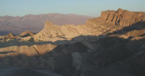
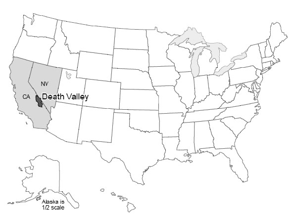
Death Valley National Park of California and adjacent Nevada sits as deep as 282 feet below sea level near Badwater, the lowest land in the western hemisphere. Yet, Telescope Peak in the Panamint Range, 11,049 feet high, is in the park less than 20 miles west of Badwater, and Mt. Whitney, at 14,494 feet the highest peak in the continental United States, is only about 80 miles away.
Death Valley is the hottest, driest place in the United States. On July 10, 1913, the temperature reached 134oF (57oC), and 125oF is common. All of the rainfall (about 2 inches or 5 cm per year) evaporates quickly.
Occasionally, water will sit on mud flats for a while (especially in the colder winter) before evaporating to leave salt deposits. Sometimes in winter, the water freezes on top, and strong winds blow the ice, dragging rocks that are frozen in it. The tracks of such rocks, at the Devil’s Race Track, long puzzled people before the answer was discovered. (And you’ll still find people who argue about the tracks and rocks out on the flat surface—no one has ever watched the rocks when they were moving!) During the ice age, more rain and cooler temperatures than today caused the valley to fill with water, forming Lake Manly, which was about 90 miles (150 km) long and almost 600 feet (200 m) deep at its deepest.
Salts left on mud flats by evaporating waters often contain boron, a rare element that has leached from volcanic rocks nearby and been carried into the valley by streams. Boron is used in soaps, water softeners, pottery glazes, and other things. Mining of the boron-bearing borax salts began in the early 1880s, and they were hauled out by the famous 20-mule teams. Mining was allowed to continue in the park after it was established (as a national monument in 1933, and a national park in 1994), but is being phased out. Copper, gold, silver, lead, and talc has been mined in or near the park.
Pull-Apart Faults
The great depth of Death Valley was not carved by a river or glacier or the wind, and is not from a cave-like Mammoth Cave collapsing. Instead, as shown in the diagram below, labeled Pull-apart fault at Death Valley (which is more-or-less what you would see if you could take a slice across the valley from the air at the top down into the Earth at the bottom), Death Valley has been dropped along faults as the region has been pulled apart. Similar down-dropped and upraised blocks extend across much of Utah, Nevada, and neighboring areas, forming the Basin and Range region. A little bit of such faulting even extends up into Wyoming, and the great front of the Teton Range is geologically a close cousin to the west side of Death Valley.
The geologic evidence of faulting is clear—layers of rock and even recent stream deposits are offset across the faults, as you'll see in a VTrip at the end of this unit. The faulting occurs in fits and starts rather than smoothly, producing earthquakes. The Basin and Range regions remain active in producing earthquakes. (More about earthquakes is coming soon.)
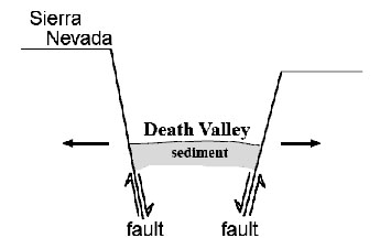
Because of the way that the faults are angled, the dropping of blocks requires that the region is getting wider! (Look again at the diagram to the right labeled Pull-apart fault at Death Valley.) It has recently become possible to measure this widening using GPS or very-long-baseline-interferometry techniques. The widening is not fast—maybe an inch or two (a few centimeters) per year across the whole Basin and Range—but the widening is occurring.
Go south from Death Valley and you will splash into the Gulf of California. The geologic record shows that all of Baja California was attached to the main part of Mexico, but has been moved out to create the Gulf, and is still moving out. Eventually, the Gulf may extend up into Death Valley as the spreading continues and the west “unzips,” although the unzipping may stop before the whole west is opened up (see figure below — Pull-apart fault in the Gulf of California).
Next, boat across the Gulf with a depth-finder running, and you will see that there is a ridge down the middle of the Gulf. Get in your submarine and dive on that ridge, and you will find that it is a volcano. Lava leaks up along a crack in the middle of this ridge volcano, hardens, and then moves slowly away as new lava leaks up along the crack. Interestingly, lava also leaks into Death Valley along its faults, with eruptions within the last 200 to 300 years.
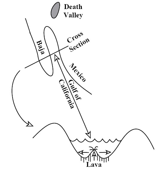
Sea-Floor Spreading
Next, follow this ridge volcano south. You will find that it runs into the open Pacific Ocean and then wraps around the globe through all of the world’s oceans, like the seam on a baseball. The ridge runs right up through the middle of the Atlantic (coming to the surface in Iceland). (Because the ridge is in the middle of the Atlantic, and the middle of the Gulf of Mexico, and the middles of some other ocean basins, it is often called a mid-oceanic ridge, although in some places the ridge is most assuredly not in the middle of the ocean.) Study the seafloor, and you will see that it is made of rocks that are young—they hardened as the lava cooled recently—near the ridge, with older rocks—they hardened as the lava cooled a long time ago—as you move away in either direction. We will discuss how we learn the ages of rocks later; for now, please accept that the rocks, and the sediments just above the rocks, are progressively older with increasing distance from the ridge.
Everywhere we meet the ridge, it is shallow and hot. The rocks that form at its volcano slowly cool as they move away, contracting and sinking. The ridge is a bizarre place in many ways—water circulates through cracks in the hot rocks, dissolves many chemicals in the rocks, and emerges as “black smokers” where the minerals reprecipitate or “rainout” in the colder ocean as a sort of black dust or as a cone around the emerging water. Many valuable ore deposits were originally formed from the chemical precipitates around these black smokers. An entire ecosystem of tube worms, clams, etc., lives on bacteria that use these chemicals for a fuel source, rather than relying on the Sun for energy, as do most living things.
Heat Inside the Earth
We just discussed a lot of observations—a baseball-seam volcano through all the world’s oceans that is making seafloor and splitting and spreading continents and ocean basins. Explaining these observations will tell us much about the Earth and how it works.
The existence of volcanoes, bringing melted rock up from below, tells us that the Earth is hotter inside than at the surface. We learn the same in deep mines and drill holes—the Earth is warmer towards the center (once you get below the top thirty feet or so that are warmed a little by the summer and cooled by the winter). All rocks contain radioactive elements (mostly uranium, thorium, and radioactive potassium, but with some others). Radioactive decay of these makes heat in the Earth, much as radioactivity produces heat in nuclear power plants. Most of the Earth’s heat comes from this radioactive decay, although some heat is left over from when the Earth formed, or is being released as the core freezes, or the core, mantle, and crust continue to separate and things sink and give up heat from friction.
Heat is just the vibration of the atoms from which everything is made. More heat causes more vibration. Temperature is a measure of these vibrations; more vibration gives a higher temperature.
Heat is moved around in three main ways: radiation, conduction, and convection. Vibrating atoms give off electromagnetic radiation. The electromagnetic radiation that comes from very hot atoms is visible to us and is called light; cooler atoms give off infrared or other electromagnetic radiation we cannot see. When an atom gives off electromagnetic radiation, the atom cools and slows down, unless it receives other energy to speed it up again. You soak up electromagnetic radiation if you lie out in the sun (and may get skin cancer as it damages the DNA in your skin), and you can feel electromagnetic radiation if you hold your hand off to one side of a hot stove burner. Electromagnetic radiation is a very efficient way to move heat from the sun to the Earth through space and our atmosphere, but radiation is a very inefficient way to move heat through rocks—the radiation doesn’t get very far before it is absorbed. (Thus, you cannot see far through most rocks.)
If a rapidly vibrating atom (a hot one) sits next to a slowly vibrating atom (a cold one), collisions between the two will tend to slow down the fast one and speed up the slow one. This process is called conduction and moves heat energy from atom to atom. Conduction is a very rapid process over short distances. (If you foolishly touch a hot stove burner, you will almost instantly realize how quickly it makes the atoms in your skin vibrate rapidly, and how much damage can be done if they vibrate too rapidly and jump out of those places where they are supposed to be in your skin.) Conduction is a very slow process over long distances. Think of standing in a line of 1000 people. If you push your neighbor, the response is almost immediate. But if you wish to disturb someone at the other end of the line, pushing your neighbor who pushes her neighbor who pushes his neighbor... it becomes very inefficient. For the Earth, the distance from the center to the surface is about 10,000,000,000,000,000 atoms. The Earth is not old enough for heat trapped at its center when it formed to have been conducted to the surface.
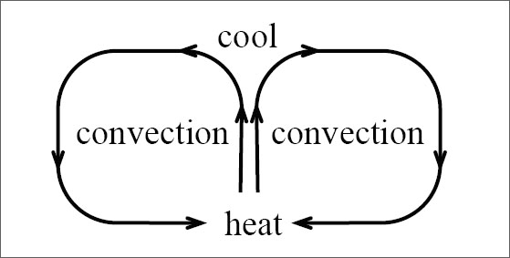
Convection is the third option for moving heat. Take something hot, and move it from here to there. To get heat from the stove to your dinner table, you cook things on the stove and then carry them to the table, which is much more efficient than putting the food on the table and waiting for conduction or radiation to bring heat from the stove.
Nature has a special way to arrange this motion in many things. Heating causes almost all materials to expand because hotter molecules vibrate more rapidly and tend to bounce farther away from each other. This lowers the density of the material; its mass is the same, but it takes up more room. Low-density materials tend to rise, and high-density materials tend to sink. This leads to convection currents—a material is heated, rises, cools, and sinks. Typically, rising occurs in one place, the material flows along while it cools, then it sinks and flows back to the rising point (see the convection figure above). (Technically, moving heat by rising of materials that expanded when they were heated is called “convection,” and moving heat by transferring hot materials in other ways is called “advection,” but introductory texts usually call it all “convection.”) You should have seen the effects of convection currents in the air (we’ll talk about them later, but they produce wind, rain, etc.), and in the boiling water of a pot of spaghetti on the stove. We believe that convection currents occur in the Earth as well. This may seem odd at first because most of the Earth is solid rather than liquid. (Volcanoes come from a depth where there is a little bit of liquid, but even there most of the rock is solid.) However, sufficiently hot rocks are soft enough to flow slowly. Again, we will discuss this later, but it is the same principle that allows a blacksmith to work hot iron into horseshoes, or allows a chocolate bar to droop on a hot day.
Our modern picture of the Earth, then, is that it is heated inside, mostly by radioactivity. That heat cannot escape easily by radiation or conduction. When the Earth was young, the heat stayed in and warmed the planet. When the rocks became hot enough, they began to convect. The planet probably melted completely and convected vigorously, followed by solidification that slowed but did not stop the convection.
In convection, the hotter rocks rise and then spread. Rising occurs beneath the ridges in the oceans. There, the new seafloor is made and then rafted away on the spreading convection cells. Where a spreading zone passes under a continent, the continent is thinned and stretched and may be torn apart to make a new ocean. This is occurring under East Africa in the rift valleys, and in the Basin and Range of the western United States—including Death Valley—and occurred to open the Gulf of California, moving Baja away from the mainland. (There may be convection cells stacked on top of each other in the mantle, and other complexities—if we tried to cover all of the wonderful complexity in an introductory course, some of you would be overjoyed but many of you would be unhappy—but this is a good start.)
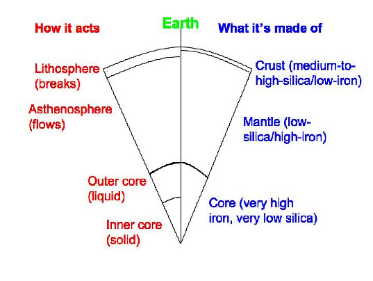
The Earth is layered chemically into a medium-to-high-silica crust, a low-silica mantle, and an iron core (well, there’s a good bit of nickel in the core, too). The Earth is also layered based on its ability to flow rather than break (see the Cross section of the Earth figure on the right). The lithosphere includes the crust and upper mantle. The lithosphere can flow a little in some places but usually breaks rather than flowing if you hit it or squeeze it or pull it with sufficient vigor. Below the lithosphere, the asthenosphere is that part of the mantle that flows rather than breaking, and from which many spreading-ridge volcanoes come. The topmost layer of the mantle is the bottom part of the breaks-rather-than-flows lithosphere. Below this in the mantle is the flows-rather-than-breaks asthenosphere, and then other layers that also flow rather than break, and that we don’t make you learn. And the core has a liquid outer part and a solid inner part.
The lithosphere is broken into a few basic pieces called plates. These float around on the convecting, soft asthenosphere. A plate may include just continental rocks, or just sea floor, or some of each. A plate map is given in chapter 3, in section 3.2 on Olympic National Park. The study of these plates and how they move and interact with each other is called “plate tectonics.”
Textbook 2.2: Plate Tectonics 1, Yellowstone
Yellowstone is Shaking - Real-world Applications: Yellowstone and Earthquakes
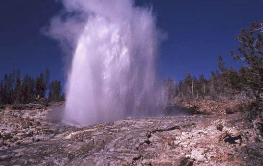
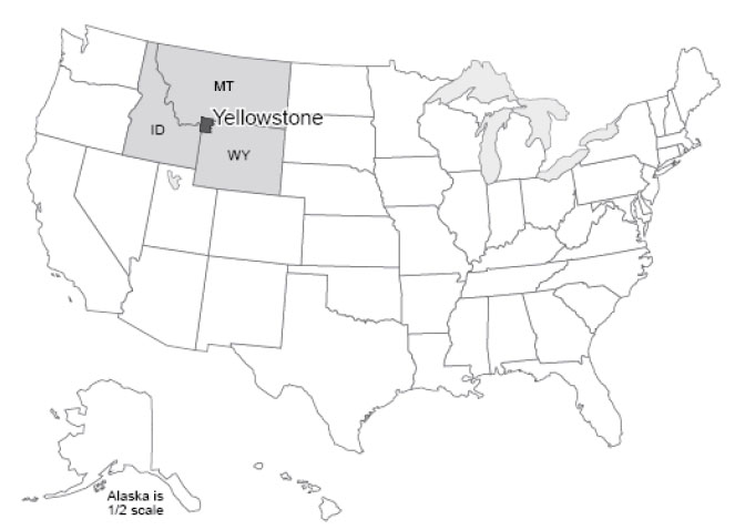
Yellowstone: for many people, the name is synonymous with national parks. Yellowstone was the first national park, for a while it was the biggest (at approximately 60 miles by 60 miles—100 km by 100 km—it is still a big one), and it is widely considered to be the best. You could probably identify a dozen features or more that, separately, would merit protection by a national park. The Grand Canyon of the Yellowstone is a great chasm cut through volcanic rocks that have been “cooked” by hot water and steam circulating through them, in the process gaining the yellow color that gave the park its name. The Canyon contains two large waterfalls (rather unimaginatively called the Upper and Lower Falls), where the river plunges over more-resistant rocks. Mammoth Hot Springs is a mountain being turned inside-out, with acidic hot-spring waters dissolving caves underground, bringing the dissolved limestone to the surface, and depositing some of it as gleaming terraces. Specimen Ridge is home to at least 20 petrified forests complete with petrified roots, standing one on top of the other, from roughly 40 million years ago. Volcanic ash and debris flow buried the standing trees, and chemical reactions caused the silica in the ash to move into the wood, replacing it (a subject for much later in the course). A new forest grew and was buried, and this was repeated 20 or more times.
The biggest draws at Yellowstone are the thermal features. Various lines of evidence indicate that there is a body of melted rock (magma) under the park, now up towards the northeast side. The rocks under most of the park are anomalously hot at shallow depth. In addition, the park receives abundant rainfall and snowfall. The water from rain and melted snow circulate deeply through rocks broken by numerous earthquakes, and the water is heated from below. In some places, the water is heated all the way to steam, which emerges from holes known as fumaroles. In other places, hot water bubbles to the surface in beautiful springs. If the bubbling action mixes in enough mud, then paint pots, mud pots or mud volcanoes develop.
Sometimes, cold water on top holds hot water down, with the pressure preventing the boiling of the hot water in a pressure-cooker effect. Eventually, a little boiling manages to expel a little of the water above, reducing the pressure, allowing more boiling, and a geyser erupts. Geysers require heat, water, and a tight, tough plumbing system to hold the hot water and withstand the high pressures. The volcanic rocks of Yellowstone are rich in silica, which is dissolved and re-precipitated by the hot waters to seal cracks in the rocks, helping produce geysers. Perhaps half of the world’s geysers are in Yellowstone, including the largest and most spectacular ones. Yellowstone also is noted for many waterfalls besides those in the Canyon, for a number of other interesting features, and for abundant wildlife, which we'll visit later in the course.
Yellowstone itself is centered on the Yellowstone Caldera, a collapse feature related to three great volcanic eruptions, or periods of eruptions. The caldera, roughly 50 x 30 miles (80 x 50 km), includes Yellowstone Lake but extends well beyond it. (No lake in the nation is both higher and larger than Yellowstone Lake, yet it is only a piece of the caldera.) The eruptions occurred roughly 1.8, 1.2, and 0.6 million years ago. Each of these eruptions moved roughly 1000 times more material than did the Mt. St. Helens eruption of 1980 that we will discuss soon; thick deposits erupted from Yellowstone are known from the Badlands region of South Dakota. The erupted material that spread across South Dakota was removed from a magma chamber, and after removal, the “top fell in” to create the large depression that is the caldera.
Yellowstone has many lessons to teach us. (Some year, it would be fun to have a course on the geology of Yellowstone alone, and we certainly could fill a semester.) The size of the Yellowstone eruptions is of considerable interest, especially considering the likelihood that they will recur. Here, we wish to use Yellowstone to introduce earthquakes.
European exploration of the Yellowstone region probably began with “mountain man” John Colter during his return from the Lewis and Clark expedition in 1806, although Native Americans had used the region for thousands of years before. Colter brought back fantastic tales of the region, which were largely dismissed because they seemed impossible. Other travelers, and especially Jim Bridger in the 1850s, returned with similar tales, which also were discounted, in part because Bridger was a bit of a tall-tale teller. He is credited with stories of petrified birds sitting on petrified trees singing petrified songs (an exaggerated description of Specimen Ridge), of rivers that ran so fast they became hot on the bottom (the Firehole River, which actually has hot springs on the bottom), of trying to shoot an elk and missing because a mountain of glass was in the way (Obsidian Cliff, where rapidly-cooled volcanic rocks have made a glass called obsidian, which was mined, shaped, and traded by the Native Americans), and more.
To separate fact from fancy, the Washburn expedition from Montana (Washburn was surveyor-general of the Montana Territory) visited the region in 1870, and first developed the idea of a national park. The government-sponsored Hayden expedition of 1871 provided scientific documentation of the wonders of Yellowstone, supported by the artwork of Thomas Moran and photography by W.H. Jackson, which convinced Congress to found the park in 1872.
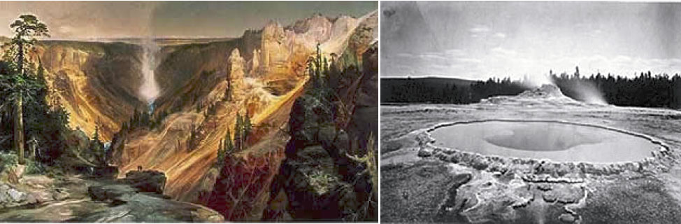
While in the park, the Washburn party felt earthquake activity. Breaks in recent stream and glacier deposits showed the geologists of the party that faulting had occurred recently, and motion on faults produces earthquakes. Since then, modern monitoring equipment has detected numerous quakes in the area.
On August 17, 1959, a Richter-magnitude 7.5 quake occurred, centered near the northwestern boundary of the park. Many of the geysers were changed, and a new one (Seismic Geyser) suddenly began to erupt. The ground over the quake (at the epicenter—the place above the center of the quake) was broken, with one side dropping roughly 6 feet (2 meters) relative to the other side, and with a little twisting and turning causing even larger drops in some places. A large landslide was triggered, burying a campground, damming the Madison River to form Quake Lake, and burying many highways. 28 people were killed. Some survivors had their clothes literally torn off by the immense blast of wind pushed out of the way by the huge landslide. The Old Faithful Inn was evacuated, and the west entrance to Yellowstone closed. The University of Utah’s Seismograph Station has a nice summary of the press reports. You may find it interesting to search for and read the report from the Billings Gazette that a beauty pageant was going on in the historic Inn with 800 people watching, and that “Moments after the queen had been crowned and she was walking down the aisle to the plaudits of the crowd, the first, mighty shock hit. Everyone in the place dashed for the door.”
Elastic Rebound Theory
An earthquake is just the shaking of the ground, and many things can cause earthquakes. Much effort has been devoted to detecting underground nuclear tests by the earthquake waves produced. Mining cave-ins, conventional explosions, and other events can cause earthquakes. The deepest earthquakes, which are very rare but often among the biggest ones, may have a phase-change or "implosion" origin, which we'll discuss later.
However, most earthquakes are produced by elastic rebound. We’ve already seen that rocks are moving around on the planet and that the pull-apart action has allowed Death Valley to drop down. We will see that other motions occur as well, with one group of rocks moving past another. Where rocks are warm and soft, they flow. Where cold and hard, they cannot flow.
Consider, for example, two large pieces of rock, such as southwestern California and the rest of the state. The southwestern part of the state, from Los Angeles to San Francisco, and the adjacent ocean floor are moving northwest relative to the rest of the state. The break separating the different parts is called the San Andreas Fault. (Both sides are moving westward, but the southwest side has an additional bit of northwesterly movement relative to the northeast side. Faults may go east-west, or north-south, or any other direction, may be vertical or angled, and the rocks may move vertically or horizontally or in-between across the fault.) The forces that move the rocks are huge and applied over large areas so that far from the fault the motion is smooth. But at the fault, rough patches can get stuck against each other and become locked for a while. The rocks then bend. This bending is elastic—it can spring back. Eventually, the stress on the rough spots becomes too great, the fault “lets go”, and the bent rocks “spring back”. The springing back is very rapid, in the same way as for a spring or a rubber band. Displacements of several feet (more than a meter) or more are possible in much less than a second. A building sitting on the rocks near the fault can be subjected to very large accelerations and may fall apart.
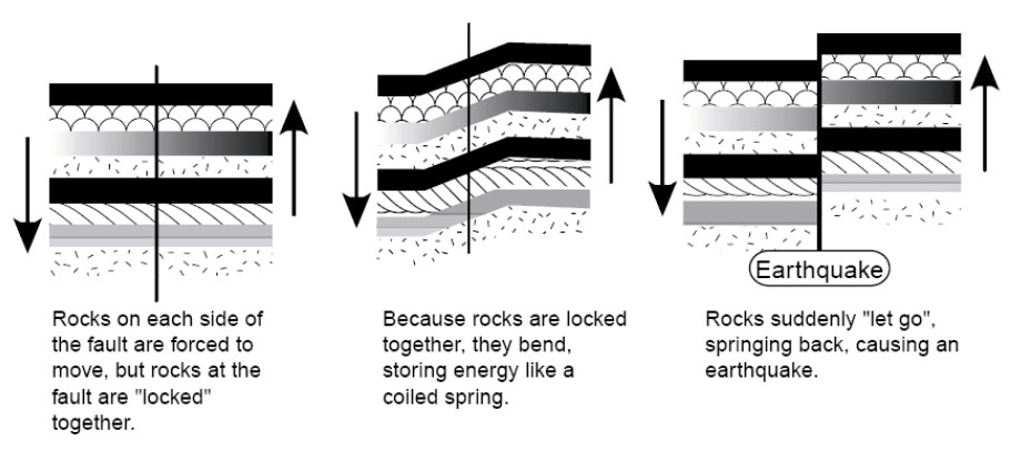
Such an earthquake will shake rocks beyond a fault. This is achieved through seismic waves—one piece of rock pushes another next to it, which pushes one next to it, and so on. Two major types of seismic waves are P or push, and S or shear. The P-wave is the ordinary sound wave. It represents a push-pull in the direction the wave is moving. A P-wave moving to the north will shake a mineral grain north-south-north-south. An S-wave moves slower than the corresponding P-wave. When an S-wave moves to the north, the mineral grains are shaken east-west-east-west or up-down-up-down (or some combination). A shear wave is similar to the wave you generate by shaking a rope. A piece of the rope moves up and down or back and forth, but the wave moves along the rope. The “wave” at football games is the same way—you stand up and sit down, but the wave moves along the bleacher bench. A P-wave may start a building shaking in one way, and then the S-wave hits the building and starts shaking it a different way, making the building more likely to break and fall down. (Earthquakes also make surface waves, which move more slowly than shear waves and go along the surface of the Earth like wind-driven waves on the ocean, rather than going through the Earth the way P- and S-waves do. The surface waves can also contribute to breaking buildings.)
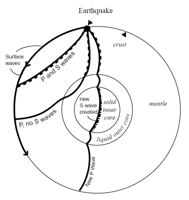
S-waves don’t travel through liquids at all. (Wiggle one piece of liquid to the side, and the moving piece slides freely past the next piece rather than wiggling it.) Recall that earlier we claimed that the outer core of the Earth is liquid. You may have asked, “How does anyone know that?” The answer is that, after a really big earthquake, P-waves can be detected all over the Earth. But S-waves are missing across the Earth from the quake, in places reachable only by passing through the core, as shown by the figure. So we know that the outer core is liquid because it transmits P-waves but not S-waves. And the outer core is nearly spherical, because no matter where an earthquake occurs on the planet, there is a zone on the other side of the Earth in which S-waves are absent. (Learning that the inner core is solid is tougher; one of the pieces of evidence is based on wave conversions. The P-wave that passes through the outer core loses some energy in making an S-wave when the P-wave hits the inner core; this S-wave passes through the solid inner core, making a new P-wave when it hits the liquid outer core again, and that P-wave travels on to the surface. The delay associated with the slower motion of the S-waves allows this to be figured out. But don’t worry about wave conversions, or the other evidence for a solid inner core, in an introductory course such as this one.)
Where Quakes Occur
Earthquakes, as noted above, occur where rocks are moving past other rocks. We have seen that this happens where rocks are being pulled apart, as in Death Valley, because the breaks often are angled rather than vertical, and the upper side slides down over the lower. We will see that there are other situations in which rocks are being pushed together, or that rocks are sliding past each other as at the San Andreas Fault, and these also can make quakes. This mostly occurs near plate boundaries. Volcanoes can cause small-to-medium-sized quakes as well, when moving melt pushes rocks aside or leaves spaces into which rocks fall.
Quakes also occur at weak spots in continents. Often, when a continent is splitting open at a spreading ridge, the tear assumes a 3-armed form, something like the Mercedes-Benz logo. (Poke your finger through a piece of paper and you’ll often get the same thing.) Two arms then grow into a spreading ridge that forms an ocean, and the third arm fails. Major rivers often form in such failed rifts. When the Americas split from Africa and Europe as the Atlantic Ocean grew, failed rifts became the river beds of the Amazon, the Niger, and the Mississippi. You open a fast-food ketchup packet by tearing at a little notch cut in the foil, because the notch weakens the foil. If the notch isn’t there, you may have to poke a fork through or end up saying bad words, because the packet is much harder to tear without the pre-existing notch. In the same way, earthquakes can occur at the tips of failed rifts, which are the “notches” in the “foil” that is the lithosphere of the Earth. Some of the largest quakes known to have occurred in the U.S. were located at the northern tip of the rift along which the Mississippi flows, near New Madrid, Missouri. Quakes also are known from an old weakness near Charleston, South Carolina.
Size of Earthquakes
There are several ways to measure earthquake size. The commonest is the Richter scale, a measure of how much the ground shakes during a quake. Richter developed a logarithmic scale—a magnitude 2 quake shakes the ground 10 times more than does a magnitude 1 quake, and a magnitude 3 quake shakes the ground 10 times more than does a magnitude 2 or 100 times more than does a magnitude 1. You may think of the number of zeros after the 1: if the ground motion of a magnitude 1 quake is 10 (you can choose the units you use, or the distance from the quake at which you measure, to get a motion of 10), then at the same distance from the quake in the same units, a magnitude 2 moves the ground 100 (two zeros), a magnitude 3 moves the ground 1000 (three zeros), a magnitude 0 moves the ground 1 (zero zeros), a magnitude -1 moves the ground 0.1, and so on.
The ground motion can be measured with special instruments called seismographs. Scientists usually look at either P-waves or surface waves to get the size of the quake. The motion must be corrected for distance from the quake; the farther away from the quake your seismograph is, the smaller the ground motion you will measure. Distance can be calculated from the difference in arrival time between the first P-wave and the first S-wave from the quake to reach the instrument, using the difference in speed between P- and S-waves, or by timing the arrival of the earthquake waves at three or more stations, and determining where the quake must have been so that the waves arrived earlier at this station than at that one.
A Richter magnitude 1 quake is just big enough to feel if you are standing on the ground very near where the quake occurs. Magnitude 3 or 4 quakes are usually strong enough to convince some people to call the police (although it is not obvious what these people want the police to do), and magnitude 5 quakes usually cause some damage. The largest known quakes, around 9, each release about 10,000 times the energy of the first atomic bombs.
Small quakes are very common and large quakes rare—one or more years may pass between one magnitude-8 quake and the next one anywhere on the planet. Approximately, each increase in magnitude of 1 causes a 10-fold decrease in frequency of occurrence. But, moving the ground 10 times more takes about 30 times more energy, so most of the energy release and the damage is by the few big quakes rather than by the many little ones.
Predicting Earthquakes
A tremendous amount of effort has gone into trying to predict earthquakes. This is because they are so destructive of life and property. Seventeen quakes are estimated to have killed more than 50,000 people each, and the worst, in Shaanxi, China in 1556, is estimated to have killed over 800,000. (In the U.S.A., the worst death toll was 503 in the San Francisco quake of 1906.) The magnitude 9.0 Tohoku earthquake in Japan in 2011 killed over 15,000 people, although the toll would have been far, far worse if the Japanese had not put so much effort into making strong buildings and otherwise planning to reduce the damages. Earthquakes usually kill by dropping pieces of broken buildings on people, but also by triggering tsunamis (big waves) or landslides, and by breaking gas lines or other things that cause fires.
The easiest way to “predict” quakes is to identify those places where quakes are likely to occur. This can be done from historic records, and from prehistoric geologic evidence. A pattern of landslides of a single age in a region, or of drowned forests related to land subsidence, may indicate the effects of an earthquake. Once people know where quakes are likely, appropriate zoning codes for buildings can be enacted. Spending a million dollars on special engineering for a building to survive quakes is wise indeed near the San Andreas Fault, and really helped Japan, but may not be necessary in State College, Pennsylvania, where big quakes are considered to be highly unlikely.
Other ideas have been advanced for predicting quakes. One is to use patterns of seismicity. If one section of a fault has had a quake every 20 years for the last century, you might expect another quake 20 years after the most recent one. Also, a fault that is slipping and moving may have lots of little quakes, whereas a locked fault that is building to a big quake may have no little quakes. So you could use such a no-quake “seismic gap” in predictions. Such a pattern—historical repeats and a seismic gap—was used recently to predict a quake near Parkfield, CA on the San Andreas Fault. The prediction failed miserably. The possible explanation is that there are many faults in that part of California, and several big quakes occurred on faults near the San Andreas shortly before the expected quake. These certainly perturbed the state of stress at Parkfield, at least delaying its quake. (The other quakes allowed rocks to move, and even caused some faults to run backwards compared to their normal behavior for a while, taking the load off and delaying the next quakes.) This illustrates the difficulty of predicting quakes. Perhaps, if the motions of all of the important blocks were monitored, one could model the whole system and do a better job of predicting where stresses are accumulating. Such work is ongoing, but results are not yet in.
Even if pattern-predictions of earthquakes can be made to work, the predictions are unlikely to be precise enough to really tell us what we want. Knowing that a quake will occur sometime in the next few years, or even the next few days, does not allow us to get people out of old buildings, off bridges, etc., during the quake. The best hope for predictions within hours or minutes is to find premonitory events. As the stresses build toward failure, rocks may begin to crackle, groundwater may move around in the cracks so that water rises in some wells and falls in others, electric signals may be given off by the cracking rocks, and animals may act strangely. The difficulty is that groundwater rises and falls in wells for many reasons, strange actions in an animal may indicate bad feed, mating season, or any number of other causes, and other premonitory events of earthquakes also have non-earthquake causes. The subtle clues to an earthquake may be recognized using 20/20 hindsight, but no one has figured out how to read them in advance. The possibility is there, though, waiting for brilliant insights and hard work by some interested researchers. (After a big quake, lots of people show up claiming that they predicted it, but none of these “predictions” has ever been verified. And, many people, including some scientists, have made predictions of particular earthquakes to come, but again, these predictions have not proved to be useful.)
Virtual Field Trips
Virtual Field Trip #1: Death Valley National Park
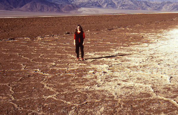
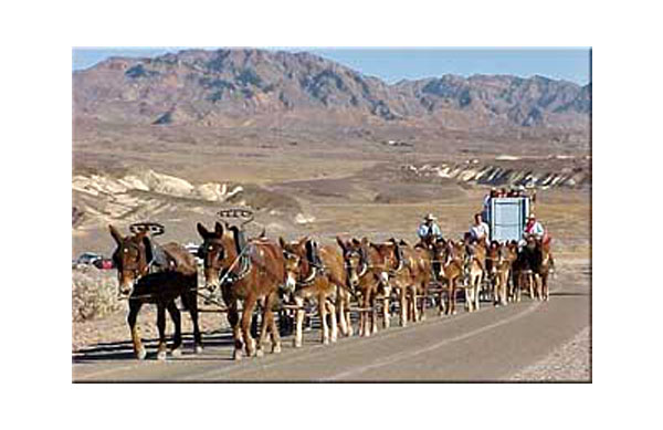

.jpg)
.jpg)
.jpg)
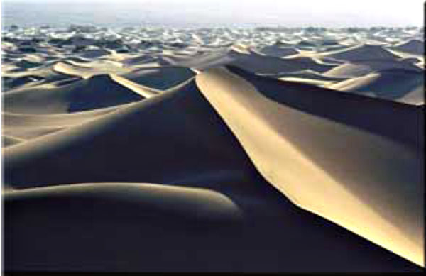
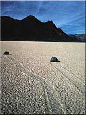
Image 1: Death Valley: Take a stroll through one of the lowest peices of land in the Western Hemisphere (282 feet below sea level), a place that, strangely enough, also happens to be adjacent to the highest point of land in the lower 48 states of the U.S., the 14, 494 ft. mountain peak of Mt. Whitney.
Image 2: Zabriskie Point, in midwinter. The soft sediments at Zabriskie Point were deposited in an old lake, and are being eroded into the beautiful features seen here. The snow-covered peaks in the background tower two miles above the valley floor. (Photo by Penn State graduate, now University of New Mexico professor, Peter Fawcett.)
Image 3: Badwater in midwinter. Peter Fawcett, noted Penn State alumnus and University of New Mexico professor, at 282 feet below sea level. The little bit of water from a midwinter storm will evaporate quickly.
Image 4: Salt flats in midwinter, Death Valley. Water, such as seen in the previous picture, carries dissolved minerals (ask a plumber who has tried to remove a faucet in a house with hard water if you don't believe this!). When the water evaporates, the salt is left. Photo by Peter Fawcett.
Image 5: 20-mule team. The salts deposited in Death Valley included valuable materials such as borax, containing boron dissolved from volcanic and other rocks around the valley. The salts were mined, and the borax hauled out by 20-mule teams. This is a picture from a reenactment of the mule teams, years after the mining ceased. Photo by Ed Derobertis of the National Park Service.
Image 6: Probably the most familiar of the many uses of borax is in laundry detergents. Before he was president of the United States, actor Ronald Reagan advertised a laundry detergent containing borax, as shown in this photo from the National Park Service archives.
Image 7: Another salt flat is shown here. Behind the salt flat, at the foot of the mountains, is an alluvial fan, a pile of gravel brought down into the valley from the mountains by streams that run for a short while after rainstorms. The vertical distance between the lowest point and highest point on the fan is greater than the vertical distance from Spring Creek to the top of Mt. Nittany near Penn Stateas University Park Campus--the fan is taller than most eastern mountains! The scale of things in Death Valley is immense, and very difficult to comprehend. Photo by Peter Fawcett.
Image 8: Again, putting Penn State’s Mt. Nittany, or many other eastern mountains, into this picture wouldn’t change it much - they would reach only part of the way from the salt flat at the bottom (shown by the orange arrow) up the fan (the top of the fan is shown by the yellow arrow), far shorter than the peaks in the picture. Photo by Peter Fawcett
Image 9: During the ice age, more rain fell in Death Valley because storm tracks had moved, and less water evaporated because temperatures were lower than today. A huge lake filled Death Valley then. In this rather fuzzy slide downloaded from the USGS-National Park Service web site, the horizontal lines (the ends of one are shown by the blue arrows) are old beaches from that lake. The photo of Shoreline Butte is by Marli Miller.
Image 10: Some of the gravels washed into the valley by streams are shown in this photo by Peter Fawcett.
Image 11: Deserts are not dominated by dunes in many places, but dunes do occur. The streams flowing into Death Valley carry salts, big rocks, but also sand. If the sand is piled by wind, beautiful forms may result, such as these. Photo by Paul Stone, United States Geologic Survey
Image 12: The enigmatic Devil's Racetrack. The stones rather clearly have moved across the surface of the salt flat. Strong winds during wet times are probably involved. Perhaps a thin water layer forms in a winter storm, freezes on top on a cold night, and then the wind drags the ice carrying the rocks. Photo by Marli Miller, from the Death Valley National Park web site.
Image 13: Death Valley was dropped along faults (or the mountains were raised, or both). The Hanaupah Fault (between the blue arrows) cuts the toe of an alluvial fan coming down from Telescope Peak, shown in this photo by Marli Miller from the Death Valley National Park web site.
Image 14: A closer view of The Hanaupah Fault (between the blue arrows) as seen in the previous picture, with labels showing which side of the fault was raised (“UP”) and lowered (“DOWN”). Photo by Marli Miller, from the Death Valley National Park web site.
Image 15: Hot rocks occur at shallow depth under Death Valley, and break through occasionally in volcanoes, usually coming up along faults; farther to the south, stronger volcanism has made the sea floor of the Gulf of California. In Death Valley, the eruptions are not especially strong, but they have made craters, such as those in the Ubehebe volcanic field, shown in these photos.
Image 16: Sometimes, volcanoes make small cinder cones, composed of little rocks and hardened blobs of lava thrown through the air. And, sometimes faults move rocks horizontally, as shown here (upper left without lines, and lower right with fault shown by dashed line and motion by arrows) for Split Cinder Cone in Death Valley. Most of the faulting in Death Valley is related to the dropping of the Valley and raising of the mountains, but horizontal motions such as this do occur occasionally.
Virtual Field Trip #2: West Yellowstone, Earthquake Lake

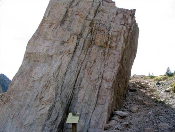
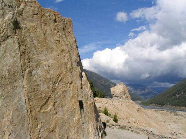
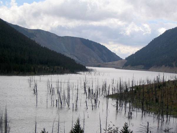
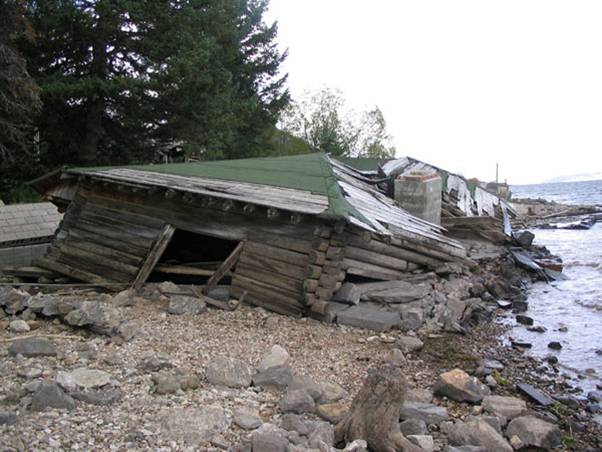
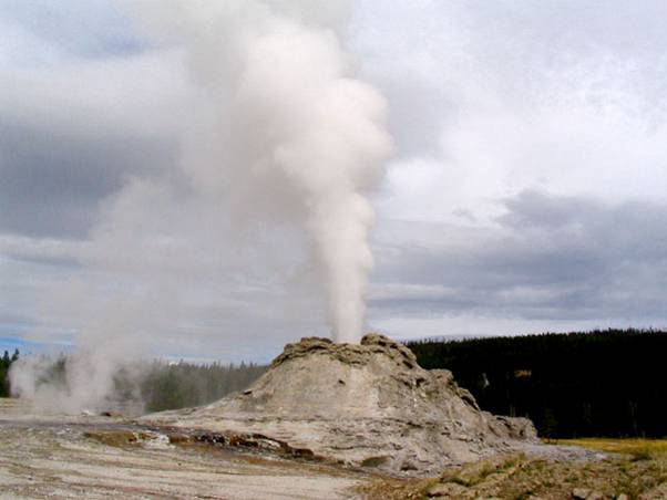
Image 1: Earthquakes! Take a quick virtual tour with Dr. Alley through the U.S. Forest Service Madison River Canyon Earthquake Area. (last picture is in Yellowstone National Park)
Image 2: On the night of August 17, 1959, at 11:37 PM, a large (magnitude 7.5) earthquake struck just northwest of Yellowstone, near Hebgen Lake in the Madison River Canyon of Montana. Land on the west side of the Cabin Creek Fault moved down about 21 feet (almost 7 m) relative to land on the east in a sudden drop that shook the surroundings, forming the Cabin Creek Scarp, shown here. (A scarp or escarpment is a steep ramp connecting places that are more nearly horizontal; think of a wheelchair ramp between sidewalks down here and up there.)
Image 3: The shaking caused a massive landslide from the south side of the Madison River Canyon. An estimated 80 to 90 million tons of rock and debris thundered into the canyon, forming a layer estimated at 400 feet (120 m) thick in the bottom of the canyon and bouncing another 400 feet up the north wall. The scar left when the rocks fell is shown here. 26 people died in this vicinity, most in a campground that was buried under the landslide debris. (Two more were killed by a falling boulder elsewhere.)
Image 4: This closer view of the scar from the landslide shows large trees next to the slide and growing in the scar, emphasizing the immense size of the slide.
Image 5: Huge boulders were carried across the valley and up the other side. The rapidly moving mass of rock blasted air and river water in front of it; some survivors reported having their clothes ripped off by the force of the blast.
Image 6: Another shot of the immense boulders carried across the valley by the rapidly moving mass of rock.
Image 7: The landslide dammed the Madison River, and the trapped water rose to form Earthquake Lake, drowning many trees that still are visible, as seen here. Quick work by the US Army Corps of Engineers stabilized and lowered the new dam. Landslide-dammed lakes often overtop their dams, cut down through the loose debris, and release a devastating flood; this was avoided by the quick government response.
Image 8: Hebgen Lake was a reservoir a little upstream of the new Earthquake Lake. On the night of the earthquake, Hebgen Lake’s dam cracked and water washed over, but the dam did not fail. The land under the lake tilted, raising one side and lowering the other. One person ran safely from her house as the lake rose and the house and land slipped into the waters. Huge waves sloshed back and forth in the lake after the quake. Houses knocked down and flooded by the tilting and waves are still visible, as seen here.
Image 9: The quake caused many changes in Yellowstone, stopping some geysers, starting others, and changing the patterns of still others. Many tourists fled in panic, small landslides and rockfalls were triggered, dishes fell off walls in houses, etc., but no one was seriously injured in the park. Earthquakes such as this probably have occurred many times over the geologic history of Yellowstone, although this was the largest experienced in Yellowstone since modern instruments were installed to provide measurements. Monument Geyser, in the Upper Geyser Basin, is shown here; this one was not affected more than most, but it's pretty.
Virtual Field Trip #3: Alaska & San Francisco
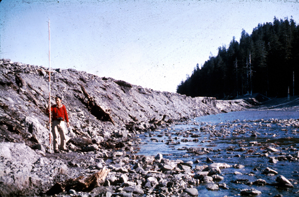
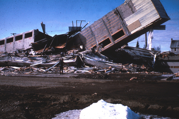
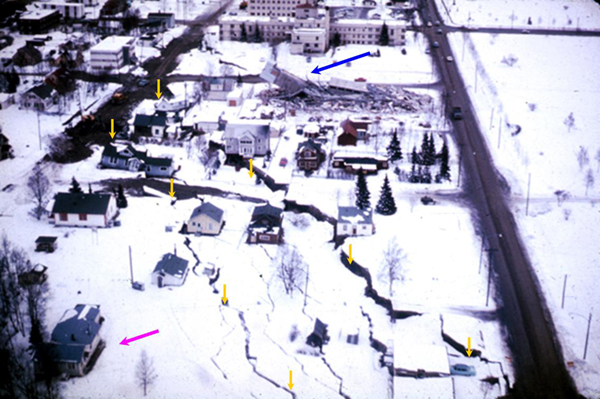
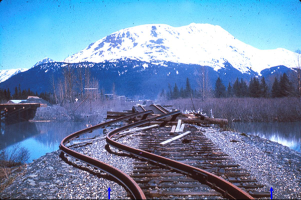
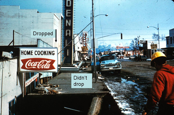
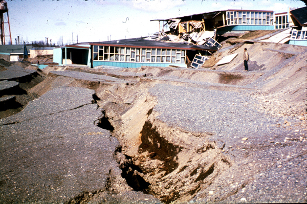
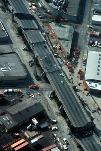
Image 1: More Earthquakes! Visit Alaska & San Francisco to get a glimpse into the effects of major earthquakes. Photos courtesy of the U.S. Geological Survey
Image 2: Alaska Earthquake, March 27, 1964. The geologist on the left stands in front of the Hanning Bay fault scarp on Montague Island. During the earthquake, the scarp formed when the rocks on the right dropped suddenly relative to the rocks on the left--the scarp is 12 feet high beside the geologist, and 14 feet high near the trees in the background.
Image 3: Alaska Earthquake, March 27, 1964. The Four Seasons Apartments in Anchorage was a six-story lift-slab reinforced concrete building, which cracked to the ground during the earthquake. The building was under construction, but structurally completed, at the time of the earthquake.
Image 4: Alaska Earthquake, March 27, 1964. The shaking caused some land to slide toward the ocean. Everything in the lower-left corner of the picture moved about 11 feet farther to the lower left in the direction shown by the magenta arrow, toward the ocean bluffs that are just out of the picture in that direction. The strip of land between the yellow arrows dropped by 7 to 10 feet, as indicated by those arrows. Notice that several houses were left hanging over the void, to be destroyed later. The collapsed apartment building from the previous slide is visible at the top of this picture (blue arrow).
Image 5: Alaska Earthquake, March 27, 1964. The shaking caused the banks on both sides of the river to landslide toward the water carrying the rails along, as shown by the blue arrows at the bottom. This in turn caused the rails to bend, and also buckled up the center of the bridge, as shown here. This is near the head of Turnagain Arm, not far from Anchorage.
Image 6: Alaska Earthquake, March 27, 1964. The Denali Theater was built on a block that dropped as the shaking of the earthquake moved land toward the sea, but Fourth Avenue was just beyond that moving block and did not drop. The marquee is now at eye-level.
Image 7: Alaska Earthquake, March 27, 1964. This was the Government Hill Elementary School in Anchorage. It was not designed as a split-level.
Image 8: Alaska Earthquake, March 27, 1964. Bridges and buildings are usually designed so that they don’t fall down. An earthquake moves the ground horizontally as well as vertically, so buildings and bridges often fail by falling sideways, as happened to the “Million Dollar” railroad bridge over the Copper River.
Image 9: Loma Prieta, California, Earthquake, October 17, 1989. The Bay Bridge between San Francisco and Oakland failed during the earthquake, with the upper deck falling onto the lower deck of the double-decker bridge, killing one person.
Image 10: Loma Prieta, California, Earthquake, October 17, 1989. The shaking of the earthquake caused landsliding and other land motion, destroying this driveway in the Santa Cruz Mountains.
Image 11: Loma Prieta, California, Earthquake, October 17, 1989. The shaking knocked this section of Highway 1 near Watsonville off its bridge supports, which poked through the road bed.
Image 12: Loma Prieta, California, Earthquake, October 17, 1989. The shaking of the earthquake caused collapse of the Cypress Viaduct of Interstate 880 in Oakland. 40 of the 67 fatalities caused directly by the earthquake happened here, primarily to drivers on the lower deck who were crushed by falling of the upper deck.
Here are some optional vTrips you might also want to explore! (No, these won't be on the quiz!)
Death Valley National Park (Provided by UCGS, 3D version requires red/cyan stereo viewing glasses)
GeoMations and GeoClips
About GeoMations
GeoMations are drawings that are captured as animations, narrated by Dr. Richard Alley and posted on YouTube for you to review at your own convenience.
The material in these drawings is almost never new—rather, it is a visual presentation of ideas and concepts you'll have already encountered in the readings and lectures. It's also important to note that these drawings are like the rest of the material presented to you in this class — that is, you should expect to be familiar with all the GeoMations in order to be successful in your weekly quizzes, just like you need to be familiar with the readings, the notes, the slide shows, and anything else included this week.
Death Valley
The great depth of Death Valley was not excavated by a steam shovel or an atomic bomb, nor were the rocks ground down by rivers, wind, or glaciers. Death Valley was dropped, as the sides of the valley were pulled apart as part of the great motions of the planet’s rocks. High drama indeed. Here is a brief description:
Sierra Nevada Mountains, a big, beautiful mountain range sitting way the heck up there. Got gimongous trees growing on top of it, and so you're going to tell that this is a slice that I am showing you through the mountain range, and then bang, down into Death Valley, way down, deep, hot, starkly, gloriously beautiful place. Place you desperately do not wish to be in the summer without your water bottle. But then there's another range, and another valley, and another range, all the way across Nevada, many more than shown here. And eventually, up in the Wasatch in Utah, end up where you'll find all these skiers standing around. That's Snowbird, so here's a skier so you can remember that this is Snowbird.
And so this is a picture of the west. If, however, you could see underground, what you would find is that there's a break along the front of the mountains. And that break continues on down. And all of these things have breaks sitting underneath them, running down underground. They're earthquake faults.
Furthermore, what you would find is that there has been motion, that the mountains have been raised and the valleys have been dropped, the mountains raised and the valleys dropped all the way across here. And for this to be happening, there has to be space made for the valleys to drop into. And so, in fact, the west is getting wider, and that creates the space into which the valleys drop and the mountains raise.
If you were able to find a particular layer of rock that you cared about, you might find it up here, and then you would find it way down below somewhere. And then you'd find it up, and then you'd find it down below, and so on across. And so it's a fascinating thing that the west is getting wider. You can measure this with GPS. It's actually there. It's shown in the geology, and there's a big story here.
In addition, one thing that one finds in the west is that there are volcanoes, as well. And those volcanoes tend to come-- that blue line-- it really should be a red line there-- the volcanoes come up, and they often leak up along the cracks, and spout up along the sides like this. And you get pretty little volcanoes growing. And that's part of the important story of how the west works, as well.
Baja
A person zipped into too-tight pants may “leak out” as the zipper is lowered. Baja California is being unzipped from the mainland of Mexico, and the leak is a volcano making new seafloor. If the unzipping continues, the sea might someday extend up toward or into Death Valley. Get a good grip on your zipper pull, and let’s go see.
So we're going to slice our way through the earth. We're gonna drive off of Baja, California, down undersea, and across. And out in the middle, we find this big bridge. And then sitting out there is Death Valley. And then we're going to come on across and back up onto the coast of Mexico.
And just to make sure it's clear, this is all under water. So here's the waves of Baja. If you're really keen about SCUBA diving, this is a good place to go. And there's birds flying over the top, and there's little boats that are floating in the water, so you can see what the thing is.
Now, if you were to measure the motion of this stuff, we're going to find that it's doing what we've seen elsewhere, which is, there's a motion going away from this ridge. If we could look very carefully, we would find that there is a volcano underneath this, and so material is leaking up into the cracks and making little volcanoes. And as it comes up in the cracks here, it hardens.
Looking at what's undersea, you find that there are lots of rocks that hardened in the cracks. And so the whole seafloor is made of these rocks that hardened in the cracks, and the oldest ones are farthest away from the center. So they get older if you go out on either side.
If you were interested in fish poop and wind-blown dust, and things of that sort, you'd find there's almost none of them on the seafloor very close to the center. And then as you go away, they become more and more common. And that's because there's been more time for them to pile up, and very close to the center of the ridge, they just have not had very much time to pile up at all.
Now, you might imagine that this is related to other things. Then you remember that way down in the earth, one finds convection cells. And so you get the convection cells coming up and then spreading aside, and a little bit of leakage is coming up into the crack that it makes, making seafloor. And all of the world's sea floors are made in this way.
Fault Types
You can push things together, pull them apart, slide them past each other - or some combination of pushing or pulling while sliding. Nature does the same, giving different types of faults, which are found in different geological settings. Here’s a quick look.
There's three major fault types that correspond to the three major plate boundary types. And we're going to look at these. They're push together, pull apart, and slide past. And so right now, we're looking at a block of rock. And this block of rock is being squeezed by great tectonic stresses that are pushing on it from the sides. And this block of rock happens to be the place that you decided to build your giant, multi-million dollar McMansion that's just sitting up there on a hill.
Underneath your beautiful McMansion, there is an interesting yellow layer of rock, which you can follow. Now, we hope that you were smart enough, when you built your McMansion, that you didn't fail to account for the earthquakes that happen in the place that you built it, because otherwise, you're going to be an unhappy camper. Because when the earthquake happens, you shove one side above the other in the push together environment, and then your house tends to fall down, and then you'd better know your insurance agent very well. And the layer of rock will be offset in the earthquake. So that is a push together plate boundary.
We also know that there are pull apart plate boundaries that are going to do a different motion pattern. There is a block of rock again. You have gotten the insurance settlement on your McMansion, and you have built a new one, which is sitting up here on the hill. But uh-oh, you didn't check with your geologist friends, or you didn't remember your GEOSC 10, and so now you have a fault underneath you.
But it's a slightly different fault in this case, in the sense that rather than being pushed together, now this one is being pulled apart. If you have a pull apart fault going on, then what you will find is that sometime later, you're in a Death Valley situation. The earthquake happens. It drops the valley relative to the mountain, and you get an offset that looks something like this.
Your yellow layer of rock is still there. It has still been offset. And again, if you haven't been careful in your construction, or you haven't worried too much about things, your house has fallen down and your insurance agent would be a good phone call.
Now, there's a third possibility. Suppose that you've now gone broke because you didn't have good insurance. You're flying over the San Andreas Fault, and as you look down at the San Andreas Fault, you see the highway that's crossing the fault, and you're very pleased to see your new gas station where you're working because you have to raise money somehow. And in the middle of your highway, there are these beautiful, really fat dashed yellow lines that you see.
Now unfortunately, if you're not careful, you may have problems yet again, because the San Andreas Fault has motion going on. And so you come back some time later and the road has been offset, and the offset of the road is not a good thing for you. It came about because of the tendency for the west side of California to move north and the east side of California to move south.
And when it did what it was doing, the cars come driving along. And if a car comes driving along this particular highway and isn't careful what the car is doing, why, the car will run over the rubble that is left of your gas station after the earthquake. And so these are the three possibilities, the push together, the pull apart, and the slide past earthquakes corresponding to those plate boundaries.
GeoClips:
Dave Janesko, a geologist, was one of the students on the CAUSE trip. Here, he and Dr. Alley explore the great Sevier Fault just west of Bryce Canyon in Utah. The pull-apart action that opened Death Valley actually affected a lot of the west and is responsible for the Sevier Fault. The red limestone of Bryce was deposited in a lake. Much later, black lava flowed over the top and cooled. Then, the faulting occurred, and the black rocks were dropped to lie next to the red ones. Where the two meet along the nearly-vertical although slightly inclined fault, the red rocks show no sign of having been heated by the lava, so they must have been put together when cool. The red and black show near-vertical scratches, formed when the rocks slid past each other to get where they are now. So, join Dave on the fault.
CAUSE 2004 - The Fault Hunters
OK, so we're standing on the Sevier Fault right now. This side over here is basalt. You can see the dark, black color. Over here, again, is the Eocene pink member of the Claron Formation, and it's the red rocks. So right now I'm going to show you exactly what was going on here, what a normal fault means.
So all right, let me figure this out. Richard, how do you think I should do this?
What I would probably do is something like this. I'd do this one's deposited in a lake, later the lava flows came out and they were deposited on top and across in various places. And then after that, the fault broke and this one has dropped down so now that it's next to it rather than being on top of it.
Sounds good.
Something like that.
All right. Maybe I should just use that.
This rock right here is 40 million years old. This is from the Eocene Claron Formation, and it's a lake deposit. This is what we saw earlier. And this right here is a piece of the basalt, which is Miocene, which is 10 million years ago.
And what this would look like in cross-section, something like this. The Claron, some more rocks, and then the basalt was deposited on top of it. Now when the fault occurred, these rocks would drop down along it like that. And now they're sitting right next to the Claron Formation, which they really didn't have any association before.
Right now we're on this basalt here. I'm on the south side, and if you can look in the distance there, you can see how this line of this fault moves right along into the distance. So again, the red rocks on that side, and the basalt on that side.
Richard, you, why does the basalt have more trees than the red side?
The soil probably?
It erodes faster on the right.
It will erode faster, and it's probably more minerals and nutrients in it.
In basalt?
Yeah.
Yep, doing great. Just be careful out there.
Then just take a pan from this.
Want to see more?
Here are some optional videos and animations you might also want to explore! (No, these won't be on the quiz!)
The original "geyser" in Iceland
Yellowstone has roughly half of the world's geysers, but there are geysers in New Zealand, Iceland, and elsewhere. The original "geyser" is Geysir, in Iceland. Here is a short film clip of Geysir erupting, just for fun. Filmed by Vicki Miller.
Plate Tectonic Movement Visualizations
Watch the NSF-sponsored video on Plate Boundaries
San Francisco Earthquake Aftermath 1906
(Amazing film footage that is now over 100 years old!! Click on one of the "View Movie" options on the left side of the new page to watch the 1:39 minute clip.)
Video Lecture
Please watch the 50-minute Unit 2 lecture featuring Dr. Richard Alley.
Hello, and welcome to another day of Geoscience 10. This one is maybe a little bit like an old-style fraternity initiation. We make you run through something really hard to get started.
And so we're going to go cranking through a lot of material in a fairly big hurry here. You will find this material is supplied to you in the textbook, in much slower and greater detail. You also will find there's a lot of v-trips, virtual field trip slide shows that are online. So you can see the pictures that I'll show you here, in much greater detail and at your leisure.
There's actually only a few big ideas that we're going to go through here. But they may be different for you. You may have seen them in some earlier class. But if you haven't, I hope you'll find this interesting.
We have started into the big picture of how do you make mountains. After we make mountains, then later we will tear down mountains. And then we will see about how people live on earth, how animals live on earth, what the history of the planet is. So that's sort of the broad outline of the course, building mountains, tearing mountains down, living on the planet.
And we're going to start with making mountains. We'll do some earthquakes, and we will look a little bit at what we call plate tectonics, which is the vast underlying processes that make the mountains. We're going to do this by starting at one of the more interesting places that you could go for a national park, which is to go to Death Valley. OK?
So we'll look at Death Valley. We will look at how it is spreading apart. How that spreading is being driven by the heat within the planet. And then we will briefly pop by Yellowstone, just long enough to see that it's shaking, and what we can learn about that, about the interior of the earth from earthquakes and so on.
You will be given, for each of the parks we visit, one or more v-trips, virtual field trips. We would love to take you and zip out to the parks and have a good time. We haven't quite figured out how to do that. And so we've done the next best thing. We've gone ourselves. Some of our friends have gone. We've collected pictures and put them together, so that you can see virtual field trips. And so you will find these online.
This is Death Valley. Death Valley is tremendous. You're looking at the lowest spot on the continent, right here. And in the background you're looking at a spot that is more than two miles higher. It is just phenomenal.
These pictures were actually taken by Peter Fawcett, shown here. Peter worked with me a number of years ago and is now a professor in New Mexico. And he was out there in the dead of winter. You can see the snow way up high on the peaks above Peter's head. You can see a little bit of water behind Peter.
It does snow, it does rain in Death Valley. The water does come down in the valley. And in the winter it may puddle for a little while. And then, poof, it evaporates. And it's gone very, very quickly. And when it evaporates it leaves salts behind. And so you can see the white salt behind Peter, there at the picture.
That was economically important in Death Valley. Some interesting things dissolve out of the rocks. They come down in the valley with the water. They're left when the water evaporates.
And you could go and mine these. And so early people actually did mine in here. The 20-mule teams hauled boron salts, borax out. And this was used in soaps and paints and glass making and all sorts of other things. And it contributed to economic development in this area.
And also, one of our former presidents, President Reagan, earlier in his career, before he was president, sold soap. And he sold Boratine, which had borax, which came with the 20-mule teams. And so he was something of a celebrity, in part, based on Death Valley soaps.
A point in this course, you will get the joy and privilege of taking quizzes occasionally. In each time we visit a park, we're going to give you introductory material such as this. And we do this, because we find it interesting. We think you will. We hope that some day you'll be off on a road trip, and you'll get to go see these things. And this will help in your visit.
We would never, on a quiz, ask you which president sold soap. Nor would we ever ask you, which soap did the president sell? This is strictly for your edification and enjoyment.
Once we get to the point of saying, OK, geology is tearing Death Valley apart, that could show up on a quiz. But this early stuff, what's pretty, what's neat, what's exciting that you want to go see this park, this is for you. So please do not attempt to memorize the soap that President Reagan sold before he was president. That doesn't— that's just for you.
But Death Valley is something. This picture, the scale here, if you ever been to Penn State's University Park campus— and we're very impressed around here with our mountain, Mount Nittany. If you put Mount Nittany in this picture, it would tower over that little white line on the far side of the picture, almost a third of the way up that first slope.
There's nothing in the Appalachians that you could put in this picture that would look even vaguely large. You'd drop the whole Appalachians in this picture, and they would not go halfway up. This is immense. It's just truly an awesome place to get to.
You find the right place in Death Valley, such as the one you see right here, and there's beaches. During the ice age, when it was colder, the rains that came in didn't evaporate as fast. There was a big lake in Death Valley, which has now evaporated.
You go and look various places in Death Valley, and you'll find that the floor of it is salt and it's gravels and things. The streams are tearing down the mountains. They're dumping stuff down in the valley to fill it up.
And yet the valley is there. The valley is there, even though they're trying to fill it up. There's a little bit of sand, a little bit of sand dunes. Not too much. Usually the desert is not sandy. But there are such beautiful things as this.
There are really amazing things. You can look at this picture. You see those big rocks out on the salt flat. And those rocks have moved. And people have come and surveyed them, and they do move.
And we're still not absolutely positive how. The best picture is when it rains, you get a little water here. And then in a really cold day in the winter, it might freeze. And then these rocks are locked in the ice.
And the wind blows, and it pushes along on the ice, and it actually sort of skates these things along. But no one's sure. Racetrack Playa, the rocks move somehow. Neat place, neat place to visit.
The valley is actually growing. It's widening and it's deepening. And if you look at this picture, you can see the great mountain range towering more than two miles above the valley.
And you'll see right along the bottom, it's just a straight line. Well, that straight line is actually an earthquake fault. And here's another view of it. The near side has dropped. The far side has been raised.
These things happen. They are ongoing. It is part of our world today. And that's really what's very interesting and why we're visiting Death Valley at this point, is why are things moving? What's going on on the planet?
When this motion occurs, occasionally volcanoes come leaking up along the cracks. And so you can see volcanic craters if you go and visit Death Valley. You can see some places. This is an old, little volcanic feature, which has been torn apart by motions.
This is a slightly different motion. Most of Death Valleys' motion is sort of an up and down thing. This one's a little bit of side to side as well. And the diagram will show you what's going on. Things are moving away there.
So there's some pictures of Death Valley, if you get the chance to go. If you want to impress your friends, go in midsummer. If you want to have fun, don't. It's really stinking hot. But it's a wonderful park, big park sitting on the California, Nevada border.
Now, what's going on? Death Valley is getting bigger. And it's doing so from heat down within the planet. And so that's what we have to look at a little bit now. And then we'll go see what that does at Yellowstone.
So let's do the Death Valley. OK, Eastern California, Nevada border, the lowest, the hottest, the driest spot in the country. The water does come down. It does evaporate. It does leave salts behind. This drove various economic activity. It's largely turned off now.
And now, let's see what we do. This is a cross-section of Death Valley. If you could go in and you could take a giant saw and hack your way down and then look at it sort of as a cliff, you have spaces up above in this picture. And the earth is down below, and it's shown to you as blue. And we're going to look at it. The little line across the top is just for your reference in there.
And so what's going on, Death Valley measured? If you go in and you put in GPS receivers across Death Valley and on across Nevada and over to Utah, and then you survey what's happening, what you will find is it's very slowly, about as rapidly as your fingernails grow, the west is getting wider. One side and the other side of the valley are very slowly pulling apart.
As they do so, the valley drops down. And it drops down on what we call pull-apart faults. Because you pull it apart, and then the fault allows the drop. The fault is a break where there's motion. OK.
So the block in between is going to drop down as we pull apart. And it is measured. This is not storytelling anymore. The early geologists look at this, and they said, this has to be happening. We understand that, but we can't measure it.
It's pretty hard to measure a state spreading at the rate your fingernails grow. But we can do that now. This is directly measurable by GPS. It does work.
And so this is the picture. You can actually put out your GPS and measure that the mountains on the east of the valley and the mountains on the west of the valley are moving apart. It's actively going on. This is real. It's happening today. And as they do, they allow earthquakes. And the earthquakes drop the valley down.
Erosion takes stuff off the top. It fills it in the bottom. But then the bottom drops, and the sides are raised as the whole thing is pulled apart. And so Death Valley is getting bigger. The west is getting bigger. And the fault, the break in the rock along which there's motion, there's one on each side of the valley. And basically every valley in Nevada and Utah has this same structure going on.
If you were to find a rock layer, an old friend that you happen to know— the pretty purple rock, the pretty red rock, whatever it is— you can see the pretty red rocks scribbled in on either side. If you wanted to find that in the valley, and you drilled in your oil well— you're not allowed to drill there now, but if you were, you'd drill down— you would find that same rock layer. It's down there. And you would find it down there.
Now, this is one of the things that geologists were quite confident that this motion was going on, before they had a GPS satellite to help them measure it, because of things such as this. You say, OK, what happened to the layer in the middle? There it is. It's way down below. The valley, the west is getting wider. The bottom is dropping down.
Now, here's a map version. If you want to get in your satellite and look from above, down onto these things, Death Valley you'll see labeled way up at the top of the map there, above Las Vegas. That's sort of along the California, Nevada border. And Death Valley and through Las Vegas and on down passed Scottsdale and headed to the south, all of that region is getting wider.
You'll also see looking farther down, past San Diego and Tijuana down there, that we get down to water. We get down to very pretty beaches, plus fun places that you could go diving. And what you find is that this pull-apart action of Death Valley is running all the way down to the ocean, down to the Gulf of California, down past Baja there. This whole area is being pulled apart. Baja, that piece out on the left, and Mexico as a whole are pulling apart. The same spreading that tends to open Death Valley is opening this whole area.
And so we've drawn in here, you can see a circle up by Death Valley and then a green line that runs down to the Gulf of California. And the Gulf of California actually is getting wider. It's unzipping. It's open.
Given enough time, it possibly will open all the way up to Death Valley. It is conceivable that you could, over time, actually have the ocean extend on up into the central part of the West there. We're not sure if it will get there or not, but that's what's going on. Is that whole thing is measured to be unzipping, with Baja moving out towards the Pacific, Mexico moving over towards the Atlantic, the space in between, the ocean basin getting larger.
Now, this is part of a much bigger phenomenon. As you might possibly imagine, if it's going— we started in a cool place, but you start moving things around on the continent. And if I move here, it's going to bump my neighbor and bump the other neighbor, you sort of get the idea that this must extend much farther along. And so what you find is this sort of spreading behavior. This pulling apart behavior happens not only at Death Valley, not only where Baja is moving away from the mainland of Mexico, across the Gulf of California, but it actually happens through the world's oceans.
The places that they pull apart from, it turns out, tend to be raised a little bit. We know that there's these big mountains next to the valley at Death Valley. And so there's high stuff associated with that.
If you go down under the Gulf of California, the center where it's pulling apart is a little bit higher than the rest of the sea floor. It's sort of arched up a little bit. And so we talk about spreading from ridges. And so that's spreading ridges. And so we find a lot of places in the oceans have these places that it's being pulled apart from, and they're a little bit high. OK?
If you played baseball, or if you play tennis— tennis would work too— but you'll find that the ball has a seam on it. And that seam sort of wraps around it. And we often say that you can follow these spreading ridges of the earth, and they wrap around the planet like the seam of a baseball. And they're raised a little bit like the seam of a baseball.
And so here is a map. And the black lines— you'll see one black line disappearing up there, pointing towards Death Valley. And then you'll see the black lines wrapped around the rest of the planet, primarily running through the oceans. If you look very carefully, way over on the far right of the picture, you can see where one black line sort of points down into Africa, towards the great African rifts.
And so there are other places that these black lines, these spreading ridges are trying to tear a continent apart, the same as is happening up in Death Valley. But for the most part, they're out in the oceans, wrapping around, and again, sort of like the seam of the baseball. If you're not a Mets fan, well, just imagine that that's whatever team you like to cheer for.
You will see that these black lines look a little bit like the edges of jigsaw puzzle pieces. And so you can sort of see between the black lines what you might think of as being jigsaw puzzle pieces. These are plates. And you'll see they're labeled in there, the Antarctic plate, the Pacific plate, the Cocos plate, and so on. These plates are going to be very important in our story of how the world works here, as we try to put this together.
You also see the Ring of Fire all the way around the Pacific. At the edge of the plates there's volcanoes. That's sort of fiery. And so that gives us a Ring of Fire. That is something we will revisit a little bit later. OK?
Where we started again was in Death Valley, where you can see one of these spreading ridges disappearing and trying to unzip the continent. And then you can follow that out and then on around. And these are some of the plate boundaries.
We will see, in a little bit, that while plates, these big chunks, the jigsaw puzzle pieces often have a spreading ridge at the edge. Sometimes they will have something else at the edge. And so some of the plate boundaries are shown by the red lines in here, but there are other sorts of plate boundaries that we will revisit.
And there's your baseball. And again, I can't say I grew up a Mets fan. I'm from Ohio, and so it's Cincinnati or Cleveland. But that's life.
All right, now, if you go to Death Valley, you find there's volcanoes. If you go to the center of the Gulf of California, you'll find it's hot along that spreading ridge. And in fact, there's a volcano there. There's melted rock, leaks up along that crack.
And as Baja moves away from Mexico, melted rock will sneak up along that crack and freeze. And then they move away. And more melted rock sneaks up and freezes, and it moves away. And more melted rock--
And so that should tell you one thing. It's hot down below, because there's heat coming up from there to drive the volcanoes. Certainly, if you see a volcano at Death Valley, there has to be a heat source. And so we're going to talk a little bit about heat. Because it turns out that all of this action on top is being driven by heat from below. So let's take a quick look at what is heat and how it moves around.
I'm sure, for some of you, this is really old hat. Some of you may have not encountered this before, and I hope you get something interesting out of it. The normal way we look at it, if you were able to look inside of me very, very careful, you could see all the little pieces of which I'm made are vibrating. There is heat in me. There's vibration going on in the atoms that make me up.
Atoms, as you know, smallest units of matter that are sort of recognizable as something. If you started to— please don't do this— if you started to break me up into pieces, using chemistry, using fire, using other tools that you have available to you, you could make smaller and smaller and smaller pieces down to some limit. Below that, if you wanted to break it up more, you're going to need an atom smasher or something like that.
And so the things that you can get to with a fire or your stomach or something like that are atoms. And they have, we talk about different types. I'm made mostly of carbon and oxygen and hydrogen and a little nitrogen and a tiny bit of iron and other things.
And each one of those carbons, you could pull it out, and you could weigh it. And say, oh that's carbon. And that's because of how many pieces are in it, the little protons and neutrons. And so there's a little blurb in your textbook. If chemistry is completely foreign to you, it might be worthwhile to go back and read through in the textbook. If this is old hat, great. Don't worry about it.
Now, we will come back to some of that terminology. It is true that a carbon inside of me, one of them may be a little heavier than its neighbor. And so if you've never run into an isotope in your life, you might have a quick look at that. This is going to show up for us in just a little bit.
But again, if you've never had chemistry or you completely forgot your chemistry— Oh my goodness, don't tell me about chemistry— there's about a half a page or three-quarters of a page in the text. It will get you completely up to speed. So you might have a look at that.
Now, suppose we started making it cold. The vibration slows down. It slows down. At absolute zero the vibration stops, or very nearly. There's a little quantum stuff, but don't worry about that. OK. So as you warm from absolute zero, the stuff in me vibrates and that's heat. And that's there. And it's very good, because if it wasn't going on I would freeze and that would be the end of us.
OK. So now, suppose we have some heat. There's someplace that the molecules in me are vibrating like crazy. Does the heat always stay in me, or does it go somewhere else? And the answer is, it goes somewhere else. There are other ways to get things going.
And so if something cold were next to me, if you put an ice cube on my head, it will melt. The atoms in it will start vibrating faster. The atoms in me will vibrate slower. And so I will transfer heat to it.
And so there are ways that heat is moved around in things. How does it work? One way that heat gets moved around is by what we call radiation. The lights are shining on me. I'm picking up just a little warmth from the lights that are shining on me.
It gets here by radiation through space. Radiation works great. If you wanted to get a suntan, you go out and lie in the sun, and you soak up the sun. And then you get skin cancer. And so that's maybe not a good idea.
But our cats are very clearly solar powered. Now the radiation brings energy all the way from the sun, all the way down to the cat. And the cat just sits there and soaks it up. And then the cat goes and runs around like crazy at 2:00 in the morning. And so radiation moves heat around very well through space. And as noted, don't soak too much of it up, or when you're old and feeble, you won't be happy about that.
How else do you move heat around? Conduction. If you turn on the stove burner, and you let it get hot, then you hold your hand out to one side, you feel a little bit of heat coming off the side. That's radiation actually. If you take your finger and you touch the burner, you will notice very quickly that you feel a whole lot of heat. You're feeling that heat by conduction.
The atoms in the stove burner are vibrating really fast. And when you put the atoms in your finger against the atoms in the stove burner, the collisions between the two make the atoms in your finger vibrate really, really, really fast. And then they jump out of the places where they're supposed to be, and they sizzle and combine with oxygen and disappear in the atmosphere, and your finger burns up. So don't do that either.
That is really all it is though, conduction moving heat around by collisions between a fast one running into a slow one. And then they sort of share their speed. That works really well over short distances. You touch your finger to that stove burner, and immediately you'll notice it.
It doesn't work very well over space. If I vibrate really fast, I can't make a molecule on the moon vibrate faster. It doesn't even work really well over miles and miles. If I vibrate really fast, if I had a neighbor that I could shake, and the neighbor would shake the neighbor, by the time you try to go a few miles away, it's really hard to get your neighbor to shake the neighbor to shake the neighbor to go few miles away. And so conduction works really well over short distances, not over long distances.
Convection is where we're headed. This is sort of the third big way of moving heat around. And essentially this is just taking something hot and moving it.
If you cook dinner, and the dinner's on the stove, and it's hot, and you want hot food on the table, you could go bring the hot food over. You could wait for radiation to bring the heat. You could wait for conduction to bring the heat. But I think you're going to go get the food and bring it over. OK, that's advection. But convection is just sort of that. It's the natural way for hot things to move to somewhere else, taking the heat with them.
You've probably seen convection work if you've ever cooked spaghetti on the stove. You make it hot at the bottom. It expands. It's lower in density, then it rises. It gets to the top and it cools, and then it's going to sink again. But it can't sink where it's rising, so it gets out of the way and goes around in a loop.
Wherever you have soft solids, really soft, or liquids or gases, and you heat them and they expand, you end up with convection cells running after a bit. And it works in spaghetti. It works in spaghetti sauce, even though that's a little thicker. As you can imagine, if we're talking about it here, it's going to work in the planet as well.
So convection, heated material moves to a new place, carrying the heat with it. Primarily because hot things are less dense. The vibration, as you heat it up, it shakes around more. It shoves its neighbors away.
Now you've got the same amount of stuff taking up more space. And so you get a little lower mass in a place, it's less dense. It tends to rise. In case you forget what density was, it's mass divided by volume.
So what happens if you have a low density thing down, it tends to rise. If you have a high density thing up, it tends to sink, and they get organized. And that's not a terribly tough thing.
You've probably seen it in the atmosphere. What happens and what's very interesting is that over the times of geology, slow times, even rocks will do this if they're very warm. And so you go down in the earth, and it gets hotter and hotter. It's mostly solid, except in a couple of places. But most of what's down there is solid, but it's soft. And you know if a blacksmith takes a horseshoe and heats it almost up to the melting point, it can be deformed. It can be worked.
Well, if you get a huge mass of stuff and you heat it up, almost to melting, it gets soft. If you heat it at the bottom, it can convect, even though it's essentially solid. And that's a cool thing.
But if I had a chocolate bar in my pocket, I'd eat it right now and I'd be happier. But if I had a chocolate bar in my pocket, it would be fairly soft. As you warm it almost to melting it gets soft. And I could deform it. I could make it do things.
And so the same is true in the Earth. It's warmed almost to the melting point. It's soft. And because it's soft, it can do things.
So that's a convection cell, here's a picture. OK? Now we're going to very briefly sort of divide the world up for you. What you see here is a diagram planet. There's a much nicer diagram in your text that you might want to look at.
The planet is layered, as described in the text. The center is sort of an iron ball. It's got an outer core, which is liquid, and an inner core that's solid, that's basically iron. Around that there's this vast shell that's got some iron, but it's got some silicon and oxygen and a few other things. And that is soft. It's not melted, but it's almost melted. And so that's soft.
And then on top there's sort of a layer that's too cold to flow very well. It prefers to break rather than flowing. And we call that the lithosphere. And at the very top of it, especially the crust, has a little bit more silicon and oxygen and a little less iron than the rest. And it's got a little water in it, little [? us, ?] and some other things. So it's fine.
But anyway, here's the picture, if you can see it. And so you've got stirring going on down below. You'll see the surface of the earth labelled there. You'll see that this is only part of the earth. Yes, the whole planet is spherical. And you'll see the center marked down below there. Just so you know what we're looking at and what's going on.
The spreading ridge is right in the middle, on top there, where it says ridge. You'll notice that the convection cell comes up and it spreads. And as it does that, a little bit of melt will leak up and freeze and then get pulled away and leak up and freeze.
And so you'll get the volcanoes in Death Valley. And you will get the spreading and making of new seafloor at those places that allow the motion of Baja away from the mainland of Mexico and so on. The process here, we've got this cold stuff on top, the jigsaw puzzle pieces, we call those plates. And the moving around of these on the convection cells we call plate tectonics. It's a big, fancy word. It's a fun word. And it's written out there for you, in case you can't spell from my speaking.
So again, pull apart. We started in Death Valley. It's pulling apart. A little bit of melt leaks up. And you go south from Death Valley into the Gulf of California. Baja is moving away from Mexico. There's pull-apart going on. A little bit of melt leaks up. Things are pulling apart, and they're doing so riding on the back of giant convection cells. The stuff on top is just rafting around on what's underneath, with the ridges at Death Valley being where we started.
Heated rock rises, less dense, cools at the surface of the earth. Then you sink back, and this gives you the completion of the loop. And this gives us action. This gives us motion. This gives us drama.
You pull apart here, it's going to run into something somewhere else. We're going to have rifts and collisions and earthquakes and volcanoes and fun. And so you get ultimately the heat of the earth making this go on. Rising rocks push aside the cool rocks at the surface. The cool rocks travel sideways. And there will be interaction when cool rocks run into other cool rocks, which we have to look at.
Where does the heat come from? A little bit of it may be left over from when the planet formed. There's some other things going on. Mostly it's radioactivity.
If you get a rock, and you put it in a Geiger counter, you'll get occasional action. There's always a little bit of radioactive stuff. Now, not huge amounts. You usually don't get wiped out by the radioactivity in the rocks next to you.
But it's a big planet. There's a lot of radioactivity. There's a lot of rock. That makes heat.
And that heat is ultimately the big source of what drives the planet. There is a little left from the formation of the planet, a little bit from separation of the planet and freezing of things. But mostly it's radioactivity that does it.
As a wonderful story, if you're into history— don't get too bogged down on this— but if you're into history, the physicist Lord Kelvin says, OK, I'm a physicist. I'm smart. I know all this stuff. The earth started melting, and it's cooling off. And I measure how much heat is coming out of it. That tells me how old the earth is, 24 million years.
And the geologists said, oh, no, no, no, no. It's longer than that. It's lots longer than that. It's more than 100. It's— you got to go way back.
And he said, no, no, no, I'm a physicist. I have it right.
Well, he didn't know about radioactivity. He got it completely wrong, because his assumptions were entirely wrong. Darwin as well as the geologists are saying, come on, come on, we need a longer clock than this.
And actually it took the discovery of radioactivity. Marie Curie, who is shown here, and others find the energy source and say, no, there's heat down there. This will work. Your physics was right. Your assumptions were wrong. Something worth— and so geologists, we like this. So those who study the earth like this.
OK, so brief summary. Heat inside the air from radioactive decay, it drives convection cells. The cells move plates. The jigsaw pieces on top, where it's cold, they go rafting around on the surface of the planet. Where they pull apart, you get faults, you get spreading, you may get a little volcanoes leaking up. Death Valley is one. You get ocean spreading centers beyond that.
You're welcome to pause right now and take a deep breath. [BREATHING] If not, we'll go screaming right along. We're going to briefly visit another park.
And we will look at one of the implications of this. You might say, why should I care? Who cares what's going on here?
One of the reasons this matters is occasionally things that are moving get stuck, and then they move again. And when they move, they go fast. And if you're standing on top, your feet get knocked out from under you. And if you're a building, you fall down. And that's not good.
So we're going to go to Yellowstone. And we're going to look at— Yellowstone has everything. It has geysers, and it has bears, and it has beautiful trees and lakes, and it has earthquakes and volcanoes and river erosion.
Yellowstone has everything, the first national park. The first serious European Western exploration. People are there, and they've had earthquakes. The ground shook. That's cool. Sort of everything is here. It must be going on.
Yellowstone itself is a huge volcanic pit, a volcanic caldera left from giant eruptions. And there will be another one someday, with fairly high confidence. It's due, plus or minus 100,000 years, the next one is due. You can count 1.8, 1.2, and now 0.6, but we're due. Not to worry.
Those were big eruptions, really seriously big eruptions. But we're going to visit there and talk about earthquakes. You go to Yellowstone, and if you read into the history, back here a little bit, there was actually a beauty pageant going on at the Old Faithful Inn. I don't think they do this anymore.
And in the middle of the pageant, in the late 1950s, there was an earthquake. And there's this wonderful text you can read about it, in our textbook, about all these people watching the queen walking down the aisle. And the ground starts shaking. And they all screamed and ran out.
What had happened is just west of the park there was a big earthquake. And the picture you're looking at in front of you, the side that I'm standing on taking the picture, the side that the bottom of the tree is on, dropped about 20 feet relative to the other side. And in the middle of the night, it just went PFFT! And it does this huge motion.
Now you can imagine what happens. There's a hill there. And this is a serious hill. This is a couple-thousand foot high hill. And it drops, and it stops.
Well, if I had something balanced precariously on me, and I dropped, it falls down. What happened is the whole hillside fell down, and it killed a bunch of people. It was not very nice.
But there's these dramatic stories. When the hillside fell down, it's just slid across the river, and it pushed the air out of the way in front of it. And there's this story of this guy that had his clothes blown off of him in the middle of the night. He's sitting there in his tent and pfft— the things come. So it was truly an amazing thing.
You can see the pictures here. Those are big pine trees along the edge of that failure. So this entire hillside just fell off. It dammed the river. It bounced up the other side. This rock is towering over me. And this, the rock came down into the valley and several hundred feet up the other side, in the landslide that was caused by this earthquake.
Once it dams the river, it makes a lake. The Army Corps engineer says, boy, we got trouble. Because what happens, the water's going to fill up. It's going to go over the lake, go over the dam.
The dam is loose rocks. It will cut through the dam. There'll be a giant failure. It'll kill people. That happened 100 years ago, just outside the Grand Tetons. And so fortunately, the Army Corps engineers got in there real fast, and they fixed this sucker and things worked. You can still see the damage that was done by this earthquake.
There's great stories of this lady in this house. I think it was this house. The land sort of tilted. And the lake is filling up. And there was another lake just above it that had already been there.
And her house is getting flooded. And the waves are coming at her. And it's the middle of night, and she's running away. She made it. That's all right.
The earthquake shook up Yellowstone. It changed the timing of the geysers. It did all sorts of things.
And so there are earthquakes. And we know they matter. They matter in natural places. They kill people. They cause troubles.
This is a different earthquake. 1964, Alaska had a big one. And you can see one of the things that happened there.
We usually build buildings to stand up against gravity. We make them so they don't fall down. In an earthquake, they shouldn't fall sideways.
And we usually don't build things to be strong against falling sideways. Well, you notice what happened? Things moved, and that bridge truss there just fell sideways— pfft— it fell off. It's an interesting mess.
Here's another one. This one is from the World Series earthquake in California, '87, I believe it was. An again, sort of we build things not to fall down. But it shook, and it sort of slid off, and then it— So this isn't good. You really wouldn't want to drive your car over the middle span of that bridge right now.
And when you shake the ground and things move, you get cracks and that's not good. And it's not good for houses. And this one, the road is a little perched on these little— you put a real strong thing, and it sits on a post. And then you put a road on top of it, and then it shakes and whoop, the post just poked through the road. Whoop, I didn't design it that way, did I?
So earthquakes are a very bad thing when they happen. And this is also the World Series earthquake. You can see the road is not going to be useful for a little while there.
So what's going on with earthquakes? The land moves. We've seen that it pulls apart. If it's pulling apart somewhere, somewhere else it must be running together. And occasionally there's sliding passes that go on.
And so this is a diagram of the West. This is a diagram of what you might see going on for the World Series earthquake, for the San Francisco earthquake, for the San Andreas fault. What you have out there, in fact, is that there's sort of the far-western piece of California is headed for Alaska. And so it's sort of sliding along. And the join between that far western part and the rest of the country is the San Andreas fault.
So let's see if we can walk through this. We're going to see what happens when a fault get stuck and then it breaks. And what happens is it gets stuck for a while, and things sort of bend. And then eventually, they let go. And when they let go, things happen. And so let's see what we can do here with this.
OK, so we have plates. They're moving. The North American plate is probably what you're sitting on. If you're in Pennsylvania, for example, you're on the North American plate.
But the very far western part of California is out on the Pacific plate. There's a lot of motions. Everything is sort of going that way, and then there's a little of this.
But if we just focus on how they're moving compared to each other, the Pacific plate is headed for Alaska and the North American plate is not. And so there's a little of this slide pass going on. The break between them, the San Andreas fault. And so you can just take that blue line as the San Andreas and the Pacific plate moving relative to the North American plate.
Now let's start. You have a fence or a road or a building or something. You build it across the San Andreas fault, and then things are moving. OK?
So what's going to happen is the different sides are trying to move, but that fault is not letting go. You're trying to go. Maybe they're moving a little bit, but they're not going real far.
And so you actually may start things bending. Far away from the fault it's moved. Right at the fault it's stuck. The rocks, they sort of get locked around each other, and they're getting bent.
Well, eventually what's going to happen is that bend that we have circled there, something's going to break. You can't bend rocks forever. And when it breaks, [POP SOUND], OK? There you go.
And so you go, rrr, stop. And that snap is the earthquake. It's been caught on pumps or rumps or jumps in the rock. And then it breaks and it lets loose.
What happens then? If something snaps, these are big chunks of rock. I mean, sort of everything from San Francisco to LA just moved north by 20 feet. Now, if that happens, it sort of elbows its neighbor a little bit. And so other sorts of things are going to be going on with that snap. And it could get very interesting. And it will release energy.
And so when it goes 20 feet north, it shoves what's just north of that, and that shoves what's just north of that. And the truth is, on a big earthquake, the whole planet will get shaken a little bit. It's not just shaking yourself. It's shaking lots of other places.
Where are earthquakes? Well, the red dots here are earthquakes. This happens to be 1978 to 1987, fairly large quakes. And what you'll find is that these quakes actually outline the plates, the big tectonic plates. The jigsaw puzzle pieces moving around on the planet are pretty well outlined by these red dots, as you can see by comparing to this one.
And so if you sort of remember what this looks like and remember what this one looks like, you will be able to see, and you can compare them on your own time. You'll be able to see that the plates are primarily outlined by the earthquakes. The action is mostly at the edge. There's a few places in the middle that get more interesting, but not too many.
We have been looking at a couple things out there, the pull apart at Death Valley, the slide pass. If that is confusing you a little bit, there's sort of a little of both going on. There's a little of this sort of thing. And so, in fact, we're not telling you anything that's wrong, but we don't want to get this too complicated. So we'll try to keep it—
So now, the rocks shake. They shake their neighbors. They shake their neighbors. This sort of pushes things off. And so you get deformations that run away. And this makes waves, and the waves knock down buildings and do other sorts of things.
There's various kinds of waves. If you're hearing me, I am speaking and the sound is going to a microphone. And what I'm doing is essentially compressing and expanding the air. It's called a push wave or a sound wave or a P-wave. It very clearly goes through gases and liquids, as well as through solids. Because you can hear me, because it's going through the air and getting to the microphone.
There's another kind of wave. If you were to grab a rope and shake it, it sort of this kind of thing that— actually, imagine for a moment going to the football game, getting in the stadium, and doing the wave. Now what's a wave do? You're part of the wave. Yay, yay, yay. Your part of the wave is up and down.
But the wave moves around the stadium. So in that case what you're doing and what the waves are doing, you're going in different directions. That kind of wave is called a shear wave or an S-wave.
And it turns out that unless your neighbor really wants to do what you want your neighbor to do, they don't go through liquids or gases. Because if you move— yay— and your neighbor doesn't cooperate, you can't really grab your neighbor and grab your neighbor up. And so it turns out they do not go through liquids or gasses, oddly enough.
So two kinds of waves are generated. The P-wave, compressional push, they will go through liquids or gases. Sound waves, they are squeezing and then expanding. The shear waves don't go through water or air. They're more like doing the wave in the stadium. You go up and down, but the wave goes around.
Now, if you go look in the textbook you find out the earth is layered. And you find out the outer core is liquid. We say so. It's right in there. Why in heaven's name would we say a silly thing like this?
One thing that can happen, as you can see in the diagram down there, you make an earthquake. If you put out a listening device that listens for this kind of waves and this kind of waves, if you put it near the earthquake, you'll hear both kinds. P-waves and S-waves come winging by.
If you put your listening device on the other side of the planet from the earthquake, you won't hear any S-waves. You'll only hear P-waves. And no matter where the earthquake is, as long as your listening device is on the other side of the planet, there's a zone that doesn't get any S-waves. Now, S-waves won't go through liquid.
And so you start looking down there. And you can see the diagram. And what will happen is that any S-wave that hits that outer core disappears. It gets soaked up. It makes heat ultimately.
And so because every earthquake has a zone on the other side of the planet that there's no S-waves, there must be a ball of liquid in the middle of the planet that keeps the S-waves from getting there. So the seismic energy leaves the earthquake. It goes zipping through the planet. And if it's a big earthquake, you will hear it on the other side of the planet.
And we say that the outer core is liquid, because none of these S-waves or shear waves get through it. And we can look at the global map of earthquakes, listen, because now there's listening devices all around the planet. And the other side of the planet never gets one, so there must be a ball of liquid in the way.
S-waves don't go through the outer core which is liquid. Now, the textbook will tell you why we think there's a solid inner core in there that's even a little more complicated. But this much of it basically make sense.
Earthquakes, we talk about earthquakes. We say, wow, that was a nine, that was an eight, that was a seven. And we get really, really excited if it's an eight rather than a seven.
Why? Well, we sort of cheat in the way we do this. Sometimes scientists get lazy, and we really like talking about nine and eight, rather than 100 million and 10,000. And so we sort of play an interesting game in how we scale these things.
When you move up one in how big an earthquake was, that really means that the ground moves 10 times more. We just do that because it's easy. And it turns out that to move the ground 10 times more takes about 30 times more energy.
So if you have a one earthquake, it's not very much. A two earthquake actually is 10 times more ground motion and 30 times more energy. A three is 30 times more energy than two. A four is 30 times more energy than the three. A five is 30 times more energy than a four.
And by the time you get up to these big ones, they're bigger than all the nuclear arsenals of the world. They're really, really, really bad things. And they are out there occasionally.
What this turns out is that most of the action, most of the damage is in those few really big ones. There aren't many big ones, but they are so huge that they really dominate what happens. And so there's thousands and thousands of earthquakes, but you don't hear about them until that one rarity when, oh, the whole world shakes.
So quick summary, earthquakes mainly at plate boundaries, not entirely. Faults get stuck, then they suddenly slip. When that happens, the energy is spread away on waves that cause a lot of [? destruction. ?] You can measure them to get information about how the earth works. When we say that it was a little bit bigger, we mean it was a lot bigger. And most of the action is from the few big events.
And so we're started on this very interesting— interesting to us, I hope to you— this very interesting journey to understand why there are mountains. And what you can see is that the heat of the earth is stirring things. It's moving things around. It's causing things to come up and down, to stick and slip.
There's action. You can surely see that there's more action coming. And we will get to that more action next time.
Want another look?
Check out the Unit 2 PowerPoint Presentation used in the online lecture here.
A Rocking Review
Watch the Line
We've been having fun making Geosc 10 Rock Videos, proving that: 1) The material can't be too hard, because we can put it to music, and 2) There are really good reasons why Dr. Alley became a professor instead of trying out for American Idol. Most of the Rock Videos are written to review part or all of the material in a unit, although we occasionally toss in a bit of extra stuff to make it rhyme. Here, we've borrowed the tune from the great Johnny Cash hit "Walk the Line" to sing the praises of seismologists (Dr. Anandakrishnan happens to be a famous seismologist...). This video reviews a bit about earthquakes, and then shows some things we'll consider soon--volcanoes next week, and tsunamis the week after. (We never really worry about evil dictators in this course, but here's one for good measure.) So, rock on!
Hi I'm not Johnny Cash, but I wear the black for all the geoscientists helping us live in harmony with nature. This song is for the seismologists who watch a seismic line to warn about tsunamis, earthquakes, volcanoes, illegal explosions of atomic devices, and to find valuable things that make money. We keep a close watch on the seismic line, we keep our eyes wide open all the time. We have to find that early warning sign, so you're not dying, we watch the line. We find it very, very, easy to pay heed because tsunamis cross the ocean at great speed. For early warning systems, there's a crying need, so you're not dying, we watch the line. When Magma's moving beneath the volcano, the peak is swelling, and it's just about to blow. It shakes the ground, a warning from below, so you're not dying, we watch the line. Sometimes earthquakes make patterns we can see. Locked seismic gaps endanger you and me, but knowing where might stop a tragedy, so you're not dying, we watch the line. Evil dictators test their bombs at night. They think they've fooled us when they're out of sight, but when it shakes the ground we know it right, so you're not dying we watch the line. Things of great value are down there very near. It takes geoscientists to find them, this is clear, and you should know that it makes a great career, so you're not dying we watch the line and that does fine on the bottom line. Keeping you from dying and building up the bottom line.
Wrap Up
Review the Unit 2 Introduction
You have reached the end of Unit 2! Double-check the list of requirements on the Unit 2 Introduction page and the Course Calendar to make sure you have completed all of the activities listed there.
Unit 2 Overview
Review of the main topics and ideas you encountered in Unit 2.
THE EARTH: It's HOT Inside!
- The deeper a mine or oil well is, the hotter it is at the bottom; volcanoes bring up heat from below.
- The earth’s heat made mostly by the decay of natural radioactive atoms in rocks.
- How materials (and people!) behave depends on what they are (iron, silica, etc.) and on the conditions they are placed in (heat, pressure).
THE EARTH: Layered by Composition & Behavior
- Iron core, mantle with silica added to iron, ocean crust with more silica, continental crust with still more silica (way more complex than this, but this is a start)—going up, each layer less dense and floats on layers below.
- Core has a solid inner part (higher pressure squeezes to solid) and liquid outer part.
- Crust plus upper mantle (called lithosphere) tend to break not flow; deeper in mantle tends to flow not break (asthenosphere, plus other names and layers we won’t worry about) (hot solids can flow--think of a chocolate bar in your pocket, or blacksmith making horseshoes).
- Mantle and crust solid, but with a little melt in a few places.
CONVECTION: Moving the Mantle's Heat
- Heating causes expansion & rising, cooling causes contraction & sinking; together form convection cells (in spaghetti pots on the stove, and in the soft part of Earth’s mantle).
- Lithosphere is broken into a few big plates that raft around on the convection cells like scum on a spaghetti pot.
- Where the lithospheric plates are pulled apart, they tend to break. The breaks often slant down, and one side slides down along the other, making an earthquake fault.
- Death Valley is a great example of convection!
NEVADA GETTING WIDER (with Death Valley)
- Lake Tahoe (California) and Snowbird (Utah) ski areas are moving apart about as rapidly as your fingernails grow (an inch or so per year)--can measure with GPS, etc.
- We find layers of rock offset as shown in the diagram, and earthquakes still happen and increase that offset.
- Lava may leak up the cracks to feed volcanoes.
- If this kept on, it could tear the west apart to make an ocean basin.
DEATH-VALLEY: Tear-Apart Makes Oceans
- That’s what the Gulf of California is.
- Baja California is drifting away from the mainland.
- The breaking of the rocks has focused along a crack down the middle of the Gulf.
- As the rocks move away from the crack, their weight no longer squeezes the hot mantle beneath the crack.
- For most rocks, squeezing tends to make solid, and “unsqueezing” (a drop in pressure) favors melting.
- So the hot mantle under the crack melts a little, and the melt leaks up the crack and freezes.
- The sea floor of the Gulf of California (and of all other oceans!) is made of the frozen crack-filling lava.
- The sea floor is hottest, and thus highest, near the crack, forming a mid-oceanic ridge.
- Such ridges wind through Earth’s oceans like the seam on a baseball.
- Ocean-floor rocks are youngest near the ridges, oldest farthest from the ridges.
- Sediment (wind-blown dust, fish poop, etc.) thickens away from the ridges because older rocks have had more time for fish to poop on them.
- Where ridges come up on land, they are ripping continents apart, as at Death Valley and in the East African rifts.
EARTHQUAKES!
- Ground shaking from any cause.
- Few big, deep ones, maybe from pressure squeezing minerals to new, smaller form.
- Most when one batch of rocks moving past another batch gets stuck for a while, bends, then breaks loose, and the bend snaps back like a broken rubber band.
- The break between the two batches of rocks is called a fault.
EARTHQUAKE: Seismic Waves
- Rocks shake neighbors, which shake neighbors, in waves moving from the quake.
- P (or push) waves are normal sound waves, go through solid, liquid, gas.
- S (or shear) waves slower, don’t go through liquids (know Earth’s outer core is liquid because P but not S waves go through).
- Shake buildings and may knock them down.
EARTHQUAKE SIZE
- Increase of 1 in Richter magnitude means an increase of 10 in ground motion, and an increase of 30 in total energy (magnitude-3 quake moves ground 10 times more than a magnitude-2 quake, which moves ground 10 times more than a magnitude-1 quake).
- Can just feel magnitude-1 quake, magnitude-5 damages buildings, biggest (about magnitude-9) far bigger than the atom bomb.
EARTHQUAKE OCCURRENCES
- For each increase of 1 in magnitude, quakes become about 10 times less common.
- But because an increase of 1 in magnitude means an increase of about 30 in energy, most energy release (and most damage) in a few big, rare quake.
- Quakes especially where big blocks of rock moving past each other.
- Not many in Pennsylvania.
EARTHQUAKE DAMAGE
- Can be HUGE (worst ever estimated to have killed 800,000 people, China in 1556).
- We can predict where big quakes are likely.
- Can’t (yet) predict a quake is about to happen.
- Maybe rocks give hints they’re about to break, but not sure.
Reminder - Continue to work on Exercise #1. See Course Calendar for specific dates.
Supplemental Materials
Following are some supplementary materials for Unit 2. While you are not required to review these, you may find them interesting and possibly even helpful in preparing for the quiz!
- Website: Death Valley National Park
- Website: Yellowstone National Park
Comments or Questions?
Please feel free to send an email to ALL of the teachers and TA's through Canvas conversations with any questions. Failure to email ALL teachers and TA's may result in a delayed or missed response. See "How to send email in GEOSC 10" for instructions
Unit 3: Mountain Building and Volcanism
Welcome to Unit 3
Introducing Mountain Building & Volcanism (Volcanoes!)
They tied pillows on top of their heads as protection against the shower of rock. It was daylight now elsewhere in the world, but there the darkness was darker and thicker than any night…(t)hen came a smell of sulfur, announcing the flames, and the flames themselves…he stood up, and immediately collapsed…his breathing was obstructed by the dust-laden air.
—Account by Pliny the Younger of the death of Pliny the Elder in the eruption of Mount Vesuvius in A.D. 79 that destroyed Pompeii and Herculaneum in Italy. [Living with a volcano in your backyard: an educator's guide with emphasis on Mount Rainier]
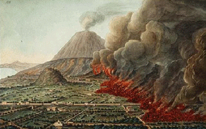
Supposedly, Atlantis was an island civilization "outside the Pillars of Hercules" and thus located in the Atlantic Ocean, where it was destroyed by an earthquake or tsunami (giant wave) about 11,000 years ago. The source of this information (according to Wikipedia) is an account that Plato wrote in 360 BC of information reportedly given to Solon two hundred years earlier by priests he visited in Egypt. Now, if someone told you that 200 years ago someone else had received information by yet another person regarding something that happened 9000 years earlier, would you immediately believe it? A lot of people apparently do; a search of Google for "Atlantis Plato" finds about 327,000 2.8 million matches, and not all of them are academic discussions.
A better question might be whether there really are islands that disappear below the sea. The answer is yes; many do. Some slide slowly downhill, at about the same rate as your fingernails grow, and disappear first beneath the waves and finally beneath the continents. Others suddenly explode, scattering themselves across the world.
Before we go any further, take a look at the following short video introduction by Dr. Anandakrishnan...
Hey, groovy cats. Welcome to my pad. This is the G-Side 10 '70s show, in which we're going to talk about vinyl, bell-bottoms, platform boots, and most importantly, lava lamps.
What? You mean you don't have a lava lamp? Run down to Uncle Eli's right now and get one. I'll wait.
So what do lava lamps and G-Side 10 have to do with each other? Well, they're a wonderful analog for this whole first section of G-Side 10. First section, if you remember from looking at the syllabus, is building mountains. And the short story for building mountains is heat from within the Earth.
We're going to talk about tearing down mountains later on, but right now we're talking about building mountains, and the heat within the Earth is what drives that whole process. And a lava lamp is a beautiful example of that. Let's take a look at it.
What we have here is a glass tube with some water in it, and then these globules of a slightly different material, and at the bottom, we just have a light bulb that produces heat and heats up the bottom of this glass bowl.
All right, I'm going to take this apart here, and just take a look on the inside. I don't know if this is going to be too bright for you, but we have a light bulb underneath here, and its only purpose is to produce heat and to light up this glass bulb a little bit.
These green globules in here get heated up at the bottom, and as they get heated up, they get less dense. This is fundamentally what's happening inside the Earth. Rocks get heated up at depth, because there's a lot of heat trapped inside the Earth. As they get heated up, they get less dense, and just like these lava lamp globules, they rise up like this one's doing right now, up to the surface of the Earth.
When they get to the surface they cool off, and then, just like this one, they sink back down into the Earth and the whole process goes on and on again. This inside the Earth we would call a convection cell. In a lava lamp, we call it cool.
What to do for Unit 3?
You will have one week to complete Unit 3. See the course calendar for specific due dates.
As you work your way through the online materials for Unit 3, you will encounter a video lecture, several vTrips, some animated diagrams (called GeoMations and GeoClips), additional reading assignments, a practice quiz, a "RockOn" quiz, and a "StudentsSpeak" Survey. The chart below provides an overview of the requirements for this unit.
| REQUIREMENTS | SUBMITTED FOR GRADING? |
|---|---|
|
Read /view all of the Instructional Materials |
No, but you will be tested on all this material. |
| Submit Exercise #1: Scientific Literature | Yes, this is the first of 6 Exercises and is worth 5% of your total grade. |
| Begin Exercise #2: Geology is All Around You | Yes, this is the second of 6 Exercises and is worth 5% of your total grade. |
| Take the Unit 3 "RockOn" quiz | Yes, this is the second of 12 end of unit RockOn quizzes and is worth 4.5% of your total grade. |
| Complete the "StudentsSpeak #4" survey | Yes, this is the third of 12 weekly surveys and is worth 1% of your total grade. |
Questions?
If you have any questions, please feel free to email "All Teachers" and "All Teaching Assistants" through Canvas conversations.
Keep Reading!
On the following pages, you will find all of the information you need to successfully complete Unit 3, including the online textbook, a video lecture, several vTrips and animations, and two overview presentations.
Students who register for this Penn State course gain access to assignment and instructor feedback, and earn academic credit. Information about registering for this course is available from the Office of the University Registrar.
Main Topics, Unit 3
Overview of the main topics you will encounter in Unit 3
PLATE TECTONICS II
- Most students find this week to have more new material than any other.
- We always debate how much time to spend on the “science,” “impacts,” and “cute critter” material.
- We usually work fast through the deep-earth and tectonics parts to get to the cute-critter and living-on-Earth parts.
- So suck it up and power through, and things should get easier.
SUBDUCTION
- We saw that the sea floor is made at spreading ridges, such as the one through the Gulf of California that almost reaches Death Valley.
- Sea floor is basalt—just what you’d get if you melted a little bit of mantle rock, and let the melt rise to the top and freeze.
- Although sea floor is generally less dense than mantle, very old, cold sea floor can be dense enough to sink into hot mantle.
- As sea floor is made, Earth does not blow up like a balloon, so sea floor must be lost somewhere.
- Sea floor is lost where it sinks back into the mantle at Subduction Zones. All sorts of things happen there:
- Moving rocks stick, then slip, giving earthquakes;
- As the rocks go down, they are squeezed until the arrangement of atoms in the minerals changes to one that takes up less space; sometimes this rearrangement affects a lot of rock at once, giving an “implosion” earthquake (the deepest quakes may be of this type);
- Mud and rocks and even islands are scraped off the down going slab, piling up like groceries at the end of a check-out conveyor belt (that’s what makes up Olympic National Park);
- Some mud and rock are carried down a bit and then squeezed back out, something like squeezing a watermelon seed between your fingers until it squirts out (you may find some of this squeeze-back-out stuff at Olympic, too);
- Some mud and water are carried even farther down; the water lowers the melting point of the rocks (just as adding water to flour speeds cooking in the oven);
- And a little melt is generated, rises, and feeds volcanoes (Crater Lake, Mt. St. Helens, etc.) that form lines or arcs at continent edges or offshore;
- This melt is richer in silica and poorer in iron than the basalt it comes from, and is called andesite, because the volcanoes in the Andes were formed this way.
A BIT OF REVIEW
- Earth is hot, soft and convecting deep (asthenosphere); colder, harder and breaks in the upper mantle and crust (lithosphere) that are floating on top.
- Lithosphere is broken into a few big plates and many little ones; most “action” is at plate edges.
- Plates pull apart at spreading centers, splitting continents to make basaltic sea floor.
- Plates come together at subduction zones, where cold sea floor is dense enough to sink into hot mantle, where scraped-off materials pile up to make edges of continents (Olympic, etc.), and where water and sediment taken down lower melting point of rock, feeding silica-rich (andesitic) volcanoes.
- Plates also may slide past at transform faults, such as San Andreas.
- Stick-slip of moving rocks makes earthquakes; in subduction zones, collapse of minerals under rising pressure may make very deep quakes.
INTRODUCING VOLCANOES
- Towers of rising rock from very deep (often core-mantle boundary) feed “hot spots.”
- Plates drift over the top, and hot spots occasionally punch through to make lines of volcanoes, which often are oceanic islands (seamounts).
- Hotspots are from the mantle, basaltic, very similar to sea floor.
- A new hotspot looks like a mushroom when rising; the head feeds huge (state-sized) lava flows called flood basalts, and the stem then feeds the lines of volcanoes.
- Hawaii is the classic example.
- Yellowstone also a hot spot; the head of Yellowstone hot spot covered eastern Washington and Oregon with basalt, but Yellowstone's lava is modified coming through the crust so that more silica is erupted than for Hawaii.
VOLCANO CHARACTERISTICS
- In melted rock, silicon and oxygen make SiO4 tetrahedra that try to polymerize (stick together in chains, sheets, etc.) to make lumps;
- Can break up lumps with great heat and much iron (in basalt); makes lavas that flow easily and don’t explode, so Hawaii is a shield volcano, much wider than high;
- Can break up lumps with volatiles (water, CO2, etc.), but when these escape near the surface, lava won’t flow easily and plugs the system, so the next time trapped volatiles explode; form steep stratovolcanoes with alternating flows and pyroclastics (blown-up bits) from explosions.
VOLCANIC HAZARDS
- Include pyroclastic flows, deadly hot, fast rock-gas mixes;
- And pyroclastics, big rocks that fall on your head, or smaller ones that plug up jet engines;
- Also, poison gases, that kill many very quickly;
- And landslides and mudflows, that bury whole cities;
- Tsunamis, giant waves that devastate coasts;
- Climate change, especially cooling from particles blocking the sun and frosting crops;
- Hazards especially dangerous from subduction-zone volcanoes; Hawaii flows mostly block roads and burn houses, usually out-runnable.
PREDICTING VOLCANOES
- Easy to figure out where they are likely;
- Often, but not always, possible to figure out that an eruption will happen in next days or hours;
- Predictions are valuable and have saved many lives, but are imperfect;
- And people get mad if you tell them to leave and then nothing happens;
- United States Geological Survey especially handles predictions in US; highly valuable, and greatly under-appreciated;
- Lots of people continue to build and live where dangers await.
Textbook 3.1: More Plate Tectonics, Crater Lake
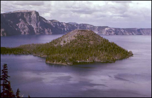
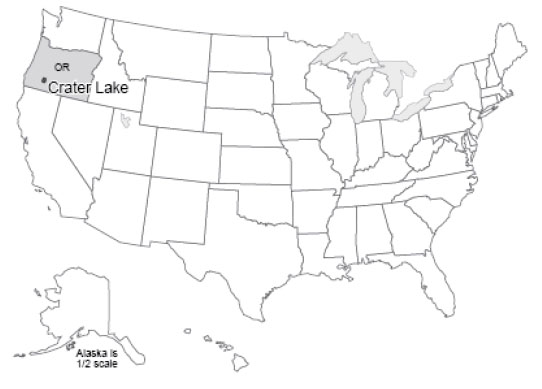
Crater Lake, at 1932 feet (about 600 m) deep, is the deepest and probably the cleanest lake in the United States, and surely among the most beautiful. Crater Lake sits in a great volcanic crater or caldera, 5 miles (8 km) across, formed when Mt. Mazama experienced a cataclysmic eruption about 6600 years ago. That massive eruption laid down ash that is 200-300 feet thick (almost 100 m) on the flanks of the volcano; the ash forms a recognizable layer hundreds of miles away in Yellowstone, and has been identified in Greenland ice cores.
The peak of the volcano had risen more than a mile above its mile-high base on the highlands of southwestern Oregon, but the great eruption removed about 4000 feet (1200 m) from the mountain’s height. About 16 cubic miles (40 cubic km) of rock were blown away. Glaciers had flowed down from the mountain peak; today, the glacial valleys can be followed upward until they disappear at the caldera rim. Although 50 feet (15 m) of snow falls in a typical year now, melting in the summer is sufficient to remove all this snow, and no glaciers exist. A tongue-in-cheek Christmas celebration on Aug. 25 substitutes for the snowbound December event.
After the great eruption, lava flows began building Wizard Island. If the water were removed from the lake, you could see that Wizard Island is roughly 0.5 mile (0.8 km) high. No permanent streams feed into the lake; the great rainfall and snowfall in the crater are balanced by evaporation, and by seepage through the rocks and eventually out the sides of the volcano as springs. With no streams supplying sediment, the lake is exceptionally clear and clean. Aquatic moss receives enough sunlight to grow 425 feet (130 m) below the water surface. When trout were stocked in the lake, freshwater shrimp were stocked first because otherwise biologists feared that the trout would have nothing to eat.
We will discuss volcanoes soon. For now, note that Crater Lake sits atop one of a string of volcanic peaks: Lassen Volcanic National Park and Mt. Rainier National Park preserve other peaks in the Cascades range. Mt. St. Helens, Glacier Peak, and several others are protected federally. These peaks line up in a row, called a volcanic arc, parallel to the coast. A similar arc sits along much of Central America, and forms the Andes of South America. And similar arcs also occur as island chains—the Aleutians, Japan, and others. In fact, the Pacific Ocean is almost entirely encircled by such volcanic arcs, forming the “Ring of Fire”.
Ring of Fire
Sitting offshore of the Ring of Fire is a ring of trenches, which include the greatest depths of the ocean. The trenches parallel the arcs. Some trenches, which sit near continents, are nearly filled with sediments dumped off the continents, but other trenches are almost free of sediment and so have very deep water, to almost 7 miles (11 km) deep. (Figuring out depths often is complicated by sediment. The surface of Death Valley sits more than two miles lower than the adjacent peaks of the Sierra Nevada. But below the salt flats of Death Valley there are sediments as much as three miles thick, materials that were eroded off the tops of the peaks, so the valley has dropped by much more than three miles relative to the peaks.)
The trenches and volcanoes that ring the Pacific are clues to help solve a problem that might have been bothering you from last time. If the sea floor is made at spreading ridges and then moves away, where does it go? The earth is not getting bigger. (Well, meteorites are adding a tiny, tiny bit, but not nearly enough to account for sea-floor spreading.) So, the sea floor must be disappearing somewhere. The oldest sea floor we know of is only about 160 million years old, but the continents contain rocks as old as almost 4 billion years, suggesting that the sea floor is being consumed before it gets very old. (Remember, before the class ends, we’ll discuss how geologists date rocks.) (And remember that when a geologist dates a rock, it involves physics or chemistry but not dinner or a movie.)
Now, a few more clues. Sea floor is made of basalt. This is just the kind of rock that would be made if you melted a little bit of the deep, convecting rocks of the Earth’s mantle, and let that melt float up to the surface and “freeze” (cool until it solidifies). If you take basalt, a little ocean sediment, and some ocean water, and heat them enough to cause a little melting, let that melt come to the surface and freeze, you obtain a rock called andesite with a little more silica and a little less iron and magnesium than basalt, lighter in color and lower in density than basalt. Interestingly, the dominant rock in the walls of Crater Lake, and in the other Cascades and Ring-of-Fire volcanoes, is andesite (named after the Andes, which are part of the Ring of Fire).
If sea floor were plunging under the continents and melting to make andesite, you might expect that occasionally the down going rocks would get stuck and then break free, making earthquakes. Indeed, a three-dimensional map of earthquakes shows that shallow ones occur near the trenches, and the quakes are progressively deeper inland beneath the volcanic arcs. The great 1964 Alaska earthquake was such an earthquake, which happened where rocks of the Pacific Ocean floor plunge to the north under coastal Alaska and the Aleutian chain. The earthquakes there are shallow to the south and deepen to the north, along the down going rocks. The disastrous 2011 Tohoku earthquake in Japan was of the same type.
Careful work on the speed of earthquake waves, which is affected by the temperature of rocks, even provides a picture of cold slabs going down into the hotter mantle. As these down going slabs of rock are heated, with their water and sediment, a little melt is produced. (Interestingly, wet rocks melt at a lower temperature than do dry rocks, just as adding a little water to flour and yeast speeds cooking in the oven.) When the melt rises to the surface and cools, andesite forms, such as is seen around Crater Lake, in the Andes, or in the Aleutian volcanoes.
So, sea floor is made at the spreading ridges. It is hot and low-density initially, but cools and contracts as it gets older and loses heat to the colder ocean water. When the sea floor becomes cold and dense enough, it can sink back into the mantle, and we call the place where it sinks a “subduction zone”. The sinking sea-floor slab drags along a little sediment and water, warms up and melts a little of the slab and some of the sediment, and feeds the volcanic arcs. Old sea floor is going down around much of the Pacific Ocean, and in a few other places, such as beneath the Caribbean and beneath portions of the Alps. Wherever this happens, andesitic volcanic arcs form (see Figure 1).
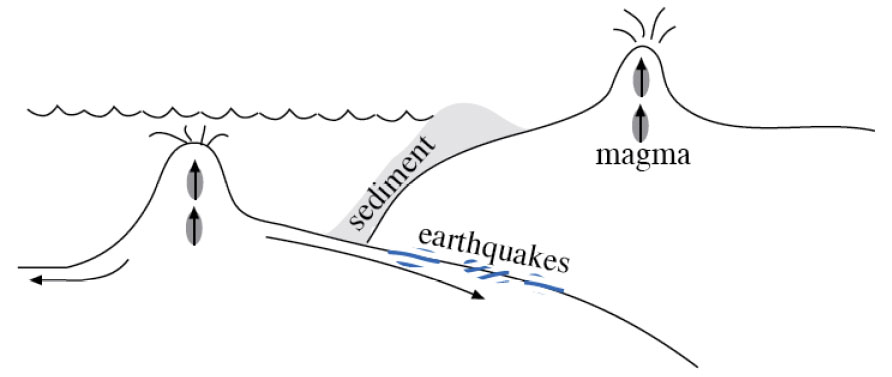
Textbook 3.2: More Plate Tectonics, Olympic National Park
Grocery Shopping at Olympic National Park
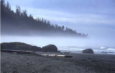
The Olympic Peninsula juts out into the Pacific Ocean, separated from Seattle by Puget Sound. Moisture-laden winds off the Pacific dump more rain and snow on the Olympic than anywhere else in the lower-48 United States. Great old-growth forest trees—Sitka spruce, Douglas fir, etc.—tower up to 300 feet (almost 100 m) above the forest duff, where butterflies flit past crystalline streams and cascading waterfalls. Along the coast, sea lions bask on offshore stacks, while urchins and starfish populate tidal pools. On the “high peaks,” numerous glaciers form and flow downhill. More snow accumulates than melts above about 6000 feet (2000 m). On most mountains, you have to go much higher to find summertime snow, but the huge winter snowfall on the Olympic allows the peaks to be snow-clad year-round despite rising less than 8000 feet (about 2500 m) above sea level.
Olympic National Park is a bit unusual in that it was established as much for biological reasons as for geological—to protect the Roosevelt elk that live on the peninsula. (The elk, named after Theodore Roosevelt, were critical in obtaining national monument status, which was signed by President Theodore Roosevelt. Later, the upgrade to national park status was signed by President F.D. Roosevelt. The Roosevelt elk is the largest of the elk subspecies in the country. Some consideration was given to naming the park Elk National Park before Olympic was chosen.)
The geologic story of the Olympic is somewhat shorter and less dramatic than for most of the national parks. The rocks of the Olympic are almost all young--less than 40 million years. (Again, please bear with us—we will justify these numbers before the course ends!) Before that, the coastline must have been farther to the east, perhaps in North Cascades National Park, and before that even farther east.
The Olympic Grocery
You’re standing at the grocery-store checkout. You put a bag of potato chips on the conveyor, and off they go, followed by a case of Pepsi, three loaves of bread, a watermelon, a box of Ho-Hos, and a sack of potatoes. Then, you realize that there is no bagger working, and that everything is piled up at the end, in a BIG mess. That mess is a good model for the Olympic Peninsula, and the whole coast from there up to Alaska.
The rocks of the Olympic Peninsula are a mixture of sea-floor basalts and of the sorts of sediments that accumulate today off the coast and fill the trench there. Rivers draining the peninsula, and much of the West Coast, carry great loads of sediment down to the ocean. Much of that sediment piles onto sea floor that is slowly moving beneath the continent, a conveyor belt that tries to pull the sediment down to melt and be erupted. Most of those sediments are “scraped off” on the way down, just as at the grocery store. The Olympic Peninsula is the off scrapings. Most of the rocks have been bent and twisted from the attempt to shove them under the continent (think of the potato chips after the Pepsi hits them!). Some of the Olympic rocks have been heated a good bit—the conveyor belt took them down a ways, but they then were squeezed back out.
Our emerging picture of plate tectonics is that the earth is heated inside, softening the deep rocks of the asthenosphere enough that they can move in great, slow convection currents that transfer heat from deep in the earth to near the surface. Heat is conducted through the upper rocks, or is erupted through them by volcanoes, and eventually is lost to space. But, the upper rocks in most places are cold enough that they tend to break rather than flow—they are brittle. These brittle rocks form the lithosphere, which includes the crust and the uppermost mantle. The rocks of the crust in continents are rich in silica (often like andesite in composition), making them light in color and low in density, so that they float on the deeper rocks and are rafted around on them by the moving convection currents. The sea floor rocks in the crust fall between the continents and the mantle in composition, and typically are basalt. The sea-floor rocks are usually intermediate between continents and mantle in density as well, but if the sea-floor rocks are cold enough, they will be slightly denser than hot mantle. Then, the sea-floor lithosphere consisting of the sea-floor crust plus a little attached mantle will sink into the asthenosphere of the deeper mantle.
The lithosphere is broken into a few big rafts, called plates—eight big ones plus some smaller ones, depending a little on how you define “big” and “small”—that float around on the convection cells below. Plate boundaries include spreading ridges where the plates move apart (remember Death Valley and the mid-ocean ridges), and subduction zones where the plates come together and one side sinks under the other. You might imagine that if plates can come together or pull apart, they must be able to slide past each other as well, which is what happens at the San Andreas Fault in California (we met it when we were discussing earthquakes); such slide-past boundaries are often called transform boundaries or transform faults (see Figure 1). You might worry that sometime, two continents would run together; we’ll meet that soon when we visit the Great Smoky Mountains.
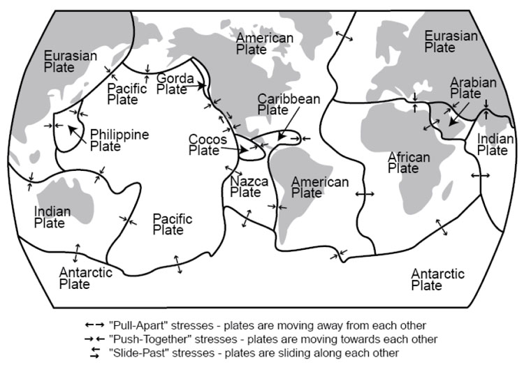
Plates shown are as follows:
- Eurasian Plate
- Indian Plate
- Antarctic Plate
- Pacific Plate
- Philippine Plate
- Gorda Plate
- Cocos Plate
- Nazca Plate
- Caribbean Plate
- American Plate
- Arabian Plate
- African Plate
The lithosphere and asthenosphere are solids, but a little melted rock may occur in the asthenosphere, and leak out where plates are pulled apart, feeding basaltic volcanoes. And the water taken down subduction zones can stimulate a little melting, feeding andesitic volcanoes that line up in arcs above the downgoing slabs of the subduction zones; examples of these volcanic arcs include the Cascades, Aleutians, and Andes. Continents are a collection of scum from melting of the mantle, too low in density to sink back into the mantle. Continents grow as the conveyor belt from the mid-ocean ridge to the subduction zone brings in sediments and islands and what-not, or when andesitic volcanoes are erupted on continents, or when andesitic volcanoes form an arc offshore that then collides with a continent (sometimes the site of subduction moves, and the volcanoes find themselves on the conveyor belt, or they hit a different continent). Because much of the sediment comes from the continents themselves, the growth of continents is not fast—material eroded from the continents falls on the conveyor and is added back at Olympic or erupted back at Crater Lake.
Textbook 3.3: More Plate Tectonics, Mt. St. Helens
Mt. St. Helens & Volcanic Hazards; More to Worry About
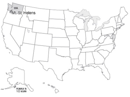
Mt. St. Helens, in southwestern Washington, was in some ways the queen of the Cascades Range. Beautifully symmetric, snow-capped, it had been called the Fujiyama of the Pacific Northwest. Scores of people flocked to St. Helens’ flanks to hike, camp, ski, and generally enjoy the environment. And all that changed in 1980.
Mt. St. Helens has also been the most active of the Cascades volcanoes over the most recent centuries. In early 1980, the volcano clearly was “waking up”. Earthquakes shook it almost continuously, including special “harmonic tremors”, similar to those sometimes caused by fluid flow in pipes, which showed that liquid rock was moving up from below. Small eruptions occurred, and hot springs and fumaroles (steam or gas vents) became increasingly active. The north side of the mountain was bulging, blowing up like a balloon as the magma moved into it. Scientists were scrambling to study the volcano, and predict its course. They recommended evacuation for safety, and most people (but not all, including some scientists) were moved out of the way. Penn State professor Barry Voight warned that the huge bulge on the north side of the volcano would fail, unleashing a giant landslide and a devastating eruption.
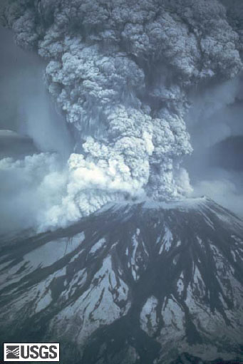
On the morning of May 18, 1980, Professor Voight’s prediction came frighteningly, awesomely true. The bulge failed. A large earthquake either caused, or was caused by, failure of the north side of the mountain in a giant landslide. Like pulling the cap off a hot, well-shaken soda bottle, the liquid beneath flashed into froth, driving an eruption 12 miles (20 km) high. A shock wave knocked over full-grown trees in an area 20 x 10 miles (32 x 16 km). The landslide eventually poured more than 100 million cubic yards of rock material down the Toutle and Cowlitz Rivers, raising the floor of the North Fork of the Toutle as much as 600 feet (200 m), and sweeping roads and houses downstream, with the debris reaching and clogging the shipping channels of the Columbia River. The Toutle floor now sat higher than the smaller streams that fed it, and lakes began to form; only quick work by the Army Corps of Engineers prevented those lakes from overtopping the mud damming them, cutting quickly down through it and releasing further floods.
All told, the Corps of Engineers spent $250 million clearing shipping channels and doing other critical work. Approximately 60 people were killed in the blast and landslide; some were buried under hundreds of feet of steaming mud and their bodies were never recovered.
President Jimmy Carter scowled at the disaster from a helicopter. Disaster planners pontificated. And in the shadows of the other Cascades volcanoes, people continued building houses in regions of known volcanic hazard.
The Mt. St. Helens Volcanic Memorial today has little in common with conditions pre-1980. The center of the volcano was more than 1/2 mile (nearly 1 km) lower after the eruption than before, with the missing rock spread over the surrounding countryside, forming a visible layer as far as 900 miles (1500 km) away. (Professor Alley and his wife Cindy were driving in Alberta, Canada during the summer of 1980, on a great, seven-week, see-the-national-parks-in-a-Chevette-with-a-tent honeymoon. A secondary eruption of Mt. St. Helens put enough ash in the air to halt traffic because of reduced visibility, hundreds of miles from the volcano.) Many of the trees knocked over by the blast still lie there—hundred-foot-long toothpicks pointing in the direction of the searing winds of the blast. Among these dead trees, however, salmonberry and fireweed and young firs are pushing skyward, elk are grazing, and coyotes search for rodents. In some places, salvage-logging of the downed trees was allowed. In some of those places, it appears that erosion has run amok, large gullies have developed, and the return of vegetation has been greatly slowed. In the crater of the volcano, a new lava dome is forming, squeezing slowly upwards like toothpaste from a very hot tube, and amazingly, a glacier sits behind it, fed by the great snowfall and the avalanches down into the crater. At night, the dome glows dull red. (It may seem weird that we focus on an event from before most of you were born, from 1980, when larger eruptions have happened more recently. But, St. Helens is the largest recent eruption in the lower-48 of the US, the easiest eruption site to get to and observe, and it really is awesome. The elder Alley daughter, Janet, was a ranger there one summer, and recommends that you take in Ape Cave if you visit, but the real goal is to see just how immense the eruption's effects really were.)
Types of Volcanoes
Volcanoes occur where melted rock rises to the Earth’s surface. Almost all volcanoes are associated with one of three settings—pull-apart margins (spreading ridges), push-together subduction zones, and hot spots. We’ve already met the volcanoes at spreading ridges, where low-silica basalt is erupted, and those producing higher-silica andesite at subduction zones.
Hot spots are creatures of another type in the zoo of Earth’s features, and especially interesting creatures at that. Deep in the warm, soft, convecting mantle of the planet, in some places a rising tower of hot rock forms and then lasts for quite a while. Some of these rising towers may come all the way from the base of the mantle where it meets the core; others may start shallower. (To see something that looks vaguely like the formation of such a hot spot, go back and view again the “lava lamp” film of Dr. Anandakrishnan in the introductory material to this unit.)
As the lithosphere drifts overhead, the hot spot may “punch through” to make a volcano. Then as the lithosphere carries that volcano away, the hot spot punches through a new place to make a new volcano. Rising melt behaves a little bit like people driving cars, who use one road or the other but not the lawn in-between; hot spots often make a string of separate volcanoes rather than a continuous line or ridge, by coming up through one hole in the lithosphere for a while and then switching to a different one. Hot spots bring melt from deep in the mantle, and so normally make basaltic volcanoes (it takes fairly subtle and sophisticated chemistry to tell the difference between hot-spot basalt and sea-floor basalt from spreading ridges). However, where a hot spot pokes through a continent rather than through sea floor, silica from the continental rocks may mix with the melt to increase its silica content, as at Yellowstone.
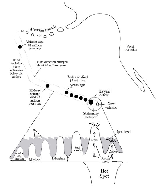
When a new hot-spot first rises from below, the top must push through the mantle and crust, and the resistance of the stuff in the way of the rising column causes its top to spread out like the head of a thunderhead, or of a mushroom cloud from an atomic bomb, or of a blob in a lava lamp, and for the same reasons. When that wide head reaches the surface, immense lava flows can be produced that spread across state-sized areas and bury them hundreds of feet deep. Much of central and eastern Washington and Oregon is buried by the “flood basalts” from the head of the Yellowstone hotspot. As the continent has moved across the hot spot after it reached the surface, a string of volcanoes erupted, including Craters of the Moon National Monument in Idaho. The hot spot now fuels Yellowstone (which is why it is called the Yellowstone hot spot…a lot of this stuff isn’t that difficult!).
The flood basalts from the Hawaiian hot spot have been subducted beneath the Aleutians, but the string of volcanoes that has formed since from the hot spot can be traced from the Aleutians south all the way to the volcanically active big island of Hawaii. A new volcano, Loihi Seamount, is growing undersea just off Hawaii as the big island slowly drifts away, and Loihi will someday (not in our lifetimes!) be the new, volcanically active “big island” while the volcanoes of the current big island die and the island slowly erodes away.
So, melt can leak up from below to feed volcanoes at spreading ridges, at hot spots, and above subduction zones. But very different volcanoes develop: sea floor from spreading ridges; flood basalts and then wide, not-very-steep Hawaii-shaped volcanoes from hot spots; and, steep Mt. St. Helens-type volcanoes above subduction zones. The type of volcano that develops at a place depends on a host of factors: temperature, composition, supply of melt, duration of supply, and several others. We will focus on two: composition (how much silica) and volatile content (mostly how much water, although carbon dioxide, hydrogen sulfide, and other compounds that are gaseous under earth-surface conditions may be present and classified with volatiles). Silicon and oxygen get together in melt to form the material we call silica. Left to itself, each silicon atom will be surrounded by four oxygen atoms, which form a tetrahedron (a little pyramid). But, give them a little time, and the tetrahedra will start sticking together, or polymerizing, into chains and sheets and bigger clumps, with some oxygens serving in more than one tetrahedron. If these lumps get big enough, they are minerals and the melt has solidified.
When the lumps are present but not too big, the melt is like lumpy oatmeal—it doesn’t flow very well. There are three ways to get rid of the lumps: make the melt really hot; fill the melt with iron, magnesium and other elements that interfere with the tetrahedra polymerizing; or, fill the melt with volatiles that interfere with the tetrahedra polymerizing. When polymerization is low, the melt flows easily. Lava comes out of the volcano quietly, without making big explosions, and flows easily and far from the mouth of the volcano. In extreme cases, flows may be nearly horizontal and cover much of a state, as in the flood basalts. If the melt spreads almost as easily as flood basalts, the lava will have very slight slopes of only a few degrees, forming shield volcanoes (they look like a warrior’s shield lying on its side) such as Hawaii. Hawaiian lavas and flood basalts flow easily because they are hot and are high in iron and magnesium.
When volatiles remove the lumps, a different situation develops. This is because the volatiles will only stay in the melt under high pressure. Just as a bottling company can force CO2 into the water of a soft drink under high pressure, but the CO2 escapes as the pressure falls when you open the can, the water and CO2 and other volatiles stay in the melt under high pressure down in the Earth but escape when the melt gets close to the surface.
Silica-rich melts usually form with many volatiles. Remember that in subduction zones, wet sediment dragged down the trench releases water (and carbon dioxide and others) that promote melting. When the melt (called magma when it is in the Earth and lava when it reaches the surface) nears the surface, the lower pressure allows the volatiles to bubble off and escape into hot springs, geysers, etc. (Note that most of the fluids that come out of such hot springs are rainwater that has circulated down into the earth, but some of the fluids may be “juvenile” waters from the magma below.) Silica-rich, relatively cool lava that has lost its volatiles flows only with great difficulty. It may emerge from the volcano and flow a little ways as a very thick, slow-moving, steep flow. It may not even flow, but simply form a dome directly over the volcanic vent. And, it may “plug the system” when it solidifies. Then the stage may be set for a big explosion.
The next melt that rises in the volcano cannot follow the same path, because hardened lava above prevents escape. The gases are trapped, and pressure builds up. The volcano is like a hot, shaken pop bottle. If the top is removed, either by an opener (say, a landslide as in the case of Mt. St. Helens, or a crack opened by an earthquake) or just because the pressure becomes great enough to blow the top off, the sudden release allows the soda, or the magma, to come foaming out. A good champagne may fountain to many times the bottle’s height, and blast the cork across the room. A powerful volcano may blast ash higher than jet flight paths. The melt really does get foamy, and that foam hardens into little glass shards. The ash layer deposited by Mt. St. Helens, which stopped drivers hundreds of miles away, was mostly of such little glass shards, although torn-up bits of the former volcano were also included.
The andesitic volcanoes of the Ring of Fire are typically stratovolcanoes, formed of alternating layers of thick lava flows and of pyroclastics—things thrown through the air by the volcano. The steepness comes from the flows, which cannot get far from the vent. Some of the andesitic volcanoes, including the rebuilding Mt. St. Helens, include plug-dome elements, the oozing lava staying right above the vent.
So, the major volcanoes for our purposes are the quiet, basaltic shield volcanoes of hot spots, the quiet basaltic rift volcanoes of spreading ridges, and the steep, scenic, explosive, andesitic volcanoes of the Ring of Fire. Other types exist, notably cinder cones thrown up by typically minor eruptions tossing pyroclastics short distances. Also, hot spots or rifts trying to poke through continental rather than oceanic crust may produce explosive silica-rich volcanoes. But if you understand shields and stratovolcanoes, you will be a long way toward understanding volcanism.
Volcanic Hazards and Prediction
People who live near volcanoes should be worried about them. Volcanoes can do much damage. The volcanic-triggered landslide that buried Armero, Colombia in 1985, and the eruption of Mt. Pelee on the island of Martinique in the Caribbean in 1902, each killed about 30,000 people. Other volcanic disasters bring the human death toll to perhaps 200,000 over the last few centuries. Compared to war, disease, or even automobile accidents, this is not a terribly high toll; however, the 200,000 people directly involved almost certainly would have appreciated enough warning to get out of harm’s way. One of the goals of modern geology is to predict volcanic hazards and to save lives and property by doing so.
There are many hazards to worry about. These include:
- Pyroclastic flows. Often, a volcano will produce a dense mixture of ash and hot gases (up to 1500oF or 800oC, and including poisons such as hydrogen sulfide). This potentially deadly mix is either forced away from the volcano (the lateral blast released by the landslide on Mt. St. Helens) or forced upward to then collapse and flow under gravity, at speeds up to hundreds of miles (hundreds of km) per hour. The deaths on Martinique were caused by such a “glowing cloud” (nuee ardente in French, where the only survivor in the whole city of St. Pierre was a lone man locked in a heavily built prison.)
- Pyroclastics. If the heat and gases don’t get you, the rocks might. People have been killed by rocks up to car-sized or bigger, called bombs, that were thrown from volcanoes. Having a car-sized rock fall on your head from a great height is not recommended. Even fine-grained ash deposits may bury and kill nearby crops. Jet aircraft are endangered by flying into ash at high speeds. From 1980-1995, ash caused an estimated $200 million in damage to the 80 aircraft that flew into eruption clouds, mostly over the Pacific. Of those, seven lost engine power and came close to crashing. Improved monitoring of eruption clouds, to provide warnings and steer the airplanes into safer air, has greatly reduced damages since then. However, to avoid crashes from the 2010 eruption of Eyjafjallajökull in Iceland, literally millions of passengers were stranded in Europe and elsewhere as flights were suspended over weeks.
- Poisonous gases. Sometimes, a volcano will smother or poison victims without burning them up. Pompeii and Herculaneum, the cities entombed by the eruption of Vesuvius in the year 79, have proven to be archaeological treasures, but certainly would be considered tragedies by the many people killed there and by their relatives. The people apparently were killed before they were buried, and they were not “fried” by intense heat; they probably were killed by poisonous gases and then buried by falling ash. Lake Nyos in Cameroon rests in a volcanic crater. Volcanic CO2 feeds into the bottom of the lake, but the lake typically remains stratified and does not mix. The CO2 thus builds up in the deep waters. In 1986, the lake overturned, perhaps because a landslide from the crater wall temporarily mixed the water at one end. The escaping CO2 made a great fountain, filled the crater, and then flowed down outside the crater, killing about 1700 people through some combination of suffocation and poisoning. The lake now is re-stratified and building up CO2 again; schemes to vent the CO2 safely through a huge pipe are working, but additional work may be needed to prevent a repetition.
- Landslides and mudflows. These are less dramatic, but more dangerous cumulatively, than the explosive events. Most of the andesitic volcanoes are steep, and many are capped by very large glaciers. Mt. Rainier, for example, has 25 times as much glacier ice as Mt. St. Helens had, ready to melt and trigger mudflows after even a minor eruption. The tragedy at Armero arose from a minor eruption that triggered a big landslide. It is worth noting that Armero was built on a known, older debris-flow deposit.
- Tsunamis. A large undersea eruption may move a lot of water. This water movement may form into a tsunami, a long, low wave that moves very rapidly. When a tsunami nears a shore, the water “piles up” into a short, steep wave that may be 100 feet high. Such waves, which also can be caused by landslides or earthquakes, may affect coasts hundreds of miles (or kilometers) from the source. The largest eruption of historical times, that of Krakatau in Indonesia in 1883, killed thousands of people on neighboring islands in this way. The great Tohoku earthquake of 2011 in Japan made a tsunami that was over 130 feet high (40 m) at its worst, where it came ashore where people lived. We’ll look more at tsunamis soon.
- Climate change. A large volcanic eruption puts a lot of sulfur gases into the stratosphere, together with ash and other materials. The sulfur eventually forms sulfuric-acid droplets, which typically remain aloft for one to a few years before falling out across much or all of the planet. While they are aloft, the sulfuric-acid droplets block some of the sunlight, cooling the planet a little. This can produce killing frosts during normal growing seasons, leading to widespread starvation in sensitive regions. The Tambora eruption of 1815 is associated with the starvation “year without a summer” of 1816. Ice cores from Greenland, Antarctica and elsewhere record volcanic fallout (the ash and sulfuric acid are preserved in the ice) and the temperature (from certain indicators including the isotopic composition of the ice), and show that big eruptions typically are accompanied by a cooling of a good chunk of a degree for a year or two, with more cooling in some places and seasons, and less in others. This isn’t a huge change, but when one killing frost can cause starvation, it may be too much. If many volcanic eruptions occurred in a short period of time, it might produce major climate changes; however, volcanism doesn’t seem to get organized—there is no way for a volcano in Alaska to tell a volcano in Indonesia that it is time to erupt. (Volcanoes also release carbon dioxide, which tends to warm the climate, as we will see later in the course. However, not a lot of carbon dioxide comes out in one volcanic eruption. If all the world’s volcanoes started erupting a lot faster, maybe twice as fast as normal, enough carbon dioxide would be released in “only” a few hundred thousand years to start warming the world notably. Over really short time scales of years to centuries, more volcanism would cause more cool years, because the sun-blocking effect would be much bigger than the warming-from-carbon-dioxide effect. If you turned up volcanoes, you would get first cooling and then warming.)
Predicting Eruptions
So, we wish to predict when and where volcanoes will endanger people. Various things can be done. For problems such as climate change, the best we can do is to know that every few years or decades some region is likely to experience difficulties with crop production because of eruptions. The solutions are either to maintain a little excess food to feed those endangered people, or to ignore them and figure that some will starve to death. (Many other climate changes, including droughts, give us the same choice. Despite the apparent silliness—either we stockpile food and figure out how to distribute it to the needy, or we let people starve to death—it is surprising how often starving to death is the outcome.)
For tsunamis, an operational warning system now exists around the Pacific and in some other places. If a tsunami is detected, or if seismographs detect the shaking caused by a large earthquake, landslide, or volcanic eruption, warnings are relayed to coastal regions likely to be affected, in time to allow evacuation. Such a system is being assembled for the Indian Ocean following the tragic 2004 earthquake-generated tsunami that killed approximately 250,000 people.
One way to avoid volcanic hazards is to stay out of harm’s way. Geologists can map regions where large pyroclastic chunks have fallen, or where landslides have occurred, with great confidence. Using carbon dating of logs caught in debris flows, or tree-ring dating of those growing on landslides (just hang on; explanation of such things will come later), we can determine the recurrence interval—how often do such disasters happen? Today, whole subdivisions are being built around Mt. Rainier National Park in the growing Seattle-Tacoma region that have a danger of destruction by landslide many, many times higher than their danger of destruction by fire. Roughly 200,000 people work, and more than 100,000 people live, on debris-flow deposits less than 10,000 years old, with more people coming. The homeowners will all carry fire insurance, but few if any are insured against the volcano; presumably, if they survive the next volcanic disaster, these people are counting on disaster aid from the rest of the country to bail them out.
(Much argument is attached to sending disaster aid for predictable events, even if they are not very common. Should those who wish to live in beautiful but risky areas carry insurance to pay for their gambles? Increasingly, planners are saying “yes,” and much effort is being devoted to quantifying the hazards so that insurance rates can be set wisely. This applies to such things as hurricanes along coasts, earthquakes along faults, and floods along rivers. Geologists have an important role to play in learning hazards and thus setting rates.)
With sufficient care, volcanic eruptions can be predicted with some confidence. Volcanoes usually give off many signals before an eruption: the ground swells as magma moves up; the moving magma and the swelling ground create earthquakes and especially the distinctive harmonic tremors of fluid flowing in a pipe; small eruptions occur; gaseous emissions increase as the magma nears the surface and then cease if the system becomes plugged and builds up pressure for an explosion. A monitoring program of seismographs to detect earthquakes, repeat surveying of laser reflectors set on the mountain to watch for deformation patterns, gas sampling, and perhaps photographic or other sensors to watch for landslides, can track a volcano’s behavior and allow timely warning. Monitoring of ground shape from space can even see the changes in volcanoes as magma moves under them. The eruption of Mt. St. Helens was predicted well enough to save hundreds of people including the residents of a YMCA camp. The eruption of Mt. Pinatubo in the Philippines in 1991, which heavily damaged the U.S. military bases there, was predicted accurately, allowing timely evacuation and saving tens or hundreds of thousands of lives of residents and military personnel.
The burden of predicting eruptions is very high. Imagine telling an Air Force general to abandon his or her assigned duty post, spend a few hundred thousand dollars to move tens of thousands of people, and then having nothing happen—the general, and all of those people, would be very unhappy. Imagine instead deciding to wait another day to be sure, and having all of those people (possibly including you) killed. Important as this is, predicting disasters is not for the faint of heart.
The Mt. St. Helen’s eruption was a small one compared to many others. Each of the major eruptions of Yellowstone moved about 1000 times more material than Mt. St. Helens did, and Yellowstone’s eruptions were not the largest known. Small eruptions are more common than large ones. But, eruptions ten times as big as Mt. St. Helens are perhaps five times as rare, but not ten times as rare. This means that, as for earthquakes, most of the “work” done by volcanoes is achieved by the few big ones, not the many little ones.
Virtual Field Trips
Join Dr. Alley and his team as they take you on "virtual tours" of National Parks and other locations that illustrate some of the key ideas and concepts being covered in Unit 3.
TECH NOTE
Click on the first thumbnail below to begin the slideshow. To proceed to the next image, move the mouse over the picture until the "next" and "previous" buttons appear ON the image or simply use the arrow keys.Virtual Field Trip #1: Crater Lake
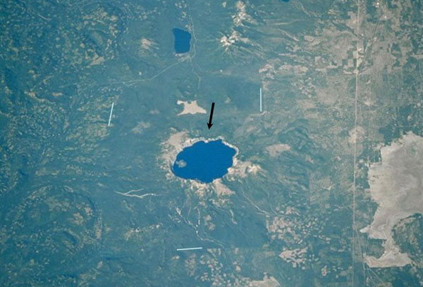
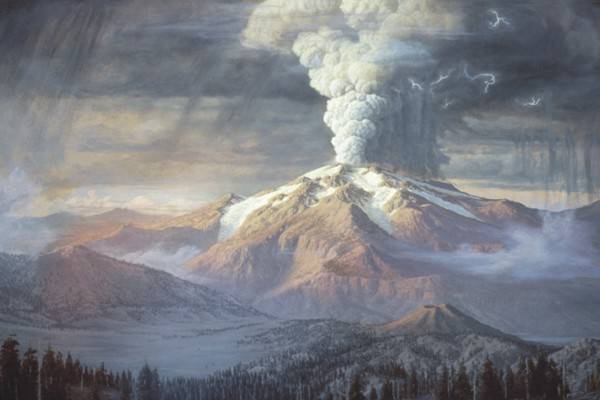
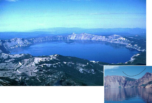
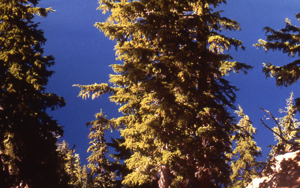
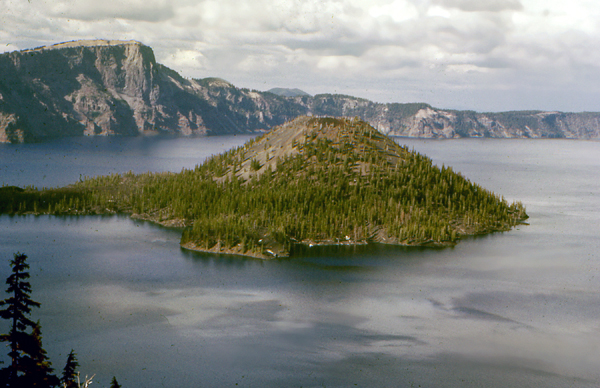
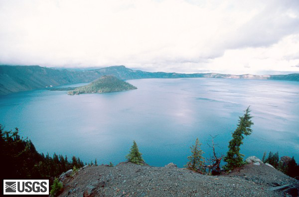
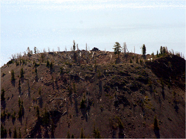
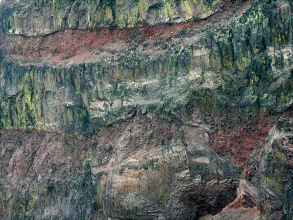

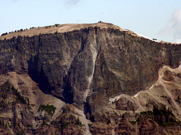
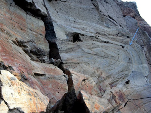
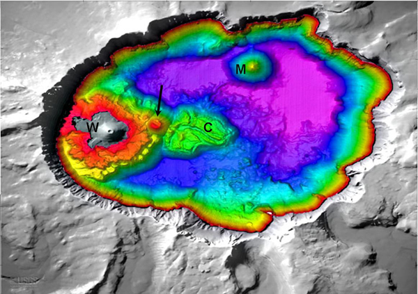
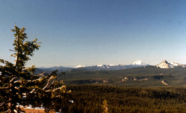
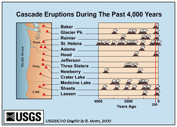
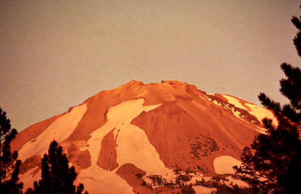
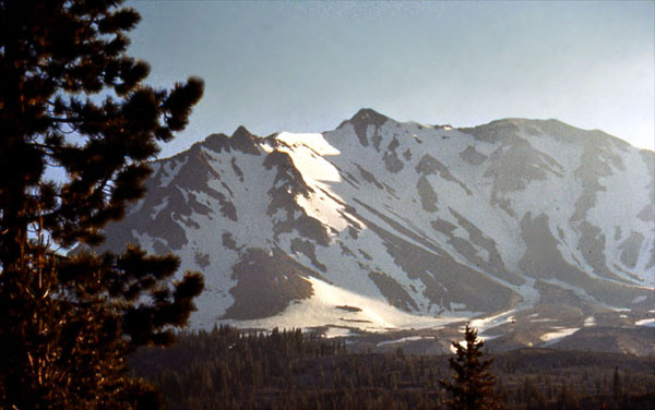
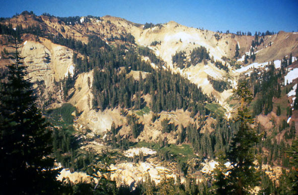
Image 1: A view of Crater Lake from the sky. Crater Lake, which is about 6 miles across, is the big blue circle in the middle of this satellite photograph. A catastrophic eruption from a towering, snow-capped volcano called Mt. Mazama blasted a recognizable layer as far as Nebraska. The remnants of the volcano then collapsed into the hole left behind. As the hole cooled and water collected, Crater Lake formed. This NASA photograph is from the USGS archives. Because logging and other uses continue outside the park but not in, careful examination will show you the outline of the park.
Image 2: Paul Rockwood’s painting of the cataclysmic eruption. Here is artist Paul Rockwood’s reconstruction of how the peak might have appeared 6600 years ago, early in the cataclysmic eruption. Notice the glaciers flowing down the sides. The USGS hosts this image courtesy of the Crater Lake Natural History Association.
Image 3: Two images. Top, an oblique aerial view of lake. Bottom, a close-up view of the lake. After the eruption, this USGS photo by W.E. Scott shows the lake in an oblique aerial view (out the window of a plane). On the right, a close-up view (USGS photo by Ed Klimasauskas) shows the “U”-shaped valley of a former glacier, which flowed down from the peak that is no longer there (the outline flying in the sky emphasizes the “U” shape). Later in the semester, we’ll learn why glaciers make “U”s while rivers make “V”s.
Image 4: Now, we begin some pictures by Prof. Alley. Here is a view looking up one of the valleys that once carried glaciers down from the peak of Mt. Mazama. If we had stood in the same place before the eruption, this whole picture would have been filled by a massive, snow-capped volcano, with a glacier flowing down the valley towards you and to your right, following the magenta arrow.
Image 5: This is Crater Lake from the rim of the crater. The trees are silhouetted against the water, it’s not sky! Crater Lake probably has the cleanest water of any major lake in the country.
Image 6: Another shot of trees against the crystal water of Crater Lake. There are no rivers to carry mud into the lake; the rivers all drain away down the sides of the volcano. Rain and snowmelt evaporate from the lake, or leak through the rocks to emerge as springs on the side of the volcano.
Image 7: A person sliding down a hill of snow at Crater Lake. Crater Lake gets lots of snow, which melts to fill the lake, and contributes to the fun at the park.
Image 8: Crater Lake with Wizard Island in the middle. After the cataclysmic eruption, additional volcanism began building Wizard Island, which rises about half a mile above the bottom of the lake.
Image 9: A wide angle view of Wizard Island in the Lake. Photo by Lyn Topinka.
Image 10: Top of Wizard Island showing the crater left by the “little” volcano that built the island. Zooming in, you can see the crater left by the “little” volcano that built Wizard Island. Although Wizard Island looks small in Crater Lake, and this crater is just a small part of Wizard Island, notice how big the crater is compared to the trees growing on it. How big something looks can sometimes be misleading!
Image 11: Layers of lava from Crater Lake. We call these big, steep volcanoes of the Cascades and the Ring of Fire “stratovolcanoes”, and say that they are made of layers of lava flows and pyroclastic pieces thrown in eruptions. But how do we know what a big volcano is made of inside? Drilling holes is expensive and provides a narrow window. Geophysicists can learn some things, and geologists can watch volcanoes growing or look where streams have eroded volcanoes. But here at Crater Lake, the insides of the volcano are laid bare. This picture is a telephoto shot of a piece of the cliff above the lake, showing lava flows and pyroclastic layers stacked a couple of hundred feet high. These are strata, and this is a stratovolcano.
Image 12: Llao Rock. Not too long before the cataclysmic eruption, a small eruption threw white pumice that covered the floor of a valley running down from the peak. Then, a big lava flow from the peak filled the valley, giving us what is now known as Llao Rock. The white arrow is pointing to the pumice, with Llao Rock outlined in black. Notice the wonderful layering in the volcanic rocks below the pumice, beside the big red “L”. The next picture is the same view, without the labels.
Image 13: Another picture of Llao Rock.
Image 14: Main lava fold visible in a road cut. Here’s one of the lava flows that make up Mt. Mazama, from before the cataclysmic eruption. You can see this one in a road cut on the southeast side of the lake, where the Rim Drive crosses Dutton Ridge. The thick, viscous lava didn’t flow easily, and some parts flowed faster than others, making the interesting folds that you see in the rock. The arrow points to the main fold—let your eye follow the layers at the end of the arrow, and you’ll see that the layers bend around. Looking carefully, you may see wiggles within the wiggles in the layering. We will see later that folds such as this are also found in metamorphic rocks, but the minerals and other things are quite different.
Image 15: Water depths at Crater Lake. Everything above the water is gray-white, all below is garishly colored, with red the shallowest water, then orange, yellow, green, blue, and on to purple/violet in the deepest water (to 1949 feet deep). Minor volcanic activity after the main eruption produced features, including Wizard Island (marked with a “W”), which sticks above the water. A later eruption produced lava flows (the Central Platform, “C”) coming from a small volcanic dome (at the end of the arrow). Another volcanic peak in the crater is evident below the water (Merriam Cone, marked “M”). From the USGS at http://craterlake.wr.usgs.gov/bathy_images.html
Image 16: Dr. Alley's view from Crater Lake, looking along the Cascades Range of similarly explosive volcanoes.
Image 17: The history of eruptions of the main Cascades volcanoes of Washington, Oregon, and northern California over the last 4000 years, as compiled by the USGS. Each volcano icon indicates an eruption or closely spaced series of many eruptions. The record of written observations is especially good to the right of the red line on the far right, but use of tree-ring dating and other techniques makes all of this highly reliable.
Image 18: Lassen Peak, in Lassen Volcanic National Park of northern California. Lassen, shown here reflecting a beautiful sunset, erupted about a century ago. Lassen is quite similar to the other Cascades peaks, and remains capable of eruptions.
Image 19: Another view of Lassen Peak
Image 20: Yet another view of Lassen Peak
Image 21: Bumpass Hell at Lassen Volcanic National Park. This Yellowstone-like, hot-spring-and-sulfur site attests to the volcanic heritage of Lassen.
Image 22: Mt. Ruapehu, New Zealand. If this peak looks like those of the Cascades that haven't blown up to make a lake, you're getting it. Ruapehu is part of the Pacific Ring of Fire, and has the same basic origin as the Cacades.
Virtual Field Trip #2: Olympic National Park
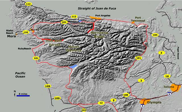
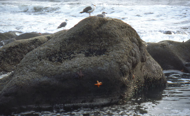
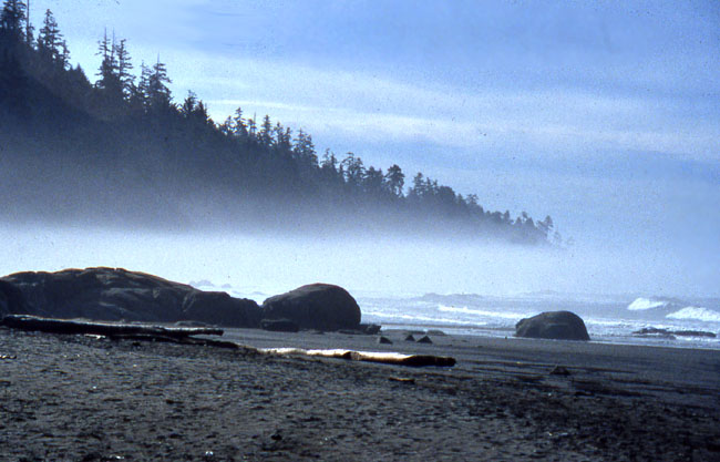
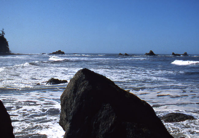
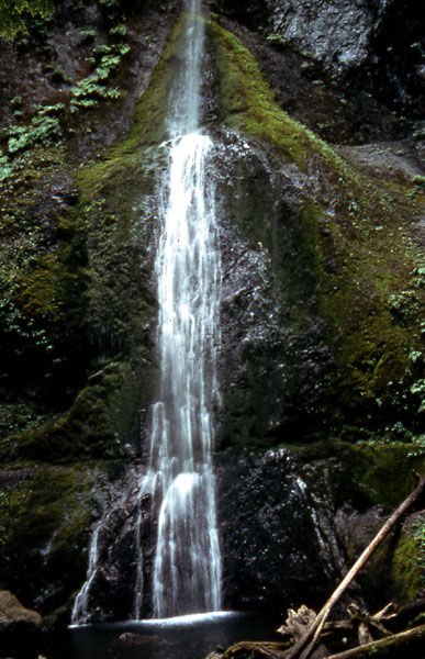
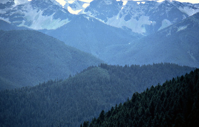
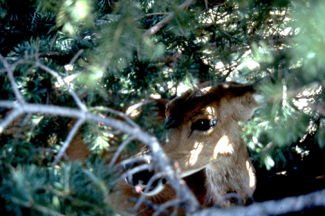
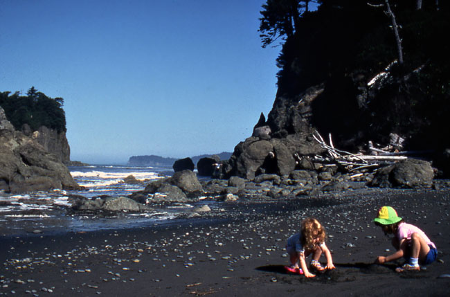
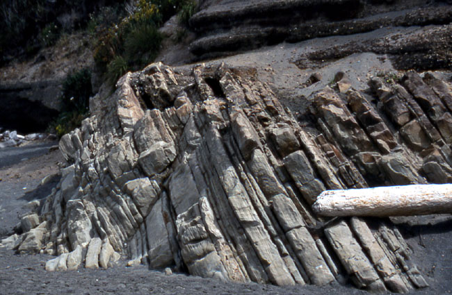
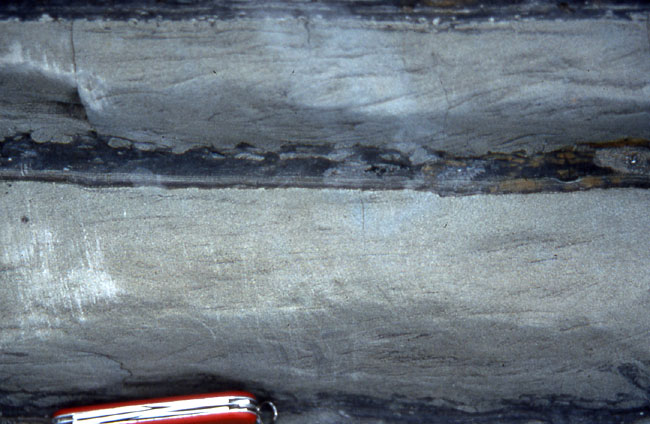
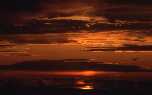
Image 1: Map of Olympic National Park. Welcome to your Olympic National Park tour! Jutting out into the Pacific Ocean, just west of Seattle in Washington, is this extraordinarily picturesque park, where the Pacific's moisture-laden winds dump rain and snow more rapidly than anywhere else in the lower-48 states. It’s also home to some of the country's greatest old-growth forests (with trees towering up to 300 ft), crystalline streams, cascading waterfalls, rugged coastlines replete with basking sea lions, tidal pools filled with urchins and starfish, and high peaks that sport active glaciers. Known more for its biology than its geology, Olympic is also the home for the largest subspecies of elk in the country, the Roosevelt Elk, which the park exists to preserve (thanks to, you guessed it, the Roosevelt’s). Photos by Richard & Cindy Alley, map by USGS.
Image 2: Seagulls sitting on rock near Kalaloch at the SW edge of Olympic National Park. The Olympic Peninsula features beaches on three sides. Gulls and starfish grace the Pacific Coast near Kalaloch at the southwest edge of the national park, shown here.
Image 3: Fog along the coast of Olympic National Park. Cool waters offshore favor the formation of fog, which reduces evaporation from the trees. Combined with a general lack of hurricanes, tornadoes, and ice storms, this probably contributes to the ability of west-coast temperate-rain-forest trees to grow roughly twice as tall as their east-coast equivalents. Cutting of trees may increase wind flow and reduce fog, making it difficult for tall forests to re-establish themselves in some places, a problem raised with cutting of redwoods to the south.
Image 4: Coast of Olympic National Park with rocks jutting out of the water. The young, rocky coast is attacked by the waves of the Pacific, which exploit cracks and layers in the rocks to carve out interesting shapes.
Image 5: Sea Cave. A strong rock between cracks may be left standing in the waves as the rocks along the cracks are worn away. Continued attack by waves sometimes cuts through the remaining rock to make a sea cave, such as is seen here.
Image 6: Rainforest growth found inland at Olympic National Park.
Image 7: Epiphytes – plants growing on plants found inland. One hallmark of rainforests is the lush growth of epiphytes. This is a very difficult niche in which to live in climates with droughts, because lack of soil leads to lack of water-holding capacity; this difficulty is much smaller in a rainforest.
Image 8: Sol Duc Falls. The abundant rainfall feeds beautiful streams, some of which host important salmon runs. Sol Duc Falls is shown here.
Image 9: Marymere Falls, shown here, is almost ninety feet high. Don’t try to memorize these details--but take the pictures along if you’re going to visit so you know what to see. Instead, look for the big-picture geology, coming soon.
Image 10: The higher peaks in the park host glaciers. Peaks of similar elevation farther to the east do not have glaciers, however; the high snowfall, frequent cloudiness (blocking the sun) and cool summer temperatures cause glaciations to reach to low elevations at Olympic National Park. Melting of glaciers contributes to summertime stream flow, and the glaciers erode valleys more rapidly than rivers do.
Image 11: Mule deer in the forest. When your professor visited Olympic, he wasn't fortunate to see the famed Roosevelt Elk, but this mule deer was napping the day away, and looking remarkably inconspicuous.
Image 12: Two children playing on the dark sand beaches in Olympic. The beaches of Olympic typically have dark sand, eroded from the sea-floor rocks exposed along the coast. Many common dark minerals break down more rapidly than do light-colored minerals, so “old” beaches, such as those of the east coast where the sea has had a long time to interact with the sand, are dominated by light colors, but “new” beaches such as this are dark-colored. The young ladies enjoyed their visit!
Image 13: Layered rocks jutting out of the beach called Turbidites. The layered rocks in the center of the picture are a special type, called turbidites, shown and discussed in the next slide. The layers seen here were almost horizontal when they formed. But, the layers are now tipped up on edge, the result of deformation as the rocks were scraped off the conveyor-belt of the Pacific floor into the Olympic grocery check-out lane.
Image 14: Close up of the Turbidites, with a pocket knife at the bottom for scale. Sediment eroded from the Peninsula is moved by streams to the sea, and then taken farther out beneath the sea by waves. When an earthquake occurs (and sometimes for other reasons), a landslide or flow sometimes develops, carrying the sediment down into the offshore trench. Sand settles out of such a ”turbidity current” first, followed by smaller pieces (silt and clay). Just above the knife, the light-gray rock is sandstone, grading up into the darker siltstone and claystone. The next flow tore up the top of the clay, so there is mixing between the new, light-colored sand and the old, dark-colored silt and clay, followed by another sand layer and then another clay layer. These rocks were then scraped off the downgoing slab and brought to the beach for you to see.
Image 15: Pacific sunset in Olympic National Park
Virtual Field Trip #3: Mount St. Helens
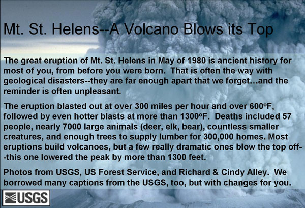
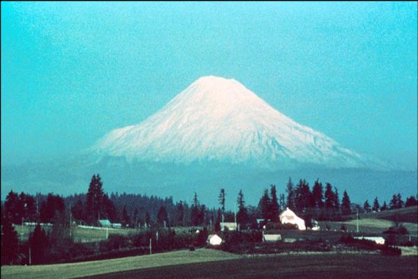
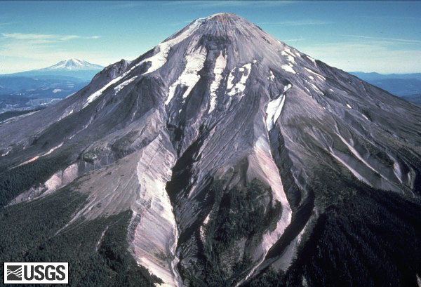
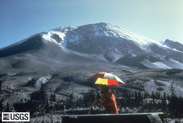
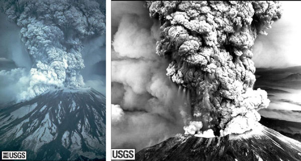

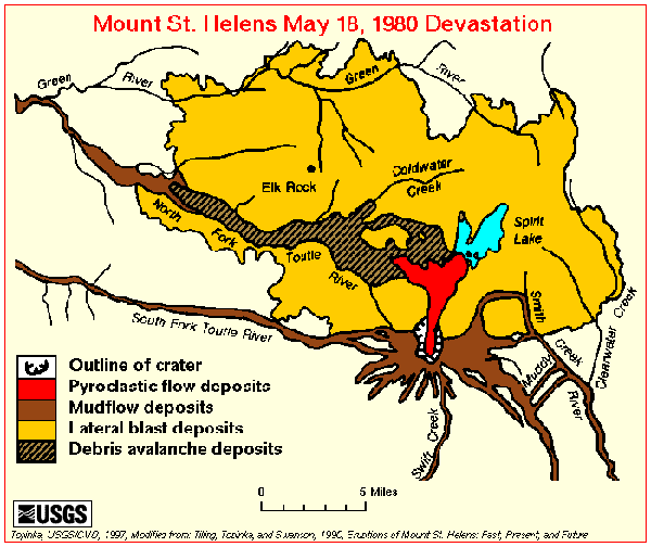
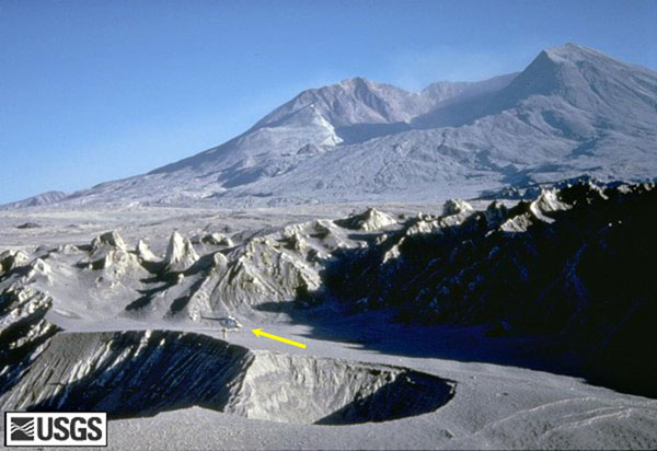
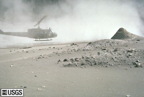
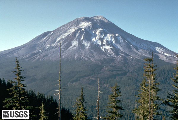
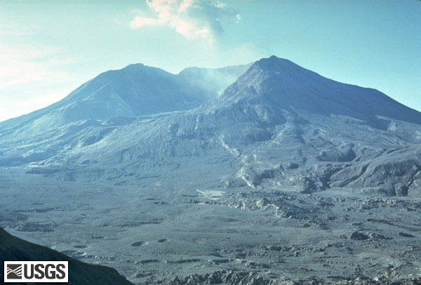
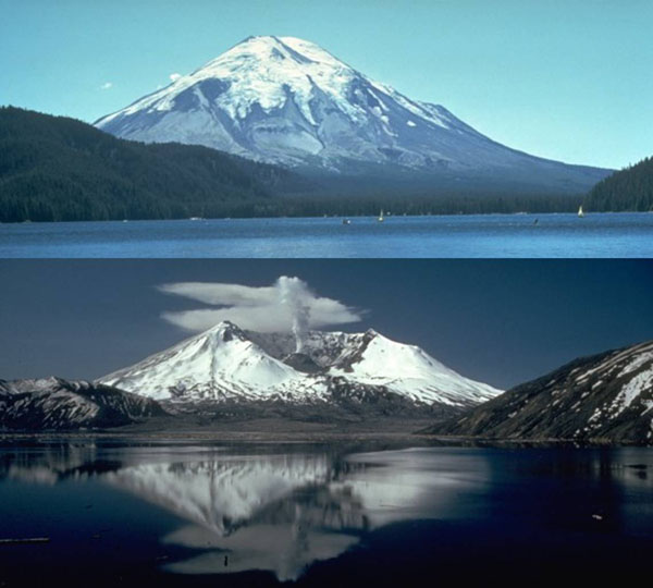
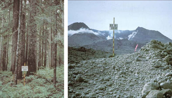
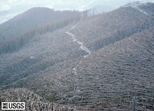
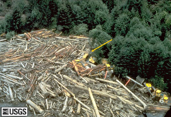
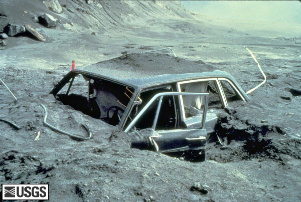
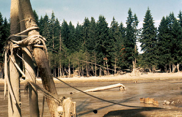
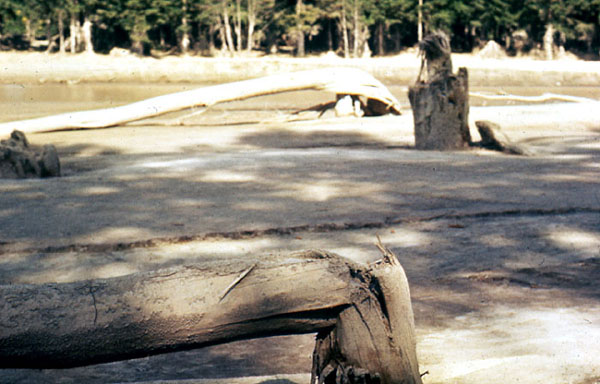
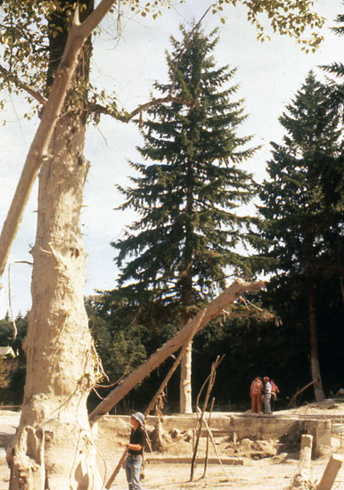
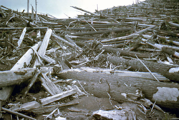
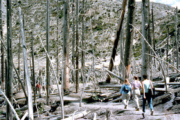
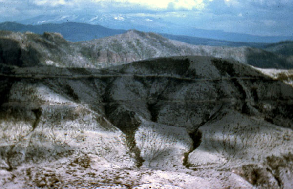
Image 1: Picture of ash in the sky from Mr. St. Helens. The great eruption of Mt. St. Helens in May of 1980 is ancient history for most of you, from before you were born. That is often the way with geological disasters – they are far enough apart that we forget… and the reminder is often unpleasant.
The eruption blasted out at over 300 miles per hour and over 600 degrees F, followed by even hotter blasts at more than 1300 degrees F. Deaths included 57 people, nearly 7000 large animals (deer, elk, bear), countless smaller creatures, and enough trees to supply lumber for 300,000 homes. Most eruptions build volcanoes, but a few really dramatic ones blow the top off—this one lowered the peak by more than 1300 feet.
Photos from USGS, US Forest Service, and Richard & Cindy Alley. We borrowed many captions from the USGS , too, but with changes for you.
Image 2: Mt. St. Helens, before 1980. Before 1980, Mt. St. Helens was the queen of the Cascades, snow-capped, symmetric, and beautiful. But, geologists knew that the peak had also been the most active of the Cascades over many centuries.
Image 3: Mt. St. Helens on April 10, 1980. In winter and spring of 1980, magma moved upwards beneath the volcano. (Magma is melted rock underground.) Small eruptions started, covering much of the snow with volcanic ash, as seen here. Mt. Adams, another Cascades peak, is visible behind and just to the left of Mt. St. Helens. This USGS picture was taken by Donald A. Swanson on April 10, 1980. No need to memorize numbers or dates here, but appreciate the power.
Image 4: Mt. St. Helens on April 27, 1980 shows a ‘bulge’ developing on the N. side. A “bulge” developed on the north side of Mount St. Helens as magma pushed up within the peak. Repeated measurement of the distance to the bulge (as shown here) found growth of up to five feet (1.5 meters) per day. By May 17, part of the volcano's north side had been pushed upwards and outwards over 450 feet (135 meters). You might not be surprised to learn that such a huge blister will tend to rupture and fall down. The view is from the northeast in this April 27, 1980 photo by Peter Lipman.
Image 5: Mt. St. Helens erupting on May 18, 1980. On May 18, 1980, at 8:32 a.m. Pacific Daylight Time, a magnitude 5.1 earthquake shook the peak, and the bulge and surrounding area slid away. The pressure release triggered a major eruption, as the magma bubbled and blew apart to create ash carried aloft by poison gas. The landslide from the bulge buried 24 square miles (62 square kilometers) of valley. Before going up as shown in these photos, the blast first went sideways, gravely damaging 250 square miles (650 square kilometers). Fifty-seven people were killed or are still missing. USGS photos by Austin Post (left) and Robert Krimmel (right).
Image 6: Plume of ash erupting from the mountain. For more than nine hours a vigorous plume of ash erupted, eventually reaching 12 to 15 miles (20-25 kilometers) above sea level. The plume was blown eastward at an average speed of 60 miles per hour (95 kilometers/hour), with ash reaching Idaho by noon. By early May 19, the devastating eruption was over. This May 18 USGS photo of the ash plume is by Donald A. Swanson.
Image 7: Map of the area affected by the May 18, 1980 eruption. Map of the area affected by the May 18, 1980 eruption. North is to the top, and the little scale bar at the bottom is five miles--this was a big deal. The blast knocked over trees across most of the yellow area. Much of the bulge ended up in the black-lined debris-avalanche deposits, while melted snow and ice plus water pushed out of lakes made the brown mudflow deposits. Thick layers of hot ash fell to make the red pyroclastic flow deposits.
Image 8: After the May 18, 1980 eruption, Mount St. Helens' elevation was over 1300 feet lower than before, and the volcano had a one-mile-wide, horseshoe-shaped crater. This photo by Tom Casadevall of the USGS was taken four months after the eruption, on September 16, 1980.
Image 9: Volcanic ash covering the landscape around the volcano. A helicopter is hovering near the ground. For weeks, volcanic ash covered the landscape around the volcano and for several hundred miles downwind to the east. Noticeable ash fell in eleven states. The total volume of ash (before its compaction by rainfall) was approximately 0.26 cubic mile (1.01 cubic kilometers), or, enough ash to cover a football field to a depth of 150 miles (240 kilometers). In this USGS photograph by Lyn Topinka from August 22, 1980, three months after the eruption, a helicopter stirs up ash while trying to land in the devastated area.
Image 10: Mount St. Helens on May 17, 1980, one day before the devastating eruption. The view is from Johnston's Ridge, six miles (10 kilometers) northwest of the volcano. USGS photo by Harry Glicken. The next photo is from nearly the same place, four months later.
Image 11: Mount St. Helens soon after the May 18, 1980 eruption, as viewed from a similar location as the previous photo, at Johnston's Ridge. USGS photo by Harry Glicken on Sept. 10, 1980
Image 12: Mt. St. Helens before the explosion - top of the mountain still intact. The mountain after the explosion showing the resulting crater. The blast lowered the peak by more than 1300 feet. These USGS (bottom) and US Forest Service (top) pictures are not exactly from the same place, but they’re close.
Image 13: Left image is a stand of trees. Second image is taken from the same place but shows no trees, piles of ash and the mountain with a crater after the eruption. Difficult as it may be to believe, these photos are from the same place, looking in the same direction! The trees on the left were obscuring a view of the beautiful snow-capped peak, which has been blown away, along with the trees, in the photo on the right. US Forest Service photos: http://www.fs.fed.us/gpnf/mshnvm/digital-gallery/25yearsofrecoverybefore...
Image 14: Knocked over coniferous trees. They were knocked over by the eruption. These were towering coniferous trees before the eruption, but now are knocked over like matchsticks. Trees in the upper left weren’t knocked over, but were burned to death. USGS photo on Aug. 22, 1980 by Lyn Topinka.
Image 15: A destroyed logging camp including huge pile of logs and multiple full sized logging trucks. Destruction by a flood created by a landslide. The eruption melted glaciers, and the landslide pushed water out of Spirit Lake, together making a huge flood that destroyed many things including this logging camp on the South Fork Toutle River. Those yellow things in the upper-right are full-sized logging trucks destroyed by the flood (the arrow points at one). USGS photo taken on May 19, 1980, by Phil Carpenter.
Image 16: A car buried in lava approximately 10 miles from Mount St. Helens. Reid Blackburn's car, located approximately 10 miles from Mount St. Helens. Reid was a photographer for National Geographic as well as the Vancouver Columbian newspaper. Unfortunately, Reid did not make it out alive. A scholarship is now given by The National Press Photographers Association in Reid Blackburn’s honor. USGS Photograph taken on May 31, 1980, by Dan Dzurisin.
Image 17: Mudflow created by the melting of the glaciers. As noted for previous slides, the Mt. St. Helens eruption melted the glaciers on the peak, and also dumped immense amounts of rock material into Spirit Lake. The water displaced from the lake, and melted from the glaciers, mixed with volcanic ash and mud to make a giant mudflow that raced down the Toutle and Cowlitz Rivers, causing great destruction. This image and the next two, by Dr. Alley and his wife Cindy, show the situation miles downstream.
Image 18: Damage caused by the mudflow that raced down the Toutle and Cowlitz Rivers include a tree broken off a few feet from the ground. Another view of the damage caused by the immense mudflow that raced down the Toutle and Cowlitz Rivers. The broken trees attest to the power of the mud-filled flood.
Image 19: Another view of the mudflow. In this one, a much younger Dr. Alley (this was 1980, remember) is visible in the lower-left of the picture, dwarfed by the high-mud mark on the tree. The tourists on the right are looking at the foundation of what had been a house.
Image 20: Many logs scattered across the landscape 10 years after the eruption. Some bark remains on the trees. In this picture taken about 10 years after the eruption, trees knocked over by the blast are scattered across the landscape. Some bark remains on these; they were slightly shielded by a hill and were not as strongly blasted as some.
Image 21: 10 years after the eruption students walking through a stand of dead trees that were largely shielded from the blast. In this image taken about 10 years after the eruption, members of a geological field trip attended by Dr. Alley take a walk through some standing former trees that were greatly shielded from the blast, which came over the hill from diagonally behind the camera position. Notice the green vegetation flourishing on the far hillside; salmonberry, fireweed and others moved back in quickly.
Image 22: Part of the mountain with no dead trees. Many trees were salvage-logged. This third picture of Mt. St. Helens a decade after the blast shows deep gullying in a region without dead trees. Many dead trees were salvage-logged because of the value of the lumber, but such actions do have consequences for the landscape--without dead trees to dam the flow, rains feed little streams that rapidly wash away the loose soil, making it harder for new plants to grow.
Image 23: Two women collecting vials of ash. Mt. St. Helens was a media star. T-shirts, coffee mugs, and vials of ash were among souvenirs sold to enthusiastic tourists. These ladies realized that people standing ankle-deep in Mt. St. Helens ash were spending $5 for a little vial of Mt. St. Helens ash, and so the ladies decided to gather some of their own. The colorful garb is possibly reflective of the era.
Image 24: Some additional links about the Mt. St. Helens story.
Virtual Field Trip #4: Hawaii Volcanoes National Park
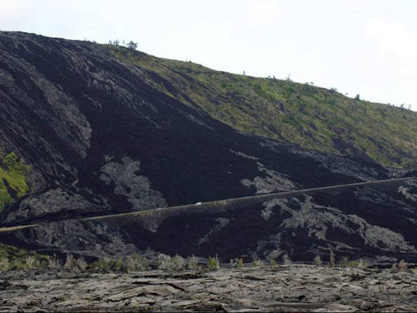
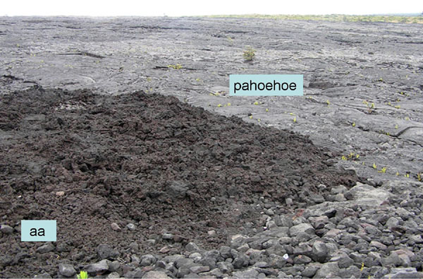
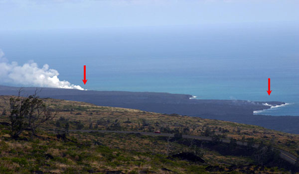
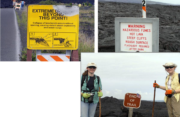
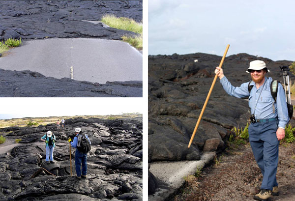
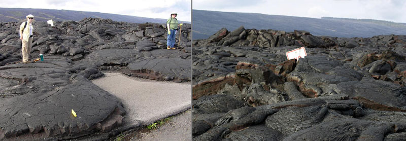
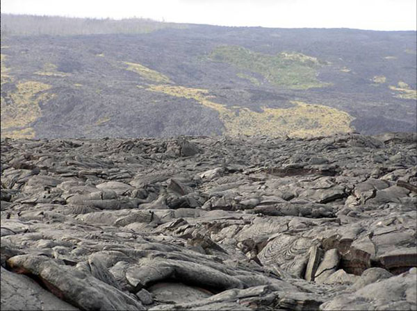
.jpg)
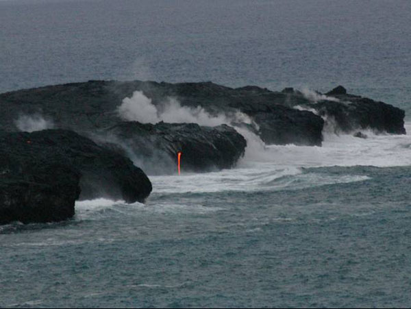
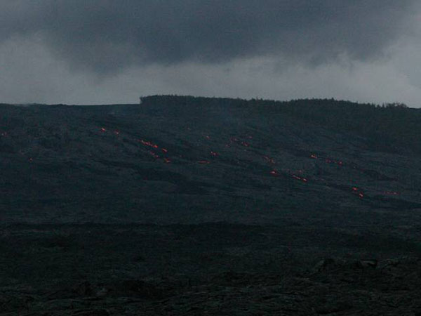
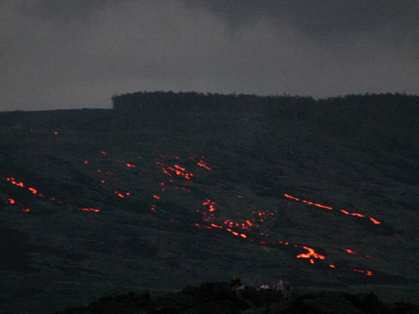
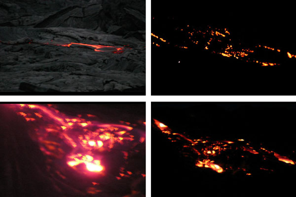
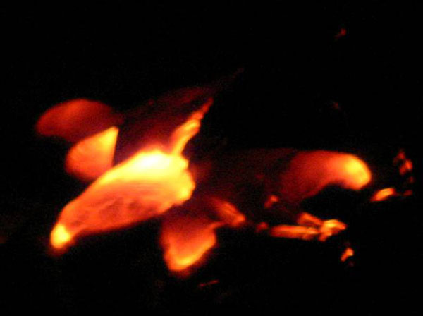
Image 1: Mauna Loa mountain. Mauna Loa (13,679 feet above sea level); Hawaii’s peaks start from 18,000 to 19,000 feet below sea level, making them the tallest mountains on Earth. Mauna Kea (peak at 13,796 feet above sea level, is out of picture to left)
Image 2: Mauna Loa on the left of the picture, Mt. Lassen in the middle and Mauna Kea is off the picture to the right. The hot-spot volcanoes of Hawaii are vigorous enough to kill the unwary, but are much more approachable during eruption than are the steep, explosive stratovolcanoes of the Ring of Fire and elsewhere, such as Mt. Lassen. This slide show gives you an up-close-and-personal visit to this “nicer” Hawaiian lava.
Image 3: Chain of Craters Road, Hawaii Volcanoes National Park. Older flows, now vegetated, are green. Darker flows are either gray pahoehoe (pronounced pa ho ee ho ee; ropy lava from hotter flows) or black aa (pronounced ah ah; broken-up lava from cooler-but-still-really-hot flows).
Image 4: Close up of lava Pahoehoe (sloid) and aa (looks crumbly)
Image 5: View of ocean with steam rising out of the water. The steam shows where lava is entering ocean.
Image 6: Janet and Karen Alley, on what used to be the continuation of Chain of Craters Road, now lost beneath lava flows from the East Rift of Kilauea volcano. The hike to the active lava from here is just enough adventure to be exciting.
Image 7: Chain of Craters Road was lost, along with almost 200 houses and other buildings, when engulfed by lava.
Image 8: Two pictures. Left, Karen and Cindy Alley along the former Chain of Craters Road. Right, a ‘no parking’ sign buried in the lava. The ropy pahoehoe lava is a strange surface for hiking, but can be traversed safely by careful hikers.
Image 9: The “trail” to the active lava showing Pahoehoe. Hot lava is still flowing down the hill in the far upper right of this picture, as you will see in later photos.
Image 10: Lava flows out of tubes in the rock into the sea. You can see the red lava flowing into the sea and the steam rising out of the ocean where the lava enters. We didn’t get down to measure, but the higher “lava fall” probably is more than 30 feet tall.
Image 11: Closer view of lava flowing into the sea from a large rock outcropping.
Image 12: Mile-wide view of lava flowing from the East Rift of Kilauea. On a sunny day, the hillside looks black, but as darkness falls, the glow of the molten lava shows.
Image 13: Slightly closer view of glowing lava
Image 14: Glowing lava.
Image 15: Glowing lava.
Image 16: Glowing lava.
Image 17: At roughly 2000 degrees F, the lava glows in the night. The lava surface chills rapidly in the air, forming a glassy shell, which then crackles and breaks as the sizzling lava moves beneath. You can sometimes watch a new crack appear as you hear the breaking glass. The red arrow points to a tongue of lava that will harden to look like the pahoehoe tongues shown in the next slide.
Image 18: Hardened lava tongues (pahoehoe). Four pictures showing different flow patterns.
Image 19: “Lava Falls”
Image 20: Karen and Janet Alley with hot lava flowing in the background.
Want to see more?
Here are some optional vTrips you might also want to explore! (No, these won't be on the quiz!)
Hawaii Volcanoes National Park and a second Crater Lake Slideshow
(Provided by Dr. Alley)
Hawaii
(Provided by USGS)
Crater Lake National Park
(Provided by UCGS)
Crater Lake National Park - 3D version
(Provided by UCGS - red/cyan stereo viewing glasses required)
Mount St. Helens National Volcanic Monument
(Provided by UCGS)
Olympic National Park
(Provided by UCGS)
Word Document of Unit 3 V-trips
GeoClips
There are three Unit 3 GeoClips (movies) linked below. We hope they help you understand Unit 3 just a little bit better, and that you enjoy them.
Hawaii: Night Lava
Hawaii Volcanoes National Park below the east rift Kilauea, this is the lava headed for the sea. It is 2,000 degrees Fahrenheit or so. This is the innards of the Earth turning inside out, building new land that we're sitting on right now. And this is way cool because it's so hot. You just can't imagine what this is like.
Below us, it is fountaining into the sea and jetting up great bursts of steam. New land being born, this is geology in action, this is the real thing. The breeze blowing over us is a little bit sulfurous, it's a little bit warm-- we're going to get out of here fairly quickly. But we're having a lot of fun, I wish you could be here with us. This is an amazing, amazing sight.
Hawaii: Lava Tube
We're in the rain forest on the side of Kilauea, and behind me is a lava tube. A great lava flow came through here in the past, the top freezes first, the sides freeze, the inside-- glowing hot lava-- comes flowing out, and it drains. And you go inside and there'll be stalactites that were little drips that were falling off the ceiling when they froze. And this is the way a lot of the lava gets to the coast. It's that the top will freeze, and the insides will go squirting on out to the sea. And so it's a really interesting place, a very different kind of cave.
The hot spot of Hawaii erupts runny lava to the surface, giving some very interesting features, such as the lava tubes you will see forming in the first video, and formed in the second video. The hike out to the flowing lava was, in spring of 2007, over three miles across rough, often broken and glassy lava that solidified from glowing hot flows over the last couple of decades. Whales were spouting offshore when Dr. Alley and family made the trip. Tag along, and see what they saw.
Hawaii: Southwest Rift
The Southwest Rift of Kilauea on Hawaii. There's a vast and fascinating volcanic history sitting here. Layers of rock that were made of pieces that were tossed through the air. Glass that froze in the air as it was thrown as molten little bits from the volcano, and then other sorts of layers.
Then there's been a great cracking here, probably an inflation from underneath as melted rock is moving underneath that sort of bubbles things up and breaks it. Then an eruption happened at some point, and there was actually sort of a waterfall of melted rock, and it was flowing into the crack. And we can see behind me all these places where this stuff has flown down into the crack. Just a wonderful record of the excitement of the geology of this place.
Lava was erupting in the Southwest Rift of Kilauea not that long ago. Sometimes, the lava erupts with a little force, throwing pieces that freeze to glass in the air and rain down. Other times, the lava flows even more quietly along the surface. Here, you can see evidence of both.
Want to see more?
Optional Videos, for your enjoyment (and education, but you won't be quizzed on them.) Volcanoes are just too interesting to leave so quickly, so here are some more looks at these important, and dangerous, pieces of our planet. First, visit Hawaii again, and see some strange things. Then, head over to Sunset Crater Volcano National Monument, Arizona, with the CAUSE class. Have fun, and keep your feet cool!
Hawaii: Tree Mold
I am in one of the stranger positions in one of the stranger places you'll ever see. The camera is looking right down on me, and I am sort of lying over the ground. And behind my head is a tree mold in Hawaii Volcanoes National Park. There used to be a giant Ohia tree here. A lava flow came in around it, the lava chilled where it hit that tree and was boiling the water away from the bark. Eventually the tree rotted out, but it left its shell of lava sitting here behind me, and you can see sort of the shape of the bark sitting here in the tree.
Then a new tree has grown, and is putting its roots down in the hole where the old one was. But this is the mold that was left from a tree that was hit by a lava flow. And it's really something you can see. There's places in the park where there are footprints that you can see, where people walked in the lava, and here's the mark of a tree.
Hawaiian lava flows engulf whatever is in their way, including trees. What happens when hot lava hits a cold, wet tree? Find out here, your chance to look down on Dr. Alley.
Hawaii: Boiling Cauldrons
Kilauea, Hawaii Volcanoes National Park. Deep beneath us, a boiling cauldron of melted rock that wells up from possibly the core mantel boundary on the giant hot spot that is Hawaii. Next to us, the great crater here, fills with magma, with lava, that comes boiling up from below. And then it rifts out, it breaks, and you get cracks in the ground, and the lava flows out, and it is now flowing into the sea and building new pieces of the island just below us down at the coast.
Around me here, you can see swirling-- the fogs, the mists, the steam, the hot sulfurous gases that come off of this volcano. Where the rain from above soaks down through the cracks, it hits a hot rock, it flashes to steam, and it comes boiling out. This is a place where geology lives, where geology is living right now. And it's an amazing place to try to breathe in this.
Kilauea Volcano is a wonderful place to visit. Stay in the lodge on the rim, and you'll wake up to the view shown here behind Dr. Alley.
Cinder cones are rather odd volcanoes, formed of pyroclastic bits tossed through the air to pile up near the vent. If you let the spaghetti sauce boil on the stove, without a lid, you would soon have a lot of tomato-sauce blobs around the pot. Let those build up, and you are heading for a cinder cone. Here, see three different versions of the cinder cones at Sunset Crater.
CAUSE 2004 - Sunset National Park #1
Right now we're at-- this is called Lenox Crater, and it's a volcano. It's a cinder cone volcano. If you looked around behind us, right at the center there's a big crater, hence the name. And all the stuff that we're sitting on right here is cinders, basalt rock that was ejected from the volcano. And as it was ejected, it was thrown up and out, kind of like this. And--
Kind of like what?
[LAUGHTER]
Kind of like that. And it just over the years built up and built this-- what did it say, it's 400 feet high or something like that? Yeah. Not too bad.
An explanation of cinder cone volcano formation by CAUSE student Sam A.
CAUSE 2004 - Sunset National Park #2
ROh. That was hard. Why?
Well, Ryan you just walked up a really steep side of a volcano.
What volcano?
This volcano.
That's a volcano?
Yeah. Right over there's the center of the volcano. And we're sitting on top of cinders that were thrown out of the volcano.
What's a cinder?
These are cinders.
What are they?
OK, imagine this is the bottom of the volcano. Stuff's thrown out of the center of the volcano. And it starts to build up around the side. So eventually when enough stuff's thrown out, you get a steep-sided volcano. It's just layer, upon layer, upon layer, upon layer, upon layer of stuff that's ejected out of the volcano, falling down on top of each other.
How far does cinder travel?
Well, we're sitting about a quarter mile from the center of the volcano, so these cinders traveled about a quarter mile. They can go further than that, a mile.
So if this is cinder, it's so small. I mean, are they all this small?
Yeah. Well, some are real small, some are a little small. Some are big, and some are the size of Volkswagens.
Oh. But Stef, I still don't get it. I mean, where else are we going to see this in the real world?
Have you ever made spaghetti?
Yeah.
All right. Well, think of a pot of spaghetti sauce. You've got the heat cranked up real high, and the sauce starts boiling. You get bubbles and then, next thing you know, you've got butter and spaghetti sauce. You've got spatters of sauce all over your kitchen stove.
And that's exactly what's going on over here?
Yeah. Why don't we go to take a look?
OK.
Go down in the crater.
Hey!
Another, slightly "dramatized" explanation of cinder cone volcano formation by CAUSE students Stephanie S. and Raya G.
CAUSE 2004 - Sunset National Park #3
We're looking at Sunset Crater, a volcano that erupted almost 1,000 years ago. It's primarily a cinder cone, so when it was erupting it was sort of spitting out little pieces like a pot of spaghetti sauce bubbling and throwing things.
Those little pieces-- we can actually see similar pieces from either that one or a different eruption here. And we've been walking on them, and they're not terribly pleasant for walking on, but you can build a pile out of stuff like this. There's probably lava flows helping to hold that one up.
A little more oxidized late in the eruption, and so you get that pretty red around the top that gives the Sunset Crater name.
A third explanation of cinder cone volcano formation, by Dr. Alley himself.
Video Lecture
There are TWO Unit 3 lectures both featuring Dr. Sridhar Anandakrishnan.
Start with the first lecture. It is 40:50 minutes long.Welcome to G-Sci 10, Geology of the National Parks. My name is Sridhar Anandakrishnan, and I'll be your guide through some of the beautiful parts of the planet. Last time, we talked a little bit about Death Valley, about the spreading, about how Death Valley is going apart. This time, we're going to go slightly further north up along that same coast, go up to Crater Lake National Park, an absolutely gorgeous place, head on up the coast a little bit further, up to Mount St. Helens, go over and take a look at the Olympic National Park, and really understand why these volcanoes, Crater Lake, Mount St. Helens, why those two volcanoes are where they are.
And we're going to actually spread our picture out a little bit beyond that and look at why there are volcanoes in other parts of the world. All right? So, we'll start our talk about making mountains and making volcanoes, why they are where they are, and what they can tell us about the insides of the Earth.
Here is a screenshot that I took on my computer of a program called Google Earth. And I encourage all of you to go out there and download it. It's free. It runs on Macs. It runs on PCs. And it's a wonderful program for just looking at this planet. You can wander around to different parts. You can zoom in, zoom out. And I really encourage you to download it and to use it. It will really give you a good sense of how big this planet is that we live on.
I've circled in those sort of blue squiggly lines. They're not the best pictures in the world. But you can see that there are some places on the West Coast of the US. That's California on the bottom, Oregon in the middle, Washington state on top. And the circles represent the areas that we're going to go to, Crater Lake National Park on the bottom, Mount St. Helens in the middle. And then right up on the top, right up jammed up against the Pacific Coast is the Olympic National Park. So, as I said, go get yourself Google Earth, and you'll be able to zoom in to these spots yourself.
The other thing that you can do is you can go to your website, go onto Angel, and you'll be able to download what we call V-Trips. They're virtual field trips to these places and to other places. And they're just PowerPoint presentations or web page presentations that just have beautiful pictures of these places.
Let me take you to a couple of these places right now. We'll go take a look at Crater Lake. We'll take a look at Mount St. Helens. And then we'll come back and start the lecture proper.
I like to do this to motivate you, to say, man, these are beautiful places. I want to go see those, and I want to understand them. I want to know why there is a volcano there. So, let's hop out of this program real quick and go over and take a look at Crater Lake National Park. As I said, this is on Angel. You can see all this for yourself. I'm going to whip through it quickly. But you can find it on there.
So, this is just a shot looking down from the rim of Crater Lake through all these lovely trees, down onto that blue, blue, blue water. Crater Lake is this volcano way up high on the top of this mountain, up at 6,000 feet. And that water is as clear and as beautiful as anything.
It's just all snow melt that comes down into the crater. There are very few streams that bring in sediments into it, and no industry, no pollution, no agriculture. And so, that water is as blue and as beautiful as they get on this planet.
Here's a picture on the sides. Even though this was late in the summer, you get lots and lots of snowfall. As you can see, our friend there is wearing his T-shirt as he slides down the side of Crater Lake in the snow. Even though it's in the middle of summer, there's still lots of snow.
So, you pull back. Here's a picture of that crater. The bottom of it there is water.
You can see the far side of the crater. We're standing on the near rim. It's an almost circular feature with this little island called Wizard Island rising up in the middle of it. And then there's the far rim that you can see. And if I could pan, if this camera could pan around, you would see that rim continuing around all the way until it came back to where you are.
Absolutely gorgeous place way up high in the mountains, as I said, 6,000 feet. It's a spectacular place to go and see the world. Here's just another picture looking out over that blue, blue, beautiful water.
Here is a very garishly colored picture of the depth of the water. The purples are where the water is very, very deep. And the grey-white parts are the rim.
So, you can see that near-circular crater with Wizard Lake off on the left side there, that little dome that's starting to build. And then over in the top, there's another little dome starting to build. So, this has something to do with volcanoes. So, let's find out more.
And this is just a picture from Crater Lake looking along the Cascade ranges. And you can see in the distance one, two, three, four volcanoes, each of those perfect little cones marching up the coastline. Why? Why are there volcanoes there? Why aren't there any volcanoes here in central Pennsylvania? Why do they have four of them over there in Oregon in Washington?
That seems awfully unfair. They get all the volcanoes, and we don't get any. Let's find out why they've got them.
Here is a map of the California, Oregon, Washington coast. Each of those little triangles is a volcano. Lassen, Shasta, Medicine Lake, Crater Lake, that's the one that we're going to be talking about. And on the right, you have a little graphic depicting when they most recently have erupted.
As you probably might know, Mount St. Helens erupted in 1980. And that's marked on the right over there. Mount St. Helens has been very, very active, erupting many, many times over the course of the last 4,000 years.
And it's actually getting even more active even as we speak. The dome is starting to build today. And it might be due for an eruption in the next few years to tens of years.
Here's just a beautiful peek of Lassen Peak. It's not Crater Lake, but it's another volcanic peak. Whenever you see one of these nice triangular mountains, you should say to yourself, volcano. It's just a beautiful spot. And here's another view of Lassen Peak, looking at it from a slightly different place.
All right, here is a picture of a little car, a little 1980 Chevette going up the road to Lassen Peak. You can see all the snow there, even though it was the middle of August. I encourage you to go on to the website and just take this V-Trip. And it will encourage you to go there.
This, we went a little bit further afield. Those little white dots are sheep. When you think sheep, you should think New Zealand. And this is indeed a shot of Mount Ruapehu in New Zealand, another volcano on the other side of the Pacific Ocean.
All right, enough wandering around the world. Let's learn why those volcanoes are where they are. So, plate tectonics two, making mountains and volcanoes.
Here is a map of the world. And what we're looking at here is North America, and the US in the middle. The Pacific Ocean is on the left. And each of those little red dots is a source of volcanic activity.
And you should be able to see that those dots circle the Pacific Ocean. Sure, there's a few volcanoes in the Atlantic Ocean. Iceland in particular has quite a few. There's a few volcanoes that occur in Africa and Arabia. But most of them are around the circum Pacific, Australia, New Zealand, heading up the coast towards Japan, over to Alaska, and then down the US and Canadian coast, and then down through Central and South America.
Why? Why is it that these volcanoes are where they are? So, here's a graphic showing where all of these volcanoes are. And because all these volcanoes stretch right around the Pacific, we call it the Ring of Fire. It's a nice, evocative name.
There's another thing that happens that goes along with these volcanoes. There was a curious thing that people noticed is that if you were to take the water out of the Pacific, in the same place where you have all these volcanoes, you'd see these really deep ocean trenches. The ocean would go down 10,000, 20,000, 30,000, in some places even more, 40,000 feet. It's an extraordinary thing. It goes way, way down, as deep down into the ocean as mountains are high.
Why? Why are there trenches that go along with volcanoes, but no trenches anywhere else? That's the second thing people notice.
The third was that you get these big earthquakes in the same place. Volcanoes, deep trenches, big earthquakes, how are they all related? How do they all come together? And then the next thing is we're going to take a look at one of the great songs of all time.
[MUSIC PLAYING - "RING OF FIRE" BY JOHNNY CASH]
By the great Johnny Cash.
[MUSIC PLAYING - "RING OF FIRE" BY JOHNNY CASH]
So, I hope you enjoyed that. And you should be grateful that I did not try to sing that for you.
So, the overview that we're going to-- what we're going to try and go over in this class is ocean materials made of spreading ridges. We saw that last time, Death Valley, mid-ocean ridges. So, somehow ocean materials made at these mid-ocean spreading ridges, material comes up, freezes on, spreads off to the side, if you remember that from last time.
It collides with continental crust. So, all this material is being made in the oceans. It runs into the continent, and something's got to happen.
And what happens is one of two things. Either you get subduction, where that continental crust goes over, the oceanic crust goes under the continental crust. This material gets subducted.
Or you get accretion, where the continental crust and the oceanic crust run into each other, and they actually glom together to create new land. All right? So, those are the two things that can happen. Some of the side benefits, if you will, of that collision of either the subduction or the accretion is the creation of volcanoes and mountains and these deep oceanic trenches.
The third thing that we'll talk about this time is hot spots. And I'll get to that in a minute. Let's talk about subduction and accretion first.
To review, this you should remember from last time, the mantle is a deep part of the Earth, way down deep. You have those hot, relatively soft rocks that make up the asthenosphere. The upper part of the mantle and this crust are this rigid, more brittle mass of rocks called a lithosphere.
And the lithosphere, this upper part, is broken into a number of smaller plates. And these plates float over on top of the asthenosphere, and they will occasionally run into each other. Where they run into each other, that's where these mountains are made.
The convection cells, they bring up this mantle material. It freezes at these mid-ocean ridges. And then the ridges push material off to the side. So, the ocean is continually moving its crustal material off to the side.
That stuff has got to go somewhere. We don't live on an infinite plane. We live on this nice, round planet. So, if you push stuff off to the side, eventually it's got to hit something.
And this is my depiction of what the Earth looks like. If I took the Earth and took a great big hatchet and sliced through it, what I would find is I have the outer core, and then I have-- or the outer lithosphere. And then right in the middle of it, we would have the inner core, which was solid, the outer core that was liquid. And then right up at the surface, this is where we live. There's trees and houses and so on and so forth.
Right underneath that, we have the crust, which is part of the lithosphere. Underneath that, we have the mantle, which is this hot, soft rocks. And then right in the middle, you have the core, which is either solid right in the middle or liquid outside of it. So, this is a little bit a review of if I could take this hatchet and slice through the Earth and look at it from this side, this is what we think we would see.
We don't really know. Nobody's ever drilled into the Earth much deeper than a few miles, three or four miles. So, all of this is inferred from other evidence. But we think this is a pretty good picture of it. It's probably grossly simplified, but this is what we think the world looks like.
I'm going to redraw that picture here. Here we have the Earth again, sliced through. The upper part of it is called the lithosphere. Underneath that, you have the asthenosphere.
And that lithosphere is broken up into a number of little plates. I've just labeled them plate one, plate two, plate three, and so on. So, we've taken a cross-section through it. In your head, you have to imagine that this thing is a globe or a sphere, and those plates are all riding on top of the surface of that globe or sphere.
From the interior of the Earth, because of the heat inside of the Earth and the heating of the rocks that makes them low-density, that material rises up through the asthenosphere until it gets to the surface of the Earth, where it cools off and then sinks back down in these convection cells. All right? So, this should all be review if you remember it from last time.
But what goes on as a consequence of these mantle convection cells is that these plates, plate three there, for example, will slide off in one direction. And plate two will slide off in the other direction. And when plate two slides off, what happens to it? It runs into plate one. All right? You can see that plate one is in its way.
Plate two runs into plate one. Something's gotta happen there. And at that collision spot, that's where either subduction or accretion takes place.
So let's talk a little bit about this oceanic crust. We have these mantle convection cells, materials coming up from deep inside the Earth. It's deposited underneath the oceans. And it cools off, gets more dense, gets shoved off to the side. And this mantle material is basically basaltic.
Basalt is a mineral. It's heavy in silica, iron and magnesium. It's dark in color. It's relatively dense compared to continental crustal material.
Density is a key notion that I've talked about a little bit last time. I'm going to talk about it this time. You'll keep running into it over and over again during this class.
When something is dense, for its size, it's relatively heavy. So, if I have a bottle of water here, I can fill it up with water. And it will have a certain weight to it. And if I divide the weight by the volume of this bottle, I have its density.
I could pour this water out, fill it with olive oil, extra virgin olive oil, please, always. And it would weigh different. It wouldn't weigh the same as the water in here because oil has a different density than water does. You know this stuff, but it's worth emphasizing it anyway.
Ocean floor is mostly basaltic, formed at the ridges. Because we know the Earth isn't getting bigger, as this material comes up, it isn't as if there's this material that's coming from somewhere else. It's all being recycled. It comes up, and then it goes back down. The Earth stays the same size.
What is subduction? That's a word that you ought to write down, maybe look it up in a dictionary. To subduct means to go under. "Sub," under, "duct," I'm not quite sure where that "duct" comes from. I'm not an etymologist. But subduction means for oceanic crust, as it gets denser, as it cools down, moves away from the ridge, gets denser, it starts to sink back down into the mantle.
Think of a lava lamp. If you go onto the Angel website, there's a little movie there, it's a little bit goofy, but it's fun, in which I have a lava lamp. And I show you how that material in the lava lamp rises up as it heats up, and then it goes to the top, and then it sinks back down again. The reason it's sinking down again it's getting cool, meaning it's getting dense.
All right? So, that's what's going on there. And this is to remind you, this is the goofy movie that you will find on the website of the lava lamp.
As this cooling oceanic crust moves to the side, it'll run into a continent. It might run into a continent. It sometimes does, sometimes doesn't. But in the case of the western US, it does run into the continent. It runs into California, Oregon, and Washington.
So, this cooling Pacific oceanic crust is heading eastwards. And there, bang, in its way is California, Oregon, and Washington. They're sitting there in the way, and this oceanic crust runs into it.
If it is cold enough, if it is dense enough, if it is so dense that it wants to sink down, then it does sink down and goes underneath the oceanic crust, which is low density. And it bobs up high. The continental crust is low-density and bobs up high, and so, the oceanic crust, which is higher density, will go underneath it.
If it is still relatively warm, if it hasn't had time to cool down, only recently it was formed, and it runs into the continent, it's still buoyant. It still rides high up there, doesn't want to sink down. Then when the oceanic crust and the continental crust meet, then the oceanic crust doesn't sink down. It just stays up high, and you get what's called accretion. And we'll talk about that.
As this ocean crust sinks down, and I'll draw a picture of it for you in a second. But let me get the words out, and then we'll go back and look at this picture. As this ocean crust sinks down, it carries seawater and sediment with it as it goes underneath the continental crust.
As it sinks down, it starts to heat up again. Remember, the Earth is hot inside. What's the reason for it? You know it. We talked about it last time.
The reason it's hot is because of radioactive decay inside the planet. Inside the Earth, there's all of these radioactive atoms that are slowly splitting apart, giving up a little bit of heat. And so, the inside of this planet is warm.
So, as this oceanic crust sinks down, carrying its water, carrying all these sediments as it sinks down, and starts to heat up, this added water, these added sediments help that crust to melt. If all we had was that oceanic crust, you could heat it up. And you'd have to heat it way, way up before it would melt.
But because of all these impurities that have been added, the water and the sediment, that stuff melts really quickly. All right? Most things melt better in the presence of impurities. And this is an example of one of those.
So, let's take a look at a picture of that whole thing. Here's my cross-section through the ocean. I've drawn a mid-ocean ridge.
We have material coming up from underneath. It's being deposited at this mid-ocean ridge. That's that little peak over there.
And as it cools, it gets shoved off to the right. So we have material coming up, and material gets deposited, cools, and gets shoved off to the right. There's more material going off to the left, but lets only worry about the stuff that's going off to the right.
Here's my picture of the ocean. And there's a little boat. And there's a little fishy. So now you know that's the ocean. It's got a fishy in it. And the sea floor there is the black line.
And that material is physically moving off to the right. If I could go there and put a mark in it, I would come back a year later, and that mark would have moved a little tiny bit to the right, maybe half an inch, maybe a tenth of an inch. But it would have moved a little bit.
Now over here on the right, in the green, I've drawn the continent. So this is the coast of California. This is the coast of Oregon.
What's going to happen when that black line runs into that green line? The continent is low-density. The ocean is basalt. It's high-density.
When the two run into each other in this case, because the mid-ocean ridge is way far away, the basalt has had a lot of time to cool down. It's high-density. It wants to sink back down, and it will. It will subduct down underneath the continental crust.
And in the process of subducting-- I'm sorry, I had to draw a new picture here because my last one got so ugly. In the process of subducting, it will carry down material with it. That junction there that I've circled in yellow has water, and it has ocean sediments with it.
So two things happen at that junction. The first is that the continental crust and the oceanic crust get deformed to form these trenches. So without this motion of the oceanic crust going underneath the continental crust, we wouldn't have that little dip that you see, where the black and the green meet. That part would have just gone flat across.
But because of the motion, you can imagine in your head. This, my left hand over here that's wiggling, is the ocean crust. My right hand over here is the continental crust. And as I move my hand down, down, down, it drags and makes this little triangular indentation that is a mid-ocean ridge.
So, that's why we have trenches where we have subduction zones. That's what that is. This is a deep trench in the ocean floor. If that trench is near a continent, near water, near freshwater, rivers, sediment, that trench will fill up quickly with sediments because the continent will just dump all of this material into it. But if that trench is way out in the middle of the ocean, it won't fill up with sediments, and it'll be really, really deep.
Let's draw another picture of this because my pictures tend to get very messy. So, I just erase them and redraw them. Once again, we have this subducting ocean crust going under a continent. At that junction there, you'll have a trench.
But in addition to that, you'll have sediments and water that are carried down with that subducting trench. As that material goes down, it helps that basalt to melt. As it heats up, remember, as it's going down, down, down, it is getting hotter and hotter.
Eventually, it gets so hot that it melts. And when things melt, they get low in density. When things are low in density, they rise.
And that's what those little red circles are. It's molten material that's rising up through the continental crust because now you've melted this combination of basaltic rock, water, and sediment. You've heated it up. It's melted.
It's got nowhere to go because it's low-density, nowhere to go but straight up. And that's what it does. When it gets to the top, it builds a mountain. So, when this material gets the top, it builds a volcano.
That volcano there is Mount St. Helens. That volcano there is Crater Lake. That volcano there is Mount Ruapehu in New Zealand. It's Mount Fuji in Japan. It's Mount Pinatubo in the Philippines.
So, when you get subduction, you get these deep trenches being formed. You get this melt down there that rises up somewhere back from the coast, not right at the coast. But some distance back from the coast, that melt gets hot enough that it can rise up. And when it rises up, it forms a volcano. So, that's why these things go together, subduction, trenches, volcanoes, lines of volcanoes.
You can imagine in 3D that a coastline, that green line, is a cross-section through the west coast of California. But that's just one spot on the west coast of California. If I were to go a little bit down into the screen there, I'd be up in Oregon or up in Washington, and there would be another volcano and another one and another one. And that's why there's this line of volcanoes all up the coast of California, Oregon, and Washington.
And over time, these volcanoes get bigger and bigger because there's more and more material that's continually coming up and being deposited. Now they don't keep getting bigger forever because there's erosion that will continue to make them smaller. And this process continues to make them bigger. And that fight between building mountains and tearing down mountains is what geology is all about. You'll learn all about erosion later on.
So, here we have volcanic mountains at subduction zones. So, I hope this gives you a picture of it. And I know these drawings are very crude. But they're very, very helpful for me. If you want more information, you gotta read the online textbook.
This is Mount St. Helens. This is Lassen Peak. This is Crater Lake. This is Fuji. This is Mount Ruapehu. This is all of these subduction zone volcanoes around the Ring of Fire.
OK. I'm going to draw that 3-D picture for you. I'm not a good artist. But there's some folks at the US Geological Survey that are good artists. And they have shown this process where one plate is subducting under another plate. And now you can see it in 3D.
It isn't just a single spot the way I drew it on my rather crude picture. But it heads all the way up along that suture, that contact. Where those two plates run together, the one goes under, and you just get this series of volcanoes all up and down that contact. And you get these big old trenches along there.
This type of volcanic rock, the rock that comes up at a subduction zone and forms those volcanoes, is called andesitic. it's an andesite. It's named after the Andes Mountains. There's a very noticeable mixture of basalt and these sediments that forms this andesitic rock.
Now remember at the beginning, I said there were three things that go along with subduction zones. One was volcanoes. The second was these deep trenches. The third was earthquakes.
And the reason for the earthquakes is occasionally that that downgoing slab, that downgoing oceanic material, as it's sliding down underneath the continental crust, will get stuck and get stuck. And the downgoing slab is pushing, pushing. And then suddenly, it breaks loose. And you get these huge earthquakes because of the enormous forces.
And unfortunately, you get very tragic consequences. Because one of the things that happens when these earthquakes occur is it they displace a great deal of water in the oceans. And when those water waves hit land, if there's people that are standing there, they can and unfortunately are killed by the hundreds, the thousands, and in the case of that dreadful, dreadful tsunami in December of 2004 in Indonesia, killed by the hundreds of thousands. So, these are very, very dangerous things indeed.
Trenches, we already talked about trenches. When this slab is subducting, it deforms the overriding plate, and then we get these long, linear trenches. If these trenches are near land, they get filled up with sediment because there's lots and lots of junk, if you will, that's being washed off of the coast of Oregon, the coast of Washington, the coast of California.
All those rivers are carrying lots and lots of sediments. And they'll fill up those trenches quickly. But if they're out in the middle of the ocean, then they won't be filled up quite so quickly.
Those trenches in the middle of the ocean are some of the deepest places on the planet. The Marianas Trench is the deepest spot on the planet. It's as deep as Mount Everest is high. So, Mount Everest you know is 28,000 feet high. And the Marianas Trench is actually a little bit deeper than that below the sea floor.
The trenches near continents, because of all this mud that gets washed out, tends to fill up more quickly. Marianas Trench is here, just off of the Philippines. And as I said, it's one of the deepest places on the planet.
There's a little bit of a side note here. I think I remember I mentioned last time this little symbol up in the corner there. That's my universal symbol that the choo-choo train is going off the tracks.
So, whenever you see that, you know that you can not pay attention for a minute. You can stretch. But the first, the best ever science fiction, is Jules Verne's 20,000 Leagues Under the Sea. That was a novel by Jules Verne. 20,000 leagues, that's about 60,000 miles. Jules Verne was referring to the length of the voyage that the submarine, the Nautilus made with Captain Nemo at the helm. It's a great, great read. I strongly urge you to rush off and find it.
OK. So, here is once again our picture of the West Coast of the US. You have in the blue is the Pacific Ocean and the oceanic crust associated with it. It's moving off to the east. And then in the pink, you have the continental crust. And it's staying relatively stationary. And the two will collide. Where you have that collision, you get subduction. Or further up, you get accretion. This is important to remember. Continents are the lowest density, quote, "light." I put that in quotes because it's not the weight that matters, it's the weight of a particular given volume of the material. All right?
So, I can get a pound of feathers, or I can get a pound of gold. But a pound of feathers would fill this room, and a pound of gold would fit in the palm of my hand. So, it's not the total weight of something that matters. It's the weight per unit volume. Sea floor is the denser of the two. The basalt is a more dense material. Mantle is denser still. So, I gotta always remember, it's density that we care about. The core is the densest of all. It's mostly iron.
Accretion occurs when the sea floor runs into the continent, but it's still relatively low in density. It hasn't gotten so dense that it wants to sink down. It's quote, "light." It's low-density. And so, when it runs into the continent, it doesn't sink down. It doesn't give way. It actually smears onto, it's scraped off. Some of this sediment smears onto the continent. Next time, or a little ways down the road, we'll talk about something called abduction, when two continents collide, and man, neither of them really want to give way. And you get huge mountains built that way.
Here, the oceanic crust, it has some slightly higher density than the continental crust. And so, it sort of wants to go down. But it's still buoyant, and so, it kind of scrapes along underneath, just under the bottom of the continental crust. And then all of this sediment gets scraped off and spackled onto the side of the continent. So, it makes this messy, messy story that's really hard to interpret. But that's what geology is.
As a consequence of all of this, the rocks in the bottom of the ocean are never really that old. They're produced, and then they get subducted somewhere else far way. And because they're moving to the side, sure, they're moving slowly. They're only moving this much every year. And so, it takes them a long time to get any distance at all. But we got lots of time. We'll find out later on in this class that the Earth is really, really old. We've had lots and lots of time to do everything we want to do. And so, the ocean, it's produced over here. It's destroyed over there. And it might take 100 million years to do it. But eventually, all of the ocean floor will be destroyed and then recreated somewhere else.
Continents are very different. Continents are very light. They bob up. They stay up there. They never get recycled. Continents can be as old as four billion years. And we'll talk about how we know the age of rocks.
And here is a nice picture that, again, from the USGS, showing how as the Pacific plate goes down underneath the North American plate, some of the material gets scraped off and smeared onto the side. And the Olympic Mountains are produced during that scraping off process.
There's a V-Trip for the Olympics that you can go to and look at on the website. It's a beautiful spot, It rains a lot, as you probably know. It's near Seattle. And Seattle, as you probably know, is a rainy spot. So, it rains a lot over there. But as a consequence, you get lots of beautiful wildlife, lots of beautiful greenery, huge trees. And then you've got these mountains in the background. So, I urge you to go and run this V-Trip and have a look at it.
It's a beautiful thing. As I said before, when seafloor runs into these continents, the sediments get scraped off. And the Olympic National Park, where this V-Trip was taken, is a good example of that.
So, to review, the mantle is hot. The mantle is deep down inside the Earth. It's hot. You make these convection cells. Right up at the top, the upper part of the Earth called the crust and the upper part of the mantle together make up the lithosphere that's broken up into a few, about eight, major plates and one or two or a few smaller ones. And these plates float around on top of the asthenosphere. When plates meet, one of three things can happen. Either the plates run into each other, either the plates are moving away from each other, or the plates are just sliding past each other. And there's different geology that happens at each of those intersections.
What we've been talking about today is where plates run into each other. When they run into each other, if it's an ocean plate running into a continental plate, then you get subduction or accretion. And in other cases, you have other behavior. Heat from radioactive decay drives the whole thing. Thank you.
Now watch the second lecture (36:46 minutes long).
Welcome to Geosc 10, geologies and national parks. My name is Sridhar Anandakrishnan, and I'll be your guide through volcanoes this time.
This is the second part of building mountains using subduction zone processes. Last time, we talked about what a subduction zone is, what happens when you have oceanic crust running into continental crust— you produce these volcanoes, and trenches, and earthquakes. This time we're going to go into a little bit more detail about those volcanoes. In addition, we're going to talk about a special thing called hot spots— Hawaii's a hot spot. We'll find out what a hot spot is and what's special about them.
All right. So, let's begin with a little bit of a tour of the Pacific Northwest. We saw some beautiful photographs last time of Crater Lake National Park and some of the extraordinary pictures of the destruction that went along with Mount St. Helens. This time, we'll go to a little bit more of a bucolic scene, sea shore, of Olympic National Park. Not quite so violent, but still telling us a lot about the processes that are going on.
What you're seeing on the screen here is a map of the West coast of the US— that's the State of Washington there in the middle. On the left side is Vancouver Island. Vancouver is in British Columbia, which is in Canada. If we zoom in a little bit into the State of Washington, we come close to Seattle where Boeing and Microsoft famously are headquartered. Starbucks is headquartered. I'm sure you all had your triple latte frappuccino this morning. Well, it all started in Seattle.
To the west of Seattle, you have the Olympic Peninsula. That's this big sort of rectangular-shaped mass of rocks, and mountains, and glaciers that is heavily forested, very wet, and just a beautiful place to go hiking or just simply driving around. It's also very, very heavily logged. That's the other thing to the Pacific Northwest is famous for is their logging industry —timber, paper, all those sorts of things are enormously lucrative for the Pacific Northwest. And so, some of these places that look very beautiful from the road, you go walking back a little ways, and then some timber company's clear-cut the place. So, it's a trade-off.
The Olympic Peninsula is an accretionary terrane. The sea floor has scraped off onto the North American coast. As it was scraped off and plastered against the North American coast, it created these mountains, and we're going to take a look at some of those rocks over here.
This is Mount Olympus right in the middle. Those white lines are the mountains and the snow on top of those mountains. And then, you have these deep valleys, river valleys, that cut through them, and you get enormous amounts of rainfall and snowfall there. And surprisingly, it's somewhat temperate. You get almost semi-subtropical types of plants there just because the amount of water. You get a rainforest type of environment going on over there. So, it's an extraordinary place.
We're going to switch now over to look at some photographs from the Olympic Peninsula. Here are some gulls and starfish on a big old beach rock. You can see the rock is kind of dark colored. The beach itself, the sand there is very dark in color. All of this is because the oceanic rocks that make up the Olympic Peninsula are basalts, if you remember that from last time. Basalts are dark in color and slightly higher in density, but the coloration comes from the fact that the Olympic Peninsula is made up of oceanic crust.
Here you can see the Pacific Ocean off in the distance, and all of these big, jagged rocks sticking up underneath. There's some huge cracks that are left behind and the tide smashing up against it and the big waves. You can see a big wave breaking up against that rock. It's just a great spot to wander the beach and do some sea kayaking or simply lie there on the beach.
If you walk a little bit inland, you'll go into the Hoh Rainforest where you get these enormous slugs six, eight inches long-- banana slugs. They're vast, really quite interesting looking things. Some people are repelled by them, some people are fascinated by them. You've got to go see them for yourself. It's very wet. It just rains and rains and rains constantly. You get these ferns, and you get these big waterfalls going through there. It's a lovely spot.
Here's another photograph of all the mosses and lichen hanging off of the trees. And because of all that rainfall, you have all these streams which come cascading off of the big black rocks that make up the Olympic Peninsula, and you have to make sure you take your raincoat and your rain gear and everything else with you because you're guaranteed to get rained upon on the Olympic Peninsula.
Here's another beautiful shot of a nice waterfall and some lichen and moss on it.
This is a photograph pulled back, and now we're looking at the higher peaks in the interior. This is a shot looking up towards Mount Olympus right in the middle. You can see some snow patches. And if you go right up to the top, Blue Glacier is a well-studied glacier. University of Washington folks have had a long-term project. They've got a hut up there and you can hike up to the hut and you can do all sorts of studies on the glaciology of that glacier. And here you have a deer sleeping in the underbrush looking a little suspiciously at the photographer.
Here's some kids playing on the beach. You can see, again, the very black color of the sand, an indication of the basaltic nature of the peninsula. Here you have these lighter colored material, which these are sedimentary rocks. These are material that came off of land, was deposited in the ocean. And then because of these huge forces involved, the collision of the Pacific plate and the Continental plate, these forces have turned these rocks up on their side and deformed them, and tortured them like this— broke them up into— and you see a big crack running through them. It's all very indicative of all the very large forces involved in producing the peninsula.
This is a close-up of some of those rocks. These are a very special type of rock called turbidites where you have material that goes whooshing down and jumbles up all the sands and gravels and so on, and you're left with a very layered rock. It comes out like that. And just the beautiful Pacific sunset with a gull flying off in the distance. Well worth a visit. If you're in Seattle anyway to go to the Space Needle or have a cappuccino at Starbucks, take a drive out to the Olympic Peninsula.
This slide by now should start to make sense to you. It's the first time we've seen it. We hopefully have put everything together by now. This is a cross section, a very idealized cross section, through the ocean on the left, and a continent on the right. You can think of this as the coast of Washington State or the coast of Oregon State, but it really represents a more generalized situation. This could be the Philippines, this could be Japan, it could be Alaska, it could be one of very many places.
In the middle, you have an oceanic spreading ridge where hot rock comes up, meets the surface, cools off, is shoved off to the right and to the left. When that material, that oceanic crustal material, this basaltic material cools off, it gets much, much more dense. As it gets shoved off to the right, it collides with the continental crust, which is much less dense. And during the collision you get subduction of the oceanic crust underneath the continental crust.
In the process of the subduction, some of the seawater and sediments get carried down with the subducting crust, the subducting plate. And as they get carried down, they melt and they come up as a volcano. That's all going on to the right of the screen over there. And we're going to look into this in a little bit more detail.
When basalt, water, and sediments heat up, they melt. The basalts by themselves don't really want to melt, but you mix in this water, you mix in the sediments, and at relatively low temperatures that mixture starts to melt. If you didn't have the seawater, if you didn't have the sediments mixed in with it, that subducting plate would have to go much, much, much deeper before it started to melt. But because the subduction process has taken the seawater, and taken the sediment and grabbed it, and pulled it down along with it, this mixture melts more readily.
And you've seen this yourself when you take snow out on the streets of State College, or whatever town that you're in. You mix salt with it. You mix these impurities in with it. It'll melt at a much lower temperature and you can drive your car over it. So, most materials, if you make them less pure, if you mix in all these other chemicals with it, like the sediments and like the water, they'll tend to melt more readily, and that's what happens with this.
That mixture, once it's molten, now has become much less dense, and it will rise up to form a volcano. That's what's going on in the left of this image over here. This subducting plate has carried seawater and sediments down with it, and at a relatively shallow depth because of that mixture, because of those impurities that are mixed in to basalt, you get melting, and that starts to rise up to form a volcano. That's the material, that's the picture along the right-hand side of the image.
So, as this mixed basalt, seawater, sediment mass has melted and it rises up, it forms andesitic volcanoes. It was named after the Andes Mountains and is just a type of rock that you find in the Andes. It turns out it's the same type of rock that you have in the Cascades, that you have in Mount Ruapehu in New Zealand, that you have in Alaska in the volcanic belts. It's very typical of these subduction zone volcanoes, so, we all call them all andesitic volcanoes.
As this magma rises up, it wants to polymerize— polymerize is a word you need to know. All it means is turning into these long chains or bonds of material. It wants to clump together to turn into this solid material. That's all that rock does as it goes from being molten to being solid is it's polymerizing. It's turning into a solid by making these long chains, these long compounds of the chemicals. It makes these long stringy units, sort of like lumpy oatmeal.
As this magma comes up, it comes up the top, it freezes into these long ropy, stringy lumps. And more material comes up, it comes out the top of the volcano, it immediately freezes on to the side, and you get these very steep-sided volcanoes. I'm going to draw you a picture now. I'm going to switch over and take a look at this process.
This is our subducting slab. On the left, we have the ocean, as I keep saying, and on the right we have continental crust. And the subducting slab is taking along with it some sediments and water. At a relatively shallow depth, this mixture of basaltic rock, which is the slab, of sediments and of water will start to melt. It will melt, become less dense molten rock, and it will rise up. So, this molten rock is rising up to the surface.
When it gets to the surface, it will polymerize, which is simply a fancy word for freeze, turn into a rock, turn solid, turn into a polymer. As more material comes out, it will come out the top of the volcano, and spill down the sides. I'm going to zoom in on this and draw it on the next page. This is the surface of the earth. You have this molten rock coming up. It polymerizes at the surface. It just freezes on. More stuff pushes through that, comes to the surface, spills down, and freezes on. And more stuff pushes through that, spills down the sides, and freezes on. And more stuff. Eventually you build a tall, steep volcano, known as a stratovolcano. V-O-L-C-A-N-O. Stratovolcano means tall, steep volcano. So, this is the process by which all of the subduction zone volcanoes are made.
You have molten rock, which is formed deep inside the earth where that subducting slab off the bottom of the screen there. The subducting slab has melted because of the addition of the sediment and the seawater. You have this molten material. It rises up. Where it breaks through the crust, it freezes on in the air. And when it freezes on, more stuff breaks through that and spills down the side, and over and over and over and over again. And you end up with these tall, steep stratovolcanoes. And this process goes on and on and on.
However, occasionally what happens is you get this stratovolcano. For example Mount St. Helens, and you have some hot, molten material rising up through it. So, this is molten rock. Let's see if we can't spell rock properly. Molten andesitic rock, it's rising up through there. It gets to the top, and there's a cap on top of this volcano that prevents the molten rock from getting out. So this rock is rising up, and for one reason or another you have a hard, impervious cap on top of the volcano, and this molten rock is trapped underneath this cap. And in the case of Mount St. Helens, more and more material is rising up underneath there, and this cap was bulging and getting pressurized.
So, let's switch back briefly to the PowerPoint presentation and we'll discuss how this then leads to those catastrophic Mount St. Helens explosive volcanic eruptions.
The magma, as this molten rock, as it's rising doesn't freeze within the earth. It stays liquid inside the earth. It's only when it gets to the surface that the CO2 and water that's inside escapes up out of the magma, and that's when it freezes on. And that's why you get these steep volcanoes. The stuff has molten all the way up. As it gets near the surface, the water and CO2 are released from it into the atmosphere, and then what's left behind is plain old basalt, and it freezes on, and you have a nice, wonderful steep volcano.
Sometimes the rock forms a cap, and when that happens, the pressure starts to build. You've got this magma coming up inside, you've got a cap over the thing, so the steam, the CO2 can escape, you're starting to build to a disaster. That's what happens with the stratovolcanoes. It's like releasing a cork on a champagne bottle, or on a Coke bottle, if you're under 21. Pressure, the CO2 is dissolved into the Coke. And when you pop the top on that, it fizzes out. It's all liquid in there as long as it's under pressure. You've got a cap on that Coke bottle. As soon as you pop that Coke bottle, it fizzes out all over your hand if you've shaken it up a little bit.
That's a very small example, but that's exactly what goes on with the volcano. You've got a cap on it. The magma's coming up from underneath, the CO2 and the water can't escape, the pressure builds, the pressure builds, the pressure builds. Something happens to crack the cap. In the case of your Coke or Pepsi bottle, you simply pop the pop top and that's it. In the case of Mount St. Helens, a small earthquake cracked the cap, and the CO2 and the water came shooting out, the pressure dropped and everything exploded. Mount St. Helens, 20th of May 1980. Coke bottle writ large. Champagne bottle, disastrous champagne bottle. This is another picture of Mount St. Helens again. Just a massive destructive force.
The magma contains water and CO2. If there's a cap over, it can't get out, the pressure builds, something comes along. A small earthquake that cracks that cap, and now suddenly all of that pressure that's been built up starts to get released. And then it just goes on and on, releases more, which opens the cracks some more, release some more, open the cap some more, and the whole thing takes off and you get this huge explosion.
That's all it is. It's relatively simple. You can't predict perfectly when it's going to happen, but it happened over and over and over again. Mount St. Helen's has exploded a number of times the last 1,000 years. All the Cascade volcanoes have. And so you have this cycle of pressure building up and an explosion. In the case of Crater Lake, that explosion was so enormous it just blew the whole top of that mountain off and all that's left is that big, round lake.
There's a different kind of volcano, one that isn't quite so destructive. These are the hot spot volcanoes. These are the volcanoes of Hawaii. Hawaii's the best example of them. There's a few of them around the world, but Hawaii is the best example of them. It's the one that's easiest to get to, it's the one that has a national park associated with it. Sometimes a plume of magma will come up from deep inside the asthenosphere.
Now, this is not this same as a subduction zone. If you remember, subduction zone volcanoes, the stratovolcanoes, was when you had oceanic crust going down. And at a relatively shallow depth, because of the mixture of water and sediments, that basalt would melt and it would come up. The hot spot volcano's very different. In a hot spot volcano, that material is coming from deep inside, hundreds, maybe even 1,000 kilometers inside the asthenosphere. Maybe even as deep as the core-mantle boundary.
We really don't understand hot spot volcanoes very well. They're one of the really most enigmatic features of the natural system today for volcanologists and for Earth scientists. So, they're really a fascinating thing. Why are they produced so deep inside in those places are not in other places? We don't really know.
But for some reason, deep down inside the asthenosphere, this plume of magma comes up, and this magma, because it comes from so deep inside the Earth, picks up a lot of iron. And that iron also prevents polymerization. It keeps the magma molten. Unlike stratovolcanoes, iron can't escape. With the stratovolcanoes, CO2 and water could escape and magma would freeze instantly. With these hot spot volcanoes, they come up, the iron can't go anywhere. The iron's not going to just evaporate and disappear into the atmosphere.
And so, even after the magma comes up to the surface, you still have it spreading out. It doesn't freeze instantly. You've probably seen pictures of Hawaiian big lava flows that spread for miles and miles, big rivers of lava that just spread for miles and miles. They haven't frozen on. And the reason they haven't frozen is because you have so much iron mixed in with them that they stay molten even at really low temperatures.
So, these lava flows stay molten long, long— even though they're up in the cold air, they still stay molten because of all this iron that's mixed in with them. And in the end, you end up with these broad, gentle sloping mountains known as shield volcanoes. Stratovolcano's are this big, steep ones. Why? Because the magma comes up, water and CO2 escapes, and the magma instantly polymerizes, and you just get these steep volcanoes because the magma can't run very far away from the mouth of the volcano.
In Hawaii, on the other hand, the magma comes up, it's got lots of iron in it because it comes from deep inside the Earth, comes up to the surface, comes into the cold air, and it still runs way off to the side before it finally freezes. And then more comes up and it spreads way off to the side, and you get these gentle, broad, large volcanoes, like a gladiator's shield. That's why they're called shield volcanoes. If you were to look at them in cross section, they'd be broad and rounded.
These hot spots are fixed in location inside the Earth. But as we talked about before, the surface of the earth is moving around all the time. These plates on the surface are sliding to east and to west all the time. But the hot spot itself is fixed. And so as the overriding plates goes by, the positions of volcano changes because the hot spot is fixed and location, but the overriding plate is moving. And so you get these series of volcanoes, one after the other. And I'll show a picture of that here.
What we're looking at in the left picture is a fixed hot spot. The material's just always coming up in the same spot over and over again. But the plate above it is moving. And as that plate moves, a new volcano comes up in a different spot. And then the plate moves again and a new volcano comes up, and the plate moves again and a new volcano comes up. Those older volcanoes slowly get eroded and disappear as they go off to the side.
And that's why Hawaii is this long chain of islands. You have the big island where there's current eruption going on, and then you have this whole chain of islands off to the northwest where older volcanoes have been carried off to the northwest and eroded one after the other. Hawaii is the best-known hot spot, but there's a whole bunch of them around the world. Iceland is another one, and the Galapagos Islands, and so on. So, as I said, they're very poorly understood, but they're very intriguing nonetheless.
This photograph here is showing that chain of islands. Hawaii is in the bottom left, and then you have this long line of volcanoes stretching off to the Northwest known as the Hawaiian Ridge. Midway Island and the emperor seamount chain, that will continue on, off to the north over there. And this is simply showing the Pacific plate as it moved off to the northwest carried volcano after volcano after volcano off into the distance.
So, hazards. Volcanoes are hazardous. We know that. You can see that. All the pictures that I've showed you of the ash, and the heat, and the blast. That's the biggest hazard. Don't be on a volcano. If there's a danger that it's going to explode, go somewhere else. That's the first thing you can do.
The second is you can't just go 100 feet away, or 1,000 feet away, or even 10 miles away, because this blast from the volcano can kill you even if you're 10 miles away. The gases are hot, 300 degrees plus, and that blast is fast— hundreds of miles per hour, it comes shooting down the side of the mountain so it'll knock you over. The gases are heavy, and so they flow along the ground. They don't go straight up. They flow along the ground. It's known as the nuee ardente, a glowing cloud in French.
There's a famous tragic example on the island of Montserrat where one of these clouds came blasting through and killed everybody in the town, except for one guy who was locked up in the basement of the prison, and the heavy, thick walls of it saved him because it didn't get as hot in there. But everybody else in the town was killed.
The second kind of hazard are the ashes and cinder. Those can spread much further away. Those can spread tens of miles, as much as 50 or 70 miles away from the central parts. These are the pyroclastic flows. All of the smaller pieces that spread out they can clog engines, that can bury houses and roads.
Finally, landslide and avalanche. All of the heat generated from this will melt glaciers and then you'll get floods that go along with them. So, these are some of the hazards associated with volcanoes.
Another hazard that's a little bit less well known, but is still quite dramatic, is the CO2. The carbon dioxide that comes up from one of these volcanoes can kill you in high enough concentrations. Lake Nyos in Cameroon in Africa is on a hot spot, and the lake itself was filled up with CO2 until a small earthquake triggered a turnover of the lake. All the CO2 escaped out all at once, and there was a couple of villages near the lake where everybody died because they were suffocated. There was too much carbon dioxide and not enough oxygen in the air, and they just died of suffocation.
So, CO2 seeped into lake. Something disturbed the lake and the CO2 escaped, and it suffocated hundreds of people that were living downhill from the lake. It was quite a tragic event back in the '80s. Nowadays, they just pump the CO2 out to keep it from building up, but this could happen in other places as well.
The third type of hazard, so you have all the hazards associated with living right near a volcano— nuee ardente, pyroclastic flows, those kinds of things. You have the second type of hazard, the CO2, the gases build up. The final type of hazard is a tsunami. A tsunami is a huge ocean wave that occurs when an earthquake occurs under water, and then that earthquake can generate a big ocean wave. A large volcano can also generate one of these huge ocean waves.
There was an island in Indonesia, Krakatoa, that blew up. And when Krakatoa exploded, it created this enormous cloud of dust and debris that travelled around the world. But another thing that happened was when that island exploded, because it was an island, there was a huge wave that was generated that spread out from Krakatoa that killed thousands and thousands of people.
The tsunami that was generated in 2004 was an earthquake-generated tsunami. An earthquake in a subduction zone let loose and generated a tsunami that spread across. We're going to show you a movie now, an animation, of what happens when that tsunami occurs.
This is an animation of the surface of the water in the Indian Ocean in the minutes and hours after that earthquake. As you can see, the effects of it spread outwards from the earthquake location. They do it relatively slowly, it took a couple of hours for it to spread right across the Indian Ocean, but for the island of Sumatra, which is right there— I'm going to run this animation again for you. For the island of Sumatra that's right there, the waves were enormous.
Let's take another look at this. This is right after the earthquake, and as that wave spreads out, it piles up against the island of Sumatra, and you get these huge waves that spread way inland. And this wave also spreads to the west across the Indian Ocean, and there's Indian [? Sulan ?] off to the left of the screen. And if this animation were to run for long enough, you would see that that wave would eventually hit the island of Sri Lanka and the coast of India.
We're going to run it one more time. And you can see the wave as it spreads out. There it goes, it hits the island of Sumatra, and the waves build up on the coast, and that's where 250,000 people died so tragically the day after Christmas, Boxing Day, December 26, 2004. It was a truly monumental disaster.
So, we need to make sure that we prevent these kinds of hazards, these kinds of disasters from happening. What happens is as the wave gets closer and closer to shore, the sea bottom is getting closer and closer to the surface, there's less room left over for that water. So, as this wave comes along, it builds up and builds up and it strikes with great force, flooding out villages, people, roads and infrastructure are gone. And once roads and infrastructure are gone, all the people that survived the direct effect of the wave, now have to deal with disease and hunger. Quite often the water wells are polluted, and so they don't have clean drinking water and it's just a disastrous situation.
So, next time we're going to talk about collision of continents. This time, we were talking about collisions of oceans with continental crust. Next time, we're going to talk about collision of two continents and what happens when two continents collide. Stay tuned.
Want another look?
Check out the Unit 3 PowerPoint Presentation used in the online lecture here.
A Rocking Review
Ring of Fire
Did you catch all of that? Review the chapter with another Johnny Cash tune not sung by Johnny Cash, "Ring of Fire.", Mt. St. Helens by the subduction zone—it really is a burning thing!
DR. RICHARD B. ALLEY: Hi. I'm not Johnny Cash. But I have been in a ring of fire.
[MUSIC- JOHNNY CASH, "RING OF FIRE]
(SINGING) Subduction is a burning thing. It feeds a fiery ring. Cold, dense ocean floor will soon retire down through the mantle for a ring of fire.
Subduction scrapes off mud 'round a burning ring of fire. Takes water down, drives the volcanoes higher. Makes light andesite from a ring of fire. A ring of fire. Basalt is born calm and dark at a spreading ridge or Hawaii's hot-spot park. Dangerous stratovolcanoes fountain higher when fed by subduction and a ring of fire. Subduction scrapes off mud 'round a burning ring of fire. Takes water down, drives the volcanoes higher. Makes light andesite and a ring of fire. A ring of fire.
Great earthquakes from the moving load, stick, slip, and plates just might implode.
Eruptions, landslides-- we require Tsunami warnings from the Ring of Fire.
Subduction scrapes off mud 'round a burning ring of fire. Takes water down, drives the volcanoes higher. Makes light andesite from the Ring of Fire. The Ring of Fire. St. Helen's blew high, others blow higher. Go in awe and fear to the Ring of Fire. The Ring of Fire. The Ring of Fire.
Enrichment: The Biggest Eruption in the Whole USA
The eruption from Mt. St. Helens in 1980 was not especially big—each of the main Yellowstone eruptions moved about 1000 times more material, for example. But, the Mt. St. Helens eruption killed more people (57; before that only 2 deaths in the US were blamed on volcanic eruptions, with none since), and did more property damage (almost $1 billion), than any other eruption in the United States since the country was formed. Novarupta, in Alaska in 1912, blasted more material than the Mt. St. Helens eruption, but was so far from most people that no one died and damages were small; also, Alaska, at that time, was a territory of the US but not yet a state.
The 1980 Mt. St. Helens eruption probably involved the largest landslide ever observed by humans, in the US or anywhere else, at least since we started writing down what we saw. So, by many measures, in 1980, Mt. St. Helens gave us "The Biggest Eruption in the Whole USA." Here's a Rock-Video parody to show you what happened. If an eruption this big happened from Mt. Rainier, which is close to many more people, the damages would be far, far greater. And, Rainier might just do it some day...
[MUSIC PLAYING] PRESENTER (SINGING): Good morning, Mountain. Hello, crater. Lava dome raising its head. Cracks in their showing the molten rock glowing so hot it's orange and red. Behind the new dome, there's a glacier, fed by the massive snowfall. Fire and ice may make you think twice, either can make you feel small.
May on the mountain, 1980, the magma was coming full bore. The poison gas rising, the earthquake surprising, the north slope was bulging out more. Scientists worried, authorities hurried to save everyone if they could. Those few felt the power, but in the last hour, those few feared that everyone would.
The forces of nature dwarf us here as they shape the mighty land. But as we wonder, as we fear, we can understand. But there once was a time when we could not imagine just what it would mean to say, "We saw the biggest eruption in the whole USA."
Morning the 18th came the earthquake, the north slope went sliding to ground, uncorking the bottle that went off full-throttle. "This is it!" the most memorable sound. Almost as fast as sound came fury. 700 degrees in the blast. The forest was leveled, the landscape was beveled, 57 had breathed in their last.
Now we and the mountain live together. We both have a place on this sphere. It gives us new land, and the scenery grand, new soil for the trees and the deer. But bigger ones happened before cameras. Yellowstone was 1,000 times more. And Crater Lake's blast, not that far in the past, sent ash up to Greenland and o'er.
The forces of nature dwarf us here as they shape the mighty land. But as we wonder, as we fear, we can understand. And that helps us prepare for a bigger one coming. But until then we can say, "We saw the biggest eruption in the whole USA!"
St. Helen's will reach you, St. Helen's will teach you, and stay with you when you say, "I saw the biggest eruption in the whole USA!"
Good morning, Mountain.
Enrichment: Just for Fun—Rockin' Around the Silicates
We've seen that most of the Earth's crust is made of minerals with silica (silicon and oxygen) in them. Melting these minerals feeds volcanoes, and freezing the melt clogs volcanoes and makes new minerals in new rocks. When we get to the Redwoods and the Badlands in a couple of weeks, you'll see how the weather attacks the new minerals, and you'll meet a few of the minerals being attacked. Here, just for fun, you can see some truly beautiful minerals, and learn a bit about the wonderful ways they are put together—Lego blocks and erector sets have nothing on nature! Meet the main minerals of the crust, in a parody of Bill Haley and the Comets' Rock around the Clock. This Rock Video has a bit more detail than we'd ever ask in this class, so don't worry about actually learning the difference between nesosilicates and inosilicates unless you're really interested.
[MUSIC PLAYING] PRESENTER: (SINGING) Definite chemical composition. Repeating order, each in position, controls the growth of the faces crystalline. Minerals, silicates are commonest here. Silicon plus 4 has a friendly face, gets 4 oxygens to share its space. Then little silicon is really hid in a tetradedral pyramid, SiO4 -4 won't balance out. So put a silicon on the other side, of an O -2 that's nice and wide. Then one extra O electron counts each way, with the O in two tetradedra to stay, sometimes it pays to share, there is no doubt.
But shared oxygen's not the only way to balance out the charge today. Put a +2 ion in between two oxygens from the pyramid scene. Give iron or magnesium a shout. Share all four oxygens, that's great. You've made a tectosilicate. And half of four with each Si makes SiO2 coming by. That's quartz, but crystals don't work at the bar.
But there's lots of aluminum plus 3 that needs a space where it can be. Take four SiO2 then place one Al in an Si space. K or Na plus balance alkali feldspar. Or kick out Si for two Al that happen by, and balance with Ca +2, Na to Ca solid solution, and then that is plagioclase feldspar.
But if your tetradedra just won't share, a nesosilicate is there. When each tetradedron can be found with iron or magnesium all around. SiO4, it's olivine you'll see. Share some oxygens but not each one, so many ways to mineral fun. Share 3 in sheets, the phyllosilicate way, Si2O5s in mica, serpentine, clay, with some other things, gives cleavage that's flaky.
Share one O, tetradedra form a pair. Si2O7 in the equation somewhere. Sorosilicate, epidote, you know, but we've still a little way to go 'cause some other tetradedra want to join up, you'll will see.
Share 2 in a ring, Si6O18, cyclosilicates beryl and tourmaline. SiO3 sharing two in a line, or Si2O6, tha'ts also fine. Pyroxene, single-chain inosilicate, baby. Join two ions sie by side, is it rings or chains? Si8O22 gives you amphibole grains. It's a double-chain inoslicate. Learn the hornblende formula, just can't wait. Half the tetradedra share 2 Os half share three. Neso, soro, ino, cyclo, phyllo, tecto, silicates-o, tetrahedral Si and O form the minerals commonest below with Al, Fe, Ca, Na, K, Mg.
Wrap Up
Review the Unit 3 Introduction
You have reached the end of Unit 3! Double-check the list of requirements on the Unit 3 Introduction page and the Course Calendar to make sure you have completed all of the activities listed there.
Unit 3 Overview
Review of the main topics and ideas you encountered in Unit 3.
PLATE TECTONICS II
- Most students find this week to have more new material than any other.
- We always debate how much time to spend on the “science,” “impacts,” and “cute critter” material.
- We usually work fast through the deep-earth and tectonics parts to get to the cute-critter and living-on-Earth parts.
- So suck it up and power through, and things should get easier.
SUBDUCTION
- We saw that the sea floor is made at spreading ridges, such as the one through the Gulf of California that almost reaches Death Valley.
- Sea floor is basalt—just what you’d get if you melted a little bit of mantle rock, and let the melt rise to the top and freeze.
- Although sea floor is generally less dense than mantle, very old, cold sea floor can be dense enough to sink into hot mantle.
- As sea floor is made, Earth does not blow up like a balloon, so sea floor must be lost somewhere.
Sea floor is lost where it sinks back into the mantle at Subduction Zones. All sorts of things happen there:- Moving rocks stick, then slip, giving earthquakes.
- As the rocks go down, they are squeezed until the arrangement of atoms in the minerals changes to one that takes up less space; sometimes this rearrangement affects a lot of rock at once, giving an “implosion” earthquake (the deepest quakes are of this type).
- Mud and rocks and even islands are scraped off the downgoing slab, piling up like groceries at the end of a check-out conveyor belt (that’s what makes up Olympic National Park).
- Some mud and rock are carried down a bit and then squeezed back out, something like squeezing a watermelon seed between your fingers until it squirts out (you may find some of this at Olympic, too).
- Some mud and water are carried even farther down; the water lowers the melting point of the rocks (just as adding water to flour speeds cooking in the oven).
- And a little melt is generated, rises, and feeds volcanoes (Crater Lake, Mt. St. Helens, etc.) that form lines or arcs at continent edges or offshore.
- This melt is richer in silica and poorer in iron than the basalt it comes from, and is called andesite, because the volcanoes in the Andes were formed this way.
A BIT OF REVIEW
- Earth hot, soft and convecting deep (asthenosphere); colder, harder and breaks in upper mantle and crust (lithosphere) floating on top.
- Lithosphere broken in few big plates and many little ones; most “action” is at plate edges.
- Plates pull apart at spreading centers, splitting continents to make basaltic sea floor.
- Plates come together at subduction zones, where cold sea floor dense enough to sink into hot mantle, where scraped-off materials pile up to make edges of continents (Olympic, etc.), and where water and sediment taken down lower melting point of rock, feeding silica-rich (andesitic) volcanoes.
- Plates also may slide past at transform faults, such as San Andreas.
- Stick-slip of moving rocks make earthquakes; in subduction zones, collapse of minerals under rising pressure may make very deep quakes.
INTRODUCING VOLCANOES
- Towers of rising rock from very deep (often core-mantle boundary) feed “hot spots.”
- Plates drift over the top, and hot spots occasionally punch through to make lines of volcanoes, which often are oceanic islands (seamounts).
- Hotspots from mantle, basaltic, very similar to sea floor.
- A new hotspot looks like a mushroom when rising; the head feeds huge (state-sized) lava flows called flood basalts, and the stem then feeds the lines of volcanoes.
- Hawaii is the classic example.
- Yellowstone also a hot spot; head of Yellowstone hot spot covered eastern Washington and Oregon with basalt.
VOLCANO CHARACTERISTICS
- In melted rock, silicon and oxygen make SiO4 tetrahedra that try to polymerize (stick together in chains, sheets, etc.) to make lumps.
- Can break up lumps with great heat and much iron (in basalt); makes lavas that flow easily and don’t explode, so Hawaii is a shield volcano, much wider than high.
- Can break up lumps with volatiles (water, CO2, etc.), but when these escape near surface, lava won’t flow easily and plugs system, so next time trapped volatiles explode; form steep stratovolcano with alternating flows and pyroclastics (blown-up bits) from explosions.
VOLCANIC HAZARDS
- Pyroclastic flows, deadly hot, fast rock-gas mixes.
- Pyroclastics, big rocks that fall on your head, or smaller ones that plug up jet engines.
- Poison gases, that kill many very quickly.
- Landslides and mudflows, that bury whole cities.
- Tsunamis, giant waves that devastate coasts.
- Climate change, especially cooling from particles blocking the sun and frosting crops.
- Mostly subduction-zone; Hawaii flows mostly block roads and burn houses, usually out-runnable.
PREDICTING VOLCANOES
- Easy to figure out where they are likely.
- Often, but not always, possible to figure out that an eruption will happen in the next days or hours.
- Valuable, has saved many lives, but imperfect.
- And people get mad if you tell them to leave and then nothing happens.
- United States Geological Survey especially does in US; highly valuable, and greatly underappreciated.
- Lots of people continue to build where dangerous.
Supplemental Materials
Following are some supplementary materials for Unit 3. While you are not required to review these, you may find them interesting and possibly even helpful in preparing for the quiz!
- Website: Crater Lake National Park
- Website: Olympic National Park
- Website: Mount St. Helens National Volcanic Monument
Comments or Questions?
Please feel free to send an email to ALL of the teachers and TAs through Canvas conversations with any questions. Failure to email ALL teachers and TAs may result in a delayed or missed response. See "How to send email in GEOSC 10" for instructions.
Unit 4: Mountain Building, Obduction, and Tsunamis
Welcome to Unit 4
Introducing Mountain Building, Obduction & Tsunamis
Introducing Obduction
.gif)
"No matter how sophisticated you may be, a large granite mountain cannot be denied—it speaks in silence to the very core of your being."
—Ansel Adams, The Spirit of the Mountains
Old, cold sea floor goes down subduction zones beneath warmer sea floor or continent, but what happens when a high-floating continent or island arc tries to go down a trench under another continent or island arc?
The answer is obduction, a BIG collision. The Great Smokies, Mt. Nittany near Penn State's University Park campus, and all of the Appalachians were formed by just such a collision when Africa and Europe hit the Americas, causing a long, thin slab of crust to become a short, thick one by folding and thrust-faulting. Higher mountains have deeper roots (for the same reason that toy boats can float in less water than aircraft carriers, and the iceberg that sank the Titanic stuck farther down in the water than did the ice cubes in the drinks on deck). When erosion lowers a mountain range, the root floats up, bringing metamorphic rocks to the surface that have been "cooked" by heat and pressure deep within the Earth.
Before we go any further, take a look at the following short video introduction by Dr. Anandakrishnan...
[RUNNING WATER]
Oh, hi. Welcome to the GEOSC 10 Tectonics III Section, Mountain Building. We're going to be talking about how the Appalachians were built, why they're still as high as they are now. And we're gonna talk a little bit about icebergs. Now, what does all that have to do with rubber duckies, and why am I in the bathtub surrounded by rubber duckies? Well, let's find out.
So why are we in a tub with rubber duckies? Imagine that these ducks represent the mountains that surround us right here in Happy Valley. This is Mount Nittany. Here's the Great Smoky Mountains. And these are all the ridges and valleys that spread up and down the east coast of North America, known as the Appalachian Mountains.
About 300 million years ago, North America and what's now Europe and Africa all collided to form a super-continent known as Pangaea. And when these continents collided, because they're both about the same density, neither one subducted beneath the other. In fact, as they crashed together, they formed larger and larger mountains that wrinkled up. And that's what we had 300 million years ago with the Appalachians. This big duck represents the mountains at the end of that mountain building phase.
So after that collision, we have the proto-Appalachians. They were big. They were tall. They were high.
But for the last 300 million years, they've been eroded, and eroded, and eroded. But still, we have mountains around here that are a couple thousand feet high. If you go further down towards Tennessee and Kentucky, there are mountains that are 4,000 or 5,000 feet high. Why are they still high? Well, it has to do with buoyancy.
[RUNNING WATER]
And....a Word About Tsunamis
Pull-apart, slide-past, push-together obduction and push-together subduction plate boundaries plus hot-spots make earthquakes, volcanoes, and steep slopes that can landslide. If any of these happen underwater, great waves called tsunamis can be generated, with catastrophic consequences. Fortunately, warning systems can be devised to reduce the loss of life, and building with a little foresight can reduce property damage. We'll be looking into these as we wrap up our multi-week exploration of Plate Tectonics and Mountain Building.
Learning Objectives
- Differentiate between the three basic tectonic styles: pull-apart, push-together, and slide past
- Identify which plate tectonics created various mountain ridges
- Understand how various types of obduction zones work to create geologic formations
- Visually identify various types of rocks
What to do for Unit 4?
You will have one week to complete Unit 4. See the course calendar for specific due dates.
As you work your way through the online materials for Unit 4, you will encounter a video lecture, several vTrips, some animated diagrams (called GeoMations and GeoClips), additional reading assignments, a practice quiz, a "RockOn" quiz, and a "StudentsSpeak" Survey. The chart below provides an overview of the requirements for this unit.
| REQUIREMENTS | SUBMITTED FOR GRADING? |
|---|---|
| Read/view all of the Instructional Materials for Unit 4: | No, but you will be tested on the material found in the textbook. |
| Take the Unit 4 "RockOn" quiz | Yes, this is the fourth of 12 end-of-unit RockOn quizzes and is worth 4.5% of your total grade. |
| Continue working on Exercise #2: Geology is All Around You | Yes, this is the second of 6 Exercises and is worth 5% of your total grade. |
| Complete the "StudentsSpeak #5" survey | Yes, this is the fifth of 12 weekly surveys and is worth 1% of your total grade. |
Questions?
If you have any questions, please feel free to email "All Teachers" and "All Teaching Assistants" through Canvas conversations.
Keep Reading!
On the following pages, you will find all of the information you need to successfully complete Unit 4, including the online textbook, a video lecture, several vTrips and animations, and two overview presentations.
Students who register for this Penn State course gain access to assignment and instructor feedback, and earn academic credit. Information about registering for this course is available from the Office of the University Registrar.
Main Topics, Unit 4
Overview of the main topics you will encounter in Unit 4.
Plate Tectonics III: Obduction
- In subduction, denser side sinks under less-dense side.
- But continents and island arcs are too low-density to go down—”You can’t sink a continent.”
- When they run into each other, OBDUCTION results, with folding, push-together (thrust) faulting, and thickening.
- This makes the biggest mountain ranges—Appalachians (still high after 200 million years), Himalaya, etc.
- Can even push older rocks on top of younger ones.
A Little History
- Appalachians formed as proto-Atlantic closed.
- Had subduction-zone volcanoes with big eruptions, island arcs colliding with continent, etc.
- This ended when Africa and Europe hit the Americas and pushed up the Appalachians (Great Smokies, State College, PA).
- When the push-together ended, the great, hot pile of the Appalachians spread under its own weight, with Death-Valley-type faulting.
- Thinning with spreading reduced pressure on mantle, inducing rising and melting (convection), opening Atlantic.
The Three Basic Tectonic Styles
- PUSH-TOGETHER: subduction (Olympic, Crater Lake, Mt. St. Helens) or obduction (Great Smokies).
- PULL-APART: rifting/spreading/sea-floor-production (Death Valley).
- SLIDE-PAST: faulting (San Andreas).
- Can have intermediates (push-together while sliding past, or pull-apart while sliding past).
- The three types of plate boundaries, plus hot-spot activity poking up through plates, give the great majority of mountain-building, earthquakes, volcanoes, etc.
Meanwhile, Out West:
- As the Atlantic opens, Asia and Americas approach each other, narrowing the Pacific.
- Subduction under western US started with cold rock, but as the continent moved toward the Pacific spreading ridge, more-buoyant ("float-ier") rock was forced down, scraped along under US rather than sinking deep, and rumpled up the lithosphere to make Rockies, etc., far inland.
- Where subduction zone reached and swallowed the ridge, rock is no longer going down under the west; the subduction zone was push-together plus slide-past, and the slide-past remains as the San Andreas Fault.
- Where and when the push-together of the subduction ended, the pile of the western US spread under its own weight, giving Death Valley faulting.
- (Things really a tad more complex than this, and some things out west aren’t explained—work for you?!—but this isn’t too far off.)
Old mountains & metamorphism
- Upper layers float on lower layers.
- When collision of obduction thickens the upper, crustal rocks, the mountains sticking up into the air float on a root sticking down into the mantle (like an iceberg, but bergs have about 1/10 up and 9/10 down, mountains closer to 1/7 up and 6/7 down).
- Cut off the top of an iceberg and the bottom bobs up; erode off the top of mountains and the bottom bobs up.
- Bobbing-up of eroding mountains brings rocks to the surface that had been squeezed deep and hot.
- Heating and squeezing turns sedimentary rocks (pieces of older rocks) or igneous rocks (frozen from melted rock) into metamorphic rocks, often pretty with ores or gems.
Tsunamis
- Undersea earthquakes, volcanoes, or landslides, or meteorite impacts, can move lots of water.
- Such water motion makes a wave (a tsunami) that is long and low in the ocean, but the wave front slows down as it enters shallow water, and the back catches up and piles up.
- Most tsunamis tiny, but can run up on land to elevations above 1000 feet; 2004 Indian Ocean tsunami killed over 300,000 people, and the tsunami from the Tohoku, Japan earthquake in 2011 did much of the damage in what was probably the most expensive natural disaster ever.
- Can’t stop tsunamis, but can give real-time warnings (earthquakes, etc., make seismic waves that go faster than the tsunamis; “listen” for them with seismometers, then warn people to go inland fast).
- Can enforce zoning codes to build in safe places, and keep reefs and barrier islands healthy to break some of tsunami energy.
Textbook 4.1: Still More Plate Tectonics, The Great Smoky Mountains
The Smokies—and State College?
The Great Smoky Mountain National Park of North Carolina and Tennessee includes 16 mountains over 6,000 feet (about 2,000 m) high, making this generally the highest region in North America east of the Mississippi River. Gatlinburg is a mile (1.6 km) lower than Mt. Le Conte, a relief not much smaller than in many of the great mountain parks of the west, where the peaks are higher but so are the valleys. The Smokies were preserved in a park in 1926, with much of the funding for land purchases provided by J.D. Rockefeller. The Great Smokies, today, are the most-visited national park, because they combine spectacular scenery, rich biological and historical diversity, proximity to major population centers, the lure of a quick stop-off on the drive from the northeast to Florida, and a shortage of other nearby national parks to draw off the crowds. (Although we should not forget Shenandoah, connected to the Smokies by the Blue Ridge Parkway, a beautiful park in its own right.)
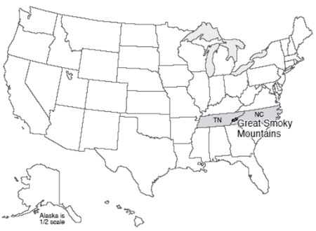
In case you’re interested, the top-ten most visited national parks in 2012 included great Smoky Mountains with 9.7 million, Grand Canyon with 4.4 million, Yosemite with 3.9 million, Yellowstone with 3.4 million, Rocky Mountain with 3.2 million, Zion with 3.0 million, Olympic with 2.8 million, Grand Teton with 2.7 million, Acadia with 2.4 million, Cuyahoga Valley with 2.3 million. Cuyahoga Valley may seem the odd-one out; it is a recent addition, seems to have been justified as a national park in part so that Ohio would have a national park, and seems to have a lot of day-picnickers from nearby Cleveland who increase the attendance a whole lot, based on Dr. Alley’s observations during a recent visit. But, Dr. Alley also believes that the Park Service is doing great things with it, and it is well worth the visit! Over 282 million people visited US national parks in 2012 (bear in mind that is with ~2 million fewer visitors than expected as a result of park closure caused by Hurricane Sandy). Note that this is nearly 90% of the whole US population. Although some people will have visited a few parks whilst others visited none, overall people are enjoying their parks!
Much interest in the Smokies centers on the historical aspects. For example, how did the early European settlers survive and flourish in this region? At Cades Cove, wonderful relicts of a bygone lifestyle are maintained in a living museum. Many visitors are also seeking to learn about the earlier Native Americans. Biologically, the Smokies host an amazing array of tree species, flowering bushes (azaleas, rhododendron, and mountain laurel in particular), wildflowers including many orchids, and more. Approximately one-third of the park is covered with "virgin" timber that was not cut by European settlers, and the regions that were logged are growing back rapidly.
Abundant rainfall and snowfall “scraped” from the sky by the high peaks feed numerous cascades and waterfalls, with trout in the pools and kingfishers by their banks. Rainfall is roughly 50 inches (1.3 m) per year in the valleys, and more than 85 inches (2 m) per year on the peaks, so the Smokies share some characteristics with temperate rainforests of the west such as in Olympic. Especially during “off-peak” times, you can get lost in the Smokies, and imagine what the Appalachians must have looked like without humans; approximately 3/4 of the park is wilderness.
Obduction Zones – The Push-Together Boundaries
The Smokies are a small part of the great Appalachian mountain chain, which extends along the coast of North America from Newfoundland through the Smokies, and then bends westward into Oklahoma. In the Great Smokies, the mountains display a truly remarkable feature—older rocks sit on top of younger rocks! (See the diagram below.) The very high peaks are composed of hard, resistant, old metamorphic rocks (which we will explain soon), of the sort that one finds deep in a mountain range. Beneath them are younger, sedimentary rocks that were deposited in shallow seaways. Between these is a surface called a thrust fault or push-together fault. Thrust faults often show evidence of sliding—scratches and polish indicating motion in one direction, crushing or breaking of rocks, etc. In some cases elsewhere in the world where deformation is still active, thrust faulting has been observed during earthquakes. In the Smokies, the older rocks have been shoved as much as 70 miles (110 km) to reach their present position on top of the younger rocks. The picture below the diagram shows two very much smaller thrust faults, with the upper rocks shoved up to the right only a few inches, but the idea is the same.
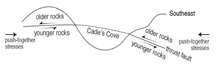
You may recall that we started with pull-apart faults at Death Valley. As shown in the diagram above, thrust faults are of the push-together type. Squeeze from either side, and one set of rocks will be pushed over another set. Each set is right-side up, but where they meet, the older rocks are on top of younger. This is seen clearly in the Great Smokies.
Farther north, in the State College, Pennsylvania area, where Drs. Alley and Anandakrishnan teach and where Dr. Alley wrote most of this text, we see a different way that rocks can respond to push-together stresses. There, in addition to some push-together thrust faults, many folds occur. Take a piece of paper, lay it on your desk, and squeeze the opposite sides towards the center. The paper will buckle into a fold. You may achieve the same effect by trying to push a carpet along the floor. Clearly, there are push-together forces involved here.
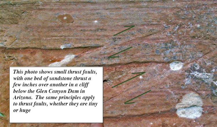
Just as pull-apart forces occur at spreading ridges, we should expect push-together forces at subduction zones, or at other collision zones. Today, the Appalachians and the east coast of South America look across the quiet sea floor of the Atlantic, across the spreading center of the mid-Atlantic ridge, to the coastlines of Africa and Europe. The coastlines on either side of the Atlantic are parallel to each other and to the mid-Atlantic ridge—slide the new and old worlds back together again, and they fit like a jigsaw puzzle. You can put all of the modern continents back together jigsaw-puzzle style. This fact, and especially the wonderful fit across the Atlantic, has figured prominently in suggesting the idea of drifting continents to scientists and other observers almost since the first decent maps were available of the Atlantic coasts. More importantly, putting the continent shapes back together jigsaw-puzzle style puts the “picture”—the geology—back together as well for events that happened while the continents were joined. For example, the tracks of a glacier run out to sea from Africa, and glacier tracks run from the sea into South America; put the continents back together, and the tracks fit together in showing the path of a single ice flow.
The oldest rocks on the Atlantic sea floor are about 150 million years old, approximately the same age as sediments that were deposited in a Death-Valley-type setting in the Newark Basin of New Jersey and elsewhere along the U.S. east coast. Evidently, the modern situation of a spreading Atlantic began about then, splitting apart a supercontinent to form the Atlantic Ocean in the same way that Baja California is being split off to open the Gulf of California.
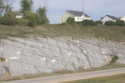
But, the Appalachian Mountains are much older than that. A story begins to emerge of a cycle—older push-together forces led to closing of a proto-Atlantic ocean that produced the Appalachians. When the proto-Atlantic was closing, subduction-zone volcanoes formed and spread ash layers across the land, much as Crater Lake/Mt. Mazama and Mt. St. Helens did more recently. (You can find some of those ash layers in many places, including the road cut along the Route 322 expressway just south of East College Avenue in the State College, PA area; see the picture at left.) Sometimes, the proto-Atlantic subduction zones formed offshore and then their volcanoes collided with the North American continent.
When the pushing stopped, the giant pile of the Appalachians, with deep, hot rocks beneath, began to fall apart in Death-Valley style, and red sandstones and mudstones accumulated in Death-Valley-style valleys along parts of the U.S. east coast. The drop in pressure as the Appalachians fell apart probably caused a convection cell in the deep mantle to rise right there, eventually forming the Atlantic Ocean.
Such a cycle, with subduction or continental collisions building mountain ranges that then spread Death-Valley style and eventually split to make ocean basins, has been played out many times over the history of the Earth. And, the fun isn’t over yet; North and South America are cruising westward toward Australia and Asia, as the Atlantic widens and the Pacific narrows. Africa is still bumping into Europe and pushing up the Alps, and India has not yet grown weary of ramming Asia to raise the Himalaya. At fingernail-growth speed, the next 100 million years or so should lead to a lot of geological high drama, but the next 100 years won’t see a whole lot of change. A good animation of this cycle can be found on YouTube.
The key to most of this is that you can sink old, cold sea floor, but you can’t sink a continent. Island arcs and continents float on the mantle too well. So, rather than going down the subduction zone with the oceanic lithosphere, the island arc or continent rides across the subduction zone for a major collision. In such a collision, called obduction, layers of rock are bent into folds such as those of the State College area, or broken into thrust faults such as those under the Blue Ridge and the Great Smokies. In the case of the Appalachians, the thrust faulting was very efficient, with older rocks sliding tens or hundreds of miles (or kilometers) over younger ones.
The Three Structural Styles
You have now seen, at least briefly, the three structural styles that are possible: pull-apart (Death Valley, spreading ridges); push-together (Crater Lake and Mt. St. Helens subduction, State College and the Great Smokies obduction); and slide-past (the San Andreas Fault in California). Pull-apart behavior involves stretching of rocks until they break, forming pull-apart or gravity faults (after being pulled apart, gravity pulls one block down past the other). Pull-apart action occurs at the spreading centers, probably where the convection cells deeper in the mantle spread apart. Push-together behavior occurs at subduction and obduction zones, and produces squeeze-together folds and faults, with the faults also known as thrust faults. Slide-past boundaries, also called transform faults, occur where two large blocks of rock move past each other but not toward or away from each other. Slide-past motion produces earthquakes without mountain ranges
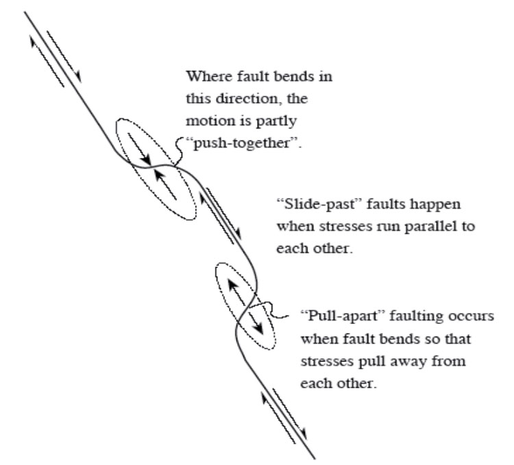
Now, you might imagine that we have oversimplified just a little. There is no law that rocks must move directly toward each other (push-together) or exactly parallel to each other (slide-past); sometimes you see an oblique motion with rocks approaching on a diagonal. Or, the rocks may pull apart on a diagonal. And a bend in a slide-past boundary may produce pull-apart or push-together features, depending on which way the bend goes relative to the motion, as shown in the diagram above. A large bend in the San Andreas Fault just north of Los Angeles gives push-together motion and some impressive mountain ranges.
Mountain ranges correspond directly to the main boundary types. Fault-block mountains—the Sierra Nevada, the Wasatch Range, the flanks of the great rift valleys of Africa, and the mid-oceanic spreading ridges—form at pull-apart margins. The mountains are high because the rocks beneath them, in the mantle, have expanded because they are the hot upwelling limbs of convection cells. Volcanic-arc mountain ranges form over subducting slabs, where some of the downgoing material melts and is erupted to form stratovolcanoes; smaller ranges (such as the Coast Ranges of the Pacific Northwest, including Olympic National Park) may form from the sediments scraped off the downgoing slab just above the trench. Continent-continent or continent/island-arc obduction collisions occur at convergent or push-together boundaries as well, producing folded and thrust-faulted mountain ranges.
Why the Great Smokies Are Still So High
Remember that crustal rocks are the low-density “scum” that floats on the denser mantle. When obduction occurs, this crustal scum is crunched—it goes from long and thin to short and thick, in the same way that the front end of a car is changed when it runs into a brick wall. Then, just like an iceberg floating in water, a mountain range is a thick block of crust floating in the mantle, with most of the thickness below and only a little bit sticking above.
With an iceberg, about 9/10 of the thickness is below the water and 1/10 above. If you could instantly cut off the 1/10 that is above water, the iceberg would pop up to almost as high as before. A 100-foot-high berg would have 10 feet above the water and 90 feet below. Cut off the top 10 feet, and it is a 90-foot berg with 9 feet, or 1/10, above the water and 81 feet below. So removing 10 feet from the top shortens the ice above water by 1 foot, and the ice below the water by 9 feet. With mountain ranges, the density contrast between crust and mantle is larger than that between ice and water—only about 6/7 of a mountain range projects down to form the root, and 1/7 projects up to form the range.
It remains, however, that if you erode a mountain range, some of the root is freed to float upward. Only by eroding the equivalent of 7 mountain ranges can you eliminate the mountain range entirely. So the Appalachians, despite having been deeply eroded, are still high because they still have a root.
The idea that things on the surface of the Earth float in soft, denser material below is called isostasy, which means “equal standing”—that each column of rocks on Earth has the same weight or standing. Lower-density columns then must be thicker to weigh as much as thinner, higher-density columns. The continents stand above the oceans because the silica-rich continental crust is lower in density than the silica-poor sea-floor crust. The mountain ranges stand above the plains because the thick, low-density roots of the mountains have displaced some of the high-density mantle that is found beneath the plains, or because the rocks beneath the mountains are especially hot and so low in density.
Put a big weight on a piece of crust (say, an ice sheet, or the Mississippi Delta, or a mountain range) and that piece of crust sinks, pushing up material around it in the same way that the surface of a water bed sinks beneath your posterior when you sit down, while the surface is pushed up around you by the water that is shoved sideways. The rising and sinking of the land are slower than for a water bed—thousands of years rather than seconds—because the hot, soft, deep mantle flows a lot slower than water does. But for a mountain range over 100 million years old, a few thousand years doesn’t mean much.
Notice something else fascinating; when a mountain range is being eroded, the top is taken off, and rocks below bob up. Those are taken off, with their place taken by more rocks from below. Pretty soon, the rocks at the surface have come from far down in the Earth, where temperatures and pressures are high. And as you might imagine, high temperatures and pressures change rocks. The rocks around State College, PA have not been “pressure-cooked” much, but the rocks around Philadelphia have been; they tell the story of a great mountain range that fell apart, leaving the remnant that we know as the Appalachians. The rocks in Rocky Mountain National Park are similar to those in Philadelphia, having been deep and now occurring at the surface. Let’s go take a quick look.
Textbook 4.2: Still More Plate Tectonics, The Rocky Mountains
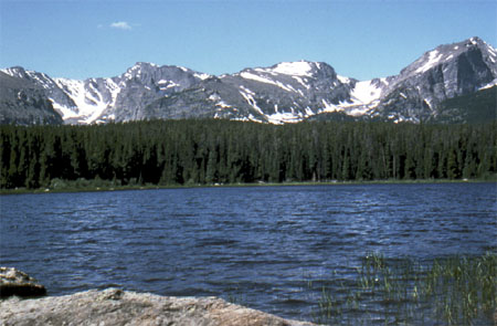
Mountain Building and Metamorphism
Rising high above Estes Park, Colorado, and almost within shouting distance of the population centers of Boulder and Denver, Rocky Mountain National Park is a natural destination for the crowds that throng to this mountain playground. Long’s Peak, at 14,256 feet (about 4300 m), dominates the south-central part of the park; the peak was first climbed in 1868, by a party that included John Wesley Powell, the man who later commanded the first boat passage of the Grand Canyon and then led the United States Geological Survey. Numerous peaks over 13,000 feet (4000 meters) in Rocky Mountain lure climbers.
Small and rapidly shrinking active glaciers still carve the mountains, and much greater glaciers of the past left the numerous tarn lakes, moraines, and other features that decorate the park. Trail Ridge Road surmounts the high tundra of the park, giving the visitor a first-hand look at periglacial processes and ecosystems (those of cold regions; more on this later). The Colorado River rises on the west slopes of the park, and lovely little trout streams such as the St. Vrain flow down the east slope. Bighorn sheep and elk attract traffic jams in Horseshoe Park.
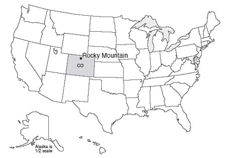
It is a tad embarrassing to say that we don’t fully understand the Rockies yet, including those of Rocky Mountain National Park. Oh, the long history of mountain building, erosion, glaciation, etc., is well-known—we can tell the story. But most mountain ranges hug coasts, or are trapped inland only by the destruction of the ocean to which they once were coastal, whereas the Front Range of the Rockies is as far as almost 1,000 miles (1600 km) from the coast, yet the Rockies are not the direct result of obduction.
The U.S. West is a complicated region (see the Enrichment section for a little more on this). The continent has been approaching and overriding the East Pacific Rise spreading ridge. The San Andreas Fault is the product of the rise running into the trench. Before these met, subduction had been occurring from push-together motion, but with a little slide-past motion thrown in. After the meeting, the subduction stopped, so the push-together stopped, but the slide-past remained to make the San Andreas. To the north of the San Andreas Fault, subduction is still active, forming the Cascades including Mt. Rainier and Mt. St. Helens.
Long ago, the west-coast subduction zone started in the usual way, with old, cold ocean floor going down into the deep mantle. But as the continent approached the spreading center, the down-going ocean floor became progressively warmer and more buoyant. The ocean floor didn’t “want” to go down, but it was still attached to the older, colder floor ahead of it that was going down. So, the ocean floor went under the continent, but stayed high rather than sinking, and rubbed along the bottom of the crustal rocks rather than plunging steeply into the mantle. The friction between this buoyant subducted ocean floor and the crust above, in turn, caused thrust-faulting and crustal thickening far inland (see the figure just below). Because the western part of the country has been built up of many old rock bodies and sediment piles bulldozed from the Pacific, there are scars of many old faults and other geological features that have been reactivated by the recent events, so mountains and valleys have formed along the old weaknesses in response to the new pushes.
As to exactly how this came to produce 14,000-foot (4300-m) peaks in the Rockies, geologists can tell the story, but it isn’t clear that any geologist could have predicted this story without seeing the rocks first. Science moves from explanatory (easier) to predictive (harder), so we still have some work to do. (And, we've oversimplified a bit here; see the Enrichment for more.)
If you drive west from Boulder up the slope to Rocky Mountain National Park, you will go through sedimentary rocks, made from sediments brought down from the current Rockies and from earlier versions of the Rockies. As folding and faulting pushed up the mountains farther west, and as erosion of those peaks allowed “bobbing up” of their thickened deep root, the sedimentary rock layers were tilted (see the figure below), so you actually will be driving into older and older rocks as you go. Eventually, you will reach the heart of an old (Precambrian) mountain range that also forms the heart of the modern one. Even to a casual observer, the rocks here have been “beaten up.” Follow a single layer in a rock, and you will see that the layer twists and bends, doubles back on itself, or even pinches out in places. Analyze the rocks chemically, and you will find a composition similar to the common sedimentary “mud” rock called shale, but the rock clearly is not shale.
Cooking the Earth
Think about cooking. If you mix up a bunch of ingredients to make cake batter, throw the mixture into a pan and put it into a warm oven, the cake you obtain will not be very similar to the mixture you started with. Grill a steak, and the original cow part will come out quite different. Marinade the steak before grilling, and more differences appear. It is common knowledge that a material that is stable in one environment will change if it is placed in a different environment. This is true of everything (and everyone!) on Earth.
The Earth clearly has a great range of conditions. The inside of a mountain range is hotter, higher-pressure, and less affected by acidic groundwaters than is the surface. Materials that are stable at the Earth’s surface (such as the clays in a piece of shale) are not stable deep in a mountain range. The minerals change, grow, and produce new types even without melting. This process is called metamorphism. Metamorphism makes rocks that many people consider to be especially pretty, produces some wonderful gems, and contributes rock names that make good puns. (The Geoclub at Wisconsin used a metamorphic rock, a volcanic rock, and a sedimentary rock in claiming that geologists are “gneiss, tuff, and a little wacke.”) You can read a little more about rocks and minerals in the Enrichment section.
Where Tectonics Meet People: Tsunamis
We’ve been looking at the ways the planet moves rocks around and makes mountains, and some of the ways that mountain-building can be dangerous to humans. Volcanoes and earthquakes are sometimes truly dangerous and damaging. But it is worth remembering that, in the developed world, only about 1% of us die in “accidents,” and car crashes greatly dominate those deaths (so 99% of us die of other things, such as heart disease, cancer, etc.). With good scientific warnings, good zoning codes, trained medical personnel, hospitals and ambulances to take care of us, nature just doesn’t kill that many of us. (In the less-developed world, this is, sadly, less true.) For the developed world, things we do to ourselves (smoking, eating and drinking too much, not exercising enough) are far, far more destructive of health and life than anything the planet does to us.
But, it is still wise to know about the dangers from the Earth. And now that we’ve completed the tour of mountain-building, we will look at another hazard. Tsunamis are not directly related either to the Great Smokies or the Rockies, but anything that makes earthquakes, volcanoes, or really steep slopes in or near the sea might be involved in a tsunami. And tsunamis can be truly horrific. We’ll start with a surprising hot-spot tsunami, and then look at some others.
On the flanks of many of the Hawaiian Islands, including Lanai, Molokai, and Maui, to at least 1,600 feet (500 m) in elevation, there are deposits of broken-up, mixed-up, battered corals, other shells, and beach rocks. Corals are undersea creatures, and surely don’t grow 1,600 feet above sea level. Some corals grow just below sea level and later are raised above the water by mountain-building processes; however, these Hawaiian deposits occur on islands that are sinking as they slide off the “hill” made by the rising motion of the hot rock of the Hawaiian hot spot, and the deposits are geologically too young to have been raised so far by mountain-building processes. Clearly, something strange happened.
One of the deposits in particular is the same age as a nearby, giant underwater landslide, as nearly as the age can be measured, which may suggest something. The Hawaiian volcanoes have rather gradual slopes above the water, where the hot, low-silica lavas spread out to make shield volcanoes. But when lava hits the water, the hot flows cool and freeze very quickly, and can make steep piles. Too steep, and eventually the side of the island fails in a great landslide, perhaps when melted rock is moving up in the center of the island and shoving the sides out to make them steeper. Surveys with side-scanning sonar have shown where several such slides have slipped. (Try saying the previous sentence five times fast!) Such slides can be miles thick, tens of miles wide, and over 100 miles long.
Now, if a chunk of rock miles thick and tens of miles wide suddenly starts moving, maybe at hundreds of miles per hour, it will shove a LOT of water out of the way. Where will the water go? The answer is that it will make a huge wave, or tsunami, that will race up any land it encounters after crossing the ocean. Imagine a wave that would run far inland and reach heights of 1,600 feet above sea level. Fortunately, the highest deposits in Hawaii are from a tsunami about 110,000 years ago, long before people were in the way there. Although many such tsunami-generating landslides have occurred, they typically are spaced thousands of years apart or more. But, we can’t absolutely guarantee that there won’t be another one.
The word tsunami comes from two Japanese words, for harbor and wave, a sort of shorthand for a wave that devastates a harbor. Most tsunamis are generated by undersea earthquakes, but undersea landslides or volcanic eruptions, and even meteorite impacts in the water, can generate tsunamis.
Tsunamis move rapidly across the deep ocean, with speeds of 300 to 500 miles per hour (600 to 1000 kilometers per hour). In the deep ocean, the “bump” of water that is the wave of a big tsunami may be only a very few feet high, but may extend well over 100 miles in the direction it is moving. Waves slow down as they enter shallower water, and the leading edge of a wave hits shallow water before the trailing edge. So, the leading edge slows as it nears the coast, the trailing edge catches up, and the wave goes from being long and low to being squashed and high. Even so, the tsunami wave is usually not a towering wall of water, but a strong surge, something like the tide coming in but higher (hence the mistaken name “tidal wave”).
An especially nasty feature of a tsunami is that the water often goes out before it comes in (waves consist of troughs and crests, and some places get the crest first while other places get the trough first). The sudden retreat of water and exposure of the sea floor tempts people to walk out and look around. Then, the ocean returns faster than a person can run. The outcome is predictable and unpleasant.
Terrible tsunamis have occurred. Still horribly fresh in our memories is the Indian Ocean tsunami of 2004, which was triggered by the second-largest earthquake ever recorded, and which killed over 300,000 people. Japan was much better prepared for the 2011 Tohoku earthquake, but almost 16,000 people still died, mostly from the tsunami. The massive 1883 explosion of the volcano Krakatau in Indonesia essentially destroyed the island, with tsunami waves observed as far away as England. Floods raced miles inland on Java and Sumatra, with probably tens of thousands of deaths. Another volcanic eruption, likely in the 1600s BC, of the Greek island volcano Santorini, pushed a tsunami perhaps 300 feet (100 m) or more high across the coast of Crete, and may have contributed to eventual demise of the Minion civilization there. Many commentators have suggested that this is the source of the myth of Atlantis. The great 1964 Alaska earthquake generated a deadly tsunami that killed 118 people, with deaths as far away as California. In 1958, an earthquake-caused landslide in Lituya Bay, Alaska, caused a tsunami that included a wave 50-100 feet high out in the bay, which a father and son safely rode out in a boat. They watched in awe as the wave then ran 1,800 feet up an adjacent coast; five people were killed in the event.
There isn’t a whole lot that can be done to stop tsunamis, but loss of life and property damage can be limited. Tsunami warning systems are functioning in many places, and are being extended rapidly. When instruments (called seismometers) sense the shaking of the Earth from a large undersea earthquake, volcano, or other disturbance, if characteristics suggest that a tsunami is likely, communications are sent out to various agencies concerned with safety, and sirens or other warnings on beaches are activated to get people away from the coast before the tsunami arrives.
The Indian Ocean tsunami seems to have been especially deadly in places where human activities had caused damage to the coral reefs and coastal vegetation that would have blunted the strength of the wave, so maintenance of these natural buffers can help the people living there. And, scientists can figure out where tsunamis are likely, how big and how frequent they are likely to be, and then zoning codes can be enforced so that people build in appropriately safe ways on appropriately safe land if they want to live in an area.
Virtual Field Trips
Join Dr. Alley and his team as they take you on "virtual tours" of National Parks and other locations that illustrate some of the key ideas and concepts being covered in Unit 4.
TECH NOTE - Click on the first thumbnail below to begin the slideshow. To proceed to the next image, move the mouse over the picture until the "next" and "previous" buttons appear ON the image or simply use the arrow keys.
Virtual Field Trip #1: Great Smoky Mountains
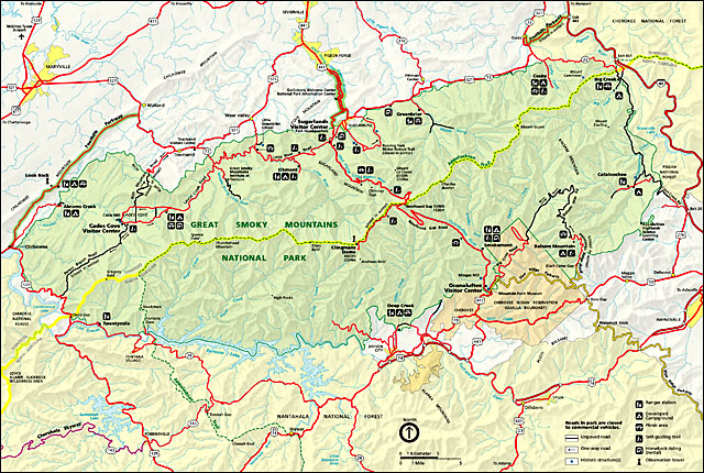
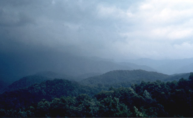
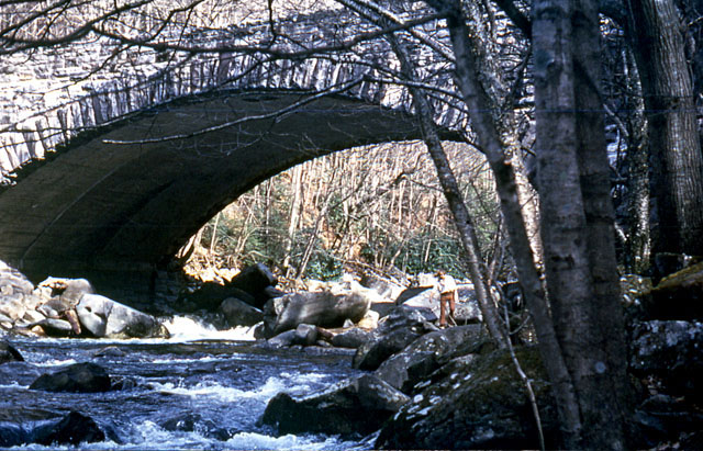

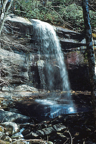
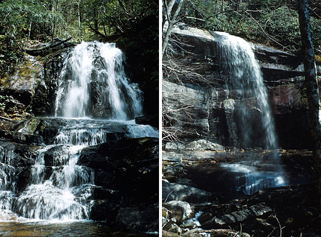
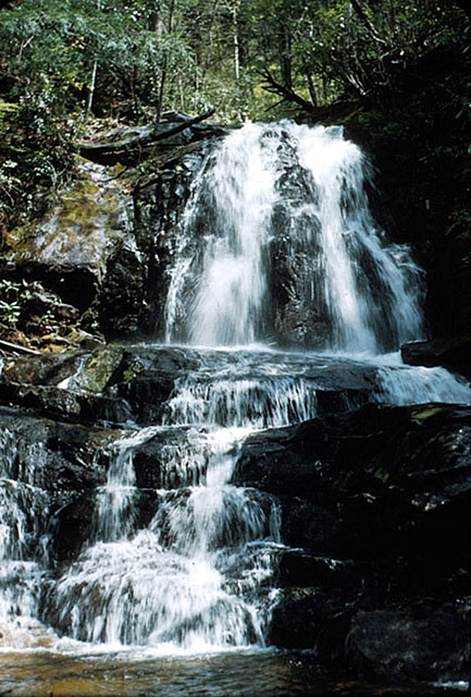
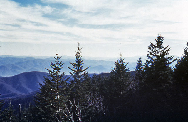
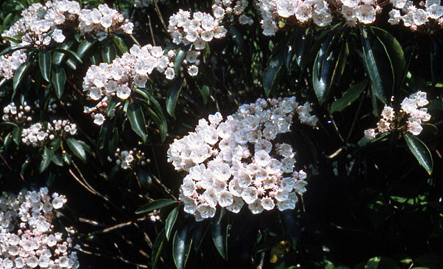
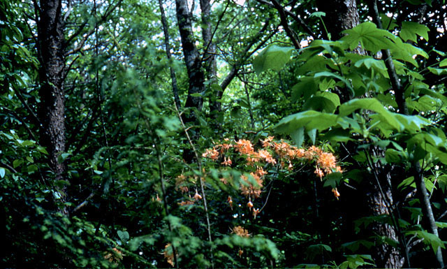
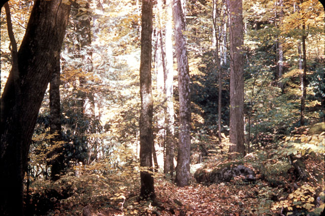
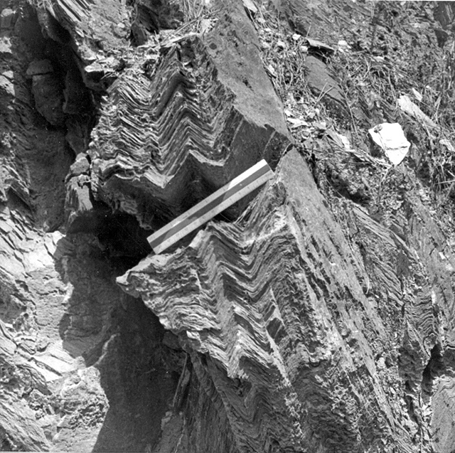
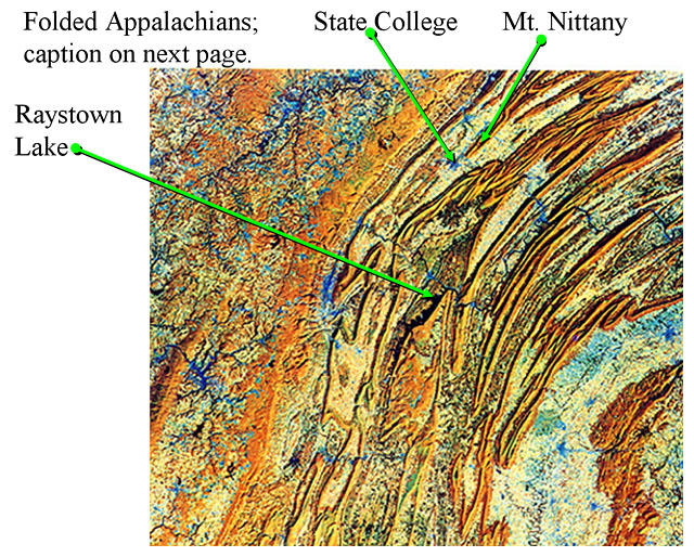

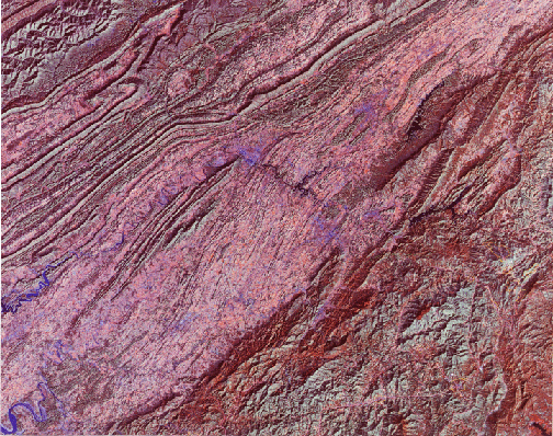
Image 1: Park Service Map of Great Smoky Mountains National Park
Image 2: Thunderstorm over Great Smoky Mountains National Park. The Smokies are the wettest spot in the lower-48 except for the Pacific Northwest, with the high elevations scraping rain out of the sky to water the wonderful forest.
Image 3: A stone bridge over a stream. Caption: Bridge, Great Smoky Mountains National Park. The abundant rainfall in the Smokies feeds numerous beautiful streams, such as seen here and in the next picture; many streams host native brook trout.
Image 4: Close-up view of a stream in the Smokies. There are many large rocks with white water rushing around them.
Image 5: A waterfall in the Smokies. Caption: This photo and the next, from the USGS archives, were taken by W.B. Hamilton in 1954. They show two of the many beautiful waterfalls in the Smokies. A little extra description of waterfalls is inserted between the two.
Image 6: Two waterfalls in the Smokies. Both photos from the USGS archives were taken by W.B. Hamilton in 1954. Caption: Waterfalls usually indicate something interesting in recent geological time; water flows faster and erodes more on steeper slopes, so waterfalls quickly become rapids. Hence, these waterfalls suggest a recent event, perhaps of mountain-building. Yet, the newest scientific studies suggest that conditions have not changed recently. The debate is more than academic; if mountain-building has occurred recently, then the risk of earthquakes is higher than it otherwise would be, with implications for zoning codes and construction practices and emergency services. Although the basic outline of geology is well-known, large and important questions remain!
Image 7: Another Smoky Mountain waterfall photo from the USGS archives, taken by W.B. Hamilton in 1954.
Image 8: Late-autumn view, Great Smoky Mountains National Park. There are evergreens in the foreground, a dark blue ridge directly behind the evergreens, and then many smaller mountain ridges fading into the distance as typical of the Appalachians.
Image 9: Close up of mountain laurel in Great Smoky Mountains National Park. Caption: The ridges of the Smokies are mostly sandstones, metamorphic rocks, and granites, which give rise to fairly acidic soils that are favored by rhododendron, azaleas (next pictures), and Laurel, among others. Limestones in places produce less-acidic soils and host different plants.
Image 10: Flame azalea with orange flowers, Great Smoky Mountains National Park. Caption: About 10,000 species of plants and animals are known to live in the park, and many more are probably present.
Image 11: A stream with rhododendron in the background.
Image 12: Close up of Goat’s-beard, a common wildflower of the Great Smokies. The Goat's-beard has dark green leaves and a plume composed of tiny white flowers.
Image 13: Old-growth forest in Great Smoky Mountains National Park. There are large deciduous trees with smaller evergreens growing below the trees and short undergrowth. Historical (1953) USGS photo by W.B. Hamilton.
Image 14: Metamorphic rocks near Cades Cove, Great Smoky Mountains National Park. Heating caused former muds to change into new minerals, and squeezing caused the prominent folds seen. A rich and varied geological history is recorded in the diverse and beautiful rocks of the Smokies. USGS photo by W.B. Hamilton, 1953.
Image 15: Remote Sensing Image of the folded Appalachians.
Image 16: Remote Sensing Image of the folded Appalachians. The Great Smoky Mountains were raised to their present elevation by obduction, when Africa and Europe collided with North America as the proto-Atlantic Ocean closed. The whole Appalachian chain formed with the Smokies, including the Valley and Ridge Province—the folded Appalachians—in which State College, PA lies. This autumnal NASA photograph shows State College and Mt. Nittany near the top center, as indicated. The ridges appear orange, the valleys white and blue (some of the colorations is “false-color”—NASA takes subtle differences in appearance and makes the differences appear bigger by changing the color scheme), and Lake Raystown is the black body near the center. From NASA’s Remote Sensing Tutorial.
Image 17: Another Remote Sensing Image of the folded Appalachians. The Great Smoky Mountains occupy the lower-right part of this image, with the folded Appalachians across the center and the Cumberland Plateau in the upper left. The false-color image is from the NASA Remote Sensing Tutorial.
Image 18: A crash test car crashed head-on into a wallm with the hood crumpled together. Caption: Obduction, which produced the Great Smokies, the folded Appalachians, the Himalaya, etc., has some things in common with running a car into a brick wall or another car--something long and thin becomes short and thick, with folds and push-together faults. This rather elegant example is from crash-safety testing by the Department of Transportation, Transportation Statistics Annual Report 2000.
Virtual Field Trip #2: Rocky Mountains
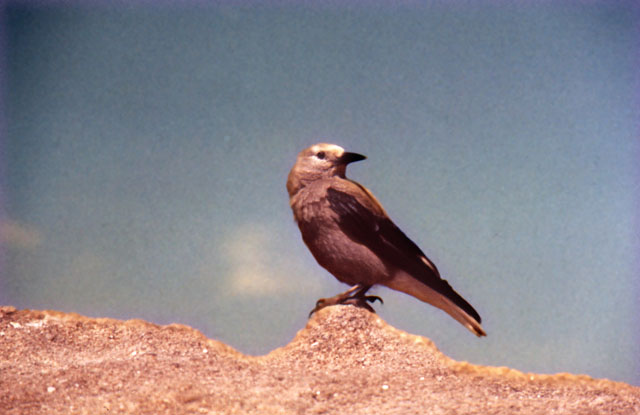
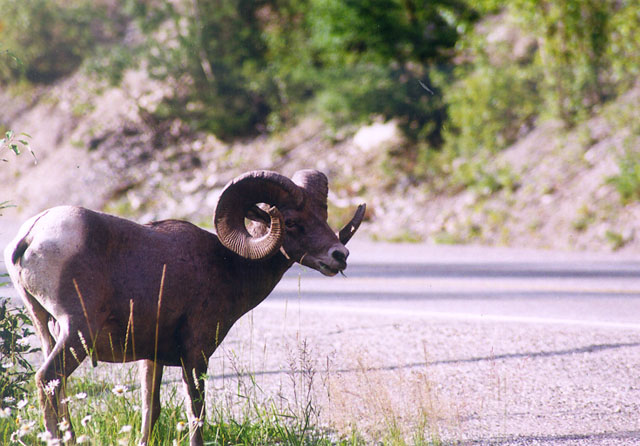
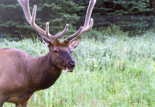
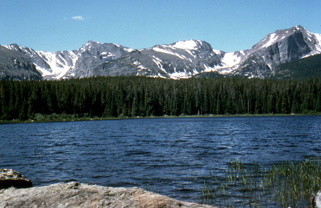
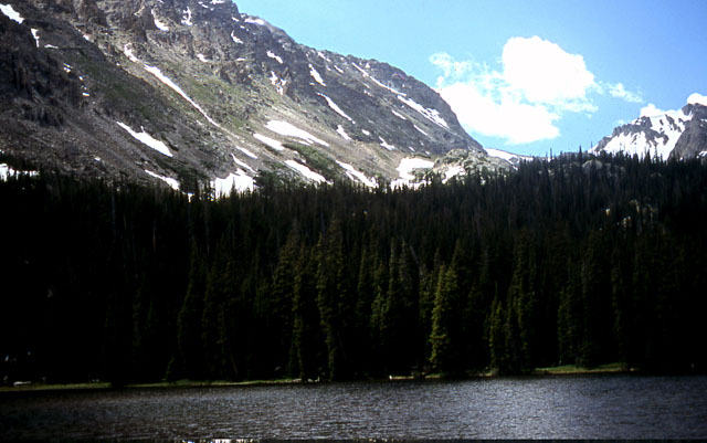
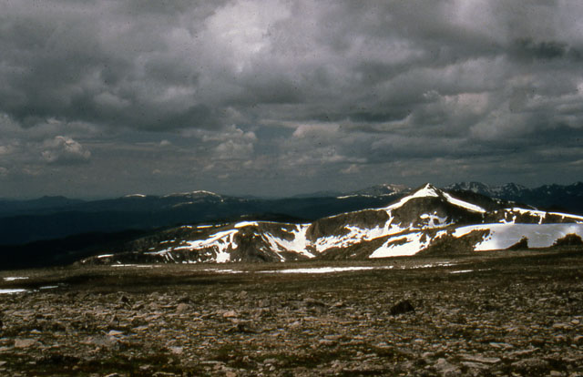
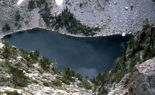
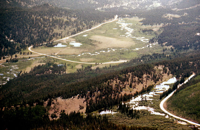
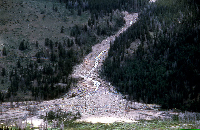
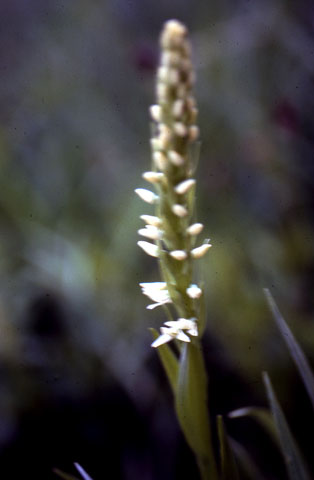

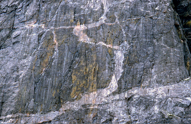
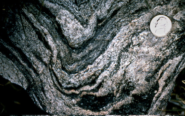
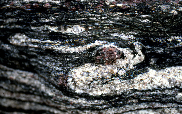
Image 1: National Park map of Rocky Mountain National Park. A quick field trip to Rocky Mountain National Park, Colorado. If you want to see elk, bighorns, big mountains, and big marmots, Rocky Mountain is great AND It has some beautiful metamorphic rocks, which we’ll look at in a minute. All photos by Richard Alley; map from the National Park Service.
Image 2: Clark’s nutcrackers (bird) sitting on a rock. Clark’s nutcrackers are well-known moochers at campsites and highway pull-offs. Feeding the animals is not allowed, however.
Image 3: Bighorn sheep standing beside a road. Bighorn sheep are common in the park and often come right down by the road near Sheep Lakes in Horseshoe Park.
Image 4: Close up of an elk eating grass and wildflowers. Elk are also common in the park and make a bit of a nuisance of themselves in nearby Estes Park sometimes. As for students, breakfast is the most important meal of the day for elk.
Image 5: Rocky Mountain peaks with small glaciers rising above Bierstadt Lake.
Image 6: Rocky Mountain peaks with small glaciers rising above a lake. Glaciers carved numerous lakes in the park, to which we will return later. Here is Ouzel Lake (an ouzel, or dipper, is a small gray bird that walks underwater looking for food.)
Image 7: Top of Flattop Mountain. It is crowned by tundra, short plants growing on permanently frozen ground (permafrost), another topic for our next visit to the park.
Image 8: View of Glacier-carved Emerald Lake, between Flattop and Hallets Peaks, from above. The photographer is standing at the top of a cliff, looking straight down into a lake. The lake is surrounded by mountains.
Image 9: View of Horseshoe Park, a glacier-carved valley. You can see trails, a road, and lakes. Trail Ridge Road runs along beaver ponds in the lower-right side. The ridge behind the beaver ponds is a moraine, pushed up by a glacier that filled the valley beyond during the ice age. Sheep Lakes, in the upper left, are frequented by bighorn sheep.
Image 10: Alluvial fan from the Lawn Lake Flood. In 1982, a dam failed far above this site, unleashing a flood that killed three people and left the trail of sand, rock, and debris running down the mountain and ending in a triangular area of debris. The barely visible road crossing the fan shows the great size of the deposit.
Image 11: Close up of a bog orchid. The park has glorious wildflowers such as this bog orchid.
Image 12: Close up of a calypso or fairy-slipper orchid . Calypso or fairy-slipper orchids are common on the forest floor on both the east and west sides of the park; this one is in the Wild Basin, an outstanding hiking destination.
Image 13: A cliff on the side of Hallets Peak that shows dark metamorphic rock and streaks of lighter colored igneous rocks. This cliff on the side of Hallets Peak is several hundred feet high. The darker metamorphic rocks are cut by lighter-colored igneous rocks that were squirted in while melted and then froze.
Image 14: A close-up of a metamorphic rock (called gneiss) shows beautiful layering and folding that formed when the rock was heated almost to melting. Remarkably, this rock started as mud and then recrystallized under heat and pressure.
Image 15: Metamorphic rock with a red garnet in the center. Metamorphic rocks often develop interesting minerals, such as the red garnet in the center of the picture. The rock folded around the harder garnet as it grew from the parent mud.
Virtual Field Trip #3: Tsunamis

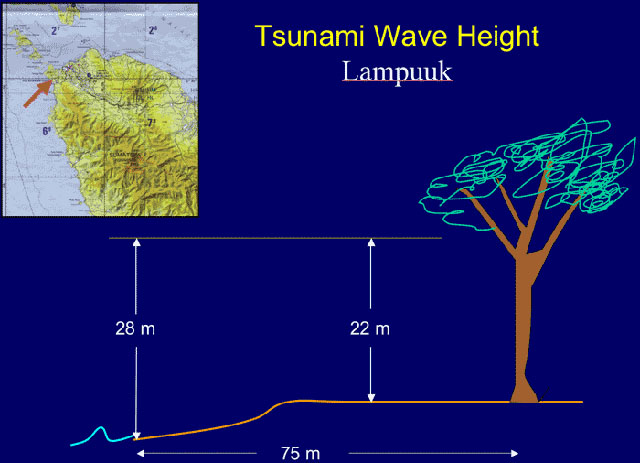

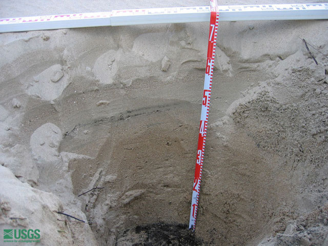
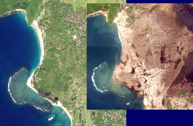
.jpg)
.jpg)
.jpg)
.jpg)
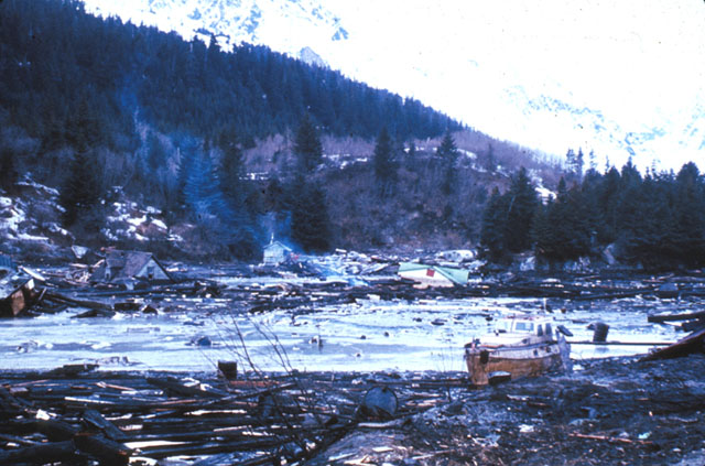
Image 1: Title page that simply says ‘Tsunamis’. Tsunamis are among the most deadly natural disasters.
Image 2: Map with an arrow pointing to the N. tip of Sumatra. It says Epicenter Magnitude 9.0, Dec 26, 2004, referring to the 2004 Indian Ocean tsunami. The 2004 Indian Ocean tsunami is among the worst natural disasters ever. An immense earthquake (one of the two or three biggest ever) triggered a wave that killed over 300,000 people. Many of the resources shown here are from the United States Geological Survey.
Image 3: Tall tree with branches broken off and bark scraped off up to the height of the tsunami. It has a 1.5 meter stick leaning against the base for reference. Branches are broken and bark is scraped off of trees up to the height of the tsunami. The 1.5 m (5 ft) high stick does not come close to the high-water mark, which is off the top of the picture.
Image 4: Map with an arrow pointing to Lampuuk. At Lampuuk the peak water depth was 28 m (nearly 100 ft) above normal water level, and the huge surge pushed well inland. Imagine the last time you were on the beach, at Atlantic City or Virginia Beach, and then mentally put 100 feet of water over the place where you were sunning.
Image 5: Steel reinforced beams broken at the base and laying across the sidewalk. The inrush of water carrying trees, boats, etc. can have immense force. Here, steel-reinforced beams were broken by the tsunami.
Image 6: A 2 ft deep hole in the sand. The sand was found inland. It was relocated from the shore to Lampuuk by the tsunami. The tsunami eroded the coast, and some of the eroded sand was carried far inland and deposited. Here, at the village of Lampuuk, 73 cm (2 ft) of sand was deposited on the dark soil at the bottom. Excavations in coastal regions can find such records of tsunamis, and help learn how frequent they are.
Image 7: Before and after satellite images showing the coast at Lampuuk. Before = green and has sandy beaches. After = brown and no sand beaches.
Image 8: Aceh, NW Sumatra, Indonesia: BEFORE the tsunami. Images processed by StormCenter Communications, Inc., Captured by Space Imaging Ikonos Satellite, processed by CRISP-Singapore.
Image 9: Aceh, NW Sumatra, Indonesia: AFTER the tsunami. Large parts of the land are under water and all of the land is brown rather than green. Text on the image says "sinking from earthquake motions also affected this area."
Image 10: Another section of Aceh, NW Sumatra, Indonesia: BEFORE the tsunami. It is green and lush.
Image 11: Another Section of Aceh, NW Sumatra, Indonesia: AFTER the tsunami. Now it’s brown and much of it is underwater.
Image 12: Seward, Alaska after the 1964 Alaska earthquake. Houses are leveled and trees are toppled. The great Alaska earthquake of 1964 generated tsunamis from the plate motions and from landslides and the tsunamis caused most of the deaths. Damage in Seward is shown here. 1964. Figure 4-D, U.S. Geological Survey Circular 491. Digital File:aeq00016
Image 13: View of downtown Kodiak, Alaska, before and after the tsunami. The after image has many missing buildings and a boat found inland.
p>Image 14: A large tractor-trailer bent around a tree with its back wheels in the air. This truck was 32 feet above sea level before the tsunami hit, two miles from Seward. The force of the wave bent the truck around the tree.Image 15: Blackstone Bay, Alaska. The wave reached 80 feet above sea level, washing the snow away (trees are 50-75 feet high). ( 1964. Figure 14-A, U.S. Geological Survey Circular 491 )
Image 16: Prince William Sound, Alaska. Man is standing along the coast, surrounded by trees up to two feet in diameter that were splintered by a tsunami from an earthquake-triggered underwater landslide. Since then, the Trans-Alaska oil pipeline was built, ending near here.
Image 17: Man holding a large tire with a two by four sticking straight through the rubber part of the tire near Whittier, Alaska. This shows the strength of the wave and the strange things that happen when a whole lot of energy is let loose.
Virtual Field Trip #4: Blue Ridge Mountains

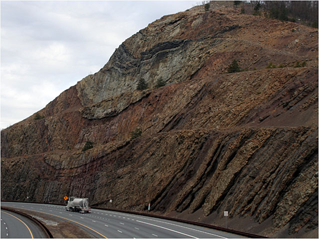
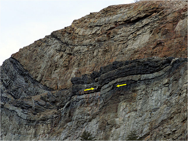
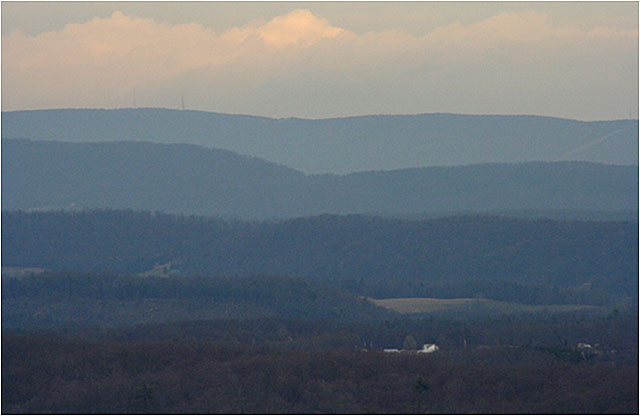
Image 1: A winding road through the Blue Ridge Parkway, Virginia, in January - there are no leaves on the trees. The Blue Ridge runs north from the Great Smokies into Pennsylvania. Along the top is one of the world’s best reasons for hiking boots, the Appalachian Trail. Also up there for less-dedicated hikers is the Blue Ridge Parkway, one of the National Park Service’s wonderful by-ways. Most visitors favor summer, but the rocks show better in winter.
Image 2: Three images showing the long history of human settlement in the Blue Ridge Mountains. One shows a house on a hill, one shows a stone wall that was used to help control hogs, and the other shows a path through the woods. The Blue Ridge has a long history of human settlement.
Image 3: Two images. Left, a turkey in the undergrowth. Right, an red-tailed hawk sitting in a tree. Logging greatly changed the Blue Ridge, but now that large areas are protected, much of the wildlife has returned, including the wild turkey and red-tailed hawk.
Image 4: Three images. Left, a hairy sumac tree, top right, a tulip tree with buds. Bottom right, a reconstructed narrow gauge railroad that is like those used to log tulip and other trees a century or more ago.
Image 5: Two images. Top, a waterfall cascading over granite. Bottom, fog in the valleys of the Blue Ridge. Abundant rainfall feeds numerous streams that are cutting into the high Blue Ridge, such as the waterfall cascading over granite. The Blue Ridge is high because its rocks are harder than those in the valleys. Erosion has lowered the valleys more than the mountain.
Image 6: Two images of rocks. The Blue Ridge rocks include formerly sedimentary rocks – old muds and sands – that were metamorphosed by heat and squeezing deep in the Earth, tipped up on end, and then exposed by erosion.
Image 7: Two images. Top shows layers of rock running vertically to the ground. Bottom, a snail path in the hardened rock. The standing-on-end layers of rock (top) attest to the great stresses in mountain-building. But look at the side of a layer, and you may see the track of a snail or other animal, from when the rocks were still soft mud.
Image 8: This greenish rock is greenstone
Image 9: A greenish rock outcropping. The greenish rock is greenstone, an old lava flow that has been metamorphosed by heat and pressure deep in a mountain range. Sideling Hill road cut, Interstate 68, western Maryland.
Image 10: A truck driving by on the highway next to Sideling Hill road cut along I68 in western Maryland. Folding squeezes the inside of a curve and stretches the outside. Fold a thick phone book and you’ll see this behavior. The arrows show the broken ends, where squeezing on the inside of the fold split a layer and pushed one side over the other.
Image 11: Another view of Sideling Hill road cut. The folded rocks of this obduction zone, like wrinkles in a carpet, give the beautiful ridges that we know as the Appalachians.
Image 12: image with the ridges of the Appalachians in the distance. The folded rocks of this obduction zone, like wrinkles in a carpet, give the beautiful ridges that we know as the Appalachians.
Word Document of Unit 4 V-trips
Want to see more?
Here are some optional vTrips you might also want to explore! (No, these won't be on the quiz!)
Death Valley National Park
(Provided by UCGS)
Death Valley National Park - 3D version
(Provided by UCGS - red/cyan stereo viewing glasses required)
GeoMations and GeoClips
There are two Unit 4 GeoMations (animations) and three GeoClips (movies) linked below. We hope they help you understand and enjoy Unit 4.
GeoMations:
The Rockies
We've been looking at how spreading ridges under the ocean make seafloor, which moves away from them and eventually gets old and cold and sinks down. And it will be sinking down beneath a continent, often, and it will scrape things off to make the Olympic. And then it will have a big volcanic range such as the Cascades, Mount Saint Helen's, and so on.
And they will be sitting there next to the ocean, which we can draw in. And coming up from below, there will be melt to make seafloor out here. And coming up from below there will be materials that erupt at the volcanoes like that.
Now, that works all fine, but what happens when there is a little bit of a swinging down of the slab? We know that the slab is moving away from the seafloor spreading ridge, as I show here. But the slab really does have a little of this swinging down, as well, in some cases. And the continent moves to catch up with it.
And so pretty soon, the continent is going to end up getting close to the spreading ridge. And the stuff going down is then not going to be cold. It's going to be getting warmer.
And when that happens, we have to erase this, because now the materials don't want to go down anymore. You'll get something that goes more like this, with it running right underneath the edge of the continent and staying high. And where it runs under the continent and stays high, you'll get a lot of rumpling, a lot of pushing happening in this way. And so then you might expect to see something that gets pushed up like this. And we're reasonably confident that that sort of push up is what the Rockies are.
In a few cases, as in the west, where the San Andreas Fault is, in fact, the subduction zone has been pushed all the way out and has run over the spreading ridge. And the subduction zone and the spreading ridge annihilated each other. And then you've got the San Andreas Fault.
Icebergs
Out in the ocean, there's a giant iceberg sitting out here. Big thing threatening the oil platforms floating around. And in the bottom of this very special iceberg, there is a really strange looking, googly-eyed space alien. And you have been given the task to go out there in your little boat sitting here in the water to get the space alien out.
Now, you're a good geosciences 10 student, and you know that all icebergs have about 1/10 above the surface, and they have about 9/10 below the surface. So you know immediately what to do. You take your gimongous chainsaw and you chainsaw off the top of the iceberg and throw it away, because you know what this will cause is that the iceberg will come bobbing up, carrying the space alien with it.
And so after it gets done bouncing up and down for a little bit, you find that the iceberg is almost as tall as it was before. It still has, sitting way down in the bottom of it, the space alien that you're trying to get to. So there's a space alien down here. And it still has about 1/10 of its height above the surface, and about 9/10 of its height below the surface.
But what you find is it's just a little bit shorter than it was, and it doesn't stick down quite as far as it did. Now you wump the top off again, and you keep wumping the top off, and you keep wumping the top off. And after a long time, you get down to a little iceberg that doesn't stick very far down.
Now it still is the same picture, that it has 1/10 above, and it has 9/10 below. And if you're not careful, you're sitting there admiring this lovely fact of science, and the space alien sticks out a giant tentacle, and it grabs your ship and throws it to the bottom of the sea. And so you'd better not do that.
However, there is a scientific piece to this. Suppose instead of space aliens, that we wanted to talk about mountain ranges. Now, we know that mountain ranges stick up above the plains. But you might not have known that they also stick down.
They have a root in the same way that an iceberg has a root that it's sitting on. There's a slight difference in that about 1/7 of a mountain range is up and about 6/7 of a mountain range is down, way down. The rocks have been heated. They've been squeezed. There's all sorts of interesting things going on and new minerals being grown.
And at the surface, the streams are sitting here, busily trying to grind away the mountain range. As the streams grind away the mountain range, why, the deep stuff will come bobbing up towards the surface. And if you come much later and look at it, you'll find that the rocks have barely any mountains left.
There's still a little bit of root with 1/7 up and 6/7 down. But now what you'll find is that the rocks that had been cooked way down, and bent way down, are very near the surface. And you can go see them.
GeoClips
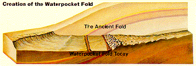
In the text, you read about changes in subduction as North America neared and overran the spreading ridge in the Pacific, with the increasingly warm downgoing slab rubbing along the bottom of the continental lithosphere and squeezing and wrinkling the rocks far inland. The Front Range of the Rockies is the most dramatic evidence of the "wrinkling" from that squeezing, but many other ranges and smaller features have the same origin. All sorts of different shapes of folds and wrinkles are observed. One spectacular one, which few relatively few people visit, is the Waterpocket Fold in Capitol Reef National Park. The diagram here, from the Capitol Reef website of the National Park Service, shows the fold (of a type called a monocline, although you don't have to worry about memorizing fold types) both before and after erosion along the lovely Fremont River. You will see more of the fold with Kym Kline and Dave Janesko in the short video. (Note that the Park Service diagram and Dave-and-Kym’s demonstration are of the same thing, but viewed from opposite sides, so that Dave-and-Kym’s fold slopes down to your right and the Park Service’s slopes down to your left.)
CAUSE 2004 - Capitol Reef Monocline
[MUSIC PLAYING]
We're at Capitol Reef National Park, home of the famous Waterpocket Fold. In the background, we can see it. We can see the layers dipping this way from the west, and you can't really see the layers on that side. This is a classic monocline, and it's a 100-mile long flexure in the Earth's crust. And Dave going to help show us how it formed.
This is the Earth's crust. And then 50 to 70 million years ago compressional stress came from the west and caused a bulge. And rocks on the west side were lifted up on along a thrust fault about 7,000 feet higher than rocks on the east side. Later, uplift during the uplift of the Colorado Plateau about 15 to 20 million years ago left it susceptible to erosion and the top part was eroded off. and you got many of the geological features you'll find in the park, like monoliths, and canyons, and arches.
The reason the Waterpocket Fold got it's name is when the younger layers up here were eroded, softer layers beneath were exposed and formed small basins in which water gathered in, which provided a water source for early settlers.
[MUSIC PLAYING]
Metamorphic rocks—those cooked and squeezed deep inside a mountain range—are often especially pretty. At the bottom of the Grand Canyon, you can see such rocks. They were formed long ago and many miles down, and then reached the surface as erosion removed the mountains above and the deep roots of those mountains floated upward. Later, these rocks were buried again under sediments from oceans, rivers and wind, and finally revealed to us as the Grand Canyon was carved by the Colorado River. Some people—including Dr. Alley—think that these rocks are so beautiful that they're worth the overnight hike into the canyon all by themselves!
Toothpaste Rocks / Grand Canyon National Park
[MUSIC PLAYING]
This is the most glorious place. Just look at this place. We're sitting on these old rocks, these seriously old, 1.7 billion year old rocks.
Everything around us that's black didn't quite melt. Everything around us that's pink actually did. That was molten magma squirting into cracks. And the stuff that didn't melt was like toothpaste. It was so soft, because it was so hot, that it just flowed and crinkled and folded, and--
It's been bent, and one can follow any of these layers along. And you see that they wiggle, and they come around, and then they come out here and back. And so these rocks were really, really hot. They were almost up at the melting point.
And they were being squeezed. There was mountain building of some sort going on that caused them to have squeezing and to be pushed from here to there. And as they go, very often, you get something like this folding. If you take a phone book and squeeze it, it'll fold. And in the same way, when you squeeze these rocks, you end up folding them.
The other part that's interesting, here, is that we can see these beautiful things so very well because this stream has come over them. And it's eroded them, and it's polished them. And the surface that we're on is very smooth.
But this is the heart of the mountain. This is what it would look like if you could get down in a mountain range somewhere, down there about 5 or 10 miles. And that's what we're standing on.
Migmatite. M-I-G-M-A-T-I-T-E. It's not quite magma. It's migma. Mixed magma. And you'll see all of these awesome morphs and wiggles and the little things through here.
This melted. This didn't. This melted. This didn't.
Oh, this layer-- that's beautiful. These things have been really, really hot.
The Great Smokies are geologically attached to the whole Appalachian mountain range, including the ridges near Penn State’s University Park campus. There, if you’re so inclined, you can visit the beach in the mountains—all thanks to Africa.
Ancient Collisions
[MUSIC PLAYING]
So we're just outside of Happy Valley, Penn State, up behind the ski area on the road up to Bear Meadows. And we've stopped beside a pretty little stream to look at an old beach. The rocks behind me here are made of sand glued together with hard water deposits. They're sand stone.
This is an old beach fed by old rivers. It came down from a great mountain range that used to exist up to the east of us. Now, if you go and look at most beaches, the layers are flat. And if you look at the layer behind me, it very definitely are not flat layers.
The layers are tipped way up on edge. They're very steeply slanted. And so something fundamental has happened here to get the slant that we see out of the flat layers that used to be.
What happened here was that there was a great collision, and Africa rammed into North America. The oceans open and close, and the continents drift around, and occasionally one continent runs into another. And when there's a running into, you get a lot of breaking and you get a lot of bending. And so the rocks in this part of the world have been bent in various ways, and you get all sorts of interesting bends.
The rocks that we see behind me are one of these bends. They're the little slant on this side of the bend. And they go up here and over the top of Penn State and down on the other side in a great arch, the Nittany Anticlinorium. And we're seeing a little side of that. And that's why we have mountains in central Pennsylvania.
The same thing as the Smokies. The same thing as the Presidential Range, Mount Washington up in New Hampshire. The entire trend of the Appalachians is a result of this giant collision that bent and folded and broke the rocks.
The Atlas in Africa, the mountains up through Norway are the same thing, this giant collision that bent everything. It's happening today to make the Himalayas. And so when you see these rocks slanting up behind me, this little piece here in central Pennsylvania, it's part of the vast damage and the beauty of a collision that happened long ago.
Want to see more?
Here are some optional animations you might also want to explore! (No, these won't be on the quiz!)
Tsunami Visualizations
(An extensive collection of animations on this subject)
Mountain Uplift and Erosion
(An extensive collection of animations on this subject)
Video Lecture
There are TWO Unit 4 lectures both featuring Dr. Sridhar Anandakrishnan.
Please watch the unit 4 lecture #1, Plate Tectonics III: Making Mountains & Obduction (36:10 minutes).
Welcome. This is Geology of the National Parks, GSCI10. My name is Sridhar Anandakrishnan, and I'm going to be your guide through obduction, it's a word that means collision of continents and what happens when continents collide. So, you're probably watching this somewhere in Central Pennsylvania. Maybe you're not, maybe you're off on holiday somewhere else, but State College here is certainly in the middle of central Pennsylvania. And what is remarkable about this area geologically is the so-called ridge and valley structure that stretches for hundreds and hundreds of miles to the Northeast and to the Southwest. You've seen them. You driven over them. You've had to go long ways along these ridges with Tussey Mountain on this side or Mount Nittany on this side, Bald Eagle Ridge. So, it's a very characteristic structure of this area, and it was created by obduction, by the collision of continents.
So, that's what we're going to do. Let's take a look at some pretty pictures first that will motivate what it is that we're talking about, and then we'll go to the PowerPoint presentation. This is a picture of a thunderstorm over Great Smoky Mountain National Park. Great Smoky is down in the southern US, it's just an absolutely gorgeous place. High mountains, 4,500 feet high, wooded for the most part, except for these wonderful balds that they have there, these tops of mountains that are bare for reasons that I'm not particularly clear on. But you'll be hiking through and then you'll break out into one of these balds, and you can see forever, ridge after ridge after ridge, and there's all these clouds that give it its name, the Great Smokies. And maybe there's a thunderstorm on the next ridge, or maybe it's raining over there. It really is an amazingly dramatic place. It's not that far away. It's a day's travel from here, but there's some lovely scenery in between as well. Well worth a spring break trip. You've don't have enough money to go to Cancun or something like that, time much better spent. Drive down to the Great Smokies.
Great Smokies is where the Appalachian Trail comes through, one of the most extraordinary hiking trails in the world. It goes from Springer Mountain in Georgia right up the Appalachian Mountains right up to Maine, to Mount Katahdin in Maine. And every year, there's a few people, a few hardy souls, that hike the whole thing. They start down in Georgia in the springtime and they follow the spring up through. They come up through Pennsylvania, go right up Harrisburg right up the Susquehanna Valley, and then on into New York, and then finally through the Northeast up into Maine. So, it's a beautiful place. Here's a picture of the Great Smoky Mountain Park.
There's a bridge over one of the many, many streams. You have these mountains that stick up and to the west of the Great Smokies, you've got nothing. You've got these huge planes that stretch out for miles and miles to the west, all the way through the Midwest until you get to the Rocky Mountains. And the winds build, and the weather patterns, the weather systems come down through there, and they have to climb up over the Great Smokies. And as they climb up over it, they dump all their rain down into them.
They do the same around here. We're pretty wet here in Central Pennsylvania, and one of the reasons for it is that these wind patterns and weather patterns bring a lot of water in. When you've got water, you have streams. And here's one of those streams, a close up of one of those raging torrential streams.
You can go online. This is one of our virtual trips, virtual field trips. We call them vtrips, and you can read the captions. This is just a lovely place. And you're hiking along, you'll come across one of these waterfalls. This is two views of the same one. There's some text, they're talking about why those waterfalls are where they are. So, you should have a look at this. All right?
Late autumn, things are starting to thin out a little bit, and the ridges, one after the other. You see that around here, too. One ridge after the other. You climb up on top of one, and there's another one behind it. The early European settlers were quite unsettled by this. They would get up over one ridge, and there was another one that they had to go past. Lots of lovely vegetation, mountain laurel, flame azalea. Lots and lots of animals that live in there.
This is another thing that national parks are wonderful for. They preserve flora and fauna. If we didn't have a national park in Great Smokies, who knows what would be there? Maybe it would have been logged for farmland, or a subdivision, or a highway. So, the fact that it's a national park preserves all of these wonderful critters and plants. Rhododendrons in the background. Just a lovely place. So, you should take a trip down there. So, we're going to find out why the Smokies are important to us, why the Appalachians are the way they are, why the Appalachian Trail stretches up through there.
We're going to switch out to the PowerPoint, we're going to talk about Tectonics Part Three: When Continents Collide. You get obduction — there's how the word is spelled — and we're going to plunge right into it with "Go dog go." If you can see, there's blue dog and yellow dog, and blue dog has run into yellow dog. Yellow dog is chastising blue dog for being such a poor driver. But the important thing is that the hoods of their two cars have scrunched up like an accordion. Neither one gave way. Neither one submarined under the other one. They just smashed into each other, and they accordioned up and crumpled and rumpled up.
And that's what we're seeing over here. Those rumples in the hood of the red car, and those rumbles in the hood of the yellow car, think of those as the Appalachian Mountains. That's how the Appalachians were created. Two continents collided, not go dogs, but two continents collided. And when they collided, neither one gave way. . If you remember from last time, the subduction one, when oceanic crusts and continental crusts collide, one of them gives way. One of them sinks under. And so, you don't have these types of mountains that are produced when two continents collide. When they collide, neither one wants to sink down, and so, they just crumple up, get shortened. And as they get shortened, they rise up in these peaks that we see around us here in Central Pennsylvania and down in the Great Smokies.
Here's a picture of the Appalachians. And this is a perfect shot, ridge after ridge after ridge after ridge, long skinny things. We are sitting on the hood of the blue car looking up along the hood of that car towards one of the drivers. I'm going to go back here real briefly to the go dog picture. Imagine you're sitting at that collision point, looking up along the hood. That's all it is. That's all that these Appalachians are, writ large.
Here's a photograph in West Virginia. There's a road cut where Route 68, I think, goes west through there. Now there's a wonderful visitor center where you can pull off the highway, and there's a wonderful explanation of it. You have these extraordinary curved layers. What used to be nice and flat, during the collision, they got smashed together and got turned up and turned down, and you can see that over here because the road has cut right through there, and so, they've sliced through that part of it.
So, we're going to do a quick review of what we learned last time, or the last few times. And I know we've been throwing a lot of material at you in the last few weeks, but there is a lot of material to be thrown at you. It's all available online. It's on Angel. The text is free, you just have to download it and read it, and it connects to all of this. Tectonics is driven by heat. I've said that over and over again, I'll say it again. If I ever ask you what drives tectonics, you just yell all together, heat. There are a number of plates, the upper lithosphere is broken up into eight or nine plates, and they move about on these convection cells. The convection cells are due to heat. Oceanic plates are made up of basalt, and the continental plates have more silica in them. Silica ridge, they're a lower density, they're more buoyant.
When cold ocean plates collide with buoyant continental plates, the cold ocean plates sink down. They're of high density. They just sink down, you get a subduction. When continental plates collide, that's what we're going to talk about this time. You get the Appalachian Mountain range, that stretches all the way from Newfoundland down to Alabama. In Alabama, it sinks down underneath the coastal sedimentary plane, but the Appalachians actually come up again in Oklahoma. So, they're just an enormous mountain chain.
Continents are rarely destroyed. The story gets really complicated. If you take something and you just keep piling stuff on top of it year after year, you shred it, you munch it, you fold it up, you put in a corner, you take it out, understanding its history becomes really, really difficult. The ocean is easy. It's created, it's destroyed. After 150 million years, 200 million years, all of the ocean is gone because it's been subducted and disappeared. But the continents are old. They're four billion years old. And in that time, they've had lots and lots of things done to them. And so, it becomes really difficult to know what happened in the past.
The analogy that I give is one of my colleagues— not me, of course. I have a very clean office. That's a joke. You should come see my office sometime. But one of my colleagues has a really messy office. He's an older gentleman. He's been working in the department for almost 40 years. I don't think he's thrown a thing away in that time. And you go in there, and it's piles of books and manuscripts, piles and piles of folders and papers, and rocks that he's collected, and instruments that he's collected. And so, they get jumbled up sometimes, because he pulls something out from underneath and he puts it on top. And so, understanding the relationship of these papers to each other is really difficult.
And that's the way the continents are. They've been all jumbled up, and stuff has been piled on top, and stuff has been pulled out from underneath. We're going to give it a try, though. We're going to give it a try and try and tease out the history of the Appalachian Mountains.
Here's a satellite image of the east coast of the US and the eastern Canadian Shield. And you have this very characteristic wiggly line, you can see it there, that stretches right from the southwest right up through central Pennsylvania— I hope you can recognize the Delaware River there and the Chesapeake Bay. That's where Philadelphia is. And then on up into New England, and then right off the map— that's Maine— and then right off the top would be Newfoundland and Canada. You can see that this mountain chain stretches a long, long ways, and it's got these long, linear features to it.
This is the Susquehanna Valley from space. This is looking down at just the region right around here. That's the Susquehanna River, Harrisburg is right in the middle over there. And you can see these ridges, one after the other, stretching up through there, and this river slicing through them, allowing us to work out their history. This is what we're trying to figure out. Why are the Appalachian Mountains here? What's their relationship to the rest of the world?
The Appalachians are a complicated place. They aren't simple. As I said, the analogy that I give is of my colleague who has an office and it's been filled with stuff, and stuff has been removed, and it's very hard to tell the relationship between things. But we're going to give it a try. About 300 million years ago, North America and what's now Africa and Europe collided. These two huge continents— neither of which wants to sink, because they are low density. Neither of them wants to sink under the other. It's like a game of chicken. And the two, neither of them gave way. They smashed into each other. And they crumpled up to form these huge mountain chains, possibly as high as 15,000 feet. We don't really know, but we think some of those mountains might have been as much as 15,000 feet high.
It's similar to what's going on today, right now, in India and Tibet. The Indian continent is running into the Asian continent, and as the two run into each other, you have these enormous mountain chains, the Himalayan Mountain chains. The highest spot on earth, Mount Everest, is 28,000 feet high, and it's because of this collision of India and Asia.
This is a picture of that collision. The Indian land mass was way out in the Indian Ocean 70 million years ago, and it came zooming up over the last 70 million years. And today, it has smashed into the Asian plate. And in the process of those two continental massesIndia is a continental mass, Asia is a continental mass neither one wants to give way. And they just run into each other, and they crumple up, and then the rocks in between have nowhere to go but up, and so you get these huge mountain chains of the Himalayan mountains. This is a photograph of Mount Everest. Sagarmatha is what Mount Everest is called in the Nepali language. And it's an absolutely awe-inspiring sight, first climbed by New Zealander.
So, in the process of these two continents colliding, they get shortened up. It's just like the hood of the two dogs that we saw. That's an analogy, but it's a pretty good one. You take a hood that used to be longer, you accordion it together, now it's shorter. And that's what happened with the North American continent, and presumably with the European/African continent when they collided 300 million years ago.
One of two things could happen. The first is what's known as a thrust fault. This is where, when the two continents collide, you actually do get sliding of one over the other. You don't get subduction. Nothing sinks back down into the earth. But you can think of two sheets of paper that run into each other. One just climbs up and slides over the other one. This is known as a thrust fault. You can shorten up a continent by sliding one part of it over the other. And this is partly what happened in the Great Smokies area.
And one of the reasons that we know that is that there are places where there are young rocks underneath older rocks, and this is a very unusual situation. Usually, the old rocks are on bottom, and you pile younger rocks on top. It's like my colleague with his office. He gets a book, and he puts it on top of an older book. And he gets a newer book, and he puts it on top of an older book. And then he gets a newer book, and he puts it on top of that one. And so you can look at them, and oh, there's a book that he got 30 years ago, and there's a book that he got last week. And that's this normal sequence of things. Occasionally though, he'll go and he'll pull out one of the older books and read it and put it on top of this pile, and so the whole thing gets jumbled up and you don't know the sequence. That's what's happened down in the Great Smokies area, where you have older material that's ridden up on top of younger material.
Further north, around here, the rocks are more wrinkled. They look like a kicked up rug, or a sheet of paper that has been collapsed. We've got a young kitten that we just adopted from the shelter, and boy is he ever active. And he loves our rug. We don't have one of those little rug runners, the little rubber things that keep the rug from sliding around. And so he'll run as fast as he can, and he'll attack the edge of the rug, and he'll slide into it and he'll shove that rug back. And as he does it, he'll form these wrinkles, one after the other. And he doesn't seem to realize that that's a valuable rug, but his enjoyment of it simply comes from rumbling it up.
This is a similar sort of thing that happened over here. These two continents collided. Instead of one sliding under the other, what happened is the continent got shortened, but now by being crumpled and rumpled up like a rug. The rug itself is layered. There's hard layers and soft layers. And as time goes by, you get differential erosion, that we'll talk about next.
This is a cross-section. Remember what I told you a cross-section was. If I could take something and slice it open and look at it from the edge, that would be be a cross-- look at it from the end, that would be a cross-section. This is a cross-section through State College, going from the Northwest side-- the Allegheny Plateau and the Allegheny Front on one side, going down through Bald Eagle, through Mount Nittany, through Tussey Mountain, and heading off to Southeast on the right, down towards Harrisburg and down towards Philadelphia on the right. You should recognize this. If you have ever driven from here to New York City or ever driven from here to Philadelphia, you've seen this. You have to drive up over Seven Mountains and down the other side, and then there's another valley there, and you have to drive up the next one and down the next one, and that's what's going on over here.
But if you're a geologist, you can go and look at the types of rocks that form the different mountains. And what's interesting here is that these layers, what used to be a sequence of nice flat layers, that have now been squeezed together and crumpled up, have eroded in slightly different ways. Where you used to have very hard rocks, were the high places, and those cracked and you went down into the softer material, and those just eroded right down to what are now the valleys. So paradoxically, it's where the very hardest rocks used to be very, very high up, those are what have broken through, and now we have very deep valleys there. And the ridges in between are made up of what used to be the somewhat softer areas.
Eventually, the collision stopped. These things are colliding, they're getting pushed together. Eventually, the collision stopped, and then a spreading began. Similar to what's happening in Death Valley today. Death Valley is a mid-continental spreading ridge, and that's something that also happened in this area. About 150-200 million years ago, you started to have spreading apart of this in similar fashion to what happens in Death Valley. And the Atlantic Ocean was formed. As you started to rip it apart, and then the waters rushed into that low spot that was created where the continent was spread apart.
The mountains stopped being pushed up. You're no longer shoving them together, so you've stopped shoving these mountains up into the air. As soon as you stop doing that, those mountains will start to be eroded downwards. Mountains are very rapidly eroded. This is something we'll talk about more down the road when we're talking about erosion. But when you have these high mountains, the winds blow on, the water rains on them, the glaciers build on them, and they slowly get scraped off. That's what erosion is. Erosion is simply scraping off pieces of this mountain and making it go away, and depositing them in the low spots.
But for some very interesting reasons, the mountains are still fairly fine. There are 2,000, 3,000, 4,000 foot high peaks. They used to be much higher. They used to be 15,000 feet. But even though they're very old, they haven't been scraped down to sea level yet. And we know about rates of erosion, and so we should have been able to scrape down those 15,000 feet to sea level by now, but we haven't These mountains are still up 2,000, 3,000, 4,000 feet. Why is that?
It's something called isostasy. Mountains have very deep roots. When we squeeze those continents together, the continent bulged upwards, but it also bulged downwards. When you squeeze them together, it isn't as if the bottom was flat and it's just the top that bulged up. When you squeezed it together-- think of silly putty. When you squeeze that together, it bulges out in both directions. And that's what happened with the Appalachian Mountains. Some of it bulged upwards, and some of it bulged downwards. And as the mountains are scraped off on top, these roots ride up, scrape off some more. The roots ride up, scrape off some more, the roots ride up.
And so to get this mountain scraped down to sea level, you don't just have to scrape away the stuff above. You've got to scrape away the stuff below. So I'm going to go to the drawing pad and illustrate this notion.
Obduction is the collision of continents. And about 300 million years ago, we had the North American continent, we had the African/European continent, and the two of them collided. They ran into each other. And over time, as they kept pushing against each other, you had to give way. The one had to give way. Neither of them wanted to give way, but something had to happen. And so you've got shortening of the continent, and one of the ways they shortened is that the continent rumpled up like a rug.
This is still Africa here, and this is still North America on the left. They've shoved into each other, and they have rumpled up. But in the process of rumbling upwards-- I'll go to a different color here-- they've also rumpled downwards. Wherever you see a high spot like this, they also have a low spot underneath them. You squeeze them together, and in the process of squeezing them, you squeeze upwards, and you squeeze downwards. So I'm going to zoom in on that and show that in a little bit more detail.
This is a view of one mountain peak. And it has a deep root that might be three times as deep as the mountain is high. So even if the mountain is three miles high, then the roots might be 10 miles deep, or sometimes much deeper even than that. So it depends on the density contrast between crust and mantle. After the collision, you've now created a mountain, let's say 15,000 feet high. But at the same time, you've created this deep crustal root that goes deep down into the mantle, that is squeezed downwards at the same time that the crust has bulged upwards.
Over time, the collision ended, and so the mountain stopped growing. And in fact, erosion took over, and the mountain started to be scraped away. But the mountain isn't gone yet. Even though we've scraped away and scraped away and scraped away, we've kept eroding that mountain away, it's still there. After all this time, it's still there. And the reason for that is as you scrape material away, more material bobs up from underneath. And that's the principle of isostasy. That's what we're going to talk about next.
I'm going to switch back to the PowerPoint very briefly here, and then we'll come back to this picture drawing. As the mountains are eroded, they remain high because the material from below is floating up at the same time. It's like an iceberg floating in water. You probably have heard this expression, 9/10 of an iceberg is below water and only 1/10 is sticking up. And if you remember that movie The Titanic, with Kate Winslet and Leonardo DiCaprio or somebody. The two of them are on the Titanic, they're riding along, and it smashes into the great iceberg and disappears and all of that. It's because only a little bit of it is above water, and a big chunk of it is underwater. Ice is slightly less dense than water, and so it mostly sinks down into the water, but a little bit of it sticks up.
You can do this experiment for yourself. You can go home today, get yourself a glass of water, take an ice cube out of the freezer, and just drop it in. And if you look at it, you'll see most of it is underwater, and a little teeny bit will stick up above water. If you want to do it a slightly different way, you can go up to your bathtub, take a bath, put in lots of hot water, put in some bubbles, get your little rubber ducky out, and put your rubber ducky in. You'll see that the rubber ducky floats way up. A little bit of it underwater, a little bit of it above water.
That's the principle of isostasy. Different things that have different density contrast. An ice cube in water, a rubber ducky in water, a mountain in mantle, a crustal mountain in mantle. Each of these will float in the fluid. A little bit of it will be below water, and a little bit of it will be above water. And the amount that is below water and the amount that's above water depends on the density difference between them. Ice and water have almost the same density, so most of the iceberg or ice cube is below water, and a little bit of it sticks up above water, and the Titanic can run into it because you can't see it. So that's what we're going to talk about.
We're going to show you a picture of what this iceberg looks like. Before we do that, let me review a little bit about plate collisions. We saw in the first week, pull apart, that was Death Valley. Last time or two times ago, we saw subduction. Crater Lake, Mount St. Helens, all of those. We're seeing obduction this time, and we talked about slide past very briefly when we talked about the San Andreas Fault. In slide past tectonics, sometimes these two plates, when they're sliding past each other, they won't slide very smoothly. You'll have a kink in the boundary, and where these two are sliding past each other, you'll get these big mountains being built.
This goes along with the theme of all the action is at the boundaries. It's where the plates are running past each other, it's where the plates are running next to each other, it's where the plates are running into each other. That's where all the action is, that's where the mountains are being built. So we talked about obduction. We've built the Great Smoky Mountains, and we're going to come back to isostasy in a minute.
Let's briefly take a detour to slide past tectonics. If there's a kink where these two boundary plates are running past each other, once again, you'll have these great mountains being built. The San Gabriel Mountains near Los Angeles are a perfect example of that. The San Andreas Fault wants to go straight, but it's got a little kink in it and you get these big mountains being built. All of these are examples of isostasy. Where these mountains are built, you get these high mountains, and you get these deep roots underneath. Any time you've got a high mountain on a continent, you've got a deep root underneath it.
We're going to take a little detour here. If you remember, I told you when you see that little symbol up in the corner, that means we're running off the tracks and we're going to wander off and talk about something slightly different. During World War II, there was a proposal to build an aircraft carrier from an iceberg, because it would be unsinkable. The Germans could come along-- this was an Allied project, a US and British project. The Germans could come along with their submarines and fire their torpedoes at these aircraft carriers which is made out of an iceberg, and it wouldn't sink. It would just float. And this was an actual project. It would be unsinkable.
They thought big during War II, they really did. They were in a struggle for their lives, and for their way of life, and they would do whatever they needed to do to survive. And they came up with what now seems like a perfectly ridiculous idea, but it was actually taken forward quite a ways. It was called project Habakkuk, not quite sure why Habakkuk. There was a small one that was built on Lake Louise. As a glaciologist, I find it very interesting, things that people do with ice. But this was quite a visionary project that never went anywhere.
Back to the track. We're going to talk about the Rocky Mountains next. That's going to be another example of mountains built within a content. We've seen how obduction can create the Appalachian Mountains, how they will rise up high and they'll have deep roots. And as you scrape away the top of the mountain, the bottom will rise up to take its place, and so you've got to scrape away some more, and more and more has to come up. So that was obduction. You can also produce mountains at a kink in a slide past boundary.
So now, I think we've run into just about every type of mountain building mechanism. The last one that we're going to look at is one of the most unexplained, one of the most enigmatic. It's the Rocky Mountains, right in the middle of the continent. Why do we have these mountains way in the middle of the continent? That's what we're going to do next time.
Now watch part 2, Plate Tectonics III, Mountain Building & Obduction (34:47 minutes)
Hi, welcome to GESCI 10, geology of the national parks. This is our section on building mountains, tectonics and building mountains. And we're gonna go to the Rocky Mountain National Park in the middle of the continental US, take a look at it. My name is Sridhar Arandakrishnan, and I'll be your guide through this part of it.
The Rocky Mountain National Parks are an absolutely stunning place. You have to go there. They are very near Denver. You can fly right into Denver, drive up to Boulder where the University of Colorado is. Some of my colleagues work there. And right there, the front range is of the Rocky Mountains and then this magnificent panorama of mountains stretching for thousands of miles, north 1,000 miles, north and south, and hundreds of miles to the east from there, and right to the west from there, and right up onto the Colorado plateau, all right. So it's just a beautiful place, a very dramatic setting. You come from the plains of Kansas and Colorado, and then you come along, and then here's this unbelievable mountain chain. It must have been quite something for those who first saw it.
On the map here, you're seeing a map of the western US. California is right off to the west, and then you have Nevada and Utah that make up the so-called Colorado plateau, Utah and western Colorado. And then right where that Colorado text is is the edge of the Rocky Mountains. That's where Rocky Mountain National Park is, off to the east of that.
It's all plains, very flat, lots of corn, soybeans, wheat. It is classic midwestern plains country. It's nothing like what people imagine Colorado to be. They think of, when they think of Colorado, they think of majestic mountains. Eastern Colorado is very flat. It's western Colorado that has those 12,000 foot mountains, 13,000, 14,000 foot mountains, Pike's Peak, all these amazing places, all right, so all the skiing. When you think of Colorado, most people think of skiing. Well, eastern Colorado doesn't have it. It's all in the west.
We can zoom in a little bit. And you can see the transition from Denver there in the middle. And everything to the east of Denver is all plains country. It's all flat. And you can see as you go to the west from there you get those dendritic valley patterns, those white snow capped peaks, all of the complications that always go along with mountains, you get all of these little mountain valleys with little rivers and glaciers in them.
Rocky Mountain National Park itself is right here in the front ranges. And you can see the transition there even more dramatically up into the Rocky Mountains, all of the snow covered peaks, right. So this is where we're gonna take a trip to. Let's go look at some real pictures rather than looking at satellite maps. It's a place that's easy to get to and well worth the visit.
Lots of fauna there, lots of critters, birds and mammals of many different kinds, you still have wolves up in there, still have bears up in there, lots of elk and bighorn sheep, very common, all over the place. Obviously, it's a national park so hunting is forbidden. And so it's still in very much pristine condition. It is a very popular place, you drive up in there, going to the mountain, going to the Sun Road is one of the roads that goes through there. It's one of the highest roads in the lower 48. It's up at 12,000 feet. And sometimes it's just this solid mass of RVs, and campers, and pickup trucks, and SUVs stretching as far as the eye can see.
Just pull off the road, just park, get out your car, and walk in any direction. And you walk for 10 minutes and I guarantee 90% of the people will disappear, walk for another 10 minutes and 99% of the people disappear. So few people actually get out of their cars and walk, and I don't want you to be one of them. I want you to get out and walk and walk for just a little ways, just for half an hour, 45 minutes, to experience the solitude and the majesty of Rocky Mountain National Park.
All right, here it is, here's one of these Rocky Mountains. And in the foreground you have a glacially carved lake. When the glaciers came down out of the mountains 20,000 years ago they would have covered this whole area. They would have ripped up this area and pulled up this lake, pulled up this big hole. And then when the glaciers retreated water filled in that area. Now we have these lakes. There's a whole series of lakes up, wherever you have glaciers you usually have lakes that they leave behind. Glaciers are really good at digging deep holes. And this is one of them. Here's another picture of [? Usal ?] Lake and looking up at this glacial valley behind it, really a magnificent place.
This is up on top of Flat Top Mountain. You have this classic alpine landscape, this short scrubby bushes, very hardy little shrubs that manage to eke out a living in the permafrost, in the high winds and the cold. The weather can change really dramatically. You start out in the morning, and you have blue sky, and it's 70 degrees, and you get up there then you need a jacket because the storm clouds have come up, as they have in this case.
This is looking down at a little tarn. Tarn is a Scottish word, I think, I'm not sure, for small mountain lake, usually glacial carved lake. These tarns can be just a few hundred feet across. And they have lovely cold water surrounded by all of that glacial moraine material around them, a few trees but not many.
This is a road that runs, a very popular road, that runs up. There's Beaver Ponds there in the lower part of it, and then behind it a moraine, that little ridge that you can see with a little bit of a brown material on it and then some trees on top. That's a moraine. That's what was left behind by a glacier. A glacier came down, pushed up this material and left that. And we'll talk about moraines next time, or not next time but down the road.
Here's an alluvial fan. This is material that's brought down by rivers and sometimes landslides, just comes down these mountain sides, lots and lots of flora, lots and lots of fauna. So I said, all of these pictures are available online on Angel. Go and take a look at these virtual field trips, orchids, and the classic Rocky Mountain rock, this sort of grayish colored, dark gray and light gray colored rocks, metamorphic rocks cut through with igneous rocks. We'll talk about what a metamorphic rock is, what an igneous rock is over the course of this class. All right, so, let's hop over to the presentation and we'll begin our talk.
The Rocky Mountain National Parks, Rocky Mountains are a mountain range. They're quite high, 12,000, 13,000 feet high. But they're in the middle of the continent. They're 1,500 miles from the ocean. Why are they there? We talked about why the Appalachians are here. They're the collision of North America with Africa and Asia 300 million years ago. They created these high mountains. All right, that's straightforward.
We talked about why Mount St. Helen's is there, or why Mount Baker is there, or why Lassen Peak, or all of those. Those were subduction zone volcanoes. The Cascade range is a volcanic arc created when oceanic crust subducted under continental crust. The question is what's on with the Rocky Mountains? Why are they where they are?
Normally, and the short answer is, normally oceanic crust will simply subduct under continental crust. If it's dense enough and cold enough it'll just go straight down and all is well. You will get the classic subduction zone situation that we now have in the Pacific Northwest. You'll get trenches and volcanoes. Occasionally, if that subducting oceanic crust is hot enough, if it was only created recently in the last half a million years or million years, it hasn't had a chance to cool off, then it's still buoyant.
Remember hot rocks are buoyant and low density. It's only when they get cold that they want to sink. So if that oceanic crust was still hot, buoyant, low density, it would go under the continent, but it wouldn't subduct straight down. And as it got pushed off to the side it would continue to scrape underneath. And I'll show you a picture of it here in a minute, but that's, in words, that's what was going on.
I grew up in New York City, and this next cartoon perfectly encapsulates my ignorance of this country as I was growing up. This is a very famous New Yorker cover called New Yorkers View of America. And you have Ninth Avenue, 10th Avenue, all of the buildings in great detail. You have the Hudson River. They might know a little bit about New Jersey. But then the rest of the continent is just this vast blank space. And it might be, you might know, oh, there's a few mountains somewhere in the middle, and there's something off on the other coast, and then there's the Pacific Ocean. So this is a famous picture of what New Yorkers think of the rest of the country.
And to be honest I have to plead guilty to that. And I was in college, I went to school in New York City, I had a friend who had an internship, a summer internship, in Denver. And I had another friend who had a summer internship in San Francisco. And the two of them are flying out, and on the last evening as they were ready to go, I said, oh, boy, you guys are lucky. The two of you will be able to visit each other on the weekends, and I'm gonna be left here all by myself in New York City. Little did I realize that San Francisco and Denver are 1,500 miles apart. And so my ignorance was stunning back then. Hopefully I know a little bit more now but there it is.
This is our picture of how the Rocky Mountains were made. We think this is what went on with them. This is an animation that's available for you online. But the short answer is that an oceanic ridge, one of these mid-ocean ridges where material is coming up from deep inside the Earth, used to be far offshore but was subducted under North America.
But because it was so close to the edge of the continent, it's still warm. And because it was still warm, it didn't sink down. And because it didn't sink down, as it scraped along underneath the western US, it shoved up the Rockies way, way far inland, all right. So even though subduction is supposed to sink down and only produce mountains at the coast as we have in the Cascades, in this case, because that subducting slab was still warm, it went along for a long ways underneath the continent shoving up the Rocky Mountains far in the interior until eventually it got cool enough, and it did sink down far deep inside. This is the leading idea for why the Rocky Mountains are where they are and how they were formed.
We don't really know. It's a little bit embarrassing to say this, but geologists have a pretty iffy understanding of the Rocky Mountains. But this is the leading idea. This is how science works. We come up with a hypothesis, somebody did, they said we think this is what's going on, all the evidence seems to support it. But people are still working hard to try and figure out whether that hypothesis meets all the data, or if somebody can come find some new data that shall know that hypothesis is wrong, in which case we'll throw this slide out, and we'll put in a new slide.
That's the wonderful thing about science is none of these slides are ever carved in stone, if you will. At any time I could just delete this slide and throw it away because somebody comes up and says, nope, I think that's wrong. So as this warm oceanic crust was subducted and slid right underneath North America long deep, deep under the continent, it shoved up the Rocky Mountains even though they're far, far inland. Whoops, sorry, going the wrong way.
The Rocky Mountains are made up of something called metamorphic rock. Metamorphic rocks are rocks that have changed from their original form. There are three main types of rocks, sedimentary rocks, which are rocks that are formed when sediments collect and over time those sediments pile up and get cemented together into a more solid mass. Sandstones, limestones, these are all sedimentary rocks, all right. Igneous rocks are another relatively straightforward type of rock. This is when you have molten material that comes up and freezes at the surface of the Earth and produces an igneous rock. These are made in volcanic zones. They are basically frozen lava and various frozen magma, very straightforward as well, all right.
Metamorphic rocks are the complicated ones. If you take any kind of rock, a sedimentary rock or an igneous rock or another metamorphic rock, and you squeeze it hard enough and you heat it long enough, it'll change its form and turn into a different kind of rock called a metamorphic rock. And where in the world can we find high pressures and high heat, deep inside the Earth, all right. That's the only place that you can get pressures and heat high enough to cook these rocks and to turn them into metamorphic rocks. So whenever you see a metamorphic rock, as we do in the Rocky Mountains and in a few places in the Appalachians, we know that those rocks, at one time, were deep down inside the planet.
[UNINTELLIGIBLE PHRASE]. See, I told you, you gotta have one mess up somewhere, right? There we go. You better cut this Eric. I'll give you money. How's that? Keep rolling.
Whenever we see metamorphic rocks up at the surface then we know that those rocks, at one time, were deep inside the Earth, that some kind of rock, either sedimentary rock or an igneous rock, was carried deep down into the planet, down to miles and miles, maybe tens of miles down into the Earth. And as those depths the heat is high enough and the pressures are high enough that the rocks can be cooked and squeezed until they are a different form called metamorphic rocks. And then they come back up to the surface.
Here's some pictures of these metamorphic rocks. Unlike igneous rocks, which are more even looking, are more regular in their form, these, as you can see, have all of these grains that are growing in them. They've been folded and twisted around because of the huge pressures that squeeze them together and the high temperatures. They can be right overturned and squeezed out like toothpaste, as you've seen, as you can see in the lower one over here.
This, by contrast, are two pictures of igneous rock. And the site we've talked about, and the site quite a bit, those are the rocks that come up in the Andes mountains, and also in Mount St. Helen's, and all of these other subduction zone volcanoes. Pele's hair is a type of igneous rock that you find in Hawaii, where you have the hot spot type of volcanism, very different looking than and very different chemically than metamorphic rocks.
So why are these metamorphic rocks at the surface? As I said the only way to form these rocks is deep inside the Earth. You got to take them, sink them down miles into the Earth where the heat is high, where the pressures are high, you cook them and squeeze them and they turn into metamorphic rocks. So what are they doing up at the surface? In fact, what are they doing up at 12,000 feet up in the Rocky Mountains? How'd they get way up there? And that has to do with isostasy, deeper rocks rise up because of isostasy. So, we're gonna go to the drawing board here and take a look at isostasy again.
Remember what isostasy was, this is a cross section of a mountain. So this is trees here, and this is the very top of the mountain. If you were standing at the top of the mountain, and you were to start to drill a hole down through it, you would go part of the way down and you would be at what's the equivalent of the surface of the Earth. But you wouldn't be to the bottom of the continental crust. The continental crust continues on under there. And, in fact, it continues way, way down into these deep roots, all right. So all of these mountains that stick up high have these deep continental roots underneath them because of the requirement of isostasy.
You have to have the same mass of material above you at any point to have equal pressures. So if you imagine a line somewhere deep down in here, the amount of weight above you is the same anywhere along that red line. That's the principal of isostasy. If you're over here the amount of weight above you is the same as if you were in the middle of the continental crust over there. But because continental material is less dense, crustal material is less dense than mantle material, you need more of it. Remember that.
If you want to have the same weight of two things but one is more dense and one is last dense, then you need more of that less dense material. You need more volume of it to get the same weight, all right. And that's what these roots and this mountain above allow you to have, is you have the same weight above you but because the continental crust is less dense you have to have more of it, which means you need a mountain rising up and the roots going down. So that's the principal of isostasy. It's a little bit subtle, but I encourage you to go and read the section in the book on this because it's an important notion.
But let's see what happens as we erode this mountain. Imagine, if you will, a metamorphic rock that has been formed inside this continental root. This black blob here represents the metamorphic rock. And we have to somehow bring that to the surface. How do we do that? The way we're gonna do it is we're gonna do it by analogy. We're gonna go and look at an iceberg. An iceberg is very much like a mountain and a mountain root. And there is an animation online that represents this, and I'll just do it very briefly here, and then we'll understand how it is that you can bring up this metamorphic rock to the surface.
Imagine, if you will, an ocean and floating in that ocean you have an iceberg. Ice should be white. It's a little hard for me to draw a white iceberg against a white paper here. So we're gonna make it black. The blue, obviously, represents the ocean. Blue is always ocean. So here we have our iceberg floating in the ocean. Because of isostasy a little bit of it, some of it, is above the ocean, about 1/10, and most of it is under the ocean, about 9/10 of it. OK?
That's because water and ice have almost the same density. So, if I need to have the same weight of material above me, I only need a little bit extra ice. I can go over here. I can draw my same line that I did before. I can go here. I can figure out the weight of water above me. I can go to the same point in the iceberg, and I gotta have the same weight of stuff above me. That's the principal of isostasy. And I only need a little bit extra ice, but I do need that extra ice. And so I need about 1/10 more ice because the density of ice is only a little bit less than the density of water. And so I need a little bit more ice to get the same weight, the same total weight, of stuff above me, OK. So that's isostasy once again.
But let's see how this helps us with bringing metamorphic rocks to the surface. Same picture, ocean, iceberg, but this time, for the sake of argument, I'm going to introduce a space alien into this. We're going to take a space alien, and imagine that a long time ago a space alien crashed into Antarctica and got trapped in this iceberg, and more snow fell on it and more snow and more snow, and eventually somewhere down deep inside this iceberg we have a space alien, big eyes, antenna, stuck inside this iceberg. How can we get the space alien out? Well, it's gonna happen naturally anyway. Why? Because as the top of the iceberg melts the iceberg has to bob up to replace it, all right.
Let's follow that through. Let's do a little thought experiment. Let's say I could magically take everything that's above water and simply slice it off and cart it away, all right. So we're gonna just take everything above water and slice it off and cart it away. And this is what we would be left with. And the space alien would be stuck down in here, same as before. Nothing's changed except that because of isostasy this is unstable.
That iceberg will want to naturally bob up. It has to. Because at any given depth the weight has to be the same above that spot. And in this situation the weight here is more than the weight here, all right. Water is more dense than ice. And so if you'll have the same amount of water and ice then the ice has less total weight. And so what happens next is that the iceberg bobs up in the water a little bit. Remember what we did is we just sliced off magically everything above water. Iceberg bobs up, and the space alien who is embedded in here also bobs up with that.
Let's do it again. Let's once again slice off everything that's above water. I'm gonna erase this ocean. And, once again, we slice off everything above water, and the iceberg would bob up again like this, and the space alien would now be at the surface. I hope you understand that that's an analogy. They don't really have space aliens in the Antarctica ice although according to The X Files we do. That was a terrible movie by the way. But nevertheless it did posit the presence of space aliens in the Antarctic ice.
What we do however have is that the Rocky Mountains have blobs of metamorphic rock deep inside them. And erosion slices off the top. So erosion comes along, and erosion removes the top of the mountain. And in the same way that the iceberg popped up, the roots of the Rocky Mountains also pop up. So after erosion removes the top you end up with the Rocky Mountains rising up again and the metamorphic rock along with them.
The mountains as a whole are smaller, but the metamorphic rock is at the surface or nearer to the surface. So in much the same way that glaciers can bring up these supposed space aliens with them, metamorphic rocks come up. The idea of the metamorphic rocks is a little bit more well supported than that of the space aliens, all right. We're gonna hop back to the PowerPoint here for a second, and then we'll wrap up this session.
The rocks cycle is something that is fundamental to geology. All of the rocks on the surface of the planet have been cycled and recycled and brought up. And erosion will take sedimentary rocks, and it will produce sediment which will turn into sedimentary rocks. And then subduction will carry that down. And then that rock will come back up again either as an igneous rock or as a metamorphic rock. And then it will get eroded again and produce sedimentary rock. And so this whole rock cycle says that we're always recycling all of our material on the surface. And we have to work out their history by coming up with these clever ideas and these hypotheses.
To summarize, there are three types of rocks, igneous rock formed by melting and solidification of magma, sedimentary rocks formed by erosion of other rocks and then cementing them together, and finally metamorphic rocks formed by the cooking of rocks, all right. So that's the end of this part of tectonics. We've learned about building mountains, about how you can build them at pull apart boundaries, at pushed together boundaries, and at slide past boundaries. Next time we'll move on to new material.
Want another look?
Check out the Unit 4 Overview, Obduction used in the online lecture here.Optional Enrichment Article
Raising the Rockies
As noted in the text, the history of the West is quite complex, with some big questions not yet answered, and more work to be done. The most widely accepted history, with the most scientific support, is sketched in the text and given in a bit more detail just below and in the Optional Rock Video Review, The Hanging Wall.
Much evidence indicates that beginning about 100 million years ago, the subduction zone in the west grew shallower. The Pacific sea floor that was sinking under what is now Seattle is called the Farallon Plate, and rather than going down somewhat smoothly into the deeper mantle, the Farallon began to move along just beneath the lithosphere of the North American plate. The text notes that the plate was slowly getting warmer over time and thus more buoyant because the ridge and trench were getting closer together, so the plate was having less and less time to cool off before it went down the subduction zone. Another reason, and perhaps a more important reason, may be that a huge volcanic outpouring on the sea floor more than 100 million years ago made a thick layer of not-very-dense rock, which began going down the subduction zone about 100 million years ago. Where smaller bumps on the sea floor are going down subduction zones today, as off Costa Rica, features similar to those seen in the US West are forming, so the bigger features of the West are easy to explain this way.
Anyway, friction between the top of this buoyant Farallon Plate and the rocks above it—the rocks that we see in the Rocky Mountains and elsewhere in the US West—began to squeeze, bend and break those rocks above. The breaks are thrust faults, with older rocks thrust upward and over younger rocks to make the mountains. You will recall that the rocks above the fault are the “hanging wall”, which gives rise to the pun in the Rock Video.
Where a fault didn’t break all the way to the surface, it often raised the rocks above (think of lying on your back in bed under covers, and then raising your knees—the cover draping over your knees are the unbroken rocks). If the rocks were raised in a more-or-less circular pattern when viewed from above, we call the feature a dome; if shaped more like a US football when viewed from above, it may be called an arch, and a few other names are sometimes used. Such uplifts gave us the Black Hills of South Dakota, the Waterpocket Fold of Capitol Reef National Park, the Kaibab Uplift that the Grand Canyon cuts through, the beautiful San Rafael Swell of central Utah, and many other features of the West. These events mostly happened soon after 100 million years ago, during what we now call the Sevier Orogeny, and somewhat more recently in the Laramide Orogeny—we see more faults from the Sevier, and more uplifts from the Laramide.
The squeezing and thrusting of mountains caused some downwarping as well as upwarping. One of the downwarps held the lake in which the pink limestones were deposited that we now see at Bryce and Cedar Breaks, and similar lakes gave us the Green River limestones that produce such fantastic fish fossils from farther north in Utah. Oil is found in the west in rocks that accumulated in such downwarps, too.
The Farallon Plate probably eventually broke, and a new, “normal” subduction zone started up, feeding Mt. St. Helens and Mt. Rainier in the west. The Farallon Slab is now sinking beneath the eastern part of the US. As it sinks, it creates space into which hot rock flows slowly, and this may be helping “rejuvenate” the Appalachians, so the Great Smokies are a bit higher than they would be otherwise because of processes traceable back to the Rockies and the Farallon. Why the Farallon “decided” to sink eventually may be because, as it ran into thick rocks beneath the west, either some of the low-density parts were peeled off so the higher-density ones could sink, or the low-density ones were shoved deep enough that the pressure changed the mineral structures, making denser things that can sink.
Anyway, there is still much to discover about the western US. But, to catch a light-hearted version of what we know, check out the tale of a geology student trying not to be hung on the Hanging Wall.
[MUSIC PLAYING] PROFESSOR RICHARD ALLEY: (SINGING) I came out from the Eastlands, and so no-one made a slip. I showed 'em my intentions with a Brunton on my hip. I came out to where the mountains, cliffs, and mesas tower tall, to read the planet's story written on the hanging wall, on the hanging wall.
[MUSIC PLAYING]
I was hungry, young, and foolish when I started on my quest. But with a hammer, and a field book, and a map that pointed west, I left behind the ridges that the rivers rounded small to learn the truth or perish here hung from the hanging wall, from the hanging wall.
100 million years ago beneath Pacific brine, the Farallon was sinking down subducting smooth and fine 'til the slab of thickened sea floor tried to squeeze through spaces small. And the squeeze is on the westlands that would make the hanging wall, make the hanging wall. Severe Sevier orogeny, a thin-skinned thrusting belt, as the friction of the buoyant, thickened ocean plate was felt. It broke the rocks and thrust from westward raising mountains tall. Older rocks thrust over young to make the hanging wall, make the hanging wall.
[MUSIC PLAYING]
As the thickened crust moved eastward, and then turned to sink anew, the Laramide Orogeny raised domes and arches too. The Black Hills, Water Pocket, and the Kaibab as well, Wind Rivers and Uintas and the great San Rafael Swell, great San Rafael Swell.
From mountains rising in the west, a heavy load was shed, and now basal conglomerate records that river bed. But fining up and liming up soon gave us what it takes to wash the West's interior, Bryce and Green River Lakes, Bryce, Green River Lakes. But the spreading ridge, it hit the trench to make a slab window, a growing space that filled in with a hot, upwelling flow. The squeeze relaxed, the mountains spread, and though it may seem strange, new hanging walls dropped downward, normal faults, basin and range, normal faults, basin and range.
Volcanoes leaked up some new faults, but in other outcrops clear. In the footwalls of young normal faults, old thrust faults now appear. I can read the mighty story and it leaves me feeling small. I lift the map another day safe from the hanging wall, from the hanging wall.
I'm older now and wiser as I head back from my trek. But I won't die with a hempen rope around a stretched-out neck. There's still more to learn tomorrow as it holds me in it's thrall. I'll be back to read what else is written on hanging wall, on the hanging wall. Hanging wall, hanging wall, I'll be back to read what else is written on the hanging wall.
Still more about plate tectonics and related topics
What happens when you "cook" a rock metamorphically depends on how hot, and what chemically active fluids are present, and the pressure and deviatoric stress. Both pressure and stress have units of force per area, and represent a "push" on a material. Pressure is the part of the stress that is the same in all directions--it squeezes rocks or fluids to make them smaller, but doesn't tend to change their shape. Deviatoric stress, sometimes just referred to as stress, is an extra push or pull in one or more directions, and does change the shape. Deviatoric stress has been involved in aligning the mineral grains of most metamorphic rocks into layers, or folia. Chemically active fluids—water, carbon dioxide, methane, etc.—can add or subtract chemicals, lower melting points, and dissolve and reprecipitate chemicals.
Materials that are stressed deviatorically can have one of three responses. The materials may bend and, when you release the stress, snap back (elastic deformation), they may bend permanently (plastic deformation or creep), or they may break. We have already seen examples of all of these. Earthquakes are caused by the snap-back of rocks near faults following bending. Faults such as the San Andreas are the result of breakage, and folds such as those around State College, or those in the rocks exposed in the heart of Rocky Mountain, are the result of plastic deformation.
Whether a rock bends elastically or plastically, or breaks, depends on the rock itself and on several other factors: heat (or more properly, how close a material is to melting), pressure, deviatoric stress, and even the chemically active fluids, acting over time. Elastic deformation is favored by low stresses and high pressures (to prevent breakage) and low temperatures (to prevent creep). Plastic deformation is favored by low stresses and high pressures (to prevent breakage) and high temperatures (to allow creep). Fracture is favored by high stresses and low pressures (to allow breakage), together with low temperatures (to prevent creep). Pressure matters in breakage because, to break a material, the two sides must be pulled apart, which increases the size of the material. When pressure is high, this is difficult to achieve. Fluids generally soften rocks and promote creep, although the details depend on the fluid and the rock involved. You will often see that the rocks in a region will have undergone both permanent folding and breakage, and may be bent and ready to snap back, with different modes of deformation more important in different places. Figuring this all out is fascinating, as well as useful (miners, well-drillers, and many others want to know what they'll hit in the rocks, whether the rocks are about to break, what kind of cracks the oil or gas or ores may be hiding in, and much more).
Melting and Freezing with Chemistry
If you take water and freeze it, you obtain ice that is made of the same stuff as the water. Melt the ice, and you have the water back. Melting and freezing without separating chemicals is easy to understand, but is more the exception than the rule. If you take beer and start to freeze it slowly, the crystals that form will be almost pure water ice, although each crystal typically will start to grow on a small impurity particle in the beer. Filter the crystals out, and you will have cleaned the remaining beer marginally, and you will have increased its alcohol content. Hire some advertising agents, and you have a “new” product to pitch: ice beer. (If you're under age, please substitute iced root beer. You'll end up with a lot of ice and a little sugar water.)
In the world of rocks, things are even more complex than with (root) beer. Suppose you take a piece of granite (containing quartz, mica, potassium feldspar, and a sodium-rich sodium-calcium feldspar) and melt it by heating it hot enough to melt basalt. Suppose you then start to cool it. The first minerals to crystallize may be a little bit of olivine, and a calcium-rich sodium-calcium feldspar. Cool the melt a little more, and the olivine and remaining melt react to make pyroxene, while the feldspar and melt react to make more more-sodium-rich feldspar. Keep cooling, and eventually you will get the sodium-rich feldspar and the mica, followed by the potassium feldspar and the quartz.
This ideal sequence may not be observed in many situations, but portions of it are well-known in laboratory experiments and in nature. In general, the first things to crystallize are poorer in silica, sodium, potassium and aluminum, and richer in iron, magnesium and calcium than the melt from which they grew. (Note that there are MgSiO3 pyroxenes and Mg2SiO4 olivines, or mixtures in which the Mg and Fe substitute for each other because they are almost the same size and have the same electric charge.) As the temperature drops, the early minerals react with the melt to make new minerals that are more like the original melt in composition. However, if the early minerals are removed from the melt, perhaps by settling to the bottom, they may be preserved, and exceptionally silica-rich rocks will be formed from the minerals that grow from the remaining melt. For more on the minerals, take a look at our "Sidebar" next.
Sidebar: Minerals and Rocks
If you throw a bunch of typical Earth chemicals into a pot, melt them, and cool them slowly, you will find that only certain things grow. You might, for example, find the mineral quartz (SiO2), or the mineral pyroxene (FeSiO3) or the mineral olivine (Fe2SiO4). You will not find something midway between olivine and pyroxene; it doesn’t exist. Nature puts the chemicals together in certain ways, and only certain ways. It is a little bit like building with Tinkertoys—there are only certain holes you can put the sticks into, which fix the angles at which you can build things.
Minerals are orderly—the same basic structure is repeated over and over and over (say, a silicon surrounded by four oxygens, each oxygen in contact with an iron that then contacts another oxygen that is one of four around another silicon, which is the structure of olivine). When minerals are allowed to grow freely, they assume certain shapes that look as if a gemstone-cutter had shaped them. The faces on such crystals are controlled by the underlying order of the chemicals. The classification of minerals is based on the chemical composition, and on the structure in those cases when a single composition can assume one of two or a few different structures.
Rocks are collections of minerals. One can have an all-olivine rock, or an all-pyroxene rock, or a mostly-olivine/some-pyroxene rock, or any other possible combination. We humans have chosen to classify rocks based first on their origin, and then on other characteristics such as their grain size, or their composition, or more details of their origin. The main subdivisions are igneous (rocks that formed from cooled magma or lava), sedimentary (those formed from pieces of pre-existing rocks, or from such pieces that dissolved in water and then crystallized from it), and metamorphic (those formed from igneous, sedimentary, or older metamorphic rocks by the action of heat, pressure, stress and chemically active fluids).
The classification of igneous rocks is next (we'll do igneous and then metamorphic, and save the classification of sedimentary rocks for later in the semester). We distinguish coarse-grained rocks that cooled slowly from magma deep in the Earth, and fine-grained rocks that cooled rapidly from lava at the surface; the extreme case is obsidian, a glass that cooled too rapidly to allow the high-silica types. Low-silica rocks contain the minerals olivine, pyroxene, and calcium-aluminum-rich feldspars. High-silica types include quartz, potassium- and sodium- rich/aluminum-poor feldspars, and mica. Putting these together (grain size and composition) allows us to draw the following grid:
| -- | Low Silica | Medium Silica | High Silica |
|---|---|---|---|
| Small Grains | Basalt | Andesite | Rhyolite |
| Large Grains | Gabbro | Diorite | Granite |
Of these, basalt dominates the sea floors, andesite dominates island arcs, and granite to diorite are common in the hearts of mountain ranges. Many other types occur, but these are the most important ones.
Side Bar: Metamorphic Rock Classification
The commonest sedimentary rock is shale or mud rock, and the commonest metamorphic rocks are formed from sedimentary rocks. For our purposes, then, we will just list the metamorphics that are formed from shale. With increasing heat (or time), the crystals get bigger, and some new minerals are formed. The general trend is shale (essentially mud rock), slate (harder, clinks rather than thuds when you rap it, but with grains too small to see), schist (lots of micas, grains visible to the naked eye), and gneiss (minerals have separated into dark and light layers). All of these are foliated—they appear layered. The foliations in shale come from sedimentation of small clay flakes. Those in slate, schist and gneiss come from alignment of mica grains that grow in the rock, in a direction controlled by the squeeze in the mountain range. Contact metamorphic rocks—those around igneous intrusions—don’t have the squeeze of mountain ranges and so aren’t foliated. But contact metamorphic rocks are heated, and often made wet by water that comes from the magma or by surface water that is driven to convect through spaces in the rocks by the heat of the magma. The commonest mineral in many is amphibole, a water-bearing silicate with four silicons to eleven oxygens. The commonest rock of this sort contains a lot of amphibole, and is called amphibolite.So Why Did North America Run Over the Spreading Ridge in the Pacific?
Good question. We’re not sure. But we do know that mid-ocean ridges are high because they are hot. Plates will slide off high spots, heading toward low places. So, North and South America are being pushed westward because they are sliding off the mid-Atlantic spreading ridge. If the spreading center in the Pacific simply sat still for a long while (which it probably did, more-or-less), then eventually the Americas would get to it, which they seem to be doing now.
A Rocking Review
Peaceful Easy Obduction
The Eagles got a peaceful, easy feeling while going into the desert, but they didn’t tell us whether they planned to do a lot of geology on the way. Whatever; in this parody, you can get a peaceful, easy feeling about a whole mountain range, the beautiful Appalachians. The Proto-Atlantic Ocean really did close before re-opening as the modern Atlantic, acting like a very slow accordion. While the proto-Atlantic was closing, three "collisions" happened, raising mountains near the modern east coast of the US, and erosion of the mountains produced sand that now is the sandstone of the ridges of central Pennsylvania and other places along the Appalachians. The first two collisions—small obduction events—involved North America hitting island arcs containing explosive volcanoes formed at former subduction zones. The third collision was the major obduction event as the Proto-Atlantic disappeared, with Africa and Europe meeting the Americas as the great supercontinent of Pangaea was assembled.
Geologists long ago decided that the place where subduction occurs is a "subduction zone", but have been slow to adopt "obduction zone" for the place where obduction occurs. We just couldn't make the rhyme scheme work with "the mountain range formed where an obduction event happened", so we call it an obduction zone. No one is quite sure whether the mountains in our "obduction zone" were really as high as the Himalaya, or how many glaciers eroded the top of our obduction zone, but the mountains probably were quite high and at least some of them may have been glaciated. The diagrams in this rock video have been simplified a bit, to make it easier for you. You can see slightly more-complicated versions of the second and third collisions, and see why we simplified them.
So, relax, get out your Irish flute, and let’s go obducting.
[MUSIC PLAYING] RICHARD ALLEY: (SINGING) I like the way your folded mountains lay, waving smoothly across the land. I want to hike across your thrust faults today, with your ancient rocks on either hand. I get a peaceful, easy feeling, where so much history is shown, while I'm living, and I'm loving in your old obduction zone.
Photo-Atlantic slowly closed long ago, Old World drawing near the New. Subduction zones fed many a volcano, island arcs eruptions blew. See their ashes in your roadcuts, while small collisions sent down sand. And the mighty obduction was drawing close at hand.
I found out a long time ago, continents cannot sink down. But in collisions, they will fold and break. So they make deep roots and a mountain crown. Your roots were heated, metamorphic, while glaciers carved the peaks you'd grown. The Himalaya became the Smokies of your old obduction zone.
hen as the rivers washed the heights away, rocks down deep bobbed up to light. So I can feel them on your ridges today, and hold them in your valleys tonight, because I get a peaceful, easy feeling, so many secrets ours alone, while I'm living, and I'm loving in your old obduction zone.
[MUSIC PLAYING]
Wrap Up
Review the Unit 4 Introduction
You have reached the end of Unit 4! Double-check the list of requirements on the Unit 4 Introduction page and the Course Calendar to make sure you have completed all of the activities listed there.
Unit 4 Overview
Review of the main topics and ideas you encountered in Unit 4.
Plate Tectonics III: Obduction
- In subduction, denser side sinks under less-dense side.
- But continents and island arcs are too low-density to go down—”You can’t sink a continent.”
- When they run into each other, OBDUCTION results, with folding, push-together (thrust) faulting, and thickening.
- This makes the biggest mountain ranges—Appalachians (still high after 200 million years), Himalaya, etc.
- Can even push older rocks on top of younger ones.
A Little History
- Appalachians formed as proto-Atlantic closed.
- Had subduction-zone volcanoes with big eruptions, island arcs colliding with continent, etc.
- This ended when Africa and Europe hit the Americas and pushed up the Appalachians (Great Smokies, State College).
- When the push-together ended, the great, hot pile of the Appalachians spread under its own weight, with Death-Valley-type faulting.
- Thinning with spreading reduced pressure on mantle, inducing rising and melting (convection), giving Atlantic.
The Three Basic Styles
- PUSH-TOGETHER: subduction (Olympic, Crater Lake, Mt. St. Helens) or obduction (Great Smokies).
- PULL-APART: rifting/spreading/sea-floor-production (Death Valley).
- SLIDE-PAST: faulting (San Andreas).
- Can have intermediates (push-together while sliding past, or pull-apart while sliding past).
- The three types of plate boundaries, plus hot-spot activity poking up through plates, give the great majority of mountain-building, earthquakes, volcanoes, etc.
Meanwhile, Out West:
- As the Atlantic opens, Asia and Americas approach and narrow Pacific.
- Subduction under western US initially cold rock, but as the continent moved toward the Pacific spreading ridge, hotter rock was forced down, scraped along under US rather than sinking deep, and rumpled up the lithosphere to make Rockies, etc., far inland.
- Where the subduction zone reached and swallowed the ridge, rock is no longer going down under the west; the subduction zone was push-together plus slide-past, and the slide-past remains as the San Andreas Fault.
- Where and when the push-together of the subduction ended, the pile of the western US spread under its own weight, giving Death Valley faulting.
- (Things really a tad more complex than this, and some things out west aren’t explained—work for you?!—but this isn’t too far off.)
Old mountains & metamorphism
- Upper layers float on lower layers.
- When obduction collision thickens upper rocks, the mountains sticking up float on a root sticking down (like an iceberg, but bergs have 1/10 up and 9/10 down, mountains have 1/7 up and 6/7 down).
- Cut off the top of an iceberg and the bottom bobs up; erode off the top of mountains and the bottom bobs up.
- Bobbing-up of eroding mountains brings rocks to the surface that had been squeezed deep and hot.
- Heating and squeezing turns sedimentary (pieces of older rocks) or igneous (frozen from melted rock) rocks into metamorphic rocks, often pretty with ores or gems.
Tsunamis
- Undersea earthquakes, volcanoes, or landslides, or meteorite impacts, can move lots of water.
- Makes a wave (a tsunami) that is long and low in the ocean, but the wavefront slows down as it enters shallow water, and the back catches up and piles up.
- Most tsunamis tiny, but can run up on land to elevations above 1000 feet; 2004 Indian Ocean tsunami killed over 300,000 people.
- Can’t stop tsunamis, but can give real-time warnings (earthquakes, etc., make seismic waves that go faster than the tsunamis; “listen” for them with seismometers, then warn people to go inland fast).
- Can enforce zoning codes to build in safe places, and keep reefs and barrier islands healthy to break some of the tsunami energy.
Reminder - Continue to work on Exercise #2. See Course Calendar for specific dates.
Supplemental Materials
Following are some supplementary materials for Unit 4. While you are not required to review these, you may find them interesting and possibly even helpful in preparing for the quiz!
- Website: The Great Smoky Mountains
- Website: Rocky Mountain National Park
Comments or Questions?
Please feel free to send an email to ALL of the teachers and TA's through Canvas conversations with any questions. Failure to email ALL teachers and TA's may result in a delayed or missed response. See "How to send email in GEOSC 10" for instructions
Unit 5: Tearing Down Mountains - Weathering, Mass Movement, and Landslides
Welcome to Unit 5!
Tearing Down Mountains: Weathering, Mass Movement, & Landslides
Fans of old-fogey rock music may recall that Paul Simon was "slip-sliding away," while Harry Chapin (when not slip-sliding on 30,000 pounds of truck wreck bananas) was convinced that "All my life's a circle". Mother Nature plays the best rock, and the Grand Tetons slip-sliding away are part of a circle that remakes the mountains from shells and soil. So crank up the tunes and the worm poop, and let's get rolling.
Learning Objectives
- Explain why the equator is hotter than the poles
- Discuss the effect of condensation and evaporation on the weather
- Explain and identify examples of Mass Movement and soil creep
- Explain the effects and products of mechanical and chemical weathering on rocks
- Explain and identify the effects of frost and erosion on rocks
What to do for Unit 5?
You will have one week to complete Unit 5. See the Class Calendar for specific due dates.
As you work your way through the online materials for Unit 5, you will encounter a video lecture, several vTrips, some animated diagrams (called GeoMations and GeoClips), additional reading assignments, a practice quiz, a "RockOn" quiz, and a "StudentsSpeak" Survey. The chart below provides an overview of the requirements for this unit.
| REQUIREMENTS | SUBMITTED FOR GRADING? |
|---|---|
| Review the Unit 5 Overview | No, the overview outlines the main topics and ideas that you will encounter in Unit 5. You will, however, be tested on the material found in the overview. |
| Read/view all of the Instructional Materials for Unit 5 including: | No, but you will be tested on the material found in the Unit 5 Instructional Materials. |
| Take the Unit 5 "RockOn" quiz | Yes, this is the fifth of 12 end of unit RockOn quizzes and is worth 4.5% of your total grade. |
| Submit Exercise #2: Geology is All Around You | Yes, this is the second of 6 Exercises and is worth 5% of your total grade. |
| Begin Exercise #3: The Age of Nittany Valley | Yes, this is the third of 6 Exercises and is worth 5% of your total grade. |
| Complete the "StudentsSpeak #5" survey | Yes, this is the fifth of 12 weekly surveys and is worth 1% of your total grade. |
| Read the Optional Enrichment Article | No |
| Review the Unit 5 Wrap Up including the Supplemental Materials | No, but you may find them helpful in preparing for the quiz. |
Questions?
If you have any questions, please feel free to email "All Teachers" and "All Teaching Assistants: through Canvas conversations.
Keep Reading!
On the following pages, you will find all of the information you need to successfully complete Unit 5 - including the online textbook, a video lecture, a supplemental enrichment article, and two supplemental Virtual Trips (vTrips).
Students who register for this Penn State course gain access to assignment and instructor feedback, and earn academic credit. Information about registering for this course is available from the Office of the University Registrar.
Main Topics, Unit 5
Overview of the main topics you will encounter in Unit 5.
There are certain other forms of waste which could be entirely stopped—the waste of soil by washing, for instance, which is among the most dangerous of all wastes now in progress in the United States, is easily preventable, so that this present enormous loss of fertility is entirely unnecessary. The preservation or replacement of the forests is one of the most important means of preventing this loss."
—President Theodore Roosevelt, Seventh Annual Message to Congress, Dec. 3, 1907
The foggy drizzle of Redwood National Park may cause you to want a jacket for warmth as well as dryness, yet, above the clouds, Redwood gets about the same amount of sunshine as toasty Death Valley. Much of Death Valley's warmth can be traced to Redwood rain releasing heat that was stored during evaporation of water from the hot tropical ocean. Rain and other weather phenomena break down rocks, making soil, while washing some materials to the ocean to be used for shells or other things. Landslides, rivers, and other processes eventually remove soil from the land about as rapidly as the soil is produced, and deliver the soil to the ocean, where subduction and volcanoes recombine the soil, shells and other washed-away chemicals to make new rocks for weather to attack.
Weather, Weathering, and Landslides
- The Sun hits the equator just about straight-on, but gives the poles a glancing blow, so the equator gets more of the Sun's energy.
- The Sun heats the Earth, which drives convection in the atmosphere.
- This convection in the air, when combined with Earth's rotation, makes interesting winds, including onshore breezes on U.S. West Coast.
- These winds rise up the Coast Ranges and the Sierra Nevada, watering the redwoods and sequoias.
- These winds then sink down into Death Valley, drying it.
Why Redwood Wet, Death Valley Dry?
- Warmer air can hold more moisture.
- Rising air expands, which cools the air; sinking air is compressed, which warms the air.
- Evaporation requires heat (so you cool as your sweat evaporates, taking heat from you), and condensation releases heat.
- Air cools about 5oF for 1000 foot rise, if water vapor is not condensing to form clouds.
- Air cools about 3oF for 1000 foot rise with condensation (formation of clouds and then snow or rain).
- Air from the Pacific is "wet", carrying about as much vapor as it can.
- Cooling reduces how much vapor can be carried in air, so this air rains as it cools while rising above the redwoods.
- Dry air comes down the other side of the mountains into Death Valley.
- The air cools 3oF for 1000 foot rise going up, warms 5oF for 1000 foot fall coming down, and must go up about 15,000 feet to get over mountains that reach above 14,000 feet, so the air comes down about 30oF warmer than it went up.
- This is a main reason Death Valley is hotter than Redwood; the lack of clouds over Death Valley also allows more warming from the Sun.
- The energy that warms the air 30oF going from Redwood to Death Valley was stored in the air when water vapor evaporated from the ocean, and released to warm the air when condensation made the rain for Redwood.
Rocks Are Not Forever
- "Weathering" includes the physical changes that make small rock pieces from big ones, and the chemical changes that make new minerals.
- Physical weathering is caused by crystal growth in cracks (especially ice), and other processes.
- Granite is a common rock composed of quartz (silicon+oxygen, sometimes called silica), feldspar (which is silica+aluminum+(calcium or sodium or potassium), and a dark mineral (which is silica+iron+magnesium).
- Chemical weathering leaves the quartz as quartz sand with little change, changes the feldspar to clay (silica+aluminum+potassium) while the calcium or sodium wash away, and rusts the iron of the dark mineral while the magnesium and silica wash away.
- The "chunks"—rust+sand+clay—plus worm poop make soil.
- The calcium and silica go to make shells in the ocean.
- The magnesium reacts with hot sea-floor rocks to make new minerals there.
- The sodium makes the ocean salty.
- The soil eventually is washed to ocean.
- Subduction takes seawater, sediment, shells, soils, and the sea floor with its new minerals down to melt; the melt rises and solidifies as granite (or andesite, if it erupts), in a nearly balanced cycle.
Mass Movement
- Mass movement is the downhill transport of soil and rock without rivers or glaciers or wind.
- Mass movement ranges from huge, destructive landslides to barely measurable soil creep.
- Rivers usually pick up and carry away the material delivered by mass movement.
- In most places and times, there is a natural balance between soil production by weathering and soil removal by mass movement or other processes.
- Humans are upsetting this balance in many places, typically making soil removal much faster than soil formation, so that soil is getting thinner.
- We often can figure out where mass movement is potentially destructive, and stabilize slopes or stay out of the way.
Textbook 5.1: Redwood National Park
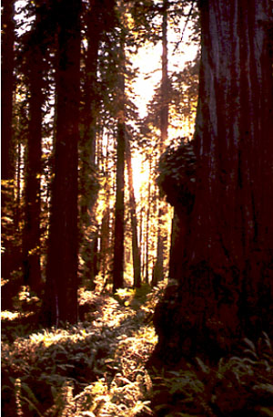
Weather and Climate in the Redwoods
Redwood National Park has the feel of a soaring, gothic cathedral—only more so. One of the great Sequoia sempervirens trees may live for two millennia, but when it falls, new trees will grow from the fallen trunk. (Hence the scientific name, which means “ever-living sequoia” in Latin.) The redwoods are the tallest trees on Earth, commonly more than 200 feet (60 meters) and with the very tallest soaring above 379 feet (more than 115 meters). If such a tree growing on the goal line fell over, it would stretch the length of a football field and the top branches would extend into the stands at the end. Ferns growing in the duff beneath the redwoods are lost, inconsequential, despite occasionally standing shoulder-high or above. Reports from early loggers included trees even taller than any known today.
The redwoods lie in the southern part of the great, coastal, temperate rainforest that extends from San Francisco north along the Pacific coast to southeastern Alaska, and includes the Olympic National Park discussed earlier. The redwoods actually grow in soils that came from rocks much like those of the Olympic.
Redwoods are mostly restricted to a narrow band along the coast with 50-100 inches (1.25-2.5 meters) of rain per year, and with frequent to continuous fogs that slow the drying-out of the trees. The trees, in turn, help maintain the fog; cutting the trees may decrease the fog, making it difficult or impossible for the redwoods to re-grow. The wood of redwood trees is highly resistant to fire and rot, and so is greatly sought after. Logging of old-growth redwoods, thus, is a contentious issue; an estimated 96% of the old-growth forest has been cut already, and with typical ages of 500-700 years and maximum ages of about 2000 years, a new "old-growth" forest is not returning soon, but some people want to cut the remaining 4% or so of the original old-growth redwood forest. Fossil evidence shows that redwoods once were much more widespread. U.S. parks that preserve fossilized redwood include the Petrified Forest, Yellowstone, and the Florissant Fossil Beds.
A bit farther south and higher on the slopes of the Sierra, but still in a wet zone, are the great sequoias of Yosemite, Kings Canyon and Sequoia National Parks. These Sequoiadendron gigantea are close relatives of the redwoods. Although not as tall (“only” up to 311 feet, or about 95 meters), the great sequoias are more massive. The General Sherman tree, at 275 feet tall and 102.6 feet around, is generally considered to be the largest single-trunk tree on Earth (and much larger than whales and such). The great sequoias are extremely fire-resistant, and require fire to clear-out competing trees and trigger sprouting of sequoia seeds. Fire suppression instituted after the parks were established led to a period with few or no new sequoias sprouting; now, prescribed burns and procedures that allow some natural fires to burn are returning the forest to a more-natural state. Sequoias can live 3500 years.
A few hundred miles to the east of the redwoods and sequoias lies the U.S. Great Basin. All across this region of Nevada and adjacent states, rainfall typically is less than 10 inches (25 cm) per year, with Death Valley receiving just 1.6 inches (4 cm) per year on average. Sage and cactus grow here instead of towering trees - in response to the very hot, dry conditions. Yet, above the clouds, this region receives the same amount of sunshine as do the redwoods. Clearly, the climate is much more than just the amount of sunshine above the clouds. We now take a brief tour through the basics of climatology. This should help you to understand climates, weathering, erosion, and glaciers, and a number of important near-surface processes.
Why the Wind Blows
The wind blows, and the deep mantle convects, for more-or-less the same reason. Both the air and the mantle are capable of flowing, and both are heated from below and cooled from above. The amount of heating and the rate of flow are VERY different, which helps make the world interesting. But you might see a thunderstorm and imagine hot-spot formation, and there is at least a little similarity between a cold front and a subduction zone.
Anyway, on Earth, the equator receives more sunshine than the poles. Some of the energy reaching the Earth is reflected back to space from clouds or snow and ice, especially near the poles. Much more sunshine is absorbed to heat the Earth at the equator than at the poles.
The equator receives more sunshine because of simple geometry. Imagine for a moment that Dr. Alley’s head is the Earth, with his nose on the equator and the bald spot on top the North Pole. (See the picture; you can congratulate yourself on good taste if you didn’t imagine a bad joke about the South Pole here.) If he stands in front of a sun-lamp “sun,” he’ll never get a sunburn on his North-Pole bald spot, but he will on his equatorial nose.
The Earth works the same way—at the top of the atmosphere, the amount of sunlight passing through a square meter is the same at the equator as at the pole (see the diagram below). But because of the Earth’s curvature, the light passing through a top-of-the-atmosphere square meter at the equator illuminates a square meter at the surface, whereas the light passing through a top-of-the-atmosphere square meter near the poles is spread over many square meters on the surface. (Additionally, in both cases, the rotation of the Earth spreads the light over a larger area than at the top of the atmosphere.)
This means that land at the equator becomes hotter than the poles. If we had no atmosphere or oceans, the equator would become too hot for life as we know it, and the poles too cold. However, the atmosphere and oceans take some of the excess heat from the equator to the poles, making both habitable to humans.

As the sun heats the land at the equator, the land heats the air above, and the air expands, rises, and then moves poleward in convection currents. Some of the energy in this hot air goes to warm the regions along the way, but eventually all the energy is radiated back to space. The sunlight that comes in is called shortwave radiation (because its waves are short—this stuff really isn’t that complex a lot of the time!), and the radiation going out has longer waves and is called longwave radiation. We will see later that the difference between shortwave and longwave is important in understanding the greenhouse effect. For now, note that the global energy budget is balanced—the total amount of energy brought in by short waves and absorbed in the Earth system is very nearly equal to the total amount of energy taken out by long waves to space. (At the moment, we are sending out a little bit less than we receive, and the Earth is warming, because we humans are changing the composition of the atmosphere. But, once we quit doing that, the Earth will get back to balance.) A factory balances the total amount of stuff coming in and going out, but little auto parts come in and big cars go out; the earth balances the total energy coming in and going out, but short waves come in and long waves go out. And, the uneven heating drives the wind, and the wind plus uneven heating of the oceans drive ocean currents.
Because the Earth rotates, the winds end up turning rather than going straight from equator to pole, and this makes the weather much more interesting than it would be on a non-rotating planet. If you want to explore this a little more, see the optional Enrichment.
Heating Death Valley
Some of our friends in meteorology just hate it when we say that warm air can hold more water than cool air. They like to say that the saturation water-vapor pressure in the atmosphere increases with temperature. But this means that warm air can hold more moisture than cool air.
Air is cooled in two major ways—by losing energy to its surroundings (longwave radiation to space, or warming the polar regions), or by being lifted. As air is lifted, it expands and cools. You can experience this by letting air out of a high-pressure bicycle tire, and feeling how cold the air becomes as it expands. Lifting may be caused when one air mass moves over another along a front, or when air moves over mountains. In either case, higher elevations have lower temperatures.
Cooling causes condensation of the water vapor in the air because cooler air can hold less water, and the condensation makes clouds and then rain or snow. Our friends in meteorology would point out that condensation requires cloud condensation nuclei—little dust particles and such that water drops can grow on—plus a little supercooling to get things started, or else extreme cooling if the nuclei are absent, but if you make a parcel of air sufficiently cold, clouds form and then rain or snow. (And if it bothers you that cooler temperatures exist higher, but that cold air sinks, see the optional Enrichment—there is really no problem, and it all does make sense.)
Evaporation of water requires energy. Remember that everything we see—including water—is made of fast-moving particles (atoms, or groups of atoms called molecules). The faster-moving particles are the hotter, higher-energy ones. In a pool of water (the ocean, or a drop of sweat on your brow) the faster, hotter water molecules break the attraction to their neighbors and escape, or evaporate, leaving the slower, cooler ones behind. Evaporation thus cools the remaining water. More heat then is conducted or radiated into the water from its surroundings (because heat flows from warmer to cooler places, and the evaporation has left the water drop cooler), cooling the surroundings while fueling more evaporation. This is why sweating cools a body. Condensation is the opposite of evaporation, and when condensation occurs, the heat that was added to the water to cause evaporation is released back to the air.
Now, consider a parcel of air rising up the Coast Ranges above the redwoods, and up the Sierra Nevada above the giant sequoias. As the air rises, the pressure on it (the weight of the air above) becomes smaller, and the air expands and cools. Once the air has cooled enough, it becomes saturated with water, and further cooling causes condensation. But the condensation releases some heat that partially counteracts the cooling from expansion. Air in which condensation is not occurring cools by about 1ºC for each 100 meters it is lifted, but air from which clouds and rain are forming only cools about 0.6º C for each 100 meters it is lifted (5ºF per 1000 feet dry, and 3ºF per 1000 feet wet). The difference represents the heat released by the condensation. The heat released by condensation originally came from the sun, and was stored in the air in the water vapor when water evaporated, cooling the ocean. As the vapor condenses, the sun’s energy is turned into heat that one can feel.
Strong moisture-laden breezes from the Pacific rise as they hit the redwood-clad Coast Ranges of California, cooling and raining to nourish the rainforest. The winds continue upward over the Sierra, cooling by 3ºF per 1000 feet upward, as they precipitate. By the time the wind has risen 15,000 feet to get over the high peaks, it has cooled about 45ºF (25ºC), and has rained or snowed almost all of its moisture. When this wind continues on down the other side, it is dry, and warms at the dry rate of 5ºF per 1000 feet. When this wind returns to sea level, the air has warmed about 75ºF (42ºC) on the way down. Hence, the wind comes down about 30ºF (17ºC) warmer than when it went up, and the difference is the heat that was stored when the rainwater evaporated from the ocean. A comfortable onshore breeze at 70ºF on the Pacific Coast will be 100ºF when it reaches the valleys on the other side. Add a little solar heating through the cloudless desert air, and it is no wonder that Death Valley is hot! (And yes, the wind usually goes around the Sierra rather than over, so you haven’t learned everything about meteorology in one short chapter of a geology book; but it’s a start.)
Textbook 5.2: The Badlands
Weathering, Weather, and the Badlands
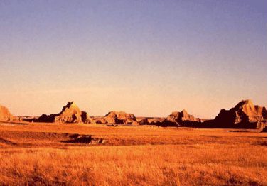
The Badlands of South Dakota are much more than just the land to the south of Wall Drug Store (“Have you dug Wall Drug?”). Today, the Badlands may be most valuable as a wonderful piece of the shortgrass prairie that once covered much of the western Great Plains. The sea of grass and flowers that nourished the bison and the native Americans of the plains has been almost entirely broken to the plow. But in the upper prairie of the Badlands, the grass still waves in the breeze like an ocean, the pronghorn still course the grass, and one can, perhaps, imagine what the prairie once was.
The Badlands are a creature of the Rockies. During one of the phases of uplift of the Rockies (especially about 30 million years ago), the exposed rocks were first weathered (changed into other forms, such as clay), and then transported from the mountains onto the plains to the east, or on down the Mississippi River system to its delta. Those sediments deposited on the Great Plains piled up until the mountains were almost completely buried, and an unbroken ramp of sediments extended to the Mississippi. The sediments were mostly river deposits, on flood plains or in channels of rivers, although some ash-falls from volcanoes and other wind-blown sediment were present.
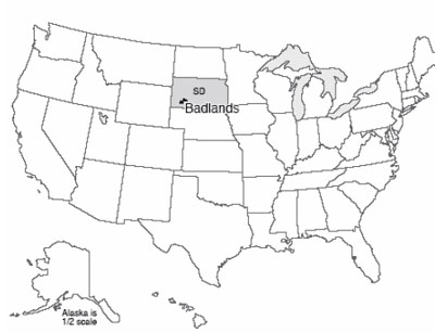
Eventually, renewed uplift of the Rockies rejuvenated the streams draining through the Badlands, causing these streams to cut down through the older deposits. In these deposits are uncounted fossils of the animals and plants that lived on those floodplains. The fossils tell a story of gradual drying from wetter times of the past, and of changes in the types of things living there.
The types of clays and volcanic ashes in the Badlands, combined with the climate in which they now occur, do not make fertile, stable soils. The clays expand and shrink on wetting and drying, breaking roots, triggering small landslides, and helping keep the slopes unvegetated. Water doesn’t flow easily through clay, so rainfall doesn’t soak in but flows rapidly across the surface during the rare but intense rainstorms, eroding channels in the clays and washing away vegetation; this also leaves the soils dry between rainfalls so that plants have difficulty sustaining themselves.
That a lush prairie can grow on the flatter regions is testament indeed to the hardiness of the prairie ecosystem. But, on steep slopes, the pastel-colored muds eroded from the old Rockies are exposed, along with the fossils they contain. We will explore stories of this sort over the next few weeks. We start with weathering, the changes that can turn hard rocks to soft clays of the type observed in the Badlands.
Weathering Processes
Squeezing mud, perhaps with a little heating, produces a sedimentary rock called mudstone or shale, and with further heating and squeezing this rock changes to various other things on the way to melting (you may have met shale→slate→schist→gneiss somewhere; we saw gneiss in Rocky Mountain, and all of them in the Enrichment, last time). The materials in mud are stable (or at least nearly so) under Earth-surface conditions but not deep in the Earth. And minerals produced deep in the Earth usually are not stable under surface conditions. Compared to deep in the Earth, the surface is wetter, has more oxygen, has a wider range of acid/alkaline conditions (with acid especially common at the surface), and has many more organisms trying to break down the minerals to extract fertilizer.
As a general rule, the further surface conditions are from conditions under which a mineral formed, the more rapidly that mineral changes at the surface. (This “rule” has many exceptions, but it is often useful, especially with silicate minerals.) The changes that occur at a place are called weathering. Moving the products of weathering is called transport. Weathering and transport together make erosion.
Weathering in turn is divided into mechanical and chemical weathering. Mechanical weathering is the making of little pieces from big pieces; chemical weathering is the making of new types of materials that were not there previously.
Mechanical Weathering
To turn big pieces into little ones, the big ones need to be cracked. Cracks in rocks are caused or enlarged by processes including:
- Mountain-building stresses, or earthquake-release stresses, breaking the rocks;
- Expansion and breakage of rock as the weight of overlying rock is removed during erosion of that overlying rock;
- Expansion and contraction during heating and cooling (especially very near the surface during forest fires);
- Growth of things in cracks (tree roots, minerals).
Probably the most important mineral that grows in cracks is ice, but others do too. For example, the mineral thenardite, Na2SO4 (no, you don’t have to memorize the formula!) can add much water to its structure (10 molecules for each Na2SO4), expanding in the process. If thenardite exists in an environment that alternately is wetted and dried, the resulting expansion and contraction from adding and losing water may break the rocks around it. Increased humidity will cause the mineral to rearrange and take up water, expanding and wedging open cracks. Continued wetting may dissolve the mineral, which will move deeper in the crack in the rock and then be redeposited and dehydrated during a subsequent dry time. Then further wetting will cause re-expansion and more wedging. This process is breaking many of the ancient monuments of Egypt as increased irrigation and other activities increase humidity in some places.
Chemical Weathering
Chemical changes are often more interesting and more complex than physical ones. There is a great range of possible changes, and you must know a lot of chemistry to really appreciate all of them. In general, the main agents of weathering are weak acids. Rainwater picks up carbon dioxide from the air and becomes a weak acid called carbonic acid. In soils, water may pick up more carbon dioxide plus organic acids from decaying organic material, becoming a stronger acid.
When acid attacks a rock, the results depend on what minerals are present, and how warm and wet and acidic conditions are, among other things. We can sketch some general patterns. Suppose we start with granite, a silica-rich rock that forms in a few continental and island-arc settings, including when bodies of melted rock solidify beneath the andesitic volcanoes of subduction zones.
Granite usually is composed of four minerals: quartz (pure silica, which is silicon and oxygen), potassium feldspar and sodium-calcium feldspar (mostly silica, with a little aluminum replacing some of the silicon, and the potassium, sodium or calcium added for balance), and a dark silica-bearing mineral containing iron and magnesium (often a dark mica called biotite). Interestingly, almost 99% of the atoms in the rocks of the crust of the Earth are oxygen, silicon, aluminun, iron, calcium, sodium, potassium or magnesium, the common elements in granite. We discuss granite here because it does so well representing the whole crust.
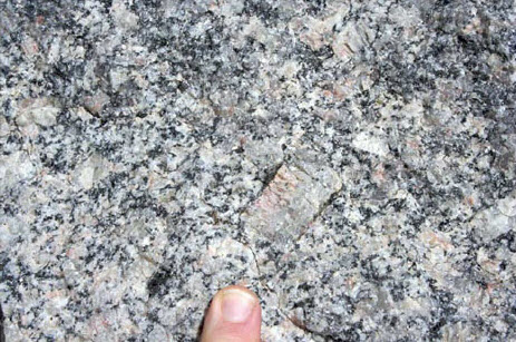
When granite interacts with carbonic acid, several things happen.
- Iron (Fe) rusts. It picks up water and oxygen, and remains in the soil as little pieces of rust.
- The aluminum (Al), potassium (K) and silica (SiO2) from the feldspars and from the dark mineral rearrange into new minerals, called clays, that also include some water.
- The calcium (Ca), sodium (Na) and magnesium (Mg) dissolve in water and wash away.
- Most of the quartz (silica as a mineral) sits there almost unchanged as quartz sand (a little of it may dissolve and wash away, but most stays).
One can write a sort of equation:
Granite → quartz sand + clay + rust + (dissolved-and-washed-away Ca + Na + Mg).
The calcium and silica dissolved and washed to the ocean are used by sea creatures to make shells, the dissolved magnesium washed to the ocean usually ends up reacting with hot rocks at spreading centers to make new minerals in the sea floor, and the dissolved sodium accumulates in the ocean to make it salty. (Eventually, evaporation of ocean water in restricted basins causes deposition of salts including table salt, which is sodium chloride, written NaCl. Also, some salt is taken down subduction zones with the water in the spaces in sediment. So, the ocean does lose sodium as well as gaining sodium.) The rust, sand, and clay left behind, plus a little organic material often including worm poop, become the indispensable layer we know as soil.
You should recognize that this is a very general description of what happens; were it this easy, there would not be hundreds of soil scientists working to understand this important layer in which most of our food grows. In general, the hotter and wetter the climate, the more stuff is removed—rust and quartz sand can be dissolved in some tropical soils, leaving aluminum compounds that we mine for use in making aluminum. In dryland soils, the Ca and Mg may be left behind (forming special desert soils), or even the Na may be left behind, forming salty soils in which little or nothing will grow.
You also should recognize that the “chunks” in soil – rust, clay, sand and organic materials – can be carried away by streams or wind, but as chunks rather than invisible dissolved materials. We discuss this loss of chunks in the next sections. If chunks are carried away more rapidly than new ones are formed, the soil will thin and we will find it difficult to grow food to feed ourselves.
When we were looking at subduction zones, we noted that old, cold sea floor goes down. We now see that it takes some extra magnesium, added from sea water by reactions with the hot rocks at the mid-ocean ridges. Sediment goes down subduction zones, including the calcium- and silica-bearing shells of sea creatures, the rust and clay washed from the continents, and some sea water. When these melt and feed volcanoes, andesite and similar rocks are made during eruptions, or their underground equivalents including granites are produced. The calcium-bearing shells include carbon dioxide, and this plus water escape from the volcanoes to make carbonic acid to attack the new granite. The Earth really does cycle, and recycle, everything! But, going around this loop once takes at least millions of years, and may take a lot longer than that, issues we'll discuss later.
Textbook 5.3: The Grand Tetons
Another Reason Why Loose Rock Matters: Mass Movement and the Grand Tetons
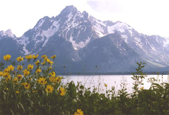
The Grand Tetons tower above Jackson Hole, Wyoming, the epitome of western scenery for many people. A steep pull-apart fault lies along the front of the range and slopes downward beneath Jackson Hole. From the highest peaks to the Hole is well over a mile (roughly 2 km), but the total offset on the fault (including material eroded from the top of the range and deposited in the valley) is almost 6 miles (10 km). The uplifted block is primarily old metamorphic rocks that erode only slowly. The faulting is probably related to the Basin and Range extension that also gave us Death Valley, although the complexity of the region makes any interpretation difficult. Dr. Alley recalls huddling next to an overhanging rock, far up on the steep front of the Tetons, watching hailstones rattle off the trail from a black deck of clouds barely over his head. It is a truly awesome place.
 \
\
A few miles (few km) east of the park is another interesting feature: the Gros Ventre slide. There, the rock layers slope steeply under a long ridge or mountain, with the layers almost parallel to the mountainside, down to the Gros Ventre River. Strong, resistant sandstone rests on weak, slippery shale. The river has eroded down through the sandstone and into the shale, leaving the toe of the sandstone unsupported. In June 1925, after a particularly wet spring, the entire mountainside let loose, sliding down and across the river. The slide mass made a dam, trapping a lake miles long and 200 feet (60 m) deep. The entire slide probably required only seconds to occur, and moved cubic miles (many cubic kilometers) of rock.
Such a debris dam is not very strong; water flow through its pore spaces or over it can remove rocks and weaken it greatly, until it collapses catastrophically. When we were discussing earthquakes, we saw that a similar slide happened during an earthquake in 1959 just northwest of Yellowstone, damming a river to form a new lake, and that the Army Corps of Engineers had rushed in to prevent collapse of the dam. The Corps had learned from previous experience, including events at Gros Ventre. In 1925, efforts were not made to stabilize the dam there. It collapsed two years later, washing out a small town downriver and killing six people.
Moving Masses
The Gros Ventre slide is an especially dramatic example of an important but usually-more-boring process: mass movement. This is the name give to the downhill motion of rock, soil, debris, or other material, provided the flow is not primarily water (if material is washed along by a river, we call it a river), or a glacier or wind.
Water is usually involved in mass movement, however, because most mass movements occur when soil or rock is especially wet. This happens for four reasons: water makes the soil heavy; water lubricates motion of rocks past each other; water partially floats rocks (a rock pushes down less in water than in air) so they are not as tightly interlocked and can move more easily past each other, and saturation of a rock mass removes the effect of water tension.
This last deserves a bit more explanation. Think about going to the beach and building sand castles. Dry sand makes a little pile with sides rising at maybe 30 degrees. Totally saturated (wet) sand flows easily, forming a pile with a much more gradual side. But damp sand can hold up a vertical face. You can even make and throw damp sand balls (be careful where you throw them).
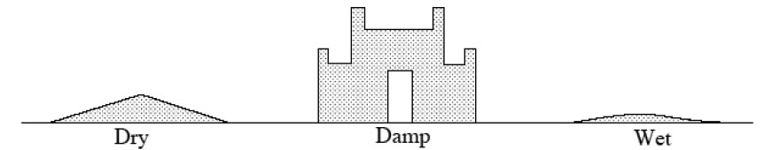
The details of the surface physics involved are a bit complicated, but basically, a drop of water will sit at the junction of two sand grains. Pull the sand grains apart, and some water will end up on each grain. This requires “breaking” the water; what had been one continuous film of water is now broken into two. Next, think of a dripping faucet. A water drop doesn’t fall off immediately, but first becomes large and heavy. Clearly, water has strength, and does not “like” to be broken. (This strength arises from the attraction of water molecules for each other, and is usually called surface tension.) Damp sand thus is strong—a landslide would require some sand to move rapidly past other sand, breaking the water bonds between the grains. In fully wet sand, however, the grains move about in the water without ever breaking it, so motion is easy.
There are elaborate classifications of mass movements, depending on how fast, how wet, how coarse, how steep, and how "other" they are. Most of the names make sense: falls are rocks that fell off cliffs, topples are rocks that toppled over from cliffs, landslides and debris flows and debris avalanches are fast-moving events, and slumps are failures of blocks of soil along concave-up curved surfaces, something like a person slumping down in a chair.
One fascinating, and scary, type of mass movement occurs on “quick” clays. These are clays usually deposited beneath the sea, in which the playing-card-shaped clay particles exist in a house-of-cards structure stuck together by ions of the sea's salt, which sit in the spaces between clay particles. When raised above sea level, ordinary water begins to replace the ions of the salt, and the structure becomes weaker. Eventually, it may fail catastrophically, going from a solid to a very thin liquid almost instantaneously, and generating a flow. Flows from such clays are known especially from parts of Canada and Scandinavia. Such a flow crossing a road can pose a problem, because bulldozing the clay out of the way does little good; more just flows across. But throwing a bag of salt into the flow near the road and driving a tracked vehicle through to mix the salt and clay may cause the flow to solidify so that it can be bulldozed away. Tragically, large portions of some towns have been destroyed, with much loss of life and property, when such quick clays have failed under buildings. Fortunately, these are quite rare.
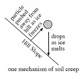
The most important mass-movement type in terms of transferring material downhill is soil creep, the slow (typically inches, or centimeters, per year or less) downslope motion of soil. Creep may be a very slow landslide. It may occur from freeze-thaw processes—a column of ice that grows under a small pebble on a cold night pushes that pebble out from the hillslope, and the pebble falls straight down when the ice melts, effectively moving a tiny distance down the hill (see the figure above). When trees fall over and uproot soil, or when groundhogs and even worms dig out rock grains and allow them to move downhill, creep is occurring. If you look at a typical hillslope, streams on the lower slopes are present to move water and rock downhill, but the upper slopes lack streams. There, soil creep serves to move material downhill.
Hillslopes typically reach a balance, in which weathering breaks down rocks about as rapidly as mass movement and streams take the broken rocks away. The balance may occur with bare rock sticking out (as in some cliffs, for example), or with a lot of soil covering the rock. If soil creep dominates the mass movement, the hillslope may always be close to balance. If landslides dominate, then the soil will build up for a long while before suddenly slumping off, and you have to watch for a long time to see that formation and transport of soil are in balance. And, over very long times, the hill will eventually flatten, causing the mass movement to slow. However, soil will very gradually thicken to slow the weathering as the hillslope is reduced, and near-balance will be maintained.
Humans are greatly upsetting this balance worldwide. Our activities—bulldozing, cutting trees whose roots held the soil, plowing, and more—are moving more material than nature moved before we were involved.
Virtual Field Trips
Join Dr. Alley and his team as they take you on "virtual tours" of National Parks and other locations that illustrate some of the key ideas and concepts being covered in Unit 5.
TECH NOTE - Click on the first thumbnail below to begin the slideshow. To proceed to the next image, move the mouse over the picture until the "next" and "previous" buttons appear ON the image or simply use the arrow keys.
Virtual Field Trip #1: Good Things in the Badlands
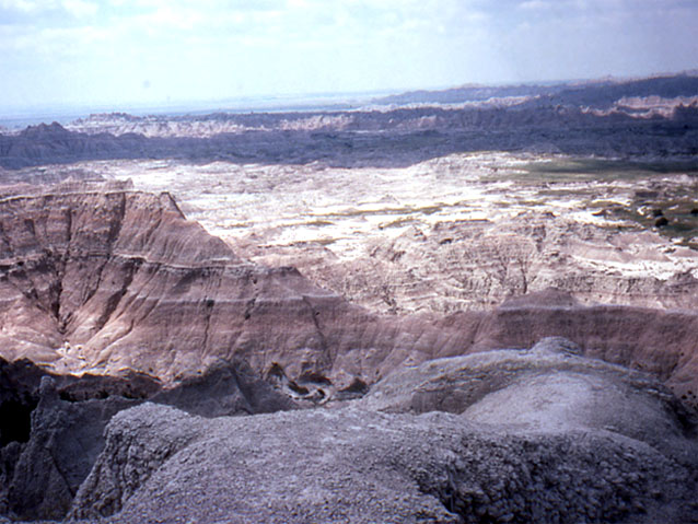
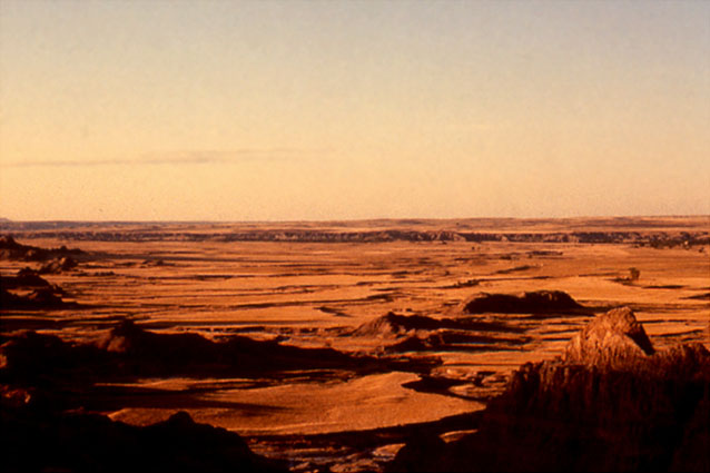
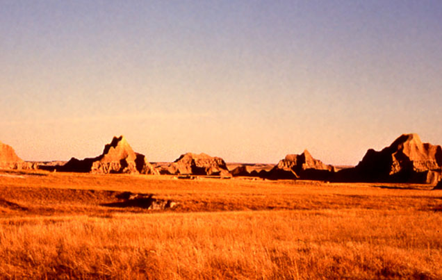
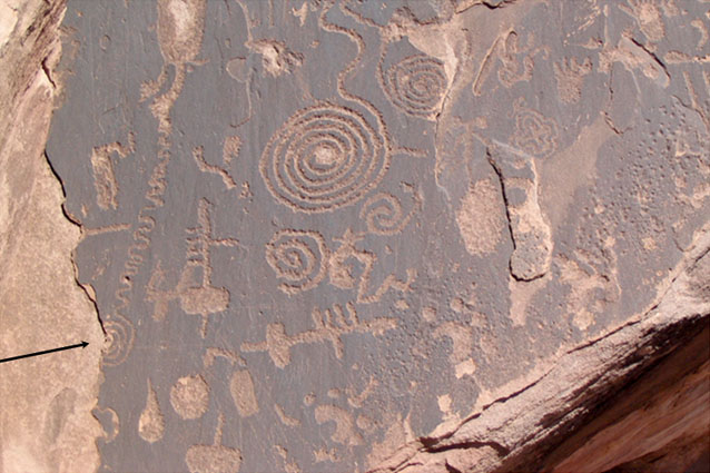
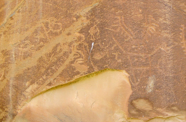
Image 1: Sunrise over the Badlands. A first look at breaking rocks to make sediment, and transporting that sediment to make beautiful and informative places.
Image 2: Children sitting on jackalope statue at Wall Drug tourist area in Badlands. Most folks who drive to the Badlands are enticed by the seemingly endless signs for a particularly well-known tourist trap, shown here.
Image 3: Badlands rock landscape. The badlands are muds and sand beds put down by ancient rivers draining the Rockies, together with volcanic ashes blown in on the wind. All of these materials were made by the breakdown of older rocks in the Rockies.
Image 4: Badlands clay landscape. The clays of Badlands soils expand and contract as they wet and dry, tearing out plant roots. Flat areas maintain vegetation, but steep areas are mostly bare sediment.
Image 5: Large weathered rocks in Badlands. Breakdown of rocks to make smaller pieces and new types such as clay minerals is called weathering. Movement of these smaller pieces is called transport. Together, weathering and transport make erosion.
Image 6: Tree roots in Bryce Canyon exposed by soil erosion. Finding evidence of erosion is not hard. This tree, on the rim of Bryce Canyon, started with its roots covered by soil, but the soil has eroded away. The very soft, steep rocks here have eroded by more than a foot in the few decades of this tree’s life.
Image 7: Ancestral Puebloan rock carving showing surface flaking. Arrow points to half-spiral. Petrified Forest National Park. Ancestral Puebloan people carved this rock in Petrified Forest National Park almost a millennium ago. A little of the rock surface has flaked off since then; the artists did not carve a half-spiral on the left (arrow added).
Image 8: Ancestral Puebloan rock carving damaged by fall of rock. Petrified Forest National Park. As in the previous picture, the thousand-year-old artwork of Ancestral Puebloan people has been damaged a little by fall of rock, showing that rocks do change, but slowly.
Image 9: Rock split in two as a result of frost grown in crack. Coast of Greenland. And in a very different environment, in the remoteness of the coast of Greenland, frost growth in a crack has split this rock in two. The rock is in the deposits from about 1850, and most of its surrounding rocks have not been split, giving some insight to the rate of weathering.
Virtual Field Trip #2: The Redwoods and Death Valley
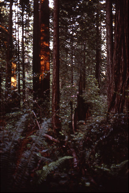
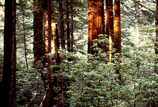
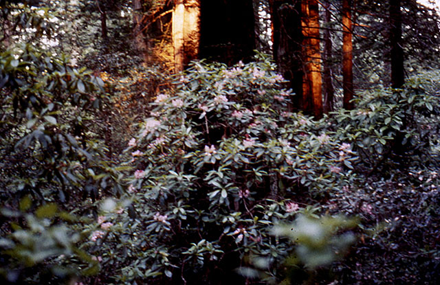
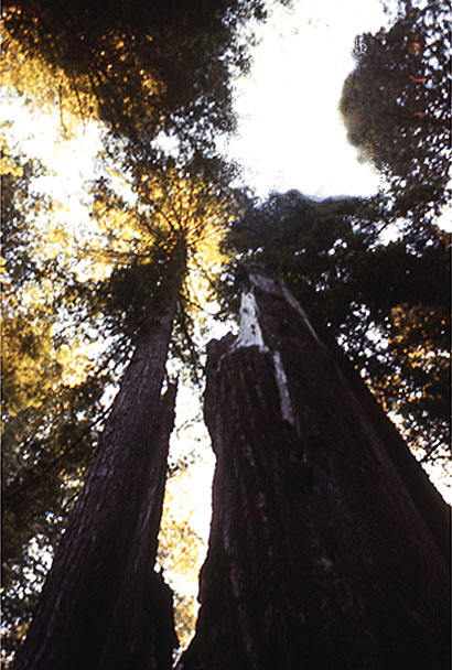
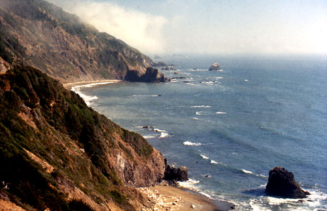
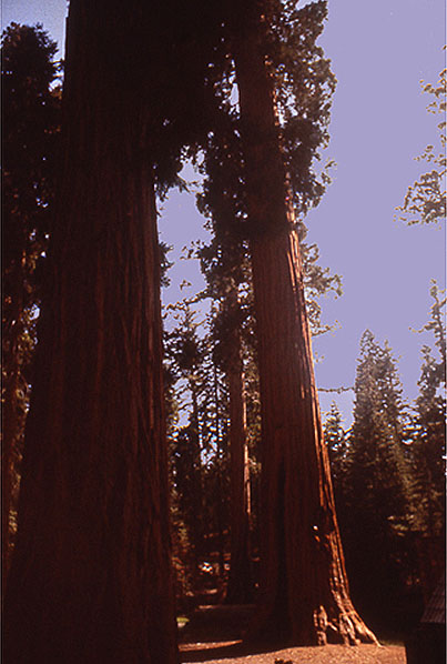
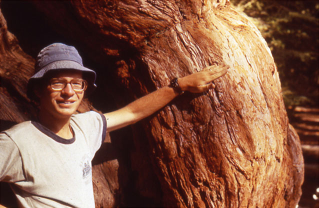
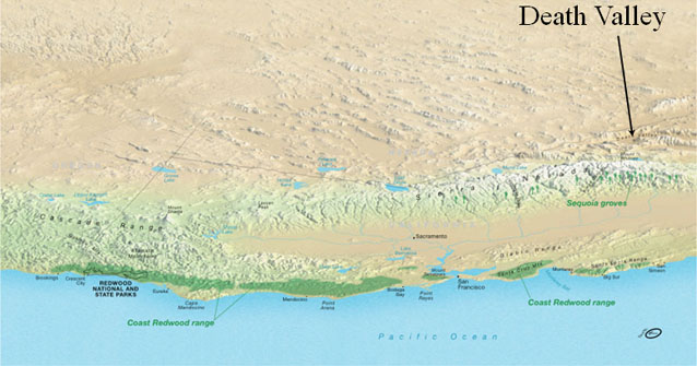
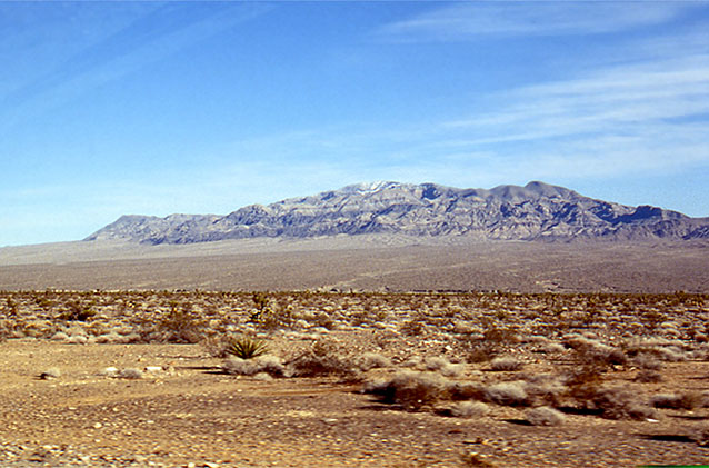
Image 1: Two contrasting photos. Top photo of Redwoods, bottom photo of Death Valley. A Contrast in Weather… Redwoods and Death Valley. Some pretty pictures by R. Alley, with a message at the end.
Image 2: Close-up of Sequoia trees in Redwood National Park. Redwood National Park is another of the parks established primarily for biological reasons. Sequoia sempervirens, the ever-living sequoia, will live for two millennia, and then sprout new trees from its fallen trunk.
Image 3: Redwood forest, with ferns, rhododendron and azaleas in the understory. The redwood forest, with ferns, rhododendron and azaleas in the understory, look like a magnified version of an eastern hemlock forest.
Image 4: Rhododendron in Redwoods. The acids in redwood needles help produce soils that favor rhododendron (shown here) and ferns, as well as more redwoods.
Image 5: Sequoia tree standing more than 370 feet tall. Reaching heights of more than 370 feet (well more than a football-field standing on end), the redwoods are the world’s tallest trees.
Image 6: Ocean view at the Redwood coast. The redwood coast is rainy and foggy; the huge trees couldn’t exist in a drier environment. The coast is also beautiful.
Image 7: Giant Sequoias representative of those found in Yosemite, Kings Canyon and Sequoia National Parks. Up the mountains from the redwoods are the giant sequoias of Yosemite, Kings Canyon and Sequoia National Parks. Although not as tall as the redwoods, these trees are more massive--generally considered the largest living things on Earth--and live more than a millennium longer.
Image 8: Close-up of man standing next to Sequoia tree, showing thick bark. The thick bark of the sequoias is nearly fireproof. The trees need fire to clear out faster-growing trees so young sequoias have room to grow, and to trigger sprouting of those young sequoias.
Image 9: Death Valley landscape. At about the same latitude as the sequoias and redwoods, and with the same sunshine above the clouds, is Death Valley and the rest of the Great Basin. This huge weather difference is discussed in the textbook--Death Valley is warmed by tropical sunshine, set loose by redwoods rain.
Image 10: Topographical map showing Coast Redwood range with arrow pointing to Death Valley behind the mountain range. Link: http://data2.itc.nps.gov/hafe/hfc/carto-detail.cfm?Alpha=REDW# At about the same latitude as the sequoias and redwoods, and with the same sunshine above the clouds, is Death Valley and the rest of the Great Basin. This huge weather difference is discussed in the textbook--Death Valley is warmed by tropical sunshine, set loose by redwoods rain.
Virtual Field Trip #3: The Grand Tetons!
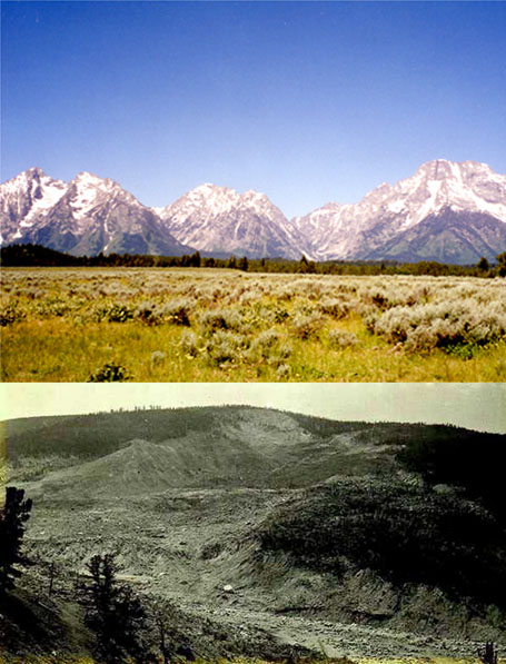
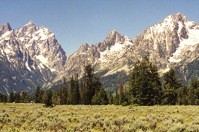
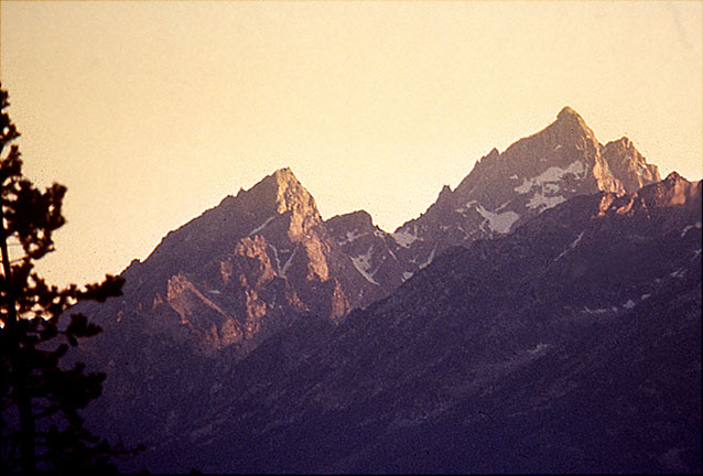
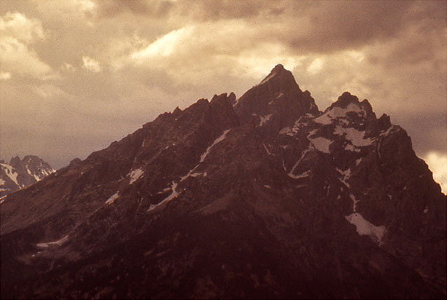
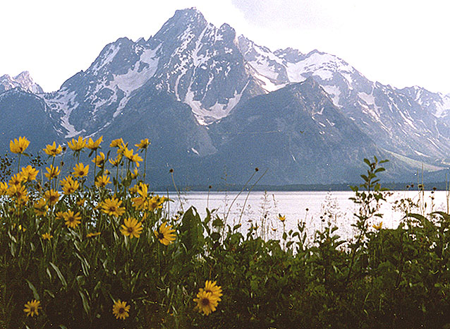
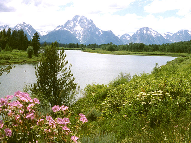
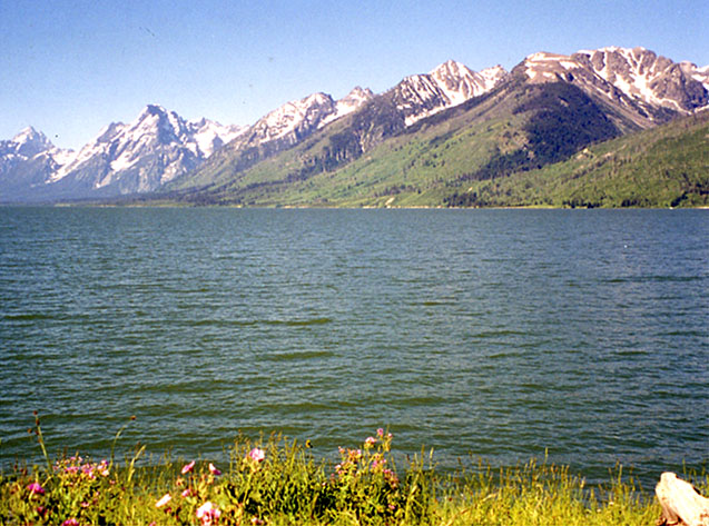
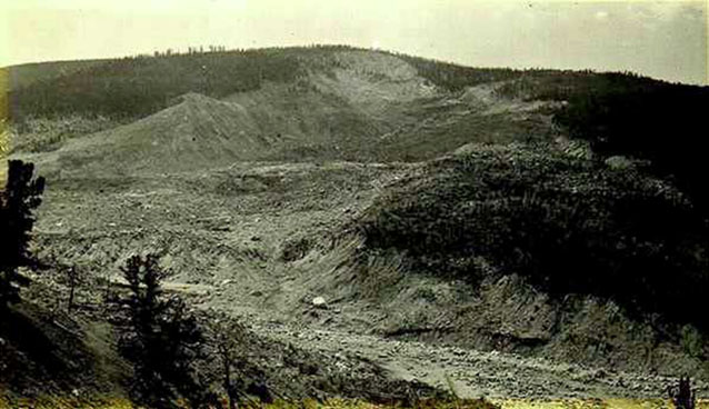
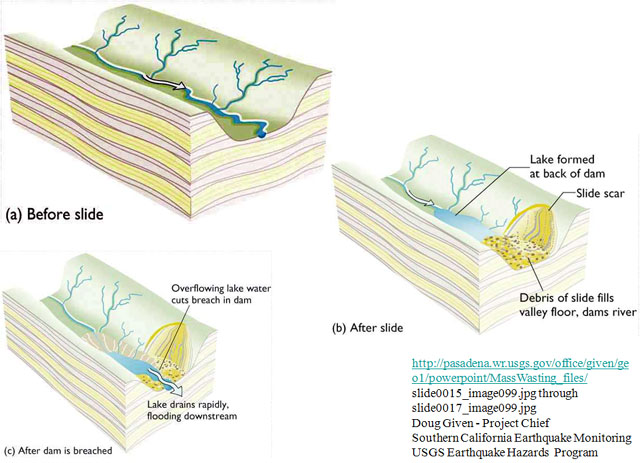
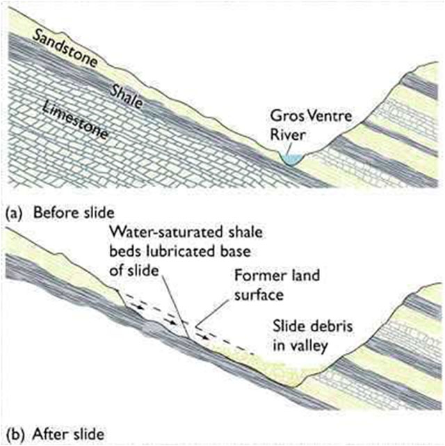
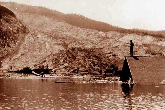
Image 1: Two contrasting images: Top photo of Grand Tetons. Bottom photo of Gros Ventre slide. (Top) The Grand Tetons--Surely one of the finest views in the west (Bottom) And the Gros Ventre slide--A reminder that the west is ever-changing.
Image 2: The Grand Tetons with evergreens in the foreground. The Grand Tetons. This is real mountain scenery.
Image 3: Close-up of Grand Tetons showing pull-apart-type faulting. Pull-apart-type faulting has dropped the valley and raised the mountains a total of several miles.
Image 4: Close-up of Grand Teton peaks with dark thunder clouds above. Rockfalls are common, especially during intense summer thunderstorms.
Image 5: Mount Moran with Darn Yellow Composites (wildflowers) in foreground. Mount Moran is framed by summer wildflowers (DYCs, or darn yellow composites, because yellow composites are often so hard to identify accurately).
Image 6: Oxbow Bend with view of Mt. Moran and other Tetons in the background. Oxbow Bend is a favorite site for viewing Mt. Moran and the rest of the Tetons.
Image 7: Grand Tetons with lake in the forefront. Numerous lakes, many glacier-carved, dot the park.
Image 8: Gros Ventre slide, near the Grand Tetons. Historical photograph of the Gros Ventre slide, near the Grand Tetons.
Image 9: Cross-section drawings of before Gros Ventre slide, after the slide, and after dam is breached.
Image 10: Valley cross-section drawing showing geological setting of the Gros ventre slide. Valley cross-section showing geological setting of the Gros Ventre slide.
Image 11: Historical photo of lower slide lake shows a person standing on the roof of a submerged building. Historical photo of lower slide lake. Catastrophic drainage of the slide-dammed lake destroyed the town of Kelly, killing six and destroying the hotel, mercantile store, automobile garage, blacksmith shop, livery stable, and homes, but sparing the Episcopal Church and local school.
Virtual Field Trip #4: Landslides!
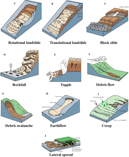
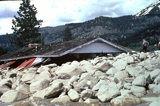
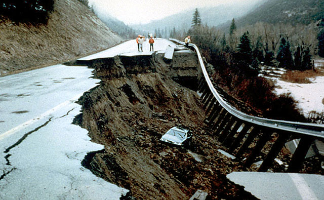
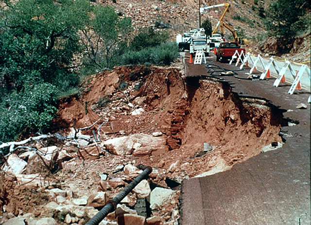

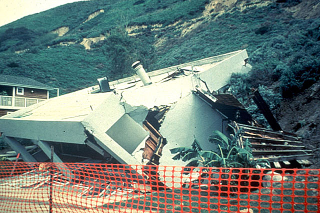
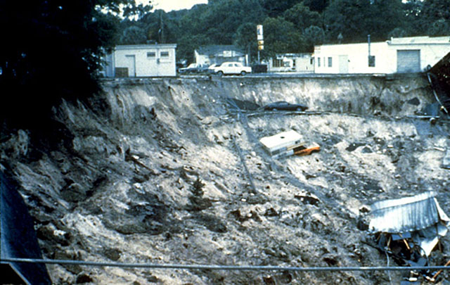
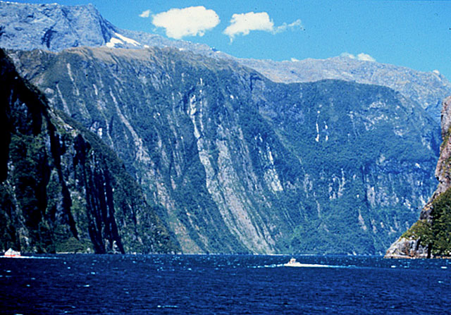
Image 1: Drawings labeled A through J representing 10 types of mass movements. http://pubs.usgs.gov/fs/2004/3072/images/Fig3grouping-2LG.jpg. There are many types of mass movements, ranging from hundreds of miles per hour to less than an inch per year, and from whole mountains to single grains of sand.
Image 2: Slide Mountain, Nevada. House buried beneath slide, only roof above surface. http://landslides.usgs.gov/html_files/landslides/slides/slide2.htm. Slide Mountain, Nevada. Snowmelt-triggered debris flow, May, 1983, killed one and injured several. USGS had publicly identified the hazard a decade earlier, but good science is often ignored.
Image 3: A car in the mud of a 1994 landslide near McClure Pass, Colorado. http://landslides.usgs.gov/html_files/landslides/slides/slide11.htm Photograph by Terry Taylor, Colorado State Patrol. Landslide near McClure Pass, Colorado, 1994. The driver did not see this nighttime slide in time to stop, but fortunately was not injured
.Image 4: 1995 Landslide under the only road to lodge of Zion National Park. http://landslides.usgs.gov/html_files/landslides/slides/slide19.htm. Photograph by R.L. Schuster, USGS Landslide under the only road to lodge of Zion National Park, April, 1995, stranded 100 people for two days. The broken sewer pipe, shown in lower part of photo, didn’t help.
Image 5: Aerial view of 1995 landslide at La Conchita, California along highway 101. http://landslides.usgs.gov/html_files/landslides/slides/slide21.htm. Photo by R.L. Schuster, U.S. Geological Survey. Spring, 1995 landslide at La Conchita, California, south of Santa Barbara along highway 101. Many homes were destroyed, but no one was injured.
Image 6: Home crumbled and destroyed by La Conchita, California slide. http://landslides.usgs.gov/html_files/landslides/slides/slide24.htm Photograph by R.L. Schuster, U.S. Geological Survey Home destroyed by La Conchita, California slide from previous picture.
Image 7: 1981 Winter Park, Florida sink hole opening. Car, truck and destroyed building in the sink hole. Caption: http://landslides.usgs.gov/html_files/landslides/slides/slide10.htm This is the Winter Park, Florida sinkhole, which opened in one day in 1981. We’ll return to sinkholes when we visit caves, which occur with sinkholes.
Image 8: Half-mile-high landslide scar, Tracy Arm/Ford’s-Terror Wilderness Area, Alaska. Caption: Half-mile-high landslide scar, Tracy Arm/Ford’s-Terror Wilderness Area, Alaska. Steep slopes caused by mountain building or rapid erosion (in this case, by glaciers) often fail catastrophically. A slide similar to this made the immense tsunami in nearby Lituya Bay that we discussed last week. Photo by R. Alley
Image 9: Landslide near Sitka, Alaska. Caption: Most landslides don’t make the news, such as this one near Sitka, Alaska. Photo by R. Alley.
Image 10: Numerous landslides on the mile-high, glacially carved cliffs in Milford Sound, New Zealand. Caption: Milford Sound, New Zealand. The numerous landslides down the mile-high, glacially carved cliffs give it the pretty, striped appearance. Photo by R. Alley.
Word Document of Unit 5 V-trips
Want to see more?
Here are some optional vTrips you might also want to explore! (No, these won't be on the quiz!)
Death Valley National Park
(Provided by UCGS)
Grand Tetons National Park
(Provided by UCGS)
GeoMations and GeoClips
There is one GeoMation and there are four GeoClips available for your viewing in this unit. Hopefully, you'll find this helpful in understanding Unit 5 just a little bit better.
GeoMation:
So out here there's the great Pacific Ocean. And the wind comes trucking in from the Pacific Ocean. And it's just going great guns, except at some point it runs into the giant mountain range of the Sierra, which we know goes up over the top and down the other side and down to Death Valley.
And so when the air runs into that, the air has to rise. And you may know that when air has to rise, it expands. And when you have air expanding, whether it be out here on the Pacific or from a bicycle tire, it cools. And when the air cools, that makes nice clouds. And when that makes clouds, that makes rain that comes dripping down. And so sitting underneath that, as you might imagine, you have really wonderful trees called the Redwoods because it rains like crazy on them. And they're really happy with that.
Now the air is cooling, and the cooling rate is something vaguely about three degrees Fahrenheit for each 1,000 feet that the air goes up. It should be five, five is the thermodynamics. But when the cooling causes condensation that makes the rain that we see, condensing actually gives up a little heat. And so you only get a cooling of about three degrees Fahrenheit per 1,000 feet going up.
Now, when the air comes over the top and starts coming down the other side, there's no water in it to evaporate. There's no water there, it's dry. And when air is coming down like that and being squeezed, it ends up warming. And that warming is about five degrees Fahrenheit per 1,000 feet that it comes down.
And so it cools going up at about three degrees Fahrenheit per 1,000 feet. It warms coming down five degrees Fahrenheit per 1,000 feet. And that in turn means that because the mountains are really high, that if the air comes trucking in at something like 70 degrees Fahrenheit, by the time it goes over 15,000 foot high, it's almost 15,000 feet to the top of the Sierra, and the air has to get over, why when it comes back down here to Death Valley, it is 100 degrees Fahrenheit. And you really would be wiser to go visit in the winter rather than in the summer.
GeoClips:
We can measure the uplift of mountains, which may occur slowly, or suddenly in earthquakes, and we can watch volcanoes erupt. But overall, nature tears down mountains about as rapidly as they form, and we can watch and measure the tearing-down, too. The slow disappearance of names from old tombstones, the hubcap-rattling holes in late-winter city streets, and the maintenance budget for university buildings all attest to the effects of nature on human-made things. Here, Dave Witmer takes you to Bryce Canyon, one of the many, many places where you can see nature removing natural things.
Erosion at Bryce Canyon National Park
Hi, I'm standing here up at the top of Bryce Canyon. And right over here we have a great example of how quickly erosion takes place here. As you can see, the roots of this tree are exposed. And this tree is only about 100 years old, but it looks like it's trying to jump out of the ground. And that's because of the ground that was up here has been washed down the canyon exposing the tree's roots. Luckily for this tree, the roots go very deep into the ground to get all the moisture it can. And that's why it's still able to surviv.
Geologists observe the wear-and-tear of nature on human-made and natural things, gaining clues to help understand how mountains are torn down. When climbing the sheer cliffs of Zion National Park into the mysterious crevice of Hidden Canyon, the intrepid hiker clings to a rather precarious-looking chain to avoid falling into the stream-carved potholes just beside the trail, and on down to the Virgin River, in the Canyon a hair-raising drop below. In these two clips, Dave Witmer and Dr. Anandakrishnan show how rocks are worn away, a little at a time, and what this has to do with south-Indian cuisine. You might begin thinking about what this wearing-away of rocks has to do with the Virgin River in the Canyon far below.
Chain of Events / Zion National Park
Hey Sridhar, look here.
What's going on there?
The chain that we are using to climb up the hillside here in Zion is actually causing some mechanical weathering. And you can see how everybody that grabs on to the chain as it goes up--
Ah, cool. Check it out.
It carves into here. It actually carves into the sandstone.
It's made these little scallop marks where the chains that are turned in this way go in a little bit deeper. And the chains that are out that way are back a little bit farther.
Yep. It would be just like a rock in a stream or even a glacier pushing stuff along. It's just scooping things up at a constant pressure along the side of the rock.
And so this stuff is actually fairly friable. It breaks apart reasonably easily. This chain's probably only been here 10, 15 years. And already it's cut in, what 1/25 of an inch, an 1/8 of an inch, something like that.
Pothole Grinding / Zion National Park
[MUSIC PLAYING]
So the water came along this way and carved out those holes coming around the bend. And then as it started to make the corner, it came down and it swirled around in these big holes. Probably, you can even see down there, there's some pebbles stuck in there and gravel size bits. And in a big flood, it would carry those size rocks and larger, bring them down.
And it's just like my grandmother grinding rice to make dosas and idlis which are these magnificent South Indian dishes, where you take rice, you put them down in a mortar and a pestle, and you just grind them around, add a little bit of water, grind them around. And you get this wonderful flour that comes out of it. That's the exact same thing happening here.
The water comes pounding down, carrying rocks, and it swirls them around because it's making the turn. And it's going fast enough that as it makes a turn it can't just go straight, it's got to curve around. It's just beautiful, it's magnificent. And we can even see some of the rocks left down in there from the last time we have a flood coming through here.
Rocks and soil on hillsides really do slide down, whether rapidly or slowly, in big chunks or small ones. When a river erodes downward to make cliffs in the riverbank, or when a volcanic eruption or an earthquake makes a cliff, rocks fall or creep or slump or are washed off the steep slope, smoothing it over time. Here, Dr. Alley shows this for a tiny "canyon" in the bottom of the truly Grand Canyon.
Making a Sand Canyon / Grand Canyon National Park
[MUSIC PLAYING]
If you make a canyon, and you deepen that canyon, the sides fall in. And one can see the sides avalanching in there merrily, eating back over time. See waves of adjustment going on. It's really beautiful to see.
I steepen it, and it steepens at the bottom. And then it eats its way back, and then it eats back at the head, eventually. Well, that's exactly what's going on here.
And so we can see across the river. The river is cut down. And then above it, there's that slope of rocks that have fallen off of the cliff. And as the river cuts down, that slope will be lowered and rocks will fall off of it and come avalanching down in exactly the same way as what we're seeing going on here in a very small scale. And you'd see all these little waves and nick points, and there are quite a number of very exciting things going on here.
Want to see more?
Enrichment: More movies for you to enjoy—and these two won't be on a quiz. Erosion has carved fantastic forms from rocks, and weathering is important in loosening pieces to be transported away. Here, National Park Service Ranger Jan Stock and the CAUSE students explore weathering in Bryce National Park, and then Dr. Richard Alley explains changes at Delicate Arch in Arches National Park.
Bryce Windows and the Freeze/Thaw Cycle, (Transcript)
Here are some optional animations you might also want to explore! (No, these won't be on the quiz!)
Soil Erosion
(An extensive collection of animations on this subject)
Mass Wasting/Landslide Animations
(An extensive collection of animations on this subject)
Video Lecture
The Unit 5 lecture features Dr. Sridhar Anandakrishnan and is 57:43 minutes long.
Good morning. Welcome to GSCI 10, Geology of the National Parks. Now for the next two or three classes, we're going to be looking at how we tear down mountains. For the first part of this class, for the last four lectures, we've been building these mountains.
And just to do a real quick recap, if you remember, it's all driven by heat inside the earth. And where does that heat come from? From radioactive decay. All right, so radioactive decay inside the earth drives the heating or produces the heat, which then drives these convection cycles inside the asthenosphere. So the hot rocks rise up, get to the surface, cool off, sink back down again. And these big cycles go on inside the asthenosphere.
Up at the surface, in the lithosphere, that's broken up into 8 or 10 lithospheric plates. And those plates move around on top of the convection cells. When they move around, they interact with each other because the surface of the earth is a finite space. And so when one plate moves, it's got to do something relative to another plate. It's either moving away from another plate, or it's moving towards another plate, or it's moving parallel to another plate.
Most of the action of building mountains goes on at those places, where the plates are moving apart, like Death Valley. Where the plates are coming together, like here in the Appalachians, like the Himalayan Mountains in India and Tibet. Like the Pacific Northwest, where the subduction zones are producing those beautiful volcanoes and mountains. Like the San Gabriel mountains in Los Angeles where there the plates are sliding past each other, but because of that small kink in the San Andreas fault, we get mountains being built over there.
All right, so all the action is at these plate boundaries, 30 second review of the last four sections.
Now we're going to take the next step. We've built these mountains. They're sitting out there. We know they're not static. We know they're not just sitting there and nothing happening to them. We know that they change. We know they erode over time. They get torn down. They get lowered further and further down.
We actually saw hints of that when we were talking about how the Appalachian Mountains used to be much higher and now they're much lower. They're not as low as they could be because of isostasy, because they're being floated up by these deep roots. Like that iceberg, if you remember that cartoon, the iceberg and the alien embedded in it, and that alien slowly rose up from within the iceberg.
So, we got a little bit of a hint of this when we talked about how the Appalachians were lowered down, how the tops of them were chopped off. That's what we're going to spend the next few minutes talking about, is how that chopping off process goes on.
Here we are in the badlands. Badlands in the Dakotas are a really beautiful place, but there's a reason they're called the badlands. Not very much grows there, except jackalopes. There's a lot of tourist trade through there because that's all they can do. They have a very hard time growing crops. It's one of the poorest parts of the country. The Pine Ridge Indian Reservation that's near here is the poorest county in the country.
Nevertheless, it is a dramatic place. All of these lovely gullies, and beautiful, stark moonscape-like surfaces, they're lovely for us to look at as tourists, not so nice for the people that live there.
Most of the rocks that you see here are sediments that have been washed down from the ancestral Rocky Mountains. The Dakotas are far away from Colorado, and Wyoming, and Montana, but nevertheless, transport of this material can take place over long, long distances. Mix in some volcanic ashes from, for example, the big Yellowstone volcano and you have the soil of the badlands.
Here's another picture of it. It's a very clean, rich soil. And so, as these soils get wet and dry, they expand and contract. And the trees and plants have a really hard time living in that kind of environment. Their roots get ripped up and torn to pieces. The water comes along and washes off the surface layer or cuts these deep gullies. It's a hard place to make a living.
And if you don't have plants, if you don't have grasslands, or you have very minimal grasslands, this is another shot showing some of the lovely landscape, then there aren't that many animals there. And so eventually, it's hard for people to make a living there as well.
Here's an example of erosion. This tree didn't grow that way to begin with. Those roots were deep inside the soil, but the soil got washed away from around them. You can see to the left of that tree there's that deep gully. And as the rains come along, that soil gets washed off and carried down in there.
This is really commonsense stuff. You've seen it. You've seen it in your backyard. It has enormous implications. If you can do it for year after year, after year, after year for millions of years, then you can even take a huge mountain like the ancestral Appalachians or the Rocky Mountains, and you can tear them down to nothing.
Here's an example of the rate at which this goes on. This as a carving that the ancestral Pueblo people did on rock varnish in the desert. This black glaze gets on to these surfaces in the desert where it's really dry. And the ancestral Pueblo people would go and make these carvings in it.
And what you can see in the corner over there is where one of those designs, that spiral design, has broken off. This ancient artist didn't come along and simply end his design at the edge of his canvas, his design continued on to the left and there was probably even more to the left of that. But it broke off, and that front part fell down.
And so that is weathering. The rate of it is slow. This design is from perhaps 1,000 or 2,000 years ago. And you can see some of it is still there and a very little bit of it has torn away. Here's another example of that same thing. At the lower end, you have some designs of animals, some deer and perhaps horses. And those are being torn down.
Here's an example from far afield, from Greenland. This is a rock that has been split open by one of the most powerful processes known on earth for erosion, a simple act of freezing. You take water, you put it into something, you let it freeze, it expands, and it will crack open just about anything. It'll crack open that rock.
It'll certainly crack open your water bottle. Your mom told you when you were a kid, fill up that water bottle and put in the freezer. You didn't fill it right to the top. Because if you filled it right to the top, when the water froze, it would crack that water bottle open. So, you know that.
And the same thing happened here. The water got down into some little, tiny, minute crack and eventually it broke that big rock. It's the size of your head, that nice big rock.
All right, so we've taken some pictures. We've had a look at some of the weathering that goes on in the badlands, and a little bit of it in the desert southwest, a little bit of it in Greenland. Let's take another quick field trip to where the source material is. I said that these rocks, these big mountains get torn down, and then the material gets spread out in the valleys, in the badlands, and then turns into soil. Well let's go take a look at one of those mountains because they are really beautiful places.
This is Grand Teton National Park in Wyoming, near Jackson Hole, Wyoming. Jackson Hole is very famous. Lots of famous and rich people have their ranches there. It has become quite a popular destination. But before that, it was a simple ranching town. And one of the reasons that people went there was for tourism, for some of the really just magnificent scenery that's available there.
These high, sharp peaks, we're looking from the hole, from Jackson Hole Lake, up towards the mountain to the west. You have this relatively low spot and then these mountains rise, soar up, thousands of feet next to you.
There's a large active fault in the earth and these mountains are actually growing along them. As they grow up into the sky, weathering processes, erosion processes work at them and tear them down producing these jagged cliffs, and these sharp edges, and these very steep sides, and these very dramatic looking valleys and gullies. It's because of that process that you have those sharp edges, because of the erosion process. Here's another beautiful shot of it with the sun setting in the background.
There's lots of rain up there. You get these thunderstorms. And those thunderstorms will go up there and there's these big rocks that are lodged up in these gullies. And the water will come down and then these rocks will all cascade down. Gravity is a very irresistible force. Everything wants to head downhill.
It might stay up there for a little while, it might stay jammed into the side for a little while, but eventually gravity will win and things will come down. Now, if you've got a big rock and it's solid, it won't just simply fall apart by itself. It has to be helped along. That's what we're going to talk about there.
Here's a beautiful photograph of Mount Moran with Jackson Lake in the foreground. Another beautiful view of it. As I said, all of these slides are available online.
Back about 20,000 years ago, there used to be huge glacier that came down from the mountains, down into the lake and probably carved out that lake. And now that glacier is gone. We'll talk about that in a couple of sessions.
Here's the Gros Ventre slide in the Grand Tetons. This was a landslide that came down and dammed a river and ended in a catastrophic flood.
So, let's go to the videotape now. Let's move to the drawing and we'll do a quick summary of where we're going to head for the next class.
Tearing down mountains, weathering, wind, and mass movement. What is erosion? Erosion consists of three things. Weathering, all weathering means is taking a rock and breaking it down, either physically breaking it into smaller pieces or chemically breaking it down into some of its constituent minerals. That's all it is, taking a big thing, making it smaller.
Transport is moving those weathered materials, the smaller rocks, the dissolved chemicals, moving them from here to there. Deposition is the end process of that transport. You've weathered something over here, you've transported it over there, and you've deposited. That whole cycle is known as erosion.
If you have enough time, even very slow erosion processes can dramatically modify the landscape. You can take a huge mountain and you can tear it down to nothing if you give it enough time. This was one of the keys that the early geologists used to say that the world must be really old. Because they looked at these mountains and they said, but look, we know that erosion is really slow here, but we've torn down this huge mountain. It must have taken hundreds of millions of years to do this, to produce all of this deposited sediment pile and so the earth must be old.
That's one of the keys that the early geologists used to say that the earth was old. And then, we got more evidence as time went along and we've found newer and better techniques to date the earth. And we'll talk about that later on.
The most important agents for erosion are water, ice, and temperature. You take water, you put it into a rock, you freeze it, that will break the rock apart. You take that same water, you turn it into a river, it will carry the broken-up pieces down river. Where that river gets to a spot where it slows down, where it gets to the plains, where it starts to meander and heads to the ocean, that material will be deposited.
Ice is the same way. Glaciers come along. Glaciers can tear rocks apart. They can move the rocks to a new place and then they'll deposit those rocks and build these beautiful big moraines like Cape Cod. And we'll learn about Cape Cod in a little while.
So, the atmosphere is involved because that's where the rain water and the snowfall comes from for the glaciers. All of that material, that snow or rain, lands on the earth and it works on the rocks to tear them apart.
The erosion agents are, as I said, water in glaciers and simple, old downhill flow of stuff. You've got a hill, you pile up rocks on it, eventually that will start to head downhill. Especially if you break it up and you help it to move down by raining on it or something like that. So, let's take a look at mass wasting first and then we'll talk about the others in a second.
When we talk about mass wasting, think of Teton National Park, those beautiful, big, sharp, jagged peaks. The reason they're like that is that the edges have been sharply torn down and head downhill. That's mass wasting. We'll talk about soils. Think of Badlands National Park with all of this big soil layer that was produced by weathering. And when we talk about rain, we'll talk about Redwood National Park.
Mass wasting is defined as simply masses of debris or bedrock moving downhill. It can be something fast and dramatic and disastrous like a landslide, or it can be something as slow and innocuous, but ultimately far more important, like simple mass creep, it's called. And we'll talk about that.
All of these things are driven by gravity. Gravity is a force that is pulling material at the surface, mass at the surface, towards the center of the earth. And if you give a small slope or a big slope, there is a component of gravity that's pulling it along that slope. And anything on this slope will want to head downhill.
This is the most basic, simple, common sense thing in the world. You live it every day. You live it when you take a slide down a children's plastic slide in the playground. The children go up to the top, they jump on to it, and they slide whooshing down these plastic slides. They don't know it, but what they're doing is they're responding to the force of gravity. But you do know it because now you've grown up, and you've studied this, and we're talking about it here.
This map here is a map of the landslide potential in this country. How much in danger of having a landslide are we in Ohio, or Wisconsin, or Florida? Not very much. How much of a danger are we to having a landslide in Colorado, or Idaho, or Washington state? Quite a bit.
That's what the colors are. The dark greens are high severity of landslides and the white and tans are low or moderate risk of landslides. Why? It's very simple.
You've got these high mountains in Colorado, or Washington, or Idaho, or Montana. And you don't have them in Florida. In Florida, it's all flat. You're not going to have a landslide. Common sense, it's just plain old gravity that's going to grab things and shove them down. So, this is where gravity comes into play with mass movement downhill.
We can classify this mass movement into a couple of different ways. And really, all it comes down to is how fast this stuff is going to swoosh downhill. If it comes really, really fast, then it's a landslide. If it comes really, really slow, then it's called creep. And it can be everything from in between. From 100 kilometers per hour, the stuff comes shooting down the mountain and wiping out houses, and roads, and bridges, and people that are in the way, and it really is quite disastrous and dramatic. Or it can be really slow, this slow creep of soil where just little bits and pieces of soil will head down the hill, year after year. And after 100 years, maybe it's come down a foot, or half a foot, or something like that. In the end, soil creep is the most important because it happens everywhere.
Here's a picture showing the gravity pulling down towards the center of the Earth. And if you've got a slope, then you have a component of gravity that's pointing downhill along that slope. And you put something on that slope, and it will slowly make its way down the slope. If the slope is really steep, maybe it will go shooting down really fast. If the slope is really gentle, then it will move down much, much more slowly. But in the end, it will move down.
And there's a few things that control that rate. If you've got lots of trees and grass on this hillside, then the soil gets bound together by the roots of these trees and grass, and so the soil doesn't want to slowly go creeping down the hill. Whereas, if you don't have any trees holding it back in place, if you don't have any grass holding the soil in place, the first rain that comes along will wash this soil downhill.
You've seen that. You've seen where there's a gully with nothing planted in it, it will erode faster and faster. But if the farmer goes and plants some crops on it, then it will not waste away quite so fast.
The most important of the controlling factors is water. Water inside the soil will bind the grains together. Unless there's too much of it, at which point the grains will be floated apart, and then it will swoosh away.
When you were a kid, you went to the beach, I know you did. And you were given a bucket and a little shovel, and you were told to build a little sand castle. And away you went, and you started playing in the sand and building your sand castle. And you found that if the sand was completely dry and you tried to build a sand castle with it, whoosh, it would just swoosh away, slump away, and you wouldn't get a sand castle. All it would be would be a pile of dry sand.
You knew that if you went down into the surf and you picked up a bucket full of sand that was filled with water from the ocean waves and you tried to make a sand castle out lot of that, flump, it would just slump down and you would just have this pile of wet sand. But if you got the water mixture just right, if you mixed the right amount of sand with a little bit of water, you got these lovely clumps of sand that you could then build your walls, and your turrets, and your towers, and you could put a little flag in it, and put seashells on it for decoration, and all was well.
So, a little bit of water bound the sand together. If there wasn't enough water, then the sand fell apart. If there was too much water, then the sand fell apart. The same thing happens in soils. And the same thing happens with mass wasting. Ice and vegetation can control that. If you've got vegetation that is holding the soil together, then it will help to stabilize the slopes.
We're going to go to the drawing tablet, and we'll go over these controlling factors once again. I have to have this thing come up.
When you have a mountain as we have over here, gravity wants to pull everything towards the center of the earth. But if you've got a rock sitting on the side of this mountain, it can't shoot towards the center of the earth because the hill here is preventing it from doing that. But what it can do is roll along that slope.
And if you have a very shallow slope like this, it's not going to roll very fast. But if you have a steep slope as we have up in here, then these rocks will flow downhill, or roll downhill, more rapidly.
If we zoom in on the soil surface right over here, what we will find is that the soil is made up of lots and lots of small particles or grains. And inside the pore spaces we have water. That water can bind the grains together unless there's too much of it, unless there's too much water. If there's too much water in there then the grains will be floated apart. Or float them apart.
And it really depends on the amount of water in there. And that's why after a rainfall, you will get much more erosion, much more movement of soils downhill. Because all of that water in the rainfall goes down into the soil and it will float the grains apart. And then those grains will simply wash downhill.
Grasses and trees can stabilize a slope because the roots hold the grains in place. And the roots will suck excess water out. That's what trees and grasses do really well, they drink water. So it rains and a lot of that water gets sucked up by the grass and trees, and so it doesn't float them apart.
The way that these smaller grains do move down hill is helped a lot by ice. And let's take a look at that next. Ice plays a major role in erosion in a couple of ways. The most important is in freeze-thaw splitting of rocks.
If we have a rock with a small crack in it, and we fill it with water, and then we let that water freeze, it will expand. You know that. You've seen that many times.
When it expands, here it is down in this crack. It's filled up this crack, the water has, and it starts to freeze. And it's got to expand, it needs more room. What's it going to do? It's going to push against the sides of the rock. I know rocks are hard, I know rocks are strong, but it turns out the ice can be even stronger. Rocks just cannot resist this. When the water freezes, and turns to ice, and starts to jack the sides of this rock apart, that crack gets deeper and deeper until finally the rock splits in two.
Now you have two smaller rocks. And you do it again, and you do it again, and you do it again, and you keep breaking these enormous boulders down into smaller and smaller pieces. Eventually, the pieces are small enough to be washed away by streams and rivers.
Ice also helps this erosion process in a second way. So the first and most important is breaking large rocks into smaller ones. A second way in which ice does its thing is when you've got a slope, and you've got a bunch of grains piled up on this slope, and you have water in the pores in between the grains. When this material freezes in the wintertime, what happens is, when the water freezes in winter, the grains are pushed apart.
And so, you can imagine that we have frozen this material. And I'm just going to erase these pictures and redraw it after it's been frozen. And we'll exaggerate it a little. Now, we have these rocks pushed apart after freezing.
And then, finally, spring comes around, that ice starts to melt and thaw, and it goes back to water, and the water shrinks back down again. And what happens? And we'll erase it again and redraw it a third time. And now, in spring, the ice thaws and the grains fall down. But not to their original position. They have moved a little downhill.
These grains that used to be piled up, nicely pile together uphill. They froze, got pushed apart a little bit. When they thawed, they didn't simply go back to where they were before. The one that got pushed up fell downhill a little bit.
I know it seems like such a minor, tiny process. But you do this over, and over, and over again, and eventually this grain can be moved here, and then here, and then here, and then here, and slowly creep down the hill. This process is known quite descriptively as soil creep. It is the most effective way of eventually tearing down these mountains.
So, you have this big dramatic action of the rocks breaking off into smaller pieces and then breaking up into even smaller pieces. But eventually, when you get down to small grains that are just the size of a grain of sand, for example, or even smaller, that's when this process takes over. And even on very gentle slopes, you can start to move these grains of sand or grains of soil downhill.
We're going to go back to the presentation here and look at some pictures of this action. Here's one of those dramatic examples. This is a hill slope. You can see there's all those tarps that are lying there. The reason there are tarps there is because it was raining. And after the rain, that hill slope failed, fell apart, fell to the bottom of that hill slope there on the right, and these poor houses are left high and dry.
Here's one of my favorite pictures. Here's this poor policeman that took shelter under a highway overpass. And he was sitting there, maybe eating some doughnuts, I don't know, waiting for the storm to pass. And what happened? This big mud slide came by very rapidly and covered up his cruiser. Poor fellow.
Here's one of those dramatic examples. You've got this rock face off on the side of the road. And probably because of freeze-thaw action, one of these big rocks that was held up against the side of the mountain got water in it. It froze, it thawed, it froze, it thawed, it froze, it thawed. And it just jacked those cracks apart until eventually the whole hillside failed.
Here is a picture of a hill slope in Los Angeles. And we have that white scarp or wall that you're looking at. It didn't used to be white like that, it used to be nice, and gentle, and grass covered. And it has failed, probably after a rainstorm. You get these amazing downpours of rain in Los Angeles. And it has just slumped down. And all that material at the bottom is what used to be a big hill slope.
Here's another picture of some dramatic destruction along the coastline in California. The bottom one, you have all these houses that have been torn apart when the hill slope failed.
This is a very dramatic and tragic example from Wales where it was a mining town. And they used to mine up on the hill just above this little town of Aberfan and drop all of the mine tailings. The tailings are the waste products that are left over from the coal mining. They would bring them up to the mouth of the mine and simply pile them up in these big piles. And after a big rainstorm, you had this huge landslide that came down and killed a number of people in this town. And you can see where that landslide has come through and destroyed the houses.
This is in South America and two enormous landslides that have come through and destroyed part of this village.
All of those were the dramatic examples. The most common one, the one that you see around here, even on gentle slopes, are soil creep. Very, very slow flow, even after a year if you were to sit there and very patiently watch one particular piece of soil, after a year it might have moved half an inch. So it doesn't seem like a lot, but you do that for 100 years, you do that for 1,000 years, you do that for 100,000 years, and eventually you've moved a lot of material downhill.
With these very dramatic things, those happen once every 10 years, or 20 years, or 30 years. And you move a lot of material down with those, but this other process of soil creep happens everywhere, all the time, it doesn't matter how steep the slope is. You've got to have some slope, but as long as you've got a little bit of slope, you're going to get some of this process. If you have vegetation, it happens even slower, but it does happen. It's facilitated by water in the soil and it's facilitated by freeze-thaw in colder climates.
Here's that picture that I showed you, again. You have all of the grains that are piled up, it freezes, they all spread apart. When it thaws, some of the grains fall down, farther downhill than they started out. And so the one in the bottom right is the grains after a winter and a summer. And the grains at the top left are before all of that began.
And here's an example of that soil creep. We have this beautiful stone wall along the side of this house. And the person that built this didn't build it with that big dip in it. They built a nice flat stone wall that went all the way along there. And over time, that very gentle slope above that stone wall has managed to slowly slump down and deform that wall that way.
So we've seen mass wasting and the pictures that we saw were in the Teton National Park. Now let's take a look at soils and what's going on with those soils.
Badlands are erosion from the Rockies transported from the Rockies all the way across to the Dakotas and deposited over there. And this soil is very clay rich. Clay minerals are ones that create a really hard surface that channels the water away and washes away plants. You just can't grow stuff in this. When you mix in lots and lots of clays into the soil, you turn what used to be very friable, very workable soil into this hard layer.
You know that. Pots are made out of clay. Clay pots, you go out into your garden and you'll find all of these lovely reddish clay pots there. Those are hard. They're just soil. They're a type of soil called clay. They just happen to be really, really hard.
Now those are obviously put into a potter's kiln, and fired, and so on, and so those become really, really hard. But the same process goes on even in nature, even without a kiln, even without taking those soils up to high temperature. You take these clays, and you spread them through the soil, and they make a really hard layer.
And that's why the badlands are bad lands. Beautiful places, nice jackalopes in them, but very, very hard to grow plants because that hard layer channels the water. You don't get the water sinking down into it. It just runs along the surface and washes away any trees that are in the way.
Weathering is the breakdown of the rocks at the surface. Remember, I said water controls it to a great extent. Changing temperatures are the next thing that we're going to talk about and biological organisms, plants, trees, and earthworms and other burrowing insects.
There are materials removed by erosion. I defined erosion earlier, which was taking big rocks, breaking them up, transporting them somehow, by water, or wind, or glaciers, however you want to do it, and then depositing them someplace. Now, if you just take a nice low, flat spot, and you start working on that soil, you get what's known as in place weathering, without the transport, without the final deposition. And that's how you make soil.
If you just take a chunk of real estate right around here in State College or wherever it is it you live, and you start working on that soil, you start heating it up, and cooling it, and washing water through it, and you'll eventually change it enough to produce soil. And if you have earthworms, they help, if you have insects, they help. All these things go into making soil.
Mechanical disintegration was the one that just tore these rocks apart. And then, we'll talk about soil. OK, I'll have to delete some of those.
Biological organisms, tree roots and trunks, burrowing insects, earthworms, all of these burrow down into the soil and they bring material up. One thing they do is they bring deeper layers up to the surface. But more importantly, they let water trickle down to those deeper layers. And water is one of those really important materials they can operate on these soils to weather them and to break them down even more. So, all of these critters have a huge impact on them. And when we sterilize the soil, when we don't allow the soil to have vegetation and sources of nutrients for these insects, then we make these soils less productive.
Here's a beautiful example of how these biological organisms work. There's a tree growing in a rock. There's just a little crack in that rock and that tree has managed to get its roots down into it. And those roots will allow water to get down in there, and they will allow soil to get down in there, and they will allow organisms to get down in there. And over time, that tree and all the associated processes that go along with it will break that rock down into smaller pieces.
Chemical weathering, or in place weathering, is helped most strongly by these very weak acids that are formed when rainwater falls through the atmosphere, picks up carbon dioxide, and creates something called carbonic acid. And these acids fall down onto the rocks or onto the soil and they basically dissolve little bits of the soil. And the water carries away some of those, and it leaves some things behind.
The acid attacks the rock. It depends on the type of rock, temperature, acidity, so on and so forth. But at the end of the day, if you spend enough time doing this, even this really, really weak acid can break down the rocks. And we'll look at one example that produced the soils in the badlands. And we'll go through it quickly, but it's all in your textbook, and you can take a look at it.
In the rocks of the badlands you have all of these small grains that are made up of pieces of granite that have washed down from the Rockies. The rain falls down on them. This rain falls through a CO2 layer, that's what we have in the air around us. It makes this acid, this really weak acid called carbonic acid, and it attacks the granite.
The granite is made up of the number of things and one of them is iron. And as you know, iron simply rusts. You take a chunk of iron, you leave it out in the air, it's going to rust. And that's what will happen. The iron parts of the granite will oxidize, will rust, they will fall out, and they'll stay in the soil. That's one of the reasons that some of these soils have this reddish tint to them. It's because all of the iron in the rock has been pulled out and it just lies there within the rock.
The aluminum, potassium, and silica are clays and they remain in the soil as well. These don't get washed away. These are minerals that spread out through the soil. And so what you're left with are iron and these clays in the soil of the badlands. There's a few other parts of the granite, they all get washed away. They all disappear and go off with the rainfall.
Calcium, sodium, and magnesium all get dissolved into the water. And they wash away to the ocean. The calcium is used by critters in the ocean to make seashells. And the sodium washes into the sea to make it salty. And the magnesium eventually gets deposited at the bottom of the ocean and gets recycled at spreading ridges.
So, this is one process we've gone through. And we'll draw it out here in a second. Granite comes down from the Rocky Mountains, gets deposited in the badlands, the rainwater falls on it, and then these pieces of granite get weathered or altered in place. It's not physically tearing it apart, it's chemically tearing it apart, pulling out the differences constituent parts of it. The irons and the clays stay there in the soil. The calcium, and the sodium, and the magnesium all get dissolved into the water and get washed away. I'm going to go to the drawing tablet here and we'll draw that process.
Rocky Mountains, badlands, mechanical disintegration. that's that freeze-thaw. That's taking rocks, breaking them up into smaller pieces, all of the things, the trees growing in the cracks, breaking them apart, all these other things, and breaking the rocks into the smaller pieces. Gravity and streams carry material downhill and deposit them in badlands.
All right, so that's the beginning of the process. We've taken granite up in the Rocky Mountains, broken them into pieces, washed them down in the streams, and deposited them in the badlands. Then we have chemical disintegration in the badlands that makes soil. In the case of the badlands, it isn't very good soil, but it's soil nonetheless.
You have chunks of granite in the soil. You have rainfall. And in the air, you have carbon dioxide or CO2. These two mix together to make a weak acid called carbonic acid that attacks these granite grains and pulls iron and clays out and leaves them in the soil. The water dissolves calcium, sodium, and magnesium and washes it away to the ocean. So, you're left with this iron and these clays over there because all the rest have been washed away.
In areas with lots and lots of rainfall, at high temperatures, this process happens really fast. And so a lot of the material gets washed away and the soils are very poor. In areas with moderate rainfall and moderate temperatures, this process is not quite so fast and so you end up with good soils, better soils, ones that have more of these natural products, of these chemical still left in them, and so you have richer soils.
Let's go back to the presentation. And we will finish up this process with a review. More heat and more water, more stuff is washed away and the soil has fewer minerals in it. In very, very dry areas, even the calcium, and the magnesium, and the sodium stay in the soil and you get these really, really salty soils, which are really bad to grow anything in. So, paradoxically, you could have either too much water, in which case all of these things will be washed away, or too little water, in which case all of this material will stay in the soil. And you've got to have just the right amount to make it all happen.
Next time, we're going to look at the rainfall. Where did this rain come from? Rain seems to be so important for both producing the rivers that wash all this material away and for producing this acid that can eat away the water and for washing away all of these other materials into the sea. And that's what we're going to look at next time.
Want another look?
Check out the Unit 5 Overview Presentation used in the online lecture here.
Optional Enrichment Article
Why the Wind Spins
The rotation of the Earth is surprisingly fast. If you buckled a belt around the Earth at the equator, the belt would need to be 25,000 miles (about 40,000 km) long. The Earth spins once every 24 hours. This means that the Earth’s rotation is moving a point on the equator just over 1000 miles per hour (1600 km/hr). In comparison, a point near the pole is essentially stationary (the pole itself stays in place as it rotates). Dr. Alley has walked around the South Pole in three steps, but he couldn’t walk around the equator in a day. If this doesn’t make sense, get a tennis ball or the head of a friendly classmate, draw an equator, and try it out!
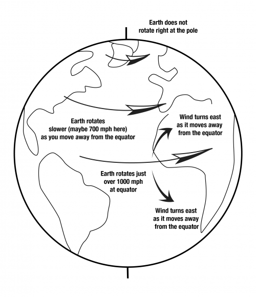
If you stand on the equator, the wind is not blowing 1000 miles per hour. This is fortunate indeed, because the “mere” 150-mile-per-hour winds occasionally reached in hurricanes can cause immense disasters. Rather, the air near the surface of the Earth on average is moving with the surface, because of the drag of mountains and trees and such on the air. This is somewhat akin to driving down the highway at 65 miles per hour with a bug stuck to your windshield. The wind at 65 miles per hour is plenty strong enough to blow a bug, but the wind very close to the windshield is very much slower than 65 miles per hour—really strong winds don’t blow close to surfaces, because of the friction of the surface, and instead the air close to the surface does almost the same thing that the surface is doing.
Now, suppose that you watch a parcel of air that rises at the equator and begins moving towards the North Pole in a convection cell. Once the air has moved a ways north, the Earth under it is no longer rotating at 1000 miles per hour, but is somewhat slower, perhaps 900 miles per hour and dropping northward toward zero at the pole. But aloft, there aren’t trees and mountains to slow the air down from the 1000 miles per hour it had at the equator. Thus, this air “gets ahead” of the Earth. The Earth rotates to the east—you see the sun rise in the east as the rotation of the Earth brings the sun into view—so, the equatorial surface air is moving east at 1000 miles per hour. As this air moves northward over slower-moving land, the wind will appear to turn to the right or east as it blows, getting ahead of the ground. Wind heading south from the equator will also move east ahead of the surface, making a left turn.
Similarly, wind moving from the pole to the equator in the returning limb of a convection cell will lag behind the rotating surface of the Earth, again seeming to turn to the right in the Northern Hemisphere (and to the left in the Southern Hemisphere). Thus, the wind cannot go directly to where it “wants” to go; instead, it turns and tends to go in circles. The circular air flow around low-pressure systems and hurricanes is unavoidable on a rotating Earth.
More-precise definitions are possible of this “Coriolis effect,” the turning of flows on a rotating Earth. The intuitive explanation given above will fail you if you think of a wind moving due-east or due-west, because those also turn. Starting from conservation of angular momentum might be better, and you can find that in any good meteorology textbook. Notice, however, that the explanation given above will get the right answer for you, in how much the wind will turn, and which way.
Notice also that Coriolis turning affects large, fast flows. The convection in the Earth is too slow to feel Coriolis much. The difference in rotation speed between opposite sides of a sink or toilet is so tiny that Coriolis turning has no significant effect on the direction that water swirls as it goes down. That is controlled by the design of the sink or toilet, and by any motion in the water at the time the drain is opened; get the water swirling in a sink and then pull the plug, and the water usually will keep swirling in the way you started it as it goes down. Dr. Alley has seen both clockwise and counterclockwise flows in Pennsylvania and Greenland, and in New Zealand and Antarctica.
More Enrichment: Why Cold Air Sinks but Valleys Are Warmer than Mountain Peaks
When air moves up, it expands, which requires that work is done in pushing away other air to make room for the expansion. The work requires energy, which comes from the heat energy in the air, so the rising air cools. Similarly, when air moves down, it contracts as the surrounding, higher-pressure air squeezes the sinking air parcel, and this squeezing is work that is done on the sinking parcel, and warms the parcel. If this is happening near the surface of the Earth, and the air is dry, the change in temperature is about 1oC per 100 m of vertical motion. This applies everywhere, at all times. So, in the 2004 movie, The Day After Tomorrow, when huge storms brought air down from above so rapidly that the air didn’t have time to warm up, that was complete hooey.
Now, imagine that a “chunk” or parcel of air, sitting somewhere, cools a little (say, by radiating energy to space as the sun goes down in the evening), and you want to know whether that air parcel will sink now. If your air parcel sinks, it must warm by about 1oC per 100 m of sinking, and it must push other air out of the way. You measure the temperature of your parcel, add 1oC for the warming from sinking 100 m, and if your air is still colder than the air it must displace 100 m below, then your parcel will sink. (Friction comes in as well—if your parcel plus 1oC would be only a tiny bit colder than the air it must displace, motion is unlikely; you need a notable difference.)
Overall, a balanced, stationary atmosphere will cool upward by about 1oC per 100 m under dry conditions, and slightly less under wet conditions (when cooling causes condensation that releases heat which offsets some of the cooling, or warming causes evaporation that uses heat which offsets some of the warming). Vertical motions will be triggered when cooling or warming creates air that is anomalously cold or warm relative to this stationary profile. So, cold air on a mountaintop won’t necessarily sink, unless that mountaintop air is anomalously cold. Perhaps on an October evening in the Appalachians, when a fog develops and holds heat in the valleys while the mountaintop radiates heat to space, then the mountaintop air will become anomalously cold and sink to the valleys.
A Rocking Review
Somewhere Over the Puddle
If you want another look at the weather system, and the difference between the Redwoods and Death Valley, the Wizard of Odd takes you Somewhere Over the Puddle in this review revue. (The Sierra tops out over 14,000 feet but in most places is lower, so don't let it bother you that the air in the GeoClip went a little higher than the air in this song--both are right, depending on just where the air goes over.)
Dr. Alley: (SINGING) Somewhere over the rainbow, raindrops fall. Sun and rain make a rainbow with your eyes in between, that's all. Sun falls straight on the equator, just skims the poles.
So tropical heating is greater. Air rises and sinks in rolls. Air lifted in these currents great expands as it feels lesser weight, brings cooling. Air cooling holds less H20, condenses to rain, clouds, or snow. That fall, no fooling.
When there's evaporation, it takes energy, That is why perspiration drying cools you or me. Equatorial evaporation stores solar heat that's released by cloud condensation. Energy is conserved, pretty neat.
This heat from Condensation slows. Cloud cooling as it upward grows while raining. But when this air comes down, it's dry and squeezing drives its fever high. And you know from your training.
Three degrees F per 1,000 feet upward, cools and rains. Five degrees F per 1,000 feet downward warms up the downwind plains. Somewhere over the rainbow, raindrops fall.
Sun and rain make a rainbow with your eyes in between, that's all. Wet redwoods, cold sierra high above Death Valley set to fry. That's why.
Wrap Up
Review the Unit 5 Introduction
You have reached the end of Unit 5! Double-check the list of requirements on the Unit 5 Introduction page and the Course Calendar to make sure you have completed all of the activities listed there.
Unit 5 Overview
Review of the main topics and ideas you encountered in Unit 5.
Weather, Weathering, and Landslides
- Sun hits equator straight-on, poles a glancing blow, so equator gets more sun.
- Sun heats Earth, drives convection in the atmosphere.
- On rotating Earth, this creates interesting winds including onshore breezes on US West Coast.
- Winds rise up Coast Ranges and the Sierra Nevada, watering redwoods and sequoias.
- Winds sink down into Death Valley, drying it.
Why Redwood Wet, Death Valley Dry?
- Warmer air can hold more moisture.
- Rising air expands and cools, sinking air is compressed and warms.
- Evaporation requires heat (so you cool as sweat evaporates), and condensation releases heat.
- Air cools 5oF for 1000 foot rise until condensation starts
- Air cools 3oF for 1000 foot rise with condensation (formation of clouds and then snow or rain).
- Air from the Pacific is wet, rises over Redwood and rains.
- Dry air comes down the other side into Death Valley.
- Air cools 3oF for 1000 foot rise going up, warms 5oF for 1000 foot fall coming down; for 15,000-foot-high mountains, air comes down 30oF warmer than it went up.
- So Death Valley is hotter than Redwood (lack of clouds to shield Death Valley warms it further).
- Air going from Redwood to Death Valley is heated when condensation releases the energy originally used in evaporating the water that rains out on Redwood.
Rocks Not Forever
- Weathering=physical changes that make small rock pieces from big, and chemical changes that make new minerals.
- Physical from crystal growth in cracks (especially ice), etc.
- Common rock granite has quartz= silica (silicon+oxygen), feldspar=aluminum+silica+(calcium or sodium or potassium), dark mineral=iron+magnesium+silica; chemical weathering.
- Quartz stays as quartz sand (little change).
- Feldspar makes clay; calcium and sodium wash away.
- Dark mineral makes rust; magnesium and silica wash away.
- Rust+sand+clay+worm poop=soil.
- Calcium and silica go to make shells in the ocean.
- Magnesium reacts with hot sea-floor rocks
- Sodium makes the ocean salty.
- Soil eventually washed to ocean.
- Subduction takes seawater, sediment, shells, and soils down to melt, rise, and solidify as granite in a nearly-balanced cycle.
Mass Movement
- Mass movement is the downhill transport of soil, rock without rivers.
- Mass movement ranges from huge, destructive landslides to barely measurable soil creep.
- Rivers usually pick up material from mass movement and take it on.
- Usually get a balance between soil production by weathering and soil removal, although humans are upsetting the balance in many places.
- Can often figure out where mass movement is potentially destructive, and stabilize slopes or stay out of the way.
Reminder - Exercise #2 is due and Exercise #3 opens this week. See Course Calendar for specific dates and times.
Supplemental Materials
Following are some supplementary materials for Unit 5. While you are not required to review these, you may find them interesting and possibly even helpful in preparing for the quiz!
- Website: Grand Teton National Park
Comments or Questions?
Please feel free to send an email to ALL of the teachers and TA's through Canvas conversations with any questions. Failure to email ALL teachers and TA's may result in a delayed or missed response. See "How to send email in GEOSC 10" for instructions
Unit 6: Tearing Down Mountains - Groundwater and Rivers
Welcome to Unit 6
More on Tearing Down Mountains: Groundwater and Rivers
(with apologies to John Fogerty & Creedence Clearwater Revival)
Left a big cliff in a landslide, Loosened by a rain and an earthquake, too
And I never lost one minute of sleepin', Worryin' 'bout that trench 'neath the ocean blue.
River keep on movin', Bed load keep on groovin'
Rollin', rollin', rollin' with the river.
Shot through a braid in the mountains, Wrapped around a big old meander bend
But I cannot see the good side of the river, A reservoir trapped me away from my friend.
River can't keep groovin', When dams stop the bedload movin'
Holdin', holdin', holdin' from the river.
If you go down to the river, Bet you're gonna see some houses too near
They might want to worry, storms are in a hurry, When the levees fail, there is something to fear.
River will get movin', Wildness will be provin'
Rollin', rollin', ever-rollin' river.
Learning Objectives
- one
- two
- three
What to do for Unit 6?
You will have one week to complete Unit 6. See the course calendar for specific due dates.
As you work your way through the online materials for Unit 6, you will encounter a video lecture, several vTrips, some animated diagrams (called GeoMations and GeoClips), additional reading assignments, a practice quiz, a "RockOn" quiz, and a "StudentsSpeak" Survey. The chart below provides an overview of the requirements for this unit.
| REQUIREMENTS | SUBMITTED FOR GRADING? |
|---|---|
| Review the Unit 6 Overview | No, the overview outlines the main topics and ideas that you will encounter in Unit 6. You will, however, be tested on the material found in the overview. |
| Read/view all of the Instructional Materials for Unit 6 including: | No, but you will be tested on all of the material found in the Unit 6 Instructional Materials. |
| Take the Unit 6 "RockOn" quiz | Yes, this is the sixth of 12 end of unit RockOn quizzes and is worth 4.5% of your total grade. |
| Continue working on Exercise #3: | Yes, this is the third of 6 Exercises and is worth 5% of your total grade. |
| Complete the "StudentsSpeak #7" survey | Yes, this is the seventh of 12 weekly surveys and is worth 1% of your total grade. |
| Read the Optional Enrichment Article | No |
| Review the Unit 6 Wrap Up including the Supplemental Materials | No, but you may find them helpful in preparing for the quiz. |
Questions?
If you have any questions, please feel free to email "All Teachers" and "All Teaching Assistants" through Canvas conversations.
Keep Reading!
On the following pages, you will find all of the information you need to complete Unit 6, including the online textbook, a video lecture, several VTrips and animations, and two overview presentations.

Students who register for this Penn State course gain access to assignments and instructor feedback and earn academic credit. Information about registering for this course is available from the Office of the University Registrar.
Main Topics, Unit 6
Overview of the main topics you will encounter in Unit 6.
It was kind of solemn, drifting down the big, still river, laying on our backs, looking up at stars, and we didn't even feel like talking aloud..."
— Mark Twain, Adventures of Huckleberry Finn, Chapter 12.
Water, Rivers, Floods, and Caves: Canyonlands, Delta and Mammoth Cave
- Most of the rain that falls then evaporates, especially from plants; most of the remainder soaks into the ground.
- Soil and shallow rock usually have air as well as water in spaces; deeper, below the water table, the spaces are all water-filled.
- The water table looks like a smoothed version of the ground surface, and hits the surface at streams.
- The ground acts something like a sponge, with spaces filling during rains, and draining to keep streams running between rains.
- So, the water table rises during wet times, and sinks during dry times.
Rivers Move Rocks
- Rivers get water mostly soaking through the ground, and rocks by mass movement.
- If more rocks arrive than the water can move away, the rocks pile up, steepening the river so it can move more rocks.
- Sticky, small clay particles favor single, deep meandering channels that move suspended load up in the channels.
- Lots of sand, gravel, or larger rocks that don’t stick together favor many shallow braided channels.
Dams Make a Big Difference
- Sediment builds deltas to fill reservoirs formed by damming rivers.
- A delta builds out but also up, “backing up” sediment to bury fields and houses for some distance upstream.
- Regions downstream of dams no longer get floods after a dam is built.
- This makes a huge difference for what lives on floodplain (favors humans over nature).
- Without floods, big rocks are no longer moved by rivers.
- Clean water released by dams picks up sand, removing sand bars and affecting river ecosystems.
Ignoring rivers can be dangerous
- A delta is a big pile of sediment, which compacts under its own weight.
- The Mississippi delta is miles thick, and compacts a lot.
- The natural sinking is balanced by new mud from the annual flood.
- Humans hate mud on their carpets, so raise natural levees to keep the river out of houses.
- But sinking continues—most of New Orleans had subsided below river level, and some is beneath sea level.
- Wetlands below New Orleans have been lost as levees and dredging for shipping kept flood mud from balancing sinking.
- A low city by a high river and sea with no wetlands to slow storm surges brought huge hurricane disaster.
- Before this happened, scientists, disaster planners, many journalists, and others repeatedly warned that it was coming…
- The sinking continues; rebuilding without major changes will cause the next disaster to be even worse.
Caves are Cool
- Some rocks (esp. limestone) dissolve easily; if cracks are rare so the dissolving is focused, then sinkholes form going down from the surface, with caves beneath, springs, etc., giving a landscape called karst.
- If the cave then becomes air-filled, water dripping in will lose extra CO2 picked up from the soil, depositing dissolved limestone to make cave formations.
- Water goes through caves quickly; pollution discharged today may harm someone tomorrow.
- For other rocks, water moves much more slowly; pollution may not “get” anyone for a while, but once it does, clean-up usually is very hard and very slow.
- Scientists and engineers have developed some clean-up options, but the best option is to keep poisons out of the ground.
Textbook 6.1: Canyonlands National Park
River Processes
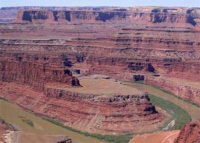
Southwest of Moab, Utah lies Canyonlands National Park. A “rough” park with few services available, little water (except for the rather muddy rivers), pot-holed roads, and awesome mountain biking, Canyonlands preserves the confluence of the Colorado and the Green Rivers. Many “visitors” to the park never actually enter it, choosing to gaze down on the Colorado from the vantage point at Dead Horse Point State Park. The two rivers of the park are incised a third of a mile (half a kilometer) or more into the red sedimentary rocks of the Colorado Plateau. Those rocks, mostly sandstones (made from sand) and shales (mud rocks, made from pieces smaller than sand), give the distinctive cliff-slope pattern of the canyons—resistant sandstones form cliffs and cap the flat-topped mesas, while softer shales form slopes.
The great Colorado Plateau, flanked by the spreading regions of the Basin and Range to the West, and the Rio Grande Rift to the east, occupies large parts of Utah and Arizona plus some of Colorado and New Mexico, and includes Zion, Bryce, Capitol Reef, Arches, Grand Canyon, Petrified Forest and Mesa Verde National Parks as well as Canyonlands, and many national monuments and other public treasures. The Colorado Plateau is noted for reddish, flat-lying, rocks from the Paleozoic of a few hundred million years ago.
The details are not all known of how the Colorado Plateau avoided extreme deformation for hundreds of millions of years, while most of the rest of the west was being bent, broken, or erupted. The silica-rich continental rocks of the Plateau may be a bit thicker than in its surroundings, so the spreading of Death Valley was unable to tear the Plateau apart and instead jumped across to the east side of the Plateau to continue as the Rio Grande Rift (the valley in which the Rio Grande flows). The spreading even seems to have nibbled away at the Plateau, with a few big pull-apart, Death-Valley-type faults visible in places such as Red Canyon just west of Bryce (see the picture below). However, our concern here is slightly different— the role of streams.
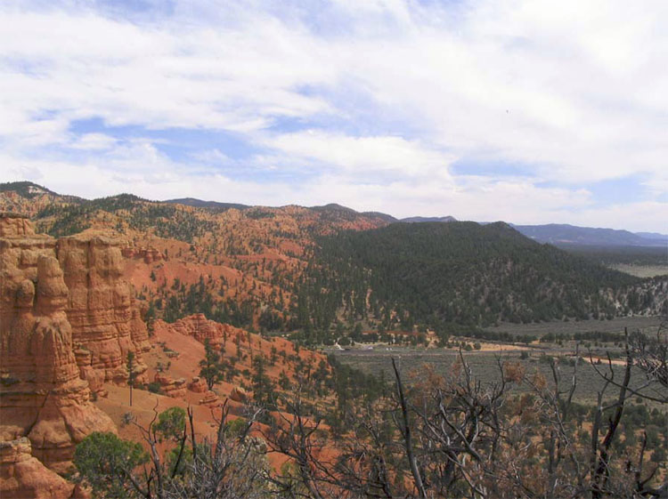
Rain, Rocks, and Rivers
The rivers of the Colorado Plateau are nearly as well known as their parks, for great rafting, incredible scenic views, and deep canyons. The Colorado, the Green, the San Juan, the Fremont, the Virgin and others have taken their place in history. But what are those rivers doing down there in the canyons?
Simply put, a stream or river is a conduit to take excess water, and sediment, from high places to low ones and usually to the ocean. Looking first at the water, rain or snow falls on the ground. Averaged around the world, rainfall (plus snowfall after it melts) is about 3 feet per year. Pennsylvania's annual rainfall is also right near the global average, as is much of the tree-covered eastern US. Some of this water evaporates directly, but most is used by plants and then is transpired (evaporates) from them. The evaporation from plants and from other surfaces usually is lumped together and called “evapotranspiration.” In a humid temperate climate such as central Pennsylvania, roughly two-thirds of the rainfall is involved in evapotranspiration and returned directly to the sky; in dry climates, a larger fraction of the rainfall—maybe almost all of whatever rain falls—may be returned to the air by evapotranspiration.
Of the water that avoids evapotranspiration, a little actually falls on lakes or streams, and some may fall on the land surface and then flow directly and immediately over the surface into lakes or streams, especially from the surfaces that humans have covered with buildings, roads, and parking lots, thus keeping the rain from soaking in. But most of the rain that avoids evapotranspiration soaks into the ground to form groundwater.
Soils and most rocks include interconnected spaces, either gaps between grains of sand, the cracks in the rock called joints, caves, or other openings. The ground acts a bit like a sponge, with water soaking in and then slowly draining out to the rivers. We will discuss this groundwater flow a bit more when we visit Mammoth Cave, next; for now, simply note that because gravity pulls water down, rocks near the surface usually have some air in the spaces even where conditions are damp, and deeper rocks usually have all their spaces filled with water. The surface separating the rocks with water-filled spaces from those containing some air is called the water table, and where the water table intersects the surface of the Earth, a stream or lake occurs.
Rivers flow even when it isn't raining because water is slowly draining through the ground from beneath hills to the rivers. The water table rises in elevation during wet times as the “sponge” of the Earth fills up with rain, and the water table falls during dry times as the sponge drains to keep the streams flowing. And, the water table is just below the surface in valleys, actually hits the surface at streams, but you must drill deeper under ridges to penetrate the water table and complete a water well.
As we saw back at the Badlands, weather attacks rocks to produce loose pieces through the processes of weathering. And as we saw at the Gros Ventre slide in the Tetons, processes on hillslopes including soil creep and landslides deliver the loose pieces (which we can call sediment) to rivers. A river is then faced with a balancing act; it must transport both the water and the sediment delivered to it.
You may be able to think of many ways for the river to adjust if more or less water, more or less sediment, or bigger or smaller or “stickier” pieces (those more likely to clump together) of sediment are delivered. For example, if more sediment is delivered to a river than it can remove, then the sediment will pile up, raising the elevation of the bed of the river. This steepens the river—the elevation of the ocean where the river ends has not changed, but the elevation of the river bed away from the ocean is now higher—so the river flows faster and is better able to move the sediment. Deliver more water and less sediment, and the river will wash away all the sediment and have energy left over to carve into the river bed. This cutting downward will make the river less steep—because the river ends at sea level and can’t lower that, lowering the upstream reaches of the river must make the slope to the ocean less steep. A less-steep river will carry less sediment and so quit cutting its bed—the river tends to reach a balance in which it just removes the water and sediment supplied to it. In the process of reaching this balance, rivers also may adjust the width and depth of their channels as well as the steepness.
Rivers are diverse; a white-water rafter on the Youghiogheny River sees a very different setting than greets a river passenger on the Mississippi River going to New Orleans! Of the many river patterns, we often focus on two: meandering and braided (the Mississippi is a meandering river; the "Yough" has some meanders, but not nearly so well developed as the Mississippi). Whether a river meanders or is braided depends on the sediment supplied to the river as well as the water.
A river moves small sediment particles up in the water (suspended load), and larger pieces by rolling or bouncing them along the bed (bed load). If the river receives mostly small particles—what geologists call "fine-grained sediment"—the river typically will form a deep channel. Such a channel is especially efficient at transporting water, and the sediment in the water, because most of the flow is kept away from the river bed and river banks where friction with tree roots and other things slows the water. Very fine sediment—clay—can make fairly deep and steep river banks without collapsing, because the clay particles stick to each other—if you’ve ever worked with clay in art class, you know how well the clay particles stick together, and how much easier it is to make a pot out of clay than out of gravel or sand!
Such deep streams typically curve back and forth, or meander, along their paths. Put a tree’s roots in the way of the stream, and the water flow will curve around the obstacle. In doing so, the stream will race along the outside of the curve and erode it, and a meander bend will grow. (Meandering has been observed to occur without any tree roots in the way, and so is a bit more complex than just curving around obstacles.) Meandering streams usually occur in relatively flat, lowland regions towards the coast.
If a stream receives lots of sand and gravel or even bigger chunks, the large blocks will tend to plug, or dam, a single, deep and narrow channel. The stream then assumes a wide, shallow pattern that is efficient at rolling debris. When sand and gravel get really wet along a river bank, they cannot form steep slopes, as we saw with the mass movements in the Tetons, and the collapse of any steep slopes that start to form along a river bank contributes to having a wide, shallow stream. Within this broad stream bed, gravel (or boulder) bars often form when floods are ending and losing their ability to roll lots of sediment; the water then must flow around these bars. The splitting and rejoining of channels around bars, when viewed from above, looks something like ropes of water that have been braided together, so these are called braided rivers. They are common in upland regions, where steep mountain slopes shed landslides of coarse rocks into the channels.
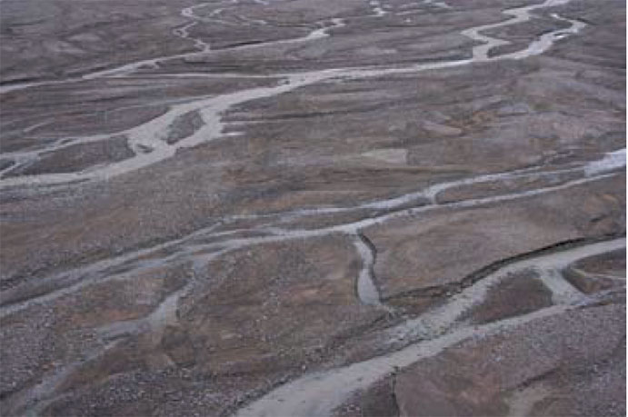
Again, please recognize that this is a very simple view of stream processes. You can find meandering streams in the flat bottoms of valleys in which beaver dams have trapped mud, for example. Streams with bedrock rather than sediment in their beds often have relatively straight single channels, as do many small streams with sediment beds. The key thing to remember about a stream is that it exists to move sediment as well as water.
A tremendous example occurs a little ways downstream of Canyonlands and upstream of the Grand Canyon. The Glen Canyon Dam was built on the Colorado River in the 1960s. The dam stopped floods coming through Canyonlands from reaching the Grand Canyon—water from floods that had raged through the canyon now is stored in the reservoir and then released gradually. Several things began happening to the river once the dam was completed. The dam trapped the sediment carried by the river, and released clean water, so the reservoir is filling with sediment, and in a few centuries or less will be full. Unique fish species that thrived in the muddy waters of the Grand Canyon suddenly were easy prey for clear-water species that were introduced, so many of the native species are endangered and disappearing now.
With no floods raging down the canyon, high water no longer piled up sand in corners of the canyon to make sand bars. The clean water was able to carry some sand and smaller pieces of sediment, so the existing sand bars below the dam were slowly washed away. The many types of wildlife that depend on sand bars thus were harmed—cottonwood trees that rooted in the sand, birds that lived in the cottonwoods, deer that came down to drink from the river by standing on the sand bars rather than the rocky cliffs. Floods on un-dammed side streams continued to dump large rocks into the Colorado, but the Colorado lacked the high flows to move this material onward, so the rapids at the mouths of side canyons began to steepen.
In the spring of 1996, an artificial flood was released from the dam to attempt to re-balance the system. Indications are that this flood was a partly successful experiment, rolling some of the big rocks out of the rapids at the mouths of the side streams, freeing sand trapped beneath, and forming that sand into bars. But, those bars weren’t very big and didn’t last very long. Additional human-made floods were released in 2004 and 2008, timed to occur when natural floods coming down side streams were delivering additional sediment, to help make bigger sand bars. Additional attempts may be made. Such human-caused floods cost money (lost hydroelectric power when extra water is routed around the hydroelectric plant in the dam to get water into the river in a hurry) and require lots of planning (you need to warn people camping or hiking in the Canyon before you suddenly flood them out!), and they can never get the Canyon back the way it was originally, but the artificial floods do seem to have helped restore some of the sandbars that are so critical for wildlife.
Meanwhile, upstream of the dam, as sediment builds up to fill the reservoir, sediment will also accumulate along the river upstream of the reservoir. There aren’t many people living there, but if there were, their fields and houses would begin to be buried by mud. A river slows down as it enters a reservoir, or any other lake or the ocean, and sediment is dropped from the slowing water. Unless strong waves and currents in the reservoir or ocean take that sediment away, a pile called a delta forms. But, the delta cannot be perfectly flat on top. If it were, then the stream would drop its load when it hit the flat spot and slowed down, and that would raise the flat spot. So, as the delta grows into the lake, the upstream end of the delta must build up so that the river still flows downhill, and that, in turn, will cause sediment to build up for some distance upriver (see the figure below).
The troubles with the dam on the Colorado at Glen Canyon are not unique. Reservoirs immediately start filling with sediment, and so cannot last forever. This filling contributes to deposition of sediment upstream, which may bury houses or fields. The clean water released tends to pick up fine-grained sediment below the dam, but the lack of floods means that the river is no longer able to move coarse-grained sediment. Hence, the river bed is changed, affecting species that lived there. The lack of floods often has huge effects on the plants and animals that live along the river; what had been a region reserved for wildlife adapted to the changing water levels and channels becomes a place for humans to settle in the shadow of the dam.
When two dams were built on the Elwha River, which flows north from Olympic National Park, the dams contributed to blocking salmon runs, to washing away the sand and gravel in which the salmon had spawned downstream of the dam sites, and to turning an annual “flood” of 300,000 salmon into a trickle of barely 3,000 salmon. (A fish hatchery was built instead of fish ladders around the first dam, but the hatchery was quickly abandoned.) Once the spawning bars were washed away below the dam, the river quit delivering sediment to the beaches of the Strait of Juan de Fuca (an arm of the Pacific Ocean); as the beaches washed away, the native peoples were no longer able to carry on their traditional shell-fishing, and engineering was required to protect the nearby harbor of Port Angeles, which was no longer guarded by sediment-fed bars. In an ambitious plan to help the beaches, the river, the salmon and the park, the federal government purchased the dams. One was removed in spring of 2012, with the second slated to follow quickly. The river, beaches, harbor and more will take a while to get back to "normal," because so much was changed by the dams, but there is much optimism about the recovery. You can read more, and track the progress, at the official website for Olympic National Park.
Textbook 6.2: The Delta National Wildlife Refuge
Controlling Rivers
At the tip of the Mississippi Delta lies the Delta National Wildlife Refuge. This is one of several wildlife refuges along the Gulf Coast that, in addition to spawning a great range of resident wildlife, draw migrants from the north. Ducks and geese, herons and cranes, gallinules and rails, the wetland birds of most of a continent stream in through the fall, and then spread north again in the spring. (Yes, technically, a National Wildlife Refuge is not a National Park, but it is a national park, so we’ll cheat a little and use it—it makes a good story. And, it is just down the river from the wonderful bayous of the Barataria Reserve in the Jean Lafitte National Historical Park and Preserve—be sure to stop if you're in the area!)
Unfortunately, these wetlands are disappearing at an astonishing rate, because of the indirect effects of human activities. Estimates are that every year Louisiana is losing over 100 square kilometers of wetlands (equal to loss of a square with sides more than six miles long). Whether the wetland birds will continue to stream north for generations to come may depend on how humans respond to the challenge.
The Mississippi Delta is a massive pile of mud and sand from the Rockies and Appalachians, transported by the river and dumped into the Gulf of Mexico. The Gulf used to extend far into the heartland of what is now the U.S.; over the last 70 million years, the delta has grown southward from near Cairo, IL (up by St. Louis), until now the former embayment has been turned into a projection from the end of Louisiana into the Gulf. There, the delta is as much as seven miles thick. If you have ever watched mud settle in a bottle of water, or if you have observed how your boot packs mud down if you step in it, then you know that, over time, mud will compact under its own weight or under the weight of anything placed on it.
As the delta grew into the Gulf over the millennia, a natural balance was reached. The compaction that occurred during a year would leave a little space at the top, but the springtime floods would bring new mud to fill the space. Trees and other vegetation would grow up through the new sediment, or re-seed on top, and the system would continue, wildly productive and vibrantly green.
Wrestling with Mud
There is a problem with this system and humans, however. Many people have settled near the river. Plants can grow up through the mud of floods, but people don’t enjoy having their houses slowly fill up with mud. So, humans have built control structures. We built dams upriver, which trap sediment behind them and which hold some floodwaters in check. Because large floods threaten dams and must be let through, we also built levees along the river in its downstream reaches, great walls that hold the river in. We also dredge the river, deepening it to carry the water—and shipping. The great floods that shoot down the river then do not spread over the floodplain and the delta, depositing fertile sediment to fill the space left by compaction of mud, but instead are piped to the Gulf, where the sediment jets off the edge of the delta to settle in mile-deep water.
Way back in 1996, when the very first edition of this textbook was written, it read:
"Today, much of New Orleans, which does lie on the delta, is well below sea level. A tanker in the river between its levees is higher than the playing field of the Superdome. Rainfall, and water seeping from the river, must be pumped out so that the city doesn’t fill with water. If the pumps were to fail, the city would become a lake. The city steadily sinks deeper, and the levees are steadily raised by the Army Corps of Engineers, as instructed by Congress, to keep the river caged. Meanwhile, the wetlands of the delta, unnourished by new sediment, are sinking beneath the Gulf..."
After 2005, we know how terribly accurate the geological understanding of New Orleans really was. Where natural wetlands should have slowed the waves from Hurricane Katrina (which was not a really big storm by the time it got to New Orleans!), the high waters of the storm surge roared unimpeded from the Gulf. Parts of the levees failed. The pumps failed. The city filled with water, as much as 20 feet deep.
The hurricane showed what geologists (and emergency planners!) had long known, and had long told Congresspersons and Senators and students and others—New Orleans was a disaster waiting to happen, not “if” but “when.” With almost 2,000 people killed, hundreds of thousands of people displaced, and damages approaching $100 billion (that is, more than $300 from every single person in the United States), the danger of ignoring solid scientific evidence and hoping for the best is clearer than ever.
But, the city is rebuilt where it was, the sinking will continue, the loss of wetlands will continue unless many things are changed, and the levees will need to be raised. With the likelihood that the strongest storms will get stronger and sea level will rise in the future (we’ll revisit this later in the semester), the scene will be set for an even more horrific disaster at some future date. Many options are available, including restoring wetlands, filling parts of the city with debris or other materials, moving construction to higher parts of the city, moving out entirely, and more; it will be interesting to see how much of this will be done. But primarily, the donations and tax dollars from the rest of the country after the 2005 disaster were used to rebuild the city directly in harm’s way, with the knowledge that the rest of the country will once again foot the bill when disaster strikes.
Another story is being played out in this region as well. The river wants to leave New Orleans. The city has a love-hate relation with the river, fearing the floods but needing the drinking water and the shipping channel. The river can harm the city rapidly by flood, or slowly by leaving.
To understand this tendency of the river to leave New Orleans, note that especially large, muddy, flood-prone rivers normally have natural levees (which are much lower than the human-made ones). When a flood happens, the water spreads out of the main channel onto the flood plain, the flattish region of river-deposited muds next to the main channel. As the water spreads out into the trees or houses of the flood plain, the flow slows, and the water drops some of its muddy load. Just as the water leaves the main channel, the water is carrying the most load, and the slowing is most prominent, so most of the load is deposited right there next to the channel. Hence, the mud layer from a flood is thicker next to the river than farther away, forming a natural levee. Humans have raised these natural levees in many places.
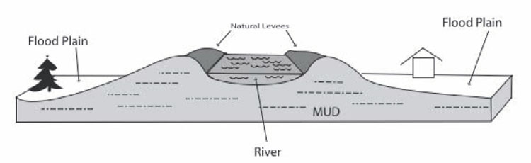
When we discussed reservoirs, we saw that the delta of sediment formed when a river enters a lake must build up as well as out, so that the river still flows downhill into the lake. The same is true for a river entering an ocean. The Mississippi River, with its levees, naturally dumps mud into the Gulf of Mexico, slowly lengthening and raising the river bed. After a while, the river is a bit like a log flume in an amusement park, following a long path to the Gulf; a break in the levee wall would allow a much steeper, shorter, and more exciting downhill trip. The recent history of the Mississippi Delta is that, roughly every 1,500 years, the main outlet of the river has broken through the natural levee, like a log full of park-goers breaking through a curve in the ride, and the river has then followed that new shortcut. But, as mud is deposited along that new shortcut, it lengthens until it is like a long log flume, and then the river breaks through a side again.
During the 1940s and 1950s, the Mississippi started to break out, into a side stream called the Atchafalaya River. To save the shipping channel and the water supply for New Orleans, the Army Corps of Engineers has used the Old River Control Structure and other dams and levees to allow some water to go down the Atchafalaya while keeping a vigorous flow in the main log-flume channel past New Orleans. During a flood in 1973, the Corps very nearly lost the Control Structure, and the river, when a giant whirlpool undercutting the dam came close to causing it to collapse. The task of the Corps is very difficult, taming immense natural forces as the system becomes more and more out of balance.
(An excellent account of this is given in John McPhee’s book The Control of Nature, 1989, Farrar, Straus and Giroux, New York, which may be a little out of date but is still fascinating, and shows that policy-makers and others were warned about the dangers in the area long before the disaster of the 2005 hurricane.)
Textbook 6.3: Mammoth Cave
Deep beneath the rolling Kentucky hills lies Mammoth Cave. With about 390 miles (almost 630 km) of surveyed passageways, this is the longest known cave in the world, more than twice as long as second-place Jewel Cave (which is in a national monument in South Dakota, and has just under 160 miles or 260 km of surveyed passageways). The great size was achieved when a team of explorers showed that the historical part of Mammoth Cave and the even larger neighboring Flint Ridge Cave were actually connected, followed by a lot more surveying. There is every reason to expect that further connected passages remain undiscovered, and estimates extend as high as 1000 miles of total passageways.
The cave was mined for saltpeter (containing nitrates) for use in gunpowder, especially during the war of 1812. The source was bat guano (the polite name for it) deposited over the ages by great flocks of bats. Native Americans used the cave long before European settlement.
Cave Formation
The cave was dissolved in limestone. The limestone was deposited in shallow seas during the Paleozoic (a few hundred million years ago), mostly as shells of sea creatures. The limestone lies beneath sandstone from old beaches. The sandstone is a rather sturdy layer, and provides a “roof” that does not collapse easily, which is important in making Mammoth Cave so big.
As we saw in discussing rock weathering to make muds for the Badlands, rainwater and soil water are weak acids. Chemically, limestone is calcium carbonate, which is especially prone to attack by acid. The usual test for limestone is to drip a little weak hydrochloric acid on a sample; limestone fizzes vigorously as the rock decomposes, freeing carbon dioxide gas, but most other rocks react much more slowly and do not fizz. Where soil waters move through limestone, the rock dissolves and washes away rather rapidly. If the rock has lots and lots of cracks, the water may follow so many different paths and spread out the dissolution so evenly that caves are not formed. But if the limestone has just a few cracks for water to flow through, all of the dissolution will be concentrated in those few places, and cave passageways may form. Then, if the water table is lowered (say, because the nearby river has cut downward through rocks and is draining water from the rocks to its new lower elevation, as Kentucky’s Green River has done near Mammoth Cave), water will drain away and the cave will fill with air.
The beautiful stalaCtites (from the Ceiling), stalaGmites (on the Ground), and other cave formations can then develop. Because processes in soil—worms exhaling, and similar activities—typically release carbon dioxide, groundwater usually contains more carbon dioxide than does rainwater, so groundwater is more effective than rainwater at dissolving limestone. Occasionally, a cave may be so isolated from the surface that dangerous levels of carbon dioxide exist in the cave, but caves usually exchange enough air with the outside world to have near-normal levels of carbon dioxide. When groundwater drips into a cave that has a near-normal carbon-dioxide level, the water loses carbon dioxide to the air. The water then cannot hold all of the dissolved limestone, and deposits some of it to form the beautiful stone features we see.
Sometime, look at a cliff or road cut (but be careful—we don't want to lose anyone to distracted driving, or being run over along a roadside!). If you look carefully, you should see that almost all cliffs and road cuts have cracks (called joints), and that some of those joints are usually vertical; very often there are two or more sets of vertical joints, perhaps with many joints oriented north-south but many others oriented east-west. Rainwater that is not used by plants will trickle down the “pipe” where the joints intersect. If the rock around the pipe is limestone, the rock will dissolve, leaving space, although that space may fill with mud. Such a hole, whether mud-filled or air-filled, is called a sinkhole.
Sinkholes formed by downgoing waters are very common in the State College, PA area, where Dr. Alley lives. Penn State’s Geosciences Department is housed in the Deike Building, which required extra funding for special strengthening because the building has sinkholes beneath—a building can rest firmly on bedrock, but tends to fall into air-filled or mud-filled holes. Extra funds were similarly expended to strengthen the nearby Mt. Nittany Middle School, the runway extension at the airport, and other construction projects in the area. A newly constructed storm-water catch basin at the airport filled with water during the first rain, and the weight of the water blasted mud out of a buried cave passageway somewhere beneath, suddenly turning Spring Creek red with trout-choking sediment.
Where sinkholes and caves are common, streams often disappear underground into swallow holes, only to re-emerge at springs. Spring Creek is aptly named, and many other similar features occur around central Pennsylvania, around Mammoth Cave, and in other such regions. Corn cobs once were dumped in a sinkhole behind a cannery at Old Fort east of State College, and after a rain would pop out of a spring in Spring Mills, a few miles away. Regions with sinkholes, caves, springs, swallow holes, etc., are referred to as karst, after a region in Slovenia with many such features. Karst features are present across 20% of the Earth’s surface, and roughly 40% of the US population obtains drinking water from karst, according to the National Park Service.
In the past, people often threw trash into sinkholes. Big pieces would sink into the mud or fall into cave passages beneath, “disappearing.” When Dr. Alley was in high school and went to Sloan’s Valley, Kentucky to go wild caving (spelunking), one of the cave entrances was known as the Garbage Pit, which led into the Tetanus Tunnel. A commercial cave near Mammoth Cave was forced to close in the 1940s because of the stench from sewage draining in.
Slowly, we are learning just how stupid it is to dump things in sinkholes. A test run by Penn State’s hydrogeologist, the great Dick Parizek, during the building of the Nittany Mall showed that a little harmless dye dumped in a sinkhole near the mall came out in a nearby trout stream in a day or two. It should be evident that anything else dumped in a sinkhole near the Nittany Mall (or many, many other sinkholes in the region and in other karst regions) would show up very quickly in the water used by people and wildlife.
Dr. Alley lives in a house served by the Lemont Water Company, which is now well-known for fine water. But many years ago, before a reorganization of the water company, the intestinal parasite Giardia showed up in Lemont well water. Giardia causes intense and possibly dangerous gastric discomfort, and is to be avoided. Giardia usually is restricted to surface water; the spaces in most rocks are small enough to filter out the Giardia cysts before they reach a well, or the water takes so long to go from the surface to a well through the small spaces that the cysts die of old age on the way. At the long-ago community meeting to discuss the water contamination, company officials noted that they had installed well filters to remove sticks, leaves, etc., that came out of the wells with the water. In karst country, surface water can become groundwater and return to the surface in hours or days. Whole streams go down and up, and if sticks can go through, microscopic cysts can, too. Clearly, contaminants dumped somewhere today can be poisoning someone tomorrow.
In some other regions, the groundwater-contamination problems are quite different. In sandstones, for example, the water moves slowly, pore-by-pore, through the rocks. In some places, the water can be shown to have first entered the ground during the ice age, more than 20,000 years ago, or even earlier. Contaminants dumped in such rocks may not bother people for a while. But, when the contaminants do start to bother people, clean-up can be very difficult.
Try this experiment. Squirt some soap on a sponge, and squeeze the sponge a few times to distribute the soap well. The sponge is our rock, and the soap is the contaminant. Now, wet the sponge, hold it up, and squeeze it. Foamy, soapy water will come out. Wet the sponge again, squeeze it again, and more soap comes out. Repeat, and repeat, and repeat. You may need ten or more times to remove enough soap that you no longer see it, and sensitive instruments would detect the soap through dozens or even hundreds of additional washings. Now, suppose that we had not soap, but a chemical that causes cancer in humans. If the water in the rocks naturally is hundreds or thousands or more years old, then nature takes a long time to wash out the rocks once, and washing them out ten or one hundred times will take much longer than all of human history.
There are things that can be done about groundwater pollution. You can pump clean water in and dirty water out, or pump steam or hot water in and out (and then try to figure out how to clean the dirty water or steam once you have them on the surface). People are experimenting with installing filters so that polluted water will flow through them, sometimes using large masses of iron filings to react with and break down some organic chemicals in groundwater. Geomicrobiologists are prospecting really dirty sites for “bugs” that “like” to eat pollutants, and then trying to introduce those microorganisms into other polluted sites; other biologists are looking into ways to design pollutant-eating microbes. But, such techniques usually are very expensive and not very effective. Most people who have thought about it agree very strongly that the best way to handle groundwater pollution is to keep the chemicals out of the ground in the first place. A whole lot of money has been spent on clean-up because we did not learn that lesson soon enough—and there are days when it appears that we have not yet learned that lesson.
Virtual Field Trips
Join Dr. Alley and his team as they take you on "virtual tours" of National Parks and other locations that illustrate some of the key ideas and concepts being covered in Unit 6.
TECH NOTE - Click on the first thumbnail below to begin the slideshow. To proceed to the next image, move the mouse over the picture until the "next" and "previous" buttons appear ON the image or simply use the arrow keys.
Virtual Field Trip #1: Canyonlands
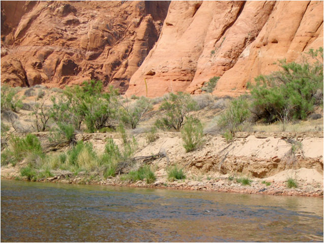
Rivers Roll Rocks, and Dams Get in the Way. All photos by R. Alley from the Penn State CAUSE trip, 2004
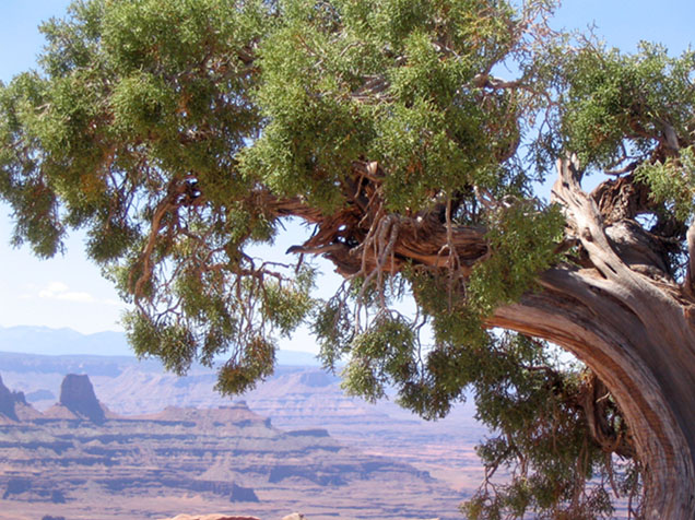
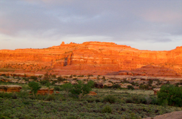
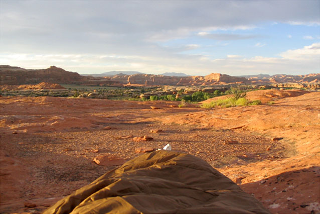
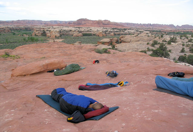
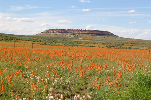
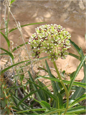
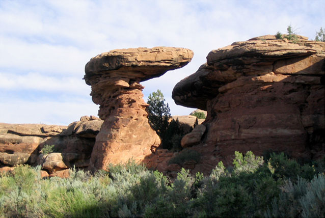
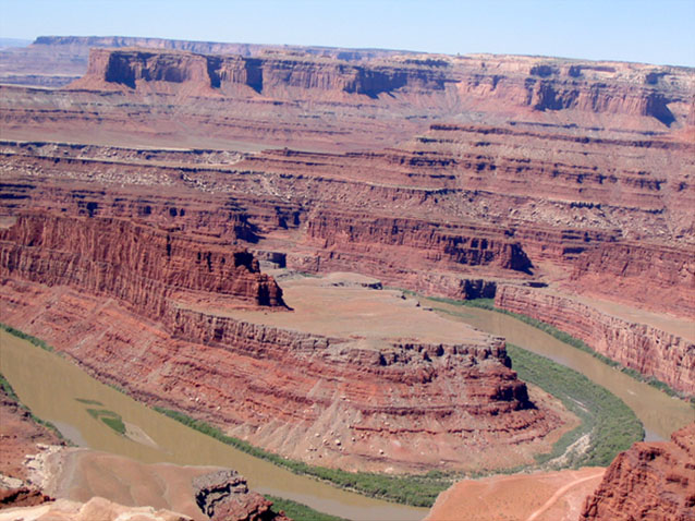
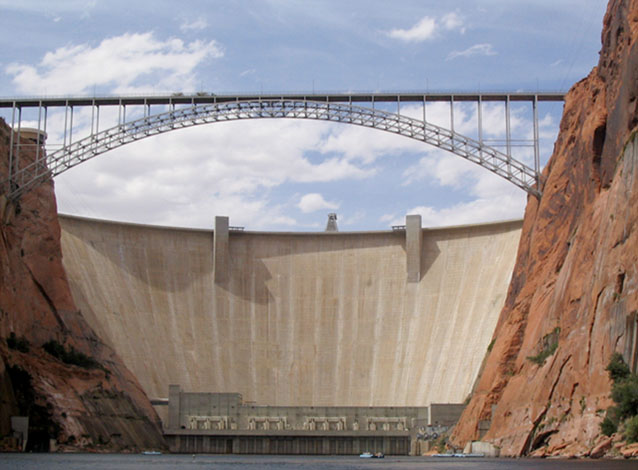
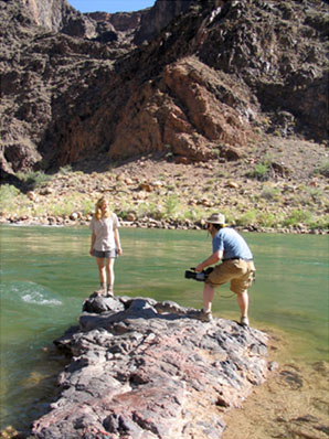
Image 1: Canyonlands to the Grand Canyon; Rivers Roll Rocks, and Dams Get in the Way; All photos by R. Alley from the Penn State CAUSE trip, 2004.
Image 2: Canyonlands, near Moab, Utah, preserves the junction of the Colorado and Green Rivers. The rocks are mostly from the Mesozoic (a couple of hundred million years ago) and include sandstones and shales.
Image 3: Sunrise over the red rocks of Canyonland in the Needles area. Sunrise washes the red rocks of Canyonlands in the Needles area, one of several distinct districts of the park--the rivers are not bridged, so getting from one district to another can take a lot of driving.
Image 4: Sunrise at Needles area campground in Canyonlands with foot of sleeping bag in foreground. Sunrise over sleeping bag, Needles area group campground, Canyonlands.
Image 5: Several students in sleeping bags on the rocks at Needles area campground, Canyonlands. Sunrise over sleeping students, Needles area group campground, Canyonlands.
Image 6: A field of orange mallows at the entrance to Needles area in Canyonlands. A field of mallows, entrance to Needles area, Canyonlands.
Image 7: Close-up of a desert milkweed in Canyonlands National Park. A desert milkweed, Canyonlands National Park
Image 8: Close-up of large uniquely shaped and patterned sandstone in Canyonlands. Rock features, Canyonlands. The sandstones shown here have weathered into fantastic patterns.
Image 9: Panoramic view of Canyonlands and a muddy Colorado River with exposed sandbars, viewed from Dead Horse Point State Park. The Colorado River and Canyonlands, as viewed from Dead Horse Point State Park. Notice the muddy water, the sand bars in the river, and the tree-covered sand bars along the river. This clearly is a river that moves much sediment.
Image 10: The Glen Canyon dam and highway bridge, viewed from a raft on the Colorado River below the dam. The Glen Canyon dam, and highway bridge, viewed from a raft trip on the Colorado River below the dam. Lake Powell, on the other side of the dam, catches the sediment from the river, so that clean water is released from the dam.
Image 11: A young woman and a man with a video camera standing on a rock in the river, at the bottom of the Grand Canyon. Stephanie Shepherd and Topher Yorks filming at the bottom of the Grand Canyon. Notice that the water behind them is nearly free of sediment, so you can see the bottom clearly in the closer parts.
Image 12: Colorado River, below the Glen Canyon Dam, with arrows pointing to an eroding sandbar. The Colorado River below the Glen Canyon Dam. The cliffs are still spectacular, but the sandbar across the center (arrowed) has largely been eroded away by the sediment-free waters released from the dam.
Image 13: Bottom of the Grand Canyon, boulder bar in left foreground and river with clear water in right foreground. Bottom of the Grand Canyon, from the silver bridge that takes the Bright Angel Trail across the river. The water is clear. The left foreground shows a boulder bar, not a sand bar--much of the sand has been washed out of the Canyon by the clean water released from the dam upstream.
Virtual Field Trip #2: Mississippi Delta National Wildlife Refuge

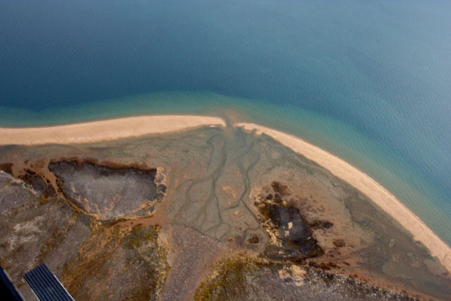
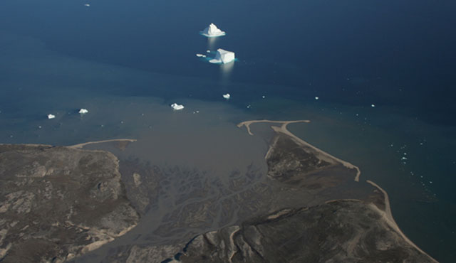
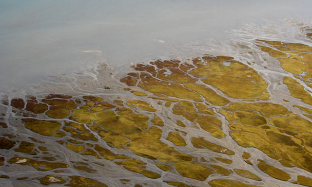
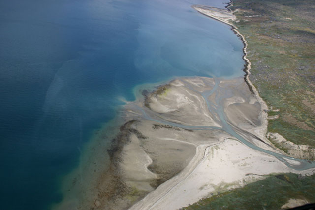
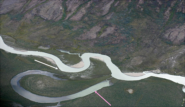
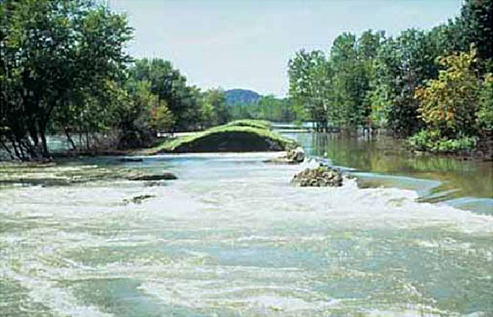
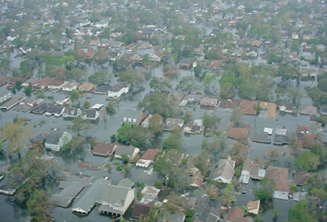
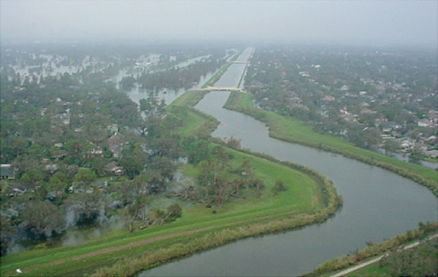
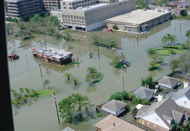
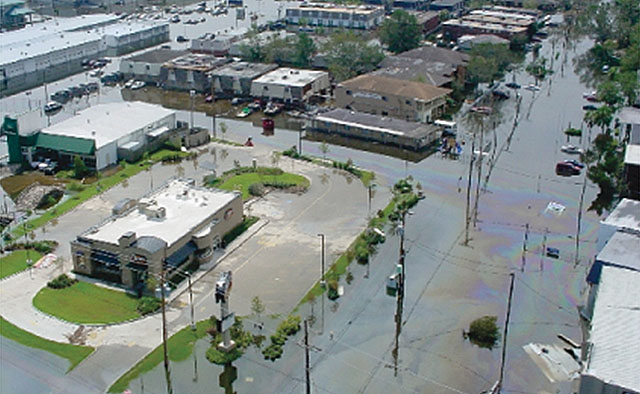
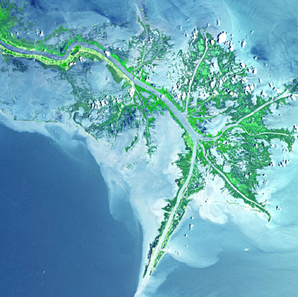 The Mississippi River flows from the upper left through green marshes to the blue Gulf of Mexico, where the river's mud colors the water whitish. Branches of the river have been deepened for shipping; the main channel extends to the southwest (lower left). Deltas come in many forms; this is somewhat different from those we saw earlier in Greenland. Source: http://photojournal.jpl.nasa.gov/catalog/PIA03497
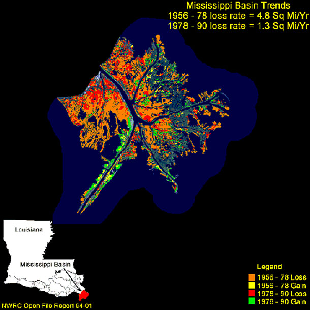
Image 1: Aerial view of Mississippi Delta. Mississippi River flows through green marshes to Gulf of Mexico and river’s mud clouds water. Deltas, rivers and floods: living with the moving water. This picture shows the Mississippi River Delta, south of New Orleans. Plants are green, deep water is blue, and the grayish-white is mud carried by the river. A few poofy white clouds are also visible.
Image 2: Aerial view of delta in Mudder Bugt (“Muddy Bay”), east Greenland. Stream at bottom of photo deposits the delta into fjord at top of photo. Delta in Mudder Bugt (“Muddy Bay”), east Greenland. A stream flowing from the bottom of the picture has deposited the delta into the fjord at the top of the picture. Sediment supply is slow enough to allow waves in the fjord to rework the sediment to make the beaches that outline the delta. Helicopter skid is visible in the far lower left.
Image 3: Aerial view of delta near Muddy Bay, Greenland. Stream flows in braided pattern and there are icebergs offshore. A delta near the one in the previous picture. The stream, flowing from the lower left, is braided, and the pattern of sand bars and beaches is quite interesting. This is Greenland, so the objects offshore are icebergs rather than oil tankers or merchant ships.
Image 4: Aerial view of a Greenlandic delta, near Muddy Bay, shows sand bars and braided rivers. Another Greenlandic delta, close to those in the two previous pictures. Some of the bars in the braided river supplying the delta have been stable long enough for tundra vegetation to become established.
Image 5: Aerial view of two side-by-side deltas in Tasermiut Fjord, South Greenland. Deltas are higher on the right, where the streams enter. Two more deltas, Tasermiut Fjord, South Greenland. Careful examination will show that the deltas are higher on the right, where the streams enter, and lower on the left--sediment builds up as well as out.
Image 6: Aerial view of stream Sondresermilik Fjord, S. Greenland. One arrow points to oxbow lake, one points to levees separating stream from lake. Meandering stream feeding Sondresermilik Fjord, South Greenland. Streams flow fastest on the outside of a curve, eroding the curve, until a shortcut forms and leaves an oxbow lake (pink arrow). Low natural levees (white arrow) separate the oxbow lake from the stream.
Image 7: Failed Missouri levee in the Mississippi basin, during the Great Midwest Flood of 1993. http://water.usgs.gov/nwsum/WSP2425/images/levee.jpeg US Fish and Wildlife Service photo, from Effects of the Great Midwest Flood of 1993 on Wetlands, by James R. Kolva, U.S. Geological Survey. This Missouri levee failed during 1993 flooding in the Mississippi Basin. Many (but not all) artificial levees rest on much smaller natural levees.
Image 8: Aerial view of flooded New Orleans after Hurricane Katrina 2005. Rooftops and tree tops surrounded by water. http://www.mvd.usace.army.mil/hurricane/chr.php Miscellaneous Photos coe_5, US Army Corps of Engineers. Flooding from Hurricane Katrina, New Orleans, 2005. Levee failure triggered this disaster.
Image 9: Aerial view of Mississippi River in New Orleans and the levees that held up during Hurricane Katrina. http://www.mvd.usace.army.mil/hurricane/chr.php Miscellaneous Photos coe_6, US Army Corps of Engineers. Flooding from Hurricane Katrina, New Orleans, 2005. The levees held on the waterway shown here; the floodwaters outside came through a different levee, and are actually lower than the water between the levees seen here.
Image 10: Aerial view of Hurricane Katrina flooding in New Orleans. Muddy waters surround homes and businesses. http://www.mvd.usace.army.mil/hurricane/chr.php Miscellaneous Photos coe_17, US Army Corps of Engineers. Flooding from Hurricane Katrina, New Orleans, 2005. A very waterlogged Wendy’s outlet is visible in the left center. The muddiness of the water is also evident.
Image 11: Aerial view of Hurricane Katrina flooding in New Orleans. Oil slick can be seen on water surrounding homes and businesses. http://www.mvd.usace.army.mil/hurricane/chr.php Miscellaneous Photos coe_20, US Army Corps of Engineers. Flooding from Hurricane Katrina, New Orleans, 2005. The colors on the water indicate an oil slick. The floodwaters raced through houses, gas stations, repair shops, chemical plants and more, releasing many toxic chemicals.
Image 12: Aerial view of Mississippi Delta. Mississippi River flows through green marshes to Gulf of Mexico and river’s mud clouds water. The Mississippi River flows from the upper left through green marshes to the blue Gulf of Mexico, where the river’s mud colors the water whitish. Branches of the river have been deepened for shipping; the main channel extends to the southwest (lower left). Deltas come in many forms; this is somewhat different from those we saw earlier in Greenland.
Image 13: Map of Mississippi Delta, showing that most of the delta has sunk beneath the sea over recent decades because of human actions. Orange indicates land loss from the Mississippi Delta between 1956 and 1978, red is loss 1978-1990, yellow shows gain 1956-78 and green shows gain 1978-1990. Losses dominate, although sedimentation has been lengthening the “log flume” of the main shipping channel extending to the southwest (lower left). Loss slowed after 1978 because most of the land was already gone.
Virtual Field Trip #3: Bayou, Barataria Preserve, Jean Lafitte National Historical Park and Preserve, Louisiana.
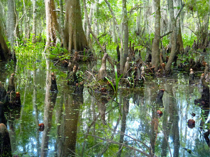
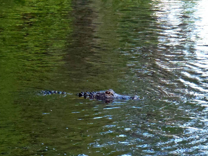
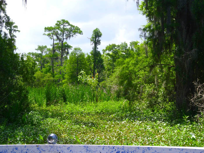

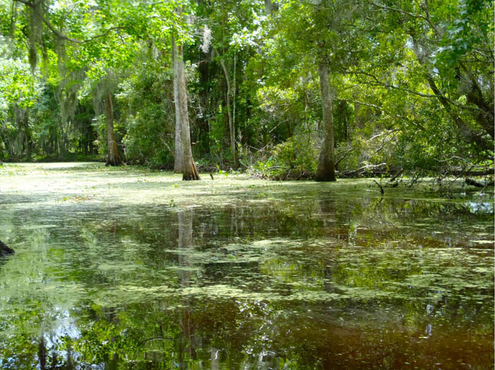
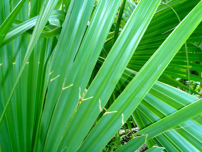

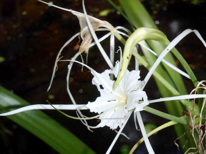
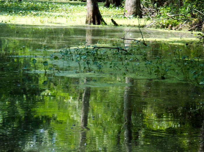
Image 1: Cypress trees in a bayou, Barataria Preserve, Jean Lafitte National Historical Park and Preserve, Louisiana. Many trees in wetlands grow “knees”, projections sticking up from the roots, that help stabilize the trees and may help the tree roots “breathe” when they are underwater. You can see such knees on the cypress trees in the bayous of Barataria Preserve, in Jean Lafitte National Historical Park and Preserve on the Mississippi Delta in Louisiana, a great place to see lots of things growing. All pictures in this slide show are by R. Alley unless otherwise indicated.
Image 2: Alligator in the bayou. Of course there are alligators in the bayou! Barataria Preserve, Jean Lafitte National Historical Park and Preserve, Louisiana.
Image 3: View of bayou plants taken from an airboat. Taken from an airboat (you can see the boat in the bottom of the picture), Barataria Preserve, Jean Lafitte National Historical Park and Preserve, Louisiana. There is water under the plants straight ahead, and that is where we went.
Image 4: A green frog sitting on Dr. Alley’s knee . This frog was sitting on my knee after we air-boated through a particularly dense patch of plants. Barataria Preserve, Jean Lafitte National Historical Park and Preserve, Louisiana.
Image 5: Bayou -- water with large trees growing out of it. Barataria Preserve, Jean Lafitte National Historical Park and Preserve, Louisiana.
Image 6: Palmetto plant in the bayou Palmetto. Barataria Preserve, Jean Lafitte National Historical Park and Preserve, Louisiana.
Image 7: Close-up of channels in limestone inside Mammoth Cave. Dragonfly on palmetto plant.
Image 8: White spider lily plant in the bayou White spider lily, Barataria Preserve, Jean Lafitte National Historical Park and Preserve, Louisiana.
Image 9: Dr. Alley’s boot in the bayou water. There is oily “scum” floating on the water. Richard Alley’s boot in water, Barataria Preserve, Jean Lafitte National Historical Park and Preserve, Louisiana. Notice the oily “scum” floating on the water to the upper right of the boot. A place such as this bayou grows LOTS of plants, which die and sink. In the mud, oxygen is scarce. The decaying plants are not “burned” efficiently in the low-oxygen environment, and some of the formerly living material produces oil. Oil mostly comes from dead algae, coal from dead woody material, and natural gas (methane) from both. Most of the oil and gas float up and escape to the surface, as seen here. In some times and places, some of the oil and gas are trapped in mud. We humans are spending a few hundred years using the oil, gas and coal that have been saved up by nature over a few hundred MILLION years, so we’re using them about a million times faster than nature saved them.
Image 10: Bubbles in the bayou. Barataria Preserve, Jean Lafitte National Historical Park and Preserve, Louisiana. Notice the bubbles in the bayou. These are “swamp gas”, which is methane, and is also called natural gas. As described with the previous picture, the gas that is made naturally and doesn’t escape is what is now being “fracked” from shales under Pennsylvania and other states.
Virtual Field Trip #4: Mammoth Cave
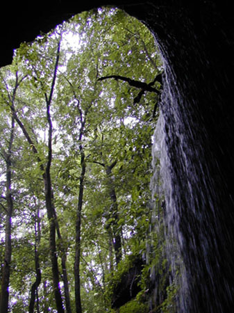
Waterfall into historical entrance of Mammoth Cave. National Park Service Photo. All pictures in this slide show are by R. Alley unless otherwise indicated (as for this one).
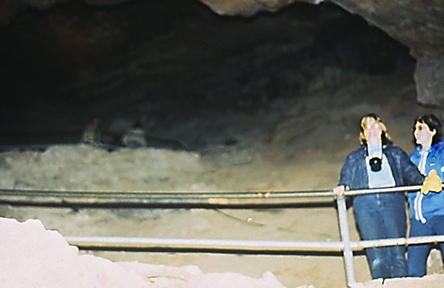
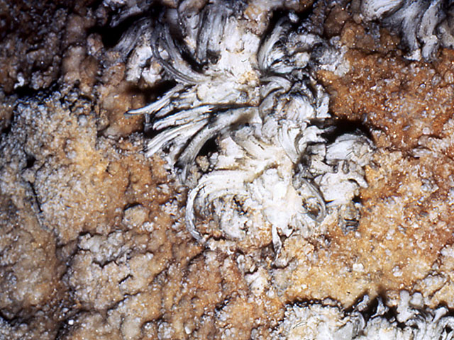
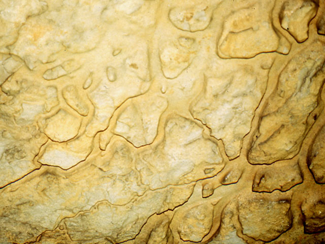
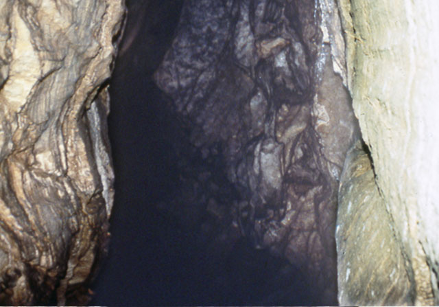
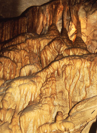
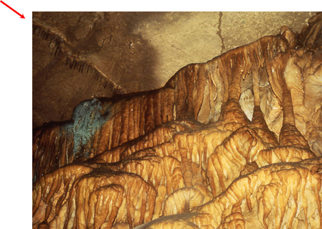
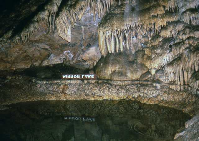
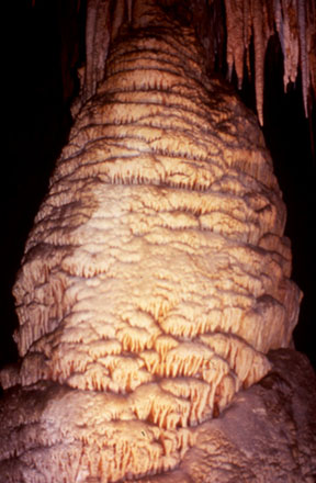
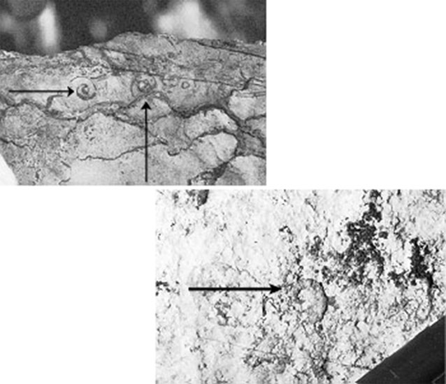
bymap/gastropod&operculae.htm USGS Photo Fossil snails (gastropods) in limestone, Cades Cove, Great Smoky Mountains National Park. Most caves and sinkholes are in limestone, and most limestone started out as shells or skeletons of marine creatures. Many shells are so broken as to be unrecognizable, but quite pretty fossils can be found.
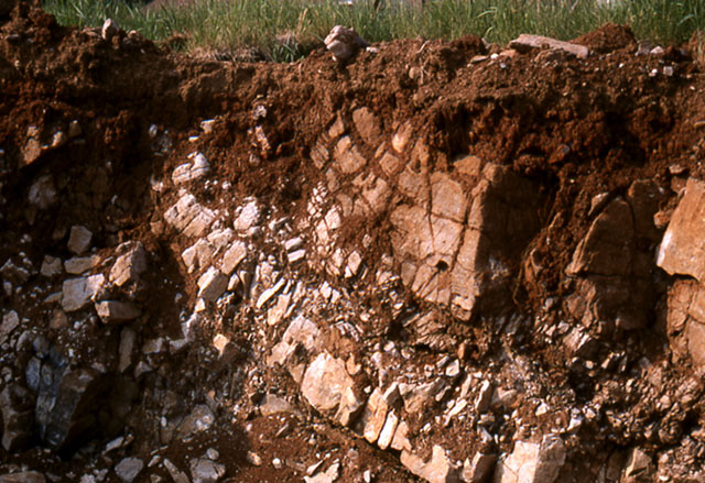
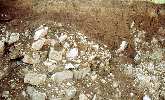

smoky/ResearchAreas/smokys/
cadesCove/GISData/bymap/sinkholes.htm USGS photo Sinkholes in limestone near Gregory’s Cave, Cades Cove, Great Smoky Mountains National Park. Similar scenes are common along the Appalachians in many places. Soil, rocks, leaves, etc., fall into such holes, yet the holes are not full, indicating that materials are sinking toward the groundwater.
Image 1: View looking out of Mammoth Cave with waterfall to the right of entrance and green forest straight ahead. Mammoth Cave: A World Unknown to Daytime--That May Matter to Your Drinking Water Waterfall into historical entrance of Mammoth Cave. National Park Service Photo. All pictures in this slide show are by R. Alley unless otherwise indicated (as for this one).
Image 2: Close-up of small, salmon-colored, eyeless fish in cave waters. http://photo.itc.nps.gov/storage/images/maca/EYELESSF.JPG National Park Service Photo. Many cave creatures are uniquely adapted to their environment, which may seem strange to us but is normal to them.
Image 3: Close-up of cave cricket on limestone ledge in Mammoth Cave. Here, a cave cricket sits on a limestone ledge in Mammoth Cave. (From tip of front leg to tip of back leg, the cricket is about 3 inches long.)
Image 4: Group of people on walkway at Broadway passageway in Mammoth cave, viewing rubble from a roof collapse. http://photo.itc.nps.gov/storage/images/maca/BROADWAY.JPG National Park Service Photo. Broadway of Mammoth Cave is one of the many huge passageways dissolved in the layered limestone of the park. Roof collapses happen occasionally, as shown by the rubble on the right, but are rare, so tourists are considered safe.
Image 5: Two people standing behind a railing in a room in Mammoth Cave. Cindy Alley (who prepared many of the graphics for the course) and friend Sue Croll in Mammoth Cave. The cave is immense; this room is several stories high.
Image 6: Close-up of Gypsum flowers in Mammoth Cave. Gypsum flowers, Mammoth Cave (photo about 6 inches across). Limestone (calcium carbonate) often has a little gypsum (calcium sulfate), which makes formations with this distinctive appearance.
Image 7: Close-up of channels in limestone inside Mammoth Cave. Channels in limestone, Mammoth Cave (photo about 2 feet across), produced by dissolution of limestone in acidic groundwater.
Image 8: Tall narrow passage in Mammoth cave. Passage in Mammoth Cave. This probably started as a vertical crack, which was widened by dissolution of the limestone rock into acidic groundwaters flowing along the crack.
Image 9: Close up of Frozen Niagara section of Mammoth Cave. Frozen Niagara section of Mammoth Cave. More groundwater enters this region than in the rest of the cave, because the sandstone “lid” that covers much of the cave is broken here. The water picks up extra carbon dioxide in soil, dissolves limestone, then loses the extra carbon dioxide to the cave air (which exchanges rapidly enough with the outside to exhaust the carbon dioxide), and deposits the dissolved limestone as cave formations.
Image 10: Close-up of Frozen Niagara. Arrow points to line of hollow stalactites in upper left. Below stalactites is small patch of greenish algae. Water often enters along cracks; a line of hollow stalactites (“soda straws”) is arrowed in the upper left. The greenish color just below that line comes from algae growing where a Park Service light provides a little energy.
Image 11: Mirror Lake in Carlsbad Caverns. Mammoth is not alone among Park Service Caves. This is Carlsbad Caverns. Wind Cave, Jewel Cave, and others are equally beautiful.Image 12: Close-up of a roughly 20-foot-high cave formation in Carlsbad Caverns. The sandstone cap that prevents collapse of Mammoth and allows the cave’s immense length does reduce drip-water entry and thus cave formations, so other Park Service caves are often prettier than Mammoth. This roughly 20-foot-high feature is in Carlsbad Caverns.
Image 13: Upper image of limestone has arrows pointing at two snail fossils. Lower image has arrow pointing at one snail fossil. http://geology.er.usgs.gov/eespteam/smoky/ResearchAreas/smokys/cadesCove... USGS Photo Fossil snails (gastropods) in limestone, Cades Cove, Great Smoky Mountains National Park. Most caves and sinkholes are in limestone, and most limestone started out as shells or skeletons of marine creatures. Many shells are so broken as to be unrecognizable, but quite pretty fossils can be found.
Image 14: Excavation area in State College, PA shows soil on limestone bedrock. Soil on limestone bedrock in excavation for a basement, State College, PA. The rock layers slope down to the lower right, and are curved a little. Dissolution has enlarged cracks and deepened some places more than others. When the deeper places become big enough, we say a sinkhole has formed.
Image 15: Excavation area in State College, PA shows soil over limestone and formation of a small sinkhole. Another view of State College, PA soil over limestone, revealed in an excavation for a basement. A small sinkhole has formed to the right, where the redder soil dips down past the whiter stone.Image 16: Group of about 20 people standing by sinkhole, near Shenandoah National Park. http://va.water.usgs.gov/karst_img/karst_photo2.htm USGS Photo. Sinkhole near Shenandoah National Park. The center of the hole is just to the right of the right-most person. The ground slopes into the hole from all directions, so rainwater that runs in and does not evaporate must go downward through the bottom of the hole.
Image 17: Tree trunks and branches in a small sinkhole in Cades Cove, Great Smokey Mountains National Park. Sinkhole in limestone, Cades Cove, Great Smoky Mountains National Park. The sinkhole is the dip containing tree trunks in the foreground. Sinkholes most commonly form by dissolution of limestone along joint intersections, but cave-roof collapse also may form sinkholes. Here, tree trunks have fallen in, but in many places people have dumped things in, which go right to the groundwater.
Image 18: Sink holes in forest floor, covered with fall leaves, near Gregory’s Cave, Cades Cove, Great Smoky Mountains National Park. http://geology.er.usgs.gov/eespteam/<br></a>smoky/ResearchAreas/smokys/<... USGS photo Sinkholes in limestone near Gregory’s Cave, Cades Cove, Great Smoky Mountains National Park. Similar scenes are common along the Appalachians in many places. Soil, rocks, leaves, etc. fall into such holes, yet the holes are not full, indicating that materials are sinking toward the groundwater.
Word Document of Unit 6 V-trips
GeoMations and GeoClips
This week, we feature three GeoMations, and two GeoClips from the CAUSE trip out west, featuring Dr. Alley and Dr. Anandakrishnan in the Spring of 2004.
The three GeoMations could appropriately be called 1) How Deltas work, 2) How Dams work, and 3) How New Orleans Doesn't work, and in the video, you'll get to see Dr. Alley and Dr. Anandakrishnan "argue" over the Glen Canyon dam and its effect on Lake Powell above the dam and the Colorado River below.
As before, we hope you enjoy these, and find them to be useful complements to the readings, class notes, and slide shows of Unit 6.
GeoMations:
How Deltas Work
We're flying along in our helicopter out over the ocean, and we're looking towards shore at a beautiful beach we just saw there. And we're seeing the pretty waves of the ocean underneath us. And we see a great river coming down to the shore, something like this, meandering along the way some of these great rivers do.
Now if we could somehow hang along in our helicopter and wait for a flood, what we'd notice is that sitting next to the river, there's a bunch of trees that are growing. And when the flood happens, the water would start trucking out of the river into both directions. And as the water came trucking out of the river, it would slow down when it got into the trees.
And as it did so, it would start depositing a layer of mud. And that layer of mud would be thickest very close to the river, and then it would thin on out across the flood plain of the river. And this would be happening on both sides of the river. And so after a while, we would see that the river is contributing to building a natural levee that sits along the river and runs all the way out to the mouth.
Now, if we could keep watching this happen over very long times, over hundreds or thousands of years, we would see that in many places, the ocean is not strong enough to get rid of all the mud that the river delivers. And so the river would start building out into the ocean, and it would just extend its way out there, building a levee. And as it did so-- not a very high one-- but as it did so, the river itself would lengthen. And so it would be coming out in there, and the water would be flowing down to the sea.
And when this is going on, it has to keep going downhill. So it builds up, as we saw earlier, as well as building out. And so you start getting higher walls that hold the river in, on up here, to allow it to flow downhill and run out like that.
And so as the bed of the river is raised, and it gets higher walls, it's like being on the log flume at the amusement park. And at some point, there's a flood, and that wall breaks, and the river takes the short way down to the sea. And then the whole process will start over again. It'll start building a new wall, and building out that way. And eventually, sometime in the future, this one will become big, and then it will do it over again. And so rivers build deltas. They switch from one place to the other as they build out.
How Dams Work
So let's take a look, a strange look, at a river. This is going along the river towards the sea. And this river happens to have trees that grow up on the riverbank. So you can get an idea how we're looking at this.
And what we want to do is ask what happens when we build a dam on this river? And we're concerned about the future of a couple of houses that used to be along the river, one just below the dam right down here, and the other one up above the dam up here, sitting along the riverbank. Well, they build the dam, and the dam fills with water, and it doesn't quite take out the house up above.
But the river's carrying mud. It's carrying sediment. And the sediment starts to deposit out into the lake to fill it with a delta.
Now, rivers have to go downhill. So as the lake is replaced with the mud, if the river were to hit a perfectly flat spot like this, you know what it has to do. It has to build up so that it's headed downhill. And so as the river builds the delta out into the lake to fill the lake, why, you have to bury the house, and that makes the person who lives there mad.
Now, at the other side, it's even more interesting. There's no floods anymore, so the river loses the ability to carry gimongous rocks, which might make the homeowner happy. But the water coming out from the dam is clean. It has no sediment in it. And if there's sand below the dam, why, the water will start washing that sand away.
And that will do a number of things. Your house, now, rather than sitting there right next to the riverbank-- you'll look out some morning and you're ready to fall into a giant hole that's been cut. And you get out there and you fall and then you say, oh, no, and you're very unhappy.
You are not nearly as unhappy as the salmon that are trying to come upstream, because as you may know, salmon like to get really amorous around sand and gravel bars. And if the river has washed away the sand, then you can't have fun with your honey and then leave your eggs there to do well. And so you have a big loss in salmon, as well as getting people's houses unhappy. And so putting a dam on a river makes a big difference.
How New Orleans Doesn't Work
Here's a great tree. And the great tree is standing up on a bluff looking down on the Mississippi River, which sits down in a valley. And the river has a little natural levee-- this, we haven't gotten to human built ones yet-- and it sits down in a valley.
And then, over on the other side, there's another natural levee, and then you go up another bluff to the top. And the river itself sits down in its river valley like this. And it is flowing towards you, which is what the head of this arrow shows.
And the river is sitting on a few miles thickness of mud that have accumulated over the years as the delta has built out into the Gulf of Mexico. And whenever you get a few miles of mud, everything is sinking under its own weight. And that, in turn, means that the surface is sinking, as well.
Now, nature has a way of handling this surface sinking problem, which is that during a big flood, the water spreads out over the flood plain. And mud falls out of the water, and the mud makes a new layer. And so as the surface sinks, more mud is added. And so there's no net change in the elevation. And that's just fine, except for one little problem.
Over here you have a city. And you've built this big city. And you really don't want that flood coming into your city. So you just call up the Corps of Engineers and you say, make a big wall, and make sure that that flood is not going to get into my city.
Well that's just fine, except that doesn't stop the sinking, because the thing is going down. And so if you come back later, what you'll find is that the surface has moved down to a place like this, and your city has moved down to a place like this. I'm using a darker line so you can see where it's gone to from where it was.
And so you tell them to make the wall bigger. But meanwhile, the city is sinking even deeper. And you've gotten up somewhere way down here, now.
And things are getting really nasty, because at this point, there's a really big storm. And it manages to get just over the top, and it fills your city with water. And then you're underwater and you're very, very unhappy. And this happened to New Orleans. And the sinking is not stoppable, so if it's rebuilt, it is likely that it will happen again.
GeoClips:
Dams cause huge changes on rivers, both upstream and downstream. In this film clip, Drs. Anandakrishnan and Alley discuss the Glen Canyon Dam and Lake Powell on the Colorado River. Huge changes were caused by this project, including in the Grand Canyon far downstream. The CAUSE 2004 class used some clever editing to manufacture a disagreement between the professors, who are much closer to being on the same wavelength than you might imagine by watching this.
DamIt!
Today we're going to go see one of the most extraordinary manifestations of man's desire to tame the wilderness.
We're looking, standing here above what was once a vast and deep and beautiful canyon and has turned into a wonderfully used lake that people like to go boating on and people like go swimming in. And so we've seen a great change in what happened here from a world that was used by very few who love solitude to a world that's used by many who love running around in motor boats.
Well, I think a lot of the early settlers really wanted to place their mark. They said, we are not going to be defeated by this land that has only a few inches of rain per year. We will live here. And the way to do it is to get lots of money from Washington that we collect out East and bring it out West here and build these dams. And these places just do not belong. They are magnificent creations. They are incredible engineering masterpieces. But they should not be here.
And so it obviously does a tremendous amount of good, and it's very clean. Once you have a dam, once the lake gets here, you don't dirty anything up. You're not running out smoke from your smokestack that will dim the air in the Grand Canyon.
They should not be here. And I think we've learned that over and over again. But you go to India, you go to China, and they're doing the exact same thing. The Three Gorges Dam in China, one of the most enormous, incredible engineering projects, displaced millions of people, is an absolute ecologic disaster.
If you've got hungry people, and you can save that water and ship it to them, it's food. If you've got people who need power to do things, and you can ship them the power then they can use it.
Dams are amazing human achievements, but they have incredible costs associated with them. So to me, it's very much of a bittersweet kind of a thing. As a former engineer myself, I can appreciate the artistry and the mastery that goes into building these. But as a practicing geologist, as a practicing resident of this planet, I find them a little depressing to be quite honest.
We're going to argue this one again on a lot of rivers in a lot of places for a lot of time.
Human actions are more and more affecting the amount and quality of water and the ground, with effects that bounce back on us and on other living things. Here, Dr. Alley chats about groundwater issues of great concern to the National Park Service at the Grand Canyon.
Canyon Groundwater / Grand Canyon National Park
So now we're on the rim of the canyon. The rim of the canyon does not have streams on the surface. When it rains, which is not all that often, but when it rains, what happens is that the water soaks in. So if you had a rainstorm, you see the water start to make a stream, but then it soaks in. What happens to that water? It goes down through the spaces in the rocks until it hits a rock that it can't get through, such as the Bright Angel Shale. Then it runs along laterally and it comes out at those beautiful springs that we see in the canyon.
Now what's happening here is there's more and more people want to live here, and they want to have water, so they drill wells. And after you drill a well, you suck the water out and you use it to water your grass, or your crops, or your golf course, or to drink or flush or what have you, and eventually it evaporates. And so what you're doing is removing the water that should be running to the springs. And there's worry-- it's not happening yet, but there is worry-- that someday, we may start to lose the springs in the Grand Canyon and the unique biota, the wonderful ecosystems, that live down there because of development outside of the park up here.
Want to see more?
Here are some optional resources you might also want to explore! (No, these won't be on the quiz!)
Join Dr. Alley to learn about formation of Fossil Fuels, in Barataria Reserve, Jean Lafitte National Historical Park and Preserve, Louisiana, from the PBS television special Earth: The Operators’ Manual.
Deltas and Plumes
(An extensive collection of animations on this subject)
River Systems: Process and Form
(An extensive collection of animations on this subject)
Processes of River Erosion, Transport, and Deposition
(An extensive collection of animations on this subject)
Video Lecture
The Unit 6 lecture features Dr. Sridhar Anandakrishnan and is 1 hour and 4 minutes long.
Good morning. Welcome to G-SCI 10, Geology of the National Parks. We're going to be looking this time at tearing down mountains some more. Last time, we broke them apart using freeze-thaw action, and by chemical action, and made soils. This time we're going to talk a little bit more about the transport of them-- streams and rivers.
My name is Sridhar Anandankrishan, and I'll be your guide through some of the lovely places. And we're going to take a little bit of a detour to look at some of the damage that water can do. So, let's take a quick look at some lovely pictures and then we'll start on the section.
Redwood National Park on the coast of California. You can go fly into San Francisco and drive up the coast from there. And it's just magnificent trees. These trees, there's a famous one that they cut a hole in it and you can actually drive a car through it. These trees are monsters. They're as big around as a small house. And they tower up in the sky. And you can imagine you need a lot of water to keep a critter like that alive, and you do.
Just go over the mountain. Not very far. Maybe a couple hundred miles. Head inland from Redwood and it's dry as a bone. It's Death Valley National Park. Hottest, driest, lowest place on the planet. Why is it that these two places just very close together, a couple hundred miles apart. Redwood National Park over here with these gorgeous, enormous, towering Redwoods that suck up all this water, this huge root system that needs lots of water to keep it alive, cool climate, rainy climate. 200 miles to the east, you go over the mountain, and you're at Death Valley National Park, it's dry as a bone. What's going on? So that's the first thing we're going to look at.
Let's take a look at some pictures over here. Sequoia sempervirens, the ever-living Sequoia. They live for a long time-- couple thousand years, and then they'll fall over-- kawoomph. And then the new trees will sprout from the trunk. And so when you go there you'll see these lines of trees. They weren't planted that way. It's just that when an old tree falls down, a new one comes up from the trunk, and so they'll be a whole line of them where the old one had fallen down. It's quite an extraordinary sight.
All these ferns and rhododendrons, all of that, surrounding the base of them. The Redwood needles help produce these very acid soils that the rhododendrons really like around here. We have that as well up on the tops of the mountains, these beautiful rhododendron forests. They can tower way up, 200, 300, almost 400 feet up into the sky. They are the world's tallest trees. They are the world's most massive organism. The heaviest single living thing.
The Redwood Coast is rainy and foggy. These trees couldn't make it otherwise. And you go inland a little ways and at the same latitude, you've got this amazingly dry landscape. This is a picture pulled straight out of our very first section a long, long time ago on Death Valley National Park.
Now we're going to look at the surface. Before, we were looking at Death Valley to understand something about pull-apart zones, about spreading, all these other tectonic forces. This time, we're going to look at the surface. Why is it dry at the surface?
Here's a map. The Pacific Ocean is to the bottom, North is to the left on this map, not at the top as it normally is. And you can see this coastal Redwood range all up and down the coast. And then, inland you have Death Valley. And, in between, you have the Sierra Nevada mountains, and that's the key. You have these tall mountains in between, and they intervene and somehow prevent the water from getting from the coast inland to Death Valley. So, let's take a look at that.
The first thing we're going to do is look at winds, and I'll come back to this map in a second. Let's go to the drawing tablet here, and we'll take a look at why the Redwood Coast is wet and cool, and the Death Valley is dry and hot.
We're talking about wind and water this time. We have the Pacific Ocean. We have the Sierra Nevada mountain range. And we have, on the left, these towering Redwoods. And on the east, we have Death Valley. Hot, dry, cool, wet. What's going on? Why is the case?
When the winds blow in from the Pacific, they carry water. Water evaporates in the Pacific Ocean, it blows on shore onto land in California, and it hits the Sierra Nevada mountain range. So, these winds have lots of water in them. The winds are heavily laden with water. They blow in from the ocean, they blow onto the coast, they start heading inland, and they hit the Sierra Nevada ranges.
When they do that they have to start climbing up the mountainside to get over. They can't just tunnel right through the Sierras, and there aren't enough passes for all of that air to go through these low passes. So, the winds as they come along have to rise up the mountain, have to go up to get down on the other side.
As they do that, as the air rises, it cools off. So, as this air rises up to the top of the mountain, it cools off. Cool air can hold less water. You just can't have as much water in the air as that air starts to cool off. What's the result? Rain. As that air is climbing up the side of the mountain, it's cooling off, it can't hold all that water. That water's got to go somewhere, and it falls out as rain. And so, you have all of this rainfall on the windward side of the mountain.
And by the time the air gets to the top of the mountain, all of the water has been squeezed out of it. You take that air, you cool it off, cool it off, cool it off as it rises up, and as it cools off, the water rains out of it, rains out of it, rains out of it. It gets to the top, it's cold and it's dry. It doesn't have any water left in it. It gets to the top, starts to sink, but it is dry. There's no more water left in it. No rainfall.
So, you get no rainfall on the backside of these mountains or what's known as the leeward side of these mountains because all of that water has fallen out on the windward side. This is the rain shadow effect. And this explains why it's so dry in Death Valley. Very simple process. It's you've got this nice, wet air coming in from the Pacific, but all that water gets dumped on the windward side of the mountain, and you end up with it being really dry on the leeward side or on the rain shadow side. That still doesn't explain why it's so hot over there in Death Valley, and that's the next thing we'll look at.
Same picture. Pacific. Sierra Nevadas. Redwoods. Sequoias. Here's that same picture. You've got air coming in off the Pacific, it's heading up the slope of the Sierra Nevadas, its cooling off. We talked about how all the water gets squeezed out. It's dry when it gets to the top of the mountain. And now it's sinking down the other side, and as it sinks it'll just heat up naturally. As you get to lower and lower elevations it gets warmer and warmer-- you know that. When you're at the base of the mountain, it's warm. As you go on a hike and you start climbing up the side of this mountain, it'll start to get cooler and cooler and cooler. Until finally you get to the top, and you've got put on your jacket.
Same process as you go down. As you head down the slope of the mountain, you start shedding your jacket, and then your sweater, and then you're in shorts and tee shirt by the time you get to the bottom of the mountain. So, this very natural process. It just gets cooler as you rise, and warmer as you drop. The one difference, though, is that the cooling off as you go up the hill is about three degrees Fahrenheit for every 1,000 feet that you rise up.
So, if you were to take a thermometer and go for a hike and go up Mount Nittany, and as you head up there, you would find that if you climb 1,000 feet, the temperature has dropped about three degrees Fahrenheit if the air is moist. If you have really wet air, if you have really moist air, lots of water in the air, very humid day, and you start to walk up, it'll cool off about three degrees Fahrenheit per 1,000 feet of rise.
On the other hand, as you head down on the rain shadow side, the leeward side, the Death Valley side, the air is heating up. Same way it was cooling off as you went up, now it's heating up. But now it heats up by five degrees for every 1,000 feet of drop. So, every time on the rain shadow side you have 1,000 feet of loss of elevation, the temperature's now gone up by five degrees. And you walk down another 1,000 feet, the temperature's gone up another five degrees if the air is really dry.
So now, we have this very dry air on the rain shadow side and it's heating up faster. And so, you drop down the same distance that you climbed up on the other side of the mountain, and you've heated up way more than you cooled off. And that's all the difference. When you take a packet of air and you raise it up to the top of the mountain, and then you remove all the water from it in that process, and then you bring it down on the other side, you've heated up way, way more than when you started out.
And so, this is why Death Valley is hot. You start out cool on the coast, you end up hot inland. There's an animation online, and you can take a look at that and review that again. Let's go back to the PowerPoint.
Where do these winds come from? We kept talking about these winds blowing in from the Pacific Coast. Why do you have winds coming in from the Pacific Coast? It's a fairly straightforward system. The sun heats the Earth, and hot air rises. That's the starting point for this whole process.
If you took one thing away from the first third of this class, it was the heat deep inside the Earth drives these convection cells, drives all of the mountain building. Take one thing away from this section, it's that the heat of the sun pounds down on the Earth, heats up the air, and that's what makes the winds, and then the winds do everything else. So let's take a look at that process.
Here we have a map of the Earth showing the places where you have these convection cells in the atmosphere. We're not talking about convection in the Earth anymore, but now convection in the atmosphere in very much the same way. You heat up the air, it rises up, cools off, and there's more heated air that's coming up from underneath it. And so this cooled off air gets shoved off to the side.
Let's take a look at this. We're going to go back to the drawing tablet. This is just so much better diagram, so you can keep this map in your head as I'm drawing my very crude pictures, that would be helpful, and then we'll come back to this.
Air circulation is driven by temperature, by heat-- same as convection in the Earth was. But the heat of the sun drives air movement. The equator is warm. The pole is cold. And the reason for that-- this is the Earth, this is the equator, and this is the North Pole where Santa has his workshop. The Earth is spinning around and around. And the Sun is somewhere way over here sending sunlight to the Earth.
If I were to go and look at a chunk, a square of sunlight, as it flies from the Sun to the Earth, I would find that it would smack straight into the equator, head on. The square, I just took a square piece of sunlight from the Sun and I carried it to the equator, and it went straight over there, and it ran straight into the equator.
If I did the same thing at the pole, I took a square of sunlight and ran it towards the pole, I would find that it would be spread out over a huge chunk of the pole. It would be a small part of the equator. All of that Sun is beating right into that small part of the equator because it's head on. But at the pole, that same chunk of sunlight is smeared across a huge chunk of it simply because of the curvature of the Earth. The Earth is curved in such a way that when the sunlight hits it, it hits the equator head on, but it smears across the pole, and so the poles get colder. They get less sunlight.
It's as if you were to take a piece of toast and take a spoonful of peanut butter and spread it across that. Or if you were to take that same spoonful of peanut butter and try and spread it across a huge sheet of plywood, you wouldn't want to eat that plywood. But there wouldn't be very much peanut butter on that sheet of plywood because you've taken the same spoonful of peanut butter and tried to smear right across this huge sheet of area, and there's very little peanut butter on any given spot.
Same thing happens on the Earth. The Sun is beating down on the equator head on, and so, all of the Sun's energy is concentrated in a relatively small area. It's nice and hot. Up at the pole, the same amount of energy's spread across this huge area, so every spot is cold and shivering. That's why the poles are cold and why the equator is warm.
What happens? We'll go back to the Earth, we'll make it bigger now, we have the equator, and we have this heat along the equator. The equator's being heated up because the sun is beating down straight on it. All of the energy is being jammed into a relatively small area.
The air gets warm. And what happens when things get warm? You know that. We've seen it over and over again. When things get warm, air gets less dense. What happens when things get less dense? We've seen that over and over again. Rises. Air rises up, hot air rises. And so all around the equator you have hot air rising upwards into the atmosphere.
As it rises up, somewhere up here, it will cool off. As it rises up it will cool off, but there's more hot air coming up from below.
And so, this cool air can't just sink straight down. This cool air gets shoved off to the side. And eventually it sinks down. When it gets to the bottom, it's heated up again. As it sinks down, it gets hotter and hotter and hotter. And then, it returns to the equator, and the whole cycle begins again. It heats up, goes back to the equator, rises back up, and you have a convection cell.
This whole process is a convection cell in the atmosphere. And this is wind. It's movement of air over the surface. What's that? That's wind. So, this wind is driven by rising air in the equator. It goes up, cools off, sinks back down, and then blows back to the equator. Rises up, goes out, sinks back down, blows back to the equator. In the process of blowing back to the equator, that's wind. Air transport by that.
Let's go back to the map that I showed you on the PowerPoint because that illustrates it so much better than this rather crude diagram. But I hope you get the idea from this.
You're seeing the same thing here, but just more fancily drawn out. This is an image from the USGS. Rising warm, moist air produces what, in this diagram is called a Hadley cell. It's just a convection cell. It was discovered by a scientist named Hadley, so they called it a Hadley cell. Rising warm, moist air. Descending cool, dry air, it gets cooled off, it falls down, and then it rotates back around, blows through the mid-latitudes back to the equator.
And so you have what are called the trade winds. They were called the trade winds because they blew so steadily that sailing ships could use them for trading purposes. They always knew these winds would be there when you needed them, and you could count on them. And so, you could fill up your ship with whatever you wanted, and your sailing ship with these big sails would catch the trade winds, and would be blown from Europe to the new world without any trouble at all. That's why they were called the trade winds.
The North Pole is cold, and you have these secondary Hadley cells, or secondary convection cells, called the Ferrel cell and the polar cell. But really, the idea is the same.
This is a map of the world's deserts. And if you look at them, what you see is you have these deserts at a few degrees north and south of the equator where that convection cell brings that air down again. The air goes up and then it comes down. Where it comes down, you get these deserts. Why? Because there's no moisture in that descending air. All of it is gone. So, rising moist air. You have all this rainfall at the equator because all of that air is rising up, and the rain's all falling out of it.
As it gets colder and colder and colder, the rain's just falling out of it. It goes up there, it goes over, and it comes down in the Sahara. It comes down in Australia. And there's no water left in it. It's all gone.
And so, you get these huge deserts, the Saharan Desert, the great Sonoran and Chihuahuan deserts in the US and Mexico. You get the great Australian deserts, and the Kalahari, and the Namibian deserts in Australia and Africa. It's because of these convection cells.
So now, we've talked about wind, and we've talked about a rain shadows. Now, let's take a look at what happens with that water when it falls out of the air and it makes rivers. You get rain, you get rivers. Let's take a look at those.
Water falls from the sky. It's called rain. Very straightforward. What happens to it when it gets down is far more complicated. About two thirds of it goes straight back up into the air. It mostly is taken up by plants and trees through their root systems.
So, here in State College we get about 40 inches of rain. That's about something like that. Every year. Some of it comes as snow, some of it comes as rain. If I were being pedantic, I'd say we get 40 inches of precipitation, but think of as rain. Two thirds of it, about that much of it goes straight back up into the air. The plants drink it, it goes straight up. The trees drink it, it goes up through their roots, goes out through their leaves, straight up into the air again. Or it just falls down and just collects in puddles and then the Sun comes out and those puddles evaporate and it goes straight up into the air again.
About a third of it, about this much, either sinks down into the Earth and turns into groundwater, or it runs off across a surface, falls into Spring Creek, falls into some other creek, eventually makes its way to the Juniata, the Susquehanna, and then down to Delaware Bay, and then out to the ocean, or to Chesapeake Bay and out to the ocean.
So, about a third of it, about that much actually remains on the surface of the Earth, two thirds of it goes straight back up again. This is known as the hydrologic cycle. Fancy name. All it means is you get evaporation in the ocean, it blows onto land, it rains out because of the processes that we talked about, rains out of it because it cools off as it goes up a mountainside. It can't hold all that water, and you get rainfall. Some of it goes straight back up again, and then maybe rains out again and it goes straight back up again and rains again. And some of it gets trapped in the Earth as groundwater, and some of it flows into streams and rivers and goes to the ocean.
Water is unique to Earth, we think. Everybody's always looking for water in all the outer planets. They go to Mars, they want to look for water. They go to the moons of Jupiter, they want to look for water. They go to the Moon and they want to look for water. It's so cold on the Moon, the water probably is almost certainly in the form of ice.
The key is life needs water. If you're going to have critters, if you're going to have any kind of organisms alive, we think they've got to have water. Water is so important to everything, for life to exist, that people don't look for living organisms on Mars, they just look for water. And they say if we find water, I'll bet you there'll be some critters alive there. And that's probably the case. Anywhere on this planet you go and you look for life, you look in the places where the water is and you'll find something alive there.
The human population of this planet is exploding. We're up to six billion or so, and we're heading towards 10 billion in the next 100 years. We all need water. And all the great wars that will come, a lot of the wars that are going on now are probably, to some extent, about water. People need water, and they'll fight each other for it. So, we need to be careful about watching what we do with it.
Here is Johnstown. Here is Johnstown. The great Johnstown flood. It came through, and it smashed in and destroyed-- there was a dam up river from Johnstown. It was a private dam that collapsed, and all the water behind it took Main Street here, nice, lovely place, some horses going down it, and all of these trees, enormous trees, rammed into the second story of this building. So, water is not a benign material. It can be quite destructive.
It's now the summer of 2006 when I'm filming this material, and just recently, just a few weeks ago, Wilkes-Barre, Scranton, the whole Northeast of Pennsylvania, Elmira, Binghamton were all flooded. These enormous rains came down and flooded out all of those rivers and they rose up over the levees. Luckily, the levees held and so people weren't killed, or not that many people were killed, but it was still quite disastrous.
These streams, when they make their way down, they modify the landscape. They dig holes, basically. Streams are very good at eroding their bed. Streams carry water. Duh. We all know that. But streams also carry sediments. Sediments are simply small pieces of rock, or sometimes bigger pieces of rock. And in the case of streams in the mountains, really big pieces of rock. So, sediments are simply pieces of rocks, and streams and rivers carry that along with the water. And they're really good at washing it away.
And so, all those processes that we talked about last time, mass wasting, a freeze-thaw breaking up all these rocks, you put a stream in there, and it'll just take that material and move it away. And then, these freeze-thaw actions and mass wasting actions will bring more material down to the river valley, and the river will wash that out. And then, more material will come down and that will get washed out.
And you do that for long enough and that mountain is gone. It takes a long time, but eventually it'll be gone. Without the river, you wouldn't have been able to wash all that material out, and so the valley would have filled up, and the mountain would still be there. With the river, you just wash the stuff out, more comes in.
Floods do most of the work. The normal flow of the river just isn't powerful enough to move much. The normal flow of the river will carry a little bit of sediment, but it certainly won't move big boulders. It certainly won't break things up. But then, every so often, just about every year usually, you get these floods, and every 10 years you get big floods, and every 100 years you get these enormous floods, and they're the ones that do the work. They're the ones that move enormous masses of material downstream. We use it. We need it. We've got to have it. We need it for agriculture, we need it for industry, we need it for moving material up and down the rivers, we need it for making hydroelectric power.
So, water is enormously important, and controlling streams has been probably one of the primary industrial motives or the things that we do most of all down through human history. If you look at human settlements, they were always on the banks of rivers because you can get water out of them to water your crops. You can use them to run mills to mill your grain. You can build boats and you can go up and down and trade with your friends up and down the river. So, all human settlements have always been associated with rivers.
Here is Glen Canyon Dam in Arizona. And the river is on the lower part there, the Colorado River is flowing down. And if you were to simply imagine that lower picture, that narrow deep gorge heading up, that's what it would have looked like 100 years ago. But back in the '30s and '40s, that dam was built, and when that dam was built, the flow of the river couldn't get past that dam. It got caught over there. And now, that lake that's above the dam is very useful. People use it for recreational purposes. But they also use that dam for hydroelectric, they generate electricity. That dam is used for irrigating crops all through that area.
So, the hydrologic cycle, as I said before, as water evaporates from the ocean it rains onto the land, and some of it goes into streams, some of it goes into groundwater, but most of it goes straight back up into the atmosphere. Let's follow one of those streams to the ocean, and let's take a look at what happens with it.
Streams are driven by gravity. Just like everything else, water wants to head downhill. And water can head downhill a lot more effectively than rock can. Because you get the soil or this rock up on a hill slope, and it can be nicely cemented in place. It can be happy where it is, especially if it's got lots of trees and grass that's stabilizing the slope. That slope can be fairly stable. You get rain, the rain falls on it, that water's going to head downhill. There's nothing that can hold water back, except things like dams.
Streams are recharged by direct rainfall, and by groundwater springs. So, rain can fall straight into the stream, or onto the banks of the stream and flow into the stream. Or the water can fall on the land far, far away, sink down into the Earth, and then slowly make its way through the earth as groundwater, and then these springs will come out and recharge the streams. And that's why rivers run even after long periods without rain.
Streams carry sediment, and mass wasting delivers sediment to the rivers, and then the rivers carry that sediment out usually in these big floods, but also during the normal processes. When those streams get down to the flat areas where the stream is falling more slowly, than that sediment gets deposited. So, up here in the mountains, mass wasting is bringing material into the stream, the streams are flowing through these very steep valleys, and so they carry lots and lots of water, lots and lots of sediment. And then, they flow out onto the plain out in front of the mountain. The streams slow down because they're going in more shallow slopes. As they slow down, the sediments can't be carried by these streams anymore, and they deposit them.
This is how a stream carries sediment. This is a cross section through a stream. The surface of the stream is at the bottom. And the top of it is where the stream is flowing most rapidly, and the bottom of the stream is where it's flowing less rapidly. And it can slowly move material either by what's known as suspended load, which are really tiny particles that are just floating up in the stream. And if you look at a stream and you see it's brown, it's because it's got all of this junk in it.
Water's blue, you know that. And normally a stream, if it's flowing slowly, is blue. But after a big storm, after it's churning and it's carried all this junk into it, all the sediment into it, it's flowing fast. You look at it, it'll be brown. And why? It's because of the suspended load. All of this dirt basically that's suspended in it-- soil that's suspended in it.
Down at the bottom of the stream, you have what's called bed load. This is the material that bounces along the bottom. The water isn't flowing quite so fast at the bottom, and so it can't carry all this material right up in it, and so it just picks it up and drops it, picks it up and drops it, picks it up and drops it, and stuff bounces along the bottom of the stream bed.
And then, you have bigger boulders, or gravel sized pieces of rock that are down at the bottom, and those usually don't move that much until you get one of those big floods. And then, all those pieces along the bottom will be washed along and moved downstream. Suspended load is the fine stuff, bed load is the bigger stuff that bounce along the bottom breaking up the rocks as they go making smaller rocks. So, this is another way that you have mechanical disintegration. These pieces down at the bottom, you have these rocks bouncing along, and every so often one will hit another rock and break it open. Or it'll just simply scrape off the bottom of the river and break off small pieces that will then be carried away with the river.
Two types of streams. Meandering streams-- this is a classic picture that you have, and we'll see some pictures here where the stream goes around one way and then comes back. Streams never go straight, they always have these big curves to them. If a river has mostly fine sediments, it'll make a deep channel, it will get clogged, and it will just meander. It will stay in its channel for the most part. It will keep breaking out or eroding along the outside of one of these curves and depositing on the inside of one of these curves. And so, the curves will get bigger and bigger, and we'll see a picture of that in a second. And then, it will make another curve and another curve. And here's a photograph of that.
So, you've got the stream that's coming down, and when it goes to the outside of the curve, it will have to speed up to make that curve. And then, it will keep eroding against what's known as a cut bank. And then, on the inner part is where the water's flowing more slowly and it will deposit material there. And so, the river over time will keep migrating inwards.
Eventually, eventually, that neck could get pinched off completely, and that ox bow will be cut off, and you get these ox bow lakes where the river has been cut off from its upper curve and now the river is just going straight. It used to meander around that curve, but over time it just cut across that curve and went straight. And that stranded piece of the curve is called an ox bow lake. It's named after these big yokes that the farmers used to put around oxen, and then that yoke would be hitched up to a cart, and then these oxen would plod along dragging the cart behind them.
A braided stream is a second kind. This is where you have lots and lots of channels that are all intermingled, and you don't know which is the main channel. They all are carrying a little bit. And what happens is you have all these big chunks of rock. They fall into the river and they block a channel, and so the river picks a different one. And then a big chunk of rock falls into that one, it gets blocked, and the river picks a different one.
So, you need big chunks of rock. Where you find big chunks of rock? In the mountains. So, it's mainly in the mountains that you have these braided streams, and it looks like a braid of hair from above, which is where the name comes from. And here's a photograph. You have all of these different channels that you don't know which one is the main one. And we'll go to another picture here. Mainly in mountainous areas where there's lots of big boulders. And one of these channels could get blocked very easily, and the river will pick a different way to go.
Another way to stop the flow of river is to put up a dam. Beavers build dams, natural landslides can create dams, or you can go out with a bulldozer and a great pile of concrete and you can simply stop the river. And that will stop the water temporarily until you get a lake built up. But, eventually, the lake will rise to the height of the dam, and then the water will start to flow again. The engineers will open the valves and the water will flow, but you'll still have a lake behind the dam.
So, the water stoppage is temporary, the sediments get stopped forever. Engineers don't like to have sediments going through their machinery, it clogs them up. And so, they pull water from the upper part of the dam. And all these sediments that we've been talking about, they come down with the river, they don't make it past the dam. They get deposited behind the dam, more sediments come along, deposited, more sediments come along and get deposited. The water keeps going through, but eventually the sediments are going to fill up that dam.
Here's a picture showing that. You have a dam, and over time, the water is filling up behind it, but along with the sediments are filling up. And that deposition is going to slowly, over time, completely fill up that lake, and then you're left with a useless dam, and you're going to have to build another one. And it's happening to many dams around the world. Dams have been-- some of these big dams have been in place for 100 years or more, or 50 to 100 years, and they're starting to fill up. People go out there, they dredge them. They have big machines that try and suck up these sediments. But in the end, these dams are going to fill up.
The river below the dam is clean of sediments. All the sediments have been dumped into the lake above the dam. And so, the river below the dam doesn't have any of those sediments left. Lots of water-- remember, the water's going right through. But that water that's coming out is clean. It doesn't have any sediments in it. What's it going to do? It's going to pick up sediments.
And so, you get extra erosion below the dam that you didn't used to have before. Before the dam was built, the river would come down, sure, there was lots of water coming, but there was also sediment coming. And so, if there was any erosion, there would also be deposition. And then, that was that most of those places would continue to have these gravel and sand bars. You build a dam, all the sediment's up there. You get this clean water rushing out past the dam, and it will enhance the erosion.
So, let's go to the drawing tablet and take a look at that process. This is a cross section of a slope, of a hill slope. Then you have a river that's happily slowing down. So, this is water that is flowing down. And remember, in addition to that, it has sediment that's caught up, and that's being transported down along with the river.
This is the case before I come along and I build a dam. It's a big old concrete wall. As soon as I do that, I put a lake here. What I've also done is I've done away with all the sediments downstream of that dam. All these sediments still coming down, all those red particles still coming down, but they're now filling up the lake upstream of the dam.
Downstream of the dam, I have just this lovely clean, blue water rushing along, and what's it going to do? It's going to start picking up sediment from the riverbed that it would not have picked up before. Before, it had all these sediments it was already carrying. It couldn't carry any more sediments. And so, it left the riverbed alone. But now, it's bright, blue, clean water, no sediments in it, it has lots of ability to carry sediments, and so it does.
Over time, you will erode downwards. Erode below the dam. This would not have happened until you put the dam in. So, you get deposition above the dam, and erosion below the dam.
Back to the slides. These gravel and sand bars below the dam get washed away. Lot of critters live on those bars. They don't have a place to live anymore. All of the beautiful, blue, clean water that's rushing out, now there's all these fish that used to like having this warm, dirty water-- dirty because it had soil in it to live in, and now they're living in this bright, blue, clean water, and they don't know what to do anymore.
They've evolved to hide in this from their predators, and they can't do that anymore. So, there's a lot of fish that go extinct because of that. Eventually, the reservoir above the dam will fill up and you need to build a new one anyway.
Let's follow that river past the damn, past the mountains, out on to the Gulf Coast. So, this river has just flowed from the mountain down onto the plains, and across the plains to the ocean into New Orleans. And we're going to talk about Hurricane Katrina. There are all these levees protecting New Orleans. Why does New Orleans need levees? It does. We'll find out why.
And one of those levees broke, the 17th Street levee, and all this water came rushing into New Orleans because New Orleans is below sea level. Why is New Orleans below sea level? We'll find out. It's below sea level, the levee broke that was protecting the city, and the water rushed in, and you know the disastrous consequences of that.
So, what's happened? Every year, snow melt comes along, extra rains come along in the spring, the rivers can't carry all of this. The rivers come along, and the water goes over the bank and on to the land on either side of the river and it floods. It happens. It happens every year. And it carries water and it carries sediment out onto the fields on either side of the river, and it deposits it there. Why? The river's rushing along, carrying sediment, it floods out onto the sides, the water spreads out, slows down, sediments can't be carried if the water's moving slowly.
Sediments will slowly sink down and be deposited onto the field. The farmers love it. The Nile Delta famously, pyramids, the Sphinx. All that civilization 3,000 years ago depended on the Nile flooding every year bringing this lovely sediment up into the farmer's field and depositing it, and then they could plant their corn and wheat and-- probably not corn. I don't think they had corn. Wheat, and grow it and store it.
And the lands and the farmers fields didn't get played out, they didn't get old because every year there was new material. When the Nile flooded, it would bring new material onto their lands. People built houses by these rivers, and they don't like the river coming into their basement. They don't like it coming into their first floor. They don't like it coming into their second floor sometimes if the flood is big enough. And so, they build levees. They build walls that keep the river from flooding.
"The Big Easy," New Orleans was built on mud from long ago. From when the river used to flood every year. Every year, the river would flood and put all this mud out onto the plains around the Mississippi, and New Orleans was built on that mud. And then, we came along, we put the levees in, and now we don't get anymore mud. But New Orleans was built on this mud. The water is slowly being squeezed out of that. And as it's squeezed out, New Orleans sinks down. It sinks lower and lower and lower. The levees are still there. And now, New Orleans is below the level of the river.
Let's go to the drawing tablet here and take a look at that sequence. I'm going to try and draw a river in cross section. And it's flowing down like this. And on the banks of the river, you've got trees and houses and tractors-- that's supposed to be a tractor-- farm fields. And so, you have everybody happily living their lives over here.
Once a year or a a few times a year, this river will flood. And water and sediments will spread out all along the banks. The sediment will get deposited as a layer on either side. So, you've got this layer of sediments on either side. And the water will slowly seep away or evaporate or whatever happens.
And the next year, you'll get a second layer on top of that. And the next year, you'll get another layer of sediments on top of that. And the next year, you'll get another layer. Now you don't build up to the sky because as you add each new layer, where the older layers sink down. So, the level actually remains the same. So, older layers sink down, new layers are dumped on top of them, they sink down, new layers are dumped on top of them, they sink down. The reason they're sinking is the water is being pulled out of them. Water is being squeezed out. And the soil is compacting.
And we go to a new page here. So, we're going to take a look at that same picture again. You've got a river, and there's the river flowing down. And on the side here, we have layers and layers of sediment. If I build a wall here, build a levee, and drive my Chevy to it, if I build a wall there and prevent the river from flooding-- so we've got this nice, solid wall here, and the river can never get out of its banks anymore. Over time, these sediments sink down because of water squeezing out.
So, they're sinking down because the water's squeezing out, but nothing is replacing it. So, over time, the surface sinks below the river level. And this is what happened in New Orleans. This is what has happened in the Mississippi River and all of Louisiana and in New Orleans. New Orleans has had these wonderful levees built to protect the city from the flooding of the river.
But at the same time, they prevent all this new mud from being spread over the landscape year after year to keep the surface up high, and so the surface has sunk down. And it sunk quite deep. In some places 20, 30, 40 feet below the level of the river.
If you go to New Orleans, you're walking along Poydras Street, or one of those streets in the French Quarter. And up there, somewhere, you'll see the top of the levee and you'll see a barge floating by above your head. It's a very, very strange feeling to be walking around and to see a ship floating by above your head way up there somewhere. But that's what New Orleans has. It's sinking down, and the river's up high. Now, that wall breaks, that water's going to come down at you.
Let's go back to the slide show. "The Big Easy" is built on mud from long ago floods. The water's slowly squishing out, the mud is compacting, New Orleans is sinking, the river's up high. Eventually, "The Big Easy" is lower than "The Big Muddy," which is what the Mississippi River is known as. The stage is set for disaster, and that disaster struck when the big Hurricane Katrina hit last summer.
It's actually even worse than that. Usually rivers do build natural levees, but then they'll break through those levees themselves and take a different path to the sea. And they'll always build these big deltas around where they come out into the ocean because you'll have one path and then a different one and a different one, and you'll just spread everything out over. But in the case of New Orleans, the Mississippi's been in the same place for the last 100 years.
Here's that picture that I drew so crudely with my pen over here, but that's the same thing that we looked at before.
Here is a satellite image of the Mississippi River coming down, and that sort of rounded peninsula is the Mississippi Delta. And then, you can see that big brown smear going out from it. That's all of the mud coming down the Mississippi and spreading out in the Gulf of Mexico. That's what that big smear of mud is. And that's how much mud "The Big Muddy" carries.
That's why the Mississippi-- that's its nickname is "The Big Muddy." It's brown. It's beautiful water, it's beautiful, clean water, but it's just filled with sediments being carried down to the ocean. And normally, the river would go along different paths and make this nice delta at the bottom of the river. But for many, many years, the Mississippi's gone down the same path year after year.
We're going to switch now to talk about groundwater, and then we'll finish up this section. Groundwater is, as the words says, its water that's in the ground. Soil's kind of like a sponge. You can put water down into it and it'll just filter through it. It's not a solid rock where you pour water on and it'll just flow off of it. It's more like a sponge where the water will go down into the little holes.
If you were to take a shovel and start digging around here somewhere, the very top part of the soil would be more or less dry. I mean there might be some water in it, but there'd be water and air. Until you got to what's known as the water table, and below that, every little hole would be filled up with water. You'd have soil particles, grains of soil, and you'd have water and no air. Everything below that is groundwater. And then the surface, they're separating groundwater from the upper part, which has some water and some air is known as the water table.
The rain seeps down into the ground and it slowly filters its way down to the water table and down into the ground water. And because it does it so slowly, any organisms, any bacteria that are living in it will die over time. Plus the little holes that the water has to make its way through are so tiny that the water can make it, but larger organisms can't.
And so the water, eventually when it gets down to the bottom, is actually incredibly pure. You can just-- people used to do this. They would just drill a hole down to the groundwater, pump it out and they would drink it. And it didn't matter. If there was all this agriculture and sheep and cattle and pollutants and everything at the surface, because most of those organisms would be filtered out before the water got down to the groundwater. You could just pump it out and you could drink it. That's true in most places.
That's not true around here in State College because in this area we have these big holes in the ground, caves, all these big sink holes around here because it's a heavily limestone dominated landscape. And so we have these big holes in it, and the water goes in, and boom, it shoots straight down to the groundwater level. It shoots straight down to the water table, and so we have a little more careful around here that we don't pollute the surface and down it goes.
If you pour a chemical into the groundwater, the water is like a sponge and it will take it. And unlike natural organisms, like bacteria, and giardia, an amoeba, which are killed over time, these pollutants like motor oil or the famous case here in State College is dry cleaning fluid. I forget what it's called, but there's a dry cleaning store here right in the middle of State College, and they found some of these dry cleaning fluids in the soil underneath it.
Those things can go down into the groundwater, and there's no killing those. You can't kill motor oil. It will eventually make its way down into there. So, do not pour your motor oil onto the ground. Take it to the recycling center. Take it to a gas station and they'll recycle it for you. Once that stuff gets into the groundwater, it is really difficult to clean it up. Think of the sponge. You add soap to the sponge, you've got to rinse it out over and over again to get it clean again.
In State College, lots of limestone. And limestone is particularly sensitive to that carbonic acid that we were talking about last time. It really breaks it down, eats away at it really quickly, and makes these big caves and caverns around here.
Our high school football stadium is actually built in a sink hole. If you go to it, the roads are all up here, and the stands head down along the walls of the sink hole, and there it is, football stadium, sink hole. The new school, the new Mount Nittany Middle School that we built for a great deal of money recently was actually more expensive than expected because there were all these sink holes underneath it that had to be filled in first and stabilized before the thing goes up.
So, State College has this problem, it's called Karst terrain, named after the region in Yugoslavia that is very similar to this-- has lots and lots of holes. Water seeps down into these cracks, get bigger and bigger, and makes these sink holes. If you put this cave up near the surface, then you can get these big depressions in the surface, or you can put a football stadium in it if you're lucky enough to have it in just the right place.
In areas with lots of limestone, the water doesn't go slowly. It goes foosh, shooting straight down because these big caves make a wonderful conduit down to the bottom into the Earth. And so, you don't have time to kill off all these bacteria. You don't have that natural filtering where the water trickles through these tiny, tiny pores and keeps out the bigger critters.
That doesn't happen here. The pores aren't tiny, tiny around here. They're big, and so the water just goes straight down, and so we're much more sensitive to groundwater pollution around here. But we are sensitive to groundwater pollution everywhere in the world.
So, my conclusion to you is that water is one of the most important substances on this planet. It falls out of the sky, it seems like it's free, it ain't, because it has to be collected in some way, for example in a dam, but that has its problems. It has to be collected down in the ground in some way, and that happens in some places and not in others.
All of the conflicts that are going to be coming up are going to be about water. So, if you do nothing else, teach yourself about the politics of water, the realities of water, and try and conserve this amazingly precious and amazing material. Thank you.
Want another look?
Check out the Unit 6 Presentation used in the online lecture.
Optional Enrichment Article
INCISED MEANDERS AND GEOLOGIC HISTORY
Canyonlands poses a special puzzle. The rivers in Canyonlands meander, making big, sweeping curves through the red rocks. In the Canyonlands chapter, you read that meandering streams occur in flat, lowland regions lacking supply of big rocks to the stream. This is decidedly not the situation in Canyonlands. The streams are steep, and in places (although not just where the picture below was taken) are laden with rapids, challenging for whitewater rafters. Landslides and rockfalls from the canyon walls deliver large blocks to the streams.
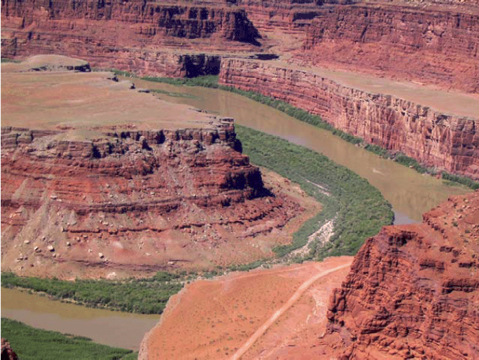
The likely story is that the streams once flowed across nearly flat lowlands. Then, uplift of the rocks began, giving the streams a steeper slope to the sea and so speeding their flow and causing them to erode. But, the uplift was gradual enough that the streams held their old courses. The streams cut downward without a change in pattern, which is called incision. Canyonlands contains clear examples of incised meanders. Similar features are preserved throughout the Colorado Plateau, documenting widespread uplift of the Plateau.
Much of geology involves study such as this; the history of a region produced the modern features. One can often learn much about that history by understanding the modern features and how they were formed. Clearly, if we did not know what conditions produce meandering streams today, we would not know what conditions likely occurred in the past when the meandering streams developed. The geological saying that captures this idea is “The present is the key to the past.”
SINKING MUD
Down at the Mississippi Delta, we saw that the mud under New Orleans is compacting under its own weight, contributing to sinking of the city. A couple of other things also contribute to the sinking.
As the delta grows, the weight of the mud pushes down the rock beneath, with soft, hot rock much farther below flowing away laterally, like water under your behind if you sit on a water bed. The sinking is not instantaneous. And, just as the strength of the water-bed cover spreads the dimple around your behind when you sit down, a fairly large region around the delta is pushed down by the weight of the delta. So add some mud anywhere near New Orleans, and you get a little sinking in New Orleans for a while.
Perhaps more importantly, as we saw with mass movements at the Grand Tetons (and as you can see in the picture of Canyonlands on the previous page, in the cliff on the inside of the meander), rocks tend to fall off steep slopes. Sometimes a single rock falls, or a thin layer of rocks slides. Other times, large thicknesses of material move. The Mississippi Delta is a giant pile of mud towering above the deep waters of the Gulf of Mexico, and that “cliff” is subject to downward motion of its materials. Some of this occurs along faults that are something like pull-apart Death-Valley-type faults—the fault intersects the Earth’s surface well inland, sloping down toward the Gulf, and the mud on top slides down and toward the Gulf.
After Hurricane Katrina devastated New Orleans, geologists renewed their efforts to understand what is going on geologically—such understanding should help in planning how to slow down the next disaster. An argument has erupted about the relative importance of the various reasons for sinking in and near New Orleans, with faulting probably more important (and mud compaction less important) than previously believed, and with sinking of the rock beneath minor but not zero. All are almost certainly contributing, but with a little work to figure out just how much to blame on each one. Naturally, all of them contributed to lowering of the surface, and sediment deposited from the river's floods filled that space—the river doesn't really care why the surface dropped, and deposits sediment in low places formed by any process.
Wrap Up
Review the Unit 6 Introduction
You have reached the end of Unit 6! Double-check the list of requirements on the Unit 6 Introduction page and the Course Calendar to make sure you have completed all of the activities listed there.
Unit 6 Overview
Review of the main topics and ideas you encountered in Unit 6.
Water, Rivers, Floods, and Caves: Canyonlands, Delta and Mammoth Cave
- Most rain evaporates especially from plants, most of remainder soaks in.
- Soil and shallow rock usually have air as well as water in spaces; deeper, below water table, spaces all water-filled.
- Water table looks like a smoothed version of the ground surface, and hits surface at streams.
- “Sponge” of ground fills during rains, drains to keep streams running between rains.
- Water table rises during wet times, sinks during dry times.
Rivers Move Rocks
- Rivers get water, and rocks by mass movement.
- If more rocks arrive than water can move, rocks pile up, steepening stream so it can move more rocks.
- Sticky, small clay particles favor a single, deep meandering channel that moves suspended load up in channel.
- Lots of sand, gravel or larger rocks that don’t stick together favor many shallow braided channels.
Dams Make a Big Difference
- Sediment builds deltas to fill reservoirs formed by damming rivers.
- A delta builds out but also up, “backing up” sediment to bury fields and houses for some distance upstream.
- Regions downstream of dams no longer get floods.
- Which makes a huge difference for what lives on floodplain (favors humans over nature).
- Without floods, big rocks are no longer moved by rivers.
- Clean water released by dams picks up sand, removing sand bars and affecting river ecosystems.
Ignoring rivers can be dangerous
- A delta is a big pile of sediment, which compacts under its own weight.
- The Mississippi delta is miles thick, compacts a lot.
- The natural sinking is balanced by new mud from the annual flood.
- Humans hate mud on carpet, so raise natural levees to keep river out of houses.
- But sinking continues—most of New Orleans has subsided below river and sea level.
- Wetlands below New Orleans have been lost as levees and dredging for shipping kept flood mud from balancing sinking.
- A low city by a high river and sea with no wetlands to slow storm surges brought huge hurricane disaster.
- Scientists, disaster planners, many journalists and others repeatedly warned that this would happen…
- The sinking continues; rebuilding without major changes will cause the next disaster to be even worse.
Caves are Cool
- Some rocks (esp. limestone) dissolve easily; if cracks rare so dissolving focused, get sinkholes from surface, caves beneath, springs, etc.=karst.
- If cave dries, loss of soil CO2 to cave deposits dissolved limestone as cave formations.
- Water goes through caves quickly; pollution discharged today may harm someone tomorrow.
- For other rocks, water moves much more slowly; pollution may not “get” anyone for a while, but once it does, clean-up is very hard and slow.
- Some clean-up options, but best to keep poisons out of ground.
Reminder - Continue to work on Exercise #3. See Course Calendar for specific due dates.
Supplemental Materials
Following are some supplementary materials for Unit 6. While you are not required to review these, you may find them interesting and possibly even helpful in preparing for the quiz!
- Website: Canyonlands National Park
- Website: Delta National Wildlife Refuge
- Website: Mammoth Cave National Park
To read about the restoration of the Elwha River, go to the Olympic National Park website, and in particular to the Elwha River Restoration page.
Comments or Questions?
Please feel free to send an email to ALL of the teachers and TA's through Canvas conversations with any questions. Failure to email ALL teachers and TA's may result in a delayed or missed response. See "How to send email in GEOSC 10" for instructions
Unit 7: Glaciers, Ice, and Permafrost
Welcome to Unit 7
Glaciers, Ice, & Permafrost—Yosemite, Glacier, & Bear Meadows
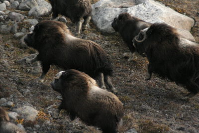
Although not quite as large as minivans, musk oxen have better acceleration and cornering. This picture shows musk oxen thundering across the tundra of east Greenland. If you had been in central Pennsylvania's Bear Meadows with a camera 20,000 years ago, you might have taken this picture--tundra and musk oxen very similar to these existed in Pennsylvania and adjacent states back then, while an ice sheet even bigger than modern Greenland's loomed just to the north. How do we know that the ice came and went, and what caused the changes? Look both ways for musk oxen or minivans, depending on where and when you are, and let's go see.
What to do for Unit 7?
You will have one week to complete Unit 7. See the course calendar for specific due dates.
As you work your way through the online materials for Unit 7, you will encounter a video lecture, several vTrips, some animated diagrams (called GeoMations and GeoClips), additional reading assignments, a practice quiz, a "RockOn" quiz, and a "StudentsSpeak" Survey. The chart below provides an overview of the requirements for this unit.
|
REQUIREMENTS |
SUBMITTED FOR GRADING? |
|---|---|
| Read/view all of the Instructional Materials | No, but you will be tested on all of the material found in the Unit 7 Instructional Materials. |
| Submit Exercise #3: The Age of Nittany Valley. | Yes, this is the third of 6 Exercises and is worth 5% of your total grade. |
| Begin Exercise #4: Which Way is Up? | Yes, this is the fourth of 6 Exercises and is worth 5% of your total grade. |
| Take the Unit 7 "RockOn" quiz. | Yes, this is the seventh of 12 end-of-unit RockOn quizzes and is worth 4.5% of your total grade. |
| Complete the "StudentsSpeak #8" survey. | Yes, this is the eighth of 12 weekly surveys and is worth 1% of your total grade. |
Questions?
If you have any questions, please feel free to email "All Teachers" and "All Teaching Assistants" through Canvas conversations.
Keep Reading!
On the following pages, you will find all of the information you need to successfully complete Unit 7, including the online textbook, a video lecture, several vTrips and animations, and an overview presentation
Students who register for this Penn State course gain access to assignment and instructor feedback, and earn academic credit. Information about registering for this course is available from the Office of the University Registrar.
Main Topics, Unit 7
When we try to pick out anything by itself, we find it hitched to everything else in the Universe.
— John Muir, My First Summer in the Sierra, 1911, p. 110
Overview of the main topics you will encounter in Unit 7.
Ice Is Nice: Yosemite, Glacier, Rocky Mountain, Bear Meadows, and NE Greenland
- A glacier is a pile of ice and snow that flows.
- It forms if snowfall exceeds melting by enough, for long enough, to make a big enough pile.
- A glacier takes water (as ice) and sediment from the accumulation zone (where snow accumulates faster than it melts) to the ablation zone (where melting, also called ablation, exceeds snow accumulation) or to calve icebergs.
- A glacier flows in the downhill direction of the upper surface (where ice meets air), even if that means the bottom flows uphill.
- Think of pancake batter flowing on a waffle iron.
Slip Sliding Away
- A glacier moves by deformation within the ice, and if the bed is warmed to the freezing point, by sliding over the glacier's bed or deforming the sediment there.
- Most deformation in the ice of a glacier is deep, but the top of a glacier moves fastest because it rides along on the deeper layers.
- The ice of a glacier deforms under stress because the ice is almost hot enough to melt.
- Glaciers erode by plucking rocks loose, sand-papering the bed, and through the actions of subglacial streams.
- Glaciers with thawed beds, especially those with surface meltwater reaching the bed, change the landscape more rapidly than is typical for landscapes shaped by streams, wind or mass movement.
Ages of Ice
- Recent (about 20,000-year-old), features known to be made by glaciers and no other processes are observed now across broad areas of the Earth where glaciers do not occur, suggesting that we have had an ice age or ice ages in the past.
- The hypothesis of past ice ages predicts that the land now should be rising where the ice was, and sinking just beyond where the ice was, and these are indeed observed.
- The hypothesis of past ice ages also predicts that sea level was lower when the ice was big, and indeed we observe dead shallow-water corals of that age in growth position in deep water on the sides of oceanic islands, flooded river valleys, etc.
- The success of the ice-age hypothesis in predicting things that have since been observed, and the failure of other hypotheses to do so, give us high confidence that ice ages did occur.
Ice-Age Records
- Isotopically lighter water evaporates more easily.
- An ice sheet is formed from water that evaporated, mainly from the ocean, and then snowed, so during an ice age the water remaining in the ocean should be isotopically heavier than observed today.
- And isotopically heavier water gives isotopically heavier shells
- The history of the isotopic composition of shells recovered from cores of mud from the ocean floor shows that the ice grew and shrank, with the biggest ice every 100,000 years, and smaller wiggles in ice size about 41,000 and 19,000 years apart.
- These exact timings were predicted by Milankovitch decades before they were observed, because they are the timings of features in Earth's orbit that control the distribution of sunshine on the planet.
- Ice has grown globally when the far north was getting relatively little sunshine, especially in midsummer.
- The rest of the world has cooled when ice grew in the north, even though parts of the world were getting extra sunshine, and the world has warmed when ice melted in the north, even when some places were getting less sunshine.
- This seemingly bizarre behavior occurred because the changing ice and other features of the climate changed atmospheric CO2, which rose when ice melted and fell when ice grew, and the CO2 controlled global temperatures.
Bear Meadows
- Ice sheets today cover about 10% of the land area; at the height of ice age the ice sheets covered about 30% of modern land; central PA was just beyond edge of Canadian ice.
- The high parts of Rocky Mountain and the coastal parts of the NE Greenland National Parks are among the places that have permafrost—soil at some depth is frozen year-round.
- Permafrost regions are especially affected by freeze-thaw processes that break rocks, and by rapid downhill soil creep (during the summer, the meltwater can't drain downward through the frozen soil beneath, so the soil gets very soggy and creeps easily).
- These characteristics of permafrost regions contribute to formation of distinctive features, which are observed in places such as central Pennsylvania that were just south of the ice-age ice sheets but which are not forming there today.
- This shows that central Pennsylvania, and other such regions just south of the ice-age ice sheets, were really cold during the ice age.
Glacier Tracks
- Abrasion (sandpapering) under ice makes striae (scratches) and polishes rock.
- Abrasion smooths the upglacier sides of bedrock bumps, while the glacier plucks blocks loose from the downglacier sides of bumps.
- Glaciers erode valleys to give them “U”-shaped cross-sections, often with the floors of valleys coming in from the side left "hanging" above the floor of the main valley; streams make “V”-shaped valleys without hanging valleys.
- Glaciers gnaw bowls called cirques into mountains.
- Glaciers deposit till, which contains rock pieces of all different sizes.
- Melting glacier ice also feeds streams that deposit outwash (because it is washed out of the glacier); the pieces in outwash are sorted by size (mostly sand here, mostly gravel there).
- Till and outwash often form ridges called moraines that outline the glacier.
Textbook 7.1: Yosemite
What Glaciers Do, Erosion and Yosemite
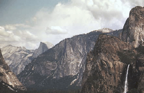
When your tour guide, Dr. Alley, was a much younger man (the year he graduated from high school, 1976), he traveled with his sister Sharon and cousin Chuck on a camping tour of the great national parks of the American west (in Chuck’s 1962 Ford Galaxy 500 land boat). At Yosemite, they hiked from the valley up to Glacier Point. The trail switch-backs up the granite cliffs, opening increasingly spectacular panoramas across the great valley of the Merced River. The view from Glacier Point, across the side of Half Dome, and the thundering Vernal and Nevada Falls, is well worth the climb. It was here that John Muir helped convince President Theodore Roosevelt of the need for a National Park Service to care for the National Parks, which were protected by law but not by rangers for some decades after the parks were established.
The hikers were a bit disheartened by the crowd at Glacier Point—the view is also accessible by the Glacier Point Road. While they sat and lunched, a tour bus pulled in. Most of the passengers headed for the gift shop, but three settled at a picnic table while a fourth strolled over to the railing to see the scenery for a few moments before joining the others at the picnic table. One of the quick-sitters asked “Anything out there?” To which the ‘energetic’ one replied “Nah, just a bunch of rocks. Let’s go check out the gift shop.” At last report, the gift shop had been removed. Regardless, it must be a sad person indeed who would not walk 50 feet to see the glory of Yosemite.
To anyone with open eyes, Yosemite Valley—the “Incomparable Valley”—is well worth inspection. It is carved from the granites and similar rocks of the high Sierra Nevada of California. Once, this granite was magma (melted rock below the surface), far beneath an earlier mountain range. The magma may have fed subduction-zone volcanoes much like those of the Cascades, which continue to the north of the Sierra. However, stratovolcanoes along this part of California have died as the East Pacific Rise spreading center ran into the trench along the west coast, forming the San Andreas Fault but ending subduction. Such a fate eventually awaits the Cascades volcanoes, some millions of years in the future.
The Sierra Nevada was raised and tilted along the great fault to its east, and looks down on Death Valley and the rest of the Great Basin. Earthquake activity, and faults cutting recent sediments, show that the mountain range is still being lifted above the still-dropping Great Basin.
The tough granite of the Sierra Nevada is more resistant to weathering and erosion than are most rocks, but granite does eventually break down, and some streams have managed to exploit weaknesses and cut deep channels through the range. These streams include the Tuolomne River, which carved the mighty Hetch Hetchy valley, now dammed so that a valley the equal of Yosemite is lost under water. The Merced River, which runs through Yosemite Valley, also cut into the range.
The stage was then set for the ice ages. Glaciers gathered on the high peaks, flowed into the valleys, and began to change the landscape.
Which Way Did It Flow?
A glacier is a mass of snow or ice that deforms and moves. Glaciers form wherever snowfall exceeds melting over enough years to make a pile big enough to flow. In places with extremely high snowfall, this can occur where average temperatures are near or even slightly above freezing, such as on the mountains of the Olympic Peninsula. In dry places, glaciers may be absent even if average temperatures are well below freezing. Such places have frozen ground instead, called permafrost (because the frost is permanent).
A pile of pancake batter spreads across a griddle, moving away from where the upper surface of the pile is highest. In the same way, a glacier moves from where its upper surface is highest to where its upper surface is lowest. In the figure below, the pressure at point A (the weight of the material above point A) is larger than at point B, because there is more ice above A than above B. The higher pressure at A gives a net push from A to B. Whether the diagram shows pancake batter, or the ice sheet on Antarctica, this push causes the material to deform and flow.
If you make a pile of pancake batter on a waffle iron, some of the batter may flow along the low grooves and then move up to cover the bumps, but the flow will always move away from the place where the upper surface of the pile is highest. In the same way, ice can flow up a hill in the bedrock if the flow is going in the “down” direction of the upper surface. For example, pieces of Canada are strewn across northeast Pennsylvania, and were brought across Lake Ontario and New York by the ice-age ice sheet. Ice at the bottom of that glacier climbed out of the low spot that now is the lake basin, driven by the upper surface of the ice sloping down from Canada to the U.S.
The total imbalance in pushes is larger for thicker ice than for thin. A very thin ice mass will not deform fast enough for the motion to be measured, and so is not considered to be a glacier. Typically, ice thicker than about 50 m (150 feet) will deform and flow, making a glacier.
Look at the second part of the figure. Glaciers move in one or more ways. All glaciers deform internally, like your slow pancake batter spreading on the griddle. A vertical hole drilled in a glacier will deform as shown in the figure. The stresses are largest, causing most-intense deformation (the permanent bending of the hole shown in the figure), in the deepest ice. The upper ice rides along on the deeper ice, so the velocity is fastest at the surface. Some glaciers are at the melting point at the bottom, warmed by heat flowing out of the Earth beneath. These melted-bed glaciers may move over the material beneath them, either by sliding over those materials (shown in the figure) or, if the materials are soft sediment, by deforming those sediments in a sort of slow landslide (not shown).
Recall that rivers adjust to move sediment and water from one place to another. So do glaciers. The water is supplied, frozen, in the accumulation zone, where snowfall exceeds melting, causing snow and ice to accumulate. The frozen water flows to the ablation zone, where melting exceeds snowfall (ablation means wearing away), or else flows to where icebergs break off (called calving) and drift away to melt elsewhere. For ice sheets covering continents or for smaller ice caps covering plateaus or mountain tops, the ice forms a dome and spreads out in all directions. For glaciers on the sides of mountains, the ice flows down the mountain—the upper and lower surfaces of the ice slope in the same direction.
When we talk about the advance and retreat of a glacier, we are referring to the position of its terminus, where the glacier ends by melting or calving. A glacier is advancing when it is getting longer, and retreating when it is getting shorter. Notice that ice almost always continues flowing from the accumulation zone to the terminus whether the glacier is advancing or retreating—retreat occurs when ice loss by melting or calving is faster than new ice is supplied, and advance occurs when ice is supplied more rapidly than it is removed by melting or calving.
Permanent deformation—flow—within ice may seem strange—after all, ice is a solid. But, as for the soft rock of the asthenosphere down in the mantle, or the soft chocolate bar in a hot pocket, or the red-hot horseshoe in the blacksmith’s shop, ice in all glaciers on Earth is nearly warm enough to melt, and so can flow slowly. As a general rule, materials heated more than halfway from absolute zero to their melting point can flow slowly, and flow becomes easier the closer the temperature is to the melting point. For ice, the coldest yearly average temperature on Earth is about eight-tenths of the way from absolute zero to the melting point, so ice at the Earth’s surface is “hot” and is able to flow. For more on this, and on the occurrence of crevasses as well as flow, see the Enrichment.
Glacier Tracks
A glacier frozen to the rock beneath does not erode much. However, thawed-bed glaciers, especially those with surface meltwater streams draining to their beds through holes (something like cave passages, although formed in different ways), can erode much more rapidly than streams or wind erode. Consider for a moment the Great Lakes of the U.S. and Canada. The lakes were carved by glaciers. The bedrock beneath Lakes Superior and Michigan is well below sea level, and was carved that deep by glaciers, not rivers! Today, rivers carry sediment into the Great Lakes, slowly filling them up. We will see later that over the last million years, times when glaciers were eroding have alternated with times when streams were filling the lakes back up with sediment, and the streams have had more filling-up time than the glaciers had eroding time. And yet, there are the lakes, not the least bit full of sediment. Evidently, the glaciers have been much better at their “job” than the streams have been. The same can be said for many other places. It is not too extreme to say that the regions glaciated 20,000 years ago and free of ice today still preserve a glacial landscape.
Ice moving over bedrock “plucks” rocks free, and then uses those rocks to abrade or “sandpaper” the bedrock, scratching and polishing it. As ice flows over a bedrock bump, the side the ice reaches first is abraded smooth while the other side is plucked rough. Subglacial streams sweep away the loose pieces, and may cut into the rock as well.
Plucked and abraded rocks show clearly that glaciers were present, but so do big features, as seen in Yosemite and elsewhere. If you could make a cut across a typical stream valley in the mountains, you would see that it usually is shaped like the letter “V”. The narrow stream cuts downward, and then mass-movement processes remove material from the walls, giving a “V”. (Where a V-shaped stream enters an ocean to make a delta, the outward and upward growth of the delta over time may eventually fill the bottom of the V with mud to make a flood plain, as we saw with the Mississippi, but initially, when a stream is cutting down, it makes a V.) However, glaciers are quite wide, and can erode across a broad region. Glaciated valleys exhibit a characteristic “U” shape. Yosemite Valley, with its near-vertical walls and near-horizontal floor, is a classic “U”, not a “V”.
The steeper a stream is, the faster it erodes. If a main river cuts down rapidly, then the side streams that flow into it will become very steep, and will cut downward very rapidly. In this way, even a small side stream can “keep up” with the main stream as it erodes downward, and stream processes usually produce “rapids,” rather than waterfalls where the side streams must plunge over cliffs to reach the main stream. Glaciers are different. A main glacier often fills its valley, the ice burying most or all of the rock. The ice from a side glacier then does not drop steeply down into the main glacier because there is no drop. So the side glacier is not steeper than the main glacier. The main glacier has more ice and rock and water than the side glacier, and so the main glacier erodes down more rapidly. When the ice melts, a “hanging valley” remains—a small stream that replaces the small side glacier must plunge over a glacially carved cliff and then flow across the bottom of the “U”-shaped valley to reach the main stream. Eventually, the side stream will wear away the waterfall. But today in Yosemite, numerous streams emerge from small “U”-shaped hanging valleys to cascade down the glacially carved cliffs—the landscape is pretty much what the glaciers left. (Piles of rocks at the bottoms of waterfalls show that the streams are indeed changing things, but slowly.)
Glaciers make many other erosional features. At the head of a glacier, where freezing and thawing can break rock that is hauled away by the glacier, a bowl can be carved into the side of a mountain. If bowls chew into a mountain from opposite sides until they meet, a knife-edged ridge is left—the Garden Wall of the continental divide in Glacier National Park, which we’ll meet in the next chapter. Where three or more bowls intersect from different sides, a pinnacle of rock is left, such as the Matterhorn of Switzerland. Mountaineers have dubbed the bowls cirques, the ridges aretes, and the pillars horns, and geologists continue to use these terms.
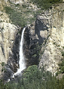
Glaciers also leave distinctive deposits. Streams, waves and wind all sort rocks by size, leaving too-big ones behind and carrying away smaller ones. Glaciers don’t care how big the rocks are that the ice carries, so a deposit put down directly from ice may have the tiniest clay particles mixed in with house-sized boulders. Such a deposit is called glacial till. Till plus glacial outwash (sediment washed out of a glacier by meltwater) may be piled up together in a ridge that outlines the glacier, called a moraine.
Pennsylvania has a Moraine State Park, which features glacial moraines. Cape Cod is a moraine, and a moraine is draped across Long Island, showing some of the places where glaciers from the ice age ended.
Textbook 7.2: Glacier National Park
Glaciers and Glacier National Park
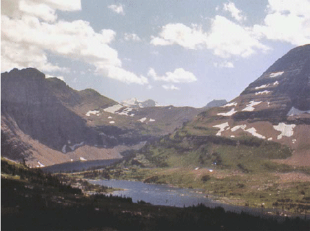
Glacier National Park is the southern half of the Glacier-Waterton Lakes International Peace Park, extending north-south across the Canadian-U.S. border and east-west across the great Front Range of the Rockies. Glacier is wolves and grizzly bears, mountain goats balanced on cliffs, moose munching on water plants, beargrass and avalanche lilies. Going-to-the-Sun Road winds past Going-to-the-Sun Mountain, among the best-named features of the park system. The continental divide snakes along the Garden Wall, in many places a knife-edge ridge left as glaciers gnawed into the backbone of the continent from the east and the west. Long, narrow lakes lie along the valleys, which sometimes host lines of lakes strung like beads on the string of the connecting river. (Such glacier-carved strings of lakes are called paternoster lakes, after a resemblance to the beads of a Catholic rosary.
Glacier National Park had roughly 150 active glaciers a century ago, but that is down to 25 or so very small ones, and many of them may be essentially dead now, as modern warmth melts many away (see the changes shown by the older and more-recent photos below). Glacier National Park thus is now more noted for the tracks of past glaciers than for the activity of present ones. But, we suspect that “Ex-Glacier National Park” would not have made the Great Northern Railway happy when they were promoting tourism in Glacier National Park (via the Great Northern Railway, of course). When the last glacier has melted away, perhaps within a few decades (we'll return to this with the Arctic National Wildlife Refuge, near the end of the course), there are no plans to change the name of the park.
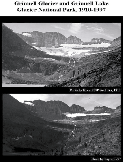
Evidence of Ice Ages
Today, permanent ice covers about one-tenth of the land on Earth, mostly in Antarctica and Greenland, with a little ice in mountainous regions. We saw at Yosemite that glacier erosion and deposition produce features that differ from those produced by mass movement, rivers, wind or coasts. Geologically recent examples of those features, from roughly 20,000 years ago, are spread across almost one-third of the modern land surface—in places such as Wisconsin, and northern Pennsylvania, and Yosemite, and Glacier, and many others, the mark of the ice is unmistakable. The 10,000 lakes of Minnesota, the Great Lakes, the gentle moraines of Illinois, and many more features reveal a landscape that is glacially dominated. Such features in Europe first motivated the hypothesis that ice ages have occurred.
This ice-age hypothesis makes many predictions, which allow testing. In times before modern geology, the glacial deposits were called “drift” because they were thought to have drifted into place in icebergs during Noah’s flood. Other people have suggested that the deposits were splashed into position by a giant meteorite that hit Hudson Bay, and still other hypotheses have been advanced. But, the ice-age hypothesis makes predictions that differ from the Noah’s-flood hypothesis or the meteorite hypothesis in many ways. (The biggest difference is that icebergs and meteorites simply do not make features that even vaguely resemble those actually observed, but let’s look at some other differences.)
If huge ice really existed, its great weight must have pushed down the land beneath—recall that the deep rocks are hot and soft, with a “water-bed” cover of stiffer rocks on top. If the ice age peaked only about 20,000 years ago, the slow flow of the soft, deep rocks should mean that the land would still be rising after the melting of the ice, while land around the former ice would be sinking as the soft, deep rocks return to their pre-ice-age positions. The global-flood hypothesis and the meteorite hypothesis do not predict such a bulls-eye pattern of rising and sinking centered on the regions with features known to be made by glaciers today—the flood would have spread evenly across the land, and so would not have concentrated its weight in one place, and the sudden blast of the meteorite would not have left its weight long enough to push the slow-flowing deep rocks far. Measurements by GPS and other techniques show just the pattern expected from the ice-age hypothesis, a pattern that was not predicted and cannot be explained by the other hypotheses.
The water for huge ice sheets would have been supplied by evaporation from the oceans, with the water getting stuck in the ice rather than returning rapidly to the sea in streams. Hence, if ice ages occurred recently, there should be evidence of lower sea levels at the time the ice was big. No such prediction comes from the meteorite or big-flood hypotheses (the meteorite might have made a wave but otherwise would not have affected sea level; the big flood would have raised sea level). Again, the ice-age prediction is borne out by the evidence, and the predictions of the other hypotheses are wrong. For example, some corals grow only in shallow waters where there is much sunlight. Dead samples of such corals from about 20,000 years ago can be found where they grew, down the sides of islands and now under more than 300 feet of ocean water. Other evidence also points to lower sea level in the recent past—the Chesapeake Bay, for example, is a river valley that was drowned by rising waters.
How Many Ice Ages?—An Ocean of Clues
So, much evidence shows that ice ages occurred. Piled tills separated by soils demonstrate that the ice has come and gone many times. But how many times? On land, the glacial record is somewhat confused—often, an advancing glacier will erode the evidence of a previous one. A pile of four tills separated by soils may record four advances, or forty, with some of the record having been eroded away. In many places in the deep oceans, sediment has been piling up without erosion for millions of years. If there were a marker of glaciation in the marine sediments, we could tell how many glaciations have occurred. If there were a way to date these sediments, we could tell when the glaciation happened. Fortunately, we can identify glaciations using shells in marine sediments, and we can date them. Identifying glaciers from shells is covered here, and learning the age of the shells is coming in the next few units.
Water in the oceans is not all the same—roughly one molecule in 500 has an extra neutron or two in one or more of the oxygen or hydrogen atoms. Such “heavy” water is still water, but weighs a little extra. (If you don’t remember isotopes, go back and have a quick look at the introduction to chemistry near the start of the course.) Not surprisingly, light molecules evaporate more easily than heavy molecules. Water vapor, rain, and snow thus are slightly “lighter” than the ocean; that is, the ratio of light water molecules to heavy ones is larger in vapor, rain, and snow than in the ocean from which the vapor, rain, and snow came.
When sea level drops during an ice age - as water vapor is changed to snow and then to ice sheets, the oceans have lost a lot of water. More light water than heavy water has been lost from the oceans, so the oceans are left a little bit isotopically heavier than normal. When ice melts, that light water from the ice sheets is returned to the ocean and makes it lighter.
These changes are very small. If we round off the numbers a little, we can say that in the modern ocean, 1 of each 500 water molecules is heavy, which is the same as saying that 1000 of each 500,000 water molecules are heavy. When the ice sheets were big, had you weighed a whole lot of molecules in the ocean, you would have found that about 1001 of each 500,000 water molecules were heavy. This is a tiny change, the water was still water, but sophisticated modern instruments are so good that such a change is very easy to measure. (And yes, the instruments actually measure the weight of waaaaaaay more than 500,000 molecules, to obtain good statistics.)
Many plants and animals that grow in the ocean build shells of calcium carbonate (the stuff of limestone) or of silica, both of which contain oxygen. These shells record the isotopic composition of the water in which they grow because the oxygen in the carbonate or silica is obtained from the water. Critters growing during big-ice times grow shells in which the oxygen is isotopically slightly heavy, and critters growing during small-ice times grow isotopically light shells. When the critters die, their shells pile up in layers on the sea floor with the youngest ones on top. A core collected from these sediments is a history of the ice volume on Earth. Just date the core, pull out the shells, analyze them isotopically, and there is the answer. With enough care, knowledge, and instrumentation, dedicated workers can obtain consistent, reproducible data that tell a wonderful, clear story. (There are a few additional details, but the main story is this simple.)
Over the most recent 800,000 years, ice has generally grown for about 90,000 years, shrunk for 10,000 years, grown for 90,000 years, shrunk for 10,000 years, etc. Superimposed on this are smaller wiggles, with a spacing of about 19,000 years and 41,000 years.
The Cold of Space
More remarkable, these cycles were predicted, and not until decades after the prediction did technology become good enough to test the prediction and show that it worked. During the 1920s and 1930s, a Serbian mathematician named Milutin Milankovitch calculated how the sunshine received at different places and seasons on the Earth has changed over long times. As the sun, moon, Jupiter and other planets tug on the Earth, the orbit changes a bit. Earth wobbles with a 19,000-year periodicity, the north pole tilts a little more and then a little less with a 41,000-year periodicity, and the orbit changes from more-nearly round to more squashed or elliptical and back with a 100,000-year periodicity. With modern computers, these changes are relatively easy to calculate for many millions of years; for Milankovitch, the calculation was the labor of a lifetime. (He did it very well, though, even correctly noting that the 19,000-year periodicity really goes from 19,000 to 23,000 years and back, a pattern that is indeed observed in the data testing his prediction!)
These orbital wiggles have little effect on the total sunshine received by the planet, but they do move the sunshine from north to south, poles to equator, or summer to winter in various ways. For example, today the northern hemisphere is farther from the sun in northern summer than in northern winter. (Remember that summer is controlled by the tilt of the planet’s spin axis relative to the plane in which the planet orbits, not by the distance from the sun!) In the few millennia centered on 9000 years ago, the northern hemisphere had slightly warmer summers and cooler winters than recently, because the Earth was closer to the sun during northern summers and farther from the sun during northern winters than today. (Meanwhile, the south had slightly cooler summers and warmer winters than recently, because the Earth was closer to the sun during southern winters and farther from the sun during southern summers than today.) The intense summer sunshine in the north 9000 years ago made mountain glaciers smaller then. As the summer sunshine decreased in the north, those glaciers expanded slowly for several thousand years, culminating in the Little Ice Age of the 1600s to 1800s; strong melting of glaciers since then is probably mostly the result of human-caused warming. (We will discuss this later in the course.)
Summer in the northern hemisphere appears to be key to controlling ice ages, probably because the northern hemisphere is mostly land and can grow big ice sheets, but the southern hemisphere is mostly water, already has ice on Antarctica, and so can’t change its land ice much more. In the north, even during warm winters the highlands around Hudson Bay are cold enough to have snow rather than rain. Survival of this snow requires cool, short summers. As summers have cooled around Hudson Bay, ice has grown; as summers have warmed, ice has melted. The way the various cycles interacted led to larger or smaller changes, and thus to the ice ages we know.
You may guess that this is slightly oversimplified so far. For example, during times when Canada has received reduced summer sunshine, allowing ice to grow, the southern hemisphere or the tropics often were receiving extra sunshine, yet they cooled during many of those times. How Canada told the glaciers of Patagonia and Antarctica to grow was for a long time a great puzzle. The answer involves the global warming from atmospheric carbon dioxide. The growth and shrinkage of the vast ice sheets, the changes in sea level, and other changes had the effect of shifting some carbon dioxide (CO2) from the air into the deep ocean during ice ages, and bringing the CO2 back out to the air during warm times. The orbits affected the ice, which affected currents and sea level and plants and other things, which affected CO2. But, as we will discuss later in the semester, CO2 in the air tends to warm the Earth's surface no matter how that CO2 got into the air. And, the changing CO2 explains why, when the ice was growing, places getting more sunshine still got colder, and why, when the ice was shrinking, places getting less sun still got warmer.
Climate records show many other types of changes. Very large, rapid changes have been caused by sudden surges of ice sheets, and by jumps in the way the ocean circulates. We do not understand these faster changes well enough to know whether they could happen again, although we're cautiously optimistic that we won't have any for a while. Naturally, the Earth’s orbit right now is in an intermediate state, and we should be looking forward to another 20,000 years or more with little change before we begin the slide into a new ice age. (See the Enrichment for a little more on this.) However, humans almost certainly are now more important to the climate than are such slow changes, as we will see later.
Textbook 7.3: Trail Ridge Road and the Seven Mountains
Permafrost and Periglaciation
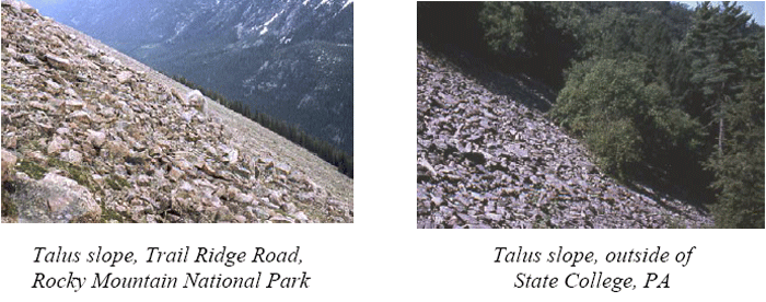
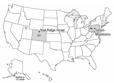
Meanwhile, what of things back in central Pennsylvania and in the many other places that were not quite reached by the ice-age ice? As you might imagine, with the world cold enough to grow ice to cover New York, Chicago, Minneapolis, and Seattle, as well as much of Europe, the climate was colder everywhere then than it has been more recently.
If you climb the ridges of central Pennsylvania, perhaps up in the Seven Mountains just southeast of State College (go up Bear Meadows Road past the ski area, for a start), you may notice several interesting things geologically. Beneath the hemlocks and rhododendron, the soils and streams and hillslopes have more in common with the high meadows of Trail Ridge Road in Rocky Mountain National Park, or with the coast of Greenland, than they do with the modern climate of State College. Trail Ridge Road crosses tundra, where small, hardy plants grow atop permafrost. Although the uppermost soil along Trail Ridge Road thaws during the brief summers, and the deep Earth is thawed by the heat of the Earth, the materials between are frozen year-round in permanent frost. (These areas are also called “periglacial,” because they may occur around the glacier, or on its perimeter.)
Consider the following features of the Seven Mountains.
- Many of the headwaters streams have the braided pattern that forms when lots of big rocks are supplied rapidly. Large rocks are evident across the beds of these braided streams. But, the sediment is not “active.” Trees grow on the bars. Even huge floods, such as the winter flood of 1996, do not move the rocks beneath them. Something in the past delivered much coarse sediment to the streams, and then that delivery stopped. Meanwhile, along Trail Ridge Road today, freeze-thaw processes in the tundra break loose large blocks of rock that can be moved to streams.
- The highest points on the ridges of the Seven Mountains are composed of resistant sandstone bedrock, but near the surface, the rock has been broken into huge blocks, of the sort that are worked loose by freeze-thaw activity. On flat places such as Big Flat, these blocks sometimes are patterned, with higher and lower, coarser and finer regions a few yards (or meters) across. (These features were described by geologists during times when logging and fire had removed the thick vegetation; the features are very hard to see and almost impossible to photograph today, but can be found during careful bush-whacking.) Meanwhile, similar features occur along Trail Ridge Road and in other permafrost regions, where expansion-contraction processes during the seasonal freezing and thawing of the upper layer sort and stir the rocks and soil into such patterns.
- Stripes or fields of sandstone blocks extend from the ridges down across other rock types to the streams. The blocks are often aligned, as they would be in a creeping soil mass. The coarsest blocks typically are on top with finer material beneath, and patterns such as those on Big Flat may be present but elongated as if they were creeping downhill. Yet the blocks are not now creeping downhill; trees grow on top, and have not been knocked over or bent by landsliding or soil creep. Meanwhile, when the top of permafrost melts on Trail Ridge Road or elsewhere, the water cannot drain out through the rocks beneath because the spaces between those rocks are plugged by ice. The water is trapped in the thawed layer, which then is capable of creeping on very gradual slopes. “Solifluction” or soil-flow lobes thus are common extending downhill.
- Bear Meadows is a young feature, probably formed during the coldest part of the most recent ice age, and probably dammed by a debris-flow or soil-flow lobe extending down from the ridge above it. Bear Meadows is one of the few natural wetlands of any size in central Pennsylvania. The meadows provide a favorite blueberry-picking spot for people—and bears—in the region. The plants of Bear Meadows are quite interesting and varied. Examination of a core pulled from the mud that fills the bog shows that the bottom is almost free of organic material—just silt. Above that, pollen and other remains of cold-weather plants appear, dating to the first bit of warming from the ice age, followed by a progression to warmer-weather types and on to the modern, productive bog. A nearly barren tundra of the Trail Ridge Road type, with a solifluction lobe that dammed a stream, followed by warming, would have produced the sediments we see.
- Other permafrost indicators can be found near State College, including some down in the valleys.
The conclusion is nearly inescapable—Trail Ridge Road in Rocky Mountain today is an excellent picture of what the Seven Mountains looked like during the ice age. Permafrost is common across much of northern Canada and Siberia and around the coast of Greenland, and in high-altitude regions. Permafrost poses grave problems for construction—the heat of a building can melt permafrost beneath, causing uneven settling that breaks the building. Permafrost also records the climate changes that have come to central Pennsylvania and other regions.
An Important Aside: Is This Story-Telling or Science? (Hint: Science...)
Perhaps more meaningful than the conclusion of past Pennsylvania permafrost is the underlying reasoning. Some people today, including important government officials, claim that “historical” geology is not really science, does not use the scientific method, does not produce scientific results, and so should be ignored. (Many commentators have noted that these government officials typically dislike policies that might be motivated by the science, and are probably really more interested in complaining about the policies than the research. But, let's look at the research.)
Consider how the process works. Go up to Bear Meadows, start up toward the ridge above, and look around carefully. You see that big rocks are present, of a type that is quite different from the bedrock directly beneath.
Many hypotheses are possible to explain this observation—space aliens dropped the big rocks; or bulldozers pushed the rocks into place; or, the rocks came screaming down from uphill in a giant landslide; or, they came creeping down slowly; or, … you could think of others. Each hypothesis leads to predictions. If a bulldozer pushed the big rocks in, we should find the bulldozer tracks, and we should be able to trace back in historical records to who was driving the bulldozer, and why. The first settlers, who arrived before bulldozers were invented, should have found hillslopes free of big rocks. If the big rocks came from uphill, we should be able to find a source of such rocks uphill. Landslides start with big falls or slumps from particular places, so a landslide should have a big scar at its head, whereas creep slowly collects rocks as they are worked loose and carries them along, lining them up as they go.
So, you look for evidence that supports or refutes each of your hypotheses. The early settlers complained about the big rocks, old cabins are built on the big rocks, so the bulldozer hypothesis won’t work. There is no evidence for a landslide scar anywhere, despite evidence for lots of different “stripes” of big rocks extending downhill from a ridgetop source where bedrock of the same type as the big rocks sticks out. You quickly come to the realization that the rocks look like a soil-creep deposit extending down the ridge crests; the predictions from each of your other hypotheses fail, but each of the predictions from the soil-creep hypothesis is supported by additional data that you collect for testing purposes.
Then, you note that the material is not now creeping—roads and trails are not being slowly buried by big rocks today, the trees are not knocked over, etc. Tree roots hold many of the rocks in place and prevent motion. So you look for a time in the past when tree roots were not holding the rocks in place. You collect more information—the big rocks are on top of smaller rocks and soil, not on the bottom, the big rocks are often standing on edge, the rocks show patterning of coarse and fine, etc. Other geologists are scanning the whole planet, laboring over centuries, and among the many things these geologists report are the conditions of creeping hillslopes in the tropics, the deserts, the temperate zones, and the poles. You talk to other geologists, devote a decade of your life to careful study, and eventually learn that the things you see on the slopes of the Seven Mountains resemble features of permafrost, and not features of any other modern setting.
But, if you are correct and these are permafrost features, there should be other evidence of cold conditions in the past, at the time that these features were active. So you take a core in the bog, and find that the bog started in a very cold time (the deepest pollen you find is from plants that today are found only on the tundra), and the bog seems to be dammed by one of the soil-flow lobes, linking the soil-flow lobes to the time of the tundra cold. (It is true that no one has used a backhoe to take the dam apart to look for a space-alien-constructed dilithium-crystal foundation, so maybe the space-alien hypothesis has not been completely falsified and the science could be improved; but, there comes a point of diminishing returns….)
Next, you ask whether this makes sense. You have tentatively concluded that the hillslopes of Pennsylvania record cold conditions at a particular time in the past. Is there a reason why cold should have been here at that time? Well, just to the north, glaciers were pushing up moraines at the same time. And astronomers making orbital calculations find that the high northern latitudes were receiving about 10% less sunshine than today during that glacial age. Climate modelers who test whether such a drop in sunshine would be sufficient to grow glaciers and make conditions very cold find that cold indeed makes sense, especially when the modelers include the effects of the drop in atmospheric CO2 levels that was triggered by the change in sunshine and that is recorded in ice-core bubbles from the time.
Now, a modern geologist who tells the “story” of this chapter—Pennsylvania hikers twist their ankles on permafrost deposits—actually has a lot more evidence than the little sketch provided here. The libraries of information collected by centuries of Earth scientists are woven together in a sophisticated, carefully tested, highly reliable whole. This great tapestry of knowledge still has gaps, dropped stitches and moth-bitten places, and the ragged edge where knowledge runs out into the unknown that so excites us as scientists. But the science of the tapestry is well-woven and exceptionally strong. We can only hope that the misguided attacks on this science come from ignorance and not malice, because ignorance is more easily changed.
Virtual Field Trips
Join Dr. Alley and his team as they take you on "virtual tours" of National Parks and other locations that illustrate some of the key ideas and concepts being covered in Unit 7.
TECH NOTE
Click on the first thumbnail below to begin the slideshow. To proceed to the next image, move the mouse over the picture until the "next" and "previous" buttons appear ON the image or simply use the arrow keys.
Virtual Field Trip #1: Yosemite National Park
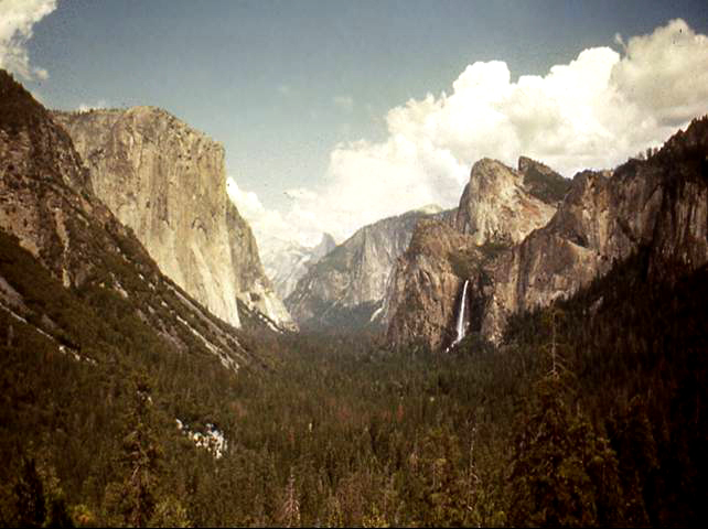
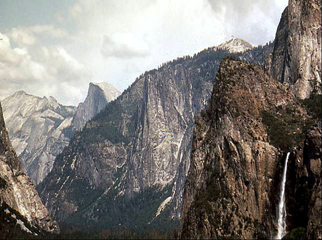
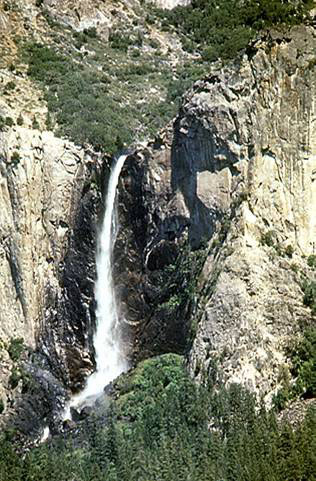
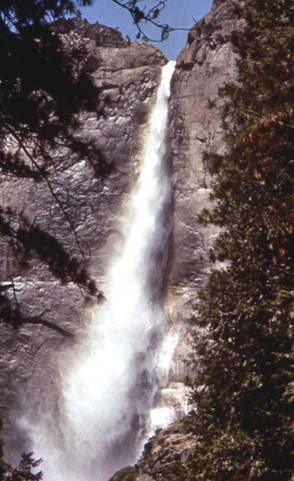
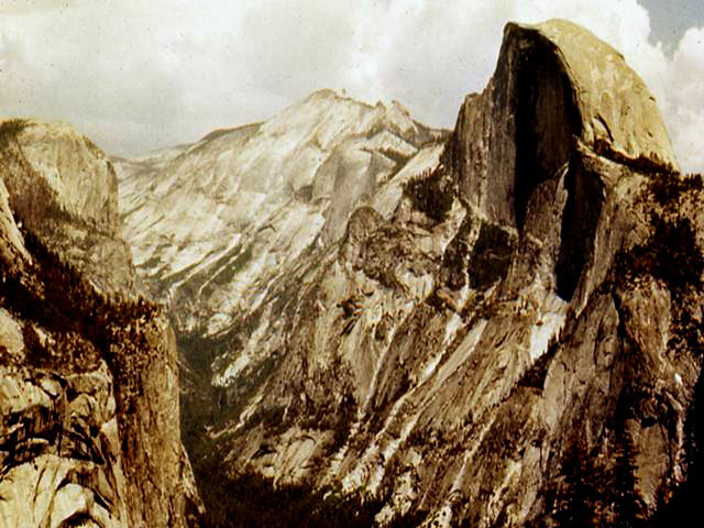
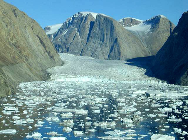
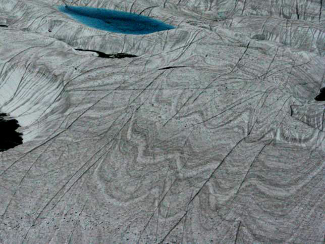
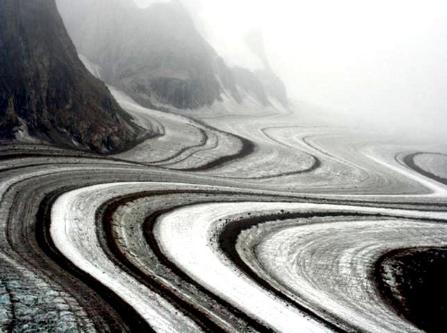
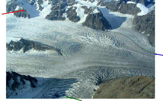
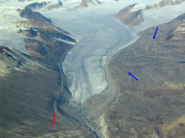
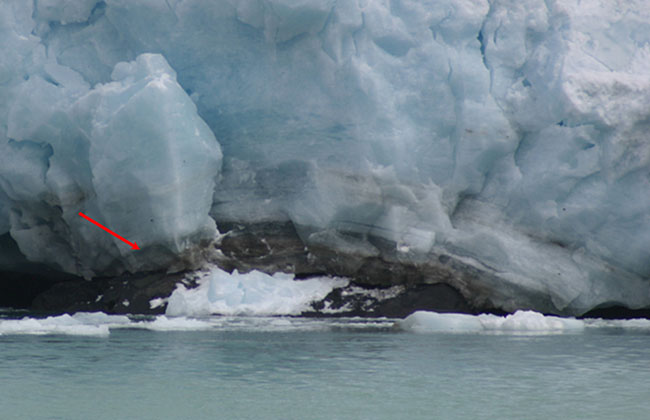
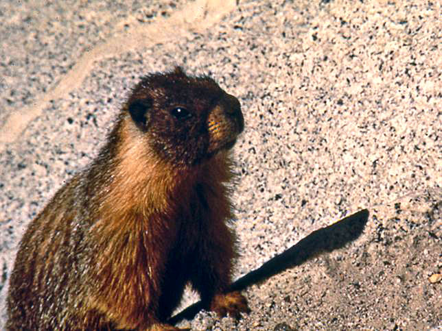
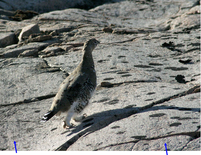
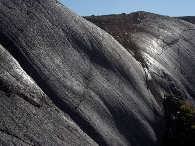
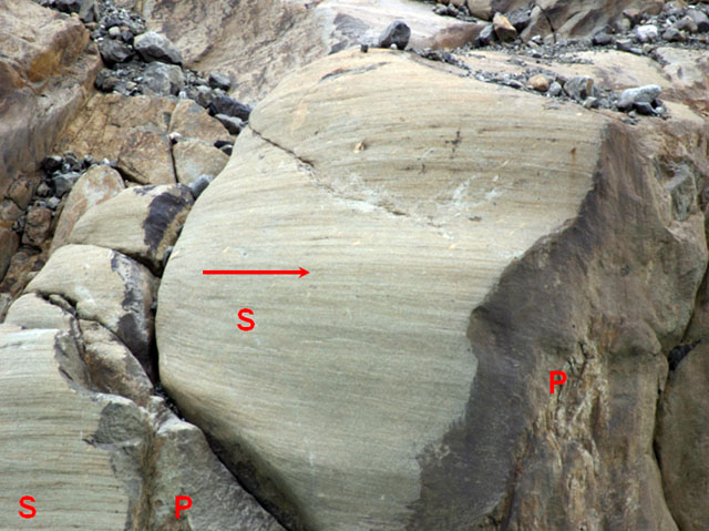
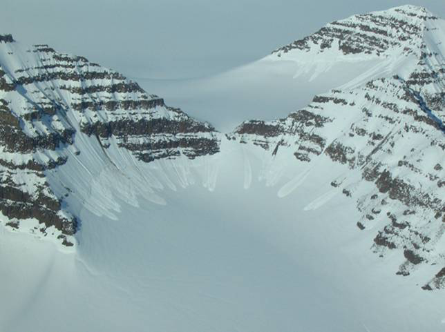
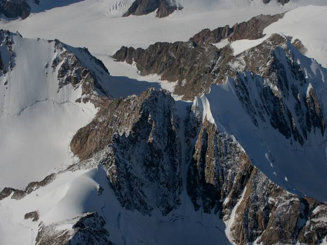
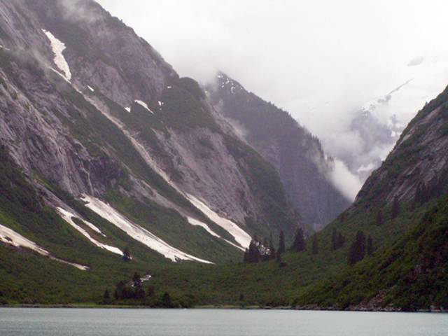
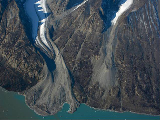
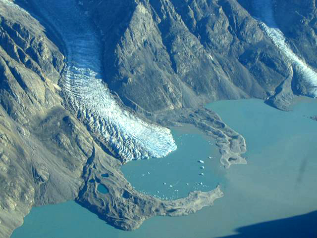
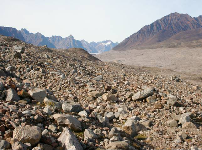
Image 1: Yosemite valley under cloudy skies. Forest in the foreground and mountains in the background. Bridalveil Falls on right in distance. Tracking the Great Glaciers from Yosemite to Greenland and Alaska. Yosemite truly is an incomparable valley. Bridalveil Falls, on the right, is a hanging valley; its small glacier did not cut downward as rapidly as the main glacier. All photos by R. Alley.
Image 2: Yosemite valley under cloudy skies. Bridalveil Falls in the foreground to the right. Closer view of Bridalveil Falls, right. The U-shape of the valley of Bridalveil Creek shows that it was glaciated.
Image 3: Close-up of Bridalveil Falls, Yosemite. Rock cliffs to each side of falls. Green shrubs just above the falls and forest below. Bridalveil Falls, Yosemite National Park. Bridalveil Creek has just started to cut a notch into the U-shaped cross section of the former glacial valley. The rapids at the bottom of the waterfall is running on rocks dumped there by the creek; eventually, the waterfall will be completely transformed into a rapids unless another ice age brings glaciers to re-form the waterfall.
Image 4: Close-up of Lower Yosemite Falls under blue sky, Yosemite National Park. Rock cliffs to each side and large evergreen in right foreground. Lower Yosemite Falls, Yosemite National Park. The numerous waterfalls of the park exist because the ice-age glaciers eroded the tremendous cliffs of the valley.
Image 5: Yosemite Valley, California. The deep, U-shaped valley was carved by glaciers. Half Dome above Yosemite Valley. A glacier flowing to the lower right deepened and widened the valley; see the next slide for a modern example.
Image 6: A valley in east Greenland that is about the same size and shape as Yosemite, but still contains the glacier that is carving it. Glacier draining Greenland Ice Sheet into head of Scoresby Sund, NE Greenland National Park. The scale is similar to that in the previous picture. Yosemite’s glaciers ended on land; this one calves icebergs into the fjord.
Image 7: Ice sheet, NE Greenland National Park. Wave-shaped folds are visible, showing flow of ice. Bright blue meltwater lake visible, top left. Near ice-sheet edge, NE Greenland National Park. The folds show that ice flows. Blue at top is a meltwater lake; such lakes may drain to the bed.
Image 8: Corridoren Glacier, Greenland. Very visible medial moraines, dark and light wavy stripes. Corridoren Glacier, Greenland. The stripes are medial moraines, rock debris picked up from ridges where two tributary glaciers join.
Image 9: Tributary glaciers joining in NE Greenland National Park. Arrows point to accumulation area, lakes in ablation zone, and medial moraine. Several tributary glaciers joining; flow is to right. NE Greenland National Park. Accumulation area in cirque (red arrow), lakes in ablation zone (green arrow) and medial moraine (blue arrow) are visible.
Image 10: Glacier in east Greenland, with high-elevation accumulation zone, low-elevation ablation zone, and older, lower elevation moraines. Accumulation zone in cirques (top), ablation zone (bottom), 150-year-old moraine (red), subtle, 11,500-year-old moraines (blue), NE Greenland Natl. Park.
Image 11: Close-up of glacier in south Greenland. Arrow points to debris-bearing basal ice. Water in foreground. Debris-bearing basal ice (red arrow) of a glacier in south Greenland. Rocks in such ice sandpaper, or abrade, the bedrock beneath as the ice moves.
Image 12: Close-up of a marmot on granite that has been abraded by debris-bearing glaciers, highlands of Yosemite National Park. The granite behind George the marmot has been abraded by debris-bearing glaciers, in the highlands of Yosemite National Park.
Image 13: Close-up of a Rock Ptarmigan on glacially striated granite, east Greenland. Arrows point to striae which are faint lines on rock. Rock ptarmigan on glacially striated granite (striae are faint lines on rock; a few of many are shown by blue arrows), east Greenland.
Image 14: Glacially striated and polished bedrock under blue sky. East Greenland. Glacially striated and polished bedrock, east Greenland. Ice flowed up the cliff from the lower right.
Image 15: Glacially abraded and plucked rock in fjord wall S. Greenland. Arrow shows ice came from left. “S” marks scratched area, “P” plucked area. Glacially abraded and plucked rock in fjord wall, S. Greenland. The ice came from the left, as indicated by the arrow, scratching/abrading (S) some places and plucking (P) others. Picture is about 10 feet across.
Image 16: Several small snow avalanches into a cirque surrounded by layered rock peaks, east Greenland. Small snow avalanches into a cirque, east Greenland. The layered rocks are flood basalts from opening of the Atlantic Ocean.
Image 17: Horn, Stauning Alps, NE Greenland National Park. Several cirques intersect and leave a towering peak. Horn, Stauning Alps, NE Greenland National Park. Several cirques have intersected to leave this towering peak.
Image 18: U-shaped valley in Tracy Arm Wilderness Area, Alaska. Thick cloud cover, highway in foreground. U-shaped valley from glacial erosion, Tracy Arm Wilderness Area, Alaska.
Image 19: Aerial view of moraines around retreating glaciers, Aple Fjord, NE Greenland National Park. Moraines around retreating glaciers, Alpe Fjord, NE Greenland Natl. Park.
Image 20: Aerial view of moraines around retreating glaciers, NE Greenland National Park. Moraines around retreating glaciers, NE Greenland Natl. Park.
Image 21: Deposits of Bjornbo Glacier, NE Greenland National Park. Rock pieces in foreground and mountains in background. Deposits of Bjornbo Glacier, NE Greenland Natl. Park. Ice was here about 1850. Glaciers carry pieces of different sizes, which make till when deposited.
Virtual Field Trip #2: Glacier, Glaciers and Glaciation: The Ice Really Was Bigger, Glacier National Park
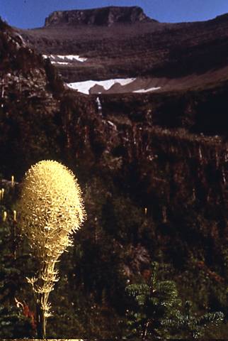
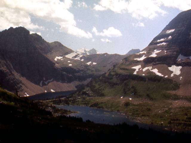
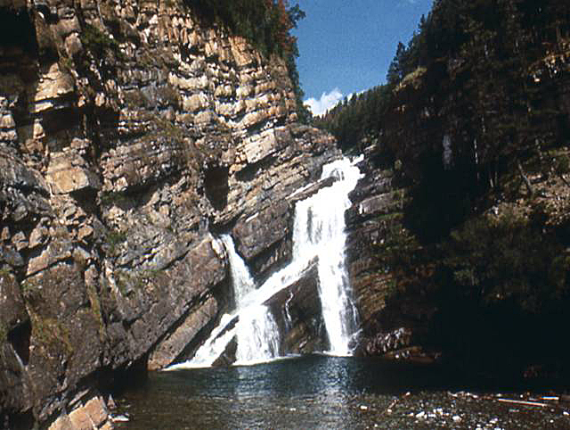
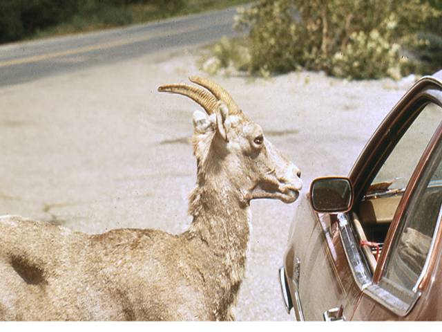
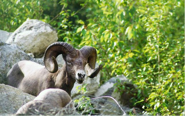
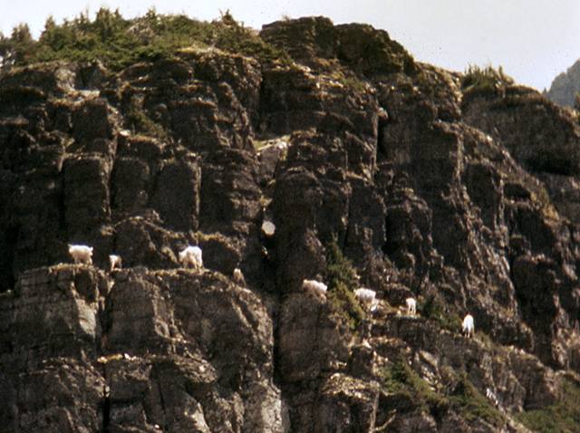
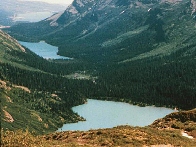
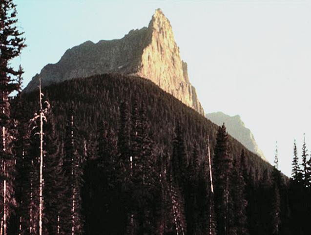
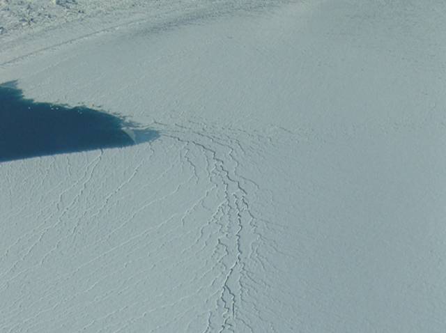
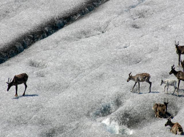
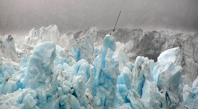

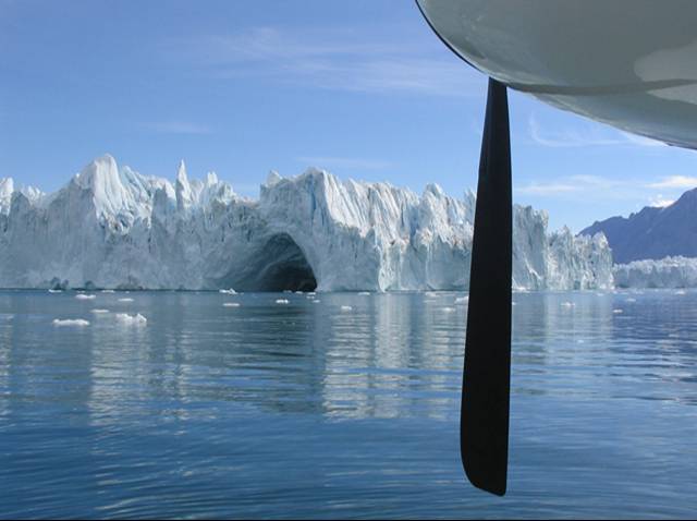
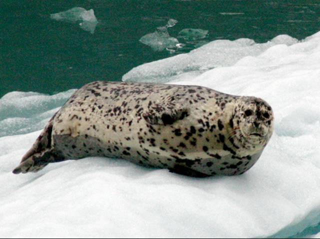
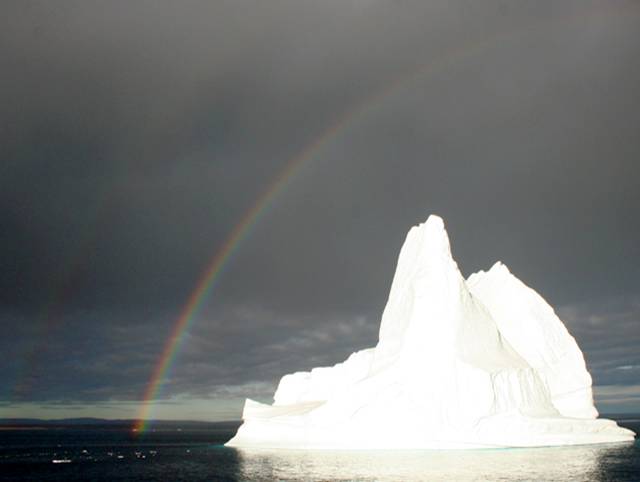
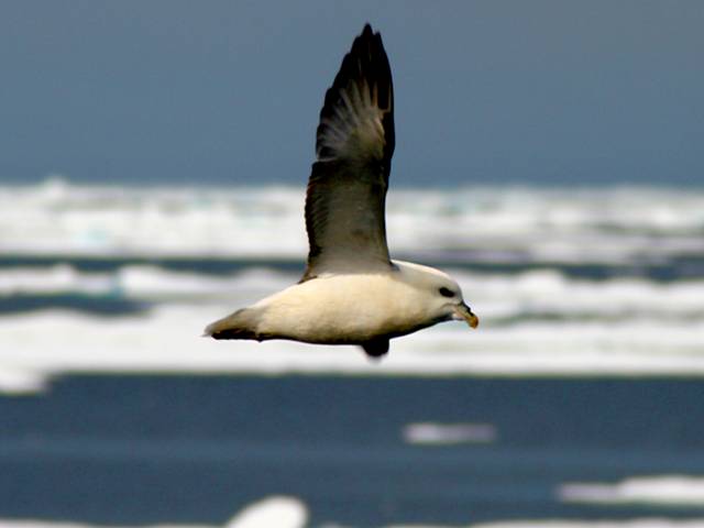
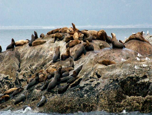
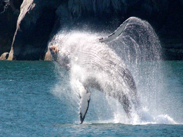
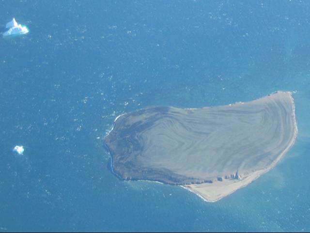
Image 1: Glacier-free cirque under blue sky in Glacier National Park, Montana. Bear Grass blooming in left foreground. Bear Grass (really a lily, not a grass) blooming in a glacier-carved but now glacier-free cirque along Going-to-the-Sun Road, Glacier National Park, Montana. All photos by R. Alley, except for some of the Alaska pictures, which are by either R. Alley, C. Alley, J. Alley or K. Alley, and we’re not sure on some of them because we kept trading cameras.
Image 2: Glacier-carved scenery, Logan Pass, Glacier National Park. Snow-spotted mountains under cloudy skies, water in foreground. Glacier-carved scenery, Logan Pass, Glacier National Park.
Image 3: Comeron Falls, Waterton Lakes, Alberta, Canada. Water falls from different heights and at different angles. Cameron Falls, Waterton Lakes, Alberta, Canada (Glacier-Waterton Lakes International Peace Park). The rocks were folded by mountain-building, and the waterfall follows the bent layers.
Image 4: Female bighorn sheep at driver’s side window of car. Glacier National Park. Female bighorn sheep, Glacier National Park. In search of salt, she was going from car to car, licking steering wheels where perspiring hands had left deposits.
Image 5: Male bighorn sheep among boulders, greenery in background. Canada, near Glacier National Park. Bighorn sheep. This ram was over the border in Canada, but surely has relations in Glacier.
Image 6: Eight mountain goats on mountain side in Glacier National Park. Mountain goats are aptly named. Glacier National Park.
Image 7: Glacier National Park. Valley with green mountainsides and two “paternoster” lakes in view. Glacially carved “paternoster” lakes, Glacier National Park.
Image 8: Cliff in Glacier National Park, that was eroded when it was the side of a glacier that since melted away. Glacially truncated cliff. The ridge on the left was cut off by a glacier that reached at least as high as the sunlit peak, and that flowed over the point where the photographer stands. Glacier National Park.
Image 9: Surface of Greenland Ice sheet with view of melterwater stream entering blue lake at left center. Meltwater stream entering lake, surface of the Greenland Ice Sheet. At higher elevation, the ice-sheet surface is just snow. Such ice sheets now cover 1/10 of the Earth’s land, but during the last ice age covered almost 3 times more.
Image 10: Eight caribou on the dulled white surface of the Greenland ice sheet. Caribou on the surface of the Greenland ice sheet, here about 1 mile from the edge, avoiding mosquitoes. Healed crevasses are evident. This is in the ablation zone, and meltwater plus wind-blown dust have dulled the white snow.
Image 11: Margerie Glacier, Glacier Bay National Park. Blue ice visible in foreground, background glaciers grey. Bald Eagle sits on peak in center. Bald eagle (arrow) on top of Margerie Glacier, Glacier Bay National Park, Alaska. Glaciers can be large. Glacier ice is blue, as seen here, for the same reasons that water is blue (preferential absorption of red by water molecules).
Image 12: Bald Eagle sitting atop a flag pole in Sitka, Alaska, near Glacier Bay National park. Bald eagle, Sitka, Alaska, near Glacier Bay National Park, in case you wanted to know what the bald eagle in the previous picture looks like. Mostly, this is an excuse to stick in a cool picture.
Image 13: Northwest Fjord, east Greenland. Iceberg under blue sky and surrounded by blue water. Float-plane propeller right foreground. Iceberg behind float-plane propeller, Northwest Fjord, east Greenland. The berg reaches about 400 feet above the water, and is close to one-half-mile long.
Image 14: Harbor seal on small iceberg, Glacier Bay national Park, Alaska. Harbor seal on very small iceberg, Glacier Bay National Park, Alaska. Glaciers lose mass either by melting, or by calving icebergs.
Image 15: Cloudy skies and double rainbows over a bright white iceberg in Scoresby Sound, NE Greenland National Park. Rainbow above iceberg, Scoresby Sound, NE Greenland National Park. Icebergs are highly relevant to the study of glaciers and ice ages, but we’re not above sticking in pictures primarily because they’re pretty.
Image 16: A Fulmar in flight over a sea of ice, NE Greenland National Park. Fulmar in front of sea ice, NE Greenland National Park. Sea ice is frozen ocean water, usually less than 10-20 feet thick. Icebergs calve from glaciers formed from snowfall, and can be more than 1000 feet thick and the size of small states.
Image 17: Marble Island, Glacier Bay National Park, Alaska, covered with sea lions. Marble Island, in Glacier Bay National Park, Alaska, was scoured smooth by glaciers, and is now home to numerous sea lions.
Image 18: A bald eagle soars among a large number of sea gulls and ravens at South Marble Island, Glacier Bay National Park, Alaska. An immature bald eagle (arrowed) concerns the gulls and ravens of South Marble Island, a glacially scoured rock in Glacier Bay National Park, Alaska.
Image 19: A humpback whale breaching in the fjords of Glacier Bay National Park, Alaska. The deep, glacially carved fjords of Glacier Bay National Park and surrounding Alaska are home to humpback whales and other charismatic macrofauna (big, cute critters).
Image 20: Small island in Kong Oskar Fjord,Greenland, with raised beaches that formed as the island rose from the ocean. Raised beaches form a bulls-eye on this small island in east Greenland. Melting of ice sheets raised global sea level at the end of the ice age, but some regions that had been depressed under the former ice sheets rebounded faster than the sea rose, raising beaches out of the water.
Image 21: Satellite image of Chesapeake Bay, an old river valley that was flooded by the rising sea as the ice-age sheets melted. Satellite image of Chesapeake Bay. Geological study of the Bay and its surroundings confirms what you can see by inspection: the bay is a drowned river valley, indicating either that sea-level rose or the land fell fairly recently (mud is filling the bay; if the change happened a long time ago, the bay would be filled). Similar features along many coasts, including those being raised tectonically, show that sea level rose rather than the land falling.
Virtual Field Trip #3: Bear Meadows
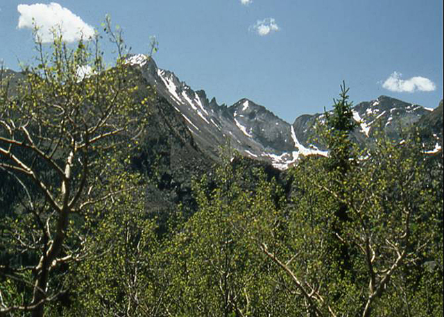
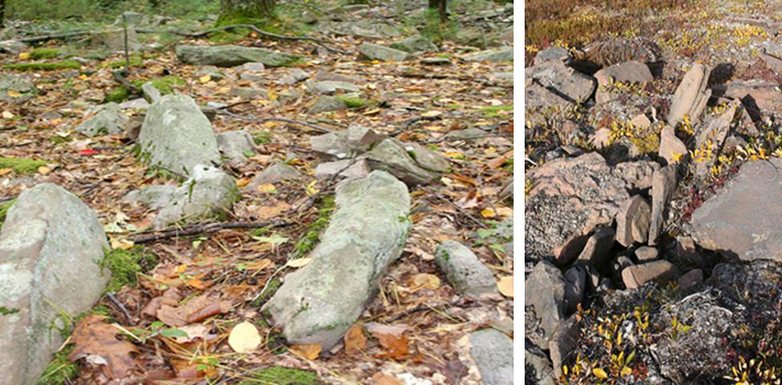
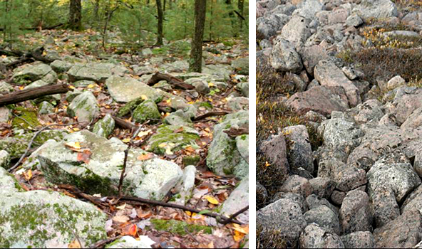
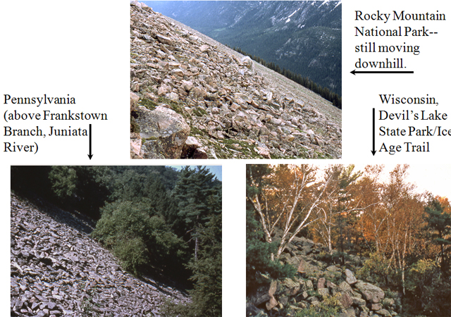
Image 1: Snow spotted Rocky Mountains, greens trees in foreground. What do Rocky Mountain, Bear Meadows, and Greenland have in common? Hint: It’s cold up there on top of Rocky Mountain… All photos by R. Alley, maps from USGS and NOAA
Image 2: Three side-by-side close-ups of flowers. On the left, spotted coral-root orchid. Center, Glacier lily. Right , blue columbine. First, some Rocky Mountain wildflowers. left: Spotted coral-root orchid, middle: Glacier lily, right: Blue columbine.
Image 3: Maps of ice-age ice, which covered almost 1/3 of modern land areas, and modern ice, which covers only about 10% of the land area. http://www.ncdc.noaa.gov/paleo/slides/slideset/11/11_177_slide.html National Geophysical Data Center, NOAA, Mark McCaffrey The last ice age was most intense between about 24,000 and 18,000 years ago. This image re-creates the northern hemisphere about 18,000 years ago (left) and today (right). Notice that broad areas now submerged were exposed during the ice age by the lower sea level (e.g., green areas west of Alaska), and that both land ice (white) and summer sea ice (gray) were more extensive then. Southern-hemisphere changes were smaller. Also notice that the ice came close to Pennsylvania.
Image 4: Map showing that ice-age ice extended into the U.S. from Canada. http://www-atlas.usgs.gov/articles/geology/features/glaciallimit.html This map from the USGS uses distinct colors for different geological units. The white line shows how far south ice-age ice came from Canada. The “Driftless Area” in Wisconsin (white outlines and arrow) was missed by ice, which was channeled south along Lake Michigan and west along Lake Superior. Numerous flooded river valleys including the Chesapeake Bay (yellow arrow) are evident. Bear Meadows (pink arrow) and surroundings were beyond the Canadian ice, but must have been very cold when ice was close.
Image 5: Bear Meadows, State College, PA. Water and water grasses in the foreground. Forest in the background. Bear Meadows, above State College, PA, occurs where natural wetlands are rare. Sediment cores indicate that the bog formed during the ice age.
Image 6: Picture from east Greenland of a “striped” hillside because of downhill creep of rocks and plants formed on permafrost. Permafrost enhances mass movement (downhill creep). Direct measurements have documented motion of roughly 1 inch per year. Such downhill motion can move a lot of rocks over time, and might dam a stream occasionally. Shown here is a permafrost hillside roughly 1/2 mile across, in east Greenland, with rocks creeping downhill toward you.
Image 7: Large band of rocks, some with patches of moss, surrounded by fallen leaves. Trunk of small tree is visible to the left. This band of large blocks has moved down to just above Bear Meadows from the ridgetop, most of a mile away. (Is it any wonder that Pennsylvania hikers need good boots to avoid twisted ankles?) Trees growing on some of the rocks show that motion is not occurring now.
Image 8: Patch of stones in Greenland, sorted by size into a unique pattern, as the result of permafrost. Permafrost often sorts stones by size, making fascinating patterns, as here in Greenland. Dr. Alley’s boot toe (bottom center) for scale.
Image 9: Sorted stone circle in central PA, surrounded by fallen leaves. Unfortunately, the best sorted stone circles in central PA are now obscured by leaves. Weak examples are shown here, with coarse clasts circling the finer centers, which are marked by the white “X” symbols in the lower left and right.
Image 10: Side-by-side images of large bands of rocks. Bear Meadows on the left and Greenland on the right. The tendency for moving hillsides in permafrost to align clasts tipped on edge can be seen in Greenland (right), and is evident above Bear Meadows (left).
Image 11: Side-by-side images of large bands of rocks. Bear Meadows on the left and Greenland on the right. Similarities in size and orientation of blocks in flows that have moved downhill are evident in Greenland (right) and above Bear Meadows (left).
Image 12: Three permafrost hillsides. Top, Rocking Mountain National Park. Bottom left, Juniata River, PA. Bottom right, Devil’s Lake State Park, WI. Top: Rocky Mountain National Park – still moving downhill. Bottom Left: Pennsylvania (Frankstown Branch, Juniata River) Bottom Right: Wisconsin, Devil’s lake State Park/Ice Age Trail Below all three images: Present and Past Permafrost Hillsides
Virtual Field Trip #4: Are Glaciers Really Changing?
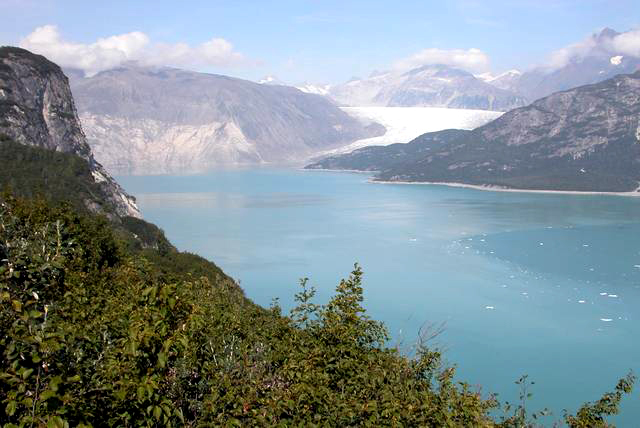
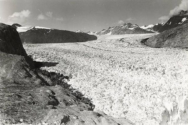
.jpg)
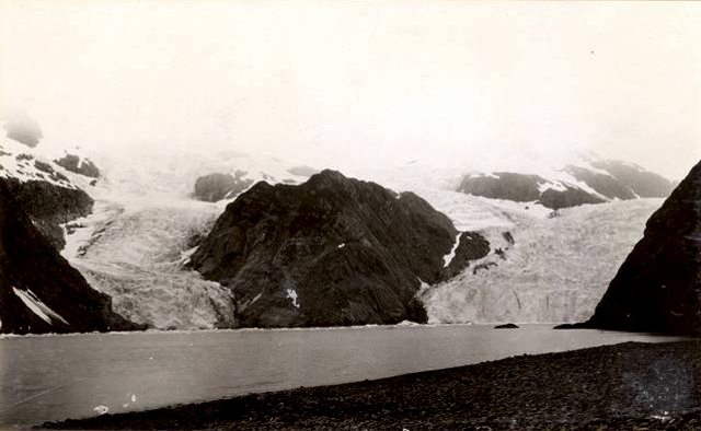
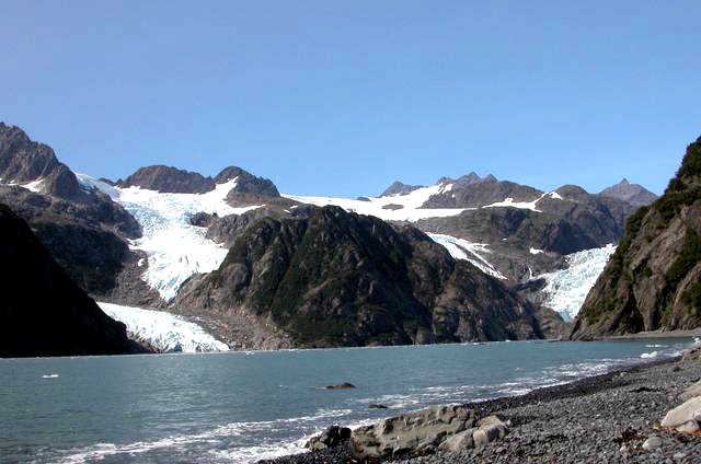
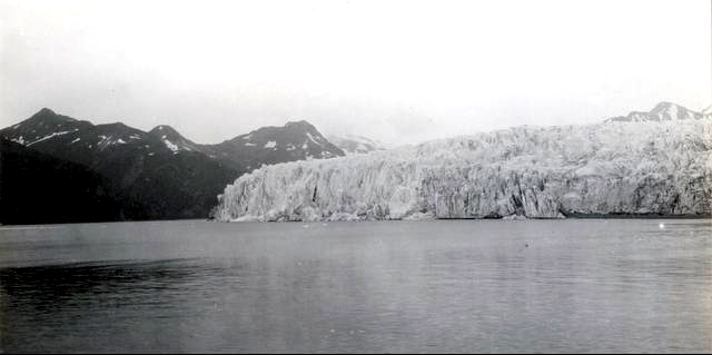
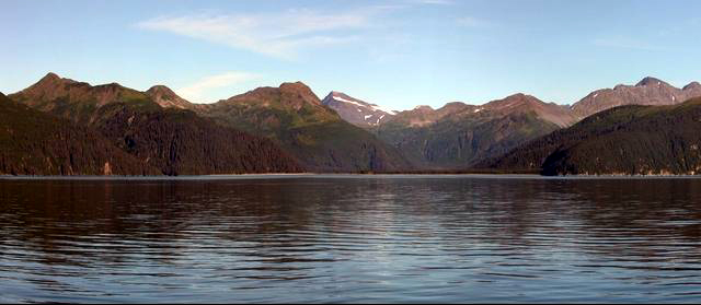
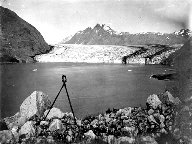
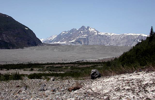
McCarty Glacier, AK, June 21, 2004, photo by B.F. Molnia.
Image 1: Muir Glacier, Alaska, 2004. Blue water in foreground, glacier in background, large amount of rock exposed. Are glaciers changing? Yes. Over the last century, and over the last few decades, essentially every glacier on the planet has gotten smaller. Over shorter times, the “fun things” glaciers do (surges, kinematic waves, etc.) have caused some to grow while others shrank, but overall shrinkage is strong. Here are some photo pairs, historical and more recent, assembled by Bruce Molnia of the United States Geological Survey, and archived at the National Snow and Ice Data Center. The lenses used are not always identical, but the photos are taken as nearly as possible from the same spot, and you should be able to see the changes clearly.
Image 2: Muir Glacier, Alaska in 1941. Glacier covers most of photo, no water visible. Muir Glacier, Alaska, August 13, 1941, photo by B.F. Molnia
Image 3: Muir Glacier, Alaska, 2004. Blue water in foreground, glacier in background, large amount of rock exposed. Muir Glacier, Alaska, August 31, 2004, photo by W.O. Field
Image 4: Holgate Glacier, AK, 1909. Glacier covers much of rock, water in foreground. Holgate Glacier, AK, July 24, 1909, photo by U.S. Grant
Image 5: Holgate, AK, 2004. Small amount of glacier visible, large portions of rock exposed, water in foreground. Holgate Glacier, AK, Aug. 13, 2004, photo by B.F. Molnia
Image 6: McCarty Glacier, AK, 1909. Large glacier in center, water in foreground, mountain visible to left in background. McCarty Glacier, AK, July 30, 1909, photo by U.S. Grant
Image 7: McCarty Glacier, AK, 2004. No glacier visible. Water in foreground, mountains in background. McCarty Glacier, AK, Aug. 11, 2004, photo by B.F. Molnia
Image 8: McCarty Glacier, AK, 1906. Rocky water’s edge and water in foreground. Glacier in background, in front of snow capped mountains. McCarty Glacier, AK, Aug. ??, 1906, photo by C.W. Wright
Image 9: McCarty Glacier, AK, 2004. Rocks in foreground, no water, melting glacier in background in front of snow capped mountains. McCarty Glacier, AK, June 21, 2004, photo by B.F. Molnia
Word Document of Unit 7 V-trips
GeoClips
This week, we feature two GeoClips, both featuring Dr. Alley. As before, we hope you enjoy these, and find them to be useful complements to the readings, class notes, and slide shows of Unit 7.
The Bear Meadows National Natural Landmark, just over the ridge from Penn State’s University Park campus, was recognized by the National Park Service in 1966 as a site that “possesses exceptional value as an illustration of the nation’s natural heritage.” Although many guide books somehow have decided that Bear Meadows is 10,000 years old, the Meadows are clearly much older, having formed during the last ice age. Here, take a walk just above the Meadows, and learn why Pennsylvania hikers, like those in the high country of the Rocky Mountains, are wise to wear sturdy shoes. Then, see what this has to do with the Formation of the Meadows—they really are related.
Rivers of Rocks and Permafrost
So why do hikers in Central Pennsylvania carry so many ace bandages? And the answer is that there's rocks on top of everything. All the trails in Central Pennsylvania are covered with rocks that are sitting up on a edge like this on top of the dirt. Why do the rocks get on top of the soil? And that story's sort of interesting. If you ever have a cat and you buy a bag of kitty litter, and you shake the bag and then you open it, you'll find the big pieces are on top.
You may find this in cereal boxes too that you'll get the big pieces floating to the top. And that's linked to a very simple geometric fact which is that little pieces can fall under big ones. And big ones cannot fall under little ones. If you want to find things like this that are happening today you won't find them here. These trees are not being rolled over by rocks that are moving. Our trees are perfectly happy here.
To find places where things like this are really moving today, you go to the top of Trail Ridge Road in Rocky Mountain National Park. You go to the North slope of Alaska. And there the ground is permanently frozen at some depth. And the rocks are slowly creeping down in the summer on top of that, lining up and turning up as the freezing and thawing move things around.
Here if you thaw the snow, it just soaks down through the rocks. It goes through the spaces. It goes down the river and it's fine. If it's frozen underneath, it can't soak down. And so you get soft mud that's full of water. It can't get rid of its water. It's sitting on top of slippery ice. What's it do? It slides downhill slowly. And so you go to the North slope of Alaska. You go to the top of Rocky Mountain. And all the hillsides are moving. And they're tipping the rocks up on edge and they're lining the rocks up in the direction they're going. And they're making things that look just like this without the trees. And so what we see here is a route of the Ice Age.
The Formation of Bear Meadows
So here we are at Bear Meadows, perhaps the biggest and best natural wetland in Central Pennsylvania. Natural wetlands, lakes, bogs, are fairly rare in Central Pennsylvania. And that's because nothing has been making them recently. And nature fills them up. Rocks wash in in streams. Trees fall and leave's fall. And wetlands fill up. So when you see a wetland, you have to say geology made this fairly recently. Or humans made it. And this one's natural.
If we were to go out into this bog and stick a pipe down in the mud about 20 feet and pull it up and split it open, the mud on top has sticks and leaves and twigs of things that live here today. At the bottom it has a remnants of things that live on the North slope of Alaska today. It has evidence of tundra. This formed during the Ice Age. Below that's rocks.
And so it's rocks and then Ice Age and then stuff that lives there today. So this formed when the climate was different. And it formed by those beautiful rivers the rocks that we were looking at just up the hill. When this was tundra, when this was the North slope of Alaska or the top of Rocky Mountain, the hillsides were creeping down in these great rivers of rocks. And one of those dammed the stream. And that made a lake. And since then the lake has been filling in to give us this beautiful wetland that's full of good things all year.
Want to see more?
Here are some optional animations you might also want to explore! (No, these won't be on the quiz!)
Glacier Physics
(An extensive collection of animations on this subject)
Glacial Landforms Resulting from Erosion and Deposition
(An extensive collection of animations on this subject)
Examples of Deglaciation
(An extensive collection of animations on this subject)
Video Lecture
The Unit 7 lecture features Dr. Sridhar Anandakrishnan and is 64 minutes long.
Good morning. Welcome to Geosc 10, Geology Of The National Parks. Today we're going to be talking about my very favorite subject in geology, glaciers. My name is Sridhar Anandakrishnan, and I'll be your guide through some of the most amazing scenery on the planet. And some of the most important geology that we have today, in my opinion. We're going to be talking about glaciers, and ice sheets, and sea level.
And sea level impacts you. You might never see a glacier in your life, but I guarantee that you know about how sea level affects beaches and coastline communities, and your life is going to be affected by that.
So, let's go and first have a quick look at some of these lovely places, and then we'll come back to the presentation.
Today's tearing down mountains. Glaciers are wonderful at destroying mountains. They're one of the best ways we have to both destroy mountains and to make them beautiful. If you didn't have glaciers, these mountains would look very, very different than what they do today.
This is Yosemite National Park in California. It's just up from San Francisco. You can fly into San Francisco, and drive, and you'll be up there in Yosemite in three hours, four hours, something like that. It's one of the most famous places because of people like John Muir, and the amazing photography that has come out there. Some of the history of the place. So, it's something that is almost legendary in conservation circles and in mountain climbing.
This is Bridalveil Falls over on the right over there. And the classic shape of that valley, going up from it, that U-shape for it tells us that this was glaciated. And we'll find out why that U-shape tells us it was glaciated.
And you just look at it way in the back, there. You have Half Dome. And there's probably people that are crawling up the side of it. It's one of the classic climbs of the world.
Here's a close up shot of that Bridalveil and showing that sort of rounded valley heading up from the falls.
Here's Lower Yosemite Falls. There's all these waterfalls all through there. We're on the lee side, the Pacific side of the Sierra Nevada mountains.
Remember last time we talked about, in the Redwood National Parks section, how we talked about when the winds, these wet, cool winds come along, and they start to rise up the mountain, and they get colder and colder, the air gets colder and colder, and then all the water gets squeezed out. Well, here's where it gets squeezed out. It gets squeezed out in Yosemite National Park. And so you've got tons of water pounding down through there. And then, you have these beautiful valleys, and then all the water comes cascading down the sides.
Here's another picture of Half Dome. The glacier was coming right down that valley. You can just imagine 20,000 years ago, if you were standing where this photographer was standing, you'd just see that whole valley filled up with ice all the way to the back, and that ice would be flowing towards you. And as it flowed along, it would be carving out that glacier, making it a deeper and deeper, year after year. And that's why you get these vertical walls.
This is a photograph not in Yosemite, but we've gone off to Greenland at this point. This is Scoresbysund. This is perhaps what Yosemite looked like. You can see there's a similarity. You have this big mass of ice coming down. You've got these huge walls going straight up. 20,000 years ago, instead of this minuscule amount of ice that we have in here— it's an enormous amount of ice, but 20,000 years ago, that ice would have been half a mile or a mile higher up. It would filled up that whole valley.
This is near the edge of the ice sheet. There's a blue pond at the surface. The ice here is perhaps half a mile thick. So, if you were to sit there, and take your shovel, and start digging, digging, digging, you'd have to dig for half a mile before you got to rock. And you can see those big folds where the ice is flowing down. A bunch of cracks and crevasses. If you're trying to travel across that, you could fall very easily into those. Absolutely dramatic, gorgeous.
This is [UNINTELLIGIBLE] glacier in Greenland. And you can see it flowing. Those big stripes coming down towards you, those are individual glaciers that all have come down and merged together. And you can still see those bands where they came together, and then as a valley curves, it comes down.
Here we have a bunch of tributary glaciers where the green arrow and the red arrow are that have come together, and these amazing, huge crevasse. I wouldn't want to be walking across that glacier. You'd just be falling into those holes all the time.
Another photograph of the glacier. Here we have some evidence, just the first beginnings of a clue that glaciers can change their size. The blue arrows are pointing at where the glacier used to sit just a little while ago. About 150 or 200 years ago, that glacier used to be at a different place. And we can tell that because of the color of the rock, and the marks on the rock. And then, the glacier has retreated back from there in the last few hundred years.
This is looking at the side of a glacier, and you have all of these debris bands in the bottom, and that tells us that glaciers aren't just these clean, beautiful, white, ice and snow masses. They also have all of this rock and mud and debris along the bottom. And so, here's a second clue that glaciers can modify the landscape. They can rip out rocks and carry them away, and here's evidence that they do that. And they're very good at doing that.
All the places in this country that have lakes— Minnesota, the land of 10,000 Lakes. The finger lakes in New York. The Great Lakes themselves, Lake Michigan, Erie, Superior. All of them are there because there was an enormous glacier—an ice sheet, really— that sat on top of North America, that filled all of Canada and flowed down into the northern tier of the US, and as it flowed down, it just churned out these big lakes and ripped them up.
Here are some of the critters that live in Yosemite National Park. And here are some more. These are not in Yosemite. This is in Greenland. Then, you can see these striations were the glacier came by. But now, the glacier's gone, and there are ptarmigan wondering across that landscape.
Here's another example of what glaciers can do. Glaciers flow across this, and they just polish it. It's like taking sandpaper and rubbing it for hundreds and thousands of years across this rock. You smooth it and striate it.
Just beautiful. Snow avalanches coming down. Just some of the most dramatic scenery. I've got a confession to make. I'm not really a geologist. I'm an engineer. I started out my life as an engineer, and I worked as an engineer. And then, I got a job to go to Antarctica and work on an engineering project. And I said, man, I got to keep doing this, and I became a geologist, just so I could go and work on glaciers, and understand them, and continue to go to these absolutely beautiful places.
Look at this. Look at that ridge running up there. If there hadn't been a glacier there, you wouldn't have that ridge. The glacier came along and literally chewed away at the side that mountain. And there was another one on the other side of the ridge that chewed away at it, and the two of them formed this sharp ridge that runs up the side of them. And then, where there's two or three of them that come together, you get these sharp horns that go up into these very, very steep peaks. You wouldn't have it unless you had glaciers doing that. This is some of the most beautiful scenery that I've ever seen.
This is in Alaska. Another one of those nice, U-shaped valleys where a glacier had come pounding down that towards us. It's all gone now. Where did it go? Why did it go? That's what we're going to be talking about today.
Here's another one. I can just sit here all day and just show you pictures, and I'd be perfectly happy. Unfortunately, we're going to have to go and talk about why this is important, and we'll do that next. Let me just run real briefly to Antarctica, and we'll see some pictures there. And then, we'll go to the real stuff.
So, this is Antarctica. The reason we want to go here is that Antarctica is the best analog to what Yosemite might have looked like 20,000 years ago. There's still huge glaciers in Antarctica. This is a mountain range that's 10,000 feet high. And that glacier almost fills it right to the top. Yosemite National Park, the mountains there are 6,000 feet high, and the glacier once did almost fill that valley. Same way here, and these glaciers do fill their valley. And so, we can study these glaciers and learn a lot about what Yosemite might have looked like 10,000 years ago or 20,000 years ago.
Here's [? Ketlet's ?] glacier that's coming down towards us. You can see those flow stripes. And as I said, those are enormous mountains, but there's only a little bit of them, maybe 2,000 or 3,000 feet, that are sticking up out of the snow. All the rest of that valley— and you can imagine if you ripped off that glacier, you'd have this two mile deep valley that would be sitting there, and you'd be standing there looking up these two mile high walls.
Here's a valley. This is a dry valley. It's in Antarctica. For fairly complex reasons, the glaciers can't get into this valley. They did at one time. They carved it out, and now they've retreated, and they have these frozen lakes in the bottom of them. But here, you have one of those two mile high valleys. We're flying over it in an airplane and looking down at it. And way in the back, way, way in the back, you have the main Antarctic ice sheet.
Here's the Transantarctic Mountains. You have these beautiful, layered sedimentary structures a long time ago. These were much lower, and then they were raised up over the last 100 million years or 150 million years. And now they stand 10,000, 12,000 14,000 feet high. And then, right behind them, you can see that white area there is the East Antarctic ice sheet flowing down towards us.
Here's one of those glaciers trying to get through the Transantarctic Mountains, coming down and flowing right around through all the rocks, and trying to erode it, and trying to deepen those valleys.
This is Mount Erebus. This is a volcano in Antarctica. You can see the steam rising up out of the top of it. There's a big lava pool up at the top. There's lots of people that go up there and study it. It's 13,000 feet high. And all the sides of it are ice covered. It's so cold in Antarctica that even though it's this huge mountain that is a volcano, and there's this bubbling lava pool at the top of it, you still have this mass of ice that's covering the whole thing.
This is Mcmurdo Station in Antarctica. This is where we do our research. We fly in here. You can see it looks kind of like a mining town. It's a very gritty place. There are no trees there. There's no vegetation there. The soil is all frozen, so you can't dig underneath it to put all your utility lines, and sewer lines, and electric lines. All of those run above.
So, it's just a very gritty place. But you've got to have that to do your research, to have the airplanes fly around, and so on. This is not one of the most beautiful places in the world, but hey.
This is a view looking out from Mcmurdo, out to the ocean. The ocean is frozen there. It's so cold that the ocean simply freezes over. In some years, it never opens up. Some years, it just remains frozen all through the summer. And then the winter comes, and it freezes, and then the ice just thickens. And that might happen for two or three years in a row, but usually that area does open out.
This is one of those distressing photographs. You got to have fuel to fly airplanes. These are big fuel tanks. And then right in the background, you have this absolutely beautiful shot of Mount Erebus rising up above the town.
There's some critters that live in Antarctica. The most famous, of course, are penguins. I've been down there many times, and I still am delighted every time I see one, because they're just such charming little fellows. And here we are, enjoying watching one of them who is looking at us as well.
And here's a close up. This is an Adalie penguin. They're about a foot and a half or so tall, and just as curious and fearless as anything. They have no predators on land, so when they're walking around on the snow here, they are not bothered if anybody walks around.
And he's off. We're not quite sure where he's off to, he or she. And off into the distance.
This is a penguin rookery. The penguins are displaying. They're sitting there sticking their head up. And those little circles of rocks— I don't know if you can see them— those are their nests. There are no twigs here. There's no place to put their eggs, except the only way to protect them is in these little circles of rocks. And so those rocks become really valuable. And they'll steal them from each other, and they'll get into these titanic battles. When the one steals it, they'll go and fight each other, and they'll bounce against each other. And it's quite serious to them. It's quite amusing us.
This is a view of Erebus stretching up above us, and in the foreground, you have a hut from one of the early explorers from 1910. This is Shackleton's hut. This is what he lived in through the winter before he went on his epic journey to try and get to the South Pole. He didn't succeed, but it was quite a story. There's a close up of his hut and one of my colleagues waiting to go into it.
This is a glacier. We're looking at a glacier. It's coming down towards us. The front of it is breaking off and falling down, but you can imagine— you have to imagine, because we're down below— that it just heads up and up and up the side of Mount Erebus for almost 10 miles. It's a huge glacier.
And here's some people for scale. So, there's these people walking around at the base of it. And that's not even all of it. Just as much as there is above, there's probably three times as much as that below the ground, below what we're looking at, below where those people are standing. The scale of these things is so majestic, it's hard to imagine.
There's a close up of it. You can see all the cracks in the face, and where it's going to break off, and the next chunk is going to fall off towards us.
Here's another picture of a glacier flowing down around the curve and coming towards us.
And to give you a scale of that glacier, off in the middle of the screen, there are two huts. Those are actually fairly big houses. They'd be a house that you might see around town over here. A nice, single story Cape Cod or something like that. These aren't Cape Cods, but that's about the scale of it. So, there's a couple of huts over there, and they're just dwarfed by the edge of the glacier, which you can see to the right of them.
And here's one of these glaciers coming down, and all destroyed, and cracked, and broken, and crevassed. And you can't travel over it, which is why it's nice to have helicopters and airplanes.
And here's another shot of it from the air. And a close up of all the huge seracs and crevasses. And another shot.
So, we're going to end this slide show. Here's one helicopters that we use to fly around. And I think I might have a couple more pictures here. Mount Erebus again, and Castle Rock in the foreground.
Even I don't want to end the slide show here, but —and here's how we move around on the surface with these snowmobiles in the storm. This was a pretty bad storm. You can see the wind blowing across the surface. And this is what we live in. Some tents. That's the tent that we spend two or three months in Antarctica, sleeping in and doing our work from. Putting up a bigger tent. It's cold down there. You've got to wear your parka, pull up your hood.
So, we've had a little tour of some lovely places around the planet. And now, we're going to find out what it all means. Why are there glaciers? How do they flow? How do we know that they came and went? Why was Yosemite filled with two miles of snow a long time ago, and it isn't today? Those are the sorts of things that we're going to be talking about. What glaciers are. Erosion by glaciers. How a glacier makes a hole. How did it make Lake Superior? How did a glacier make the finger lakes? How did a glacier make the 10,000 Lakes of Minnesota? Those kinds of things.
And then ice ages. What evidence is there for them, and why do they happen? Why did it get cold, and why did it get warm?
A glacier is very simple. It's a mass of ice and snow that deforms and moves. By deformation, I mean it simply changes its shape. It goes from here to there. It flows across the surface of the landscape. That's all it is. And it does so under the force of gravity. Glaciers flow when snow falls on the surface of the land and it doesn't melt, so it accumulates. If it's cold enough that the snowfall doesn't all melt and disappear, as it does around here, year after year —every year it snows here, too, but we don't have any glaciers. And the reason we don't is all that snow disappears in the summertime.
But if you go to a place where it's cold year round, that snow remains. And then, there's more snow that falls on it the following year, and more snow that falls on it the following year. And eventually, if the ice gets thick enough, then you form a glacier.
Where is it cold? It's cold at the North Pole, and it's cold at the South Pole. Why? If you remember from last time, we talked about that. The sun is shining on the Earth. At the equator, all the sun's rays just slam straight into the equator. And so, all that energy goes right onto the equator. Up at the poles, that same amount of energy is smeared across a larger area because of the curvature of the Earth. And so, it's colder at the polls, warm at the equator. If it's cold at the poles, then that snowfall doesn't melt.
If you go up high mountains, we talked about that last time. As you go higher and higher up, it gets colder and colder. And you get to a point where it's so cold that the snow doesn't melt in the winter time. That's where we could form a glacier.
Or if it just snows so much and the summers are relatively short so we can't melt all that snow in the summer time, then you could form a glacier. For example, in the Olympic Mountains, they just get so much snowfall that even though it's a relatively warm place, these aren't huge mountains, you can still form a glacier.
You have glaciers at the equator. You have glaciers on Mount Kilimanjaro in Africa. And the reason for that is, they're high, and they get a fair amount of snowfall.
If it's cold but you don't get a lot of snowfall, then the ground just freezes and you get what's called permafrost.
Glaciers move and deform because of gravity. Gravity is one of the key forces in geology. I've talked to you about it over and over again, many, many times. We talked about it with mass movement last time. We talked about it with convection cells earlier on. And here it is. It's coming at us again. It's how a glacier moves and deforms.
When you make a pile of anything, the highest spot in that pile will put more weight at the bottom than the lowest spot, or a lower spot, on that pile. So, there's more force under the highest spot and less force under the lowest spot. And like everybody else, glaciers respond to forcing, and they want to move from where there's high force to where there is lower force. And so, the glacier simply moves off to the left.
I'm going to go to the drawing tablet now, and we're going to sort of summarize this part of it.
Here's the ocean. Everything always starts with the ocean. Here's land. And we're going to put some trees on land. And we're going to put some houses on here. And then, we're going to have it snow. We get water that evaporates from the ocean. It gets blown up onto land, and it starts to snow, and we'll show snowfall as these little X's, and down they come. It's snowing on the land.
And if it is cold enough, that snow will make a pile. And if it's cold enough, and the snow doesn't melt, it'll make a bigger pile. And a bigger pile. And a bigger pile, year after year. Until the weight of that pile gets large enough that the glacier wants to start— I'm going to remove these little snowfall marks, because it doesn't snow inside a glacier. It only snows on the outside. So, we'll get rid of some of these things.
So we've got a pile of snow and ice. And if we make that pile big enough, it will start to flow off to the sides. And the reason for it is that the force here is high. Why? Because it's got lots and lots of ice sitting on top of it. Lots of ice.
And the force here is low. Why? Not so much ice on top.
And so, the ice flows from where the force is high to where the force is low. It flows off to the side like this, and it flows off to the side like that.
This sketch has gotten a little messy. I'm going to start it all over again. We'll put the ocean in. We'll put the land in. And we'll put in our glacier. Now we've built this big pile of ice, and it's flowing off to the side. And when it gets to the edge, it will melt. And the water will simply run back into the ocean.
So why doesn't that pile disappear? It's flowing off the side. It's melting. It's going off. And the reason it doesn't disappear is it's still snowing on top. If you remove material off on the edge, if you add material up on top, and you flow from the one to the other, you can keep that glacier at its same size. If you get it just right, if you melt just the same amount as you add on top, and you flow that from the one spot to the other, and you do this continuously over and over again, that mass of ice isn't going to change its size. It's going to stay the same year after year.
This is known as the accumulation zone. That's where snow accumulates. Simple enough.
This is known as the oblation zone. Oblation is a fancy word for removal. To oblate is to remove. The oblation zone is where you remove ice and snow.
And then, the red line indicates flow from the one to the other.
We got to finish this picture out with one more thing, which is evaporation of ocean water followed by transport inland. And then that ocean water deposits as snowfall.
So do you see that cycle? You get evaporation in the ocean. It comes inland. It falls onto the accumulation zone of the glacier. It flows down to the oblation zone. It melts, and it goes back to the ocean. And if you get it just right, the glacier doesn't change its size and the ocean doesn't change its size.
And if the temperature is constant, then the system will come to equilibrium. It will come to a spot where you are removing just as much as you're taking in. And year after year, the glaciers will stay the same. If you change the temperature, if you start to warm things up or to cool them down, then that balance will shift. And that's what we'll talk about.
So this is how a glacier works. It flows from the accumulation zone to the oblation zone, and it does so under the force of gravity.
Glaciers always move from the high to low spot. The high on the surface of the glacier, what do I mean by that? Here we have that mass of ice and snow with the rock underneath it. The rock is relatively flat. The glacier will always flow from where it is high to where it is low.
Not the rock underneath. The rock underneath, you can see, is pretty flat. And the analogy is if you take a bowl or plate, and you start ladling molasses onto it, or you start to ladle pancake batter onto it. As you make a pile, and you keep ladling material into the middle of your plate, what happens? It isn't if your pile just goes straight up in the sky as you ladle onto it. Your molasses just doesn't build up and up and up. It flows off to the side. And which way does it flow? It flows away from where that pile of molasses is high to where that pile of molasses is low. That's all that glaciers do. They flow from where they are high to where they are low.
And in fact, they can even flow— I'm going to go to a new page. Now, we're going to have a glacier sitting in a bowl. The glacier will still flow in that direction even though the rock underneath slopes up. Doesn't matter. Even though that rock slopes up, the glacier will still flow in this direction because the top of the glacier is higher there.
Now, there's a limit to this. If you make the rock really, really steep, then at some point the glacier won't be able to climb that hill. But you have to get pretty steep. You have to get 10 times as steep as the slope at the top of the glacier for the glacier to change direction and head down.
So, this is flow of glaciers. And the balance, the hydrologic balance of evaporation and accumulation and oblation.
We're going to go back to the presentation, and then we'll come back to this drawing tablet in a minute.
Whoops.
Glaciers move from where the surface is high to where their surface is low. "Their" surface. Not the surface of the rock that they're riding over, but their surface themselves. They can even move uphill, like pancake batter flows up the sides of a bowl when you pour it into a bowl. The pancake doesn't all congeal right in the bottom of the bowl. It can actually lap up the sides of the bowl and eventually drip over the edges if you keep pouring more and more into it. The North American glaciers came up into Pennsylvania, and they flowed uphill into the mountains of Pennsylvania because of this process.
And here we have a cross section of a glacier. And you have flow of it from the left, in this case, where it says "Lake Ontario," to the right, where it says "Pennsylvania." Even though Pennsylvania's higher up than Lake Ontario— State College is higher than the bottom of Lake Ontario— when the ice filled it, the ice actually flowed, quote, "uphill." The rock heads uphill, but the glacier itself, the top of it, was sloped from Canada down towards the US. The glacier was higher in Canada than it was in the US, and so it flowed from the high spot of the glacier to the low spot.
When glaciers flow and deform, they don't just move as a mass. They don't just simply have this big fat thing, and the whole thing moves together. They actually deform and change their shape. And that's what's shown in the bottom graph, and I'm going to go back to the tablet and illustrate that.
We'll use that same picture that we had on the presentations. We have the glacier that looks like this. And the bottom of it looks something like that. This is Lake Ontario, and this is Pennsylvania.
If you were to drill a hole down through this glacier, a nice, straight hole— and people do that all the time. They do it to sample what's underneath. They do it to see how thick the glacier is. They do it to sample the ice itself. So, there's lots of reasons for doing it. You drill this hole in the ice, and you come back a year later or two years later, and you measure what that whole looks like. It won't be straight anymore.
If you come back in a year, that hole will look something like that. The top moved a lot. And by "lot," I mean 100 feet, 500 feet. Maybe as much as 1,000 feet after a year, maybe as much as 5,000 feet after a year. So glaciers don't move enormously fast. In a year, they flow anywhere from a few feet to a few thousand feet, but they don't move as fast as you or I could walk, for example.
So, the top has moved a lot. The bottom has moved a little. And there is this curve in between where different places inside of the glacier have moved different amounts.
So, the top is always moved the most. If I were to stand here on the top, I would always move forward, ahead of a marker at the bottom. But it isn't a straight line. It isn't a flat line. It's this sort of complicated curve. And this is a big area of research. People want to know what shape will that hole look like after a year or after 10 years, because it tells us a lot of a glacier flow. But this is a very simple thing, is you have deformation within the glacier that will change the shape of the glacier.
Now, in addition to that, you also have sliding. of the glacier over the base, over the rock. So, glaciers can slide as well. They might slide a little, they might slide a lot. It really depends on how much water there is down there.
And you can have water underneath glaciers. Even though glaciers are ice and snow, and they're very cold at the top, they can be very warm at the bottom because of the heat that's coming up from inside the Earth. And where is that heat coming from? You know, radioactive decay. Remember that. The inside of the Earth is hot. That heat is coming up. It's coming up all around us. If you look down, you'll see heat come up through your feet. You won't be able to measure it. There isn't a lot of it. But there's enough that the bottom of the glacier is warm.
So, you get sliding of the glacier over the base, and that's where the erosion goes on. As a glacier slides along, it rips up the rock, and it destroys the rock. It pulls it up and carries it away, and you have erosion of rock as the glacier slides along.
Let's go back to the PowerPoint.
Glaciers with lots of water at the bottom are good at eroding. If you get lots of water down there, then you get this sliding mechanism. Instead of simply having deformation within the ice, you get sliding at the bottom, and then the glacier can pull up bits of rock and carry them away. "Plucking" is when the glacier literally breaks loose small rocks. You have this big mass of ice. There'll be some small crack in the rock, and it will break off or pluck a piece of rock away and literally carry it off.
"Abrading" is when the glacier drags those small rocks. So, it's plucked one of these small rocks, and it's carrying it away. And as it's carrying it away, that rock acts like sandpaper. It actually scrapes away at the rock that's still underneath the glacier, and then will break off small bits of other rock that will also then be carried away and washed away because of all this water that's down there.
Any water flow under there really helps. If you've ever done any woodworking, you know that your sandpaper will get clogged after a while. You got to clean it off. This is the same thing. So, as you rub at this, if there's water underneath the glacier, that water will simply wash away all the loose material, and then you'll have this clean surface to rub some more. The water will wash away the loose material, rub some more, and the glacier will dig down and down and down, and deeper into the rock underneath.
Here's a picture illustrating that. Both you have plucking on the one side, abrasion on the other side. If you get one of these sort of sloped rocks underneath there, then you can have both of those processes going on. The ice is flowing over these, and it's plucking and abrading. And over time, it will carry that material away, and it will keep digging down deeper and deeper.
And here's an example from the Alps where the glacier would have flowed from right to left across there, and that face we're looking at is where all of the rocks were plucked away and gone. And the glacier, of course, is gone, but this is what the bottom of the glacier would have looked like when it was there. It's smooth on one side where the glacier came from. It's rough on the other side. It's known as a roche moutonnee or rock sheep, that looks a little like a sheep, sort of a rounded thing with this fuzzy edge on the side of it.
The abrasion can be seen. Anywhere there's been glaciers, you get these smooth, polished surfaces with these long, straight lines on them. And the long, straight lines always point in the direction that the glacier was heading. And those long, straight lines are simply from those rocks that it plucked. As they get dragged along the remaining rock, it just leaves these long striations and stripes on there.
The net result of doing all this work of abrading, and plucking, and going on and on, is to build mountains. When the glacier was there, it was just tearing away at the mountains, and it leaves these huge valleys, these deep valleys. And because glaciers are very wide and broad, the valleys that they leave behind are very wide and broad and rounded. And that's why a classic glaciated landscape, like the photographs we saw in the beginning of Yosemite, have this rounding to them.
As you go higher up the valley, and you get to the top, you get to where these glaciers have been chewing away at the side, and you get these very sharp ridges between them. And then if two of these glaciers come together or three of them come together, you get these very sharp-sided features that are diagnostic of glaciated landscapes. U-shaped valleys, hanging valleys, rounded bowls, and sharp ridges and sharp mountains. These are all the things that you'll see if you go up to Glacier National Park, for example.
Glaciers are really, really good at eroding. The finger lakes are there because the glaciers. The Great Lakes are there because of glaciers. The 10,000 Lakes of Minnesota are there because of glaciers.
Streams make a very different landscape. A stream can cut down really sharply where it is, but streams are generally not a mile wide. Streams are usually a few 10s of feet wide, or 100 feet wide, or something like that. You can go out, you can look at your stream that's out there. And they're really good at eroding, too. And they're really good at cutting down. But they're not good at cutting down across broad territories. They'll cut down right here, and then more rocks will fall in and they'll cut down, and more rocks will fall in. And so you get these V-shaped valleys when a stream has been there for a long time.
Any time you drive around here, and you look at the shape of these valleys, and they have these really sharp Vs to them, you know that a stream's been going through there. You go to Glacier National Park, you get these nice, rounded, broad U-shaped valleys.
And here's an example of one of those. Nice, beautiful, rounded valley, broad across the bottom. Now there's a stream running down the middle of it. And if you leave that situation alone, and you let that stream run in the middle of it for 50,000 years, that stream will cut down, and cut down, and it will turn it into a nice V. But because the glacier's only been gone for a few thousand years, it's still rounded and U-shaped.
Here's one of those lakes that's left behind from the glacier. And here's another fjord. This is an arm of the ocean that's come in. The glacier used to flow down through there. The glacier went away and the ocean came running back in.
More, just beautiful, alpine scenery and glaciers. Here's one of those really sharp features where the glacier's eaten away at the side of it and left these sharp ridges.
This is the Matterhorn. Very, very famous mountain in Europe on the French-Swiss border. And the reason it is three-sided like that— there's two that you can see and one more on the side, on the other side— is there were three glaciers on the three sides that were eating away at the side of it. And they kept eating away and making it steeper and steeper, and where those three came together, you get a horn. Beautiful place.
We're going to go back to the drawing tablet now and start to talk about ice ages.
We're back. We'll do this again. We'll make our glacier and land. Our ocean and land. And we'll put a big old pile of ice and snow. And if it gets big enough, we call it an ice sheet. It's no longer a glacier. It really acts like a glacier, but we call it something special, just because it's so big, if it covers a continent.
The size of these is enormous. 2,000 miles, 3,000 miles. All of Canada, all of Antarctica, all of Europe. Something like that. That's how big these ice sheets can be.
Let's make this ice sheet go away. Let's just melt it all. Let's just take a thermostat knob and just heat up the planet. Where is that water going to go? It's going to go to the ocean, right? And when it gets to the ocean, it's going to raise sea level. So, remove ice means you raise sea level. It's as simple as that.
And that has happened over and over again over the last million years. It's actually happened all through the history of this planet, but it has happened very regularly for the last million years that every 100,000 years, the ice grows, sea level drops, the ice disappears, sea level rises. It just happens again and again and again. And when the planet gets cold, there's enough ice that builds up that sea level can drop by more than 300 feet. So, there's a lot of ice that gets built up on Canada, Europe, Antarctica, Greenland, when it gets cold on this planet.
Why does it get cold? Why do we have these cycles? Why is it that every 100,000 years it gets cold, the ice grows, sea level drops, and then it gets warm, the ice shrinks, sea level rises? Back and forth, back and forth. So why ice ages? And really, what evidence for ice ages?
Let's look at the evidence first. We'll go back to the ocean. Ocean with big ice. So, we've got a big old ice sheet. All of North America's covered with ice. Europe is covered with ice. The Antarctic ice sheet is huge. Greenland is huge.
This is where the ocean would sit. It would be at some level. Sea level of the ocean. If I had built a house on the beach over there, I could look out and watch the ocean water lapping up against my house.
This is my ocean level with small ice. I make the ice sheets go away in North America. There's no ice in North America. There's no ice in Greenland. There's no ice in Europe. And sea level's going to rise.
What happens is that in this process of making big ice, you change the chemical composition of the ocean. So, let's take a look at that. I'm going to back up here a second, and we'll come back to this.
In the process of making big ice, you change the chemical composition of the ocean. And the critters that live in the ocean notice that. And when they die and their shells fall to the bottom of the ocean, their shells record that. So, all I have to do is go and find a shell from the time of big ice, and I'll be able to tell how much the ocean had dropped.
What happens is— I'm going to go to the next page over here— in the process of building big ice, we have to evaporate water. You remember that. You got to take water out of the ocean and dump it on these big ice sheets.
It turns out that there are two types of oxygen. Isotopes. Remember what an isotope was? Homer Simpson's favorite team, the Isotopes, the Springfield Topes. These are when you have the nucleus of an atom has a slightly different number of neutrons. It's still oxygen, because that's determined by the number protons. But if you have a different number neutrons, it acts the same way, it's still oxygen, but it just has a slightly different weight to it.
The lighter isotope evaporates more easily. So the ratio of light to heavy changes if we build, quote, "big ice."
So, we build this big old ice sheet. And the way we build it is by preferentially grabbing these light isotopes and dumping them on the ice sheet. So, we grab all of the light isotopes— not all of them, but more of them. Preferentially, grab the light isotopes and dump them onto Antarctica, and Greenland, and Canada. And so, you're left with more of the heavy ones in the ocean.
And the critters notice that. The critters notice that in their shells. Their shells are now built up with a different ratio of light to heavy isotopes, and we can measure that. We can find a shell from 30,000 years ago, pull it out, measure the ratio of light to heavy isotopes, and tell, oh, look. The only way this could have happened is if we pulled out lots and lots of the light isotopes from the ocean. We can take that same critter from today, pick up its shell, take it to the lab, measure its ratio, and know that, oh, there's lots and lots of light isotopes in the ocean today.
So, this is the evidence for it. But why?
Everything in this section of the class, tearing down mountains, is driven by the heat of the sun. Remember that. And glaciers very their size because of variations in sunlight. The amount of sun that hits the Earth changes. Not a lot, but enough over time that you end up with variations in sunlight. It gets cooler, it gets warmer.
I'm going to go back to the slides because there's a nicer picture of it, and I won't be able to sketch those variations as easily as the more professional illustration. We're just going to jump over these.
The heat of the sun drives all of this. The amount of sunlight varies according to three things. The shape of the orbit, and I'll show a picture in a second. You know how the Earth goes around the sun. And it does so in an elliptical orbit. And that ellipse gets more squashed, and more round, and more squashed, and more round every 100,000 years. It goes back and forth. Just wobbling back and forth, like that.
And as it does that wobble, as it does that going from more squashed to more rounded, the amount of sunlight that hits the Earth changes.
The amount of tilt to the Earth's axis. You all know the Earth's axis is tilted. That changes every 40,000 years. It goes back and forth, back and forth. And as it does that, the amount of sunlight that hits the Earth changes.
And finally, the direction of the Earth's axis slowly spins around like a top. And that changes about every 20,000 years. And as that changes, the amount of sunlight hitting the Earth changes.
And let's look at that picture. So on the left, diagram A is showing the orbit of the Earth spinning around the sun. And it's more squashed in blue and more rounded in the black, dashed line. And it goes between those two shapes every 100,000 years, slowly. It takes 100,000 years to do it, but it cycles back and forth, and back and forth
And we can measure this. Astronomers and physicists are really good at this, and they can measure the shape of the Earth's orbit, and they can tell us what it's doing. Similarly, on panel B there, on the right, we have the Earth's orbit tilted over by 23 and 1/2 degrees. And the amount of that tilt changes a little bit every 40,000 years. It goes from 23 and 1/2, down to 21, back to 23. And it takes about 40,000 years to do that.
And then finally, you have that precession, which is the direction of that axis moves around. Today, the Earth's access points at the North Star. You know that. You go out at night, and you can look up, and you can always tell which way is north because all you got to do is look for the Pole Star, right? You all remember how to find the Pole Star? Find the Big Dipper— that's that Big Dipper shaped set of stars— and then follow the end of the Dipper, and you'll go straight to the Pole Star.
And you always know that the Pole Star is where the axis is pointing at. Well, 10,000 years ago, if you had been standing around and you would try to see which way is north, you wouldn't have seen the Pole Star because the Earth's axis was going somewhere else.
So, those things happen over time. And as those three things happen, the amount of sunlight hitting the Earth changes. The sunlight in the Earth changes, the temperature changes, the glaciers grow, and the glaciers shrink.
Milutin Milankovitch predicted this in the 1920s. It's known as the Milankovitch hypothesis. He was a Serbian mathematician. Long before any of these isotopes data were available, he said this ought to happen. The amount of sunlight hitting the Earth is changing. He was an astronomer. He wasn't a geologist. But he calculated that the amount of sunlight hitting the Earth was changing, and he said, I'll bet you that that would have had effects on climate. And he was absolutely correct.
The amount of sunlight in the far northern hemisphere seems to control the ice ages. This is a huge topic of research right now. This is what everybody is really interested in in the climate community. Why? Because we as humans are changing the amount of CO2 in the atmosphere. We're changing the composition of the atmosphere. We're starting to warm the globe because of our activities.
And so it's no longer these solar orbital cycles that are controlling temperature. We as humans are starting to do that. And so we need to understand the natural cycles much, much better, so that we can pull out how much it is that humans are affecting it. And so, this is a huge area, topic of research. And we'll find out more about climate change as we go forward.
Changes in sunlight are relatively small, but have very big effects because of feedbacks. And you'll find out about feedbacks down the road a little bit.
So, I hope you've enjoyed your tour through some of these beautiful places on the planet. You've seen how glaciers are built. You've seen some of the evidence for glaciers changing their size and shape over time. And now, here is a good hypothesis for why those changes take place. It's still an active area of research, and maybe we'll change some of the details, but it seems to be a pretty tight one.
Thank you very much. We'll see you next time when we talk about coastlines, and sea shores, and how the ocean can help to tear down mountains.
Want another look?
Check out the Unit 7 Presentation used in the online lecture.
A Rocking Review
The most recent ice age may have ended, but there is still a lot of ice remaining in Antarctica and Greenland. Here’s a little more about the Antarctic ice, who lives around it, how it behaves, and why we might care. We’ll talk about the warming effect of rising CO2 in Unit 12; for now, just note that we are raising CO2 in the air, and it does have a warming influence, based on fundamental physics discovered in part by the Air Force for military applications.
DR. RICHARD ALLEY: Oh, snowflake out on a chilly night. Over the ocean of blue and white. Southern Cross as a guiding light and heading for South Pole-Oh, Pole-Oh, Pole-Oh. Southern Cross as a guiding light and heading for South Pole-Oh.
Over the albatross soaring through. Penguins plying the krill-flecked blue, seals and skuas and great whales, too, all playing around South Pole-Oh, Pole-Oh, Pole-Oh. Seals and skuas and great whales, too, all playing round South Pole-Oh.
One flake's a miracle, two a display. Three and you might wreck your car today, but make a two-mile pile and they're on their way flowing from South Pole-Oh, Pole-Oh, Pole-Oh. Two-mile pile and they're on their way flowing from South Pole-Oh.
The physics are simple, all piles spread, water, batter, or cats on a bed, or a continent-wide two-mile pile snow fed and heading from South Pole-Oh, Pole-Oh, Pole-Oh. A continent-wide two-mile pile snow fed and heading from South Pole-Oh.
Slow in the middle, thick and cold, down through the mountains carved and old, picking up speed in the ice streams bold, don't fall in a crevasse-oh, crevasse-oh, crevasse-oh, picking up speed in the ice streams bold, don't fall in a crevasse-oh.
Ice streams at the sea don't make bergs right away, they flow cross the ocean for many a day. As great ice shelves in a rock-bound bay with friction from sides-oh, sides-oh, the sides-oh. A great ice shelf in a rock-bound bay with friction from the sides-oh.
If we raise CO2, warm the air and sea, melt the shelves away and let the piles spread free, it'll raise the oceans towards you and me while it shrinks that two-mile pile-oh, pile-oh, pile-oh, raise the oceans towards you and me while it shrinks that two-mile pile-oh.
Arctic fox on a chilly night by another ocean of blue and white, if we melt their ice, would that be right? Both poles are on the same trail-oh, trail-oh, trail-oh. If we melt their ice, would that be right? Both poles are on the same trail-oh.
Oh, a snowflake out on a chilly night.
Optional Enrichment Article
Types of Glaciers
Many types of glaciers exist, with fairly loose or imprecise definitions. An ice sheet is a continent-scale mass of ice that spreads in all directions. An ice cap or ice dome is a smaller version of an ice sheet, sitting on a mountain top or high plateau, and also spreading in all directions (or at least in several directions). For pretty glaciers flowing down from the mountains, different people may use different terms: mountain glacier (it flows down a mountain), valley glacier (it flows down a valley on the side of a mountain), and plain old glacier. An outlet glacier drains an ice sheet or ice cap between rock walls, and an ice stream is a fast-moving “jet” of ice within an ice sheet or ice cap flowing between slower-moving regions of ice. But if an ice sheet is drained by a fast flow with ice on one side and rock on the other, is that fast flow in an ice stream or an outlet glacier? Classifications such as this help us talk about things, but are not precise.
Flowing Solids and Hot Ice
Dr. Alley has spent months of his life living on the great ice sheets of Greenland and Antarctica. (And Dr. Anandakrishnan, who has worked so hard on this course, has spent a lot more time on the ice sheets than Dr. Alley has!) Eating and sleeping and working at -30º, it is hard to think of ice as being a hot material, but that is exactly what it is.
Recall that heat is the vibration of atoms or molecules in a material, and that in most solids including ice, the atoms or molecules are arranged in regular, repeating patterns. Melting of ice occurs when the typical molecule vibrates fast and hard enough to break free from the bonds that tie it to its neighbors and escape from that regular arrangement. When a material is almost hot enough to melt, the atoms are vibrating almost hard enough to break free from their neighbors and move around, so it is relatively easy with a little extra push to move a few molecules at a time past their neighbors. The gravitational stresses caused by the surface slope of a glacier supply that little extra push, and the ice deforms (primarily by dislocation glide, for those of you with materials-science backgrounds). When a material is not nearly hot enough to melt, the molecules are not even close to vibrating hard enough to break free from their neighbors, a whole lot of extra push is required to move molecules, and moving even a few molecules at a time is very difficult. The material then deforms elastically, or it breaks, but it does not creep and deform permanently in the way that a glacier does.
Most people measure temperature on a scale that gives “nice” numbers (something between 0 and 100) for typical daytime temperatures, so that talking about the temperature is easy for us. But, there are other temperature scales that make more sense in physics. If you slow the vibrations of molecules by cooling them, you can imagine that there must be some temperature at which vibration stops because all the heat has been removed. We call that temperature “absolute zero” or just zero in an absolute temperature scale. (Yes, in a quantum world, the Heisenberg uncertainty principle means that the last tiny bit of vibration can’t really be removed, but absolute zero comes darn close, so live with it.) If we set the zero on our temperature scale to this “absolute zero,” and then use degrees that have the same size as in the commonly used Celsius or Centigrade scale, we get the Kelvin scale. Ice melts at 273ºK and water boils at 373ºK; there are 100 degrees between melting and boiling in Kelvin, just as in Celsius. (The Rankine scale uses Fahrenheit-sized degrees and absolute zero as zero, with ice melting at 460ºR and water boiling at 640ºR, but almost nobody uses Rankine any more, so you are welcome to forget you ever heard about it. Or, you can practice sniffing disdainfully.)
As a general rule, little or no permanent deformation (creep) occurs when the temperature (in Kelvin or Rankine!) is less than about half the melting temperature, and creep occurs rather easily when temperatures exceed about three-quarters of the melting temperature. The coldest mean-annual temperature on Earth today is about eight-tenths of the melting temperature of ice (that is 217ºK, which is also -56ºC or -69ºF, in case you still like old-fashioned thermometers). Most ice is as close to melting as is red-hot or even white-hot iron being worked by a blacksmith. This is why glaciers usually flow rather than breaking—although breaking is still possible where deformation is very fast and where the pressure is very low, producing crevasses. So, the next time you are tempted to “pull down your pants and slide on the ice,” remember that ice is a “hot” material, even if you may not look very hot when you’re through. (We recommend that you don't "pull down your pants and slide on the ice," for many reasons related to public decency, avoidance of frostbite, and not sliding over a cliff or falling into a lake.)
Glacier Erosion
As noted in the chapter, glaciers that are frozen to their beds don’t erode much, but if the basal ice is at the melting point, glaciers can erode very rapidly. Such thawed-bed glaciers have three ways to erode: plucking, abrasion, and subglacial streams.
Ice is an unusual material—higher pressure lowers its melting point rather than raising it (because ice becomes smaller when it melts; the tinker-toy-structure of ice has much open space, and squeezing ice tends to force it to become denser water, whereas most materials contract as they freeze so that higher pressure favors the solid). If a glacier is sliding across a bump in a bed, ice will tend to melt on the upglacier side of the bump where the pressure is higher. The meltwater will flow around the bump to the downglacier side, where the lower pressure will allow the water to refreeze. The heat given up by the refreezing will be conducted back through the bump, to allow more melting. But, you may remember that melting and freezing can open cracks in a rock. So, a glacier sliding over its bed can work rocks loose, and then freeze those rocks onto its base, in a process known as plucking. (When water spreads over the bed of a glacier in the spring as melting on the surface starts to feed water downward, the friction with rock that holds the ice back becomes concentrated on smaller regions of the bed not lubricated by the water, and this stress concentration breaks rocks, causing most plucking.)
Once glacier ice contains rocks at the bottom, it is like sandpaper—it drags those rocks over other rocks, scratching and polishing and knocking loose smaller rocks. This process is called abrasion. If you examine rocks on the walls of Yosemite, many still retain a polished appearance with parallel scratches or striations, showing where abrasion was active. Bumps are polished on one side—the upglacier side—but may be rough and jagged on the downglacier side where rocks were plucked off of them.
Melting of glaciers can produce a lot of water. The toe of a fast-melting glacier may supply more water to streams than does a similar-sized region in the rainiest place on Earth. The glacier acts to collect snowfall from a big area and take the snow to melt in a much smaller area, and trees and grass do not grow on glaciers to use the melt but they do grow on ground to use rainfall. Glacier melt usually flows down holes in the glacier, called moulins, that often form at the bottoms of crevasses. (Some brave or foolhardy people like to go caving in moulins after they drain during the winter.) The moulins eventually reach the glacier bed, where they feed large, steep, fast-moving streams. These erode in the same ways as streams outside of glaciers. Glaciers with much melt water usually cause erosion to be faster than in nonglaciated regions. Fluctuations in water pressure, as moulins fill with water during daytime melting and drain as melting slows at night, contribute to cracking rocks for plucking.
When Is the Next Ice Age?
In the text, we noted that the history of ice ages generally has involved 90,000 years of cooling, followed by 10,000 years of warming, then repeat. The rate of cooling initially is slow, and some people prefer to refer to 10,000 years of warmth followed by cooling. The northern hemisphere has been in the not-much-change/slight-cooling phase for almost 10,000 years already, and you might expect that we are ready to drop into the next ice age. Some people have suggested that humans have already headed off that ice age, or that global warming is a good thing because it will head off the ice age.
The 100,000-year pacing of a 90,000-year/10,000-year world is linked to interaction of the different orbital cycles, but the 100,000-year cycle in the out-of-roundness of the orbit is important. The orbit goes from nearly round to more squashed and back in about 100,000 years. But, there exists a slower modulation that takes about 400,000 years. The orbit goes nearly round, a little squashed, nearly round, more squashed, nearly round, even more squashed, nearly round, not as squashed, nearly round, barely squashed, repeat, with the nearly-rounds spaced 100,000 years apart. We are in the barely-squashed part now, and the last time that the orbit was in the barely-squashed mode, the warm time of the ice-age cycle lasted 30,000 years rather than 10,000 years. Climate models have confirmed that this should be our natural future; another 20,000 years of warmth (or maybe 40,000 years) before the next ice age starts. However, human burning of fossil fuels may extend the warmth beyond the next 20,000-40,000 years.
Also, note that the 19,000-year cycle noted in the text is an oversimplification. There is instead a “quasi” periodicity ranging from 19,000 to 23,000 years, as we mentioned briefly, and this was calculated by Milankovitch and is observed in the data collected to test Milankovitch's calculations, beautifully confirming his predictions.
Central Pennsylvania and Glaciation
During at least one old glaciation (probably over 1 million years ago), ice dammed the West Branch of the Susquehanna River and formed a lake in the Lock Haven area of Pennsylvania. If that lake filled to the next lowest bedrock outlet (into the Juniata River along the Bald Eagle Valley at Dix), then the water would have lapped at the steps of Old Main on Penn State’s University Park campus. There is no evidence of such a large lake, and before the lake filled all the way, it probably drained through failure of the ice dam, but we’re not sure. With ice so close, however, the State College area was cold during the ice ages.
Isotopic Ratios of Dead-Bug Shells
In the main text, you learned how the changes in ice volume control the isotopic composition of water in the ocean, and how we can reconstruct the ice-age cycle from the history of shell isotopic compositions in a sediment core because the shells record the water isotopic composition. As usual, things are a bit more complicated than that. Shell isotopic composition also is affected by temperature. Bigger ice gives heavier isotopic ratios in shells, and colder temperatures also give heavier isotopic ratios in shells. (At high temperature, both heavy and light atoms have plenty of energy to get up and go; at low temperatures, the heavy ones tend to get stuck in shells while the light ones can jump out.) Because both colder and bigger ice favor isotopically heavier shells, it is hard to tell how much of the signal in a shell is from temperature or from ice volume.
One way around this is to go to a place that is really cold today; the water was above freezing during the ice age (there were shells living in it…), so there the signal must be primarily one of ice volume. Other approaches include finding additional paleo-thermometers, such as estimating the temperature from the species living in a place and leaving their shells, or using changes in other “contaminant” ratios in shells that depend on temperature. Yet another way is that there is water in spaces in mud, and the water in some sediments is from the ice age, so just measure the isotopic composition of that water.
The result of this is that isotopic ratios did change because there was much more ice during the ice age than today, and because most places were much colder during the ice age than today.
Wrap Up
Review the Unit 7 Introduction
You have reached the end of Unit 7! Double-check the list of requirements on the Unit 7 Introduction page and the Course Calendar to make sure you have completed all of the activities listed there.
Unit 7 Overview
Review of the main topics and ideas you encountered in Unit 7.
Ice Is Nice: Yosemite, Glacier, Rocky Mountain, Bear Meadows, and NE Greenland
- Glacier = pile of ice and snow that flows
- Forms if snow exceeds melt enough to make a pile
- Takes water (as ice) and sediment from accumulation zone (snow exceeds melt) to ablation zone (melt exceeds snow) or to calve icebergs
- Flows in downhill direction of the upper surface (where ice meets air), even if that means the bottom flows uphill
- Think of pancake batter flowing on a waffle iron
Slip Sliding Away
- Glacier moves by deformation within ice, and if bed warmed to freezing point, by sliding over substrate or deforming sediment there
- Most deformation deep, but top fastest because rides along on deeper layers
- Ice deforms because almost hot enough to melt
- Glaciers erode by plucking rocks loose, sand-papering bed, and by subglacial streams
- Thawed-bed glaciers, especially those with surface meltwater reaching the bed, change landscape more rapidly than streams, etc.
Ages of Ice
- Recent (about 20,000-year-old), unique glacier tracks across broad areas now far from ice suggest past ice age(s)
- Ice-age hypothesis predicts land rising where ice was, sinking around, and that is indeed observed
- Ice-age hypothesis predicts sea level was lower when ice big, and indeed observe dead shallow-water corals of that age in growth position deep, flooded river valleys, etc.
Ice-Age Records
- Isotopically lighter water evaporates more easily
- Bigger ice-->isotopically heavier ocean and shells
- Shell-isotopic history from ocean-mud cores shows biggest ice every 100,000 years, smaller wiggles about 41,000 and 19,000 years apart
- Predicted by Milankovitch before observed--these are wiggle-spacings in Earth’s orbit
- Ice grows globally when little northern sunshine
- Orbitally changing sun controls northern ice, which affects CO2, which controls southern ice
Bear Meadows
- Ice sheets today cover about 10% of land area; at height of ice age covered about 30% of modern land; central PA just beyond edge of Canadian ice
- Rocky Mountain, coastal NE Greenland National Parks have permafrost--soil at some depth frozen year-round
- Permafrost freeze-thaw and enhanced creep (summer melt can’t drain down, so soil soggy and creep easy) make distinctive features
- Those features exist but are not forming in central PA
- So, we were really cold in the ice age
Glacier Tracks
- Abrasion (sandpapering) under ice makes striae (scratches) and polishes rock
- Smooths upglacier, plucks downglacier sides of bumps
- Glaciers make valleys with “U”-shaped cross-sections, often with side-valley floors hanging above main-valley floor; streams make “V” shape without hanging valleys
- Glaciers gnaw bowls called cirques into mountains
- Glaciers deposit all-different-size-pieces till and washed-by-meltwater outwash, often in outlining ridges called moraines
Reminder - Exercise #3 is due and Exercise #4 opens this week. See Course Calendar for specific dates and times.
Supplemental Materials
Following are some supplementary materials for Unit 7. While you are not required to review these, you may find them interesting and possibly even helpful in preparing for the quiz!
- Website: Glacier National Park
- Website: Yosemite National Park
Comments or Questions?
Please feel free to send an email to ALL of the teachers and TA's through Canvas conversations with any questions. Failure to email ALL teachers and TA's may result in a delayed or missed response. See "How to send email in GEOSC 10" for instructions
Unit 8: Coasts and Sea-level Changes
Welcome to Unit 8
Coasts & Sea-level Changes (Cape Cod & Acadia)
The cod has been an extremely valuable resource for several centuries in Massachusetts. Its extensive use as a food dates back to the earliest period of European settlement in coastal New England. In colonial times, it was deemed so important that in 1693 the General Court of the Massachusetts Bay Colony ordered that farmers could no longer use cod as fertilizer. This action was one of the first recorded attempts at natural resource conservation and management on this continent.
Although one of the earliest fisheries resources to be broadly utilized after European settlement in New England, cod populations along the US coast proved to be very resilient. Cod apparently withstood more than 3 centuries of harvest without displaying major, long-term regulations in abundance. However, mid-twentieth century advances in fishing technology and the introduction into the northwest Atlantic of distant-water foreign fishing fleets during the late 1950's led to a period of reduced abundance and major annual fluctuations in population size. During the mid-1980s commercial vessels captured mostly 3 to 5 year old fish, indicating that few larger, older individuals remain along the North American coast.
—From the Massachusetts Division of Marine Fisheries
Will Cape Cod be there in the future? Looking out a few millennia, the answer is probably "no." Beaches, like rivers, are interplay of water and sediment. Sand is supplied, and sand is lost. Interrupt this process, and the coast must change. And in the distant future, Cape Cod is likely to be the new Georges Bank, an underwater place that could be home to great masses of fish, if we leave enough fish to get along and get it on.
What to do for Unit 8?
You will have one week to complete Unit 8. See the course calendar for specific due dates.
As you work your way through the online materials for Unit 8, you will encounter a video lecture, several vTrips, some animated diagrams (called GeoMations and GeoClips), additional reading assignments, a practice quiz, a "RockOn" quiz, and a "StudentsSpeak" Survey. The chart below provides an overview of the requirements for this unit.
| REQUIREMENTS | SUBMITTED FOR GRADING? |
|---|---|
| Read/view all of the Instructional Materials | No, but you will be tested on all of the material found in the Unit 8 Instructional Materials. |
| Submit Exercise #4: Which Way is Up? | Yes, this is the fourth of 6 Exercises and is worth 5% of your total grade. Please see the course calendar for specific open and close dates and times. |
| Begin Exercise #5: Puzzling Out Relative Time | Yes, this is the fifth of 6 Exercises and is worth 5% of your total grade. |
| Take the Unit 8 "RockOn" quiz | Yes, this is the eighth of 12 end-of-unit RockOn quizzes and is worth 4.5% of your total grade. |
| Complete the "StudentsSpeak #9" survey | Yes, this is the ninth of 12 weekly surveys and is worth 1% of your total grade. |
Questions?
Please feel free to email "All Teachers" and "All Teaching Assistants" through Canvas conversations with any questions.
Keep Reading!
Students who register for this Penn State course gain access to assignment and instructor feedback, and earn academic credit. Information about registering for this course is available from the Office of the University Registrar.
Main Topics, Unit 8
Overview of the main topics you will encounter in Unit 8.
Cape Cod girls don't have any combs
Look away, look away
They comb their hair with codfish bones
We're bound for Australia.
Cape Cod boys don't have any sleds
Look away, look away,
They slide down dunes on codfish heads
We're bound for Australia.
Cape Cod brides don't have any veils
Look away, look away
They shield their eyes with codfish tails
We're bound for Australia.
—Traditional sea shanty
Getting the Most from the Coast: Cape Cod, Acadia, and Friends
- There are many "types" of coasts (beaches, reefs, mud flats, cliffs, deltas, etc.; we’ll especially focus on beaches).
- Waves move LOTS of sand, mostly in, out, in, out…, which sorts by size to give sandy beaches.
- Waves move a little extra sand out during winter storms (breaking waves come in through air without sand, go out along surface with sand).
- And waves move a little extra sand in during summers (a wave surges up beach a bit faster than the water flows back out, and thus moves a bit more sand in than out),
The Coast Is Friendly—the Ocean Waves
- Waves go slower in shallower water.
- The first part of a wave slows as it nears the coast and waits for the rest of the wave to catch up, so the wave "piles up" to break, and turns to come almost straight in.
- But "almost" is not "completely" straight in, and this slight angle drives longshore drift of sand and water.
- Eventually, some sand is lost to deep water below the reach of waves.
- A beach thus needs sediment supply to balance this loss.
The Coast Is Friendly—Buoy Meets Gull
- New beach sand is supplied by longshore drift from river-fed deltas,
- or by erosion of the coast behind the beach.
- We can lose the longshore drift from river-fed deltas, and thus promote erosion of land behind the beach with houses, roads, and such, by
- dams on rivers (Elwha River dams in Olympic caused beach loss).
- “dams” along coast (jetties or groins that stick out, block drift to trap sand, and let clean water pass to erode beyond),
- past sea-level rise, which flooded river valleys so river sediment fills bays and doesn’t reach outer beaches (e.g., Chesapeake),
- past deposition (especially by glaciers) forming coastal land (e.g., Cape Cod) where there are no big rivers to supply sand.
But many coastal residents are crabby
- Most U.S. coasts are retreating (about 75%)
- —from past sea-level rise and glaciation, dams and coastal modifications (see previous point, "The Coast Is Friendly—Buoy Meets Gull")
- —from sea-level rise now (from warming expanding water and melting ice, plus groundwater mining, with worries about future of huge ice sheets)
- —from pumping of groundwater, oil and gas allowing compaction and sinking
- Many regions pushed down by ice-age ice are still rising, while those bulged up before the ice-age ice are sinking; mountain-building also can matter.
Textbook 8.1: Cape Cod
Coasts and Cape Cod
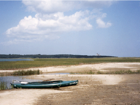
The author, Dr. Alley, is a lucky fellow. Through a fortuitous sequence of events, which involved marrying the right woman who had the right grandfather who was related to some people who have roots in the right place and worked to preserve those roots, our family has been able to occupy a room in the smallest of three houses in a “compound” in Eastham on Cape Cod for a couple of weeks during many summers. The land now belongs to the National Park Service as part of the Cape Cod National Seashore, but the houses were “grandfathered” and remain in the extended family. The bicycle trail to the Coast Guard Beach crosses the driveway, the Salt Pond Visitor Center is just around the corner, and the boat houses face Salt Pond Creek that opens on the Nauset Marsh.
Cape Cod is a glacial moraine. The part that attaches to the mainland marks the end of a lobe of the Canadian ice sheet. The “forearm” where the Cape points north is an interlobate moraine—while one glacier lobe filled Cape Cod Bay between the Cape and Boston, a second lobe lay farther east in what is now the Atlantic Ocean, and built a moraine that is now the fertile fishing grounds of the Grand Banks. (You will see this when you reach the geologic map later in this section.) The forearm of the Cape was deposited mostly by meltwater rivers flowing off these two ice lobes into the narrow space between them (more till is found along the “upper” arm of the Cape where it first projects out from the “mainland”).
This forearm part of the Cape thus is an outwash plain, and most of the numerous freshwater ponds of the Cape began their lives as ice blocks buried in outwash gravels. Melting of the ice later allowed collapse of the gravels on top to form these kettle ponds. Soon after it formed, the Cape had more ponds than we see today, but many have been filled with logs, sticks, leaves, peat, and other organic material. The logs and other materials in these former kettle ponds can often be seen weathering out of the bluffs along the Atlantic beach, including along the Coast Guard Beach that is so easily reached from the Salt Pond Visitor Center of the National Seashore. Radiocarbon dates on such deposits show that the ice was retreating from the Cape Cod region by roughly 15,000 years ago.
The sandy soils of the Cape, and its numerous kettle ponds, are home to cranberries, blueberries, and wild orchids. Beach plums produce their small but sweet fruit late each summer, and blackberries and dewberries vine across old dunes. Deer and grouse still inhabit the uplands, and turkey are multiplying rapidly as oaks spread across regions that were logged by humans but are being allowed to regrow.
Much of the interest at the Cape focuses on the sea. Nauset Marsh, for example, is miles long and a good chunk of a mile wide. The marsh is protected from the open ocean by the “outer beach,” a long sand bar that is split by one inlet or occasionally more inlets (depending on what year you visit). Behind the outer beach, the marsh is a tidewater environment, filled and then largely emptied by the flow through the inlet. Deep channels are home to crabs, scallops, starfish and striped bass. Between the channels, great flats of marsh grass flood during high tides and dry as the tide falls. Legions of herons and egrets stride the grass, and myriad shorebirds roam the beaches and mud flats. Osprey survey the marsh from high nests on perches constructed by the Park Service.
One year, a hurricane to the south had spun unusually warm waters and great swells to the Cape, and the marsh filled with ctenophores. Also called comb jellies, and looking something like jellyfish, these creatures appear opalescent in the sun because the light is broken on the cilia or hairs that the creatures beat to move themselves about. At night, this particular type (Leidy’s comb jelly) is bioluminescent. Imagine, if you can, kayaking into the marsh after dark, with golf-ball-sized fireflies of the ocean glowing and swirling with every wave. Another year, phosphorescent dinoflagellates were blown into the marsh, and the glow was everywhere rather than just in the ctenophores, with every drip from the kayak paddle lighting up, and fiery baitfish skittering across the surface, pursued by the glowing bulk of predatory stripers. Indeed, a wonderful place.
The Cape is changing rapidly, however. The large Nauset Marsh, between Orleans and Eastham, has been narrowing as the outer beach moves steadily into the marsh. Two of the Cape’s lighthouses were moved during the summer of 1996, barely in time to avoid collapsing over the bluffs into the sea as the bluffs have been eroded away.
At the ends of the Cape, to the north and south, new land is being formed as sand is deposited (yellow on the map below). But, more than twice as much land is lost each year as is formed, and the Cape is slowly but surely disappearing. With the next ice age to rebuild the Cape still far in the future, the Cape appears destined to become islands and then an undersea bank over the next few thousand years. The long-term retreat rate of the Outer Beach in Eastham has been about 3 feet per year over more than a century, with fluctuations but perhaps with a little recent acceleration.
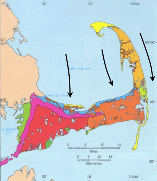
This map from the USGS Woods Hole group shows the geology of Cape Cod. Magenta indicates glacial moraines containing till, and green shows other deposits formed in contact with ice. Oranges and red are outwash plains. Blue marks deposits from a lake that formed when the ice began melting back from the Cape but still plugged Cape Cod Bay and kept the ocean out. Brown shows marsh deposits, and yellow shows new sand deposits. We added the black arrows to show where the ice flowed in the past.
Waves and Coasts
There are many types of coasts. North of the Cape at Acadia National Park, Maine, strong igneous and metamorphic rocks make sea cliffs. South, in the Virgin Islands National Park, are coral reefs. Built from the skeletons of millions of tiny animals, the reefs rise from the sea bottom and flourish in shallow, clear, sunlit, oxygenated waters far from sediment that would bury and choke them. Around into Louisiana, you remember the Delta National Wildlife Refuge, and the miles of waterfowl-filled wetlands on mud delivered by the Mississippi River. At Cape Cod, we find barrier beaches or barrier islands offshore of marshes, or we find sandy beaches with the bulk of the Cape just behind.
The type of coast depends on the supply of sediment to it, the wave energy, the tidal range, the type of rocks, and many other factors. Here, we will concentrate on the Cape Cod sandy beaches.
Watch a wave on the Cape, or any other sandy beach, and you will see that the wave moves a lot of sand. Dig a hole just above the water level during a rising tide, and within a few minutes the hole will be filled with wave-carried sand. Go to the beach during a big storm and you will see immense amounts of sand moved. Hundred-foot-high bluffs may be eroded back several feet, or layers of sand many feet thick may be added to the beach or eroded from it in hours. A movie at the Salt Pond Visitors Center includes a series of photos taken of one section of beach before and after a string of storms one winter. The summer beach is an unbroken expanse of sand, but boulders many feet across are buried in it, and were completely covered and uncovered several times during that one winter as the sand was moved on and off the beach.
The energy for all of this comes from the wind driving waves, and to a lesser extent from the tides. Most of the sand transport is simply onshore and offshore with each wave—the sand is carried in as a wave comes in, and out as the wave goes out. Most transport is to and from the beach, rather than along the beach, because most waves turn so that their crests are almost parallel to the beach, and their water motion is almost directly towards and away from the beach. The turning happens because waves go slower in shallower water. If a wave approaches a beach at an angle, the first part to near the beach will slow down, allowing the rest of the wave still in deep water to nearly catch up, as shown in the diagram to the right.
Every wave moves sand up and down the beach. On even rather quiet days, if you sit down on a Cape Cod beach in shallow water, you soon will find that sand is piling in places around you, and being eroded in other places, and that you have sand in your swim suit, and possibly even in your hair. This in-and-out movement of the sand with every wave dominates the sand transport, allows for very efficient sorting of the sand by size, and serves to knock the sharp edges off sand grains, sea shells, old soda bottles, and other material on the beach.
Look out to sea during a winter storm, and you’ll see high-energy breakers coming at you. The white caps of the waves rise high, curl over and crash down, so that some of the water arrives on the beach after coming in through the air rather than washing along the sand. But the water then rushes back toward the ocean along the sand, carrying some sand seaward. There thus often is a little net movement of sand from the beach into slightly deeper water during storms, which are more common during winter than during summer. This transport may remove enough sand to lower the beach many feet or tens of feet during the winter, exposing buried boulders. The waves of summer are on average lower in energy, and don’t break and travel through the air as much (occasional hurricanes change this story, but most of the time the story is fairly accurate). The surge of summer waves up the beach is slightly faster than the return flow down the beach, and may carry a tiny bit more sand up than back; the net effect is to bring sand from just offshore back to the beach, burying any beach boulders that were exposed during the winter.
But, the incoming waves do not turn quite enough to come straight in, as shown in the diagram—they still have some angle. If you ride the waves in, swim out, ride in, swim out, ride in... after a while you will find you have drifted down the beach away from the lifeguard—even though you were mostly going toward the beach and back out to sea, the waves also were pushing you sideways. In such a situation, we say that you are experiencing longshore drift—you, and the water, and sand, are moving along the shore. Eventually, when the water and sand reach the end of the Cape (at the Provincelands to the north, or Monomoy to the south), some of the sand builds a spit or extension of land, but some of the sand is dumped off into deeper water beyond the reach of waves. This sand is then lost from the Cape, and the Cape has gotten a little smaller. Most references say that the great beach facing the Atlantic is retreating at about 3 feet (1 m) per year, although it may have been a little faster recently, and the panicked light-house rescues were required because retreat for a few years was much faster. We’ll look at these issues, and what might be done, after visiting Acadia in the next chapter.
Textbook 8.2: Acadia
Acadia and Sea-Level Rise
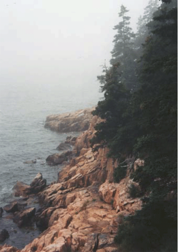
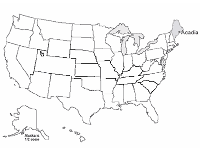
The subduction and collision with Europe during the closing of the proto-Atlantic made great granite bodies draped in metamorphosed sediments, and we find these exposed along the Maine coast. Much later, the glaciers scoured those rocks clean, leaving the bald mountain tops of what is now Acadia National Park, staring out at the storm-tossed north Atlantic across Somes Sound, the only fjord on the east coast of the U.S.
The Wabanaki tribe of Native Americans probably reversed the modern tourist pattern, summering inland and then moving to the relatively more moderate coast of Acadia in the winter. Nasty winter storms do run up the coast, but the temperatures plunge far lower inland than they do on the coast. Thick piles of discarded shells of nutritious sea creatures dating back 6000 years attest to the importance of the sea to these early people.
On September 5, 1604, the French explorer Samuel de Champlain landed on Acadia’s island. Impressed by the bare, rocky, deserted appearance of the glacially scoured granite mountain peaks of the island, he named it Isles de Monts Desert.
French influence was important until the end of the French and Indian War, after which English and then U.S. activity came to dominate. In the mid-1800s, Mount Desert Island attracted the art world, and was featured in paintings by Frederic Church, Thomas Cole and others of the Hudson River School (for example, have a look at Twilight: Mount Desert Island, Maine by Frederic Edwin Church. The artists, in turn, attracted the “rusticators,” tourists who gradually were replaced by much wealthier tourists who built summer “cottages”—the Rockefellers, Fords, Vanderbilts, Carnegies, etc. These wealthy patrons in turn invested resources and political capital in preserving most of the island as a national park.
Today, over 4 million visitors per year flock to Mount Desert Island, with most of them getting out of the gift shops and into the national park. The visitors enjoy the history, the beauty, the rather chilly ocean waters (based on personal observation by the author, even on hot summer days, there is more sitting by the sea than swimming in it!), the outstanding network of paths for bicycling, superb kayaking on lakes and sea, and much more.
Changing Coasts and Sea Levels
Change is the only constant on coasts. The Sea Grant Program at the Woods Hole Oceanographic Institution, on Cape Cod, reported that about 75% of the U.S. coastline is eroding, with only about 25% stable or advancing. For Massachusetts, 68% of the coastline is listed as eroding, 30% advancing, and a mere 2% stable.
Up in Maine, the rocky parts of Mt. Desert Island are among the few places that would be classified as “stable,” although very slow erosion is occurring as the sea pounds the granite headlands. But if you look further back in time, the size of the changes becomes evident. Glacial ice overran the highest peaks in the park during the ice age. Sea level was lowered 300-400 feet (100 m or a bit more) at that time to supply the water that grew the ice sheets, but the land of Mt. Desert Island was pushed down 600-700 feet (roughly 200 m) or even more by the weight of the ice.
Ice farther south began melting before the ice on Maine, so the sea began rising, but then loss of ice on Maine caused its rocks, including Mt. Desert Island, to begin rising faster than the sea. The rising of the pushed-down rocks is slow, and in fact is still going on today. Thus, as the ice retreated, the already much-raised sea first flooded in across broad regions of Maine and adjacent parts of the east coast. Beaches and sea caves formed, and deltas were deposited. Then, these coastal features were raised out of the ocean as the land rebounded. Such coastal features can be found today in Acadia to almost 300 feet (almost 100 m) above the modern sea level, and similar features occur all along coastal Maine. We include a picture of a similar delta from Greenland; the features in Maine are covered with trees and houses and roads and such, and although the features are quite easily identified by experienced geologists, the features are not as clear as those in Greenland to the beginning geologist.
Regions that were slightly beyond the reach of the ice-age glaciers were pushed up in a forebulge, when the hot, soft, deep rocks pushed out from beneath the sinking ice sheets bulged up the land just before the ice. In those forebulge regions, the land now is sinking, as the deep, hot rocks flow back to their starting point; where forebulge sinking has combined with rising sea level as the ice melted, the total sea level rise has been especially large. Far from the ice sheets, sea-level rise has been about what you would expect based on the amount of water returned to the ocean by the melting ice sheets (although the entire surface of the Earth was warped by shifting water from the oceans to the ice sheets and back, so the changes are all a bit more complicated than you might expect, just as a wine glass balanced anywhere on a cheap water bed will tip over if you sit anywhere on the bed).
By now, you may be getting the idea that what happens to a particular coast is fairly complex. If mountain-building is pushing the coast up, it rises; if mountain-building is pushing the coast down, it sinks. Where plates meet, when the edges are locked and building toward an earthquake, the motion may drag one side down and push the other side up; the earthquake that follows will suddenly reverse the offset—in the great Tohoku earthquake of Japan in 2011, parts of the Japanese coast moved as much as 8 feet toward North America, and offshore the largest motions of the sea floor were more than 150 feet horizontally and more than 20 feet vertically. Where cities are built on deltas, as at New Orleans, the compaction of the mud causes sinking. Much additional sinking is caused by pumping water or oil or gas out of the ground; as the fluids are removed, the ground compacts. This is happening a little on Cape Cod, and is quite dramatic in some places. Groundwater pumping may have contributed to problems at New Orleans, in Venice, and elsewhere. (Reinjection of fluids can partially offset this problem, and is being used in some places.)
Additional complexity comes from the issues of sediment supply. Beaches inevitably lose a little sediment to deep water, somewhat like losing socks behind a clothes dryer, because it is easy to drop something that falls way down there, and hard to get it back. Waves affect sediment below the surface, but only down to a depth that equals roughly half the distance between a wave’s crest and the next one. If sediment happens to slide or bounce deeper than the depth reached by the deepest-reaching waves, then that sediment cannot be brought back easily. (The sediment can go into a subduction zone, be taken down and scraped off, or else melted and erupted and loosened by weathering and landslided and transported in a river and then in longshore drift to the beach, but that takes a long time.) And, longshore drift moves a lot of sediment, but eventually the sediment often encounters an undersea canyon and drains down to deeper water below the reach of waves.
Thus, a “happy” beach requires a supply of sediment to balance the loss to deep water. Normally, that supply comes from the material delivered to deltas by rivers, and carried by longshore drift. But if there is not enough sediment coming in this way, the beach will narrow as it loses sediment to the deep ocean, and the waves will reach across the sand to erode the material behind, gaining sediment in this way.
In those cases when longshore drift does not supply enough sand to make a beach, and the waves are battering on the coast, if the rocks are really hard, like the granite of Acadia, then there won’t be a beach at all, with the tiny bit of material eroded from the granite quickly dumped into deep water. (There are a few small “pocket” beaches at Acadia in protected places, but most of the coast doesn’t have beaches, with granite sticking right out into the waves.) If the coast is sand and gravel left by the glaciers, as seen at Cape Cod, the waves cut the coast back and supply that material to the beaches.
In some places, dams on rivers have greatly reduced delivery of sediment, so the coasts are eroding. You may recall that the dams on the Elwha River, draining Olympic National Park, caused loss of beaches along the coast. At Cape Cod, there really aren’t any rivers to dam. The glaciers made a big pile of sediment in a place where rivers are not supplying much sediment to deltas, and so the Cape eventually will be lost to deep water.
Rising Sea Level and the Future
So coasts change for many different reasons, and in many different ways. But, recently, most of the U.S. (and world) coasts have been retreating because sea level is rising, and that rise is accelerating.
The rate of rise has been about 2 mm/year (just under an inch per decade) over the last century, but seems to have sped up to about 3 mm/year (a bit over an inch per decade) recently. That isn’t much if you’re at the top of a cliff in Acadia, but if you are on a sandy beach that slopes very gradually, the inch of sea-level rise may cause many feet, or even a few tens of feet, of coastal retreat. That in turn means that a whole lot of houses and property can be lost in a single lifetime.
The ongoing sea-level rise is being caused primarily by the global average warming of the last century, which is being driven primarily by human activities (we’ll return to this later, but we have high scientific confidence that it is correct). Most of the world’s small glaciers have been melting this century, returning water to the oceans. Also, as the ocean itself warms, the water expands and takes up more room.
Two other possible causes of sea-level change are humans "mining" groundwater, and melting or faster flow of the polar ice sheets. We build dams on rivers, and the water that fills the reservoirs is taken out of the ocean and stored on land, causing sea-level fall. But, we “mine” groundwater by pumping it out of the ground faster than nature puts it back, in places such as Phoenix, Arizona where green yards and golf courses and fountains seem to “need” LOTS of water, and that water eventually reaches the ocean to raise sea level. Today, groundwater pumping is probably more important than dam building, contributing a little to sea-level rise.
The polar ice sheets contain a huge amount of water—if they melted, they would raise sea level nearly 250 feet (roughly 70-80 m). Philadelphia and the other great port cities of the world would become undersea hazards to shipping but really great places for fish to hide out, and the southern coast of Florida would be somewhere up in Georgia. We do not expect such a fate within at least the next few human lifetimes, but we cannot rule out the possibility that a dynamic collapse of the West Antarctic ice sheet could raise sea level 10-20 feet (3-6 m) in a human lifetime or two, and if we don’t change our behavior over centuries, Greenland and its 24 feet of sea level is looking shaky. Drs. Anandakrishnan and Alley spend a lot of their research trying to reduce our uncertainty about the future of the great ice sheets, a fascinating and important topic.
The near-certainty of continuing sea-level rise has some policy implications. For example, disaster aid following hurricanes that allows people to rebuild in coastal regions will simply create the need for more disaster aid in the future. Many people believe that those who wish to build on the coasts should be required to carry insurance to cover their coming losses. Similar arguments apply to those who wish to build on earthquake faults, landslide deposits, and floodplains. Why should those living in relatively safe but less-scenic places pay for others to live in dangerous but beautiful places?
Because people love the coasts so much, and wish to live near them, all sorts of engineering solutions have been tried. One is to build “dams” (usually called “groins” if they are small, or “jetties” if larger) that stick out into the water and block the longshore transport of sand (see figure to the left). By making the coast rougher, and slowing waves, the plan is to trap sediment along the coast the way a dam traps sediment along a river. This plan sometimes works. However, recall that in a sand-bedded river, sediment is trapped upstream but eroded downstream. The same often happens along a coast; sediment is trapped “upstream” of the groin (on the side from which the longshore drift comes), but sediment is eroded on the “downstream” side (the side to which the longshore drift goes), where the sand-free waves attack the beach to pick up more sand. Saving someone’s beach while destroying the beach of a neighbor is a good way to generate lawsuits. People also spend millions of dollars to go out to sea, find sand that has fallen off into deep water, and bring the sand back to the beach. This sand usually lasts a single year or a very few years before being washed back to deep water, but in especially popular tourist destinations, the investment may pay off.
Geologists often take a “natural” view of the coasts—we should figure out where the coast wants to go, and build there rather than trying to stop the coast. But many people just don’t like that, and a lot of construction is likely to occur—and be destroyed—over the years.
Virtual Field Trips
Join Dr. Alley and his team as they take you on "virtual tours" of National Parks and other locations that illustrate some of the key ideas and concepts being covered in Unit 8.
TECH NOTE
Click on the first thumbnail below to begin the slideshow. To proceed to the next image, move the mouse over the picture until the "next" and "previous" buttons appear ON the image or simply use the arrow keys.
Virtual Field Trip #1: Cape Cod National Seashore
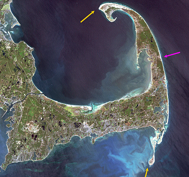
Source: NASA. All other pictures in this slide show are by R. Alley, C. Alley, J. Alley, or K. Alley.
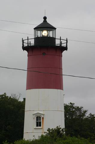
Image 1: Landsat image of Cape Cod. One arrow points to the eroding outer beach on the right. Two more arrows point to areas of sand build out to the south and north. NASA Sept. 18, 1999 Landsat image of Cape Cod. The Outer Beach (magenta arrow) along the right-hand side of the Cape is eroding back at a few feet per year. Some of the sand is building out to the south and north (yellow arrows), but some of the sand is being lost to deeper water, so the Cape is shrinking. All pictures in this slide show, except this one, by R. Alley, C. Alley, J. Alley or K. Alley.
Image 2: On the left, a tern perched on a piece of wood. On the right, a tern in flight. One good tern… deserves another.
Image 3: The Nauset Marsh, Cape Cod National Seashore. Water surrounded by green trees, under pale blue sky. Split rail fence in foreground. The great Nauset Marsh, viewed from the back porch of the Salt Pond Visitor Center, Cape Cod National Seashore.
Image 4: Close-up of a bumblebee on a pickerelweed. Bumblebee visiting pickerelweed, which grows in the shallows at the edge of Great Pond, Eastham, Cape Cod. By building a lake-studded outwash plain into the ocean, the glaciers left a rich mix of aquatic habitats.
Image 5: On the left, a herring gull landing in the water. On the right, close-up of herring gull perched. Gulls, such as these herring gulls, are widespread and successful generalists, equally at home along fresh and salt waters, as well as cleaning up messes left by humans.
Image 6: On top, a close-up of three yellowlegs in Nauset Marsh. Below, twelve or more yellowlegs in the marsh. Yellowlegs are well-named, and common in Nauset Marsh.
Image 7: Side-by-side close-up images of a great blue heron standing in the marsh in front of tall water grass. Great blue herons, Nauset Marsh. A fish that doesn’t watch out may realize too late that he blue it.
Image 8: On top, a close-up of a sandpiper on the beach with his beak in the sand. Below, a close-up of a yellowleg standing in the water. Salt marshes are highly productive, and support a diversity of life… including sandpipers (top) and yellowlegs (bottom). Nauset Marsh, Cape Cod.
Image 9: On the left, a close-up of a cormorant perched. On the right, a close-up of a cormorant on a cinder block with his wings spread. Cormorants were not present on the Cape a few decades ago, but now are commonly seen fishing or drying their wings.
Image 10: Large number of people on the beach at Coast Guard Beach, Cape Cod. slide 10 Coasts loom large in our natural psyche, and tens of millions of people each year visit our coasts for recreation and sunburns. These pictures show a cold, gray day at Coast Guard Beach, Cape Cod, and there are still lots of people out.
Image 11: On top, rippled sand, with beach grass in the background. Below, a close-up of rippled sand. Waves and tidal currents move immense amounts of sand, leaving beautiful ripples, as shown in these closeups from First Encounter Beach.
Image 12: Cape Cod sand dune with a thin layer of hardy vegetation. Ocean in background spotted with beach goers. Cape Cod’s beaches may be backed by rapidly eroding bluffs, by sand dunes covered with a thin layer of hardy vegetation that can be damaged easily by human activities (as shown here), or by salt marshes.
Image 13: Nauset Light, lighthouse on Cape Cod. Nauset Light. The light was moved in 1996, just before the rapid erosion of the bluffs along this part of the coastline dropped this historical building into the waves. Everyone with a long memory of the Cape has stories of things that have been lost to the encroaching sea.
Image 14: Family of three sitting atop Great Rock. Great Rock, the Cape’s largest glacial erratic (big rock carried by the glacier) attests to the ability of ice to move pieces of many different sizes. The rock extends below the picture, and then about as far into the ground as above.
Image 15: Bright orange sunset at First Encounter Beach. Herring gulls in the foreground. Herring gulls at sunset, First Encounter Beach, Cape Cod.
Image 16: Sunset at Rock Harbor, Cape Cod. Boats docked on left. Sunset, Rock Harbor, Cape Cod. It isn’t very geological, but it’s pretty.
Virtual Field Trip #2: Acadia National Park
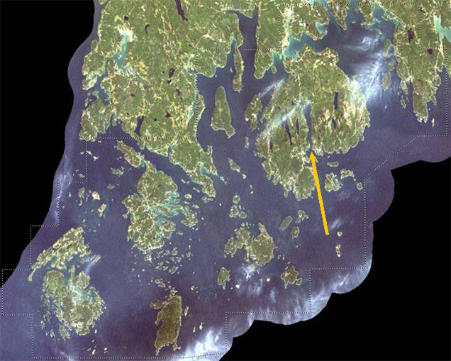
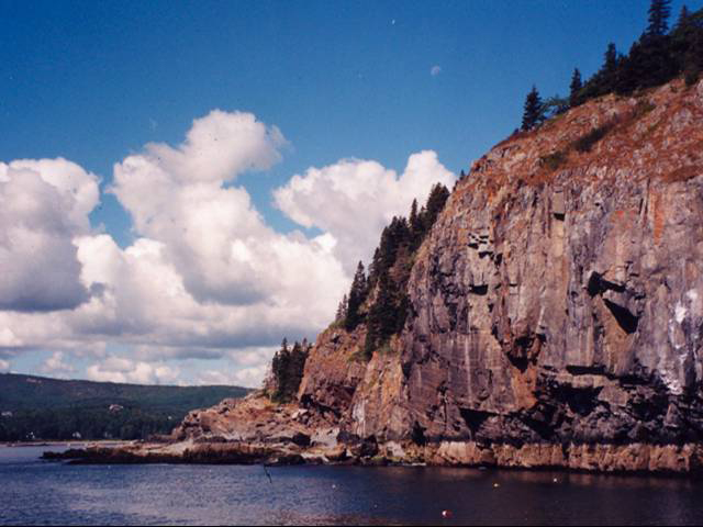
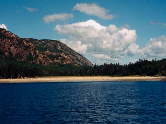
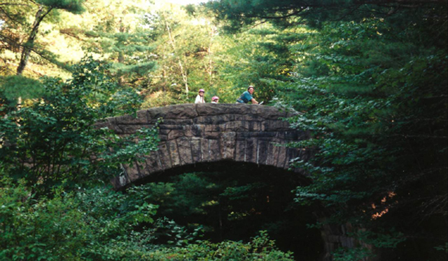
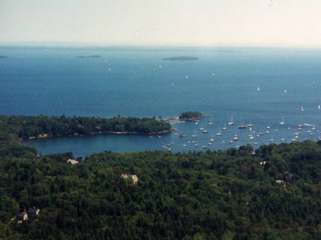
.jpg)
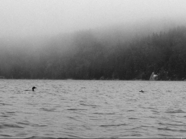
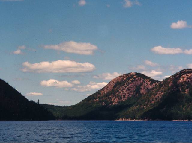
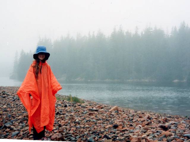
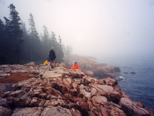
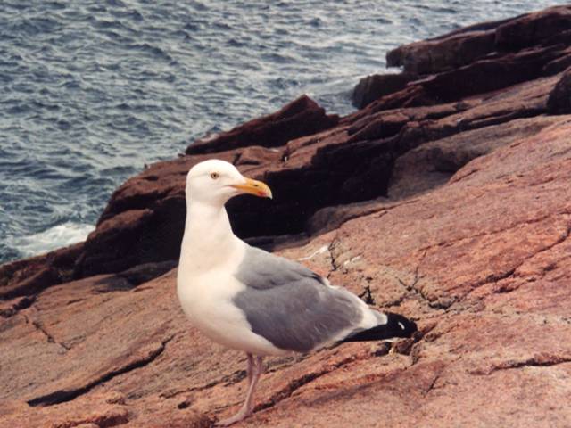
Image 1: Satellite Image of Rhode Island Acadia and surroundings. Arrow points to the fjord of Somes Sound in Mount Desert Island. Credit: NASA GSFC & Y.Q. Wang at the Laboratory for Terrestrial Remote Sensing, Univ. Rhode Island Acadia and surroundings. The yellow arrow points toward the fjord of Somes Sound in Mount Desert Island. The dotted line marks an area of interest for NASA and the National Park Service, and regions beyond have been blacked out. All pictures except this by C. or R. Alley
Image 2: Lobster pots floating in water in front of large cliffs. Blue skies with puffy white clouds. The old metamorphic rocks (shown here) and granites of Acadia make dramatic cliffs. Floats for a few lobster pots are visible in the water.
Image 3: Beach at Acadia with water in foreground, mountains and cloudy skies in background. This beach at Acadia is one of the few in the area. Most of the sand is calcium carbonate--ground-up shell--because the Gulf of Maine is so amazingly productive of shells to be ground up by waves. The beach is far at the end of an inlet; the rest of the coast is dominated by bare rock.
Image 4: Family on bicycles crossing an arched stone bridge, surrounded by forest. The Rockefeller-constructed carriage roads and their graceful bridges are well-loved at Acadia, which offers wonderful opportunities for bicycling. Dr. Alley and daughters Janet (left) and Karen for scale.
Image 5: Ocean with inlet and forested land in foreground, small islands in the distance. Sailboats anchored in the inlet and sailing in the distance. View of the Maine coast from Cadillac Mountain, Acadia.
Image 6: On left, path leading to Bass Harbor Head Lighthouse. On right, Portland Head Lighthouse, two red roofed buildings, ocean in background. Bass Harbor Head Lighthouse (left) and Portland Head Lighthouse (right), Acadia National Park and vicinity.
Image 7: Two loons in the rain on Seal Cove Pond. Black and white image. Loons in rain, Seal Cove Pond, Acadia. The deep, glacially carved lakes of the island are outstanding for kayaking and canoeing.
Image 8: Blue waters of Jordon Pond with Bubble Mountains in background, under pale blue cloudy sky. Jordan Pond and the Bubble Mountains. The rounded granite summits and U-shaped valleys are clear evidence of past ice.
Image 9: Person standing in the rain on rocky beach, wearing orange rain poncho and blue rain. Water and Evergreens in the background. Even a rainy day can be enjoyable on the shore, as here at Ship Harbor. Notice the “beach” is composed of cobble-sized rocks.
Image 10: People standing on rocks at the coast. Raining and foggy. Acadia National Park. The no-beach granite coast of Acadia National Park in the fog.
Image 11: Close-up of Herring gull standing on granite coast of Acadia. This herring gull is perched on the granite coast of Acadia.
Image 12: Body of water with island in center. Cloudy skies. Arrow at top left points to the right, indicating direction of ice flow. Ice flow as indicated by the red arrow smoothed this island, and plucked rocks off the lee or down glacier side to the right.
Virtual Field Trip #3: Coasting Down the Coast.
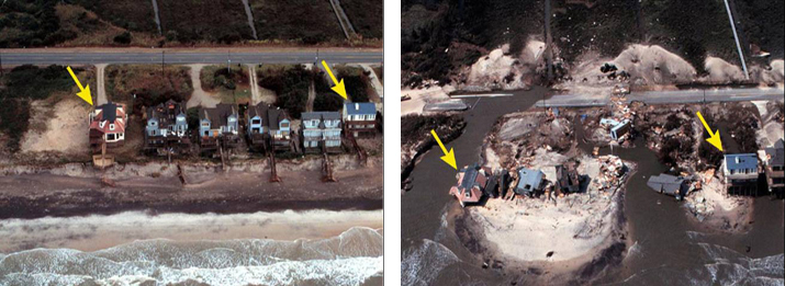
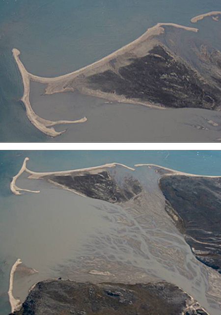
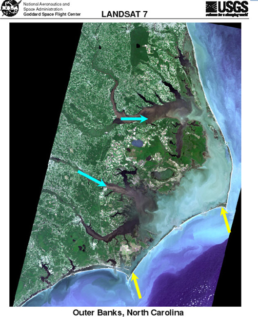
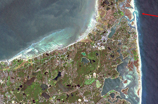
Image 1: Satellite image of Cape Cod National Seashore and surroundings. Coasting Down the Coast. Including a bit on sea-level change, some disasters, and some coastal processes, in some beautiful places. All pictures by R. Alley or taken from government Web sites as indicated. The image of Cape Cod National Seashore and surroundings is from Landsat 7.
Image 2: Raised delta, Milne Land, east Greenland. Rock in center foreground. Mountain peaks in background. Raised delta, Milne Land, east Greenland. About 12,000 years ago, a stream flowing to the left from beneath a glacier built the sandy fingers of this delta out into the sea. Then, the ice melted, allowing the land to rise, so the delta is now about 300 feet above sea level (sea is barely visible to the far left).
Image 3: A wall called a jetty built out from the coast in Washington, which has trapped sand on one side but caused erosion on the other side. Washington State Department of Ecology Shore photos--the state photographed their coasts, and makes these pictures available to the public--what a great idea! Two views of the Westport Jetty, Washington. Longshore drift from the right has built up sand to the right but caused erosion to the left of the barrier. Also notice in the left picture that waves are slowed by the shallower waters near the jetty.
Image 4: Hurricane Katrina aftermath. On right arrows point to antebellum and pier house. On left arrows point to where buildings used to be. http://coastal.er.usgs.gov/hurricanes/katrina/photo-comparisons/mainmiss... Before-and-after photos of the aftermath of Hurricane Katrina, near Biloxi, Mississippi. The antebellum house (upper right) and pier house indicated by the red arrows were destroyed.
Image 5: A picture showing tree-covered islands before Hurricane Katrina, and the smaller, treeless islands left after the storm. http://coastal.er.usgs.gov/hurricanes/katrina/photo-comparisons/chandele... Before-and-after photos of the impacts of Hurricane Katrina on the Chandeleur Islands, about 100 miles east of New Orleans. The sites marked by the yellow arrows can be identified in both photos.
Image 6: Hurricane Katrina aftermath. On left houses on Topsail Island, N. Carolina. On right, the same houses are destroyed. Before-and-after photos of the impacts of Hurricane Fran (1996) on Topsail Island, North Carolina. The house indicated by the left yellow arrow largely collapsed, that shown by the right yellow arrow lost its deck, and most of the other houses and much of the road were destroyed.
Image 7: A small stream draining into a Greenland fjord is dammed by sediment transported along the fjord shore. Evidence of longshore drift of sediment, Scoresby Sund, Greenland. The small stream valley flowing from the top (blue arrow) has been dammed by sediment transported along the coast (between the red arrows).
Image 8: Aerial view of delta, arrow points to sediment from stream that formed delta, two arrows point the beaches on each side. Sediment supplied from the stream (blue arrow) formed the delta. Waves have reworked the edge of the delta into the sandy beach (yellow arrows). Much of the area on the delta side of the beach is underwater at high tide, so this is a barrier beach. A helicopter skid is visible in the lowermost left corner.
Image 9: A braided river has wave-formed beaches near the sea; a recent storm moved some beaches well inland. Barrier beach, Mudder Bugt, Milne Land, east Greenland. Sand supplied from the right by the braided river has been reworked into the beaches shown. Storms have breached the beach on the right, washing sand into the lagoon behind and forming secondary beaches (yellow arrows).
Image 10: A delta formed by a braided river is surrounded by beaches and spits formed from the sand carried by the river. Mudder Bugt, Milne Land, east Greenland. The upper picture is a slightly turned close-up of the top part of the lower picture. Sand from the braided stream (lower right) is reworked by waves into the barrier beaches and spits seen, but the beaches are pierced by inlets.
Image 11: Satellite image of North Carolina, showing streams that deliver sand and barrier islands made from that sand. Satellite image of the Outer Banks of North Carolina, from USGS and NASA. Streams flowing from the left (two are indicated by blue arrows) have been flooded by sea-level rise in their lower reaches. Sand from the streams has been built into barrier islands (two shown by yellow arrows). Although the area covered by this picture is much bigger, the features are clearly almost identical to those shown in the previous pictures.
Image 12: Satellite image of Cape Cod. Arrow in upper right points to inlet to Nauset marsh piercing the great barrier beach. NASA Closeup of part of Cape Cod. The great barrier beach on the right is pierced by the inlet to the Nauset marsh (red arrow).
Word Document of Unit 8 V-trips
GeoClips
This week, we feature four GeoClips, all created while Dr. Alley was on vacation at the Cape in the summer of 2005. These four "home movies" provide a bit of insight into the origins of the Cape, and the forces that are continuously at work changing our coasts, shorelines, and seas. Shooting and editing credits go to Dr. Alley's wife, Cindy.
As before, we hope you enjoy these, and find them to be useful complements to the readings, class notes, and slide shows of Unit 8.
The Can
Human impacts on the land are easy to see. We have changed the oceans greatly, but the water covers our tracks. In "The Can," Dr. Alley briefly reflects on some issues of the oceans, as he watches one of the less-beautiful pieces of the Cape Cod National Seashore.
A beautiful, natural morning at Cape Cod. But if you turn to the sea, you can see that the evening revelers were there. I've been to the beaches of Greenland. I've been to the beaches of Antarctica. And everywhere I've been, the flotsam and jetsam of humanity are on the beach.
Oceanographers have traced the currents of the Pacific using shoes and rubber ducks that fell off of ships. More importantly, we've probably taken 90% of the big fish out of the ocean. We don't know what an ocean ecosystem should look like because it isn't natural anymore. We've changed the thing. We've put so much fertilizer into the ocean and places from runoff from farming and pollution and sewers that cause huge poison blooms that essentially kill the life when they rot. And taking care of the ocean is a big deal. And it's a deal we need.
The Marsh
Many of the ocean’s big fish, and other denizens of the deep, rely on salt marshes as nurseries and in other ways. But, we are losing salt marshes in many places, as sea-level rise forces the “outer beach” toward the shore, but humans don’t allow the inner side of the marsh to expand into our yards or parking lots. Obvious answers are not easily available, but Dr. Alley frames the question in this next short film clip as he paddles one of the family kayaks on the Nauset Marsh of the Cape Cod National Seashore.
Beautiful morning for a paddle. The tide's coming in, and a really happy professor is going out to see who's running around in the salt marsh, the Nossett Marsh in Eastham on Cape Cod. This is a place for birding. This is a place for shelling. These sand pipers are out getting breakfast.
Salt marshes are remarkably productive places. They are the nurseries of the fish and the shellfish. They're the nurseries of the ocean. They, too, need care.
The outer beach is coming in as the ocean rises. But the inner side is often hardened by humans and not allowed to move. And if we're not careful, we won't have these nurseries.
The Feet
Waves move immense amounts of sand, primarily up and down the beach, but also with a little motion along the beach and eventually off into deep water. In "The Feet," Dr. Alley gets cold feet on Coast Guard Beach, Cape Cod National Seashore, to show you moving sand.
Great Outer beach of Cape Cod, facing the Atlantic Ocean. Early morning. A lone figure leaving footprints on the sands of time. And you will see that, indeed, the waves move lots of sand. As the waves come in and out, and in and out, they keep moving sand ceaselessly, relentlessly. Notice the foot is on top of the sand when the wave comes in.
The foot is getting really cold, because that water is just straight out of the Arctic Ocean, practically. And now there's sand over the foot. And when the next wave comes, and the one after, you will see that indeed, the waves are moving sand in, out, in, out.
As they do so, they sort it. Little pieces are taken out to deep water and lost. Big pieces are not moved at all. And the in-between ones are swirling around the foot. And then another wave comes in, and then that one is really cold. And the hairy-legged sole here is soon going to be buried under the sand. And you can see how much sand is moved in just a couple of waves.
Meet Peat!
Cape Cod is a gift of the glaciers. The numerous kettle ponds left by the ice contribute to the biodiversity of the Cape, but are slowly filling in with sand, peat, and other things. Many of the ponds have already filled, and a walk along the rapidly eroding outer beach often reveals where the sea has cut into one of these filled ponds. In this next clip, Dr. Alley shows one such exposed, filled kettle pond, just below the old Coast Guard station in the Nauset region of the Cape Cod National Seashore.
We're on the outer beach at Cape Cod at Nauset, and we're looking at where the ocean has been cutting back a little bit of the bluffs to reveal what's behind. Now, most of the Cape is sand and gravel. It's outwash from the glaciers from the Ice Age. But what we see here is the filling of a lake. A block of ice fell off the glacier, was buried in sand and gravel, and then melted out to leave a little spot, a lake, which is filled with peat that you see here. The peat is the remains of dead plants. And if you look very carefully, you will see within the peat many of the dead plants.
On top here are grasses of the modern world, but they are not down in the material. Lakes die. They fill with this stuff. When you see a lake on the landscape, you should ask yourself, why is this here? Because something recent has happened to make the lake.
Video Lecture
The Unit 8 lecture features Dr. Richard Alley and is 51 minutes long.
Well, hello. It's a pleasure to be back and chatting with you. As you know, Sridhar and I have been working on this course together. And so, we're playing tag team. I won't actually throw him out of the ring. But we're going to do tag team. And so, now I get to chat with you for a while about some very interesting things. And I hope we have a good time with this.
As you've seen from Sridhar, we've been looking at a big story, a very interesting story, a story that goes a lot of ways. You've watched from Sridhar how the moving continents make big mountain ranges and how some of those mountain ranges explode and give you volcanoes, and how subduction works, and how obduction works, and what happens. You then saw that when you get these big mountain ranges sitting up there, that they have clouds over the top, and rain falls on them. And so, weathering happens and breaks down the rocks.
Then either glaciers come along or rivers come along, and they take the loose pieces of rocks and they head them down towards the ocean. You have seen that if you build a dam on one of those rivers, that you're going to end up trapping sediment behind the dam. And you'll get a big pile of sediment in there.
And if you don't build the dam, if you let the river do what it wants to do, eventually what you're going to find is that the river is headed down to the sea. And it's going to make a giant pile of mud such as the Mississippi Delta. And if you build your cities on top of the giant pile of mud, then they will sink into the mud. And you're going to have problems.
Now you can imagine that eventually we're going to have to close this loop. We don't just build infinite piles of mud that sit there forever. Somehow, that mud is going to make its way down into the deep sea where it can be taken in subduction zones, or it can be squashed in the giant collisions. And it can raise back up in the new mountains and start this over. And so, we're going to now try to close this loop. And we're going to close this loop by going and looking at some coasts for you.
So, let's switch over to some pictures for you. I happen to love coasts. I hope you do. They're very pretty places. They're very interesting to see. And as we're going to see, they are the extra piece that's going to get from the Mississippi Delta down into the deep ocean where eventually its subduction zone can grab something and take it back up.
Here we're going to start with a picture Cape Cod. You might possibly recognize this. It's a very nice coastal place. Cape Cod is going to be a lot of our story. Right now it is a beautiful place. It's a fun place. It is also a place that is disappearing, as we will see.
The magenta arrow sitting out here on the side is pointing at the outer beach. And the outer beach of Cape Cod is marching back. It is being eroded, slowing scratched away at a rate that's sort of that much a year. And if you had coastal property, that means well within your lifetime, it's gone.
Sediment from that, you can see if you look in this picture sort of the whitish stuff down under the sea, say down in here. This is sand that has been washed off of the great outer beach. It's being transported along. It is building the great island of Monomoy down at the bottom. It's also building the Province Lands up at the top. But then, some of it is ending up being dumped into deeper water either that way or that way. And so, eventually, what we're going to see is that Cape Cod is disappearing. It is a pile that is not sustainable. And, in thousands of years, it goes away.
Before it goes away, let's take some pretty picture looks at it because it is a beautiful place. We actually get to summer there sometimes. And we have kayaks. And so, we can go out kayaking and see what you can see. We also have daughters who like puns. So, one good tern does deserve another.
When we go to the Cape to visit, this is at Eastham. It's sort of about there. And when we go, this is the Salt Pond Visitor Center. And we like to stay right over here just out of the picture. And we take our kayaks, and we go out on the great Nauset Marsh which is sitting out here and goes for very long distances. And it's absolutely chock full of birds.
The wetlands are the productive, they're the nurseries of the ocean. They're the things that grow the fish. They grow all sorts of things. And they grow plenty of birds that can take care of them. You'll notice another bad pun, a fish that doesn't wash out may realize too late that he blew it. These are Great Blue Herons, of course, the big wading birds. There are lots of little wading birds around the marsh. Flocks of birds come through. You can just sit there in a kayak and watch for days and just keep seeing new things as they come along.
The marsh is a mixture of sand, a mixture of mud underneath, plants that are growing up, water that is sloshing in with the tides, and bringing in nutrients, and raising young things, and what have you. It's really a wonderful place.
The Cape is changing. This lighthouse, Nauset Light, almost fell into the sea because the outer beach was catching up with it. And they, just in time, hauled it back. They are hauling lights back all up and down the East Coast. Because wherever the lights are sitting on sand, the beach is heading towards them.
The Cape is there because of the glaciers. Sridhar talked to you about the glaciers. Most of the Cape is sand, and gravel, and mud. But it has little rocks like this one. This is Great Rock or Doane Rock. And it is 30 feet high, something like that. And it extends that far down below. The wind did not bring it. A glacier had to bring it there. It is just sitting there in the sand, the giant rock cliff, where the glaciers were. The glaciers made this big pile of sediment, and the ocean is slowly taking it apart. OK, a beautiful, beautiful place, a wonderful beach, a wonderful place to go visit.
Now, I'd like you remember that there's lots of different kinds of coasts. There's muddy coasts. There are rocky coasts. There are fjord coasts and so on. And so, I've got a picture here taken from space of Acadia, which is very, very different place up in Maine. And the yellow arrow that you can see pointing up there is pointing at a fjord. The US doesn't have many fjords on the East Coast. Although we have many on the left. And this sticks up into the heart of Acadia National Park.
Acadia National Park is renowned for the beautiful art that's been done of it. The Hudson River School painters love to go up and paint naturalizing sorts of things up there. The Rockefellers helped preserve this. I love the oil money going back into the public pot. There are these beautiful carriage roads that one can go ride your bicycles on if you ever get there.
Of course, the interest there is still the coast. It is a rocky coast now, not a sandy coast. The glaciers cleaned this off. They took the sand down to Cape Cod, and they left the rocky roots of the old mountain range sticking out where you can see them at Acadia.
Of course, they put the lighthouses on here. But this lighthouse is sitting on rock. And so, this one is actually not having to be moved back from the coast because the rock erodes a little slower than the sand does. And so, it's sitting there fairly happily at this point.
The glaciers carve these beautiful troughs through the mountains. And they're filled with lakes if you get inland and ocean if you get out to the coast. Here's a loon watching you right there. Wonderful, wonderful place.
Again, this is cleaned off by the glaciers. And so, the sand is down making Cape Cod. And you can see that hard rocks sticking out instead. And so, this would be granite sticking out there watching you very clearly right there.
You go down to the beach, there aren't many beaches. It's mostly rock. Where there are beaches they often are a little coarser. So, you'll see fairly large pieces down here. You would not go and sit quietly on the beach and play with the sand running through your fingers. These are rocks. And that's sort of one beach in that area. But there's not much.
And most of the beach at Acadia is more like this This is actually the bare roots of the mountain range, the granite hanging out where the waves are breaking against it and making great blow holes and spray flying when the storms come in. So, this is a very different sort of place.
You can see the tracks of the glaciers. You might remember that glaciers tend to streamline things as the ice goes over. And then, they pluck things loose from the end. And so, the glacier that went over this, and cleaned if off, and taking the sand down to Cape Cod, went the direction of the red arrow. So, you can see what the ice was doing as it came through.
OK. So, that is a little start of some of our coasts. They're beautiful places. They are mostly moving back at this point. Acadia is not. It's hard. It's sitting out there. But Cape Cod is moving back.
And so, let's talk a little bit about how coasts work, and what coasts do, why they tend to be moving back. And then, let's close that loop and show you how the mud of the Mississippi is eventually going to get down into the subduction zone where it can come back and make new volcanoes and come back over again.
To do this, we're going to start talking about waves. The main energy source for the coast now is not gravity. It's not glaciers or rivers going downhill. It's actually the wind-driven waves coming in.
So, let's imagine that you're way out in ocean somewhere, and you're in your boat, and that you have some waves going by. And so, let's do something like this. Here is a wave out in deep water. And you can tell which way is up because you have your boat sitting on top of it. There you go, wonderful boat. And let's say that the wind is blowing towards the shore. And so, the wave is moving this way. What happens when the wave gets to shallow water?
And the answer is that as you get a wave into shallower and shallower water, it starts to have friction with the bottom. It feels the bottom. And as it does that, whenever you run into friction, you sort of slow down. And so, as the wave moves in towards the shore, when it comes towards shallower and shallower water, what happens is the front slows down and the back catches up.
And so, if you were to check this wave later as it's gotten closer and closer to the shore, what you're going to find is it's doing something more like this. Here's a house over on the shore. So, you know you're getting there. And now, your boat is maybe in a more precarious position.
So, what happens is the front slows down, the back catches up, and they pile up. You can see this if you ever go down to the shore. You look out to sea, and you can see little waves coming in. But when they get close to shore, they make big breakers. Well, why? The front slowed, the back caught up. And if you take this long thing and you squeeze it, it gets high. And then eventually the top may fall over. And you get a breaking wave, and you can go surfing. So, at any rate, that's the first thing that one sees as the waves change that way.
Now, there's another important part that goes with this. Suppose instead of looking at the wave coming in and piling up, suppose that you had a helicopter, and you fly over the top in your helicopter. So, let's see if we can draw this. We're going to put the land over here. That's our beach. So, over here is land.
And you're sitting in your private helicopter, wop, wop, wopping over the top. And you're looking at the tops of the waves, or the crests of the waves as they come in. So, let's make waves in blue here.
And, typically, the wind will not be blowing exactly at the shore. It will sort of be coming in at an angle. And so, let's suppose that the top of a wave is sitting out here someplace, and the wind is blowing the top of that wave in. And so, if you had a whole line and surfers that were sitting on this particular wave, they'd be going in the direction of the arrow. They'd all be riding down the face of the wave going something like this. So, this is a top view of a surfer. And so, the surfers are all headed it in that way.
Now, what's going to happen? Remember the rule. Wave gets to shallow water, it slows down. And so, the water, as you might imagine, you're close to land up here, and you're far out down here. That's where the surfer is. OK, so, you're close to land at the top. You're far out down at the bottom. What happens when it's close in? The water is shallow. And when the water is shallow, the wave slows down.
So, on this end, when you look at the wave somewhat later, it's only moved a little. Now on this end, where it's far out, the water is deep. And where the water is deep, the wave is still going fast. So, when you look at this wave later, on this end the wave has moved a long distance. And if it moves a little bit on one end and a lot on the other end, what do you find? It's turned a little bit. And so, we have that.
And so, the wave it is now headed in. This side is still going slower. This side is going faster. If we look at this wave later, it keeps slowing down on the shallow end, and the other end catches up. And by the time it gets close to the land, it's coming in something like this. And the motion of the wave, now, is going almost towards the land, not quite, but almost straight in toward the land. And so, waves almost always turn until they're almost coming straight in.
And this is why you can always go down to the beach, and get on your surfboard, and ride the in and out. You never see anyone surfing down the coast. Because the wave is always coming in because it turns this way.
And so, what we find is that all the waves of the ocean turn. And the waves turn to come almost straight in, not quite though. And that's where this gets more interesting. The fast end never quite catches up because, as it catches up, it gets into shallower and shallower water. And it slows down itself.
And so, there's always a little bit of motion along the shore, not very much, but a little bit. And if you've ever gone down to the shore and sort of not paid too much attention. And you're just sort of riding the waves. And you come in, and you go out, and you come in, and you go out, and you come in, and you go out, and pretty soon the guard's chair is way back over that way. And so, you've got to go trucking across again. And so, there's always a little bit of motion along the shore.
So, you come almost right in. But there is a little bit of motion along the shore. Most of the motion is in and out. So, most in and out and a little bit along. So, that's an interesting thing that we can chat about.
I will show you a couple of pictures in a little bit when we switch over here. There are some seasonal effects in this, which is interesting. If you happen to go to the beach in the winter, you may not recognize it. Many beaches in the winter mostly wash away. The sand gets washed offshore a little bit. And then in the summer the sand gets brought inshore. And the reason is that the winter has bigger breaking waves. And the bigger the braking wave, the more in tends to take sediment offshore.
And this is an interesting thing. This one may not be the least bit obvious. But let's go to a new screen here. And let's see if we can do something like this. Here is now a beach face. Up here is the bathhouse where you go changing. And we have to have blue so that we can do water. And so, we have some water coming in here.
And now let's ask something. What happens if there's a giant breaking wave? OK. There's a giant breaking wave. You've got your surfer on this, crazy people out there. And what happens? The water is coming in through the air. It's not surging up the beach face, it's coming in through the air.
What's it going to do? Well, you know what it's going to do. It's going to turn over. And it's going to crash down. And there's going to be a giant BFFFT! And then the water is going to go out along the beach. Well, what does that mean? If the water comes in through the air, it's not bringing much sand in. When it goes out along the beach, it takes some sand out.
And so, at the end of a giant winter storm, the sand-- let's see if we can make some other interesting color for sand-- at the end of the giant winter storm, some of the sand has been transported out here. It's sitting down in there. And some of it may have gone off the edge into deep water.
In the summer when it's nice and quiet, and people are out there bobbing around with their kids and their little boogie boards, the waves are not so big and crashing. The waves come in more like this. And they'll actually bring some of this sand back on. But the really deep sand they won't. And so, the observation is very often in the winter, beaches will be moved offshore. In the summer, they'll be moved back onshore towards your beach. But some of it will get out to deep water and fall off.
So, just a couple of notes here is that big waves come in through the air. And if you're surfing on that big wave when it comes in through the air, it might be very interesting. And they go out along the surface. And because of that, because they're coming in, breaking through the air, they're going out along the surface, they tend to move sand. A little more sand goes out than comes in. Some comes in. If you stand on a beach facing that big wave, you'll get sand in your teeth. Don't worry. But a little more goes out than comes in. So, more sand out than in with big waves.
But with the little waves, it turns out, they come in just a little faster than they go out. They bring a little more in than they take out. And so, over time, they will build it back up. And so, the big waves coming in through the air out along the surface move more out than they bring in. The little waves bring in more than they take out, just a little bit. If you watch a wave as it surges up that beach towards your feet on a nice day, it'll come in just a little faster than it goes out. And as it comes in a little faster, it will bring in a little more than it takes out.
So, the little waves bring a little more sand than they leave with. And they build the beach back in the summer. So, they take a little more in than they take out. They build beaches. But they can't reach really deep.
Waves cannot go two miles down in the ocean, and grab some sand, and bring it up. So, if those big waves took it out to deep water, it's lost. It's gone over the edge. It's headed down to the deep water, headed down to the trench if there's a trench there. It's headed for the subduction zone. It's headed back to the volcanoes. And so, waves can't reach too deep. They can't reach to the bottom of the ocean. And so, when you get sand out to really deep places, it's lost. You need a subduction zone to bring it back. And so, eventually we're going to close this balance, and we're going to get somewhere.
When we think about these waves coming in, they bring it in on each wave. They take it out on each wave with the sand. They bring a little more in in the summer. They take a little more out in the winter. They lose a little bit more down. But you have this motion along the shore going on because the waves don't come quite straight in. So, there's always this little bit of in and out and drifting along the shore.
And so, we call that drifting along the shore a very technical name. We call it longshore drift. And so, the motion along the shore is longshore drift. Somebody lost the A sometime back in history. So, it is a longshore drift. And you're just drifting along the shore.
What you can think of now, the drift of sand along the shore is a little bit like the sand moving down a river. And so, now you can think of the beach as being a river of sand. So, let's call the beach a river of sand. It's very often used in geology. It gets sand where? From the Mississippi Delta, from lots of places that it can pick up sediment. If it's eroding a little bit, it's getting that sediment. It takes it along the shore, and then, eventually, in these big storms, or when it comes to a really deep spot, it loses that sand down into deep water.
And so, it's going to lose sand from somewhere. It has to pick up sand from somewhere. And so, you have to have a balance. Just like a river is getting sediment from mass wasting delivering it, it's losing the sediment down to the delta, or down to the reservoir, down to the ocean. The beach has to be getting sediment from somewhere. It has to be losing sediment to somewhere else.
And so, the beach loses sediment to deep water. Lose sand to deep water, we've seen that already. And it has to get the sand from somewhere. And it has various choices. It's either delivered by the rivers or the waves are going to take apart what ever is behind them to get that sand. So, it gets sand somewhere.
And so, we're going to look at some pictures here now to show you where you get the sand from. We'll come back. So, let's switch over to a pretty picture time. We're back to Cape Cod. And now, we're going to try to talk a little bit about how beaches work. I'm going to show you a bunch of pictures of different beaches, and what they've done, and how they behave. And we'll see if we end up somewhere.
So, this is a weird beach. You don't have to worry too much about this one. This is a very interesting beach. We are actually in Greenland at this point. And you may possibly remember when Sridhar was telling you about glaciers, that glaciers are very big, and they can be very thick, and they can be very heavy. And we know that the land down underneath, down in the upper mantle is soft.
And so, you put a big weight on the land, and it sinks. And you take that weight off, and the land bobs up. But it's slow. It's like sitting on a waterbed that's full of molasses. It doesn't sink immediately. And so, it's slow.
So, what happens is in places where glaciers melt the land is push down, and the ocean comes in. And you get beaches. And then the land raises up. And those beaches get raised out of the ocean. And so, here way over in the corner you'll just barely see the ocean sitting way over there. And here is the top of the old beach that has now been raised 200 and some feet out of the ocean as the land popped up.
And so, you can actually see this particularly one was sort of a delta/beach combination. And you can see where the sand coming down from the rivers was deposited. And it was growing out in the ocean. And then the land popped up. And here's this beach sitting up there in the middle of nowhere on the edge of Greenland. So, that's sort of cool. I don't know what you'd do with that. But it's cool.
This may be a little more interesting. These are pictures. The state of Washington has actually put pictures of their whole coast on the web. And you can find the website here. And if you want to see a particular cool place along the coast of Washington, they've got pictures of it. And that's all right.
And so, this is a place, the Westport jetty. They built this big, big wall that's sticking out into the ocean here. And there's a number of things that we can learn from looking at the Westport jetty. One of them is this business about how waves behave. You'll remember that when a wave hits friction, when it hits shallow water, it slows down and that in deep water the waves are still going faster.
So, suppose you're a wave. And you come in here, and here comes a wave coming in. And so, there is the top of the wave I've drawn in yellow. And the wave is moving in the direction of the arrow that we're showing.
OK, so what's going to happen to this wave when it hits the jetty? Well it slows down on the shallow end by the jetty. And so, if we watch the wave, you'll see the top of it sort of there. And then you'll see that it starts sort of bending around. It's moving fast out here in deep water. And it's moving slow right there in next to the jetty.
And so, later we look at the thing, and you can see that it's bent a whole lot. And so, it's wrapping around. And you look way in there, and you can see actually wave tops that have bent all the way the other way. They're being held slow against the jetty. They're moving faster elsewhere. And they're trying to turn to come in towards the shore. And so, the waves are always trying to turn to come towards the shore. And we see that happening with the jetty.
There's some other things, though, that happened in this picture. You'll remember that the waves don't quite come straight in. They move sand along a little bit. And so, the waves have just a little bit of motion which is tending to cause the sand to go this way. And so, the net is a little bit of sand moving along this way headed that way.
Now, what happens on a river if you have a dam, and you slow down the water. The river is bringing in sand, and it dumps it right front of the dam, and it fills in the reservoir. What happens if you build a dam on a river of sand that is the beach? Well, it does the same thing. It fills in with sand here. The dam of the jetty is trapping sand. You see it in that picture. You see it in the other picture that we have here. And so, this is the sand that has been trapped as it drifts along, and it comes up to this big dam which is the jetty.
What happens then is that the sand is blocked there. And so, clean water gets around. And that water promptly starts picking up sand. And so, you end up with places like this that are eroding because the clean water passing your dam is going to pick up more sand again. And so, you end up with a deposit on one side and an erosion on the other side out in here.
And so, whenever you put a dam like this up, it makes a big difference to a whole lot of things. If you wanted to save your house, and you put up a dam like this, you'd say, wow, I'm happy. And then your neighbor's house would get eroded. And the neighbor would be very unhappy. And so, whenever you tweak something like this, it matters.
There are other ways that sand moved. It's not always in the winter. It's not always very simple. 2005, Hurricane Katrina comes in. It was not a nice hurricane. It was not nice to New Orleans. It was not nice to very big pieces of the coast. Here are a couple of pictures.
Picture in the upper left here is a September 1998 picture of the coast near Biloxi, Mississippi. And if you notice the sort of building that the red arrow is pointing to with the blue roof over there-- somewhere about there there's a nice blue roof-- if you come back and look at the picture after the hurricane, you'll notice that it's different.
And you'll notice a number of other things. There's a very, very beautiful antebellum mansion in the before picture, that white building. And you'll notice that it isn't actually there in the after picture. Terrible, terrible things that can happen.
Pieces of that are now part of the beach. Some of them get washed inland. Some of them are left there. But some of them are down on the beach. And so, if you compare the look of the beach right here before, and you compare the look of the beach afterwards, you can see that nature really is, when the waves come in, they will get things. They will make a beach. They will erode what's behind them if they can.
These are two more. This is a natural setting now rather than a human setting. These are the same places. It may not be immediately evident. The arrows are pointing to things that are matched. In the far upper left of the before picture over here there's a little lake that is outlined right there that the yellow arrow it was pointing to. And that same lake can still be identified in the after picture.
And I hope it is fairly evident that there is more stuff in the before picture, more plants, more sand, and so on, that are available than there is in the after picture. If you look, you'll see some of the sand in the after picture is down there. It's been moved around. It's been eroded. It's been transporting away. So, it's very clear that when those big waves come in, they grab pieces of the beach, and they take them away.
This is not the same hurricane. There are lots of hurricanes. There are lots of coasts. These are before and after pictures for Hurricane Fran in 1996 on the Outer Banks of North Carolina. There's a yellow arrow in the before picture pointing to somebody's really fancy orange beach house up there. Boy, I bet they liked that thing. And then after they eventually had to tear the thing down because this new stream showed up. The beach was torn apart, and it undermined the house, and it started to fall in.
You'll notice that somebody had a really nice beach house right here in the before picture. And that's it in the after picture. It went away. It was not very nice. And so, you can see that there's a lot of changes when big waves come in and they attack things.
This is evidence of longshore drift in a very much nicer place. You don't have to worry about as much. We're back in Greenland now. And what you'll notice is there's ocean that's sitting out here. The waves are moving along this shore a little bit. Boy, that's not very well written. But here's ocean.
Here, this is actually Scoresby Sund in East Greenland. And what you'll notice is that the sediment has been transported across the mouth of a little stream. And so, this sediment bar has been built up here by sediment being moved along. The sediment is headed for somewhere. It's headed for somewhere deep to fall off into the deep water. But on the way it may pause temporarily and give you interesting things like this.
These are some more pictures in Greenland. You have streams that are bringing sediment down from the glaciers and taking them out to the ocean. So here is a big stream. It's carrying lots of mud and sand. And so, it gets all these bars out there. And you can see the muddiness of the water.
And when it meets the ocean, the waves start to move the sand. And the waves make bars-- outer beaches, if you would. And so, you get these beautiful barrier beaches. All of these things have geologic names that you can learn if you get really excited by this, little tidal inlets and all sorts of other things going on.
And so, you see some very interesting things. And it's obvious that the sand is being affected by the waves where the ocean meets the land and the rivers. You get interesting things going on.
This is the same thing except very much bigger. And so, now we're looking down on the Outer Banks of North Carolina. And you have rivers that are coming out like this. And they're carrying sediment. And the sediment gets down to the sea. And the sea stars banging against it. And it builds these wonderful barrier islands that we know along the coast of North Carolina.
And then behind the coast you get the great embayments that people go sailing in, and they have a good time in, and so on. But these are places that when a giant hurricane shows up, it just goes right over the top. That's very low. And it makes a huge difference to what's behind us. And so, when you look at something like this going on in Greenland, you basically have the same thing on a bigger scale going on on the coast of the US.
OK. So, let us go back. And we're now going to try to draw a few more things for you. And then we'll see if we can get out of here without getting too bored with beaches.
So, what we see is that the beach has a balance. It's getting sediment, it's losing sediment. If it loses too much in the deep water, what's going to happen? Your beach gets skinny. If the beach is skinny, what happens? The waves go over the beach, and they take apart whatever is behind it. They take apart houses. They take apart roads. They take apart natural deposits, whatever is there.
If Acadia, if it's really hard rock, they have trouble taking it apart. And you have no beach. If it's soft stuff, they take it apart and they rebuild the beach. And so, what we have to do then is if the beach gets too little sand, if there's too little sand being supplied to the beach, what you just saw from the hurricanes and other things, if there is a little sand supplied to the beach, then the beach will be narrow. And if the beach is narrow, the waves will come right across the beach, and they will tear apart whatever is behind it.
So, the waves will cross the page, and they will erode what's behind it to get sand. And that sand may start out as your car. It may start out as your house. It may start out as a natural deposit from a glacier. It may start out as granite in Acadia, whatever. The waves don't really care. They're coming across the beach, and they're going to beat up whatever is behind it. And they're going to make enough sand so that the waves can't get across the beach anymore.
And so, we have a balance now. You're supplying sand. You're transporting it. You're losing it into deep water. And you have to ask what tweaks to balance. And we humans keep tweaking the balance. For example, we build dams on rivers.
So, suppose you dam a river. What happens? People did this in Olympic National Park on the Elwha. They make a little power out of the Elwha. It's a beautiful river. It sort of cuts off all the salmon that used to migrate up there. It also cut off the sediment that the river was taking down to the coast.
Well, the next thing that happened is the waves just took the coast away. They eroded right across the beach. And the Native Americans that used to shell fish on the beach there can't do it anymore. The Corps of Engineers is spending a lot of money to shore up the harbor next door because there isn't sediment coming in the longshore drift because the sediment is trapped up in the dams.
So, if you dam a river, you stop the sediment supply to the beach. What does that do? It means that the beach will lose sand in the deep water. It won't get as much supplied. And it will narrow. And then the waves come across, and they take apart your house.
So, one of the things that we humans do that matters is tweaking this, if you would. There are some natural things that feed into this as well. And they're probably worth pointing to as well. If we switch back, for a moment, to the pictures, we're going to try to go back and see a particular slide here if I can make this work. And so, we'll view the slide.
This is along North Carolina. And what one can notice in something like this is that many of the East Coast rivers are flooded way inland. When the sea level rose at the end of the ice age, it flooded river valleys. And so, all up and down the East Coast we have bays. The Susquehanna flows into the Chesapeake Bay. Why is a bay there? The sea level rose at the end of the ice age.
And so, if you now switch back over here for a minute, we will see if we can draw something like this. Imagine, if you would, you're looking down, and you have a river. And the river is running out to the sea. And so here comes some sort of a river, and it comes out to the sea. You're looking on this from your helicopter. So, out here is the sea. And over here is the river. And you know that if you look down on the river valleys, that the river is sort of lower. And around it you'll have hills of some sort or another. And so, let's draw in some hilltops like this. And then something like that.
Now what happens when sea level rises? And when sea level rises, the sea will flood up the river valley. And so, you'll have the sea moving inland, and it will flood up the river valley. And then you have a big bay. And so, the Chesapeake Bay, or the Delaware Bay, or all those bays along the coast of North Carolina are old flooded river valleys.
Well, now what happens? The river brings mud down to the sea. Where is the mud going? Is it getting out to the beach out here? And the answer is no. The mud can't get to the beach out there. And the mud can't get to the beach out there because it's piling up here.
And so, because of the end of the ice age, there is less sediment reaching US beaches than there otherwise would. Because the sediment is trapped way up at the head of the embayments filling them in trying to build out to the beach where it can get there.
And so, if we write this down rather slowly, the ice age ended. And when the ice age ended, sea level rose because the ice melted. Remember, right under the ice it's pushed down. And then it bobs up. But most of the rest of the world was not pushed down by the ice. And so, the water coming from the melting ice sheets fills up the ocean. And it gets higher. So, sea level rose.
And as sea level rose, it flooded the rivers, and it made bays. And so, we have all these beautiful bays up and down the East Coast of the US because the ice age ended. And the rivers are now filling the bays with sediments. Rivers filled the bay with mud, sediment, whatever. We'll write mud. It goes faster.
But because they are filling the bay with the mud, that mud is not getting out to the beach. The sand is not getting out to the beach where it can nourish it. And so, the beach gets eroded. It gets narrow. And the waves take apart what's behind it to get their mud. So, the rivers filled way with mud. It doesn't reach the far out coast. It doesn't reach the beach-- reach the beach-- OK, reach beach. And so, we then see erosion going on at the beaches because they're not being supplied the sediment that they should be. And so, both human activities in damming rivers and natural activities in flooding things at the end of the ice age have contributed to this problem.
Now there's some others floating around. Cape Cod, remember, is a pile that was made by the glaciers. It happens to be a pile that was made by the glaciers in a place that there aren't many big rivers delivering sediment to the coast. And so, you go and look at something like Cape Cod, and it is a pile from the glacier. And it is a pile from the glacier that happened to be made in a place that rivers don't supply much sediment. So, there's nothing replacing the stuff that goes into deep water. OK, so there's no big rivers to supply sand.
And you know if you have a bank account, and you take the money out, but you never put any in, eventually it gets empty. And so, as Cape Cod loses sand to deep water, it is not getting a new supply of sand from the big rivers. And so, Cape Cod eventually, over thousands of years, is a goner. It's going to go away. And so eventually you lose the Cape.
You don't have to run screaming and panicking. It will take a long time for that to happen. Naturally, then, another ice age is supposed to come. The glaciers build the thing back up. And it would be happy again. Whether that happens with human activity will matter.
Another thing that's worth noting is that, in many places, we humans are making things a little worse by pumping water, and oil, and gas out of the ground. And when you pump water, and oil, and gas out of the ground, the surface settles a little bit. And if you're pumping them out from under New Orleans, and the surface settles, now you have a problem because then the sea comes in when you have a hurricane. And then you're very unhappy about this.
And so, pumping oil, and gas, and water out from under the coasts makes them sink. From under the beaches. And we do this in some places. We're getting smarter about this. But we're not real smart yet.
And so, if you're interested in this, and so, the net of all of this, the net of our damming, the net of nature, and the net of sea level rising, and sea level is rising. We will talk about the whys a little bit later in the semester. But sea level actually is rising. Mountain glaciers are melting. The ocean is warming and expanding. And so, sea level is rising.
And the net of all of this is that probably 3/4 of the US coast is moving inland. We're losing land on 3/4 of the coast. And about 1/4 is either holding its own like at Acadia, or maybe advancing a little bit in a few places. And so, the net of all of these different things is sort of 3/4 of the coast is losing. It's coming back. The coastline is being lost at this point.
That's a huge thing because we live, a lot of us, along coasts. We vacation along coasts. We love coasts. Coasts are really expensive, and they're wonderful. And everyone likes to go down to them. And they're busily being gnawed away. And that's not a good thing.
Now people try a lot of things to keep the coast from being gnawed away. They go down, and they dredge sand out of deep water. You spend immense amounts of money. And you pull the sand, and you put it back on the beach. And the next storm takes it back to deep water. And then you go it again. And so, people are trying this.
So, what do you do? OK, one thing is beach nourishment. Go get sand out of deep water and pump it back up on land. That's expensive. And it takes a lot of energy. And it doesn't last very long. And put it on the beach.
People are talking about taking out dams in places. We haven't done much of that yet. But they are actually talking about taking out dams and letting the sediment go back down. We actually bought the Elwha dams in Olympic National Park. And we were going to take them out. But now they're paying money from the hydroelectric power into the government coffers. And we're not taking them out right now. So, people are looking at that.
Some people try to change the shoreline. Remember when we saw that big jetty out along the coast of Washington that it entraps sand. And so, you'll see many people who actually have tried somehow to change the shoreline.
Suppose we get back in our helicopter, and we look down. And over here we have land. And out over here we have ocean. And in the ocean we have some sort of a longshore drift that is running this way.
And so, suppose you are sitting down here, and you say oh, my goodness. I've got this wonderful beach house here. And I love my beach house so much. And I want to save my beach house from being eroded. So, I go, and I build a giant jetty that sticks out into the water. They're also called groynes. So you're going to build a dam, or a jetty, or a groyne. They're all the same thing basically. But you may see all those different names somewhere in your life.
All right, so what's going to happen? You're going to be fairly happy for a little while. Because what's going happen is as the sand comes drifting along the shore on the beach, and it gets to where you are, it will start to pile up. And that will make you happy because now you've got a nice beach, and you're not worried about it. OK.
But the question is suppose you have a neighbor. And your neighbor also has a beach house. And the clean water goes around. So, this goes around without any sand. And what does it do? It starts picking up sand. And so, it starts eroding down here. And your neighbor's house falls in. And then your neighbor sues you.
So, when you do this, you trap sand here. But often-- not always-- but you often end up with erosion on the other side as the clean water gets around the jetty or the dam. And so, you may get erosion here. And if it erodes on this side, then your neighbor's going to sue you. And then it's going to be a real mess.
Geologists have looked at this. And they say, you can do things. You can build things, you can pump things, you can take out dams. In the long term they've said, you know, maybe we should just move back from the beach in some places. Maybe the great outer beach at Cape Cod really is a good national park. And if we just stay off of the beach and let nature play with it, and we go down and enjoy it, if we keep some of these beaches in the national park system, we'll be happier.
Want another look?
Check out the Unit 8 Presentation used in the online lecture.
Optional Enrichment Article
Wishing for Water - When Salt and Fresh Mix
Groundwater pumping can also cause saltwater intrusion. Fresh water has lower density than salt water, and so floats on salt water in the same way that an iceberg floats on water. (Salt and fresh water will mix, but if the fresh water is renewed by rainfall, the mixed waters will be forced out through the beach to the ocean, and there will continue to be nearly pure fresh water sitting on salty ocean water.) If the water table is lowered by pumping fresh water for human use, the interface between salt and fresh water will rise in the same way that the bottom of an iceberg or a mountain range rises if the top is eroded. The difference in density between salt and fresh water is small; an iceberg floating in the ocean has 9/10 of its thickness below the surface, but the fresh groundwater lens of Cape Cod floating on ocean water has 39/40 below sea level. So if enough water is pumped out of the well to lower the water table 1 m, the salt water will have risen 39 m! If the freshwater table is lowered to sea level, the salt water will rise to sea level, and there will be no fresh water left at that point. Many wells on the very low land of Cape Cod were drilled below sea level into fresh water, but are starting to pump up salt water, causing large problems.
.gif)
Before groundwater pumping, a lens of fresh groundwater extended above and below sea level, floating on deeper salt water. But if enough groundwater is pumped out to lower the water table to sea level, then salt water will rise to sea level, and the well will be pumping salt water.
A Rocking Review
Yellow Submarine
The Beatles' Yellow Submarine surely must be very high on any list of songs likely to get stuck in your brain and play over and over and over and... But, watching our beaches, with perhaps three-fourths of the US coastline retreating inland in response to rising sea level and other changes, maybe a really "sticky" song is what we need down by the shore! Anyway, we hope you enjoy this parody, which really does review a lot of the key points that are likely to show up on the RockOn quiz. "We need more sand or the beach will wash away..."
CARL PILLOT: One.
[BANG]
Two.
[BANG]
A one, two, three.
- RICHARD ALLEY: (SINGING) Near the town where we were born, there's an ocean, not far away. And you know when rocks get worn, they make sand for beaches where we play. Suppose you ride down onto the shore, just to while away your summer day. Splash no beach there anymore.
Could that happen here? What would you say? You'd say, we need more sand, or the beach will wash away. The beach will wash away. The beach will wash away. It guards the land, and the beach can wash away. The beach can wash away. The beach can wash away.
All the waves move sand about, mostly in and then right back out. Some will drift along the shore. Crashing winter breakers take out more. If sand falls too deep, it's gone down into the subduction zone. And it may take 10 million years, eruptions, weathering till new sand appears.
So, we need more sand, or the beach will wash away. The beach will wash away. The beach will wash away. It guards the land, and the beach can wash away. Beach can wash away. Beach can wash away.
If we melt glaciers into mud, sand will disappear beneath the flood. Dams on rivers will impede lots of new sand beaches need. You will not have too much luck making beaches with your rubber duck. Chunks of houses might suffice. But for volleyball, that isn't nice.
So, we need more sand, or the beach will wash away. The beach will wash away. The beach will wash away. It guards the land, and the beach can wash away. The beach can wash away. The beach can wash away.
If beaches fade beneath the sea, you might need a yellow submarine.
[LAUGHTER]
[MUSIC PLAYING]
Wrap Up
Review the Unit 8 Introduction
You have reached the end of Unit 8! Double-check the list of requirements on the Unit 8 Introduction page and the Course Calendar to make sure you have completed all of the activities listed there.
Unit 8 Overview
Review of the main topics and ideas you encountered in Unit 8.
Getting the Most from the Coast: Cape Cod, Acadia, and Friends
- There are many coast “types” (beach, reef, mud flat, cliff, delta, etc.; we’ll especially focus on beaches).
- Waves move LOTS of sand, mostly in, out, in, out…, which sorts by size to create sandy beaches.
- Waves move a little extra sand out during winter storms (breaking waves come in through air without sand, go out along surface with sand).
- Move a little extra in summers (surge up the beach a bit faster, moves a bit more than return flow).
The Coast Is Friendly--the Ocean Waves
- Waves go slower in shallower water;
- First part of the wave slows as it nears coast and waits for rest of wave to catch up, so piles up to break, and turns to come almost straight in;
- But still has a slight angle, driving longshore drift of sand and water;
- Eventually, some sand is lost to deep water below the reach of waves;
- Beach needs sediment supply to balance this loss.
The Coast Is Friendly--Buoy Meets Gull
- New beach sand by longshore drift from river-fed deltas;
- Or by erosion of coast behind beach;
- Lose longshore drift from river-fed deltas by
- dams on rivers (Elwha dams in Olympic caused beach loss);
- “dams” along the coast (jetties or groins that stick out, block drift to trap sand, let clean water pass to erode beyond);
- past sea-level rise, flooded river valleys so sediment fills bays and doesn’t reach outer beaches (e.g., Chesapeake);
- past deposition (especially by glaciers) forming coastal land (e.g., Cape Cod) without big rivers to supply sand.
But many coastal residents are crabby
- Most U.S. coasts retreating (about 75%);
- from past sea-level rise and glaciation, dams and coastal modifications (see the previous point, "The Coast Is Friendly--Buoy Meets Gull");
- from sea-level rise now (from warming expanding water and melting ice, plus groundwater mining, with worries about the future of huge ice sheets);
- from pumping of groundwater, oil and gas allowing compaction and sinking;
- Regions pushed down by ice-age ice may be rising; those bulged up before ice-age ice sink faster; mountain-building also matters.
Reminder - Continue to work on Exercise #4. Consult the Course Calendar for specific due dates.
Supplemental Materials
Following are some supplementary materials for Unit 8. While you are not required to review these, you may find them interesting and possibly even helpful in preparing for the quiz!
- Website: Cape Cod National Seashore
- Website: Acadia National Park
Comments or Questions?
Please feel free to send an email to ALL of the teachers and TA's through Canvas conversations with any questions. Failure to email ALL teachers and TA's may result in a delayed or missed response. See "How to send email in GEOSC 10" for instructions
Unit 9: Deep Time - Stratigraphy and the Sedimentary Record
Welcome to Unit 9
Deep Time: Stratigraphy and the Sedimentary Record

(With apologies to the great detective.) "Holmes, did you realize that this chess board is exactly 12 inches long?" I asked, as we sat across the table in our Baker Street lodgings.
"Come, Watson. The game is a foot," he replied. "We must explain the Giant Splat of Sue Matra's birthday."
"The Giant Splat? Holmes, I know that Sue Matra is a friend of your brother Mycroft, but how came she to have a giant splat on her birthday?"
"Sue returned home from her job as a scientist measuring the air speed of swallows carrying coconuts, and discovered a splat on the floor. Here is a brief diagram of the situation."
Holmes rapidly sketched the following:
"This takes the cake," I commented sweetly, after looking at the diagram carefully.
"No," he replied, "The cake was left on Sue's study floor."
"Holmes," I said, "You know that my medical training exposed me to the scientific method and that in my military experience I conducted forensic investigations, learning what people died of. I was even exposed to geology and paleontology during my studies at the college. Your science of detection shares much with forensic medicine, and with the fields of geology and paleontology. Something has happened, and you try to determine what."
"Indeed, Watson, I am aware that you are among those few individuals who have been trained to reason from effects to causes, so unusual in a world full of people who reason only from causes to effects."
"But it is more than that, Holmes. When faced with an effect, we quickly try to think of all possible causes that are consistent with the available data and with our other knowledge about the world—call these 'multiple working hypotheses'. Then, we see what each of them predicts that we might discover or measure—each possible hypothesis is a cause, and we reason to its effects, in the same way that other people reason from causes to effects. But we go further, and we make those measurements or observations that will identify the effects of each of our likely causes, using the results to eliminate some of the hypotheses. For example, if we postulate that a horse stomped on the cake to make the giant splat, then we expect the mark of a horseshoe in the cake."
"Even if the horse missed, the shaking of the ground might have caused the cake to fall. Close counts in horseshoes and hand grenades, as you know."
"I ignored his attempted witticism, and said, "Holmes, allow me to send a few telegrams to test some hypotheses, and we will soon have the answers."
An hour later, I was ready to explain the giant splat to Holmes. "Sue Matra is married to a diligent and helpful husband, who is also an amateur cook. He confirms that he was baking a birthday cake for Sue, and made it in three layers, putting down a layer of cake, then icing, cake, icing, cake, icing. Then, he put candles in, and carefully carried the cake across the study toward a table. Unfortunately, the couple owns a large and boisterous retrieving dog, which jumped up and took a large bite out of the cake."
"The curious incident of the dog in the daytime," Holmes muttered.
"Yes," I said, "the dog did much in the daytime. You will notice that your highly accurate sketch shows that the dog's bite has severed the candle, and that the candle was shoved through the icing, so the order of events is clear. The actions of the dog so surprised the husband that he dropped the cake, which was unbalanced by the dog anyway. Given the height from which it dropped, and the rotation imparted by the dog, the cake flipped halfway over and splatted to the floor. The husband, distraught, and worried lest the suddenly sweetened canine should have an accident on the floor, took the beast for a walk, and during this interval, Sue returned home and discovered the splat."
"And how," asked Holmes, "did you determine that the dog bite occurred before the splat."
"If the splat occurred first and the dog then bit the splatted cake, the bite would not run smoothly through the whole thickness of cake, or else the dog's teeth would have scarred the floor or become stuck in the wood, yet the bite through the cake runs smoothly the whole way."
"Well," said Holmes, "I hope they have some good old H2O to clean up the mess."
"Elementary, Holmes," I replied, "elementary."
Could you have explained Sue's splat? If so, you understand some of the secrets of being a geologist. If not, then stick with us, and you should have it figured out by the end of the unit.
What to do for Unit 9?
You will have one week to complete Unit 9. See the course calendar for specific due dates.
As you work your way through the online materials for Unit 9, you will encounter a video lecture, several vTrips, some animated diagrams (called GeoMations and GeoClips), additional reading assignments, a practice quiz, a "RockOn" quiz, and a "StudentsSpeak" Survey. The chart below provides an overview of the requirements for this unit.
| REQUIREMENTS | SUBMITTED FOR GRADING? |
|---|---|
| Read/view all of the Instructional Materials | No, but you will be tested on all of the material found in the Unit 9 Instructional Materials. |
| Continue working on Exercise #5: Puzzling Out Relative Time | Yes, this is the fifth of 6 Exercises and is worth 5% of your total grade. |
| Take the Unit 9 "RockOn" quiz | Yes, this is the ninth of 12 end-of-unit RockOn quizzes and is worth 4.5% of your total grade. |
| Complete the "StudentsSpeak #10" survey | Yes, this is the tenth of 12 weekly surveys and is worth 1% of your total grade. |
Questions?
Please feel free to email "All Teachers" and "All Teaching Assistants" through Canvas conversations with any questions.
Keep Reading!
On the following pages, you will find all of the information you need to successfully complete Unit 9, including the online textbook, a video lecture, several vTrips and animations, and an overview presentation.
Students who register for this Penn State course gain access to assignment and instructor feedback, and earn academic credit. Information about registering for this course is available from the Office of the University Registrar.
Main Topics, Unit 9
Overview of the main topics you will encounter in Unit 9.
Nice Bryce: Stories in Sediment
- Weathering changes large rocks into small pieces and salts.
- After being transported, these small pieces and salts are deposited as sediment.
- Sediment is slowly changed to sedimentary rock.
- Transformation is NOT magic, but happens because:
- Hard-water deposits cement grains together;
- Squeezing compacts grains;
- Recrystallization as new minerals grow creates interlocking grains.
Classy classification
- Clasts (another name for pieces) make clastic rocks; dissolved salts make precipitates (rock salt, Death Valley borax).
- Limestone is both--precipitated as shells, which are clasts.
- Subclassify clastic rocks by size:
- Clay (tiny) makes claystone, also called shale;
- Silt (small) makes siltstone, sand (bigger) makes sandstone;
- Cobbles (still bigger) make cobblestone, boulders (even bigger) make boulderstone, both often called conglomerate.
Environment is Evident
- Clues in the rock tell the environment in which the sediment was deposited. For example:
- Sand dunes, lizard tracks? Desert
- Quiet-water muds, fish fossils? Lake
- Corals and shells? Coastal Reef
- Takes lots of study to know the rocks that different environments produce, but now is well-known.
May I Take Your Order?
- Something must exist before it can be moved or cut; a clastic rock is younger (that is, formed more recently) than the clasts it is made of, and a fault is younger than the rocks that it cuts.
- Sediment layers initially are nearly horizontal (mass wasting flattens steep clastic layers).
- Layers on top are younger than those below (Principle of Superposition).
- After being hardened by hard-water deposits, etc., layers may be stood up or turned over; however, the rocks contain many "up" indicators that tell us which way was right-side up when the sediment was deposited, so we can learn whether it was turned over.
Getting Into "Up" Indicators
- Mud cracks, footprints, raindrop imprints go down into mud.
- Tops of slightly slanting sand-dune layers are eroded by wind.
- Shells on a beach are typically flipped into the stable hollow-side-down position.
- Bubbles rise toward the tops of lava flows.
Nothing Succeeds Like Succession
- Using these rules, we can put rocks in order from oldest to youngest.
- Remarkably, this puts fossils in order, so the more similar in age, the more similar in type—we call this the "Law" of Faunal Succession.
- Gives geologic time scale:
- Cenozoic=New Life, Age of Mammals
- Mesozoic=Middle Life, Age of Dinosaurs
- Paleozoic=Old Life, Age of Shellfish
- Precambrian=really old, Age of Algae
Textbook 9.1: Bryce Canyon
Sedimentary Rocks
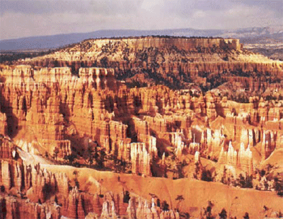
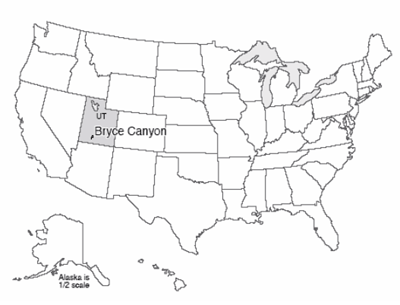
Bryce Canyon is a fairyland. Pillars, spires, and minarets, seemingly fragile and toy-like when viewed from the rim, tower far above the hiker who descends into the “canyon,” which is really a bowl carved out of the edge of a plateau. The morning sun, bouncing off the pink and pastel walls, casts a rosy glow on everything and everyone in the canyon. Gnarled trees cling to high slopes, their root structure exposed by erosion but somehow holding and nourishing the twisted branches. The old settler Ebenezer Bryce called the scenery of this tributary of the Paria River “a hell of a place to lose a cow,” but almost everyone who followed him has had a kinder assessment.
The main pink rocks of Bryce are a mixture of limestones, shales, and some coarser sandstones and conglomerates, deposited in a lake or a series of lakes, and together known as the Claron Formation or the Bryce Limestone. (Geologists studying regions have found it useful to give specific names to recognizable bodies of rock, with the names taken from geographic locations. Because the criterion for a new name is the ability to easily recognize a unit in the field, some really careful observers like to subdivide, and others like to lump, so there is often slight disagreement as to which name is most appropriate.) These Bryce rocks are from the early part of the Cenozoic, roughly 40 million years ago. The rocks record a generally wet time shortly following uplift of the land from a shallow seaway, and before continued uplift led to the high plateaus of today, and climate change dried the surroundings to the dry climate now at Bryce.
Some of this story is told in the rocks of Bryce. The rest is told nearby. Northeast of Bryce in central Utah, the rocks record the gradual transition from undersea to terrestrial. The growth and erosion of mountains to the west are marked by the appearance and then disappearance of coarse braided-stream deposits. These were replaced by slower streams, then by lakes, then another pulse of river sediments, and then the great Green River lakes that spread from Bryce to Wyoming and that record a wet, warm time in the west.
Geologists love to tell stories like this one. The seas came in, the seas went out, the mountains rose, the mountains were eroded. Such stories are useful, because they often include chapters such as “The oil formed here, and migrated there, and was trapped in those rocks, and we can drill into it this way and get rich.” Such stories tell us much about the stability of the Earth’s climate. And the stories are interesting to many people. But how do you read such stories, and gain confidence in them? One way to find out is to major in Geosciences and spend the next three years learning to do so professionally—in case you’re interested, talk to us! But if you’re really excited about the great career prospects in your current major of theatre or philosophy, at least read over the next few sections and you’ll get a brief sketch of geological techniques and what they tell us.
We saw at the Badlands that weather attacks and breaks down rocks, and we saw at the Tetons, in Canyonlands, and elsewhere that the loose pieces are transported. The processes of weathering and erosion produce new minerals from old, produce small pieces from big ones, produce dissolved salts, and move these around on the surface of the Earth. Eventually, these materials end up somewhere. The pieces derived from older rocks we call sediment. Sediment may be deposited on the bottom of a sea, or on the flood plain of a river, or at the end of a glacier. Sediment may stay for a while and then be moved on. If it stays for too long, it may be hardened.
There is no magic in making rock from sediment, nor is there an abrupt line separating the two. Many processes slowly transform loose pieces into pieces stuck together. If you don’t believe that loose pieces get stuck together, go to an old house and try to remove some piece of plumbing without using a really big wrench, or try to get pieces off an old bicycle without a big wrench. If you don’t have the time, trust us—people make big wrenches for a good reason! Nature does rust and otherwise bond things together in many cases.
The weight of additional material deposited on top of a sediment layer will squeeze it, forcing grains together and pushing water out. The resulting material is harder than what was there before. Continued squeezing and heating as sediment is buried (remember that the Mississippi delta is miles thick) produce rock from this sediment, and eventually may change these sedimentary rocks to metamorphic rocks. The clays in sediment change into different clays and then into other things as the cooking proceeds (just as flour and water and yeast make cookies in the oven), and as the crystals of the new minerals grow, they tend to wrap around each other and get “woven” together so they are hard to separate.
Groundwater circulating through sediments will dissolve minerals in some places and precipitate them in others, in response to subtle changes in temperature, pressure, or chemistry. We saw that there is dissolved rock in Spring Creek water, and in all other waters. If you have “hard” water, of the sort that causes people to buy water softeners, that means the water has a lot of dissolved rock and especially dissolved limestone. The white deposit that builds up on drinking glasses in houses with hard water is not soap scum but rock, very similar to stalactites in a cave. A lot of the sticking-together of plumbing pieces is linked to minerals precipitated from hard water. What happens in your house can happen in nature, where the precipitate serves as a cement that binds particles together. This cementation, together with the compaction from squeezing and the recrystallization from heating and changing clays, slowly turn loose sediment to sedimentary rock. Sometimes, rocks are made entirely of hard-water deposits—stalactites are an example, but so are the salt deposits left in the bottom of Death Valley when the water that runs down from the peaks quickly evaporates. Rocks made entirely of precipitate are also called sedimentary rocks.
Classification of Sedimentary Rocks
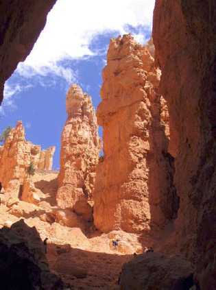
Our classification of sedimentary rocks is a bit of a hodge-podge. We first consider whether a rock is clastic (made from pieces or clasts of older rocks) or chemically precipitated (deposited from chemicals dissolved in water). This subdivision is not always satisfactory—a sea shell is a chemical precipitate because the animal pulled the material in its shell from the water, but a limestone made up of sea shells might be called clastic because the sea shells are chunks. Usually, people consider limestones and evaporites (rocks left by evaporation of water containing salts) to be chemical precipitates, and all others to be clastics.
Clastics are classified based primarily on grain size. The very smallest particles of clay make claystone or shale. Slightly coarser pieces are silt and make siltstone. Coarser still is sand, which makes sandstone. Going to still-bigger clasts, cobbles and boulders produce cobblestone and boulder-stone, but we also call both of these conglomerate.
Reading Sedimentary Rocks
We learn about the past through sediment. Archaeologists dig up the garbage dumps and houses of past peoples to learn how they lived. Historians root through the intellectual sediment of people to learn what they have done. Sedimentary rocks, in the same way, tell the history of the surface of the Earth.
A typical sedimentary rock contains all sorts of clues as to how it came to be. The clast size or grain size is a measure of the energy of transport—tiny clay particles will not settle out of a swift mountain stream, so a fine-grained deposit indicates slow or no currents. Grain shape tells more—an angular clast has not been transported far in water or wind, because during transport sharp corners are knocked off and the clast becomes rounded. Sorting also tells something—wind and water sort sediments by size, but landslides and glacier ice do not, so the sand grains on a beach are all about the same size, but a landslide leaves a deposit that ranges from miniscule clay-sized particles up to house-sized boulders and houses.
Composition provides clues—olivine is a mineral that is changed rapidly by chemical weathering and occurs primarily in low-silica igneous rocks such as sea-floor basalts, so if you find olivine grains in a sandstone, you know both that the sand was derived from such rocks, and that the sand was not transported very far in a wet environment because the olivine was not broken down. Even surface textures have information—the striations and polish of a glacier-transported rock look very different from the sand-blasted appearance of a quartz grain in a sand dune.
The sizes and shapes of deposits give further information. There are several ways to tell which way a current of wind or water was moving when it deposited a particular rock. For example, with sand dunes, the wind carries sand up a gradual slope and then dumps the sand over the top where it avalanches down and forms a steeper slope. When we find the gentle and the steeper slope in the rock, we can tell which way the wind was blowing. Sand ripples and bars deposited by flowing water have similar indicators. A sand body deposited by a stream often is long and skinny in the direction that the stream was flowing. A “fossil” sandy beach may be long and skinny like a stream deposit, but the current directions caused by waves will be pointing more-or-less across a beach but along a stream, so there is not much danger of confusing one type of deposit for another.
The list of indicators is very long. When mud dries out, it cracks to form mud cracks. Such features are easily recognized in rocks, and indicate occasional drying. Raindrops that spatter down on rocks leave little pock marks that are readily recognized if they are turned to stone and preserved.
Added to this, we have the advantage of fossils. Tree trunks in growth position indicate a non-desert deposit on land—trees are replaced by cactus in desert environments, and by seaweed underwater. Coral skeletons indicate a reef in the ocean.
With such a wealth of information, we certainly should be able to read much of the story of the past. All that is required is that: 1) we study the rocks carefully; 2) we know what sorts of sediments are produced in what sorts of environments today; and 3) we make the common-sense assumption of “uniformitarianism”, that the present is the key to the past.
Suppose that you go out today and observe that streams flow downhill and carry rock and mud from the hills to the sea. You dig around in a lot of different streams, and find that they have sorted sedimentary beds, occasional fish fossils, current-direction indicators pointing more-or-less the same way in many different sand bars, sand bars of certain shapes and sizes, etc. You talk to a lot of people, and read history books, and learn that streams have been flowing downhill and carrying rock and mud from the hills to the sea for a long time. You find a place where earlier people had diverted a stream into a canal, dig up the old stream bed, and find that it looks just like modern stream beds. You find still older deposits that look exactly like modern stream beds, and you find deposits in which the sand has been cemented by hard-water deposits to make sandstone, but everything else looks just like modern stream beds.
The reasonable person would say that these “fossil” cemented-to-stone stream beds are indeed old stream beds. Of course, we cannot prove that they are. Perhaps space aliens made the world the year before you were born in such a way that it looks like there were old streams, and the aliens invented all the history books and fake memories of old people. Calvin (of the Calvin and Hobbes comic strip) once told Susie that their class was having a substitute teacher because “our REAL teacher rocketed back to Saturn to report to her superiors. They’re trying to subvert us little kids with subliminal messages in our textbooks, telling us to turn in our parents when the Saturnians attack. Earth will be rendered helpless! I’m too smart for ‘em, though! I don’t read my assignments!” (To which Susie replied, “I think one of us has been eating too much paste in art class.”) Maybe Calvin is right. And maybe the Geology-of-National-Parks professors are Saturnian aliens, too! The textbook author, Dr. Alley, has really strange-looking hair where it hasn’t fallen out, and acts a bit peculiarly, you know.
However, despite his occasional interest in the topic, Calvin had not quite mastered geologic thought. Geologists take the common-sense approach: if it looks like a duck, and walks like a duck, and quacks like a duck, is genetically identical to type specimens of ducks, has a bone structure as observed in x-ray examination that matches known duck bone structure, mates with other ducks and produces duck offspring, etc., we call it a duck. If it looks like a stream deposit in size, shape, arrangement, location, grain size, sedimentary structures, fossils, etc., we call it a stream deposit. We learn from the present—what do streams do, what do they make, where do they occur—and then we use that knowledge as the key to interpreting the past.
Learning from the present is not a casual undertaking. By working hard in one or two advanced courses, a really adept student can learn to distinguish most of the main deposits—streams versus lakes versus beaches, for example. Many geologists spend their whole lives really learning what stream deposits look like, how they form, etc., while other people are spending their lives working on beaches, or lakes, or glaciers.
When lots of these experts agree that the limestones of Bryce and surroundings were deposited in a shallow lake and adjacent streams and mud flats, you should know that the rock type (limestone, but with differences in chemistry and texture from limestones forming in oceans), the fossils (algae, fish fossils, alligator bones, bird tracks), the structures (mud cracks, raindrop imprints), etc., have been considered carefully in telling the story. We can’t rule out Calvin’s Saturnians, but a more down-to-earth explanation is more convincing.
Textbook 9.2: Arches National Park
Stratigraphy and Arches
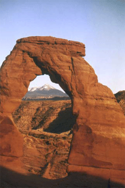
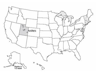
Arches National Park is just outside of Moab, Utah, almost within shouting distance of Canyonlands. Arches contains the largest concentration of natural stone arches in the world, with dozens of major arches, and numerous other holes and interesting rock features. The longest natural arch in the world is there, Landscape Arch, spanning about 300 feet (almost 100 meters). Several rockfalls have occurred from Landscape Arch since European settlers arrived, reducing the arch to a thickness of only 11 feet in one region. The trail under the arch has been closed; the Park Service knows that eventually more rocks, and the whole arch, will fall, and the rangers do not wish to be involved in extracting compacted humans from beneath the remnants of what used to be the world’s longest arch.
The arches are all eroded in sandstone, and especially the mid-Mesozoic (deposited during the time of dinosaurs) Entrada Sandstone, which includes both marine and wind-blown sands. Arch formation started with deposition of thick beds of salt in the Arches area. Sediments including the Entrada sands were deposited on top of the salt, and cemented by hard-water deposits to make sandstone. When the weight of those sediments became large enough, the salt began to flow, squeezed from places where thicker sediments caused higher pressure on the salt, to places where thinner sediments gave lower pressure, like ketchup in a fast-food packet squeezed from one place to another. However, the foil wrapping of a fast-food packet is fairly flexible, but the Entrada sandstone was not, so as the salt moved, the tough sandstone broke. The most common joints formed by this motion are parallel, nearly vertically oriented, and a few yards (or meters) apart. Weathering processes attacked the rocks along these joints, which were slowly widened to leave vertical slabs of rock called fins.
Some weathering and erosion processes are more effective near the ground than high up. For example, you will see huge steel bolts sunk into the rock of some road cuts just above the highway to keep the weight of the rock above from popping slabs of rock loose that might blast into the road and kill people; such rock-bursts also occur in quarries. When such slabs of rock fall, they often leave a curved or arch-like top, because it is easier to break off a curve than a square-cornered piece. This process is among those contributing to arch formation, breaking through the fins to make the beautiful stone arches.
Stratigraphy
The text above says that the Entrada Sandstone is from near the middle of a time we call the Mesozoic, an Era of geologic history, and for Bryce, our text told you that Bryce Limestone is from early in the Cenozoic Era of geologic time. You have not been asked to learn these terms yet (but you will be, so might as well lodge them in your brain now). The Mesozoic is older than the Cenozoic, so the Entrada is older than the Bryce. How do we tell which layers are older or younger?
Putting rocks in order is an enjoyable puzzle, requiring the sort of logic used in sudoku or in crossword puzzles. You rely on a few general principles that really boil down to common sense, plus a lot of puzzling and looking and thinking. Start with “what’s on top”? The layer of mud that settles out of floodwaters is deposited on top of the mud and grass and linoleum and grand pianos of the flood plain. Naturally, the mud from the flood of the next year is deposited on top of the mud from this year (nature doesn’t dust the grand piano). In ordinary sedimentary rocks, the youngest ones are on top and the oldest on the bottom. We call this the Principle of Superposition.
Note that this applies to ordinary rocks. There are cases in which rocks are turned upside down. Take a sheet of paper on your desk, put fingers on opposite sides and squeeze your fingers and the ends of the piece of paper towards each other (see the figure on the left). The paper will buckle into a fold. If you get your fingers together, the fold may “fall over”. A vertical hole through your paper would now go through the top of the page and out the bottom, but then through the bottom of the page and out the top, before finally going through the top and then the bottom—going from top to bottom, the paper is right-side up, then upside-down, then right-side up (look at the figure again).
Fortunately, there are many “up” indicators in rocks that tell you which way was up when the rock was formed. Animal tracks and raindrop imprints are made down into mud, not up. If you find a track pressed up into the roof of a cave, it is reasonable to suppose that the track originally went down but then has been turned over, so it is now upside-down. Mud cracks narrow and disappear at the bottom, not the top. Curved clam shells are usually flipped by currents into the stable, hollow-side-down configuration rather than the rocking, hollow-side-up configuration. Bubbles in lava flows rise to the top where they are trapped just beneath the quick-cooled upper surface; the bubbles do not sink down to the bottom. (You will meet some of this in the second V-Trip, and in the Rockin' Review of this chapter, and in Exercise 4.) Hence, you can learn whether the rocks have been turned upside-down or not.
In clastic sedimentary rocks, the clasts must be older than the rock is. So a conglomerate containing pieces of granite and of other things tells of formation of a granite from melted older rock, followed by physical erosion to break the granite into pieces, followed by transport to mix the granite pieces with chunks of other rocks, followed by deposition of the chunks and hard-water cementation to make the conglomerate rock. A conglomerate containing pieces of sandstone tells of two cycles—make the sand from older rocks (perhaps from breakdown of a granite by chemical weathering), followed by transport of the sand to a beach, followed by cementation of the sand with hard-water deposits to make sandstone, followed by physical weathering of the sandstone to make sandstone chunks, followed by transport of the chunks and mixing with others and deposition and cementation to make the conglomerate. If a fault has split a granite clast in a conglomerate, and moved one side relative to the other so that the pieces no longer match, the fault must be younger than the conglomerate—something must exist before you can break it. If a layer of sandstone is standing up on edge, then it must have been deposited, hardened, and then tilted—because of mass-movement processes, layers are nearly horizontal when deposited (not exactly, but pretty close); if you tip a mud layer up on end before it has hardened, it spreads into a new, nearly horizontal layer.
Below is a photograph of an outcrop near I-70 in the near-desert conditions of central Utah (left), and a sketch of the outcrop (right). The rocks at the bottom were deposited on a sea coast—they contain marine fossils and other markers of the sea, and are mostly sandstone and shale. But they are standing on edge and truncated at the top. Developed on the top of them is a soil, and on top of that are lake deposits with flamingo bones, fish fossils and alligator bones.
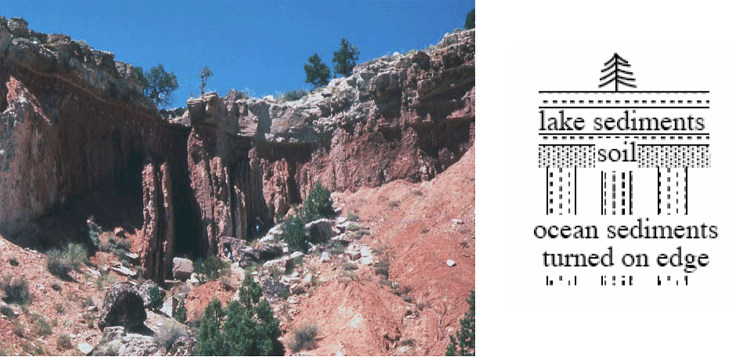
The story of this outcrop includes:
- Some history to produce sand and mud and deliver them to the sea, where they were deposited and then hardened;
- A mountain-building episode to turn the rocks up on edge;
- Erosion to truncate the rocks, together with weathering to create the soil;
- Growth of a lake, with sediment accumulation in the lake;
- Drying or draining of the lake; and
- Erosion to reveal a cross-section of the deposits.
You can postulate many other things—Dr. Alley is just lying about the rocks; or, the space aliens put the rocks there; or, a giant tornado blew the rocks there one afternoon; or…. We humans are very inventive, and can always come up with a new idea. But when you follow out the implications of these other stories, some fundamental problem always comes up, whereas the story of the rocks being deposited and hardened and tipped on end and eroded and so on works just fine, and makes predictions that are borne out over and over. Hence, the “geological” or “scientific” interpretation is the sensible one.
Notice that the erosion surfaces [events iii and vi in the list above] represent time gaps in the sedimentary sequence; the rocks at this site do not have a record of the environment during the time erosion was occurring—you have to go to where rocks were being deposited to learn that. A time gap in a sedimentary sequence, whether from actual erosion or just lack of deposition, is called an “unconformity”. Most of the land experiences erosion most of the time—the mud in the Mississippi is eroded from the lands upstream, and most of us most of the time do not have to worry about mud being deposited on our grand pianos or carpets. But, sediments are deposited on land, and sediments are deposited almost everywhere almost all the time under the sea, allowing a fairly complete story to be told.
Fossils and Relative Time: The Law of Faunal Succession
The material above explains how geologists can put rocks in order. The job may be quite difficult, because some outcrops are covered by soil, water, or other rocks, because offsets on faults may be so large that rocks on opposite sides can’t be matched back up easily, etc. But the job can be done.
When this job is done, a remarkable result emerges. Many rocks contain fossils, and different rocks contain different fossils. Arranging the rocks in order reveals that the fossils also are arranged in order. Rocks of similar age from similar environments have similar fossils; the more different the ages of the rocks (the farther apart they are in our ordered pile), the more different the fossils appear. The younger fossils have more in common with things living today than do the older ones. This observation, that fossils succeed one another in a definite and recognizable order, is called the Law of Faunal Succession. “Law” here is not something passed in Congress; a scientific “law” such as this one successfully summarizes an immense number of different observations, and works very well in explaining and predicting many different things in many places and times.
The Law of Faunal Succession was developed in England by a 17th century canal engineer/geologist named William Smith. He faced practical problems; digging in some rocks is easier than in others, some rocks hold canal water better than others, etc. If he crossed a river or a region with no rocks showing, and then found a few rocks, he wanted to know whether they were the ones he wanted, or whether the ones he wanted were up or down in the pile. Sometimes, a few fossils would be evident in a streambed, or even would be in use as weights for balances to weigh cheese of the local farmers, and he found that the fossils made his job easier by providing shortcuts for putting things in order.
Much later, faunal succession figured in the debates over evolution. But you should remember that the Law of Faunal Succession is like so much good science—a practical idea that gives useful results and helps humans do things successfully.
The Geologic Time Scale
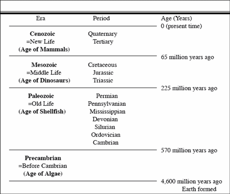
| Era | Period | Age since end of period(Years) |
|---|---|---|
| Conozoic = New Life (Age of Mammals) | Quaternary, Tertiary | 0 (present time) |
| Mesozoic = Middle Life (Age of Dinosaurs) | Cretaceous, Jurassic, Triassic | 65 million years ago |
| Paleozoic = Old Life (Age of Shellfish) | Permian, Pennsylvanian, Mississippian, Devonian, Silurian, Ordovician, Cambrian | 225 million years ago |
| Precambrian = Before Cambrian (Age of Algae) | None Listed | 570 million years ago |
Geologists learned to put rocks and fossils in order long before calendar-year ages could be assigned accurately (how many years old is that?). Lacking accurate year counts, the early geologists agreed on a “shorthand” for describing ages. Time is divided into big chunks, called “eras,” which are themselves divided into smaller chunks, or “periods,” and on into still smaller chunks. The big chunks (which you would be wise to know) are, from youngest to oldest, the Cenozoic (= new life), the Mesozoic (= middle life) and the Paleozoic (= old life) (see the table on the following page).
The oldest period in the Paleozoic is called the Cambrian, and the rocks older than it are called the Precambrian. As the Precambrian includes most of the history of the Earth, more and more workers are using “-zoic” terms for pieces of it (see the Enrichment for Unit 9). The periods are mostly named for places where the rocks are well-developed, such as the Cambrian for Cambria (also known as Wales), Devonian for Devonshire in southwestern England, and the Pennsylvanian for Pennsylvania (Europeans usually lump the Mississippian and Pennsylvanian and call that lump the Carboniferous, but we have such wonderful deposits of their Carboniferous that we divide them to allow better time resolution, and to use our names). The youngest two periods, the Tertiary (third) and Quaternary (fourth), were named in an old scheme that also included primary and secondary; history dies hard in geology.
Life appeared early in the Precambrian, and multicelled organisms were present in the Precambrian. The Cambrian began with a great diversification of organisms with shells. Older fossils are rare because soft body parts usually are not fossilized; when shells appeared, they accumulated to make limestone layers, so fossils “suddenly” (over a few million years) became common. The Paleozoic and the Mesozoic ended with mass extinctions that probably killed the great majority of organisms on Earth (we’ll return to this soon). The mass extinction at the end of the Mesozoic was caused by a meteorite impact at the end of the Paleozoic that is not fully explained, although radical changes in ocean circulation in response to global warming and massive volcanism that produced a widespread lack of oxygen in the ocean probably were involved.
Virtual Field Trips
Join Dr. Alley and his team as they take you on "virtual tours" of National Parks and other locations that illustrate some of the key ideas and concepts being covered in Unit 9.
Click on the first thumbnail below to begin the slideshow. To proceed to the next image, move the mouse over the picture until the "next" and "previous" buttons appear ON the image or simply use the arrow keys.
Virtual Field Trip #1: Bryce Canyon National Park
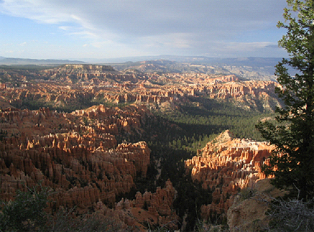
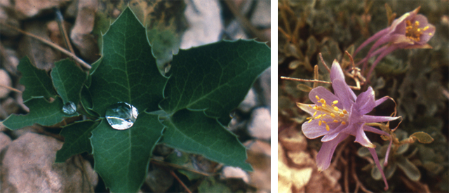
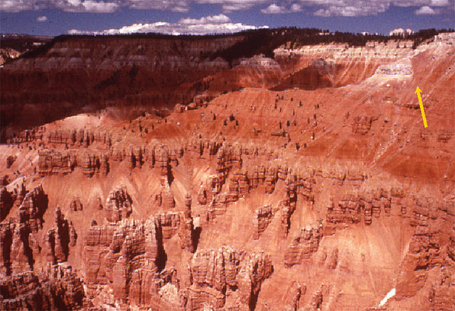
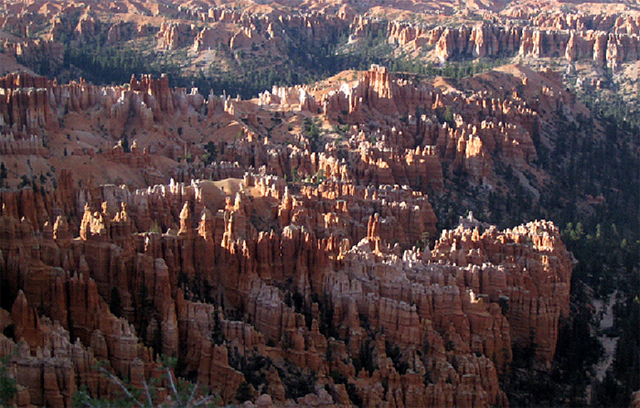
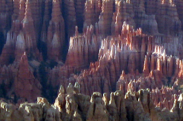
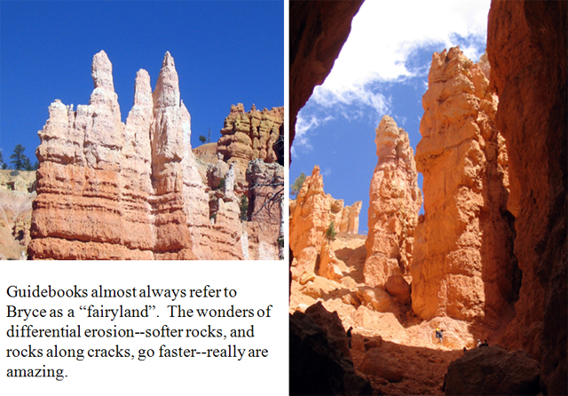
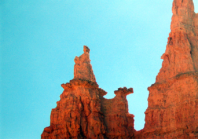
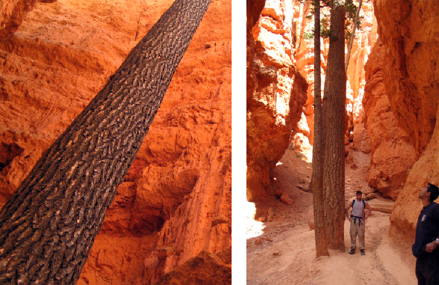
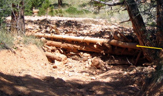
Image 1: Panoramic view of Bryce Canyon BRYCE CANYON: “A Hell of a Place to Lose a Cow”—quote by Ebenezer Bryce.
Image 2: A 2-inch tall dwarf columbine and a dewy Oregon-grape leaf struggle to grow at Bryce. Although Bryce Canyon is higher, cooler and wetter than many of the nearby parks, life is still tough on the unstable slopes of the canyon. Here, 2-inch-tall dwarf columbine (right) and a dewy Oregon-grape leaf struggle to grow at Bryce.
Image 3: Cedar Breaks National Monument, near Bryce, has the same sort of limestone as Bryce, of the same age. Notice where a small fault has offset the white layer in the upper-right corner.
Image 4: A valley of hoodoos (towers of rock with the harder rocks on top) in Bryce As at Arches, water works wonders widening joints. But the rocks here are not strong enough to hold up arches, instead making hoodoos (towers usually with harder rocks on top).
Image 5: A closer view of some hoodoos shows striations of color Much of the coloration is linked to how rusty the iron is in the rocks. The sedimentary layering is quite evident.
Image 6: Another close view of hoodoos. Guidebooks almost always refer to Bryce as a “fairyland”. The wonders of differential erosion – softer rocks, and rocks along cracks, go faster – really are amazing.
Image 7: A hoodoo named “Queen Victoria” because the top looks like a queen. The Park Service now discourages “naming” rocks, because visitors are so disappointed when erosion then changes those rocks. This one was named Queen Victoria back when naming was condoned. The layered sedimentary rocks are beautiful by any name.
Image 8: Trees in Bryce Canyon.
Image 9: Logs across a stream bed. A decade or so ago, the Park Service put the logs across the stream bed to slow the burial of a trail by sediment. As we’ve seen with dams, rocks filled the space upstream from the logs, and erosion happened downstream. Fast erosion supplied lots of rocks to fill the “lake” above the dam quickly.
Image 10: A close up of a rock at Bryce shows river gravels, conglomerates and clasts and sedimentary rocks. Bryce’s rocks are mostly limestone, but include river gravels such as the conglomerate shown here. Many types of clasts are present; the orange one in the middle is a conglomerate itself, and the clasts in it include several types of sedimentary rocks. This picture shows a long and complex story--try telling it.
Virtual Field Trip #2: Arches National Park
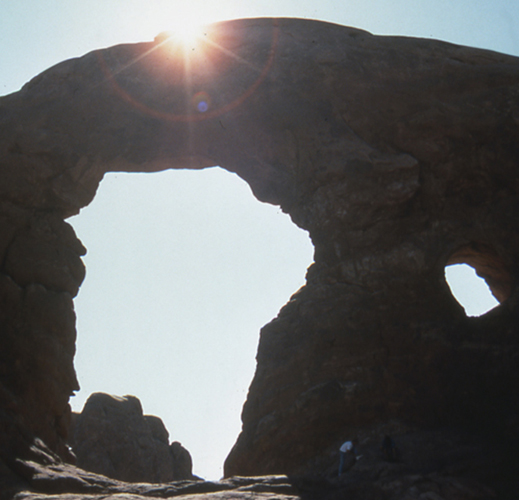
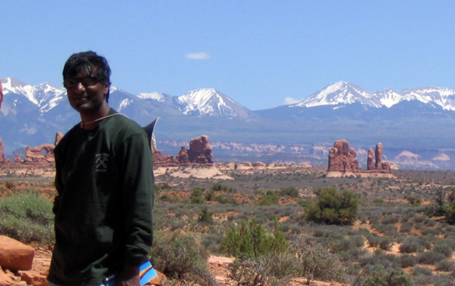
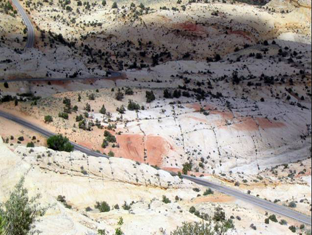
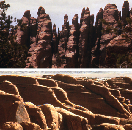
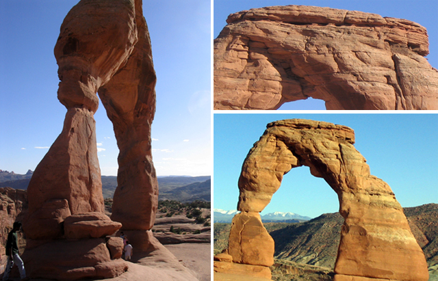
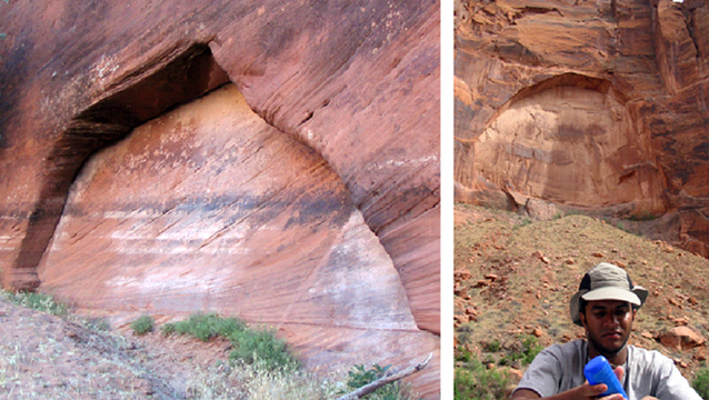
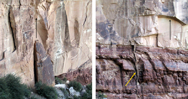
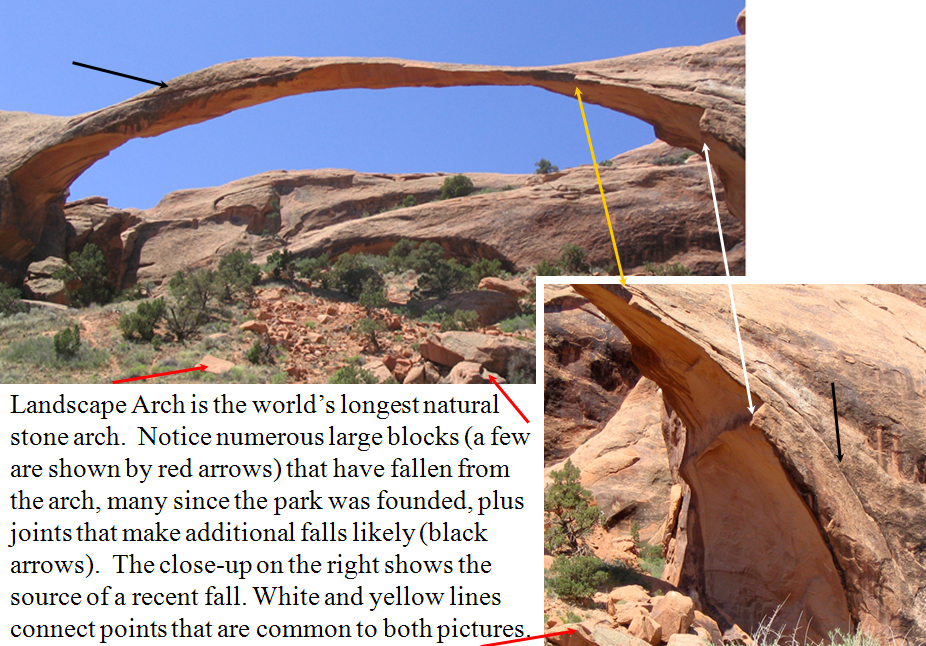
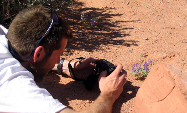
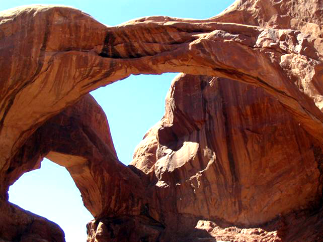
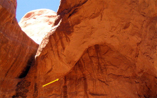
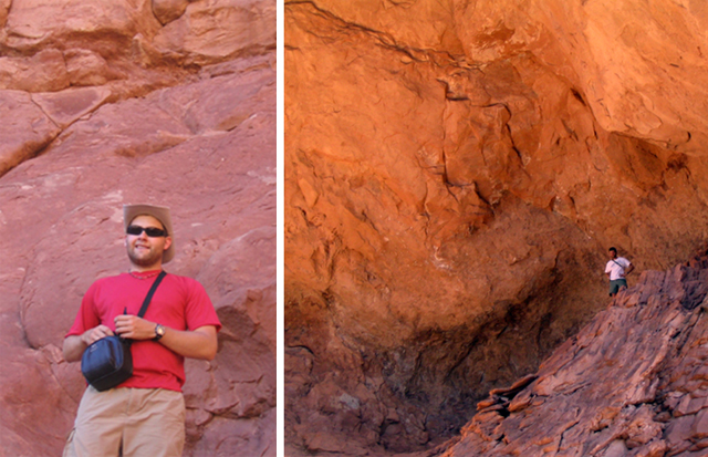
Image 1: A rock arch at Arches National Park. ARCHES NATIONAL PARK: Stories in Stone Photos by R. Alley.
Image 2: Dr. Anandakrishnan at Arches with the La Sal Mountains in the background. Dr. Anandakrishnan, Arches National Park. The La Sal Mountains in the background are named for the salt beneath them. The motion of the salt created joints that then isolated the fins that made the arches, such as the one next to Dr. Anandakrishnan’s shoulder.
Image 3: looking down onto the ground at Utah’s Grand Staircase-Escalante National Monument. The ground is white with a grid pattern of green plants. This isn’t Arches, but Utah’s new Grand Staircase-Escalante National Monument. Plants follow water that soaks down into joints in the fossil dunes of the Navajo Sandstone, making the grid pattern in the rocks. Various joint patterns exist; parallel rather than crossing joints are very important in making arches at Arches, as we will see next.
Image 4: End on view of fins at Devils Garden, Arches NP and an angled view of fins at Devils Garden, Arches NP. The tough sandstone has been broken by parallel, vertical joints, and weathering along those joints isolates “fins” of sandstone that then are eroded to make arches.
Image 5: Three images of Delicate Arch. The sandstone of Delicate Arch started as a sand dune (note bedding, top-right picture).
Image 6: Two pictures of arch shaped amphitheaters created by falling fins in sandstone. CAUSE student Raya Guruswami in Glen Canyon (right), and a cliff in Canyon de Chelly National Monument (top). Rock falls from the sandstone cliffs have left arch-shaped amphitheaters. Similar falls from fins help make arches.
Image 7: Two pictures of rocks that have fallen and the arch shaped scars they left in the stone cliff above. (right) an arrow points back up from the fallen rock to its arch-shaped scar. (left) Fallen rocks are gone, but an arrow shows their arch-shaped scar. Two views of fossil sand dunes over redder flood-plain muds, Grand Canyon. Sand fills a gigantic mud crack on the right (yellow arrow). Today, sand dunes encroach on the Nile in a very similar setting. The arch-shaped rock fall scars suggest how arches may form.
Image 8: Landscape Arch is the world’s longest natural stone arch. You can see that numerous large blocks that have fallen from the arch, many since the park was founded, plus joints in the rock that make additional falls likely.
Image 9: CAUSE instructor Eric Spielvogel photographing a lupine near Double Arch. The high desert of Arches is a harsh environment, but surprisingly beautiful flowers appear after the rare, brief rains.
Image 10: Double Arch. You can see dark streaks on the rock. The dark streaks down the rock are desert varnish, mineral deposits formed partly by microorganisms that grow briefly when rainwater runs down the rock.
Image 11: Close up of dark streaks (called varnish) at Double Arch. There is a crack near the top of the arch through which rainwater flows to form desert varnish. Enlargement of the crack will eventually lead to rock fall, changing the arch.
Image 12: Two pictures of men standing close to Double Arch. Rock falls have helped shape the immense cliffs.
Image 13: A rock with a grid like pattern of mud cracks in it. Mud deposited in a small lake near the sand dunes dried and cracked in the sun. More mud washed in and filled the cracks. After the mud hardened, the rocks were split apart, and the upper piece turned over; Dr. Alley’s index finger points to the crack-filling mud.
Word Document of Unit 9 V-trips
Want to see more?
Here are some optional vTrips you might also want to explore! (No, these won't be on the quiz!)
Arches National Park
(Provided by USGS)
Bryce Canyon National Park
(Provided by USGS)
GeoMations and GeoClips
This week, we feature one GeoMation and three GeoClips. The GeoMation focuses on "detective work"—the kind employed by geologists to trace and identify the geologic histories of the features and structures they study. The GeoClips take you out to Capitol Reef and Bryce with the CAUSE class, to see a little bit about how the detective work is done in the field. The real detective work involves more rainbows and rattlesnakes than you'll see here; for that, you might have to come see us about majoring in Geosciences.
We hope you enjoy this unit's multimedia presentations and that they help you make a little more sense out of Unit 9.
GeoMation:
It's the weekend, and you're baking a cake for the game for the big game. And so you put down a layer of cake like this. And then it's gotta be for the Penn State game. So then you're going to put in a little blue icing, so it's more enjoyable. And you're going to make another layer cake on top of that, still sitting there. Boy, you're a good baker. It's really very impressive.
And we'll put some more Penn State blue icing in the middle. And then you put down one more layer of cake to make the top of the thing. And wow, this is getting to be fairly serious when all is said and done. And then you're going to ice the top of that, and wow, isn't that beautiful.
And then you want to put some candles on. It's going to be Wisconsin game, and Wisconsin's going to get burned. So you better put on some Wisconsin red candles, and they have a little wick sitting out the top of them like that. And then you're carrying the cake across the floor and your big dog comes up and takes a gimungous bite out of your cake, which doesn't necessarily make you entirely happy. And so now your cake is going to look something more like this with this big hole out of it. And the hole goes all the way down, something like that.
Oh dear, what a mess the dog made out of the cake. And you're really very, very unhappy about what your dog did to it because you were carrying the cake while this happened, and you happen to know that if you're carrying the cake while it happens that you may lose your grip, and the cake turns upside-down, which is now a real mess, and the candles gets scrunched, and so they're no longer sticking down the way they're supposed to be. They're actually sort of sticking off to the side the way they get bent over.
Now, if you were to see this, if you were to find this cake on the floor, you would have absolutely no trouble telling what happened, and the sequence of events in which they happened. In the same way, a geologist faced with something such as a rock viewed edge on that has some mud cracks in it like this, there's a crack, says oh, this rock is right-side up, it has not been turned over because we know that when mud cracks, that the cracks go down in the rock, not up.
In the same sense, if the geologist was faced with some sort of a footprint, and let's make a dinosaur footprint here, if you would like to. Do, de-do, de-do. Here's the big footprint. OK. And the footprint is stuck down in the rock, something like that. And so you can see this is how it might have happened somehow. And that's not the world's finest footprint drawing, but you get the idea what we're trying to do. That has been shoved down into a rock so there's a big hole here where the footprint was made.
If you were to happen to find that footprint, and you're going to have to find that footprint as being upside-down, as we can make it very easily with the foot vertically, you wouldn't know that. And so geologists do that. They can put things in order in the same way you that could look a that squished cake and put it in order.
GeoClips:
Oysters! - Capitol Reef National Park
Rocks reveal how and where they were formed. What is in a rock, how it is put together, whether the pieces are big or little, sorted or mixed, angular or rounded, and so much more provide clues. Fossils also provide clues. Here, Dr. Alley and the CAUSE class are out in the desert at Capitol Reef National Park, but they are also in a shallow seaway from long ago. See why.
So we've been driving around the West, pointing at rocks-- there's a rock-- and saying, this is a sand dune. This is a lake. This is an ocean. But we haven't spent a lot of effort on, why do we say one is a sand dune, and one is a lake, and one is an ocean? Now in the case of the sand dune, when we looked at it, it was all sand. There were no little pieces, there were no big pieces, it was all intermediate size sand pieces. They had these structures that one sees in modern sand dunes. If you found anything that looked like a fossil, it was little reptile tracks. And so they had all the characteristics that you see in a modern sand dune.
Now here, we're in rocks that are very different. The rocks behind us are sort of washing away and they're making mud that washes down around our feet. And there's a number of characteristics of these, the layers are different, how big the grains are in them is different, sort of everything about them is different. And we can say these were rocks that were underwater. And we can go through the whole list of reasons why we can say they're underwater, but there's one very easy one. If we look down at our feet, and we look around at what's washing out of these rocks, what we find is oysters. And one can be very confident that if you find rocks full of oysters, you're not in the middle of the desert.
Mud Cracks - Capitol Reef National Park
Rocks occasionally are turned upside-down, but nature tells us when that happens. Mud cracks can show us that; they are wide at the top, narrow, and then end at the bottom. Fill mud cracks with another layer of sand or mud, and the cracks are "fossilized," to tell us which way was up when the rocks were deposited. Here, visit Capitol Reef with Dr. Anandakrishnan to see mud cracks, with a brief look at some right-side-up ones from the Grand Canyon.
[MUSIC PLAYING]
Look at this picture. You've got all these cracks developed over here. Imagine a second flood coming through here, a relatively gentle flood, water slowly flowing in here, a new layer of silt and sand and shales and clays. What's going to happen? All of that new material is going to filter down into these cracks and it's going to solidify in there as the water evaporates out of it.
So now 100 million years goes by. And we come along and we cut this open and we look at this layer and we look at these, and you'll see mud cracks. And we'll be able to tell that that layer of rock was oriented this way, because these mud cracks all start wide at the top and get narrow going downwards. And it quite often happens that these strata of rock, because of the incredible forces of nature of plates coming together, will take these layers and just flap them over upside-down. And we come along and we look at them, and you can't tell which way is up, which way is down until you find one of these mud cracks.
And then, even if the layer's upside-down, then you'll have these mud cracks teepeeing upwards. And you'll say, whoa-ho, this thing must've been flopped over and turned over upside-down. And it's the same processes-- I'm doing a Richard here. It's the same processes that produce these mud cracks, will fill them in, and then maybe after 100 million years, they'll get fossilized, turned into a hard clay layer, and then turned upside-down. But we'll still be able to tell what we call the stratigraphic relationship, the time relationship, which is older, which is younger, because clearly this is older than whatever would lay on top of it.
[MUSIC PLAYING]
Conglomerate within a Conglomerate- Sevier Fault near Bryce Canyon National Park
Geologists read rocks, and the stories are fascinating--historical novels full of intrigue. In this next GeoClip, Dave Janesko and Dr. Alley perch high up in Red Canyon just west of Bryce, and read one of those stories of deep time.
A conglomerate is a sedimentary rock in which many of the clasts are bigger than sand. Dave and Dr. Alley are looking at a conglomerate that includes many different clast types, including one that is itself a finer-grained conglomerate. The clasts in that conglomerate-within-a-conglomerate include several types of sedimentary rocks, including sandstones that are themselves made from older pieces.
Um, maybe. I can kind of break it out.
No, that's a conglomerate, isn't it?
Yeah. It is. Look at that, Dave. That's the conglomerate we were looking for. Just look at that! Isn't that a beauty?
It is.
A conglomerate in a conglomerate. What do you make of the class in the little one?
It looks like sandstone and limestone to me.
Deep time. Deep time!
Very deep.
We got deep time! This is just beautiful.
A conglomerate classed in a conglomerate?
A conglomerate, you have to have sand grains glued together to make sandstone, broken and rolled to round them off, because this is rounded. And you have to have an ocean or a lake that has things living in it, precipitating calcium carbonate to make a limestone, broken loose and rounded off. And then those have to get together in a beach or in a stream channel. They have to be deposited with sand around them, then they have to be cemented together with hard water deposits. Then that has to be broken out, rolled in a stream and rounded, put together with all these other rocks coming from every which way. All of those then have to be glued together with hard water deposits. And then we have to get from the stream or the lake or whatever it was that was making these, up here in the middle of the desert on a cliff. And it's all in that one rock right there. And there's really no other way to explain that rock.
In geology, we often meet people who tell us that we do not know what we're talking about, that the world looks like it is very, very young, that there's nothing in the world older than written history. We never tell those people that they're wrong, that they're false, that they've been led astray. But we can tell these people, it looks old, that the scientific interpretation, the best way to look at these rocks, is that they tell of vast, deep time. So when one looks at a rock like this one that has little tiny remnants of old rocks glued together into a rock which is bounced around in the stream and rounded, that then is glued in with a whole bunch of other rocks into another rock that has been bounced around in a stream and rounded, that is sitting here glued with a bunch of these things on a cliff in the desert-- it is very hard to imagine how this could be something that is only 6,000 years old. And so all we do in science is, what can we observe? What can we test? And what we can observe, what we can test says, really, really old.
Want to see more?
Optional Enrichment Article (no, this won't be on the quiz!): What do beauty, saving money at Las Vegas, religion, oil exploration, emerging new diseases, and the planet’s recovery from global warming have in common? All in some way involve deep time, the immense age of the Earth. Eric Spielvogel filmed a discussion of these and other issues with Dr. Alley, for a special “time” issue of Research! Penn State. The Deep Time film clips on the next page will give you something to think about, and may even help with the course. Enjoy! Also, here are some optional animations you might also want to explore! (No, these won't be on the quiz either!)
Sedimentation Models
(An extensive collection of animations on this subject)
Sequence Stratigraphy
(An extensive collection of animations on this subject)
Deep Time GeoClips (optional)
During three weeks in May 2004, two hardy Penn State geoscientists traveled through 12 stunning National Parks of the southwestern United States with 13 lucky students. The trip was sponsored by CAUSE (Collaborative Active Undergraduate Student Experience), an annual course offered by the College of Earth and Mineral Sciences. Richard Alley, Evan Pugh professor of geosciences, led the expedition. CAUSE 2004 was an extension of his course, "Geology of National Parks," and allowed students to interact with and learn from the rocks and landscapes of Arizona, Utah, and Colorado. In the following videos, Alley explains the concept of deep time, how it tells the history of our planet, and how it affects our lives.
Richard Alley, Ph.D., is Evan Pugh professor of geosciences in the College of Earth and Mineral Sciences, rba6@psu.edu.
—Emily Rowlands
What is Deep Time?
What is deep time? Deep time, something very much older than us. Very much older than written history. Something that's old enough to encompass the glorious things that we see as geologists, 4.6 billion years of this planet.
If you go to the Grand Canyon and you look at this great trench holding a river at the bottom of it, and you think that the world is as old as written history, you're very confused. Because how can that river be down there when we can see what the river is doing? We know how rapidly the river is changing the world. People have been coming there for a couple of centuries and writing down what they know about it. And native peoples have been there for a few thousand years. And we know that its changed a little bit in that much time.
And so what's it doing there? Why is it there? If you open the door to deep time, you say OK, a sheet of paper a year, that much erosion, taking a sheet of paper off the rock every year, and you have way more time than is needed to carve that canyon. A sheet of paper a year in a million years, and you have the canyon.
And then you can start to see these greater stories. Because that's the time to cut the canyon. But how long did it take to make the rocks first? And so you see these tremendous stories that are sitting there. And you go out and look at the canyon. If you live in a shallow time, you look at the canyon and you say, isn't that great? It would make a nice picture. It would make a nice post card. And then you go to the visitor center.
And if you live in deep time, there's all these stories. And you can sit there and play in your mind's eye, the beauty of the seas coming and the seas going. And you can imagine what was that lizard that ran up the back of that sand dune, that's fossilized, and that big cliff, the first big cliff down from the rim of the canyon? There were lizards running across sand dunes when that was there. Why were there sand dunes there?
There's these amazing stories. And you stand there for an hour, and you're still thinking about them. And then you got to go walk down in and look at them closer. And rather than running to the gift shop and taking off to Las Vegas to waste your money gambling somewhere, you're lost in deep time. And it's just beautiful.
Deep Time and Beliefs
I do think it's difficult for people to conceive of the age that we have here for a number of reasons. One is that, if you are a literal believer in certain sacred books, you believe that the earth is no older than written history. Now, as a geologist, my predecessors, back mostly in the 1700's, faced this. These were people who really believed in the sacred books and who, at the same time, had to look at the rocks and make sense of them. And some of them ended up, no, I don't believe the rocks.
Some of them ended up actually renouncing their religious beliefs. Many of them said, no, I can be a religious person and I can believe the rocks. But we're going to have to let a day be a little longer than 24 hours in the very beginning. They had to find some compromise between the two. People who absolutely believe, word for word, literal interpretation of certain particular sacred books simply cannot believe the age of the canyon.
I'm a religious person. I won't subject you to my beliefs. I am a religious person. And I belong to a very large religion that has several million members. And we have no problem with the age of the canyon.
Deep Time and Climate Change
If you want to ask, is nature going to undo what we humans are doing to the world-- we're burning fossil fuels. We're taking the carbon out of that and putting that carbon into the atmosphere-- and that's changing things. It's changing how easily plants breathe. It's changing how well shells in the ocean can be made by clams and corals. It's changing the climate. It's changing all sorts of things.
Nature will undo that. How rapidly? And so for that, we have to go back and look at how rapidly has nature done things over deep time.
And we do know. Nature has changed carbon dioxide in the atmosphere a whole lot. The dinosaurs lived in a world that had a lot more carbon dioxide in the atmosphere than we do, and they were fairly happy in that world.
It was a warm world. There were no ice sheets at the poles. It was warm all the way to the poles. There were crocodiles almost to the North Pole, and palm trees in Wyoming, and all sorts of things.
But the change between a low carbon dioxide world and a high carbon dioxide world that nature did is 100 million years, and we're doing it in 100 years. And so, is it likely that nature is going to undo what we're doing rapidly at a time that we would notice it? No. And so one needs to understand how rapidly does the world work by itself, and how rapidly do we change things. And so knowledge of deep time comes into questions like this.
Deep Time and You, Part 1
There really are things that matter to you that come out of deep time. That's one reason we have a geosciences department at Penn State. If you've got a job-- you're a geoscientist. You took an undergraduate degree here, you get a job with an oil company, and you're supposed to tell them, should I drill an oil well here or not? We know that oil is made by cooking dead organic material, dead algae for the most part. You know that if you've had oil in your engine and your engine gets too hot, the oil will burn up. Oil is flammable. If rocks have been too hot back in the past, you won't get oil out of them.
And so you need to know, has it been hot enough to cook those rocks? Has it not been too hot to break them down? What happened to them. And so to figure that out, you need to know something about how deeply they've been buried, how long they were down there, how long it took them to come back up, what is their path through time, temperature, space. And that requires knowledge of deep time. Some rocks are not going to give you oil, because it burned up. There's a little bit of carbon, a little bit of graphite, stuck in there, and you're not going to find oil out of that. And so you need to know something about that.
Deep Time and You, Part 2
Knowledge of evolution. AIDS was going to happen, something like that. Antibiotic-resistant bacteria are going to happen. Things that are alive are survivors. And things that are alive have ways to adapt if their environment changes. We have to beat that by being smart, because evolution is very slow process. It takes hundreds, thousands of generations. Modern humans have not been around long enough that evolution acts on us very much.
I have bad eyes. This is true. I've probably given my children bad eyes. But physical evolution doesn't matter to that any more. We solve it by being smart. I don't get eaten by a sabertooth tiger, A, because there aren't many sabertooth tigers running around out there, and B, because I have glasses so I can see. And so we outsmart these things, because we don't change fast enough by biological evolution that it matters, but bacteria that reproduce any 20 minutes-- they do.
And so we should know that evolution will happen, that we see the record of it in deep time, and that it matters to us. Because if you don't a really good expert in what bacteria are doing, what viruses are doing, what the flu is doing, how we can beat that when they change-- because they will change-- you're likely to die in the next pandemic. And if you do have really bright people across the street over here who are figuring out the new antibiotics and figuring out the new vaccines and figuring out what we can do about it when that happens, then we can go on being happy and healthy and terrific.
And so these knowledge of deep time things, whether it be oil, whether it be environmental issues, whether it be evolution bringing new diseases that we have to deal with, deep time matters.
Video Lecture
The Unit 9 lecture features Dr. Richard Alley and is 52 minutes long.
Hello. We are going to switch to something different now. You have built mountains with Sridhar. You've torn down mountains with Sridhar, and then you've seen where they go down to the coast with me. And now, we're going to start becoming historians.
A lot of the job of a geologist is to read the past, to find out what it tells us and what we can do with it. As you know, a lot of people make you take history when you're going to school because they believe that, if you know where you came from, that it helps. If it happened, it has to be possible. And so, learning about history is a useful thing.
And so, now we're going to start looking back into history and see if we can tell time, see if we can tell stories, see if we can find out how the environment works. We're going to do a lot of this by looking at sedimentary rocks. We're going to look at what happens to all that sediment that's washed down the river before it gets subducted and erupted again. And we're going to do this by trying to tell time. We're going to try to sort out time.
We're going to start looking at some pretty pictures because we've got to look at pretty pictures. We've got to go to national parks and have fun. And so, we're going to start out with the CAUSE class at Arches National Park.
Arches sits just outside of Moab, Utah. It's a great town, if you're into mountain biking. If you're into a whole bunch of things, you can go to Moab and have a good time. There are national parks just scattered all around the place. And Arches is certainly one of the prettiest ones.
Here's Sridhar, as you'd certainly recognize. And behind Sridhar are the La Sal Mountains. Way up in here are the La Sals.
And La Sal is salt, the salt. And down deep underneath this there are salt deposits from an old sea that dried up. And salt, when you squeeze it, gets soft and it moves.
And so, the rocks in this area have done a little bit of this over time. And by doing a little bit of this, they've given us some very interesting things. And in particular, they've given us the arches.
If you move underneath a really hard rock-- these are hard sandstone rocks from a giant dune field that looked like the Sahara way back when-- if you move underneath really strong rocks, they tend to break. And so, whether you're looking diagonal in the bottom picture or you're looking end-on in the top picture, you can see that, as the salt underneath moved and the rocks flexed, they broke.
Whenever there's a crack, the world can get in. It can go beat up the rocks. It can try to change the rocks.
And in particular, we're now underneath looking up, and you can see the blue sky way up there in the corner. And you can see where a rock has been cracked. The yellow arrow is pointing at it. And I'm going to draw you a red arrow that points at it too. You can see where the rock has been cracked.
And then these funny-looking streaks coming down the side of the rock, water is dripping through the crack. And as it does, it carries sand away. It causes chemical changes. And eventually, the rocks are going to fall off there. And as the rocks fall off, they make these beautiful structures that we know as the arches.
Here you can see a couple of places that arches have started. They haven't broken all the way through, but they've started. You'll see, on the right where Raya is sitting in front of a big stone arch that's arching up over the top of him up there, and the rocks have fallen out of that hole and have fallen down the hill here. These big chunks behind Raya came out of that arch. They fell out.
That one is in Glen Canyon. And on the left is one at Canyon de Chelly where the same thing has happened, except the stream has washed the pieces away. And so, you get this action.
You get cracks. You get weather working down the cracks. You get rocks falling out. And eventually, they break through. And you get glorious, beautiful things.
And you can see Sridhar in the very far, lower left of the left-hand picture sitting down there. And he is looking at Delicate Arch. It's one of the best icons of the National Park Service, sitting up there with the mountains framed behind it, just a glorious place.
If you look closely at the rocks of Delicate Arch, you will see, A, that they're sand, they're sandstone. They're sand that's glued together by hard water deposits. And B, you'll see that they have layers in them. In fact, they look just like a sand dune that's had the sand glued together by hard water deposits. And that is part of the story that we're going to be telling here in a little bit, is how sediment turns into sedimentary rock and then what we can do with it.
This is Landscape Arch. This is the longest natural stone arch in the world. Landscape Arch is probably not that long with us. You'll notice it's getting very, very thin in places such as that one.
You would not want to be under this one if things were shaking and baking just a little bit because, if you look underneath Landscape Arch, you'll see a huge number of bigger rocks that have fallen off. And Landscape Arch is slowly caving in. A very large one fell off of fairly recently, the last couple of decades.
And the scar is shown in the lower right-hand picture. So, down here, on the very far right-hand side, is where a bunch of rocks fell off. And you can see the rocks that fell off sitting down underneath it. And so, the thing is slowly changing. The parks really are active. Geology really does happen.
Now, this is a picture in Hidden Canyon in Zion National Park. It's one of the most beautiful places that you can ever imagine. It's a little bit south and west of Arches.
And you go up in this canyon. And it's just glorious. And you walk back there just a long distance.
And there's sand on the bottom. And the sand has little ripple marks in it from when water flows in the occasional rainstorms. And so, you see things like this. It's loose sand sitting on the bottom with these ripples.
This is sandstone. And all this is is loose sand that's been glued together by hard water deposits. And so, you go from sand to sandstone.
When does it change? Well, there isn't any set line. In just about everywhere, you get a little bit of hard water deposit put down.
At some point, you say, this one's hard enough that I'm going to change the name. But there's no real strong line. We find all sorts of gradations between sediment, sand or mud or something like that, and sedimentary rock. And so, let's go and look at that just a little bit.
So, we will switch over and we'll write a few things. And so, we are going to talk now about sedimentary rocks. You've met metamorphic rocks in Rocky Mountain with Sridhar. You've met igneous rocks belching out of volcanoes. And now, we're going to look at sedimentary rocks.
We tore apart the igneous. We tore apart the metamorphic. We made mud. We made sand and all sorts of things like that. And now, we're going to see what happens to them.
So, you saw that weathering happens. And when weathering happens, which is just weather beating up on rocks, it gives rise to a couple of things. It gave rise to clasts, pieces, chunks. So, clast is a fancy geological word, but chunk will do fine.
And we also saw that it gives rise to dissolved salts, stuff that you can't see that breaks down into individual ions and washes away to make the ocean salty. So, it gave rise also to dissolved salts. And so, these are the two things that come out of weather beating up on rocks.
And so, you can imagine that they don't always go immediately to the ocean, to the subduction zone, to the volcano. They may stop on the way. And so, if they stop on the way, if they're headed from here to somewhere and they end up stopping for a while, then we call it sediment.
So, if they stop somewhere, the stream puts them down, the glacier puts them down, the wind puts them down, whatever, if they stop, we call the pile sediment. We call it sediment. And so, you can imagine that this is going to turn into sedimentary rock at some point.
And to turn into sedimentary rock, you have to make it hard. So, if you take sediment and harden it, hardening sediment makes sedimentary rock. Pardon me, that's not a technical term. We'll give you some technical terms here in just a second. But hardening sediment gives sedimentary rock.
We change the name, nature doesn't. There are all possible gradations between sediment and sedimentary rock. And at some point, we feel compelled to say, that's too hard. I'm going to change the name, OK?
There are several processes that go into this highly gradual transition. And it certainly is a gradual transition, a gradual change that takes one to the others. Up here above where I am, if you take your rock hammer and you hit a sedimentary rock, it goes, boom! It's really hard.
I have a friend that was studying sedimentary rocks that had been scraped off of the slab in Olympic National Park. And what they called rock-- they wanted to study erosion. So, they go out and hammer nails into it and then watch how fast the nails were washed out. And so, theirs are very, very much softer than ours, but they both were called sedimentary rocks.
And so, we have this gradual change of one to the other. And it is achieved primarily in three ways. The easiest one for doing this is how you harden it, so the hardening of sediment. The easiest one to think of is probably hard water deposits.
Most people these days have soft water. And if you have soft water, they've taken most of the rock out of the water. And you don't notice that your pipes get clogged.
But you know something? In an old house, you call the plumber and you say, I need help with my faucets. The plumber doesn't come in with a little screwdriver. The plumber comes in with a big wrench.
And the plumber's got a big wrench because all the pieces are stuck together. And all the pieces are stuck together because, whenever you put water in contact with stuff, it dissolves something here and it puts something down here. And there's usually bugs living in it, microbes that are changing the chemistry.
Anybody that's ever tried to take apart plumbing knows that it's stuck. And it's stuck by hard water deposits. Whenever you've got water going, whenever there's life, there's chemistry. And whenever there's chemistry, you're taking stuff from somewhere and you're putting stuff somewhere else. And eventually, you're going to end up gluing things together or else dissolving things and getting rid of them.
And so, we always see this in human activity. This stuff get stuck together. Nature is the same way.
If you leave a pile of sand long enough and you don't stir it and you let water go through it, eventually, you'll find out that minerals get deposited in the spaces. And it's stuck together. And once it's stuck together, we say, oh, that isn't a sediment any more. Now it's a sedimentary rock.
It's easier if you squeeze it at the same time because that keeps stuff from moving around. And so, you may also see squeezing going on or compaction. If you pick up a handful of sand and you squeeze it, you won't make it stick very well. You're not strong enough to do that.
If you're at the bottom of the Mississippi Delta, it's seven miles of mud on your head. And it's pretty hot down there at the bottom. And you put seven miles of mud on your head, you get squeezed. And so, that will help solidify things.
Way down at the bottom where it's hot and things are getting squeezed, you'll start to see new crystals grow. Things will dissolve. Other things will deposit. You'll get, what we call, recrystallization, or the growing of new minerals.
And you'll be sitting there and say, OK, he's talking about growing new minerals. And he's got a fancy word for that, which is recrystallization. What's the difference between this and metamorphism? And the answer is, nothing.
We humans have to draw lines. And if it looks muddy, we call it recrystallization in a sediment. And if it looks pretty, then we call it a metamorphic rock. And we change the name.
But this grades into metamorphosis. You heat things. You squeeze things. And they start to change.
The biggie for making sedimentary rocks is really, probably, the hard water deposits. We actually have a fancy name for that, as you might imagine. We call it cementation. You're putting cement between the grains. And so, cementation is usually what glues sediments together and makes something different.
OK, now, let us, then, go look at some more sedimentary rocks. So, we'll switch over to the pretty pictures again and see if we can go there. It's so hard to pick a favorite park. They're all so wonderful.
But if you want a beautiful fairyland, wonderful, just unbelievable place, go sit at Bryce for a day. Sit on the rim in the morning. Get up early and watch the sun come up on Bryce. Sit there in the evening and let the sun sink behind you and the shadows lengthen. It is just an amazing place. It's hard to believe that anything can be so pretty.
The flowers are there. The mountain lions are there. All sorts of wonderful things to see up on the rim. They've got prairie dogs and deer and what have you.
You go in the winter and, if you can get in-- the last time I was there in the winter, they were loaning out snowshoes at the visitor's center. And you could put on your snowshoes, and you could go snowshoeing along the canyon. It's just an amazing place.
The scale of it is immense. If you look in the right-hand picture here, you'll see at the bottom a whole bunch of people. I'm circling one of the CAUSE students right here. And I can't even see which one because you'll notice that this is a big place. And yet it looks so delicate. It looks so beautiful.
Now you will notice in all of these pictures that you see layers. The rocks are layered, and that is common in sedimentary rocks. You wash something in, it's put down. You wash some more in, it's put down. And so, you end up getting layers in the sedimentary rocks.
These happen to be from a lake. Today, there's a little lake left in Utah, the Great Salt Lake. During the Ice Age, when there was less evaporation, there were a lot more big lakes that extended across many places in Utah. And as we look back in time, we see the deposits of many lakes. And so, the Bryce Lake-- there's various names given to this-- was this big lake that sat down in Utah.
If you look carefully in many of these rocks, especially some just a little farther north of this, you will find fish fossils. You will find flamingo tracks. You'll find little snails and all sorts of things that say, OK, this was a lake. It was water.
Just glorious, you know? When nature starts beating up on these rocks, it just carves such beautiful things that it's hard to imagine. Here are a couple of our CAUSE students down here, Sam and Sameer, looking at a couple of really big trees that are sitting at the bottom of the canyon. It's hard to imagine how they live there, but they're doing just fine, thank you.
I don't think they do this any more. But you remember we've talked about sediment being carried in rivers and along beaches and so on. Here's a case that a stream is flowing towards you. So, the stream is coming towards you.
Now, there isn't much water in this stream right now. It only flows when it's raining. And the trail was getting buried in sediment, so the Park Service put these big logs across the stream.
And you'll notice what's happened is that sediment has piled up above the logs, it's filled it in, and that there's actually been erosion down here below. It's cut down a little bit. So, you can see the dynamics of sediment. What you've learned in earlier units keeps carrying through.
If this were to sit here a long time, you would get hard water deposits. And it would start to become a rock. It isn't there yet. It's still fairly loose.
This is a very interesting slide. Dave Janesko of the CAUSE class and I had the good fortune to go up and look at this one. And this one feeds into a story that we're going to tell about reading history, about inferring what happened.
We are just outside of Bryce. We're down in Red Canyon and the place they used to shoot a lot of Westerns. And we're up on the same rocks that Bryce is made out of.
Now, Bryce is mostly lake sediments. And you find all these fish fossils and stuff in similar rocks around. And occasionally you'll find such things in Bryce. But if you have a lake, there's probably a river feeding into it. And so, in fact, as you go west out of Bryce, you find the deposits of the rivers.
We know what a river gravel looks like. If you've ever been down to a river that has a little gravel bar in it and looked at the rocks, you know that they sort of look like this picture you see on the left. The rocks tend to be rounded. Rivers break off the hard points. And so, after a while, river rocks tend to be rounded.
The big rocks, cobbles, we call them, or pebbles, will have sand sitting in the spaces between them. This thing just looks like a river deposit. It's shaped like one. It's shooting down from a mountain range to the west, headed down into the lake that was Bryce Canyon.
And so, this is the sort of deposit that the geologist, who has looked at a lot of rocks, will be able to say, rivers make this. And it doesn't look like anything else I've seen. The size, the shape, the arrangement, the rounding, the sorting, all the things you go into this are pointing to this being a river.
What's very interesting, though, is that one of the pebbles in that river, which is this orange one in the middle here, one of the pebbles in that river is itself a river deposit. You can see that this orange one that I'm drawing on over here is made up of little, rounded sedimentary rocks itself. There's a big story in this. And it's a story that you should start thinking in your mind, how will am I going to tell this story?
What is it that has to happen that I can have a piece of an old mountain range and a piece of mud that's been squeezed and a piece of an old beach that have been put together in a river, bounced along, the corners knocked off, had sand deposited around them? Then they've been glued together by hard water deposits enough to make them hard.
Then they've been broken out. They've been bounced around in another river until they get rounded on the outside. They get deposited with pieces of all sorts of other things, old mountain ranges and old beaches and other things. They get glued together by hard water deposits. And they're setting up on a cliff far above any stream on the outskirts of Bryce.
There is a big story in this. And it's a story that, like I say, you want to start thinking about how you would tell that story and what it would mean. So, let's go back over to drawing things that might possibly prove useful. And what we're going to do now is we're going to take a look at sedimentary rocks, such as the ones you were just looking at.
OK, so we saw that sediment is either pieces, it's clasts, or else it's dissolved stuff. It's salts that dissolved. As you might imagine then, the sedimentary rocks that are produced from sediment come in two basic types. They either are pieces or they are the dissolved stuff that is put down. And so, we see chemical precipitates.
If you take a handful of ocean water and you let it evaporate, you will get a handful of salt, a little bit. If you were to wash ocean water into a little, shallow basin next to the ocean and then close it off and let it evaporate, you'll get a layer of salt. If that happens a few times, you'll end up with a lot of salt.
We saw, way back at the beginning, Death Valley early mining was for salts. It was actually a particular salt that had borax in it that had washed out of volcanic rocks. The water is carrying the dissolved stuff.
It goes down in Death Valley. The water evaporates. It leaves the salt. And then people went in and mined that.
And so, the chemical precipitates include things such as salt. It includes things such as the borax that led to the 20-mule teams in the early mining in Death Valley. And so, these things happen. You usually find them in fairly dry places because, when it's wet, the salts tend to wash away.
Other kind of sedimentary rocks, we can do them in a different color to have more fun. The other kind of sedimentary rocks are the ones that are made of clasts or pieces. And so, we call them clastic. And they are classified in various ways, usually by the size of the pieces.
And so, if you go in and you have a bunch of sand and you glue it together, you say, oh, it's a sandstone. This is really highly technical, let me tell you. So, sand gives rise to sandstone, when it gets hard enough that we decide we want to change the name.
A little bit smaller than sand, we have something called silt. And silt gives rise to siltstone. And there are actually very technical definitions for these things that you don't need to know. Silt is 1/16 of 1/256 of a millimeter in diameter, sand is 1/16, yeah, so on.
If you have clay, it gives rise to claystone. That is less than 1/256 of a millimeter in diameter. This is little stuff, although usually, people change the name. They use an old name for claystone. They call it shale. And so, you may possibly have come across that as one that you're familiar with.
If you get things that are bigger than sand, there's granules. People don't usually talk about granule stone. They get pebbles and they call it pebblestone. And they get cobbles and they call it cobblestone.
But usually, if you've got bigger pieces, they say, oh, let's just call that a conglomerate. And we'll not worry about that. And so, you'll end up with these being the main types of sedimentary rocks.
Now, what they are, how big they are, whether they're evaporated or not, whether the corners have been knocked off, a whole bunch of things of these rocks tell you a lot about the environment in which they were deposited. And so, what we can now do is look at it a little bit. And we can say that sediments and the sedimentary rocks that they turn into reveal the environment in which they were deposited.
And now, you can start to see that, if we can read the environment, if we can tell what the conditions were in which it was deposited, then we can read time, which came first and which came later. We can tell history. We can tell what the earth was doing and how it was changing.
For example, suppose that you go down and you find a rock. And you crack the rock open. And there's a fish fossil inside. It's not terribly likely that you're looking at a desert sand dune. You're probably looking at something that had water.
And so, what you can do is you start looking at things such as fossils. And fossils are pretty good indicators of what's there. If you see lizard tracks, you're probably not at the bottom of the sea. And you might be out on a sand dune somewhere. If you see ferns pressed into coal, you're probably not out in the desert where it's too dry for things to grow.
And so, fossils are going to give you a lot of clues as to the environment. And there's a big difference between a fish and a fern and a lizard and so on and so forth. And so, you can recognize these things. And you can start reading them.
There's other stuff. If you see a pile of boulders, the wind did not blow them there. We never see wind quite strong enough that they got boulders and put them there. Now, glaciers can bring piles of boulders. And so, you start saying we can look at what it's made of.
A beach is all sand. It's sorted. All that going in and going out and washing away, the little pieces are washed away fast. The big pieces are left behind until they get broken up. And the beach makes the sand-sized ones, the in between ones.
And so, we start looking at the size, the shape and the sorting, whether they're all the same size or whether some of them have been mixed with other sizes, so the sorting of the sediment. Size, shape and sorting of sediment clearly has clues to what you're looking at. Landslides may include all sizes. Glaciers can carry all sizes.
Wind does not. Wind is very selective. Little, tiny ones get blown far away. In between ones make sand dunes. Big ones are left behind. And so, when you see sand, it's usually wind or it's a beach, something like that. And so, these are pointing to indications of the environment.
Structures in the environment also can give you indications. If you see mud cracks, the mud dries and it cracks, you've got an idea that this was sitting in a place where it could dry so it could crack. And so, when you see mud cracks, you can start to tell a story.
If you see rain drop imprints, the blob that's made when the rain fell on the mud and then more mud washes in and buries it, moraines. If you see the pile left by a glacier and all the scratching and polishing that glaciers do, you're not in the middle of the tropics in a hot place. And so, if you see moraines, that is pointing to something else. And so, we can do environment by looking at the sediments and what is there and what it's doing.
OK, if you can do environment, add time, and you can do history. So, that's where we're headed. We want to tell the history of the planet, what was where.
Where were the continents? Where were the rivers? Where were the glaciers? Was the climate changing? Who was living here?
And so, we're going to try to put time together and we're going to see what we can do. Now, to do that, let me show you a couple more pictures. So, we will flop back over to pretty pictures. And I've got to get a little bit here.
Normally, you dump some mud, you dump some more mud, the younger stuff is on top. Nature doesn't raise the lid and shove mud underneath. It puts layer on top of layer, on top of layer, on top of layer.
If you're on the flood plain of the Mississippi, you build your house and the flood comes in and it puts mud on the grand piano. The mud is younger than the grand piano. The grand piano was there and then the mud is put on top.
So, normally, they pile up, and we can do a story. The young one's on top, and the old one's on the bottom, OK? There is, however, a bit of a tweak to that, which is, occasionally, nature causes trouble.
And you remember, in an obduction zone, you can cram things together. And if you cram things together too much, that they'll start to bend. And if they bend too much, they'll roll over. And if they roll over, now we've got to make sure that we know which way was up originally.
And there's a picture over here that we've got on the left. And if you follow one of these layers, start down at the green place down at the bottom, and then follow that layer around, and whoop, it bends. And now, it's upside down at the yellow place.
And so, geologists can't just say the young one's on top because, occasionally, nature tries to throw us a ringer. Fortunately, we can tell. There's all sorts of things that say this is the direction that was up when I was deposited.
And a geologist reads these. And then they can say, OK, am I down in the green place and I'm still right side up and the young ones are on top? Or am I up in the yellow place and I'm upside down and the young ones are on the bottom? And so, there are many of these indicators.
Something has to be, before you can cut it, you know? I could cut a piece of paper. That's fairly easy. But I can't cut it before it's made.
And so, what we have here is a picture taken in a cliff at Canyon de Chelly. And this is a fossil sand dune. And when there are sand dunes, the wind blows sand. And the sand piles up and makes little layers. And so, you'll see little layers here.
This picture is only about six inches across, but you'll see layers that are piled up. The red is actually hard water deposits. It's rust that's been put in here. And so, the wind was blowing into this picture from the right to the left. And it put down these various layers that you can see in the picture.
Then the wind picked up a little bit and it cut the top off. And so, all the way along the top there, you can see the layers go up, and then they're cut. They just end right there. And then there's more layers deposited on top of them.
And so, this one has to be right side up. The old ones have to be on the bottom because they've been cut. They've been whomped off on the top by the wind that put the next layer down.
Now, I can play games with this. The picture that you just saw is now in the upper left. And the blue arrow shows which way was up, where the sky was when this sediment was deposited.
Suppose that mountain building came in and it started turning things over. And so, you can look to the right of it there. And I've taken the picture and I've flipped it on its side.
And you can look farther down. And I've taken the picture and I've turned it upside down. All of these are possible. Nature can do this.
But you look at it and you say, I know because the cut is still there. And so, I know, if I come to the upper-right picture, I can see where the layers are cut. And so, I know that the layers had to be there before they could be cut. So, I know which way is up. I know what the pointing is.
This is a picture in the wall of the Grand Canyon. You're down at the South Rim. You're headed down to the bottom. And you're going to have a great time.
And you look at that cliff and, oh man, that's such a wonderful cliff. This picture is probably 100 feet high. This is an immense, immense cliff that's sitting there.
On top are sand dune deposits. It's a giant, giant sand sea that came in here. On the bottom is a flood plain deposit. You might think of the Nile River flooding across its vast delta, its vast flood plain and then the desert of the Sahara blowing in over the top.
And so, the bottom rocks are flood plain deposits. You'll find leaf fossils in them. You'll find footprints in them. And then on top, it turns into these sand dune deposits.
Now, you'll notice right under the red arrow that the sand goes down a crack. If you've got mud and then it dries out, and this huge drought arrives, and the mud starts contracting, it'll crack. And when the sand blows in, the sand will fall down that crack.
And you can follow the sand way down this crack. This picture has to be right side up. Sand does not fall up cracks. It does not fall sideways in cracks. It falls down cracks.
And there is the sand. And there's the crack. And there it goes. This picture's right side up.
If we turned it on its side, you'd know that. You're now [? GEOSCI 10-ed. ?] You're geology of the national parks wise. You can figure this out.
These are other mud cracks. These are also right side up. This is from rocks that are just like Bryce, except just a little bit north in the Flagstaff limestone.
The cracks are going down. And so, it cracked. And then more mud will fall in. But we can see down in to these cracks. This one is right side up.
This one is a little tougher because it's a little hard to see. But you'll notice my finger in the picture in the lower left. And you'll notice the shadow of my finger.
And you'll notice the mud cracks up there in the middle. And you'll notice the shadow of the mud cracks right there and right there. So, these are sticking up at you.
This is the stuff that fell down into a crack that was below it. And then we turned the sucker upside down. And so, we're looking at the bottom of this one. And I'll draw this for you in just a minute, after we walk through this. And so, this one's upside down.
We're now out at Sunset Crater, big, beautiful volcano. And the lava came down. And it threw these little rocks.
And the little rocks that it threw actually made mulch for the native peoples that lived there, the Sinagua. And they had wonderful times for a while because their crops didn't dry out because those little rocks held the water.
But in the lava flows, when a lava flow comes down, it's usually bubbling and burping and belching and sorts of things. And the very top will freeze because it's in contact with the air and that freezes it. And the bubbles rise.
And so, if you look at this one, you'll see big bubbles at the top. And when you go down, there's a little bubbles. And then there's not many bubbles at all.
This one's right side up. The bubbles rose and they got trapped under the top. And it doesn't always work, but this one usually works too. And so, this says it's right side up.
If later mountain building turned it over, you would look at that and you'd say, I know what's going on.
OK, so let us draw a couple of those, just so we're on the same page and you're sure. This might prove useful some day. Suppose we start out and we have water. And it washes in some mud.
So, down here, we have mud. And up here, we have water. And you've got a fish swimming in the water, so you know which way is up.
OK, now what happens? The fish swims away, and the mud dries up, OK? So, now, we're going to dry this up. This fish is going off somewhere downstream.
And after the fish swims downstream to safety, then the water dries. And what happens after water dries is, usually, it will crack. And so, you'll get mud cracks.
And so, there we have a picture of some cracks. The cracks go down. They end. They don't go to the center of the earth. And so, the cracks go down and they end.
Now, what's going to happen? We're going to wash in some more mud of some other kind. Let's make blue mud. And so, more water comes.
And the mud comes in. And we get another layer in here. And what does it do? It squirts down in the crack.
OK, if you see this in a cliff, you say, oh, it's right side up. There's no problem. If you happened to come to a cliff and you happened to see something that looked like this-- let me see if I can get this-- suppose that you saw it this way. OK, and it was looking something like this.
You would look at this and you'd say, oh no, mud cracks didn't do that. The mud didn't start with a giant, overhanging cliff with cracks going up into space. This thing has been flipped over. So, this has been flipped, OK? So, this one is right-side up.
And the one down here has been flipped in a very funny way. It's not flipped quite all the way over, but nature doesn't do that. Sometimes it flips it all the way. Sometimes it flips it 3/4 of the way. There's all sorts of possibilities of what nature can do with these things, OK?
The same thing we'd do if you had footprints. If you want to think of as a footprint rather than a mud crack, it's the same sort of picture. And so, footprints do the same. Footprints go down.
Raindrop imprints, if the rain drop falls in mud and it makes a little hole, that goes down. Bubbles rise in lava flows. And they're trapped just below the top because that chills very early. So, they're trapped below the chilled upper layer, the chilled top.
People often look at shells on this. If you go down to the beach-- and this would be interesting for you to do-- this is not 100%, but it usually works. Suppose that you have a shell sitting on the beach. Beach, OK? And this is a shell. And here's a sea gull flying over the shell. OK, big shell.
Now, what happens when the wave comes in? When the wave comes in, it's going to get under this and it's going to rock it. And so, this what you would call your unstable, easy to rock position.
All right, well what's going to happen? It's sitting here and it's going to rock back and forth. And eventually, it's going flip over.
And so, it flips. And now, it's sitting here. And then it gets buried in the beach. And it will stay there.
And if you go down to a beach that has lots of curved shells and you look at them, you'll find that most of them, 80%, 90%, often are in this position. It's stable like this. And so, most shells end up this way.
They get buried. And you can tell which way was up. And so, there's all these things that are sitting there that are telling about it.
Let me try to draw the one I showed you in the cliff of Canyon de Chelly with the way that sand dunes work. And so, let's see if we draw a sand dune. We'll make it a red sand dune.
And so, the wind, we're going to bring in this way. And so, here comes the wind, and what happens? You know how sand dunes are. There'll be a pile here, but they start growing this way.
And so, over time, the sand is blown over the top. And it piles up in the lee of the dune. And so, the dune builds out that way. And so, it grows this way, grows sand there.
Now, what happens is there's usually changes in wind. Sometimes it's stronger. Sometimes it's weaker. And very often what you'll find is that the wind will come through and it will actually scour things off.
Oh, that wasn't what I wanted to do. OK, well let me draw it back in. We'll erase everything. And so, we'll go back and we'll say OK, we've got this sand dune, and it's sitting here. And it grows along like this.
And so, here comes our sand dune, and it's growing. Then the wind will come in and it will basically scour off the top. That gets cut away.
And after that's cut away, you may bury this in another sand dune that's coming through later. And so, now, let's put some more through.
The layers may be nearly horizontal. They may grow like this. But what you'll find is that, where the cut is, these things will always grade in to what's underneath them. They won't be cut, whereas, the ones on the bottom will be cut.
And so, the top ones are not cut. It's got to be there to be cut. And the bottom ones are cut. And so, whenever you see cut and not cut above it, you know which way is up. And so, there's an indicator there that you're dealing with up and not up, OK?
The other thing one notes is that most layers usually start sort of horizontal. These slant, but they don't make cliffs. You'll never go out and see a giant, 100-foot high cliff of sand. You'll see sandstone, but not sand.
And so, what you'll also find is that most layers start out nearly horizontal. And they start out nearly horizontal because of mass wasting. Otherwise, they'd schlump down.
So, that now gives us enough tools to tell stories. We can read environment. We can tell what the deposition was, whether it were a glacier, whether it were a lake, what have you. And we can read time. We can put events in order from oldest to youngest.
If you do that, a very, very remarkable result comes out. And this is something that was developed first by a canal engineer. This canal engineer, William Smith, was out trying to do canals. And he was trying to work in England.
And he found that there's a lot of sheep in England. There's a lot of grass in England. It's sort of hard to find the rocks. And he'd find the rocks in a few places. And he'd look around at the rocks.
And he started realizing that, when he put the rocks in order, that it put the fossils in order, that there were one kind of fossil here and another kind of fossil there. And it also turned out that some of the fossils, actually, he'd find in the dirt. And he could identify from a fossil which rock was underneath.
And so, there was this canal engineer. And his name was Smith, a canal builder named Smith in England. And this happened in the early 17th century. And what we found is, if you put the rocks in order, it puts the fossils in order.
What does that mean? It means that the fossils that are near each other in a pile of rocks are similar, if you do the same environment. Now, let's be very clear. You don't get exactly the same things if a lake turns into a sand dune. You have to compare a lake to a lake.
But if you compare a lake to a lake or an ocean to an ocean or something like that, what you find is the fossils that are near each other are similar. The fossils that are farther apart are more different. The fossils on top are more like the things that are alive today. And the fossils on the bottom are more different from the things that are alive today.
And so, what you find then is that the rocks of similar age have similar fossils. The rocks of very different age have very different fossils, so different age, different fossils. And the rocks on top, the youngest rocks, have fossils that look most like things still alive. And so, the youngest rocks, the youngest fossils, look most like things still alive.
Now, this was done for purely practical reasons. This is an engineer looking for a shortcut. It's to help him identify the rocks that are down underneath all these sheep and the goats and the heather and the what have you. This clearly turned into something much bigger, or it helped contribute to something much bigger, that we're going to talk about. We will come to that in just a little bit.
Right now, we just need to add a couple of things. One is that this gained a name. It was called The Law of Faunal Succession.
Now, this is not a law that was passed in Congress. This is just a rule that is found to work over and over and over again. And after you check it 10 times, you check it 100 times, you check it 1,000 times and it just keeps working, and eventually you say, well this works.
And so, we should give it a fancy name so that people know that we've checked it a whole lot and the thing keeps working. So, they call it a law, but there's no law here. It's just a summary of observations. It is The Law of Faunal Succession.
Another thing that came out of this-- and this will be the last thing we need to get through for today-- is that, when people had put all these fossils in order, they got really tired of talking about, well, you know, the time that I had those big, funky trilobites with the big, giant eyes and then the little horn curls? But not after you showed up with the big, [? iridescent ?] clams.
They needed names. They needed some way to talk about this aside from talking about the big funky eyes of the trilobites. So, they came in and they named everything. And you know that geologists, and scientists in general, have a habit of trying to name a lot of things.
And so, they gave their names-- and if we go from young rocks on the top to old rocks on the bottom, the big names that they gave it, they said, OK, today we're going to call this Cenozoic, all right? Now, you'll recognize in the word Cenozoic, "zo" for life down there. "Ceno" is actually something like new. And so this is the time of new life.
There are lots of things alive today. There are insects and all sorts of things. But the big land critters are more mammals than anything else, so you'll often hear this is called, The Age of Mammals. Although, if you've ever been out in a really mosquitoey place, you begin to wonder about that.
Now, below that, they said, well there's different things. We need another name for that. We don't see mammals dominating all the way back. So, below that, they called the Mesozoic.
And "meso" is middle. So, this is something like the middle life. This is biased for us, big land critter, so this is middle life. And the big land critters were dinosaurs then, so this is what you often hear as, The Age of Dinosaurs.
Now, below that, they had-- you might imagine, if we have new life and middle life, well let's have old life. So, let's call it the Paleozoic. And so this is something like the old life. There weren't a whole lot of land critters until the latter part of this. So, this is old life.
And if you want a catchy name, you could call this The Age of Shellfish because there's lots of marine life that's making shells. And we have good records of that.
Below that, there are a bunch more "zoic" words. If you were taking a course in historical geology, we'd pound them into your head. We're going to use an old term that's a little easier and lumps a whole bunch of them together. We're going to call it the Precambrian.
It turns out that the Paleozoic and the Mesozoic and the Cenozoic have subdivisions. And one of the subdivisions of the Paleozoic is named for Wales, or Cambria, in the United Kingdom. And the rocks that are exposed there have these cute goggle-eyed trilobites.
Since they called that the Cambrian, and then this is older than that, so it's the Precambrian. And if you want, that's just the rocks that are before the Cambrian, so, don't worry about that. And there isn't a lot there, a lot of algae, blue-green algae, cyanobacteria, various other things. So, let's just call this the Age of Algae. That is a little bit loose, but I think it'll get us there.
And so, we have come a fair distance here in a very short period of time. You've seen some beautiful things. I hope that you enjoy seeing these. I certainly enjoyed going there with the CAUSE students to take the pictures.
We have seen that sediment, which is washed down from the hills, which is land-slided down, which is brought by glaciers or what have you, can be glued together by hard water deposits to make sedimentary rock. We can look at those and say, are you a sand dune? Are you from a glacier? Are you from a landslide? Are you from a lake?
We can put them in order. We can tell if nature has tried to fool us by flipping them upside down. And so, we really can say this one's younger and this one's older. We can put the events in order. And once we do that, we are going to start telling histories.
One of those histories is going to involve who lived where, when. Some others are correlating changes in where the continents were. There are going to be changes in all sorts of things in the climate. But one of those stories is going to be who lived when. And we've got a few words now down here that sort of help us summarize who lived when.
Notice that we don't have any numbers on this young and old. And so, we have to go look at putting numbers on the young and old before we can go further. So, that will be our next task is to try to put years on this. And then we're going to tell history.
Want another look?
Check out the Unit 9 Presentation used in the online lecture.
Optional Enrichment Article
The Cenozoic, Mesozoic, and Paleozoic Eras are lumped together into the Phanerozoic Eon; “Phanerozoic” is from Greek roots meaning that life showed itself. The Phanerozoic started with the fairly sudden (over a few million years) appearance of common shells, which greatly “improved” the fossil record. You have to look mighty hard to find the remains of a jellyfish in a rock, but with shells, the remains are the rock. Going back in time before the Phanerozoic are the Proterozoic (earlier life), the Archean or Archeozoic (beginning life; different people prefer Archean or Archeozoic), and the Hadean (like Hades; hellish).
The Hadean, from about 4.55 or 4.6 billion years to about 3.8 billion years ago, probably experienced such huge meteorite impacts that they vaporized the whole ocean and some rocks as well. Life would have been hard-pressed to survive such catastrophes.
Life was present by the beginning of the Archean, at about 3.8 billion years ago. The central regions of the continents had formed by the end of the Archean, about 2.5 billion years ago. Oxygen remained scarce or absent in atmosphere and ocean, and carbon dioxide helped keep the world warm under the gaze of a young sun that was not as bright as today.
In the Proterozoic, oxygen from cyanobacteria and other microbes “rusted” the oceans. Iron rusts with oxygen, but in the oxygen-poor world of the Archean, iron dissolved and washed to the ocean rather than rusting. As oxygen was released by photosynthesis, the iron was rusted and fell to the bottom to form the great banded iron formations that we mine today in Minnesota, Australia and elsewhere. Oxygen then increased in the atmosphere. First a poison to many living things because it is so highly chemically reactive, oxygen proved invaluable as life figured out how to use the “new” chemical, allowing development of larger organisms. Oxygen also shielded all organisms from damaging ultraviolet rays by giving rise to protective ozone in the stratosphere. As oxygen rose in the atmosphere and combined with gases there that were stable without oxygen but unstable with oxygen, those gases were removed. Some of those were strong greenhouse gases, and removal of them under the not-yet-modern-brightness sun allowed “snowball Earth” events that very nearly froze the planet.
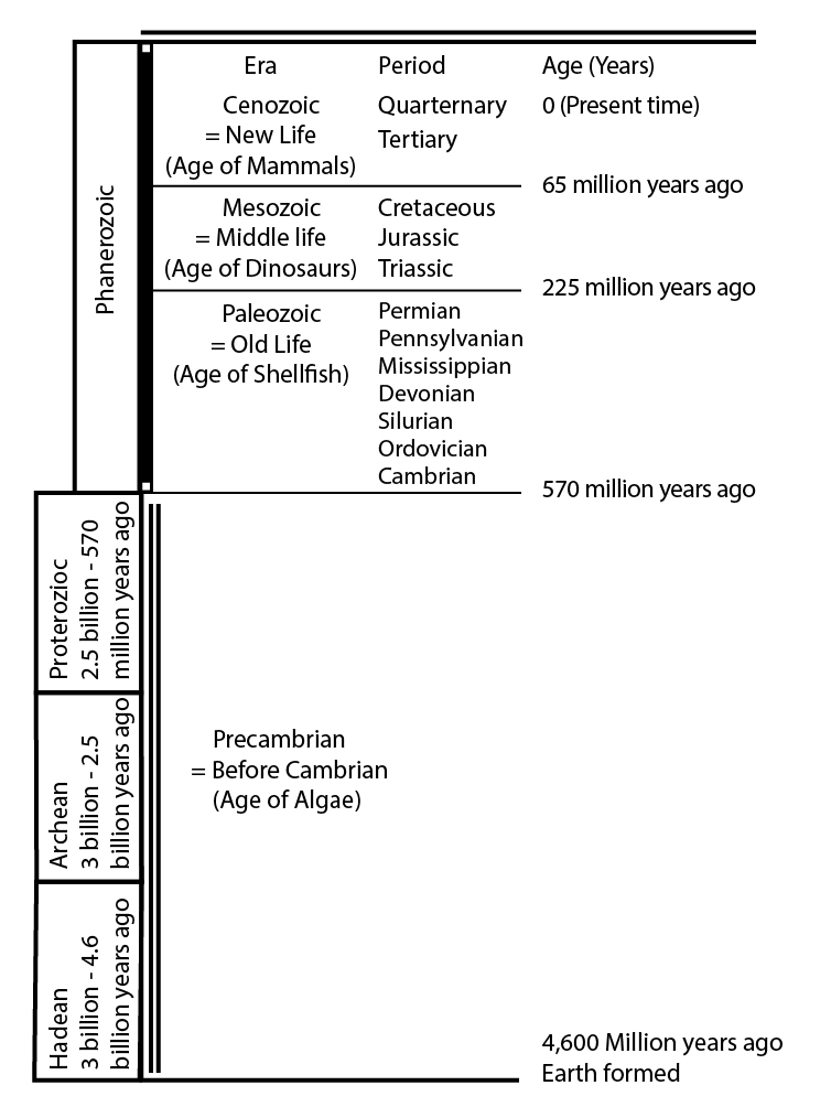
| Era | Period | Age (Years) |
|---|---|---|
| Cenozoic = New Life (age of mammals) |
Quaternary Tertiary |
0 (present time) |
|
Mesozoic = Middle Life |
Cretaceous |
65 million years ago |
|
Paleozoic = Old Life |
Permian |
225 million years ago |
| Era/Period | Age |
|---|---|
| Proterozoic | 2.5 billion - 570 million years ago |
| Archean | 3 billion - 2.5 billion years ago |
| Hadean | 3 billion - 4.6 billion years ago |
A Rocking Review
Down-Doo-Bee-Doo
Here's another look at learning which way was "up" when a rock layer was deposited. Dance on down with the dinosaur in this parody of Neil Sedaka's "Breaking Up Is Hard To Do". (3 minutes and 19 seconds long)
PRESENTER: If all that dancing has your head spinning so fast that you can't tell up from down, then this next song is just what you need. It was Neil Sedaka who said it first, "down, doo-bee-doo-down-down."
(SINGING) Footprints sink down, doo-bee-doo-down-down. Mudcracks grow down, doo-bee-doo-down-down. Raindrops imprint down, doo-bee-doo-down-down. They tell us which way started up.
Don't let confusion rule your mind if footprints in the ceiling you find. 'Though mountain building turns it all around, the dinos always put their feet down. When sand falls behind a dune, a big gust blows the top off soon. And when the old dune sits beneath the new, the cut end started up. It's true!
They say that reading rocks is hard to do. Don't believe it. We know it's not true. No mountain building turns rocks over or on end. We know this occurred because the footprints started down, my friend.
Bubbles rise up, doo-bee-doo-up-up. Cross-bed cut-ends up, doo-bee-doo-up-up. Shells rocker-sided up, doo-bee-doo-up-up. They tell which way started down.
Take a look at a lava flow. Crust forms on top while it's soft below. The bubbles rise, but they can't get out. Lots of big ones near top, no doubt.
If cross-bed cut-ends don't point up or clam shell pieces make a loving cup, don't be alarmed and don't wear a frown. The rock is just turned upside down. For history you must know which came last, which came first in the distant past. Geologists can put 'em in a all in a row, 'cause the dinosaurs all put their feet down we know.
Footprints sink down, doo-bee-doo-down-down. Mudcracks grow down, doo-bee-doo-down-down. Raindrops imprint down, doo-bee-doo-down-down. They tell us which way started up.
Wrap Up
Review the Unit 9 Introduction
You have reached the end of Unit 9! Double-check the list of requirements on the Unit 9 Introduction page and the Course Calendar to make sure you have completed all of the activities listed there.
Unit 9 Overview
Review of the main topics and ideas you encountered in Unit 9.
Nice Bryce: Stories in Sediment
- Weathering makes small pieces and salts.
- After transport, they are deposited as sediment.
- Sediment is slowly changed to sedimentary rock.
- Transformation is NOT magic:
- Hard-water deposits cement grains together;
- Squeezing compacts grains;
- Recrystallization as new minerals grow creates interlocking grains.
Classy classification
- Clasts make clastic rocks; dissolved salts make precipitates (rock salt, Death Valley borax).
- Limestone is both--precipitated as shells, which are clasts.
- Subclassify clastic rocks by size:
- Clay (tiny) makes claystone, also called shale;
- Silt (small) makes siltstone, sand makes sandstone;
- Cobbles make cobblestone, boulders make boulderstone, usually call both conglomerate.
Environment is Evident
- Can tell environment in which sediment or sedimentary rock was deposited:
- Sand dunes, lizard tracks? Desert
- Quiet-water muds, fish fossils? Lake
- Corals and shells? Coastal Reef
- Takes lots of study to know the rocks that different environments produce, but now is well-known.
May I Take Your Order?
- Something must exist before it can be moved or cut; clastic rocks are younger than the clasts, and faults younger than faulted rocks.
- Layers initially nearly horizontal (mass wasting flattens steep clastic layers).
- Layers on top are younger than those below (Principle of Superposition).
- After hardening, layers may be stood up or turned over, but many “up” indicators tell us this happened.
Getting Into “Up” Indicators
- Mud cracks, footprints, raindrop imprints go down into mud;
- Tops of slightly slanting sand-dune layers are eroded by wind;
- Shells on beach are flipped into stable hollow-side-down position;
- Bubbles rise toward tops of lava flows.
Nothing Succeeds Like Succession
- Can put rocks in order;
- Puts fossils in order--“Law” of Faunal Succession;
- Gives geologic time scale:
- Cenozoic=New Life, Age of Mammals
- Mesozoic=Middle Life, Age of Dinosaurs
- Paleozoic=Old Life, Age of Shellfish
- Precambrian=really old, Age of Algae
Reminder - Exercise #4 is due and Exercise #5 opens this week. See Course Calendar for specific dates and times.
Supplemental Materials
Following are some supplementary materials for Unit 9. While you are not required to review these, you may find them interesting and possibly even helpful in preparing for the quiz!
- Website: Arches National Park
- Website: Bryce Canyon National Park
Comments or Questions?
Please feel free to send an email to ALL of the teachers and TA's through Canvas conversations with any questions. Failure to email ALL teachers and TA's may result in a delayed or missed response. See "How to send email in GEOSC 10" for instructions
Unit 10: Uniformitarianism and the Age of the Earth
Welcome to Unit 10
Uniformitarianism and the Age of the Earth
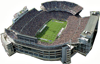
Imagine that the 100 yards of Penn State's Beaver Stadium, or any other football field, are like a timeline of all of Earth's history, and you're the star of the team, driving for glory. The planet formed on your goal line, half of the Earth's history had passed as your team marched across the 50-yard line, and now the coach personally sent you, the acme of creation, to carry the ball across the opposition's goal line of today for the winning score. If you have been carrying the ball for the whole 20 years of your life, how far did you run? (If you're not 20 years old, pretend.)
Congratulations--tomorrow's newspaper will report that you gained just a shade under 0.0002 inch, or a bit less than 1/200 of the thickness of a sheet of paper. The defense was vanquished by your onslaught, and instant-replay officials weren't needed to see that you broke the plane of the goal.
Some people still insist that the Earth is no older, and looks no older, than the roughly 6000 years of written history. But, that is barely the thickness of a sheet of paper on the 100 yards of Earth's "dark backward and abysm of time," as Shakespeare called it. Geologists often feel sorry for those young-Earth supporters—they may have seen the instant-replay of the touchdown, but they missed the thrill of the game. So come along and see how the team got you the ball for those last two ten-thousandths of an inch!
What to do for Unit 10?
You will have one week to complete Unit 10. See the course calendar for specific due dates.
As you work your way through the online materials for Unit 10, you will encounter a video lecture, several vTrips, some animated diagrams (called GeoMations and GeoClips), additional reading assignments, a practice quiz, a "RockOn" quiz, and a "StudentsSpeak" Survey. The chart below provides an overview of the requirements for this unit.
| REQUIREMENTS | SUBMITTED FOR GRADING? |
|---|---|
| Read/view all of the Instructional Materials | No, but you will be tested on all of the material found in the Unit 10 Instructional Materials. |
| Submit Exercise #5: Puzzling Out Relative Time | Yes, this is the fifth of 6 Exercises and is worth 5% of your total grade. |
| Begin Exercise #6: Fossil Fuels (& Driving Hazards) | Yes, this is the last of 6 Exercises and is worth 5% of your total grade. |
| Take the Unit 10 "RockOn" quiz | Yes, this is the tenth of 12 end-of-unit RockOn quizzes and is worth 4.5% of your total grade. |
| Complete the "StudentsSpeak #11" survey | Yes, this is the eleventh of 12 weekly surveys and is worth 1% of your total grade. |
Questions?
If you have any questions, please feel free to email "All Teachers" and "All Teaching Assistants" through Canvas conversations.
Keep Reading!
On the following pages, you will find all of the information you need to successfully complete Unit 10, including the online textbook, a video lecture, several vTrips and animations, and an overview presentation.
Students who register for this Penn State course gain access to assignments and instructor feedback, and earn academic credit. Information about registering for this course is available from the Office of the University Registrar.
Main Topics, Unit 10
Overview of the main topics you will encounter in Unit 10
Leave it as it is. You can not improve on it. The ages have been at work on it, and man can only mar it. What you can do is to keep it for your children, your children’s children, and for all who come after you, as one of the great sights which every American...should see.
–President Theodore Roosevelt, speech at the Grand Canyon, Arizona, on May 6, 1903
We have gotten past the stage, my fellow-citizens, when we are to be pardoned if we treat any part of our country as something to be skinned for two or three years for the use of the present generation, whether it is the forest, the water, the scenery. Whatever it is, handle it so that your children’s children will get the benefit of it.
–President Theodore Roosevelt, speech at the Grand Canyon, Arizona, on May 6, 1903
Parsley, Sage, Rosemary and Time
- Last chapter, we did “relative time”—which came first?
- Now we spice it up with “absolute time”—how many years?
- Count annual layers, for accurate estimates, for “short times” (less than about 100,000 years);
- Calculate from recent rates and reconstructed effects, for less-accurate estimates, for short and long times (uniformitarian approach);
- Use radiometric (radioactive) techniques, for accurate estimates, for short and long times.
Annual layers
- Overlapping-tree rings, to more than 10,000 years;
- Special-lake sediments, to more than 40,000 years;
- Ice-core layers, to more than 100,000 years;
- MANY checks, including:
- reproducibility of counting;
- agreement with historical records (chemically fingerprinted fallout of volcanic eruptions, etc.);
- consistency amongst ice, lakes, and trees for ages of abrupt climate changes;
- agreement with radiometric and uniformitarian ages.
- MANY checks, including:
Old as the Hills
- Annual-layer records from geologically young materials (ice sheets, trees, and lake sediments not turned to stone yet, on top of rocks) are much older than written history;
- Virtually all scientists, most religions agree Earth looks much older than written history;
- Some religions disagree vehemently;
- Whatever the Truth, the science is good.
Climbing out of the Grand Canyon
- Metamorphosed old mountain range at bottom;
- Unconformity, then two miles of sediments;
- Tipped by faulting, then unconformity, then another mile of sediments with several unconformities within;
- Rocks are “normal,” with tracks, mudcracks, etc., at many different levels, fossil changes upward;
- North Rim rocks slant down under Zion, which is under Bryce, which is…
- Roughly 100 million years to deposit sediments, plus time for old metamorphics, plus erosion…
Radiometric Dating
- Half of parent atoms decay to offspring in one half-life (easy to measure; don’t need to wait for a half-life to pass, just for a measurable change);
- Half-life fixed by the same physics that make the sun shine and keep us from blowing up—is not a variable;
- Parent:offspring ratio plus half-life give age;
- Requires a little care and attention;
- Agrees with written records, layer counts, uniformitarian calculations, other radiometric techniques.
Radiometric Dating Example
- Solid potassium-40 parent included in lava flows, but gaseous argon-40 offspring escapes;
- After flow hardens, additional argon-40 produced from potassium-40 is trapped;
- 1.3-billion-year half-life;
- If you start with 400 parents, after one half-life (1.3 billion years) average 200 parents left (and 200 offspring), after second half-life (total 2.6 billion years) average 100 parents left (and 300 offspring), after third half-life (total 3.9 billion years) average 50 parents left (and 350 offspring), …
0.0002 Inches and a Cloud of Dust
- Oldest rocks about 4 billion years old, but Earth bombarded, melted before that;
- Meteorites formed with Earth; they are about 4.6 billion years old (agrees with whole-Earth estimates);
- If 4.6 billion years is the 100-yard length of a football field, written history is about the thickness of a sheet of paper, and a 20-year-old student has lived through 0.0002 inches.
Textbook 10.1: Great Basin
The Age of the Earth I, Great Basin and Layer Counting
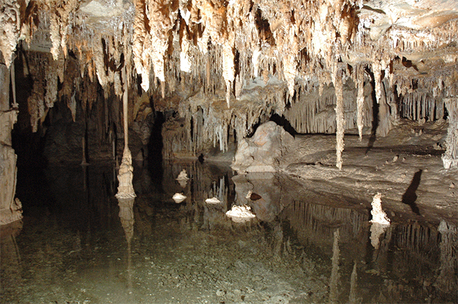
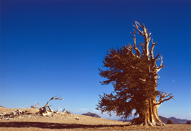
Out in eastern Nevada, a long way from almost anywhere, is Great Basin National Park. The jewel of Great Basin is Lehman Cave, one of the most "decorated" caves known, with a wide range of odd cave formations (stalactites and stalagmites, but lots more, too). Lehman Cave is dissolved into marble (metamorphosed limestone) on the side of Wheeler Peak, which rises to more than 13,000 feet (almost 4000 m), and which was glaciated during the ice age—the remnant cirque glacier has wasted away to a debris-covered rock glacier over the last decades. Fewer than 100,000 visitors make the trek to Great Basin each year, and you can find a lot of solitude and wonder in this beautiful place.
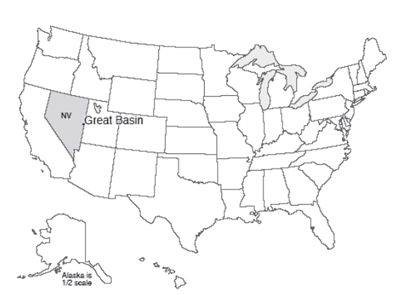
Far up on Wheeler Peak, Great Basin bristlecone pines are living. These gnarled, straggly trees grow slowly in high, cold places, whereas those bristlecone pines growing in warmer, moister, lower-elevation sites live faster and die younger. In part because of this slow growth, the high-altitude trees can be very old. The oldest known living bristlecone pine is more than 4,600 years old, in the White Mountains of California. The oldest tree known so far was cut on Wheeler Peak in 1964, when the land was still administered by the U.S. Forest Service, as part of a study to learn more about the growth and behavior of the trees. Now known as Prometheus, that tree was 4,950 years old when cut. That one old-looking tree was not notably different from many others in the large grove. Because it is so unlikely that the first such tree cut on Wheeler Peak out of the many there would happen to be the oldest tree on Earth, it is likely that there are older trees out there that have not been sampled yet.
In a seasonal environment, a tree reliably produces a visible growth ring each year. The reasons for this behavior are well-understood, and the annual nature of the rings has been checked many, many times. Rarely, there is a problem (a piece of a ring may be missing if the tree was damaged, by a fire or a burrowing beetle, or a late frost or other odd event may make a ring look strange), but tree-ring daters (dendrochronologists) have learned to recognize these events. In general, tree-ring dating can be practiced with no errors. Many, many tests have been conducted to confirm that this works, that the results match historical records, etc. Most such sampling is done using narrow coring devices, and does not harm the trees.
In studying tree rings, one sees that the width is not the same from year to year. Thick rings grow during “good” years, and thin rings during bad years. This allows tree rings to be used to reconstruct past climates. In a dry area, a good year is a wet one, so tree rings can be used to find out how much rain fell in the past. In a cold area, a good year is a warm one, so the tree rings function as thermometers.
For our purposes here, the pattern of good and bad years (fat and thin rings) is important for dating. On Wheeler Peak, and in the White Mountains and elsewhere, dead trees occur near the living bristlecones. Some of these dead trees sprouted before the living ones and overlapped in age with the still-living trees. Other dead trees can be found in archaeological sites or buried in sediments. A tree-ring specialist can date the good and bad years using living trees. The specialist can then find the pattern of thick and thin rings in the dead tree, and so use the dead tree to extend the record back to when the dead tree first sprouted (see the figure below). By overlapping a few long-lived trees, or many short-lived trees, very long chronologies can be generated.
So How Many Layers?
Such techniques are used to date archaeological sites, including those of the Ancestral Puebloan peoples (also called the Anasazi; at Mesa Verde and several other national parks). Professor Peter Ian Kuniholm and his collaborators at Cornell have for decades been doing amazing work using tree rings to understand classical history in the Aegean region, the Middle East, and elsewhere, confirming, refining, and extending historical accounts. The beautiful agreement between tree-ring and historical accounts as far back as the oldest reliable written records confirms the accuracy of the techniques.
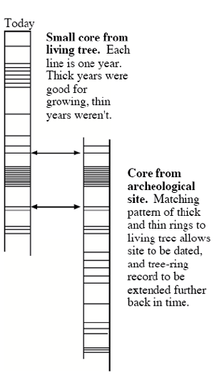
But, the tree-ring records extend well beyond reliable written histories. The longest tree-ring record in the U.S. Southwest is now more than 8000 years. The longest known of such records is from tree trunks buried along rivers in Germany, and extends to 12,429 years—before that, closer to the heart of the ice age, conditions were too cold for trees in that region of Germany. Because most trees live for “only” centuries rather than millennia, such records (and a few other really long ones, such as a 7,272-year record, as of 1984, from Irish oaks buried in bogs) represent immense investment of time and effort, but people have devoted whole careers to assembling these outstanding records. Notice that there is much older wood, including the fossil trees at Yellowstone, Petrified Forest, and elsewhere. The more than 12,000 years in Germany are the longest continuous record reaching the present, but surely do not come anywhere close to including the whole history of trees.
Several other types of annually layered deposits exist. For example, some lakes in cold regions freeze every winter. When the lake is thawed in the summer, sand and gravel are washed in by streams. When the lake and its surroundings freeze, the streams slow or stop, and the only sediment settling to the lake bottom is the very fine silt and clay particles that were washed in during the summer but require months to fall. A coarse layer capped by a fine layer marks one year. Many such layered, or varved, lakes have been studied, and found to contain thousands of years to more than 14,000 years. Many of these lakes occur in glacier-carved basins, and so their records extend only back to the melting of the ice. One lake in Japan, Lake Suigetsu, has a spring bloom of diatoms—algae with silica "shells"—that make a light-colored layer, alternating with darker mud during the rest of the year. 45,000 annual layers have been counted in that lake.
Most lakes lack annual layers. If there is a lot of oxygen in the deep waters, worms will thrive in the mud beneath, and their burrows will disturb the layers. If the lake is shallow, waves will disturb the deep muds. But enough lakes exist with annual layers to be useful. And, simply seeing layers doesn’t prove they are annual; lots of tests have to be done, as described below for the ice cores.
A difficulty in lakes—and other archives such as annually layered stalagmites—is that an annual layer must be thick enough to be recognized, but a lake or a cave will fill up quickly if layers are thick, so the records cannot be extremely long.
Longer records are possible from the two-mile-thick ice sheets. Dr. Alley has been very active in this work, and Dr. Anandakrishnan has contributed in important ways. In central Greenland and some other places on ice sheets, the temperature almost never rises high enough to melt any snow and ice. However, summer snow and winter snow look different because the sun shines on the snow in the summer, “cooking” the snow and changing its structure, but the sun does not shine on the winter snow, which is buried by new storms before the summer comes. You can count many, many layers by looking at an ice core, and Dr. Alley did so, working especially on one core called GISP2.
To verify that the layers are annual, several things were done. First, one person (Dr. Alley) looked at the core, waited a while, and then looked at it again to see that the counting is reproducible. Then, other people counted the layers visible in the core (without cheating by finding out what Dr. Alley had gotten), just to make sure they agreed.
There are many annual indicators in ice cores, probably more than a dozen. For example, the isotopic composition of the ice is a thermometer that records summer and winter. And sunshine makes hydrogen peroxide in the air in the summer when the sun shines, and the peroxide falls on the ice quickly, but there is almost no peroxide made and deposited in the dark winter. So annual layers have been counted using several different indicators, and they agree closely.
This is still not good enough. When a large volcano erupts, it throws ash and sulfuric acid into the stratosphere. These spread around the Earth. The bigger pieces of ash fall out quickly, often in days or less, while the sulfuric acid may take one to a few years to fall (and, until it falls, affects the climate by blocking a little of the sunlight). You can use electrical or chemical techniques to find the layers of volcanic fallout in ice cores. The key sections can then be cut out, melted, and filtered, and any volcanic ash that is found can be analyzed chemically and compared to that from known volcanic eruptions. So, if you count back to the year 1783 in a Greenland ice core, you are in the year of the great Icelandic fissure eruption of Laki, which spread dry fogs across Europe and is well recorded in histories—Ben Franklin commented on the fogs in Paris while he was ambassador there for the fledgling United States. In fact, ash of the composition of Laki occurs in Greenland ice cores at the level dated 1783 by layer counting—the layer counting is right (or very close—some counts missed by a year or two initially). Similarly, ash from many other historical volcanoes has been found, back as far as historically dated volcanoes are known.
Comparison of counts of strata by one person at different times, by different people, and by different methods, and comparison to volcanic fallout, yield almost the same answers, within about one year in one hundred (so one person may count 100 years, and another will count 99, or 100, or 101, but not 107 or 93 or some similarly large error).
There are a few more tests yet. There were very large and very rapid climatic changes at certain times in the past. Ice cores record the climatic conditions locally (how much snow accumulated and how cold it was), regionally (how much dust and sea salt and other things were blowing through the air to the ice from sources beyond the ice sheet), and globally (by trapping bubbles of air, which contain trace gases such as methane that are produced across much of the Earth’s surface). Changes in all of these indicators occur at the same level in the ice cores, showing that the climate changes affected much of the Earth.
These changes left their “footprint” in the ice of Greenland, and the lakes of Switzerland and Poland, and the trees of Germany, etc. So one can date such changes in the annually layered deposits of all of these different places. And, the dates agree closely. These events also have been dated radiometrically (we’ll cover this soon), and the dates also agree closely. One event, for example, was a return to cold conditions during the end of the ice age, and is called the Younger Dryas. Close agreement as to its age is obtained from all of these different layered deposits and from radiometric ages—the Younger Dryas ended about 11,500 years ago.
Thus far, the layers in the ice cores provide the longest reliable records. Over 100,000 layers have been counted. High accuracy was achieved younger than about 50,000 years, with somewhat lower reproducibility (maybe 20% or so, and with well-understood reasons for the lower accuracy) older than about 50,000 years. Still older ice exists, but the layers in Greenland have been mixed up by ice flow and no longer give a reliable chronology. Thus, we have high confidence of more than about 100,000 years from the ice cores. (Really old ice in Antarctica, to 800,000 years or so, got less snowfall in a year than the height of a snowdrift, so annual layers are not preserved and other dating techniques must be used.)
Why Are We Emphasizing This?
One of the great results of geology has been the concept of “deep time.” The world was once believed in some cultures to be only as old as the oldest historical records. The Archbishop Ussher of Ireland, in the year 1664, declared that based on Biblical chronologies, the creation of the Earth dates from October 26, 4004 BC, Adam and Eve were driven out of the Garden of Eden on Monday, November 10 of that year, and Noah’s Ark landed on Mt. Ararat on Wednesday, May 5, 1491 BC. Other experts obtained slightly different dates, but with broad agreement that the world was not very old.
Ussher’s date rested on a literal reading of the particular translation of the Bible he used, and on quite a number of questionable interpretations of the text—the Bible itself never gives an age for the Earth. Early geologists nonetheless struggled with the constraints provided by such chronological readings—how could all of geologic history fit into 6000 years? The early geologists ultimately reached the conclusion that the world looks MUCH older than 6000 years; either the world is older than this, or we have been deliberately fooled by some powerful being who crafted a young world to look old. As scientists, we work with the observable part of the world, and we have no way to detect a perfect fake, so we treat this as an old world. The geologic record speaks of “deep time,” billions of years, Shakespeare’s “Dark backward and abysm of time.”
Most biblical scholars have reached the same conclusion: the chronologies of Genesis do not allow one to fix the age of the Earth precisely, and are perfectly compatible with an old Earth. Most of the large Christian denominations, for example, have accepted an old Earth based on Biblical and on scientific interpretations. In 1996, the pope added the Catholic Church to the wide range of protestant denominations that accept an old Earth.
It remains that some denominations and people insist on what they call a “literal” reading of the Bible. In addition, a few very vocal people continue to argue that the Earth looks young. Many more people hear all of this commotion and figure that maybe there is something wrong with the science, because “where there’s smoke, there’s fire.” Other people take it as an element of faith to disbelieve the scientific evidence, and even to accuse scientists of being bad people for opposing the fundamentalist interpretations.
In this course, we go to some length to show you a small bit of the evidence that the Earth does not look young—it bears the marks of a deep and fascinating history. The annual-layer counts by themselves require an old Earth, because the tree rings, the lake sediments, and the ice cores all extend to older than the historical chronologies. The Irish oaks preserve rings from more than twice as many years as Archbishop Ussher of Ireland would have said were possible since Noah's flood, so his prediction was tested, and failed. Geologic and other scientific evidence from tree rings, lake sediments, ice cores, archaeological sites, and more match historical records well as far back as those historical records go. But as we shall see in the next sections, those annual layers and other “young” things are only the tip of a very old, very deep iceberg.
Please note that it is not the author’s intent to insult or belittle anyone’s beliefs here. Science, you may recall, has no way of verifying whether it has learned the truth; it is a practical undertaking designed to discard ideas that fail, save the ones that don’t fail as provisional approximations of the truth, and push ahead. The hypothesis of an Earth that is no older, and looks no older, than historical records, leads to all sorts of predictions. Geologists began seriously testing those predictions in the 1700s, and found that those predictions were not supported, whereas predictions of an old-Earth hypothesis worked well—with very high confidence, the rocks look very old.
Consider two people, Sam and Pam. Sam has decided that belief in his literal interpretation of his favorite translation of the Bible is the most important thing in his life, as it controls the fate of his eternal soul and his relation with the most powerful being in the universe. Is it possible for Sam to look at the rocks, trees, ice and lakes, and find some way to explain what he sees in the context of that literal belief? The answer, obviously, is yes; many people do so, and some of them will be mad at us for what we write here. Next consider Pam, who is working in an oil-company laboratory trying to refine dating of petroleum generation and migration. Which works best for her in making sense of the sedimentary record, Sam’s interpretation or that of the geological profession? The answer is equally clear; Sam’s view is unhelpful, and geology works. Finally, ask whether it is possible for Sam to be a geologist and use the old-Earth tools even as he believes in his book, or whether it is possible for Pam to be a religious believer while doing geology, and the answers are yes; some people can hold a variety of ideas in mind at the same time. But recognize that the scientific evidence for an old Earth (and later, for evolution) is about as clear as science gets, and that the level of scientific disagreement on these issues is about as low as disagreement ever gets in science. Within the scientific community, the argument about whether the Earth really is older than historical records is akin to the scientific argument about whether the Earth is roughly spherical. (Lively discussions clearly continue in the blogosphere and in other many non-scientific circles, but those discussions are at best rather weakly linked to the science.)
Textbook 10.2: The Grand Canyon
More on the Age of the Earth—Uniformitarianism and The Grand Canyon
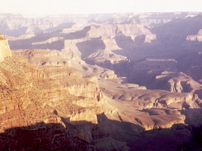
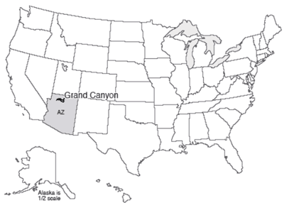
The Grand Canyon is a mile-deep, 18-mile wide, 277-mile long (1.6 km x 29 km x 446 km) gash in the Earth. The colorful spires, the rocky cliffs, the hidden pocket canyons, the pristine springs laying down lovely deposits, the roaring thunderstorms and arching rainbows are to many the quintessence of the U.S. West. The Grand Canyon is neither the deepest nor the steepest canyon of the planet, but the Grand Canyon indeed is grand, and defines “canyon” for many people.
When the author, his cousin Chuck, and his sister, Sharon, were hiking the Bright Angel Trail from the North Rim into the canyon, a snake crossed the trail and slithered into some dry grass just at the trail edge. Chuck and I, in the lead, could see quite clearly that this snake ended in a “harmless” tail. Sharon, just behind, was not aware of the snake until it stuck its head out and rattled the grass just at her feet. Deciding that discretion was the better part of valor, and that if it rattles like a rattler it might actually be one, she made one mighty leap backward, landing in a cloud of dust on a switchback below.
Sharon almost certainly was not concerned with the rocks about her at that instant, but she had leaped backward through history. And what a history it is.
The Longest Story
At the bottom, the inner canyon is cut through the Precambrian Vishnu and Brahma Schists. The older Vishnu has the appearance and chemical composition of metamorphosed sediments. The lava flows of the Brahma preserve the pillow structure of submarine eruptions, but the interbedded volcanic airfall material shows that at times the region was exposed as dry land. The total thickness of three miles of lava flows and interbedded layers, now standing almost on end although they initially were deposited almost horizontally, speaks of an important, long-lasting interval of deposition.
These oldest lava flows and sediments of the Grand Canyon have been "cooked," and are now of metamorphic types that form only in the hearts of mountain ranges at very high pressures and temperatures. During and after the metamorphism, melted rock (magma) squirted into cracks in these rocks, and then froze to form the pretty pink Zoroaster Granite. Yet this whole package of rocks was then brought back to the surface as the rocks of the mountains above them were eroded, with the erosion producing a very smooth, nearly horizontal plain on top of them, and weathering/soil formation causing changes that extend deep into these rocks.
The sea next advanced across this plain, first picking up and carrying and rolling pieces of the rocks and soils on the erosion surface to form a conglomerate, then giving way to sandstones, shales, and limestones that piled up to a thickness of two miles or so. (Such a great thickness does not mean that the sea was two miles deep; rather, in this case, the water stayed relatively shallow, but the warping of the crust by the drifting plates and other processes caused the sea floor to sink as the muds and other deposits piled up.) These rocks include mud cracks, ripple marks, casts of salt crystals that formed when the sea water evaporated in nearshore environments, and stromatolites, which are algal-mat deposits in which the algae trap mud, grow up through it, and trap more mud. All of these are similar to modern features, and indicate gradual accumulation (a layer, then drying for mud cracks, then more mud, then ripples from water flow, then drying for salt casts, and on and on and on).
Death-Valley-type pull-apart faulting then dropped and rotated these layers, so that they now slant (see the figure below). Long-term weathering and erosion then occurred, leading to a plain broken by a few higher points where especially resistant rocks did not erode as rapidly. Again, deep weathering speaks of long exposure. In some places, the sediments were entirely removed down to the metamorphic rocks beneath, but the sediments are preserved where they were dropped by faulting.
The sea returned, again reworking materials on the erosion surface to make a basal conglomerate, followed by beach sandstone, then offshore shale, and limestone from farther offshore. As the sea deepened and the beach moved towards the land, shale was deposited on sandstone and then limestone on shale. These three layers form the Tonto Plateau that is so evident on the south side of the canyon. The rocks of the Tonto Plateau include fossils of marine animals such as trilobites, and even trilobite tracks. Again, all evidence is of deposition by processes just like those operating today, over long periods of time. A layer with a trilobite track must have been exposed long enough for a trilobite to crawl across it. The thousands and thousands of different layers in the rocks, with ripples and tracks and fossils, indicate long times.
Time then passed of which we have no record in the Grand Canyon, except that stream channels were carved on top of the limestone, indicating that the region was raised out of the sea and erosion was occurring. Fossils from two of the periods of the Paleozoic are missing, indicating that much time passed. When deposition resumed, the first rocks put down were limestones in the stream valleys, but another time gap sits on top of those in-the-channel rocks. The limestones in the channels include coral and shellfish (brachiopod) fossils, and plates from armored fish.
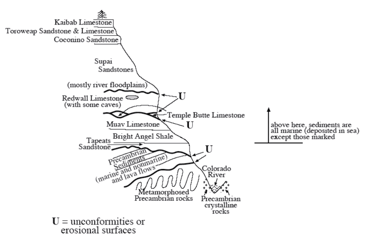
The marine Redwall Limestone was deposited next, so-named because it makes a red wall. The limestone is gray, with the red (rust and clay) dripping down from red rocks above. The Redwall Limestone contains fossils of corals, sea lilies (crinoids) and shellfish (brachiopods), but with notable differences from the fossils of those general types found in limestones below, and both sets of fossils differ from those in limestones above. The Redwall Limestone contains caves and sinkholes, which in turn contain sediments associated with the rocks above. Caves generally form on land or possibly very close to land under shallow water, not beneath the open ocean, so the rocks were lifted near or above sea level and eroded after Redwall deposition.
Then, the sea flooded in, at least in the region that would become the western part of the Canyon, and deposited the Surprise Canyon limestone in erosional stream channels in the top of the Redwall. These rocks were not even described until the 1980s, and are only reachable by helicopter or arduous climbing. These rocks are not indicated in the diagram, above, which is what you would see on the Bright Angel Trail in the central Grand Canyon. Erosion cut the top of the Surprise Canyon before deposition of more layers.
Next are sandstones, siltstones and shales with plant fossils, footprints, etc., at various levels through the rocks, indicating deposition on land in floodplain conditions. Insect fossils appear on the upward trip through the rocks, and then great dunes with sand-blasted, wind-frosted grains and occasional lizard footprints. You might imagine the sand dunes of the Sahara spreading across the flood plain of the Nile for these rocks. Marine conditions then returned, providing mostly limestones with sponge fossils and shark’s teeth as well as corals, crinoids and brachiopods, finally reaching the top of the canyon.
If you're on the North Rim of the Canyon, gaze farther north. The rocks you're on slant downward to the north, and you are looking at rows of cliffs with younger rocks, up through the cliffs of Zion from the age of the dinosaurs, up through the lakes of Bryce, up and up and up until finally you reach the trees and Native American sites older than the historical chronologies of Archbishop Ussher.
(By the way, if you’re interested in the carving of the Grand Canyon, have a look in the Unit 10 Enrichment.)
How Old?
A pile of rocks like those in the Grand Canyon does not reveal its age easily. But we have evidence of seas, mountain building, mountain erosion, more seas, more distortion, more erosion, and more, and more, and more. The rocks involved are old friends—similar things are forming today. Using the principle of uniformitarianism—the present is the key to the past—we can make some estimate as to how long events take. The schists at the bottom were buried miles deep in mountain ranges and later brought to the surface by erosion, and fast erosion rates require a million years to strip off a mile, for example.
The geologists of the 1700s, working primarily in Europe, pieced together stories such as this. They tried to estimate the times involved. One difficulty was that they could not tell how much time was in the erosional time gaps, or unconformities—was erosion fast, or slow? And they could not really unravel all of the stories in the oldest rocks because metamorphism had erased some of the stories.
These early geologists eventually estimated that the rocks told of events that required AT LEAST tens of millions of years to hundreds of millions of years. Just depositing the sedimentary rocks would take about that long, with much more time represented by the unconformities and the oldest really-messed-up rocks. This is deep time—the Earth is not the historical thousands of years, or even the ice-layer/tree-ring tens of thousands of years. History was written and trees grew on the relics of vastly greater histories. Looking into that history is one of the great joys of geology, but it brings us to the edge of a mental cliff from which some people do not wish to look. In the next section, we will see just how high that cliff really is.
Radioactive Clocks
The techniques of layer counting and uniformitarianism are useful in dating, but the real workhorse these days is radiometric or radioactive dating. The Earth is host to a wide range of naturally occurring radioactive elements. An atom of a radioactive element eventually will spontaneously change to some other type of atom, by emitting radioactive energy.
Radioactive decay occurs in various ways. The easiest to understand is when a nucleus splits into two parts, kicking out a part of itself. Remember that heat causes molecules in water to bounce around and occasionally evaporate; atoms or molecules in rocks are also bouncing around, but are so tightly bound that very, very few break free at the Earth’s surface. In somewhat the same, way, the protons and neutrons in the nucleus of an atom are always wiggling and bouncing around; most nuclei are so tightly bound that this wiggling doesn’t change anything, but some types of nuclei are weakly enough bound that occasionally some protons and neutrons “evaporate.” We call those types of atoms that “evaporate” radioactive, and those that do not stable. (A real nuclear physicist would probably yell at us because we oversimplified a bit too much, but this should do for introductory geology.)
Commonly, a nucleus that “evaporates” emits a group of two protons and two neutrons, which is the nucleus of a helium atom and also is called an alpha particle, for historical reasons. Emitting an alpha particle changes the remainder of the nucleus to the type of atom that is two protons lighter. Other types of radioactive changes also occur, including splitting of a nucleus into nearly equal-sized chunks, change of a neutron to a proton plus an electron that is emitted, or capture of an electron by a proton to change into a neutron. All of these change the type of atom from one element to another. All are explainable by well-known physical principles, and all are as natural and regular as the downward fall of your pencil if you drop it off your desk.
The behavior of any one atom is not predictable, but in large groups the average behavior is easily predictable. The basic rule is that, if you watch for some specified time such as one hour, the more radioactive atoms you start with, the more radioactive atoms you will see change. If you start your stopwatch when you have some number of a given type of radioactive atom, and stop the watch when half have changed, you will have estimated the half-life of the radioactive type. Each radioactive isotope has a distinctive half-life, which can be measured in the laboratory. (Note that you do not need to wait for an entire half-life to measure it; the Enrichment section shows mathematically that you need to wait only long enough for enough atoms to change to be measured accurately—the rule that more change in some time if you start with more is all you need.)
Suppose you start with 2000 atoms of the parent type. These decay into offspring (most textbooks refer to these offspring as daughters). After one half-life, 1000 parent atoms remain and 1000 offspring have been produced. After another half-life, half of those 1000 parent atoms have changed to offspring, leaving 500 parents and giving 1000+500=1500 offspring. After a third half-life, half of the remaining parents have changed, so that now only 250 parents remain and 1500+250=1750 offspring have been produced. During the fourth half-life, half of the remaining parents decay, leaving only 125 parents and giving 1750+125=1875 offspring.
Now, we really need to deal with large numbers, so add ten zeros to the end of each of the numbers in the previous paragraph. Such numbers of radioactive atoms are common in even relatively small samples of rock; the total number of atoms in a fist-sized chunk of rock is about 1 followed by 24 zeros.
As noted, there are many different parent types with different half-lives. Some half-lives are very short—seconds or less. Others are very long—billions of years or more. Some of the radioactive parents are left over from the explosions of stars that produced the stuff of which the Earth is made. Other radioactive parents are created by cosmic rays that strike atoms on Earth. Some radioactive decays produce offspring that are themselves radioactive parents for a further generation, and several such decays may be required to produce a stable offspring. And radioactive decays may damage neighboring atoms, producing radioactive types.
Telling Time
Consider the example of potassium-40 and argon-40. Argon-40 has 18 protons and 22 neutrons in its nucleus, for a total of 40 particles. Potassium-40 has 19 protons and 21 neutrons, also totaling 40. Potassium-40 is a parent with a half-life of 1.3 billion years. Potassium is abundant on Earth, and occurs in many common minerals, and some of the potassium is the radioactive parent potassium-40. The offspring, argon-40, is a gas. If lava flows out on the surface of the Earth, the argon escapes. Thus, a lava flow will start with some parent potassium-40 but no offspring argon-40. As time passes, the potassium-40 breaks down to argon-40, which builds up in the rock. If today the rock has as many potassium-40 as argon-40 atoms, then one half-life has passed and the rock is 1.3 billion years old. Whatever the ratio is, the math is not that difficult and gives the age.
It is possible, of course, for argon-40 to leak out of the mineral. If it does, we will think that the rock is younger than it really is. But if leakage is occurring from a mineral grain, then the outside of the grain will contain less argon-40 than the inside does, and this can be measured, revealing the problem. A mineral grain that grew in slowly cooling melted rock far down in the Earth and that then was erupted may have begun trapping argon-40 before the eruption occurred, in which case the age obtained will be the time when the grain started growing rather than the time when the eruption occurred. Scientists do not blindly apply dating techniques; they think about what is being measured, and apply a little common sense.
But isn’t it possible that the radioactive “clocks” ran at a different rate in the past? Some of the most free-thinking physicists have suggested slight changes in physical “constants” over time; couldn’t that affect the clocks? A critical difficulty with this seemingly “easy” idea is that the forces controlling the stability of atomic nuclei (hence the rate of radioactive decay) are the forces involved in all sorts of other processes including energy generation in the sun and other stars, so if you tweak the “clock” very much, you have turned off or blown up the sun, and we know that has not happened.
There is an easier argument against changing decay rates. The techniques of radiometric dating have been tested against layer-counting ages and historically documented ages of events, and found to agree beautifully. Radiometric dating techniques also have been tested against uniformitarian results, and found to be fully consistent. The techniques have been tested against each other—one sample can be dated using several different parent-offspring pairs—and good agreement is found. (Short-lived parent-offspring pairs are used to date young things—in old rocks, all of the parents are gone—and long-half-life pairs are used to date old things—in young things, the number of offspring is too small to allow accurate measurement—but enough different types exist that intercomparisons are still possible.)
You won’t have to look very far on the web to find sites—usually attached to fundamentalist Christian ideas—complaining about errors in radiometric dating. (And Dr. Alley was once shown a published tract pointing out how stupid Dr. Alley himself must be to think that he could count more annual layers in an ice core than the total age of the Earth!) Some of the objections to radiometric dating are fairly silly, and even some of the young-Earth sites have put up notes asking followers to avoid using certain common arguments against scientists because those arguments are just wrong. The 5000-year-old living clam falls in this category. (See the Enrichment if you want to get the low-down on “old” living clams.) The bottom line is that radiometric dating is useful, practical, successful, matches written records as far back as they go, matches other indications beyond that, and reveals a deep and fascinating history. Radiometric dating is not perfect, it does include errors, practitioners have to know what they’re doing and think about it, but it works.
The oldest rocks found on Earth are about 4 billion years old, and some of those contain mineral grains recycled from even older rocks. The active Earth has almost certainly erased the record of its very earliest rocks. Meteorites probably formed from the solar nebula at about the same time as the Earth did, and since have fallen on the Earth. The oldest meteorites are about 4.6 billion years old, and that is our best estimate for the age of the Earth. Careful analyses of the changing lead isotopic ratios over time (from decay of uranium) also yield that number for the Earth. And 4.6 billion years is, indeed, is deep time.
Virtual Field Trips
Join Dr. Alley and his team as they take you on "virtual tours" of National Parks and other locations that illustrate some of the key ideas and concepts being covered in Unit 10.
Click on the first thumbnail below to begin the slideshow. To proceed to the next image, move the mouse over the picture until the "next" and "previous" buttons appear ON the image or simply use the arrow keys.
Virtual Field Trip #1: Great Basin National Park and the Lehman Caves
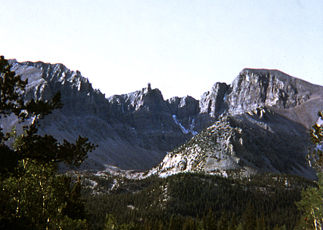
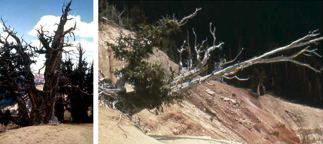
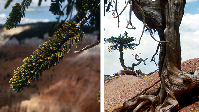
.jpg)
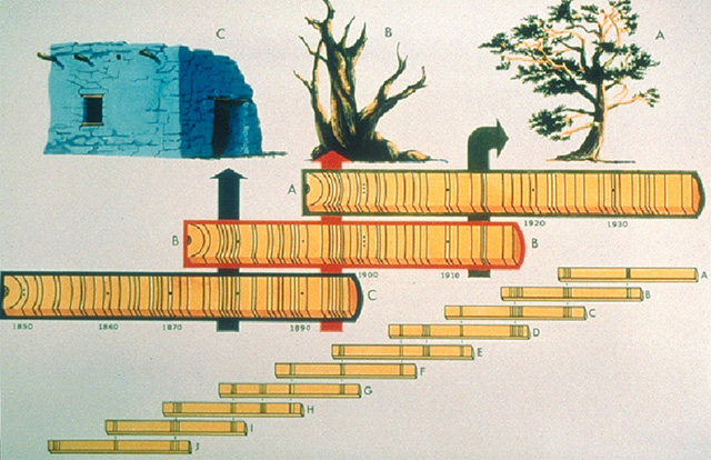
.jpg)
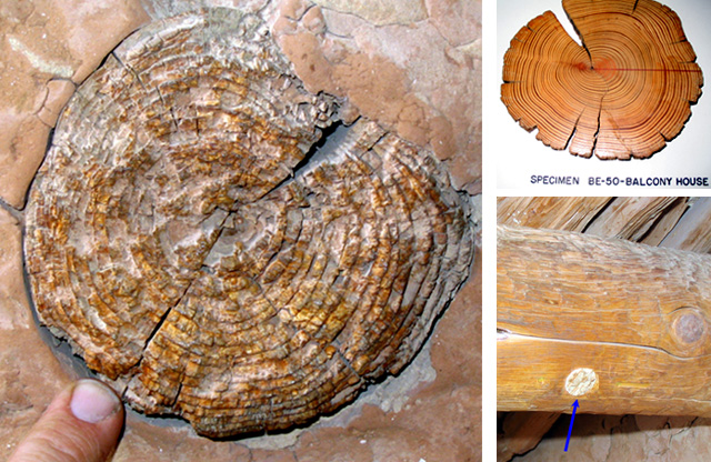
Image 1: Great Basin National Park’s Wheeler Peak, Nevada Great Basin National Park’s Wheeler Peak, Nevada--Caves, Bristlecones, and the Age of the Earth Diagram from NOAA, photos from National Park Service (indicated) and by R. Alley
Image 2: Three pictures of cave formations, Lehman Cave, Great Basin National Park. First, Popcorn formation on column, second, helectites on column, and third, flowstone.
Image 3: Two pictures. 1. Shield formation in a cave. 2. Twisty stalactites (called helectites) A shield (left) and hollow stalactites (soda straws; right). The National Park Service Web site doesn’t identify the cave pictured, but because shields are almost unique to Lehman Caves, and twisty stalactites (called helectites) are common there as well, these images are probably from Lehman.
Image 4: Two pictures of cave formations. 1. Soda straw. 2. Soda straws with helectites Soda straw formation with drop of water on the end(left) and soda straw formations with helectites growing out of them (right). Again, these may be Lehman Caves, but the Park Service web site doesn’t say. Lehman is beautiful!
Image 5: Two pictures of dying bristlecone pines at Cedar Breaks National Monument, Utah Bristlecone pines live fast and die young in “good” environments (wet and warm, with rich soils), but live long if barely prospering in cold, dry environments with impoverished soils. These are at Cedar Breaks National Monument, Utah.
Image 6: Two pictures. First, a closeup of the brislecone pines branches that look like a bottle brush. Second, the exposed roots of a bristlecone pine The distinctive “bottle-brush” branches of the bristlecone pines (left, at Cedar Breaks) look like they are ready to clean test tubes in a lab. The rapid erosion at Bryce (right) leaves bristlecone roots exposed above the ground.
Image 7: Two pictures First, several Bristlecone pines, Mt. Evans, CO Second, a close up of a bristlecone trunk. One small section has bark, the rest is gone Still more bristlecones, this time on Mt. Evans, Colorado. The tree shown at right is kept alive by a narrow strip of bark (yellow arrow), while most of the tree has had its bark sand-blasted away or otherwise removed (pink dashes). Tree-ring dating must be done under the living strip of bark.
Image 8: Diagram of cross-dating of tree rings Laboratory of Tree-Ring Research, The University of Arizona, NOAA Paleoclimatology Program Slide Set on Dendrochronology In this example of cross-dating in tree-ring research, the pattern of thick and thin rings in a core from a living tree (A) is matched to the pattern in a dead tree (B), then to wood in a native-American site, C, and then on to other, older wood samples (D-J).
Image 9: Long House cliff dwellings at Mesa Verde National Park Construction was done mostly with stone and mud, but also with some wood, often hauled in from long distances. Tree-ring studies allow reconstruction of ages and of past climates.
Image 10: Three pictures. Two logs from Long House used for tree-ring research. One shows a plug removed for tree –ring research and replaced by modern wood. The third picture is of a museum specimen tree ring.
Virtual Field Trip #2: Grand Canyon National Park
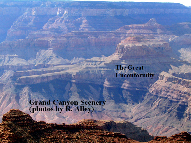
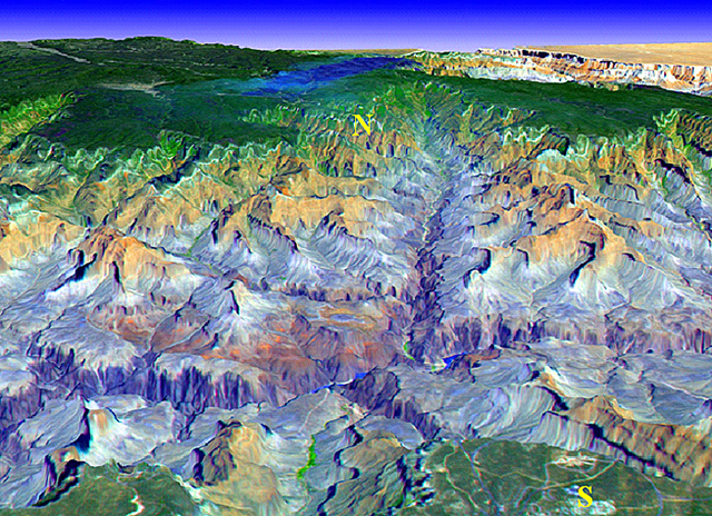
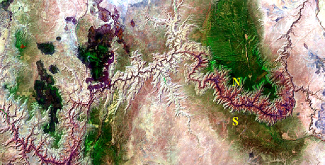
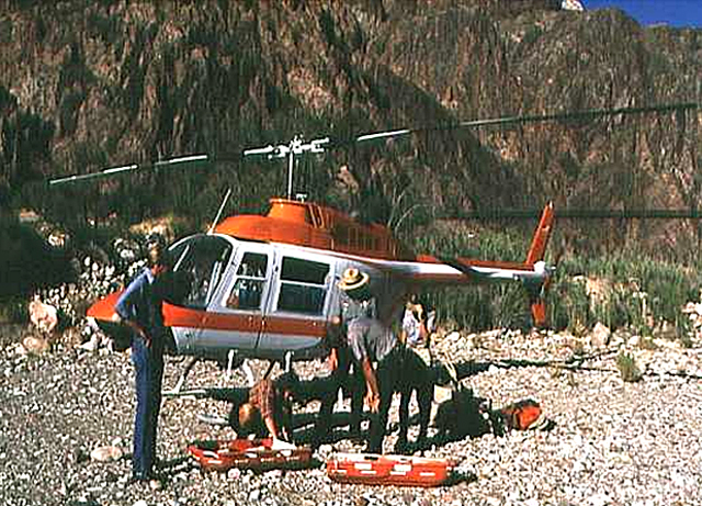
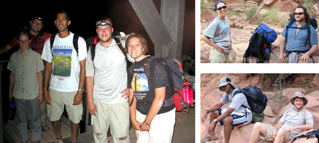
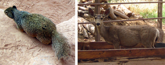
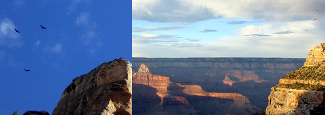
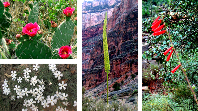
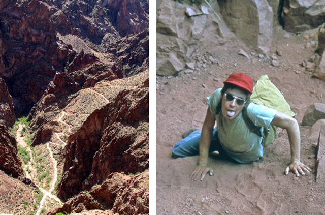
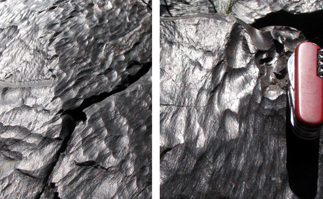
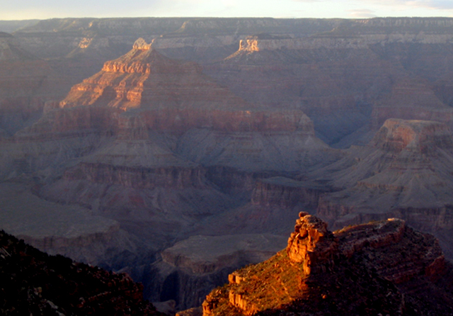
Image 1: A view across the Grand Canyon
Image 2: Satellite-generated oblique view of the Grand Canyon looking across the South Rim village toward the North Rim village.
Image 3: USGS Landsat image of the Grand Canyon: At 277 miles long, 5 to 18 miles wide (average 10 miles wide), and about 5700 feet deep (just over a mile), Grand Canyon is not the longest, deepest, widest or steepest on Earth, but it may be the grandest for combining length, depth, width and steepness.
Image 4: National Park Service Historical Photo, rescue helicopter at the bottom of the grand canyon. National Park Service web site says: “Over 250 people are rescued from the Canyon each year. The difference between a great adventure in Grand Canyon and a trip to the hospital (or worse) is up to YOU - follow the rules of smart hiking and - DO NOT attempt to hike from the rim to the river and back in one day, especially during the months of May to September.”
Image 5: Three pictures of students at Silver Bridge, bottom of the Grand Canyon.
Image 6: Two pictures from Indian Gardens, Grand Canyon. First, a ground squirrel. Second, a mule deer in a feeding trough for the pack mules.
Image 7: California condors flying over the Grand Canyon. They have been reintroduced there successfully.
Image 8: Despite the dryness, the Canyon has many beautiful flowers including prickly pear, phlox, century plant and penstemon.
Image 9: Two pictures. Left, a view looking down onto the South Bright Angel Trail. Right, a student climbing up a steep part of the trail.
Image 10: close up of metamorphosed rocks abraded and polished by the Colorado River, Bright Angel Trail. Note that river-worn rocks look very different from glacier-worn rocks, but show clear evidence of erosion.
Image 11: Sunset at the Canyon.
Virtual Field Trip #3: A Geologic Walk Out of the Grand Canyon—Climbing Time
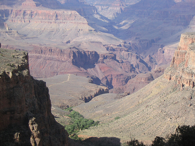
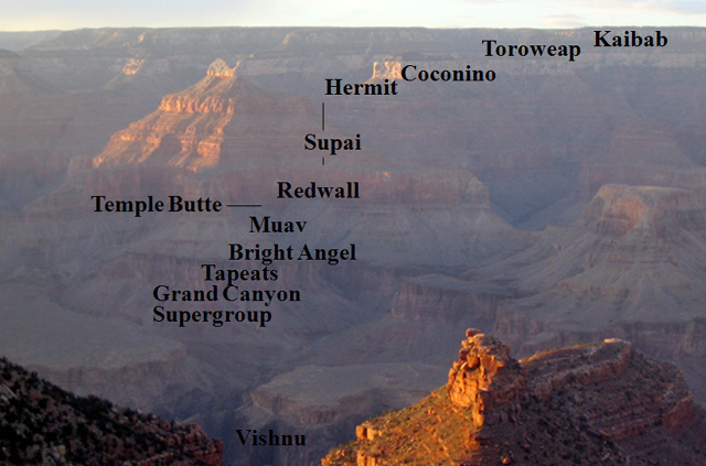
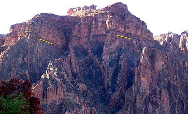
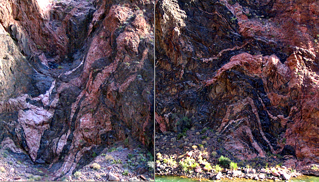
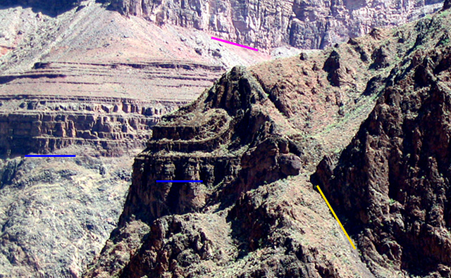
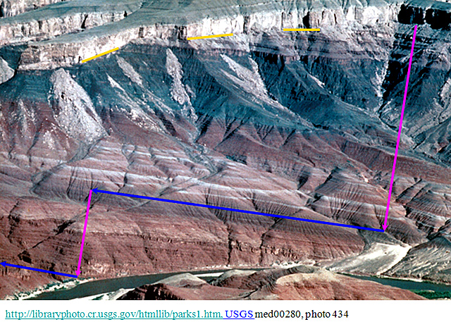
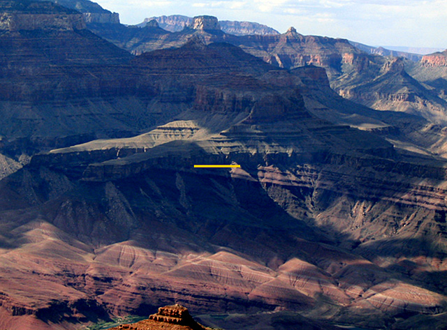
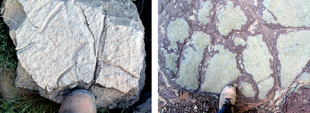
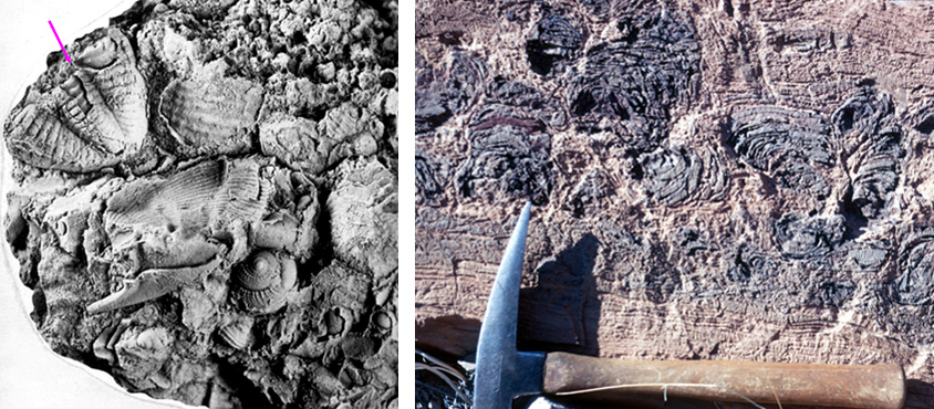
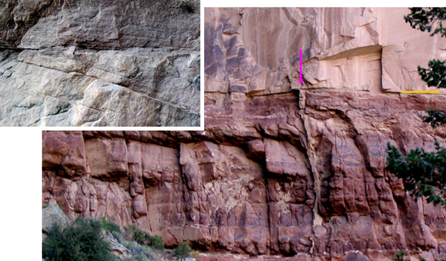
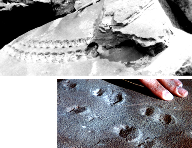
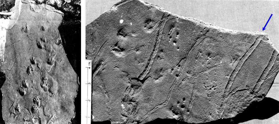
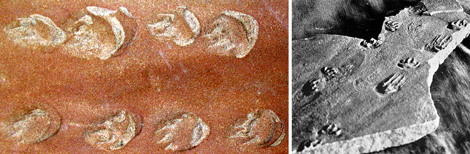
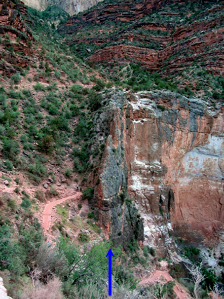
Image 1: View into the Grand Canyon
Image 2: Rock units as seen from the south rim on the Bright Angel Trail. Starting from the bottom, is the GC Supergroup, Tapeats, Bright Angel, Muav, Temple Butte (Temple Butte is discontinuous (as is the Surprise Canyon, a recently discovered unit just above the Redwall), Fedwall, Supai, Hermit, Coconino, Toroweap, Kaibab. The Supai Group and the Grand Canyon Supergroup include several named layers.
Image 3: A rock formation above Bright Angel campground (just N. of the Colorado River up Bright Angel Creek near the bottom of the Canyon) shows sedimentary rocks of the Precambrian Grand Canyon Supergroup resting on the unconformity above metamorphosed rocks
.Image 4: Views of the N. side of the Colorado River from Bright Angel Trail, showing Zoroaster granite (pink) intruded into Vishnu Schist (dark) and heavily deformed, from the heart of an old mountain range.
Image 5: Rock formations that show a push-together fault. A fault can break rocks and break through to the Earth’s surface to raise mountains and lower valleys. Then, if motion ceases on the fault, erosion can level the surface, and sediment can be deposited on top. Such a situation can be found deep in the Grand Canyon, where a fault offsets Precambrian rocks, including the very old metamorphic rocks and, above them, the still-very-old sedimentary rocks of the Grand Canyon Supergroup, but the fault does not offset the younger, Paleozoic Tapeats Sandstone.
Image 6: The ‘Great Unconformity’ between Precambrian Grand Canyon Supergroup and Cambrian Tapeats Sandstone. Sometimes in faulting of the type seen in Death Valley, a fault on one side of a valley will experience more motion than the fault on the other side of the valley, so that rock layers in the valley are tilted. Erosion may then remove the mountains, followed by deposition of new, horizontal layers of sediment on top. The surface where the tilted layers meet the younger, horizontal layers is one type of unconformity, and a famous one in the Grand Canyon is called the “Great Unconformity”. In the eastern Grand Canyon, the rocks beneath the Great Unconformity are part of the Grand Canyon Supergroup, from the Precambrian, whereas the rocks above are younger Tapeats Sandstone from the Cambrian. Measuring the thickness of the tilted older layers shows that there are about two miles of sediment there—if you could tilt them back to horizontal, they would make a two-mile-high pile.
Image 7: East end of Grand Canyon National Park shows Precambrian rocks below the Great Unconformity and Paleozoic rocks above.
Image 8: Sedimentary layers in the Tapeats Sandstone. Cross-bedding (right) and ripple marks (seen edge-on above, yellow arrow) are among features shown. These are “normal” sediments, lacking signs of catastrophic or sudden deposition.
Image 9: small animal burrows shown in the Tapeats Sandstone and Supai Formation. Creatures hide in mud or crawl through mud looking for food, leaving tracks. Time clearly is required for this to happen. Burrows occur throughout the upper mile or so of the Canyon’s rocks.
Image 10: Two pictures of mud cracks in stone from the Grand Canyon. Mud cracks also are found in many, many layers of the Canyon, from many times when the sediment surface was stable long enough for cracks to form. Those to the right are in a block that fell from the Kaibab Limestone cliff, and those on the left are in the Bright Angel Shale, along the South Bright Angel Trail.
Image 11: Limestone fossils of trilobite tail and gastropods and an algae-mat. Shelly limestone from channel fill in basal Supai rocks, with trilobite tail (upper left) and some beautiful gastropods (snails). (right) Algal-mat (stromatolite) deposits, Chuar Group, Precambrian Grand Canyon Supergroup. Mats trapped mud, grew up through the mud, and trapped more.
Image 12: A rock formation. Bottom is a 100 ft high cliff of Hermit Shale (bottom of rock) with Coconino Sandstone on top. The Coconino sandstone has a fossil-sand-dune nature. In the middle of the picture and running vertically shows where sand fills a mud crack in the Hermit Shale. South Bright Angel Trail, Grand Canyon.
Image 13: Two pictures of fossil tracks, one in the Supai Formation and one in the Coconino Sandstone. Diverse fossil tracks have been found at many different levels in the Canyon.
Image 14: Still more fossil track ways from the Coconino fossil sand dunes in the Grand Canyon. Left: Lizard track way, National Park Service museum, South Rim. Right: fossil showing millipede tracks. Historical photo taken about 1920 of sample from Hermit Trail.
Image 15: Two pictures of fossil tracks in Coconino fossil sand dunes both of a lizard track way.
Image 16: Fern fossils from the Hermit Shale near the Kaibab Trail.
Image 17: Four fossils from Kaibab Limestone. Trilobite, Bright Angel Shale, fossil-bearing limestone, and nautiloid.
Image 18: The history of the Canyon did not end with the deposition of the Kaibab Limestone, which slants down to the north beneath Zion, and Zion’s rocks slant beneath Bryce… After the deposition, erosion of the Canyon has occurred (see the Enrichment in the text), and deformation has happened. Here, the South Bright Angel Trail crosses the Bright Angel Fault--the blue arrow points at the pulverized rocks of the nearly vertical fault zone.
Word Document of Unit 10 V-trips
Want to see more?
Here are some optional vTrips you might also want to explore! (No, these won't be on the quiz!)
Great Basin National Park
(Provided by USGS)
Grand Canyon National Park (South Rim)
(Provided by USGS)
Grand Canyon National Park (Historic - Powell Survey 2nd Expedition, 1871-2)
(Provided by USGS)
GeoMations and GeoClips
This week's GeoMations feature geologic time in all of its glory; first, you'll accompany Dr. Alley on his "climb" up out of the Grand Canyon and past 1.2 billion year's worth of geologic evidence. After reaching the top, you'll stop at the rim to hear a bit about the widening and narrowing of the Canyon. Then, it's back to Happy Valley, where you and Dr. Alley will hit the gridiron and witness geologic time as it marches down the field for a dramatic goal-line ending!
Next, this week's GeoClip will take you "live" to the Grand Canyon Rim, where you will join Dr. Alley in a firsthand look at "deep time." (If that clip leaves you wanting more, "part 2" is also available as an optional enrichment this week!) So, enjoy your visit to the Grand Canyon and your walk up through time. We hope you find Dr. Alley's play-by-play commentary and his incisive post-game analysis helpful in explaining what the Earth has been doing these past 4.6 billion years.
GeoMations:
Climbing the Canyon
Click Here for Transcript of the Climbing the Canyon Video
At the bottom of The Grand Canyon, deep in its channel, flowing out of the page towards you is the glorious Colorado River. And next to the river, there are rocks that were sediments. They have been lava flows and other things. They have been bent in the heart of a mountain ranges. They have been intruded by granite. They have had the heck beat out of them.
And on top of them, there is an unconformity-- an erosion surface. Sitting on top of that erosion surface, there are various sedimentary rocks-- things that formed on the edges of a sea interbedded with lava flows. There are many erosion surfaces within that pile of sedimentary rocks.
And that is an immense pile of sedimentary rocks that has been dropped down by faults. If you actually try to measure the thing, you find that you get some thickness, and then you walk along the layer, and then you measure some more thickness. And the total thickness is actually about two miles of sediments in pile. And then on top of that, there is another erosion surface. That was the Grand Canyon Supergroup in that two-mile pile.
Sitting on top of this, the sea came in, and you end up with the Tapeats Sandstone, and you get the Bright Angel Shale, and you get the Muav Limestone. And then sitting on top of that, there was erosion, there are deep channels in places that were cut on top. And in those channels, one goes in and finds little bits of pockets of the Muav Limestone sitting in there. The sea had come in. The sea goes out, the sea comes back and puts in the Muav. It goes out and erodes again, and then you get the giant Redwall-- the great, massive Redwall.
And the top of that is also eroded. And it has some channels. And it wasn't until the 1980s, when, really, helicopter geology came in, that people realized that, in fact, some of those channels have little bits of limestone in them called the Surprise Canyon. The sea had gone out, it came back and put that down, it goes out, and there's erosion again.
And then sitting on top of this, we get the great rocks of the Supai. The Supai is ocean sediments-- limestones-- to the west, and it is a delta. It's up on land to the east. It's about four different units, and there's an erosion surface that goes at the end of each of those different units of the Supai.
The Supai then gave way to the mighty cliff of the Coconino. This is the sand dune rocks. This is the one that has all the beautiful tracks in it and so on. And on top of that, there's another erosion surface. Then there's sort of a mix of land and sea sediments that's known as the Toroweap that makes it a bit of a slope. And it has an unconformity and erosion surface.
And then sitting on the top of this is the cliff of the Kaibab Limestone, which gets up to the villages where you can go as a tourist. But this, in turn, slants down to the north. And underneath that, you're going to find Zion way up there, and then you're going to find Bryce, and so on, up through the giant pile of rocks.
Widening and Narrowing
Click Here for Transcript of Widening and Narrowing Video
I was out at the Grand Canyon a few years ago. And I was standing behind the fence there. And I was talking to a very nice and knowledgeable ranger about the history of mining at the place. And we were looking at those incomparable cliffs. And there's sort of a cliff of limestone, and a slope of shale, and a cliff of sandstone on another slope, and so on, on down to the river sitting way down below someplace like that.
And while we were standing there talking, this gentleman walked up, and he asked us why the river had gotten narrower. And we gave him a confused look. And he said, well, the river down there is very narrow. But if you try to look all the way across to the North Rim which is way the heck over there, what you see is, in fact, that the top is very broad. So he sort of figured that the river had been wide, and then it had gotten narrow.
Now, right beyond the fence there was a bit of a crack down into the cliff-forming rock there. And I ask him whether he would have any interest in going out beyond that crack and taking a jackhammer and starting to work on it. And he offered the opinion that eventually it would break off. And that when it broke off, that he would end up somewhere down the slope with a big rock on top of him, and that that would not be a good thing to do.
Well, then I ask him if he looked across the canyon, did he see places where a lot of rocks had piled up that looked like they had fallen off of the cliff. And he said, well, yeah I do. And that one fell. And this was a bright person. He immediately got it. He says, oh, what happens then is that the river must cut down. And once the river has cut down some, then, this slow process of mass wasting is going to widen it.
And in particular what happens is that the shales, the slope-formers cut down. And that makes the cliffs higher. And if the cliffs get really high, they tend to fail, and blocks fall off. And so that after a while you look at it, and you find that the canyon sort of has the same shape that it used to. But it's gotten wider as well as getting deeper as the river comes down.
100 Yards of Geologic Time
Click Here for Transcript of 100 Yards of Geologic Time Video
It is 4.6 billion years ago. You were on the goal line Beaver Stadium and you have to drive 100 yards to today where you're taking Geosciences 10. The earth is forming 4.6 billion years ago. Giant meteorites are streaming in. And when they hit the surface, they make great explosions and collisions that heat the planet so much that they evaporate the ocean. And the last one of those that was big enough to evaporate the upper part of the ocean that was warmed by the sun and given energy by the sun is about 3.8 billion years ago, which leaves you 83 yards to drive to get to the goal.
Beyond this, the continents are forming. They're no longer getting blasted. And so you start to see continents show up that the cores of the modern things and they're sitting out there very nicely. And they are formed so that you get an idea of what the world is going to be like by about 2.5 billion years ago, which is a mere 54 yards to get your touchdown.
There are bacteria in the ocean and the bacteria are committing acts of flatulence. They're putting oxygen up. The oxygen changes the composition of the atmosphere, it changes the oceans, and it eventually allows bigger critters to appear. And those bigger creators include shelly critters which suddenly make lots of interesting rocks, limestones. And so you start to get lots of shells showing up about 570 million years ago, which is a mere 12 yards to get the goal line. The shells are doing really well.
And then there's a really bad day. The ocean gets very warm from greenhouse and it belches out bad gases and most of the things alive die. And that happens about 225 million years ago at the end of the Paleozoic which is only five yards from the goal.
That clears up space so that you start to get dinosaurs. And as you know, dinosaurs were really big and they're sort of cute critters. And so you start getting dinosaurs in the Mesozoic. And here is a dinosaur if you would like one. and the dinosaurs are having a fine time and they're smiling a lot.
But there's another meteorite coming. And so the big meteorite comes screaming in and it kills the dinosaurs, and that changes the world a lot. And that happens about 65 million years ago which is only one and a half yards from the goal.
That makes room for mammals to show up, and so you start to see mammals such as this elephant that you're about to see here. This elephant happens to be running away from you. And the elephant has some big ears and a really curly tail.
And that comes up to recorded history. And recorded history, 6,000 years ago, just a little over the thickness of a sheet of paper.
And finally, to the culmination of creation to you, who are born about 1/200th of the thickness of a sheet of paper from the goal line today.
GeoClips:
The vast and varied history of the planet is best experienced by hiking the Canyon, but you can see a lot of the story from the rim. Here, you'll get a very brief overview of a very long story. ( Click the link to view movies - All are in QuickTime format )
#1: Supergroup Part 1: Grand Canyon Rim
Click Here for Transcript of Supergroup Part 1: Grand Canyon Rim
The really cool thing here is how much extra time we can see. If we look down just to the left of where we see the river in the shadow of the cloud right now, we'll see that there are layers that are slanting. And then above them there are layers that are horizontal. Now the slanting layers are the Grand Canyon Super Group.
They are rocks that were deposited between about 1.2 billion years ago and about 0.7 billion or 700 million years ago. If you add up the thicknesses of all of those going down it's almost three miles of sediment-- almost three miles. Now we've got a mile on top and then from our feet down to the unconformity.
Then there's three miles of sediment under that. And then if we peer down the canyon in that deep cut down there are the the old crystalline rocks, the old beautiful rocks that were cupped in the heart of a mountain range that are lava flows and sediments that add up to many more miles of rocks. And those have been cut. And that it was eroded. And then these were put on top.
And then faults that are sort of like Death Valley faults broke and dropped these down. And then it eroded on top. And then these were came And then those were deposited. And then those were eroded away. And then the river cut through. And it's so cool. And it's just this immense story that just keeps being told over and over and over.
Want to see more?
Optional Enrichment (no, these won't be on the quiz!):
Supergroup Part 2: Grand Canyon Rim: (Transcript)
Deep Time film clips - What do beauty, saving money at Las Vegas, religion, oil exploration, emerging new diseases, and the planet’s recovery from global warming have in common? All in some way involve deep time, the immense age of the Earth. Eric Spielvogel filmed a discussion of these and other issues with Dr. Alley, for a special “time” issue of Research! Penn State. These "Deep Time film clips" will give you something to think about, and may even help with the course. Enjoy!
Video Lecture
The Unit 10 lecture features Dr. Richard Alley and is 48:30 minutes long.
Today we get to really go into deep time. If you remember, we've built mountains, we've torn them down, we're trying to read history, and we're trying to put events in order. And the last time, we got as far as being able to say, this one is younger, and this one's older. And now we want to put numbers on things. How old is this? What can we do with this? And so to do that, we're going to go through a series of things to try to get ages-- the age of the Earth.
To do that, we get to go someplace really fun. Way out in eastern Nevada in Great Basin is Wheeler Peak. Nobody goes there. It's in the middle of nowhere. But if you ever get a chance to go to Great Basin, you've got to do it.
The real draw at Great Basin is actually a cave. It's Lehman Caves. And Lehman Caves is the most beautifully-decorated cave. It has all these helictites. If you look in the middle picture here, you'll find what they call helictites. Helictites come from the Greek for "helix." So you get these things. They just grow in all sorts of crazy directions like that, and you get just beautiful, beautiful decorations in this cave.
Things like this-- the shields are apparently only known in this cave. It's not quite clear why, but these sort of structures that you see in the left-hand picture are unique to Lehman, or very nearly so. The ones on the right, you'll see lots of caves, but they're prettier in Lehman. So if you ever get the chance to go out to Great Basin, you've got to do it. You'll have stories to tell everyone.
One of the things in Great Basin, though, is up on top of Wheeler Peak-- the glacier is gone new. There was an ice-age glacier. But up on top, there are bristlecone pine trees. Now, bristlecones, if you give them lots of water, lots of food, they live fast, and they die young. If you treat them like crap, they live just about forever.
And in fact, the oldest tree that's ever been known so far was cut on top of Wheeler Peak before it became a national park. It would be 5,000 years old now. The people that did that just walked out and cut a tree. They did not say, let's look at every tree that's out here and find the oldest one. So there's almost certainly older trees up there.
The thing's 5,000 years old. It was living with this little strand of bark that was running up the side of the tree. The sand blasting and the ice blasting and the winds and the hideous winters had taken the bark off all the way around except this little strand in the lee. And that was keeping this thing alive. It's just an amazing, amazing, place.
Now, if you get a 5,000-year-old tree, you can count the annual layers of the tree, and you know it's 5,000 years old. But next to this tree, there's a lot of dead wood. Trees die, and they don't immediately rot up there. It's sort of cold and high and miserable. So you can play a game of cross-dating. A tree that is happy grows a big, wide ring some year.
So a happy tree is making big, wide rings, as I'm indicating on the slide there. And an unhappy tree is making a skinny ring. In a place like the Great Basin on top of Wheeler Peak there, an unhappy tree is probably a cold one. Big volcano erupts, it blocks the sun, it gets cold, the tree doesn't grow very well, and so you have a bad year or two or three.
You get this pattern of good years and bad years. So if you look at your tree, and then you look at the wood next door, you can start matching up the pattern between good years and bad years. And by cross-dating, you can get a longer record than is possible from just one tree. You can find old wood in a variety of places. You find it just dead sitting next to the tree.
You find it in Native American sites. When they use lumber in their construction-- logs in the construction-- those are old wood. So you can work from that. If you go to Mesa Verde, in the upper right there, there's a little yellow arrow pointing to a tree that was used in construction at Mesa Verde. Tremendous park as well. Completely worth your while to visit.
You go to Mesa Verde, and you look-- you can see in the museum where they've cut a tree so you can look at it. You can see in the ruins themselves where you can see the tree rings, and you can look at the good years and bad years. You'll also find in many of the logs where little samples have been taken out for tree ring dating. And this is a little plug put into one of the beams in one of the houses at Mesa Verde. And that sample has been taken out, and it's used for tree ring reconstructions.
The oldest tree is 5,000 years. There is wood next to it that goes back over 8,000 years. The longest tree ring record now is about 12,000 years. And it's actually oak trees and pine trees that are buried up in river deposits in Germany. And an immense, immense amount of effort goes into getting those things. But one can actually count annual layers.
And if you are counting annual layers in trees, the oldest tree is about 5,000 years. But the oldest wood, using cross-dating-- matching overlaps, getting overlap from various trees-- you can now go back to about 12,000 years. That's just in trees. We're not down into rocks yet. We're not into anything old. We're just in trees.
You may know that there are a few places where lakes also get annual layers. Most lakes do not have annual layers. If you've got worms crawling around in the mud, they stir it up, and there's no annual layer. But there are few places that there isn't much oxygen. The lake may freeze in the winter, and the little bits of clay sift down. And then it thaws in the summer, and sand washes in, and it makes a layer.
So you'll get a layer of sand and clay and sand and clay, and one per year. So there are a few lakes that do have annual layers. Not all. And the longest one so far is about 40,000 years. It's a lake in Japan. And you can just imagine how difficult it is to count 40,000 years. They do a lot of checking to make sure it's right.
I'm going to show you some pictures of work that I was involved with counting ice core layers. So I'd like to take you to Greenland. There are some ice cores that are annually layered as well. This is a picture of the edge of the Greenland ice sheet. This is a picture of me slightly younger. We had been working for a while and we hadn't had a shower for a few weeks. So we finally got to clean off.
So I've actually been there. Behind me is snow and ice. It's actually an Antarctic picture, but I've drilled at both poles. This is a picture from Greenland. A wonderful day in Greenland, as you might imagine. They take us up in the planes, and they leave us up there and come back in six weeks to get us. So in fact, these newspapers, the USA Today over here is a month old at this point. It is, actually, perfectly functional. It does the job.
You may know that this is a good day in Greenland. This is a bad day in Greenland. The wind does blow, the snow does go, and it's a little bit different up there sometimes. Where we are, we're two miles up. The ice is two miles thick. It is 200 miles to the nearest rock. And we're sitting out there trying to do science, as you can see here.
Actually, this is a 4th of July festival, and Eric Saltzman is in the snow trap over here. This is a world-famous scientist, [? Peter Grutis, ?] who's hitting the volleyball there. And this is freeze-dried laundry. So all the comforts of home.
Now, what we were doing up there was studying snow and ice. And here's a picture-- I'm the gent down here with no shirt on. And right next to me there is John Fitzpatrick of the United States Geological Survey-- a wonderful scientist. And you'll notice what we've done is we've dug two holes in the snow-- one hole over here that we're going to leave open and the sun will shine into it, and one hole over here that we're going to put boards on top of and make a lid. Now, if we put boards on top of the one over here, and the sun shines in the other one, it will shine through this little wall in between, and you're going to be able to see the layers in the snow.
So let's do that. And here is a picture of that. It's just a little bit taller than I am here. And you'll notice that there's layers. The storm comes in, and it puts down snow, and it comes in, and it puts down more snow. So we see layers. And you'll also notice down a little bit there, about so far down, is marked "previous summer." So right here are layers that were cooked by the sun. We have watched this happen. We have monitored it from space. We've monitored it on the surface. We've done all sorts of things.
When the sun shines, it doesn't get up to freezing. It's still colder than that. But it does change the snow, and it gives a different look. So this light layer, some storm came through, and it sculpted the surface down here. And then it gets a deposit, and then it gets cooked by the sun, and then another storm and another one. And then winter comes, And there isn't any cooking by the sun in the winter, because there's no sun in the winter. So you get a unique signal, the sun did this.
And below that is the next summer down, and below that-- right the bottom, it's getting pretty dark, because there isn't much sun getting to the bottom of the pit. But below that, there's another summer, and below that, there's another one, and another one, and another one, and another one. So we do this. Now, let's drill an ice core. Big drill-- you paid for it, or your parents paid for it.
So we get this big drill, and you take the drill, and you go down, and you pull up ice. And you go down, and you pull up some more ice, and you go down, and you pull up some more ice. There's Katherine from Alaska sitting on top of the drill. This is big science. This is really cool stuff.
And you get the ice cores, and you take them down in your secret under-snow laboratory. We had this giant lab cut in the snow. You've got AstroTurf on the floor so that you don't wear out the snow. And the walls are snow. The ceiling, actually, was boards. But if you need a bigger lab, you get a chainsaw, and you whack out a bunch of the wall and take it out, and you get a bigger lab.
And you take the ice core down there, and you slice the top off the ice, which is going on right here, from Bill Kimball of the University of New Hampshire. And there's an ice core. And there they sit. These are from 1,547 meters down. So that's about a mile down. And you take it, and you slice it, and you look at it. And here's Kurt Cuffey. He was from Penn State. Now he's a professor at Berkeley. And Kurt is looking at it.
And if you look at the core, lo and behold, those sun-cooked layers made big bubbles, and the big bubbles make it look dark in this. And it's lying on its side, so you'll see the layering in the core is still there. And the blue bands are the summer. So this is a summer, and this is a summer. So we have come down, and we can still see these, and we can still count them.
Let's go back over here for a minute. I just told you that we know what we're doing, but why should you believe me? What is it that we could do to do this? So what we have to do is we have to check. If I tell you that that's an annual layer, I'd better do more than just telling you that. I've got to show you something.
So we did several things. I counted, and Kurt counted, and [UNINTELLIGIBLE] counted, and Tony [UNINTELLIGIBLE] counted. We recounted. I went to a freezer in Denver at the National Ice Core lab, and I redid a half a mile just to see that if I got the right answer. We use different techniques. There are layers in the chemistry, there are layers in the electrical properties, as well in the appearance.
So we count in various ways, and we count at various times. We don't cheat. We don't tell each other the answer until after we've done it various times by various people. This is a big undertaking, because the thing is two miles long-- the whole ice core, and there's a lot of layers. So this is a serious effort to do this.
And then we check ourselves. As far back as we can, we look for time markers. And this is probably the most important thing. The year 1783, there's a big volcano called Laki erupting in Iceland. It's a disaster in Iceland. It's blocking the sun, it's putting out poisonous gases, it's killing things. It was a very unpleasant thing. Benjamin Franklin is representing the young United States. He is over in Paris as our ambassador. And he notices the blue fogs that are blowing in, and he says, there is a volcano erupting somewhere.
If we know what we're talking about-- Greenland is right next to Iceland-- you should see the deposits from that big volcano in the snow in Greenland. Now, different volcanoes have different chemical compositions. So you can go and look for the acids from the volcano. You can cut out that piece of ice. You can filter it. You can look for little, tiny pieces of volcanic glass. You can analyze those with a scanning electron microprobe.
And you can ask, is this the same composition as Laki? If we find pieces of the Laki eruption in the layer that we date to the age of Laki, we know what we're talking about. And if we don't, we don't know what we're talking about. So we look for time markers such as the chemically-fingerprinted fallout of historically-dated volcanoes. So how about that? The chemically-fingerprinted fallout of historically-dated volcanoes.
We also can find atomic bomb fallout. We can see when the no-lead gasoline came in, and the lead falls. We can see a whole bunch of things like that. And when we do this, what we find is as far back as history goes, we're good. If I tell you it's 100 years, it's 99 or it's 100 or it's 101. I may have made an error. It could even be 98 or 102, but it basically works that way.
Once we get older than that, we start comparing to the lake people and the tree ring people to see if we match them. We counted about 110,000 years in the ice core. Clearly, once we get older than recorded history, we can't directly check this. But like I say, older than written history, we end up comparing to, do we see the same signal of climate change as they see in the tree rings as they see in the lakes? So older than written history, we compare to other records. All of this works. And so far, that ice core that we did in central Greenland is the oldest one that's been done. And the ice gave 110,000 years.
Now, there's more ice below that, but it got messed up. You remember that mountain building sometimes bend things while the glacier's flowing and the bottom is bumpy. It's like pancake batter flowing over a waffle iron. So the bottom is messed up, but there's still more ice down there. So we didn't actually clean out all the ice, but we got to 110,000 years to there.
So annual layer counting goes way past recorded history. And annual layer counting matches recorded history as far back as we can see. My friend, Kuniholm, who is a professor at Cornell, works all these archaeological sites around the Middle East and up through Classical Greece. And they actually help in the archaeology because they see in the tree rings that they can date these sites, and it works.
And so what you will find to start with is that annual layers go way past written history. And it's still ice. It's still fine. It's still trees. There's no huge things. You go back into an ice age, but other than that, there's nothing weird going on.
And there's very, very high confidence that this is correct. And we're still in the mud and the lakes. We're still in the trees. We're still in the ice. We haven't gotten down to the rocks yet. This is all in the sediment-- the scuzz on top. So this is on top of the rocks.
So now, let's look a little deeper. And to do that, let's go back to the pictures. We're going to look at Grand Canyon, and then we're going to walk out of the canyon. The canyon is incomparable. You've just got to go to the canyon someday. It's just inconceivable that the thing is as big and as beautiful and as wonderful as it is.
This is a satellite image looking down on it. Typically, they count it as being 277 miles long. The width is a few miles. It is not the longest canyon. It's not the deepest. It's not the widest. There's lots of others. Zion is deep. Black Canyon of the Gunnison is steeper. Man, you can just go right over the edge of that one and it's a half a mile down. But the canyon, just taken together, is just about as good as it gets.
The N and S in this picture are pointing to the North Rim and the South Rim, and that's where most visitors go. Most visitors drive into the South Rim, and then they walk down one place or another. They often end up going right down here. Some visitors get to the North Rim. And there's a huge amount of it that nobody ever gets to.
We had the good fortune to take our [UNINTELLIGIBLE] there. The [UNINTELLIGIBLE] students got us safely to the bottom and back. When we went down, we finished the hike by moonlight and headlamp, and you can see all our [UNINTELLIGIBLE] hikers over there on the left. And you can see various people on the way back out-- some filmers and pros and what have you. This was just a wonderful, wonderful undertaking we had.
The path down, you'll see on the left, has a few switchbacks in places. And on the right is actually my cousin cutting up. He actually did not get himself in that situation, but I have seen people in that situation. Every year, they have to get helicopters down in the canyon to get people out who really did look like Chuck does there and couldn't make it. It gets hot down there. It's a long walk.
The wildlife is surprisingly diverse in the canyon. There's a lot of stuff down there. People have lived there for a long time-- the native peoples. They have reintroduced the California Condor. You can watch the suckers. California Condors are great. They're sort of an anachronism. They belong in a world with woolly mammoths and lots of big things that can die so there's lots to eat.
We don't have woolly mammoths anymore, but they're hanging on. And they introduced this flock of condors in the canyon, and they're going. So this is good. As you're hiking, you can watch them soaring.
If you go down to the river, you see rocks, and the rocks are just beautiful. But the rocks are being eroded. They're being cut. The river is working on it. The river is active. The river carved this canyon. That much a year makes you a canyon, and that river, man, when it's flowing and it's got mud in it, it can cut. So you get things such as this. It's really beautiful.
We're going to talk about history. And we're going to walk out of the canyon here. So I've named all of the things. You're not going to have to memorize the names of every one of these. Real canyon aficionados know these. They're old friends. You go down, and the great sandstone cliff of the Coconino, and down to the beautiful hold of the red wall, and the cave sitting in the bottom of that. And down to the deep inner canyon. These are old friends. And if you've actually walked the canyon, you come back, and you really know them in a fundamental way.
So what we're going to do is we're going to stop at the bottom, and we're going to look at pictures of this as we come walking out, which we got to do. Bottom-- metamorphic rocks. Think Rocky Mountains. Think what Sridhar was showing you. Here are pictures right along the river. You can see the river right at the bottom there-- the little bit of green.
And just above it, notice these rocks. The pink actually were melted. They're granites. The black around them are schists and gneisses. These rocks are from the heart of a mountain range. They have been hot. They have been toothpasted. They have flowed and squeezed and bent.
And all along the river, you look up at the heart of an old mountain range. And it's cold now, obviously, but it was hot. It was down there. And everywhere you go along most of the river, you'll see these old toothpasted rocks that have been buried way deep. They started life as sediments-- they're sedimentary composition-- but they've been buried way deep. They've been heated, squeezed, run around, all sorts of changes.
Those rocks, in this picture, are down at the lower left. I'm sort of scribbling on them. That's the heart of the old mountain range. Above that, the blue line marks an erosion surface. So these hot rocks were brought up to the surface. They were weathered. They were eroded. You can find rust down in the rocks that is most at the top and then decreases as you go down.
So you can see that these things were at the surface the way the metamorphic rocks are in Rocky Mountain now. They were eroded on top. So you have to take sediment, you have to bury it, you heat it, cook it, then you have to bring it up, erode it.
And then on top of that, there are more sediments. Now, these are very old sediments. We'll have a look at these in a little bit. But there are more sediments on top of that. And in places there's a lot more sediments, as we'll see in a minute. And then those sentiments are broken by a fault. And this yellow line on the side is actually an earthquake fault.
This particular one is a shoved-together, pushed-together thrust fault, and you can see where it bent the rocks. So it actually was dragging the rocks with it as it went. So you can follow those layers around there. And you follow that fault, and you follow that fault, and up here someplace, there's an erosion surface-- an unconformity. And the fault doesn't go through that.
So you're starting to put together a picture here of an old mountain range brought to the surface, eroded, more sediment put on the top, a fault breaks it, and then it's eroded again up there to make another unconformity.
And that's the story that the rocks are telling. And this starts to get complicated already. The sediments on top of the old mountain range are thick. In fact, there's two miles of those sediments. How do you get two miles? Well, they've sort of been dropped in in Death Valley-type fault blocks, and there's been some pushed together, but mostly pull-apart faulting.
What I want you to do for a moment is go over to the magenta arrow on the far right here. And I'm going to circle the starting point. And these are the sediments we're talking about. Now, go down and measure the thickness of the sediment. So you go down, and you go down, and you go down. There's a big pile of sediment there. That's the river way at the bottom. That would take you some hours to walk.
When you get down here, almost to the river, just follow a layer. So I want you to just follow a layer along. And after you get tired of following that layer along, now you're back above the river. So go down to the river again. You're going through more sediment. And then follow another layer along, and then you're going to go down to the river. And just keep doing that out of the picture. And if you do all of that and add all the pink layers together for the thickness of the sediment, it's two miles.
So this is an old mountain range. The top is eroded. And then you sort of put more sediment on top, and you drop it down in basins, you get two miles of this sediment on top. And then on top of that, up where these yellow things are, it's eroded. It's cut off. There's an unconformity-- an erosional surface there. And then on top of that, we're going to find more stuff.
Now, in that mile of sediment on top, if you go in, in places you will find little ripple marks. The current came along, and it made little ripples. And you're looking in a cliff, and you can see the little ripples. And you'll find little sand dunes where the sediment has been brought along. And then it's been cut off in the top. And then something else has worked on it. So in that mile of rocks on top, you'll find all these interesting things that speak of time.
You will find burrows. Over here on the left above my finger, you'll see where something has crawled through the mud. And as it crawled through the mud, it's changed the conditions just a little bit, and you see a burrow. Lots of things crawl through the mud. They're either hiding so no one eats them, or else they're eating the poop and other stuff that's in the mud.
So everywhere you go in the marine settings, you find thing crawling through mud. And they leave trackways. And you can see the trackways. You can see the trackways. And there's lots and lots and lots and lots and lots and lots and lots of these in the mud. And it takes time to let something crawl through the mud.
You will find mud cracks. This is a block that is from the Kaibab Limestone that is turned upside down. It fell off the cliff. And and you can see where the fill had gone down into the mud cracks. This one over here on the right is down in the Bright Angel Shale, and you can see the cracking that happened and the mud cracks that have happened. Again, if you make mud cracks, you have to give it time to dry out and crack.
These are fossils. Down in that two miles of sediment, you don't find many fossils. The ones you find are just these algal mat deposits. You go down to the creek and you'll find there's scuzz on a rock. And a flood, a little bit of mud will settle on the scuzz-- the algal mat-- and then the algae grow up through it. And down at the creek, the snails eat it. But in a world without snails-- we don't find any snails down at the bottom. In a world without snails, those algal mats built up. So you see these giant algal mat deposits down there, but not much else.
As you go farther, to younger rocks, then you start finding trilobites, like this trilobite tail that I'm scribbling over. And you find beautiful snails and other sorts of things that ate the algal mats. So as you come up through the canyon, you start seeing these changes in who lived where. You might remember, last time we were looking at this picture of the cliff in the wall of the canyon that was sort of like the modern Nile. There's floodplain deposits on the bottom.
And in those, you'll find footprints. You'll find fern fossils and other things. There's a giant sand dune deposit on top. In that, you'll find tracks of lizards and other things in a place where the mud dried out, and then the sand fell down in the crack heading way down here like this. This is a close up of the sand dune over here. The sand dune marched across, another one came over the top of it, and it marched down and so on.
If we go and look in that big sandstone on top, what do we find? We find trackways where reptiles have gone walking along. These are believed to be millipedes here. Something has certainly walked through. And you'll find a layer with tracks, and then another layer with tracks, and another layer with tracks, and another layer with tracks, and there has to be time for the critters to walk across those layers to make the cracks.
You go a little farther up and you find these beautiful trackways. This one is in a little museum at the top of the canyon. And this is an old historical photograph was taken along the Hermit Trail. But you can see that somebody's been here. And many times somebody has been there.
This is in the Hermit Shale-- that floodplain deposit like the Nile. And you find these beautiful ferns that are sitting there. And the ferns have to grow, fall down, be pressed. And then another layer will have more, and another layer will have more, and another layer will have more, and another layer will have more. And on and on and on.
So what I hope that you're starting to see is that there's a lot of time there-- a lot of time there. So what I walked you out of, and I will try to very briefly summarize it here, you go down in the bottom, and what do you find? You find the heart of an old mountain range. And the thing is just beat up and broken and bent and cooked and so on.
So this is the old mountain range. And then the old mountain range was eroded. So we'll try some other color in here like this. There's an erosion surface that cut across the old mountain range like that. And sitting on top of that, there are a whole bunch of layers of rock. And those layers of rock have very few fossils in them. And they're mostly the algal mat deposits. But they're sort of sitting down there at an angle.
And if you add up all the thicknesses-- go this way and that way and this way and that way-- there are about two miles of sediment with algal mats and not much else. There are volcano fallouts. There's little salt crystal casts. There's little ripples. There's mud cracks. There's all sorts of things. There are algal mats down there. But there isn't much in the way of other fossils. And then above that, there's another erosion surface.
There erosion surfaces, by the way, have a name. They're called unconformities. So there is an unconformity-- or a time gap-- an erosion surface. Technically, an unconformity could also include non-deposition-- it just sat there and did nothing for a while-- but usually it's an erosion surface. And there's another unconformity right there.
So this is really getting complicated. And then on top of that, there's another mile of sediment to the rim. So there's one mile of sediment up to the rim. And in that mile of sediment going up to the rim, we see changes in the kinds of fossils. So the fossils change going up. There are actually many unconformities in that. There are many unconformities in the pile.
There are some really cool places where streams actually cut down into a surface, and then a flood came in, and it put little deposits in the stream channels. And you can see these things. You have tracks. You have mud cracks. You have all sorts of things on the way up. You go from being sand dunes to being lakes to being all sorts of different environments up there.
When you get up that mile, if you went up the North Rim, you will look, and the rocks will slant away from you. and they slant down to just under Zion. And then there's another mile of rocks up through Zion, and they slant down under Bryce. And you're up through Bryce, and then they go under something else. And then on top of that are the Native American sites. On top of that are old trees. So above this is Zion. And above that is Arches. And above that is Bryce. And above that are Mesa Verde's people.
The geologists worked really hard to figure this out. It is not easy. The geologists looked at this and they said, wow. This is just amazing. I can't believe everything I can see here. I can't believe how well I can tell this story. And then they said, OK, how long? People can count annual layers, they get a few tens of thousands of years.
That's nothing. They said, look at this. The river is carving. How long to carve this canyon? Whoa. Millions of years. They said, we know how fast mud piles up in the ocean. How long to make two miles of mud, and then to tip it, and then to erode it, and then put more on top? And so the early geologists tried very hard to come up with estimates of this.
So what we can say is that when the early geologists looked at this, they said, whoa, this is old. We see this. It makes sense. We recognize these rocks. We recognize the tracks. There's no magic in getting a critter to walk across a sand dune, but you have to have time for the critter to walk across the sand dune.
And then there's another layer where another critter walked. And another layer, and then the river came in, and then the lake, and then the ocean, and then sand dunes were back. And they said, whoa, this sucker is really old.
And then they did something they called uniformitarian calculations. Big, fancy word. Notice "uniform" in there. Uniformitarian calculations. They said, let's say that things in the past sort of happened at the same rate they do today. Because we recognize the mud cracks, we recognize the fossils, we recognize the tracks. We see what's going on. There's nothing catastrophic in this. It's normal. And they said, at the rates that things happen today, how long would it take to make what we see?
And what they ended up with is about 100 million years to make the rocks. And the "about" there is really fuzzy. Could it be 50 million? Sure. Could it be 200 million? Sure. That's a fuzzy thing. And then they also said, but we need time to erode. There's all those unconformities-- those erosion surfaces. So it's plus the time to erode.
And they said, we can't tell what that mess at the bottom is that's been toothpaste in the heart of a mountain range. There's more time there, but we don't know how much. So they needed plus the time for the oldest rocks that are all messed up. Technical term.
And that is starting to get to be deep time. The little skim of written history, the much longer skim of annual layers, remember, is still up on top. We find archaeology in the mud. We don't find archaeology in the rocks. So now we're looking at something that's really looking very old.
This doesn't quite get us where we want to be yet, because while this gives you the great age, it doesn't really put numbers on-- that 100 million plus plus is still pretty fuzzy. So what you'd find is that today, most of dating is done in a third way. So most dating today-- most ages of rocks-- come from radiometric or radioactive techniques.
So we have to briefly mention a word for this. And it's from these radioactive techniques. They are described in more detail in the textbook. And then there is additional enrichment material, that may prove to be helpful, that goes in even more painful detail of how you derive this and why nobody is pulling your leg when they say they can do this.
What you know is that there are types of atoms that break down. All the atoms are sitting there wobbling and wibbling, and sometimes they fall apart. So that's called "radioactivity," So some atoms break down. And we have a name for that. We call that "radioactivity." And it is sort of a statistical thing. You wiggle and wobble long enough, and eventually you break.
And if you're really stable-- you just can't fall apart easily. It takes you a long time before one wiggle breaks you. And if you're really unstable, you fall apart immediately. So the rate at which one breaks down really is a fundamental of physics. It's how stable or unstable that particular thing is. So the rate is basically controlled by fundamental physics.
Now, what do I mean by "controlled by fundamental physics?" What that means is that you cannot glibly suggest, oh, didn't they decay at a different rate in the past? Because to make that happen, you'd have to change the constants that control the world. And to make that happen, either the sun blew up or it never burned.
There is not much room to tweak these sorts of things and still leave a world that we would recognize. So the decay rate is not something. There's lots of people that say, oh, maybe in the past it ran at a different rate. Well, that is sort of the same as saying, maybe in the past the sun didn't work or the sun blew up. Because the fundamental physics do not allow the decay rate to be changing.
So decay rate can't change. And it can't change because, first of all, this business of fundamental physics. It is very easy, it is very glib, to say, oh, things ran differently in the past. But that has implications.
The other way that it can't change is to use common sense. Now, if you go and look at these tree ring records, if you go look at ice core records, if you go and look at lake sediments, we can date events using radioactivity, and we can compare to the annual layers, and they agree. So radioactive dating agrees with the annual layers. Wherever we can check it, it works very well. It agrees with the uniformitarian calculations. It says, yeah, it's pretty old there.
In addition-- well, abbreviate that. Uniform calculations. And there are many different radioactive clocks. We can use potassium argon. We can use use sarmarium neodymium. We can use rubidium strontium. And the different clocks agree with each other. So various radioactive clocks agree.
So it gets really, really hard. You've got to be a little bit smart. You've got to be a little bit smart. If you search the web long enough, you'll find the 5,000-year-old living clam. If you find something that only eats really old things-- it never eats anything that's alive today, it only eats dead stuff-- it'll look dead. And there are certain places-- there are seafloor communities that are living on oil seeps.
And the oil has been down there a long time. And if you go ask if that seafloor community, it looks old because it's eating nothing but old stuff. So you've got to be just a little smart when you use these things. And if you're really, really stupid, you might screw up.
But basically, it works. There is an example in the text that might possibly be worth looking at. The example in the text is done with potassium and argon. And that one happens to be probably the easiest one. Potassium-40 is a radioactive thing. It happens to be very common in basic all volcanic and metamorphic and a lot of sedimentary rocks. There's a lot of potassium in there. Potassium is very common in the world. It is common, and it happens to occur in minerals. It is solid.
When the potassium breaks down, it takes about 1.3 billion years for half of it to break down. And it changes to a gas. So it's changing to argon-40, which is a gas. Now, why does that matter? When a lava flow comes out on the surface, the gas escapes. So a crystal starts with some potassium and no argon. As the argon is formed by the breakdown, you can see the change in the relation of potassium to argon. So you can figure out how long it's been there.
So because argon-40 is a gas, a lava flow starts with potassium but no argon. So then you can look at the ratio of the two, and it gives you a clock. Now, you do not have to wait a half life to measure the half life. If you worry about that, the enrichment goes into great detail on how this works and so on. So you can look at that.
Just a little step aside. Most of the radioactive stuff in the planet was included in the planet when the planet formed. So most of the earth's radioactivity was included when the planet formed. It came from outer space. It came from explosion of stars. So it's included when the planet formed.
A little bit of the radioactivity is made by breakdown of that. So it just is a daughter thing. So you break down from one radioactive thing to another one to another one before you get to something stable. So a little bit comes from breakdown of these. A little more is made by cosmic rays. You get zapped, and it damages something. And it may make something radioactive. And a little bit is made by humans in giant accelerator labs. But that's about it.
So naturally, those are the sources of radioactivity. Because of this, the plant is actually very slowly running down, because we're slowly running out of the radioactivity that was included when the planet formed. So the planet is slowly losing its energy source for plate tectonics. Because remember, the radioactivity is the heat source that drives the convection cells that drives the volcanoes and the subduction and so on as the radioactivity runs out.
Now, I wouldn't lose any sleep over this. You'd have to wait a billion years before you'd even notice. This is a very slow process, so it's sort of a billion years to notice. But our best estimate is that the planet is about 4.6 billion years old.
So that's time that there have been little changes. And things probably cooked a little faster way back in the Precambrian than they do now. So the planet is estimated to be about 4.6 billion years old-- 4.55, something in that neighborhood-- based on radioactivity. And that actually is consistent with everything else.
So what do we see? Again, this is science, and I hope you've seen just a little bit of the evidence that goes into it. It's not received truth. We're not getting this from somebody whispering in our ear or passing us a particular document. This is science. What I hope you've seen is that just by counting annual layers in the muds, in the ice, in the trees, that we go older than all of recorded history.
If we once look into the rocks, we see things we recognize-- environments we recognize, trackways we recognize, erosion surfaces we recognize. It all makes sense. It's not catastrophes. It's normal processes acting over deep time. We see hundreds of millions of years or more. When you then turn on your radioactive clocks, you can put numbers on that, and those numbers really are very, very old. And they are the most glorious stage for the most glorious drama that you can imagine. So we're going to look a little a bit more at the drama that has been wrought on this stage over the millennia next time.
Want another look?
Check out the Unit 10 Presentation used in the online lecture.
Optional Enrichment Article
Carving the Canyon, and More on Radioactive Dating, and Radiocarbon and "Old" Living Clams
Carving the Canyon
A vigorous river is capable of cutting downward at 1 mm/year (or more, and glaciers may cut faster than that). At 1 mm/year, it takes 25 years to cut an inch, or only about 1.6 million years to cut a mile down and make the Grand Canyon. Usually, rivers don’t cut as fast as 1 mm/year because the rivers quickly get down close to sea level, which makes the river’s slope smaller and slows the erosion.
The Grand Canyon likely owes its existence to several events. The most important may have been the opening of the Gulf of California, south of Death Valley, as we saw way back at the beginning of making mountains. Opening of the Gulf of California brought the ocean closer to the mountains, which steepened the streams heading toward the Gulf—the height of the mountains wasn't changed by opening the Gulf, but the horizontal distance a river had to flow from the mountains to sea level got shorter as the land ripped open and the ocean extended over what had been river bed on land, so the average slope of the river increased.
A “continental divide” is the line on a map separating the rivers flowing to one ocean from the rivers flowing to another ocean. As you might imagine (and as we discussed briefly back in the history of the closing of the proto-Atlantic and opening of the Atlantic), the slope to one ocean from a continental divide is often steeper than the slope to the other ocean. The steeper side generally erodes faster, which causes the continental divide to move away from the steeper side toward the more-gradual side. (Eventually, this will lead to the slopes being similar on the two sides.)
But, the continental divide is irregular, not a straight line. Where a big river forms and cuts down, the slope from the divide to the river will be steeper than nearby, so erosion will be faster there and the divide will be forced away. Sometimes, this will cause the divide to intersect and “capture” the drainage of a stream that had been on the other side of the divide. (See the figure below.)
The upper panel in the figure shows two rivers (the black lines with arrows), separated by a continental divide (the blue line), viewed from above. If the right-hand river is steeper, then it will erode back until the headwaters of the left-hand river are “captured” in an act of “stream piracy,” as shown by the magenta line.
There are lots of small rivers in the West with fairly big canyons—look at the most-of-a-mile deep canyon of the small Virgin River in Zion, or the remarkable amphitheater that tiny Bryce Creek has gnawed into the Paunsagunt Plateau to make Bryce Canyon. So, when the Gulf of California opened, the ancestral lower Colorado River steepened and cut headward (probably involving a piracy event with a stream exploiting the easily eroded San Andreas Fault), and pirated the ancestral upper Colorado River, which previously probably had drained internally (the river ran out into the desert and evaporated, the way some rivers do in Death Valley). This happened just over 5 million years ago; at that time, chunks of rocks of types that occur only up in the Rockies at the head of the Colorado River suddenly appear in sediments of the Gulf of California, where before chunks of such rock types were absent in the Gulf of California.
Why did it take the Colorado so long to cut the Canyon, then? Well, the Death-Valley-type Basin-and-Range faults associated with the opening of the Gulf of California also have cut across the Canyon, especially in the western end. Basaltic lava has come up some of the faults, much as happened in Death Valley. At several times over the last 5 million years, lava flows have dammed the Canyon, making lakes. Lakes accumulate sediment rather than eroding, while the erosive ability of the river is spent cutting through the dam. So, the river really had to cut down much more than a mile to make the canyon—cut down, get filled with lava, cut the lava, get filled again.
Why you don’t need to wait for a half-life to pass to measure it
In the text, you saw how radioactive decay occurs and provides “clocks” for the ages of rocks. Here, we go into a little more detail on the math, strictly for your entertainment and enjoyment.
The “law” of radioactive decay says that the more atoms of some radioactive parent you have, the more atoms of that parent will decay in some time. (There are many laws of this type: hotter bodies cool faster, rooms with more cats have cats run out the door faster, etc.). In addition, each radioactive parent type decays at its own particular rate. This is easier to say mathematically than in words. Given N parent atoms of some type, the change dN in the number of that type over some interval of elapsed time dt is:
The minus sign occurs because the number of parent atoms is decreasing over time. The K is a constant, called the decay constant (and often indicated with the Greek lambda, but we’ll stick with K). The numerical value of K is different for each different radioactive parent type, and includes the “physics” of how unstable the parent type is. A large K means a very unstable parent and a very rapid change to offspring; the units of K are inverse-time (so 1/seconds or 1/years).
If you never studied calculus, or you forgot what you studied, you won't make much sense of the next little bit. Don't worry. Those of you who took a calculus course and remember it will know that you can rearrange the equation to obtain:
Integrating yields:
in which ln indicates the natural logarithm, C is a constant that we will determine, and t is the total time that has elapsed. Taking the exponential of both sides, and noting that the decay started at some time t=0 when there were N=N0 parent atoms, yields the standard decay equation:
in which exp indicates the exponential (it usually appears as ex or exp or inv ln on calculators). The negative in front of Kt is equivalent to writing N=N0/exp(Kt). As t becomes large, exp(Kt) becomes very large, so N=N0/exp(Kt) becomes very small—the equation says that after a long time, you run out of parent atoms, which is correct.
Notice that if you can measure N0, wait for some time t1 and then measure N, the only unknown in this standard decay equation is K, so K can be calculated readily. The natural logarithm, ln, reverses the exponential so that ln(exp(-Kt))=-Kt. The natural logarithm appears on most calculators as ln or ln x or possibly as inv exp. Using this,
You usually will see this written as:
using one of the properties of logarithms.
We next estimate the half-life, t1/2. Note that after one half-life, N=N0/2. (So half of the parents have changed after one half-life.) If we let N=N0/2 in the standard decay equation, take the natural logarithm of both sides, remember that -ln(1/2)=ln2, and rearrange, we obtain t1/2=(ln2)/K. This is the basis for the statement in the text that you do not need to wait for a full half-life to pass if you wish to learn the half-life; you just need to start with N0, wait for any time t1, measure N, calculate K from this, and then calculate t1/2 from K. The half-life is useful, but most professionals in the field use the decay constant K most of the time, because K is more “fundamental” (it appears in the statement of decay given first above, and does not need to be derived as for the half-life).
Radiocarbon Revisited
Skeptics about the use of scientific age dating in geology have especially focused on complaining about radiocarbon dating. This focus is odd, because radiocarbon—also called carbon-14—is not used in establishing the age of the Earth, or the age of the main geological events. The half-life of radiocarbon is only 5730 years; samples older than about 50,000 years have nearly run out of radiocarbon and so cannot be dated by radiocarbon. But, radiocarbon is used a lot in dating archaeological sites, and this may have caught the attention of people who study early written histories. In addition, as you will see, radiocarbon is more complex than many others (such as the potassium-argon system discussed in the regular text), and it is easier to argue about complex things.
Much of the complexity of radiocarbon arises because the offspring of radiocarbon (the gas nitrogen-14) is very common, and is not retained well by the samples that are dated using radiocarbon (wood, charcoal, bone, or other formerly living things—not most rocks). Thus, radiocarbon dating does not look at the parent-to-offspring ratio; instead, the starting concentration of radiocarbon is estimated, the concentration today is measured, and the ratio gives the age. Radiocarbon is mostly made in the atmosphere, when cosmic rays collide with atoms and knock off neutrons that then hit nitrogen-14 nuclei and make carbon-14. This doesn’t happen very rapidly; natural production is just about 15 pounds for the whole Earth per year, or just over two carbon-14 atoms per square centimeter (just under 1/2 inch on a side) of the Earth’s surface per second.
In the atmosphere, radiocarbon quickly combines with oxygen to make carbon dioxide. The atmosphere is well-mixed—release some gas molecules here, and within a few years they will be spread fairly uniformly around the planet—so the radiocarbon-bearing carbon dioxide is quite uniformly distributed around the globe. Green plants grow by using carbon dioxide, and roughly one of each trillion carbon atoms in the atmosphere and in green plants is carbon-14 rather than stable carbon-12 or carbon-13. Plants are eaten by animals. Most animals live less than 100 years, whereas most carbon-14 lasts thousands of years, so when plants and animals die, they have just about the same ratio of carbon-14 to carbon-12 as was in the atmosphere when they were still alive. After plants or animals die, they do not breathe or eat any more, so they don’t take in carbon-14 while the carbon-14 in them decays. Hence, the ratio of carbon-14 to carbon-12 in a formerly living material is a clock.
Whole textbooks can be written refining the previous two paragraphs, and a scientific journal, Radiocarbon, focuses almost exclusively on the topic. If you aren’t a real stickler for accuracy—if “this died sometime between 9,000 and 11,000 years ago” is good enough for you—then you really don’t need a whole journal devoted to radiocarbon. (You still need to worry about one or two things that we’ll come to, but not about too many.) But if you want to get the answer right to within a few decades, then you have to be really careful.
One problem is that production rates of radiocarbon have varied over time. When the sun is more active or the Earth’s magnetic field is stronger, they protect us more from cosmic rays and reduce production of radiocarbon. The changes are not huge, and there are ways to correct for them (strength of magnetization can be estimated from the degree of alignment of the “magnets” in lava flows or sediments of different ages, and ice-core concentrations of beryllium-10, which is also made by cosmic rays, can be used to track the sun and the magnetization).
Changes in the Earth’s carbon cycle also matter. For example, now we are pulling up immense quantities of really old fossil fuels and burning them to make carbon-14-free carbon dioxide that goes into the atmosphere, diluting the carbon-14 there. When we humans were busily blowing up atomic bombs in the atmosphere, they made a lot of carbon-14. Before we were so influential, changes in ocean circulation were probably most important—some carbon dioxide goes from atmosphere to ocean, and the ocean waters sink in certain places and spend a millennium or so down deep before coming back up to exchange carbon dioxide with the atmosphere. Because some of the carbon-14 from the atmosphere ends up decaying in the deep ocean, the ocean circulation actually reduces atmospheric radiocarbon—if water didn’t sink into the deep ocean, there would be less carbon-14 there and less carbon-14 decay there, and that would leave more carbon-14 in the atmosphere. At certain times in the past, less sinking of ocean waters seems to have occurred, allowing more carbon-14 to exist in the air.
The usual way to handle all of this is to use radiocarbon to date tree rings (which quit exchanging carbon with the atmosphere as soon as they grow) or shells in annually layered sediments, and use the layer-counted ages and the known half-life of radiocarbon to calculate the starting concentration of radiocarbon. Because radiocarbon is well-mixed in the atmosphere, and must have been well-mixed in the past, once a calibration curve is developed, it can be used for other samples. One can also date some samples, such as corals or cave formations, using accurate techniques such as uranium-series disequilibrium as well as using radiocarbon, and so obtain a calibration curve for the radiocarbon. Many different calibration studies have been conducted, and while they do not agree perfectly and research is ongoing, they agree reassuringly well. The biggest corrections are a bit more than 10%—a sample that looks to be 10,000 years old, assuming that there were no changes in radiocarbon concentration of the atmosphere, is actually about 11,500 years old, because the radiocarbon concentration of the atmosphere did change.
If you are primarily interested in the question “Does the world really look older than written records”, even radiocarbon provides a very good answer (“Yes, with very high scientific confidence”). Science has long since moved past that question, and the research frontier involves numerous fascinating questions, such as whether we can reconstruct changes in ocean circulation from the changing calibration of the radiocarbon clock after correcting for the changes in the sun and the magnetic field.
Plants actually have a slight preference for carbon-12 over carbon-13 or carbon-14 (the lighter atoms diffuse into the plant and react more easily), so the concentration of carbon-14 in a plant is slightly less than the concentration in the air. The preference for carbon-12 over carbon-13 is half as big as the preference for carbon-12 over carbon-14, so measuring the concentrations of all three types allows an accurate correction; this one is now easily done, and need not bother anyone much.
The 5000-year-old living clam raises a different but interesting issue. All of the discussion so far has assumed that the items being dated obtained their carbon from the atmosphere. But suppose that you “ate” only things that had been dead for a long time—you would not have much radiocarbon, and so you would look old to someone who assumed that you ate things containing normal concentrations of radiocarbon. Certain special ecosystems on the sea floor do just that; they live on natural oil seeps, eat the oil or eat things that ate the oil, and the oil is old and so lacks radiocarbon. If you were stupid enough to sample these and assume that they were eating “normal” foods, then you would mistakenly assume that the living creatures had been dead for a long time.
Such oil-seep ecosystems are quite rare and special. A more-common situation is a clam in a creek in a carbonate terrain. When caves are being made, the chemical equation for the water and carbon dioxide dissolving the rock is:
The rain and atmospheric carbon dioxide on the left of the equation combine with the calcium carbonate of the limestone, yielding the calcium and bicarbonate ions on the right-hand side of the equation that are freed to wash down the creek. If a clam is making its CaCO3 shell from the water, the clam just runs this reaction backward. Notice, however, that half of the carbon, C, in the water came from the atmospheric CO2 and half from the rock. The rock is almost always very old, and has no radiocarbon. So, a clam in this situation would form a shell with only half as much radiocarbon as for a clam growing in a stream that does not drain carbonate rocks and that gets all of its carbon from the atmosphere. Hence, if scientists were clever with their instruments but stupid otherwise, those scientists might end up thinking that a living clam had been dead for over 5000 years.
Scientists are fully aware of this. For decades, however, there was a convention of reporting all radiocarbon measurements as the equivalent age assuming that the sample had been in equilibrium with the atmosphere. Dr. Alley is reasonably confident that the myth of the clam that was living yet the scientists thought it was thousands of years old came from work by a distinguished senior colleague, who almost 50 years ago published papers listing dates in the conventional fashion. That colleague actually was using the results to learn about the geochemistry of the waters. As noted above, some of the young-Earth-creationist websites have asked their supporters to “clam up” about this, because using it in an attempt to discredit scientists instead makes the young-Earth-creationists look confused.
Wrap Up
Review the Unit 10 Introduction
You have reached the end of Unit 10! Double-check the list of requirements on the Unit 10 Introduction page and the Course Calendar to make sure you have completed all of the activities listed there.
Unit 10 Overview
Review of the main topics and ideas you encountered in Unit 10.
Parsley, Sage, Rosemary and Time
- Last chapter, we did “relative time”--which came first?
- Now we spice it up with “absolute time”--how many years?
- Count annual layers, for accurate estimates, for “short times” (less than about 100,000 years);
- Calculate from recent rates and reconstructed effects, for less-accurate estimates, for short and long times (uniformitarian approach);
- Use radiometric (radioactive) techniques, for accurate estimates, for short and long times.
Annual layers
- Overlapping-tree rings, to more than 10,000 years;
- Special-lake sediments, to more than 40,000 years;
- Ice-core layers, to more than 100,000 years;
- MANY checks, including:
- reproducibility of counting,
- agreement with historical records (chemically fingerprinted fallout of volcanic eruptions, etc.),
- consistency amongst ice, lakes, and trees for ages of abrupt climate changes,
- agreement with radiometric, uniformitarian ages.
Old as the Hills
- Annual-layer records from geologically young materials (ice sheets, trees and lake sediments not turned to stone yet, on top of rocks) are much older than written history;
- Virtually all scientists, and most religions, agree Earth looks much older than written history;
- Some religions disagree vehemently;
- Whatever the truth, the science is good.
Climbing the Canyon
- Metamorphosed old mountain range at the bottom;
- Unconformity, then two miles of sediments;
- Tipped by faulting, then unconformity, then another mile of sediments with several unconformities within;
- Rocks are “normal”, with tracks, mud cracks, etc., at many different levels, fossil changes upward;
- Rim rocks slant down under Zion, which is under Bryce, which is…
- Roughly 100 million years to deposit sediments, plus time for old metamorphics, plus erosion…
Radiometric Dating
- Half of the parent atoms decay to offspring in one half-life (easy to measure; don’t need to wait for a half-life to pass, just for a measurable change);
- Half-life fixed by the same physics that make the sunshine and keep us from blowing up--is not a variable;
- Parent: offspring ratio plus half-life gives age;
- Requires a little care and attention
- Agrees with written records, layer counts, uniformitarian calculations, other radiometric techniques.
Radiometric Dating Example
- Solid potassium-40 parent included in lava flows, but gaseous argon-40 offspring escapes;
- After flow hardens, additional argon-40 produced from potassium-40 is trapped;
- 1.3-billion-year half-life;
- If you start with 400 parents, after one half-life (1.3 billion years) average 200 parents left (and 200 offspring), after second half-life (total 2.6 billion years) average 100 parents left (and 300 offspring), after third half-life (total 3.9 billion years) average 50 parents left (and 350 offspring), …
0.0002 Inches and a Cloud of Dust
- Oldest rocks about 4 billion years old, but Earth bombarded, melted first;
- Meteorites formed with Earth; they are about 4.6 billion years old (agrees with whole-Earth estimates);
- If 4.6 billion years is the 100-yard length of a football field, written history is about the thickness of a sheet of paper, and a 20-year-old student has lived through 0.0002 inches.
Reminder - Continue to work on Exercise #5. See the Course Calendar for specific dates.
Supplemental Materials
Following are some supplementary materials for Unit 10. While you are not required to review these, you may find them interesting and possibly even helpful in preparing for the quiz!
- PowerPoint Presentation from the Longest Annually Counted Climate Record Yet Produced: Unit 10 Xtra—Ice Core Dating
- Website: Great Basin National Park
- Website: Grand Canyon National Park
Comments or Questions?
Please feel free to send an email to ALL of the teachers and TA's through Canvas conversations with any questions. Failure to email ALL teachers and TA's may result in a delayed or missed response. See "How to send email in GEOSC 10" for instructions
Unit 11: Evolution and Extinction
Welcome to Unit 11
Living on Earth I: Evolution & Extinction
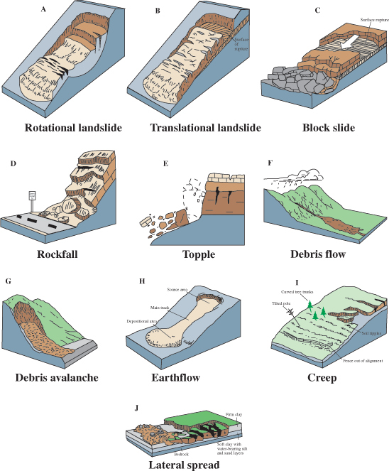
Ah, memory lane. Dr. Alley's best friend in early elementary school had a father who sold "pop" (a.k.a. soft drinks) to dealers in Ohio and often had free samples sitting around, and a mother who drove a 1964-and-a-half white Ford Mustang with a black convertible top. Hard to beat. And what a beauty that car was! Dr. Alley's Hot Wheels Mustang was a 1967, recognizably different from the '65-and-a-half. In fact, he could easily put the Mustangs in chronological order based on the differences between models.
The early geologists of the late 1600s and 1700s had never heard of Ford Mustangs, but those geologists faced a Ford Mustang problem. Recognition of unconformities and other features in the rock record opened a world far older than written records. William Smith had shown the law of faunal succession—that putting the rocks in order put the fossils in order—so biological change had accompanied geological change. But was the biological change gradual, parent-to-child in a great, unbroken evolutionary chain of being? Or did unknown cataclysms, or a tinkering god, or an angry god, repeatedly replace one world with another as Ford would one day replace each model with a new type of Mustang the next year?
Erasmus Darwin was among the evolutionists, and put his ideas in verse in the posthumously published The Temple of Nature (1802):
Organic life beneath the shoreless waves
Was born and nurs'd in ocean's pearly caves;
First forms minute, unseen by spheric glass,
Move on the mud, or pierce the watery mass;These, as successive generations bloom,
New powers acquire and larger limbs assume;
Whence countless groups of vegetation spring,
And breathing realms of fin and feet and wing.
OK, maybe this excerpt wouldn't make a hit song if put to music. But when grandson Charles added observations and mechanism to Erasmus' speculations, the evolutionists won out over the Ford-Mustang "catastrophists." What convinced the scientific community (and a great slice of "polite society") of evolution? We'll try to answer that fascinating question in this lesson.
What to do for Unit 11?
You will have one week to complete Unit 11. See the course calendar for specific due dates.
As you work your way through the online materials for Unit 11, you will encounter a video lecture, several vTrips, some animated diagrams (called GeoMations and GeoClips), additional reading assignments, a practice quiz, a "RockOn" quiz, and a "StudentsSpeak" Survey. The chart below provides an overview of the requirements for this unit.
| REQUIREMENTS | SUBMITTED FOR GRADING? |
|---|---|
| Read/view all of the Instructional Materials | No, but you will be tested on all of the material found in the Unit 11 Instructional Materials. |
| Continue working on Exercise #6: Fossil Fuels (& Driving Hazards) | Yes, this is the last of 6 Exercises and is worth 5% of your total grade. |
| Take the Unit 11 "RockOn" quiz | Yes, this is the eleventh of 12 end-of-unit RockOn quizzes and is worth 4.5% of your total grade. |
| Complete the "StudentsSpeak #12" survey | Yes, this is the last of 12 weekly surveys and is worth 1% of your total grade. |
Questions?
If you have any questions, please feel free to email "All Teachers" and "All Teaching Assistants through Canvas conversations.
Keep Reading!
On the following pages, you will find all of the information you need to successfully complete Unit 11, including the online textbook, a video lecture, several vTrips and animations, and an overview presentation
Students who register for this Penn State course gain access to assignment and instructor feedback, and earn academic credit. Information about registering for this course is available from the Office of the University Registrar.
Main Topics, Unit 11
Overview of the main topics you will encounter in Unit 11.
It is a century now since Darwin gave us the first glimpse of the origin of the species. We know now what was unknown to all the preceding caravan of generations: that men are only fellow-voyagers with other creatures in the odyssey of evolution. This new knowledge should have given us, by this time, a sense of kinship with fellow-creatures; a wish to live and let live; a sense of wonder over the magnitude and duration of the biotic enterprise.
— Leopold, Aldo: A Sand County Almanac, and Sketches Here and There, 1948, Oxford University Press, New York, 1987
For one species to mourn the death of another is a new thing under the sun. The Cro-Magnon who slew the last mammoth thought only of steaks. The sportsman who shot the last pigeon [this is the extinct passenger pigeon] thought only of his prowess. The sailor who clubbed the last auck thought of nothing at all. But we, who have lost our pigeons, mourn the loss. Had the funeral been ours, the pigeons would hardly have mourned us. In this fact, rather than in Mr. DuPont's nylons or Mr. Vannevar Bush's bombs, lies objective evidence of our superiority over the beasts.
— Leopold, Aldo: A Sand County Almanac, and Sketches Here and There, 1948, Oxford University Press, New York, 1987
Easy Come, Easy Go--Evolution and Extinction
- Kids include experiments—they are not identical to their parents.
- These differences affect the ability of the kids to survive to have their own kids (natural selection).
- But, despite the differences, kids are quite similar to their parents—the kids just receive a bit more or less of what makes their parents biologically successful.
- This acting over time gives evolution—successful experiments accumulate, unsuccessful ones are eliminated, so that new generations are different from older ones.
- Changes to living organisms are not passed on (if you get a tattoo, your kids will still be born without tattoos)—just the reproductive experiments are passed on.
The Unbroken Chain
- The Law of Faunal Succession suggests evolution.
- Evolution predicts transitional forms over time, whereas special creation or catastrophism predict that there will not be transitions.
- Transitional forms have been found, strongly supporting evolution:
- Transitional forms are common in commonly fossilized types,
- And less common in less-commonly-fossilized types,
- New species often emerge geologically rapidly from small populations (it is easier for a smaller group to change),
- Transitional forms are found as often as evolution predicts; the fossil record is incompatible with competing hypotheses.
Taking Care of Business
- The theory of evolution is explanatory, predictive, and useful.
- Germs are evolving antibiotic resistance, and the scientists trying to keep us alive are using knowledge of evolution.
- Computer scientists mimic evolution to solve complex problems (evolutionary computing).
Teach the Conflict?
- Scientifically, there is no conflict—there is much to learn and do, but with no serious problems or competitors.
- In particular, evolution is:
- Consistent with the second law of thermodynamics, and all other known physical laws,
- Strongly supported by the fossil record and age dating,
- Not anti-religion (indeed, it is supported by many religious groups).
- There is widespread scientific consensus that so-called competitors (e.g., “intelligent design”) are not science.
- Thus, “teaching the conflict” would require teaching non-science in science classes (note that a few years ago, to question evolution, the Kansas School Board invented a new definition of science, presumably because evolution was so scientific).
Extinction Can Ruin Your Whole Day
- There has been a slow "background" rate of extinction, with species being lost about as often as new species appeared during most of geologic history (population fluctuations sometimes hit zero, which is extinct).
- But occasionally there were mass extinctions, when species became extinct much much more commonly than new species arose, but these mass extinctions were followed by millions of years when new species arose slightly more often than species became extinct, thus restoring biodiversity:
- end-Paleozoic mass extinction: heat-caused loss of ocean oxygen?
- end-Mesozoic mass extinction: meteorite,
- a few others that we won't make you learn.
- The dinosaurs were doing just fine until meteorite got them.
- Their death freed ecological jobs (“niches”), allowing evolution to produce large mammals over the last 65 million years.
The Dinosaur Killer
- Evidence: the extinction event occurs with an odd sedimentary layer with much iridium (common in meteorites, otherwise rare on Earth), soot, high-pressure shocked quartz, melted-rock droplets, a giant-wave deposit in the Caribbean, and a giant crater of the right age on the Yucatan Peninsula.
- Mechanisms: the meteorite blasted things up, causing fire from the heat of fast-falling things, then cold from the sun-blocking effect of slow-falling things, with acid rain.
- A thought: there still are big rocks out there in space—averaged over millions of years (and presuming we humans hang around that long), they may kill as many people as commercial airline crashes, but not nearly so many as car crashes.
Textbook 11.1: Florissant Fossil Beds
Evolution and the Florissant Fossil Beds
In south-central Colorado, at Florissant Fossil Beds National Monument, you can visit a unique deposit of fossil trees, leaves, insects, birds, fish and more from about 35 million years ago. At that time, a lava flow dammed a stream to form a lake. Then, repeated volcanic eruptions dropped ash into the lake, making it silica-rich and favoring growth of diatoms, which have silica shells. Huge numbers of diatoms quickly grew in very thin layers on things that fell into the lake, protecting them from decay until they were buried by paper-thin layers of ash and mud. Like flowers pressed in a phone book, the flowers of that ancient time can still be seen clearly. So can the dragonflies, and bees, and mosquitoes. Before the National Monument was established, private collectors could pay a small fee and hunt for fossils there. The author found a few fossil bees and ants and seeds, and a friend found a beautiful cicada. (Taking fossils from the National Monument is strictly forbidden; they belong to all of us!)
There are, however, certain differences between some of those creatures and similar ones that live today. Remember, back at Arches, we learned about the law of faunal succession—when rocks are placed in order from oldest to youngest, the types of fossils in the rocks also fall into order, becoming more like things alive today in younger and younger rocks. The Florissant rocks are relatively young, and their fossils are immediately familiar to modern people, but the fossils are not identical to modern species.
The law of faunal succession suggests the possibility of evolution, but does not prove it by any means. One early theory held that many creations and extinctions occurred over geologic history, something like the history of automobiles. One type of automobile does not give birth to another; new ones are created. But you can place the automobiles in order from oldest to youngest, and the younger they are, the more they look like modern automobiles. This idea was called catastrophism in geology. The fundamentalist interpretation of biblical creation is a one-event form of catastrophism.
Evidence of Evolution
Catastrophism eventually lost out scientifically to evolution. Evolution does a much better job of explaining the patterns of fossils and of living things, and of predicting events such as the emergence of antibiotic-resistant microorganisms. The triumph of evolution over catastrophism owes much to biology, and more recently to genetics and molecular biology; the identification of the mechanisms driving evolution was especially important (see below).
As geologists collected more data, they also realized that evolution explained the data and predicted the next discoveries better than did any catastrophist model. The early geologists could see the clear march of types over time, but saw catastrophic elements in the record as well. In many places, geologists would find fossils of one type, and then of a somewhat different type, with no transitions between them. Evolution implies rather gradual change, not big jumps. The early geologists knew, however, that there were big time jumps in the records (remember all of the unconformities—time gaps—in the Grand Canyon sequence). So some of the jumps in the fossil record were related to the incompleteness of the rock record. Other jumps really are related to catastrophic events in the record (again, see below).
Further study has shown that many of the evolutionary changes have been geologically fast (but recall that geological time is so long that this can be biologically slow!) and often localized. Suppose that a few animals of some type colonize a small island. Then, they have babies who have babies who have babies, a generation per year, thousands of generations in a geological eyeblink. If the babies differ by just a tiny bit from the parents, eventually a new type or species may emerge. If that species then succeeds in escaping the island (say, because sea-level fell and the island became connected to the mainland), a new type would appear suddenly on the continent. Sediments from the small island may end up being subducted or otherwise destroyed, but fossils on the larger continent are more likely to be preserved. A small island may support only a few individuals, so there never would be many critters to produce fossils that humans could find. On the continent, the species might flourish and produce millions of individuals that would leave easily collected fossils. Thus, the fossil record would show a sudden jump when the actual process was gradual.

In one famous case (of many), trilobites of the genus Phacops are classified in part by the number of columns of elements in their compound eyes. In marine sediments from the Devonian (the middle of the Paleozoic) of Pennsylvania and Ohio, a species with eighteen columns in its eyes occurs for a while. Then, a time gap or unconformity occurs, from a temporary drying of the sea. When the sea returned and began depositing sediments again, the trilobites that returned with it had seventeen columns in their eyes. Not a huge jump, but an apparently sudden one. But wait—over in a small part of New York, the sea did not dry up. There, you can find the old eighteen-column trilobites, then some with seventeen columns plus a partial column containing a varying number of elements, and finally the seventeen-column trilobites. The generations of trilobites changed gradually, and you can see this where the rock record is complete in a small region of New York. In the bigger areas, the record looks more catastrophic because the seaway was dry and no fossils were produced when the changes were occurring through the generations living in New York.
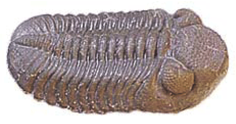
Some so-called “creation scientists” still argue that no transitional forms are known, and so that catastrophism is accurate. This is nonsense; extremely fine gradations are known in many, many lineages. There is one technical sense in which, in some lineages for which fossils are scarce, there are missing transitional types. Suppose you find young fossil type 1 and old fossil type 0. They differ a good bit—you are missing the transitional form 1/2. Now suppose you find type 1/2. It is your “missing link”. You publish your results in important scientific journals, and wait for the fame and fortune to roll in. (You are likely to wait a looooooong time….) But, while you’re enjoying your discovery, someone argues that you are haven’t really found the missing link, because now there are TWO transitional types missing: 1/4 between 0 and your newly discovered 1/2, and 3/4 between your newly discovered 1/2 and 1. So, you go back to work, and after years of effort, succeed in finding both 1/4 and 3/4. Wow! Now your critics point out that you are missing FOUR transitional forms (1/8, 3/8, 5/8 and 7/8). This can be argued to absurdity; we cannot find remains of every creature that ever lived, because almost all remains of almost all creatures are recycled by the efficient ecosystems of Earth (dead things are food to scavengers, worms, bacteria, fungi, etc.). But in many, many lines now, the gaps are vanishingly small, and the transitional forms very well known.
The gaps in evolutionary lineages are especially well-filled for commonly fossilized types, such as shelly marine creatures from shallow water. Shells are hard and resistant—they’re really rocks already—and so shells are preserved well. Although sediments from deep-water sites tend to be dragged down subduction zones and melted, which messes up old records, the underwater edges of continents are not subducted and often escape obduction for a long while, preserving their records of shelly creatures. And while most of land is eroding, most of the ocean is accumulating sediments.
The fact that most of the land surface is eroding complicates study of the fossils that especially interest people. Think about central Pennsylvania for a moment, where Dr. Alley was sitting when he wrote this. The Commonwealth of Pennsylvania has about 1 million deer, and each buck has two antlers, so Pennsylvania deer drop about 1 million antlers per year. If antlers were “preserved,” then after even a few millennia of this, walking in the state should be really dangerous, and we should hear about all sorts of antler puncture wounds from the billions of antlers scattered over the landscape. Of course, we don’t—mice and porcupines eat the antlers for the minerals in them.
In central Pennsylvania now, the only places you can find sediments being deposited are in the reservoirs (which were mostly built in the 1930s, and so give very, very short records), a very few marshes such as Bear Meadows up the road from Penn State's University Park campus (this marsh formed during the Ice Age and thus is geologically very young), and in a few caves and along a few streams. But, the caves and stream deposits don’t last long—the caves are lost as the surface is lowered, and the streams sweep across their flood plains and move the sediments on. So central Pennsylvania today is not making much of a fossil record.
Despite difficulties such as this, careful study around the world has filled in many of the details of the fossil record, including many “missing links.” (In 2001, for example, road-builders accidentally discovered Riverbluff Cave in Missouri, with loads of ice-age fossils that are offering a new window on that interesting time.) For some types of creatures, such as hominids, fossils are still scarce enough that a new find often makes headlines, and may cause a small change in the prevailing view of evolutionary history. And there was lots of excitement in 2008 when fossils of transitional flatfish were found—Darwin had worried about the way flounders evolved so the adults have both eyes on the same side of their heads, so the discovery of the transitional forms was another in the long string of successes for the theory he advanced. However, you almost never read about the great changes in thinking caused by the latest snail fossil—the record is so wonderfully complete that new insights are much harder to come by than they used to be.
The Theory of Evolution
The basis of evolution is diversity. (Modern social scientists and politicians are about 4 billion years behind nature on this one.) We know that kids do not look exactly like their parents—offspring are diverse or different. We also know that kids share more characteristics with their parents than with less-closely-related people from the parent’s generation. That is, we look a lot like our parents, but we are not exact copies. This arises because of genetics; the biological instructions or programs that guide development of an individual are passed down from the parents, but there are many mechanisms active that serve to experiment a little with the instructions between generations.
Suppose that one of these small experiments is successful (say, it gives a young giraffe a longer neck than her neighbors, which allows her to reach leaves that are out of reach of other giraffes). The long-necked giraffe will be better-fed than others, and eventually is likely to succeed in surviving to have babies of her own. Some of those babies will grow a little taller than their mother, some a little shorter, and some the same height as their mother, but the offspring will average taller than the kids of other giraffes lacking the initial, successful change.
Those other giraffes lacking this new development will be less successful, and so will leave fewer babies who go on to have babies. Most populations are small enough that, if one individual is even slightly more successful than others, after a few thousand generations, all the survivors will be related to the one with the successful experiment; if one individual is even slightly less successful than others, after a few thousand generations it will have no survivors. (You can demonstrate this easily using mathematical models, or with greater difficulty by breeding living types such as fruit flies, but both reach the same answer.)
Once all of the members of a species contain the successful experiment, the species has been changed a little. But over those thousands of generations, other “experiments” are conducted, some successful and some not. The slow accumulation of the successful experiments is evolution. The mechanism by which the changes accumulate is called natural selection—beneficial experiments allow more survival and reproduction and so are preserved and multiplied. When enough changes have accumulated, we say that a new type or species has emerged. (If a population is split into two or more parts, those parts are called new species when they no longer can interbreed.)
Notice that things that happen to adults, such as having their ears pierced or their behinds tattooed or stretching their necks to reach leaves, are not passed on to children. The changes that are passed on occur during reproduction. Sex helps generate new combinations of genetic instructions. Even species that reproduce asexually by splitting in half have ways (proto-sex?) to exchange genetic material. Sometimes, accidents occur owing to radioactive decay or toxic chemicals damaging the genetic instructions in an egg or sperm or asexually reproducing creature; however, these often are changes that hurt rather than help.
More importantly, the mechanisms of reproduction do experiment a little by moving a few things around in the genetic instructions during reproduction. Some species, and some individuals of species, conduct more experiments than others. Overuse and misuse of antibiotics by humans are producing antibiotic-resistant disease-causing organisms. These antibiotic-resistant types are often those that experiment a lot during reproduction, and so were lucky enough to quickly find an experiment that allows survival despite antibiotics.
The virus that causes AIDS is especially hard to “beat” with a vaccine or antiviral drug because the virus experiments a huge amount. This is costly to the virus—many of the experiments are failures, which means those offspring don’t succeed. But, this high rate of experimentation allows the virus to respond quickly to challenges such as new drugs or vaccines by producing offspring with new ways to defeat those drugs or vaccines. In an AIDS patient, the virus infecting the spleen often differs from the virus infecting the liver—the virus has evolved in the person to succeed in the chemically different environments of the different organs. And, given that the AIDS viruses in just one person are so diverse, it is not surprising that the viruses in different people are different. The remarkable advances in molecular biology allow these changes to be measured now.
Evolution is a well-tested, well-established scientific theory. It makes predictions that are borne out. Partial speciation has been achieved in the laboratory in fast-breeding types such as fruit flies. The geological evidence of gradual changes is strong, and becoming steadily stronger as more and more samples are collected.
Evolution is also being used routinely in science. A search on the ISI “Web of Science” in July of 2012 revealed over 3000 scientific papers with the subject "evolution and antibiotic resistance," with an ongoing rise in the number of papers on the topic. A quick perusal of the titles and abstracts of many of those papers revealed that, as microbes evolve to defeat our antibiotics, the scientists who are trying to keep us alive are using the tools and language of evolutionary biology. Antibiotics are quickly losing effectiveness against evolving microbes, more and more people are dying of infections picked up in hospitals, and scientists are increasingly focusing on the problem, informed by a full understanding of evolution, its rates and processes.
Computer scientists even use evolution—some “artificial-intelligence” approaches have been patterned after the natural processes of evolution. Techniques such as genetic algorithms or evolutionary computation successfully solve complex problems, in essentially the same way that nature does. (For more on this, see the Unit 11 Enrichment.)
In the U.S., some groups continue to oppose evolution based primarily on religious grounds. This opposition has the good effect of keeping the experts “on their toes”—the experts work harder and do better science. This opposition has the unfortunate effect of convincing many people that something is fundamentally wrong with evolutionary theory: again, perhaps figuring that “where there’s smoke, there’s fire.” Many people believe, for example, that evolution is somehow anti-religious, when the majority of church members in the U.S. belong to denominations that endorse evolution as the best description of how the biological world works. Evolution is consistent with the major religions on Earth, and even with rather strict readings of the Christian Bible. The idea that the Earth appears young, and was created recently with all of the modern types of organisms present, was tested in the 1700s and 1800s and proved wrong.
A longer discussion of some issues—evolution and religion, second law of thermodynamics, intelligent design, etc.—is given in the Enrichment. We strongly suggest that if you are interested in this topic, you read the Unit 11 Enrichment.
Textbook 11.2 Dinosaur National Monument
Extinction and Dinosaur National Monument
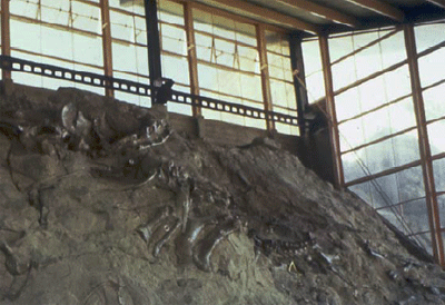
Dinosaur National Monument lies in western Colorado and eastern Utah. The key rocks were deposited in swamps and and along rivers during the Jurassic in the middle of the Mesozoic, and are called the Morrison Formation. Before the modern Rockies were raised, sluggish streams flowed across the basins of this region, with numerous low, wet floodplains. Dinosaurs flourished. After some died, their bodies were washed up on sandbars, where their bones were buried before they were consumed by scavengers and gnawers. Over time, minerals carried in groundwater reacted chemically with the bone, depositing silica. (For a little more on petrification, see the Unit 11 Enrichment—no magic is involved!)
After the bone was turned to stone at what would become Dinosaur National Monument, the rocks of the region were raised and tilted during the mountain-building that formed the Rockies. Streams, including the Green River, cut through the rocks. The Canyon of Lodore on the Green is a favorite destination for serious white-water rafting. The first scientist in the region was John Wesley Powell, who went on to run the Grand Canyon. In 1909, workers from the Carnegie Museum of Pittsburgh found Dinosaur Ledge, a sandbar-turned-to-stone on which many dinosaur bones had been deposited and fossilized. Today, some of those petrified bones are on display in the Carnegie and in other great museums, but many of the bones have been left in the ledge to be viewed in the park (see the picture above).
What Killed the Dinosaurs?
The dinosaurs were the dominant large animals on Earth for over 100 million years. Many were quite small, but some were gigantic. They included large plant-eaters and large meat-eaters. Some spent at least part of their time flying or gliding, and others swam.
Mammals co-existed with the dinosaurs for most of the dinosaurs’ existence. However, almost all of the mammals remained small creatures—they generally could not outcompete the dinosaurs for the big-creature jobs.
Extinction is a normal process. A new species may arise and be more successful than an existing type, pushing the old type to extinction. Diseases, accidents, or other events may kill an entire population. And, extinction is forever. As populations vary owing to random factors, sometimes the population drops to zero. But when the population hits zero, the species can never come back up—you can’t just borrow a few creatures from a future generation and bring them back to fill in the gap. So all sorts of random events cause extinctions, and most of the species that have lived on Earth have become extinct. (This characteristic of extinction, that when you hit zero, you're gone, also applies to gamblers at casinos. To see why you’re likely to lose if you gamble, roll on back to the Unit 11 Enrichment.)
About 65 million years ago, at the end of the Cretaceous Period of the Mesozoic Era and the start of the Tertiary Period of the Cenozoic Era (the K/T boundary, because K is used for Cretaceous and T for Tertiary), all of the living dinosaurs died out suddenly. At the same time, many other types became extinct—more than half of the species known from fossils near the end of the Cretaceous became extinct at the end of the Cretaceous. Because survival of even a few individuals from a species can allow the species to persist, it is likely that almost all of the living things on the planet were killed. It was a catastrophic event, one of the most catastrophic in the history of the Earth.
The solution to this puzzle—how the dinosaurs and others were killed—was not found until fairly recently. At the K/T boundary, sedimentary rocks around much of the world contain a thin clay layer. This layer is rich in iridium, an element rare on Earth but common in meteorites. This clay layer contains bits of rock that were melted and refrozen rapidly to form glass, such as are produced by meteorite impacts. Quartz grains in the layer contain shock features, which are caused by very high pressures applied very rapidly, but by no other known mechanisms such as volcanic eruptions. The layer is rich in soot (black carbon) from fires. The layer is thicker in and near the Americas than elsewhere. Around the Caribbean, the layer includes a deposit of broken-up rock such as would be produced by a huge wave. And on the Yucatan Peninsula is a large crater, the Chicxulub Structure, that is dated to the K/T boundary. The crater is partially buried by younger rocks, but easily detected using geophysical techniques, drilling, etc. The crater is at least 110 miles (180 km) across, and perhaps as much as 180 miles (300 km) across.
This evidence indicates that a large meteorite, perhaps 6 miles (10 km) across, hit the Earth (the hole or crater made by an energetic projectile is usually a whole lot bigger than the projectile). Such a collision would have released more energy than all of the nuclear bombs that were on Earth when the U.S. and Soviet arsenals were at their largest.
Debate continues on exactly how such a meteorite would kill things, but it looks like fire and ice, and maybe acid. The impact would have blasted huge amounts of rock, from the meteorite and the Earth, into the stratosphere or above. As this rock fell back to Earth, friction with the air would have generated heat in the same way that a re-entering space capsule or a “shooting star” is heated. For a little while, the air would have been a toaster-broiler oven, cooking and burning everything beneath.
Following that, cold probably descended. The impact site included sulfur-containing rocks. The heat of the impact would have vaporized those rocks, and that vapor would have cooled later to form clouds in the stratosphere. The small particles of these clouds wouldn’t fall fast enough to heat up much; modern space capsules and meteorites fall fast enough to get hot, but raindrops and dust particles do not. But many, many small particles would block part of the sunlight and cool the Earth. We know that such cooling occurs with modern volcanic eruptions—big ones such as Mt. Pinatubo in 1992 cool the Earth by a degree or two for a year or two. A nuclear war might do much more, creating nuclear winter or at least nuclear fall. Even more of the sunlight would have been blocked after a huge meteorite impact, and the world may have frozen for a few years.
The sulfur particles, when they fell, would have made sulfuric acid, giving much stronger acid rain than the recent human-produced pollution. The incoming meteorite may have heated the surrounding air enough to burn the nitrogen in it, forming nitric acid that also would have produced acid rain.
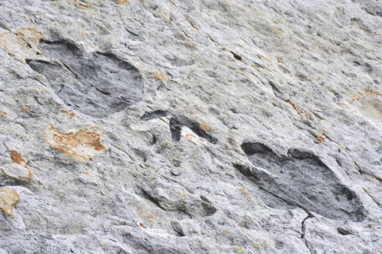
The meteorite impact was not nearly big enough to roll the Earth over, notably move the orbit, rearrange the continents, or anything similarly cataclysmic for the physical behavior of the planet beyond the few years or decades of the heat, cold and acid, but the event was cataclysmic for life—almost all of the living things on Earth would have died. Who would have survived? Plants with long-lasting seeds, hibernators, things that live in ocean sediment or along spreading ridges, scavengers, probably some others with appropriate characteristics. The general pattern is that the surviving animals were small, and mammals did better than dinosaurs. (Although, yes, birds are a branch of the dinosaurs, and the birds are still with us.)
After the fire and ice were over, the “jobs” (ecological niches) of many of the dinosaurs were left open. There were no big plant eaters, or meat eaters, left. Over tens of millions of years, the mammals, freed of the competition from the dinosaurs, slowly came to take over the jobs of the dinosaurs. Some of the larger offspring of some species were successful, although most mammals remained small (mice, voles, etc.). Lining up the fossils over time, we see an evolutionary shrubbery—lots of branches, many extinctions where those branches were cut off, persistence of small creatures, but appearance of some large creatures, with those leading to modern lions and tigers and bears—and people. Biodiversity was hugely reduced by the meteorite, but over the next millions of years new species appeared a little more often than existing species went extinct, so that diversity increased back to more-or-less what it was before the meteorite, just with different species doing the jobs.
If today, Coke and Pepsi and all other soft-drink companies suddenly magically disappeared, new soft-drink companies would be started fairly soon, not because of a magical affinity for soft-drink companies, not because soft-drink companies must exist, but because we usually figure out how to take advantage of opportunities. In the same way, wiping out dinosaurs opened up a space for mammals.
More on Meteorites and Mass Extinctions.
Meteorite impacts have been happening throughout Earth history, and a Mars-sized body colliding with the Earth and blasting things into space is the best explanation for the formation of the moon. Big impacts were common early on. Evan Pugh Professor Jim Kasting of Penn State helped show that the heat from many of the early, huge impacts would have been enough to evaporate the whole ocean during the first few hundred million years of the planet, and that it was probably only about 3.8 billion years ago when the last impactor hit that was large enough to evaporate the sunlit upper layer of the ocean. Since then, collisions have been much smaller. The dinosaur-killer was larger than any that happened since, and than any for a long time before, but was not nearly big enough to evaporate much of the ocean.
There still are many large rocks out in space that go whizzing by the planet, and large impacts remain possible. One scientific estimate found that your chances of being killed by a meteorite impact are about the same as being killed in the crash of a commercial airliner. Commercial-airliner crashes kill a few hundred people per decade, and a meteorite might wait ten million years and then kill hundreds of millions of people, so the statistics are not exactly comparable, but the number is interesting. (In comparison, car crashes kill waaaaay more people, and far out-do tornadoes and hurricanes and earthquakes and food poisoning and bee stings and airliner crashes as killers of people in the developed world. In the short term, the most dangerous thing you do is probably driving a car. In the long term, smoking, over-eating, under-exercising, and other poor health habits are much more important.)
Scientists are coming up with ways to divert asteroids, and are looking for the asteroids, to help avoid such collisions. If we see an asteroid coming from far enough away, then we need to turn its path only a tiny bit to miss the Earth. One idea is to hit the asteroid with a bag of dust that would spread across one side, changing the reflectivity of the surface; the difference between reflecting and absorbing the sunlight would cause a tiny push that would steer the asteroid. Another idea is to send a spacecraft to sit next to the asteroid for a year; the tiny gravity of the spacecraft, tugging on the asteroid, would turn it a tiny bit. The fate of the dinosaurs has stimulated much of the interest in this, so some day we may be saved by paying attention to the big beasts of the past.
Meteorites are not the only ways to cause extinctions. A meteorite ended the Mesozoic age of dinosaurs and ushered in the Cenozoic age of mammals, but there doesn’t seem to have been a meteorite at the even bigger extinction that ended the Paleozoic age of shellfish and brought in the Mesozoic age of dinosaurs. The leading hypothesis for that extinction, still “hotly” debated, is that immense volcanic outpourings (the biggest known hot-spot head, if you remember far enough back to flood basalts and hot spots) over a million years or so released enough CO2 to make the climate really hot, and also produced easily weathered rocks that broke down and supplied fertilizer to the ocean. The warmer ocean held less oxygen because heating drives gases out of water; plants growing in the ocean released oxygen near the surface to go into the air just like always, but when these abundant plants died and sank into the low-oxygen deep layers of the ocean, decay used up the oxygen there and made "dead zones." The volcanic outpouring would have supplied sulfur as well, and with the oxygen gone that would have led to an ocean containing hydrogen sulfide, which causes the smell in rotten eggs and which is highly poisonous to most things, and some of that hydrogen sulfide would have escaped to the air. Special molecules from photosynthetic bacteria that use hydrogen sulfide are found from rocks of that age. We will discuss human-caused global warming next week, but don't panic, we do NOT expect it to cause the ocean to belch out deadly gases that kill most of the life on Earth!
Virtual Field Trips
Join Dr. Alley and his team as they take you on "virtual tours" of National Parks and other locations that illustrate some of the key ideas and concepts being covered in Unit 11.
Virtual Field Trip #1: Florissant Fossil Beds National Monument—Gnattily Dressed
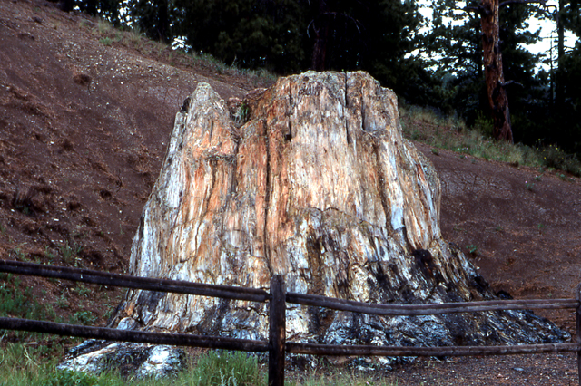
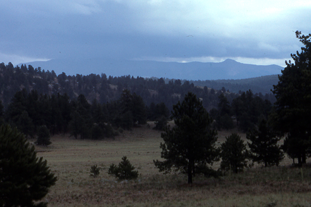
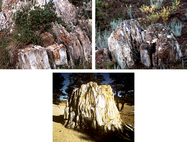
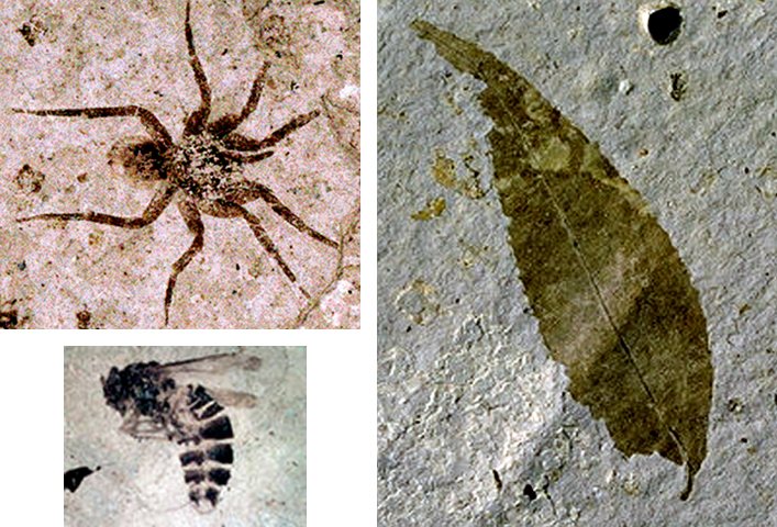
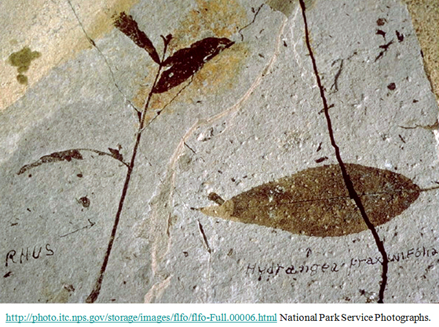
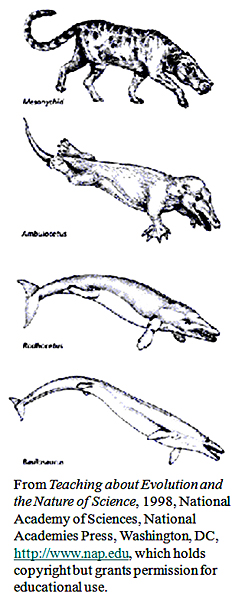
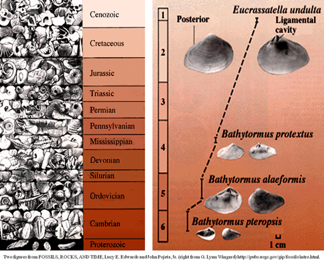
Image 1: A huge stump fossil of a redwood behind a fence. Florissant Fossil Beds National Monument—Gnattily Dressed Photos by National Park Service (indicated) or R. Alley; this is the “Big Stump” fossil redwood.
Image 2: Sunset over the Colorado Rockies. The Colorado Rockies Front Range is folded up, perhaps from shallow-subduction drag.
Image 3: South Park viewed from Wilderson Pass. Fields in front of the mountain range. West of the Front Range are the parks, occupying the low parts of the folds. This is the real South Park, viewed from Wilkerson Pass.
Image 4: South Park with colorful paintbrush in bloom. The real South Park seems to be a nicer place than the one on TV. Here, paintbrush bloom in the mountain air.
Image 5: Mountian range. Near the east edge of South Park, Colorado is Florissant Fossil Beds National Monument, one of the little-visited “gems” of the National Park Service.
Image 6: Three images of fossil redwood stumps in the park. Fossil redwoods are among the highlights at the park. These, including the “Big Stump” (bottom, Natl. Park Service picture) are along the Petrified Forest Loop Trail.
Image 7: Fossils of a spider, bee, and a leaf, Florissant Fossil Beds. When the mountains are overthrown and the seas uplifted, the universe at Florissant flings itself against a gnat and preserves it.”-- Dr. Arthur C. Peale, Hayden Expedition Geologist, 1873 Fossil spider, bee, and leaf, Florissant (National Park Service Photos)
Image 8: Fossil sumac and hydrangea leaves from Florissant.
Image 9: Graphic about evolution showing progression from a hoofed mammal to a whale.
The previous slides showed fossils of things slightly different from living types. You really need to put the old and new next to each other to see the changes. Here and in the next picture are a couple of the many, many examples. Modern whales evolved from a primitive group of hoofed mammals (top) into species that were progressively more adapted to life in the water (moving downward). Although not every step along the evolutionary path was fossilized, many transitional forms are known, and the progression is clear.Image 10: Photographic collage sowing evolution of life on Earth through the last 600 million years. (left) Photographic collage showing evolution of life on Earth through the last 600 million years. The oldest fossils are at the bottom and youngest at the top. The size of each time interval is proportional to its duration; Proterozoic extends beyond 600 million years. (right) Fossils from the Mid-Atlantic States show change through time, from late Cretaceous (late Mesozoic, 6) to Pliocene (late Cenozoic, 1). The shape of the posterior (rear) end of these clams becomes more rounded in the younger species, and the area where the two shells are held together (ligamental cavity) gets larger.
Virtual Field Trip #2: Hardwoods—CAUSE and Park Paleontologist William Parker Explore the Petrified Forest
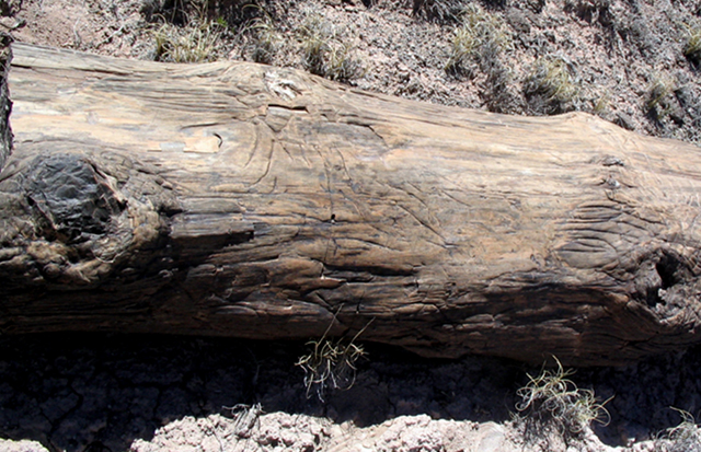
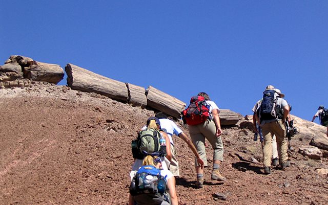
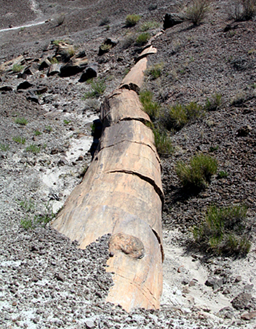
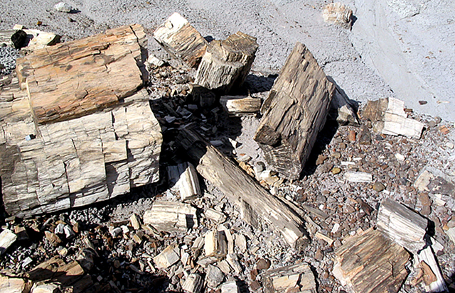
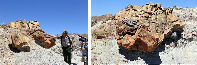
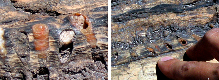
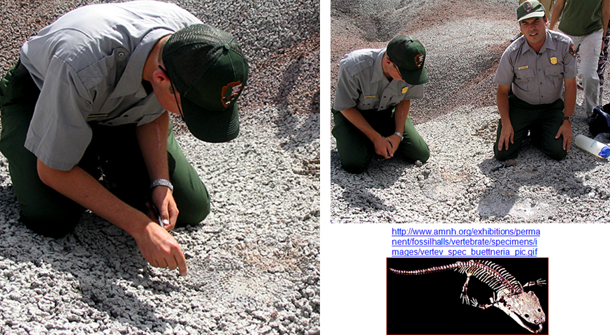
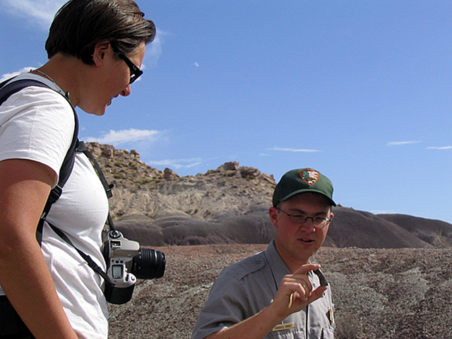
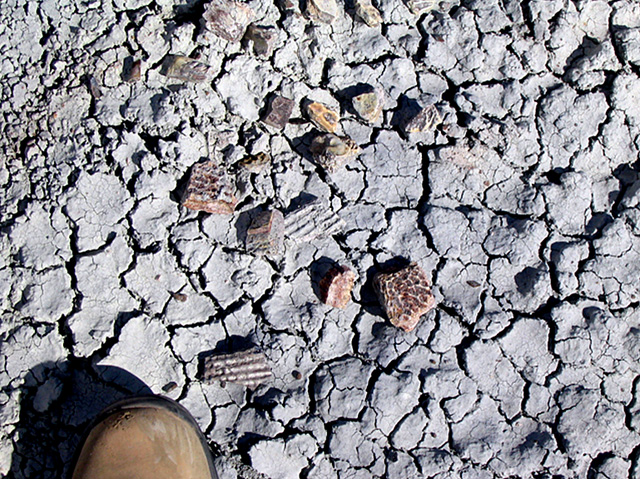
Image 1: Petrified tree laying on the ground. Hardwoods--CAUSE and Park Paleontologist William Parker Explore the Petrified Forest.
Image 2: Students hiking up a hill of dirt. There are petrified trees laying on the ground at the crest of the hill
Image 3: A large petrified tree on the ground. The trunk is split into about six pieces. Many of the trees in the Petrified Forest were transported by rivers, losing their branches and often their bark before being buried and petrified. The conversion to stone was caused by the difference in chemistry between the trees themselves and groundwater in the volcanic-ash-rich soils, and is described in more detail in the Enrichment article in the textbook. This tree is Araucarioxylon arizonicum an extinct relative of modern monkey-puzzle trees. Over 200 types of fossil plants are known to be in the park.
Image 4: Pile of petrified wood includes one large chuck and many smaller pieces. Most of the wood in the park was carried and buried in great floods.
Image 5: The “Alpha Stump”. Paleontologist William Parker shows the CAUSE film crew the “Alpha Stump”, in the Black Forest section of Petrified Forest National Park. Unlike most of the fossil trees in the park, the “Alpha Stump” is in place, its roots in the soil where it grew about 210 million years ago.
Image 6: Close up of little holes in a petrified tree. They are insect burrows and are probably the world’s oldest known fossil bee’s nest, in a petrified tree, Petrified Forest National Park.
Image 7: Park Paleontologist William Parker (upper right) and ranger and UC-Berkeley graduate student Randall Irmis (left) kneeling on the ground excavating armor plates of late-Triassic (Mesozoic) giant-armored-amphibian Koskinonodon also called Buettneria, Petrified Forest National Park.
Image 8: Paleontologist Randall Irmis shows CAUSE student Irene Meglis a still-sharp fossil tooth, Petrified Forest National Park.
Image 9: Close up of the dry ground with fossil bone fragments scattered on it. Late Triassic (Mesozoic) fossil bone fragments, Petrified Forest. A simple field test--fossil bone sticks to your tongue, and fossil wood doesn’t.
Virtual Field Trip #3: Dinosaurs: Where They Lived, and How They Died
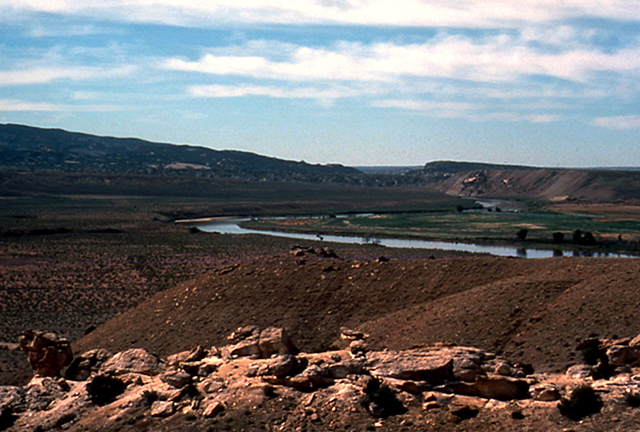
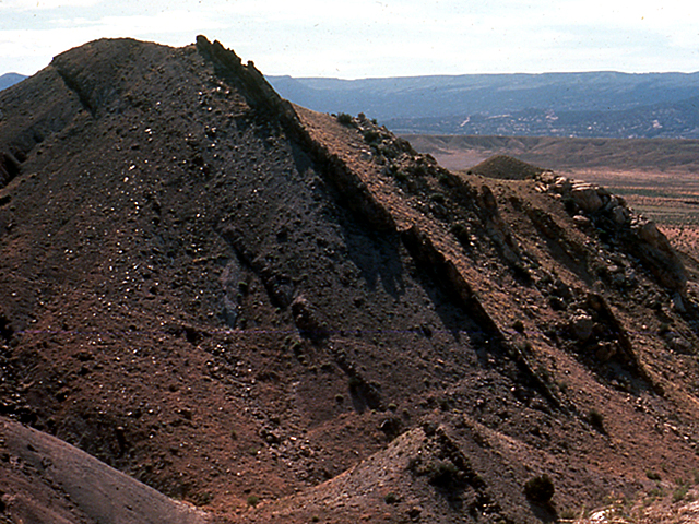
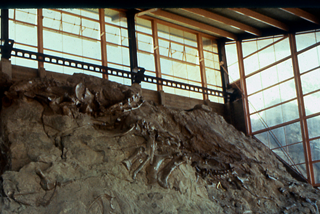
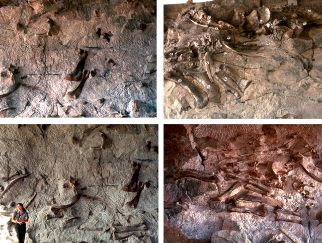
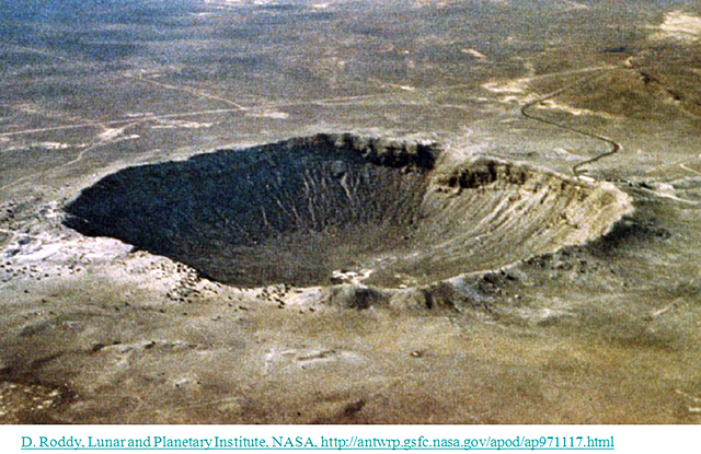
Image 1: The green river in Dinosaur National Monument. The river is winding through the landscape.
Image 2: an outcropping of rock called the Morison Formation shows tipped up layers. The river-channel and floodplain deposits of the Jurassic (mid-Mesozoic, about 150 million years old) Morrison Formation of Dinosaur National Monument, Colorado and Utah, were tipped up after being hardened.
Image 3: The quarry at Dinosaur Ledge revealing dinosaur fossils. The quarry is now under a man made structure. Eleven types of dinosaurs were washed onto this sand bar, perhaps in a great flood, buried, and their bones replaced by silica from groundwaters. The living types are quite different from their older relatives at Petrified Forest; a lot of evolutionary changes have occurred during the intervening 60 million years.
Image 4: 4 images from Dinosaur Ledge each showing fossils for various dinosaurs. There is a ranger standing next to one and the fossils dwarf her.
Image 5: A huge crater hole in Arizona. The 49,000-year-old, 0.7-mile-across Barringer Impact Crater of Arizona was made by a rather small meteorite, roughly 150 feet (50 m) across--tiny compared to the one that killed the dinosaurs. Notice the road on the right for scale.
Image 6: Three images. First is a gravity field of Chicxulub impact crater. The second is a core rock sample from Manson Iowa impact crater. The third is a shocked quartz from impact crater. First image: Gravity field of Chicxulub impact crater--the meteorite that killed the dinosaurs, on the Yucatan Peninsula. The crater is buried under younger rocks, but is quite evident here. The circular crater, between the pink arrows, is about 110 miles across. Second: Impact breccia. When a meteorite hits, it breaks rocks. This core is from the Manson, Iowa impact structure. Third: Shocked quartz from a meteorite impact. The bright colors are from the view between polarizing filters; the crossing lines are impact features. The grain is roughly 1/10 inch across.
Image 7: Two images. Left, a cosmic spherule from the moon . Right, a finger pointing to theK/T boundary bed in the stone making the end of the dinosaurs. (Left) 1/250 in (0.1 mm) diameter cosmic spherule from the moon. Spherules such as this are well-known to result from impact deposits, and are found in the special K/T impact bed that marks the end of the dinosaurs. (Right) The finger is pointing to the K/T boundary bed marking the end of the dinosaurs, at Big Bend National Park.
Image 8: This is a sediment core from offshore South Carolina, showing the extinction across the K/T boundary. The core is 40 cm long (about 16 inches). Richard D. Norris and the Ocean Drilling Project Leg 171B Scientific Party Photomicrographs by Brian Huber, Smithsonian Institution.
Virtual Field Trip #4: Dinosaurs: What They Stepped In
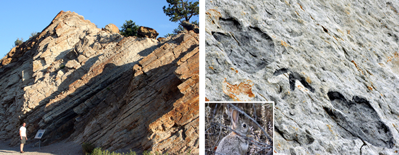
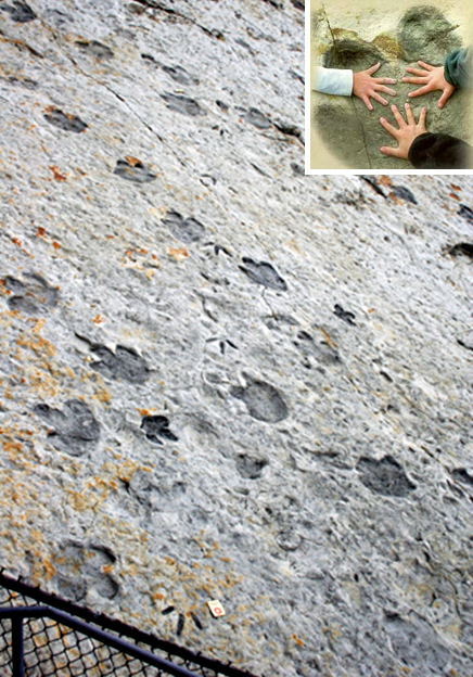
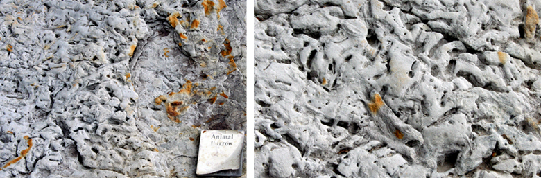
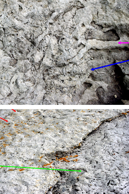
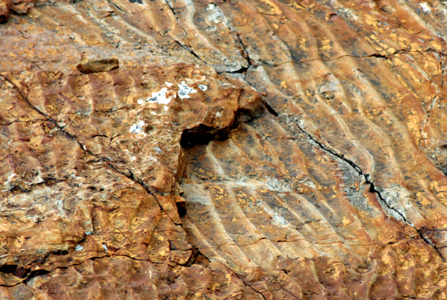
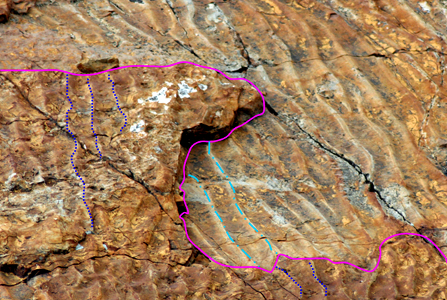
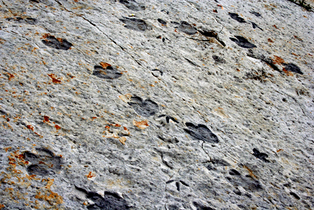
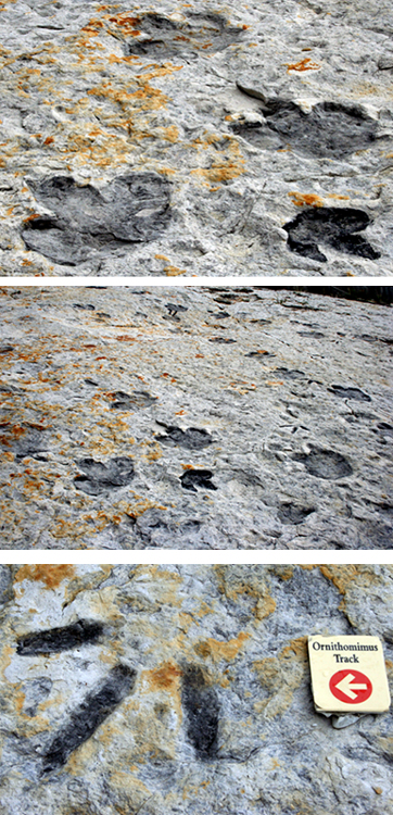
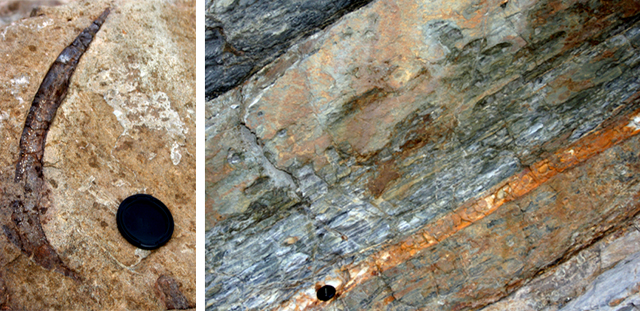
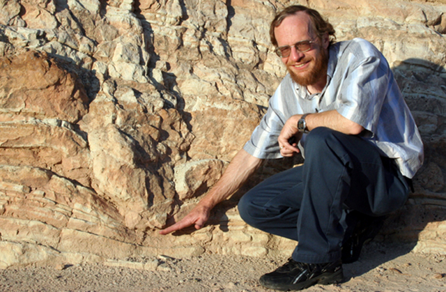
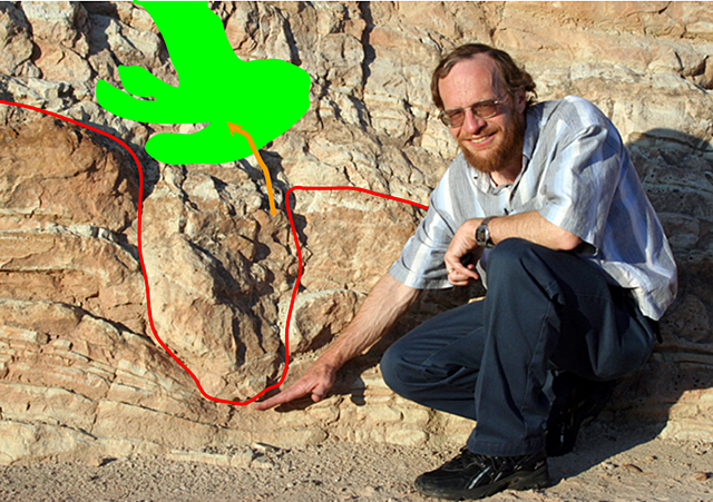
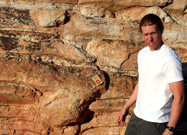
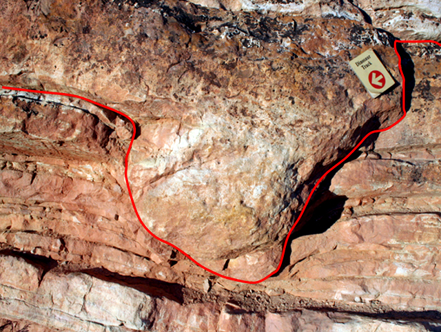
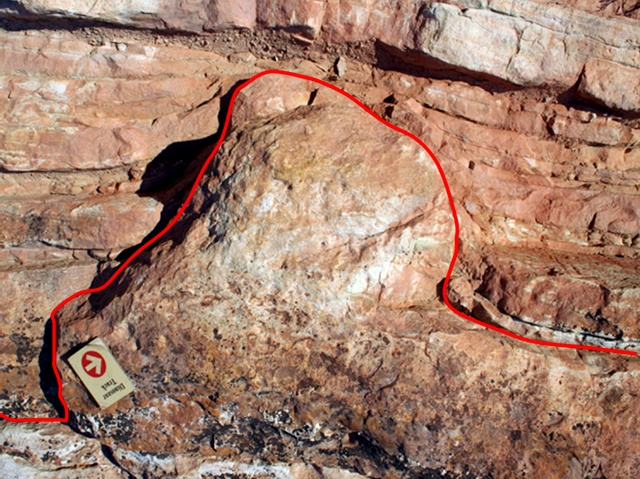
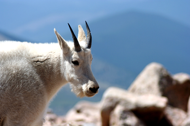
Image 1: Close up of fossilized dinosaur foot prints from Dinosaur Ridge, CO. Dinosaurs: What They Stepped In, A Virtual Tour of Dinosaur Ridge All pictures in this show are by Dr. Alley unless noted; some of the pictures here feature PSU graduate and noted scientist Matt Spencer.
Image 2: Two images. Left: Outcropping of rock that has been tipped up as the Rockies were formed. Second: Fossilized dinosaur prints. Dinosaur Ridge, just west of Denver, Colorado, is part of the Morrison Fossil Area National Natural Landmark as designated by the National Park Service. In the Cretaceous Period of the Mesozoic Era, about 100 million years ago, the area that is now the Ridge sat on the edge of the great Interior Seaway that extended eastward across Kansas, and connected the Gulf of Mexico with the Arctic Ocean. Sediments were deposited, hardened and then tipped up (picture at right) as the Rockies were raised just to the west. The dinosaur trackway (lower right) is the big attraction at the Ridge, although there is quite a bit more to see (including modern rabbits).
Image 3: Dinosaur footprints. An insert image shows one of the larger Iguanodon tracks with three kids hands in it for scale. The dinosaur tracks really are spectacular. Various dinosaurs walked across the muddy surface, probably heading for a water hole. The little sign (bottom of the picture on the left) points to a three-toed Ornithomimus track. A picture of one of the larger Iguanodon tracks is shown in the inset, with kids’ hands for scale.
Image 4: Various animal burrows from a shallow-water deposit near the dinosaur trackways. Shown here are various animal burrows from a shallow-water deposit near the dinosaur trackways (with an interpretive sign to give you an idea of the scale). Modern muds similar to these are commonly burrowed by creatures looking for food or avoiding enemies. After a mud layer is deposited, it usually takes a while for the mud to stabilize, and critters to move in and burrow the heck out of the mud, as seen here.
Image 5: Two pictures. Top: Burrowed rock shows burrows from big and small animals. Bottom: Heavily burrowed area buried by a moderately burrowed area. A careful examination of the burrowed rocks from the previous picture shows that various critters were stirring the mud, including big ones (pink arrow) and little ones (blue arrow). Not every layer gets burrowed--if there is too little oxygen to support critters, or too little for critters to eat, or the layer is buried too rapidly, then burrowing may be restricted or absent. Here, the heavily burrowed layer (far right, green arrow) is buried under a moderately burrowed layer covered with ripple marks (the two red arrows in the upper left of the picture point along ripple-mark crests). In turn, the rippled layer was buried by another layer, which was buried by another… (see next slide).
Image 6: Close up of a rock showing a rippled layer covered up by another rippled layer. The previous slide showed a burrowed layer buried beneath a rippled layer. Here, a different rippled layer was covered up by yet another rippled layer. (If you don’t see it, the next slide adds some annotations to help.)
Image 7: Close up of a rock showing a rippled layer covered up by another rippled layer. In case you didn’t see the features in the previous slide, the solid pink line divides the layer on the bottom (which in the picture is to the upper right) from the layer on top (which in the picture is to the lower left). The crests of two ripples on the layer on the bottom are marked by the light-blue dot-dash lines, and the crests of five ripples on the layer on the top are marked by the dark-blue dotted lines.
Image 8: Dinosaur tracks. As interesting as ripples and burrows may be, most people go to Dinosaur Ridge to see dinosaur tracks.
Image 9: Three close ups of dinosaur tracks. And, here are a few more pictures of the main trackway at Dinosaur Ridge. Many more trackways have been reported along the Front Range near Denver, and there are other tracks at Dinosaur Ridge in other rock layers (some coming later in this show), but this is the easiest one to see.
Image 10: Two images. Left: Dinosaur bone still in the rock. Right: Layered rock with a orange ayer in the middle. The yellow-orange-ish layer is volcanic ash, from a very large eruption nearby, which is sandwiched between more-ordinary sedimentary rocks.
Image 11: Dr. Alley standing next to an edge-on dinosaur track. On the other side of Dinosaur Ridge from the “main” trackway seen earlier, you can see dinosaur tracks edge-on, such as this one indicated by Dr. Alley. The next picture includes an outline of the track.
Image 12: Edge-on dinosaur track.
Image 13: Another Edge-on dinosaur track. Matt Spencer with dinosaur track, Dinosaur Ridge, near Denver. The next picture is a close-up with this track outlined.
Image 14: close up of the previous edge on dinosaur track with the track outlined.
Image 15: Previous image turned upside down showing what a dino footprint would look like if the rock turned upside down. Dinosaurs didn’t walk on the ceiling. We just turned the previous picture upside-down, but if you found a track this way in nature, you should conclude that the rock has been turned upside-down.
Image 16: Mountain goat. A long and fascinating story links the dinosaurs tromping on mud when Denver was a coastal city, and this mountain goat looking down toward Denver from Mt. Evans 65 million years later. The giant meteorite that killed the dinosaurs left their “jobs” open to others, and evolution filled those jobs with the creatures we now know and enjoy.
Word Document of Unit 11 V-trips
Want to see more?
Here are some optional vTrips you might also want to explore! (No, these won't be on the quiz!)
Dinosaur National Monument
(Provided by UCGS)
GeoMations and GeoClips
This week's lone GeoMation features Dr. Alley's visualization of the evolutionary process. Two additional GeoClips discuss "Ancient Bees" and "Extracting Fossils." Hope these add some insight into your Unit 11!
GeoMations:
Evolutionary Process
Sometime about 3.8 billion years ago, life appears. And it starts coming up. There's new kinds appear. There's evolution going on. There's splitting of the types of things that are alive. And each of these lines represents a lineage. It's a living type, something that's alive in the world.
Now we know that about 570 million years ago, as oxygen is rising, as big critters are appearing, as shells appear, that there's this great diversification giving rise to lots of different kinds of life, which we call the Cambrian explosion. We find more and more types coming up. Each new living thing can give rise to other ones. And there's always some extinction going on, and so some of these lines don't come up to the today.
But there's quite a variety of life. Land plants appear. Land animals appear. And then we see this hideous mass extinction at the end of the Paleozoic, when most of the things on Earth died, probably because a really hot stagnant ocean is belching out poison gases that are really nasty. There's still a little debate on that.
We know that just a few things managed to get through that, and that they then are spreading, giving rise to new species in the new world. Because all the big critters were gone, there's room now for diversification. You get dinosaurs appearing and the other interesting things.
The dinosaurs are actually doing very well. They're flourishing. They are the big critters. Mammals are around, but they can't beat the dinosaurs. And then the meteorite does, so you get the great mass extinction at the end of the Mesozoic. And just a few kinds, again, succeed in getting through.
Those few kinds that manage to get through again give rise to diversity. There's space for splitting, for new types to appear. And so over 10s of millions of years, we see the rise of diversity and the things coming up to today. And so the world goes back to being a very rich, very diverse place, again with some level of natural extinction, but with a lot of splitting going on, a lot of types getting up to today.
Now, a couple of things that you may want to notice. One is that there's different types, that you come over here and you'd see something that might be mammals, or it be some subset of mammals like bears, and they will seem to be very different from some other type. And that difference arises because the split that gave rise to those types is actually way the heck down here.
And you can follow one type up to here, and you can follow the other type on up over here. And so because they came so far down in time that they split, you'll find that they look like very different types today. The other thing to notice, there's a reasonable chance that today, as we see marked right there, today may be the next mass extinction if we don't change our behavior.
GeoClips:
The fossil record includes some amazing things. If there were trees and insects far back in time, wouldn't you expect that the insects would have burrowed into the trees then as they do now? And wouldn't you expect that a tree with some of those burrows would be fossilized? Well, here is one example. Park Paleontologist William Parker of the Petrified Forest National Park explains fossil burrows to the CAUSE team.
Ancient Bee's Nests / Petrified Forest National Park
[MUSIC PLAYING]
What you'll find in here, too, is you'll actually find insect traces, where they were underneath the bark, burrowing in just like modern ones do. This log, they call it the discovery log. This is actually a pretty important discovery.
What you're looking at here are insect traces and actual nest-- like little capsules here. You can see they're lined up. Little capsules of some nests of some kind of insect that actually lived in this log. You can see them here and here, coming out.
Now, these have been interpreted to be bees' nests. And if that's true, these would be the earliest record of bees by about 130 million years. Some entomologists disagree and say that this is very similar to some of the traces that modern beetles make, rather than bees.
But what they did is, some of these capsules in here, they went in and they found some preserved resins. And they actually tested them for geochemically, and they found the chemical that bees secrete. So some more work needs to be done on these to verify these results. But they were definitely made by some kind of insect. And it's a great example of how insects lived in these logs and used them as a food source and as a home.
[MUSIC PLAYING]
Petrified Forest National Park is best-known for trees turned to stone, but also has an immense wealth of fossils of various types from the late Triassic (in the Mesozoic, about 210 million years ago). Here, Park Paleontologist William Parker and assistant Randall Irmis explain to the CAUSE class the paleontological excavation of plates of the armored amphibian known either as Koskinonodon or Buettneria.
Uncovering Fossils / Petrified Forest National Park
We're heading into one of the famous locality areas at for paleontology at the Park.
Volcanic ash? Is that what you just said?
Yeah.
There is volcanic ash here.
It is. It's volcanic ash.
There's a big hole. See, so a lot of times when we find the bones, this is what you'll find. There's an accumulation, and it's rolled down the hill. And this is what happens to the bones when they sit on the surface for a long period of time. They basically break apart into smaller and smaller fragments, and at a point in time, it becomes impossible to put them back together. So all the bones at the bottom of the hill have basically come from these bones here.
So what we do is we dig in, and we see if we can uncover them. These little tools, like dental picks, and things like that, and brushes, and we slowly expose the bone. It's kind of hard to see at first, but once we get it cleaned off, you'll be able to see it a lot better. Yeah, everything you're seeing here that's dark colored is bone, and the gray is the rock that's surrounding it.
So what we would do next is we would come here and we'd excavate around this. And we kind of leave this suspended on a pedestal. And then we cover the bone and the surrounding rock and the pedestal with plaster. Generally, we take strips of burlap and plaster, and we'd cover it with a little separator in between, usually toilet paper or tissue paper, to keep the plaster from sticking to the actual bones.
And then, after we have it all pedestaled, and a plaster cap on top, we'd undercut it, flip it over, put plaster on the other side, and then that's basically a handy carrying case to bringing it back to the lab. And then once we had it in the lab, we'd open it up and remove all the rock, glue together all these broken cracks and stuff. And pretty much you'd end up with the whole element, just like you see in the museum.
Want to see more?
Optional Enrichment (no, these won't be on the quiz!):
Agate Chunks in Sand - The formation of fossils is both rare and normal—most dead things are eaten, burned, or otherwise recycled before they are turned to stone, but over the diverse environments of the planet, conditions favoring fossilization are bound to occur in some places at some times. Here, Irene Meglis and Dr. Alley use a little geological sleuthing to understand why the fossil trees of Petrified Forest National Park were preserved. (Transcript)
Deep Time film clips - What do beauty, saving money at Las Vegas, religion, oil exploration, emerging new diseases, and the planet’s recovery from global warming have in common? All in some way involve deep time, the immense age of the Earth. Eric Spielvogel filmed a discussion of these and other issues with Dr. Alley, for a special “time” issue of Research! Penn State. These "Deep Time film clips" will give you something to think about, and may even help with the course. Enjoy!
Deep Time Geoclips (repeated optional content)
During three weeks in May 2004, two hardy Penn State geoscientists traveled through 12 stunning National Parks of the southwestern United States with 13 lucky students. The trip was sponsored by CAUSE (Collaborative Active Undergraduate Student Experience), an annual course offered by the College of Earth and Mineral Sciences. Richard Alley, Evan Pugh professor of geosciences, led the expedition. CAUSE 2004 was an extension of his course, "Geology of National Parks," and allowed students to interact with and learn from the rocks and landscapes of Arizona, Utah, and Colorado. In the following videos, Alley explains the concept of deep time, how it tells the history of our planet, and how it affects our lives.
Richard Alley, Ph.D., is Evan Pugh professor of geosciences in the College of Earth and Mineral Sciences, rba6@psu.edu.
—Emily Rowlands
What is Deep Time?
What is deep time? Deep time, something very much older than us. Very much older than written history. Something that's old enough to encompass the glorious things that we see as geologists, 4.6 billion years of this planet.
If you go to the Grand Canyon and you look at this great trench holding a river at the bottom of it, and you think that the world is as old as written history, you're very confused. Because how can that river be down there when we can see what the river is doing? We know how rapidly the river is changing the world. People have been coming there for a couple of centuries and writing down what they know about it. And native peoples have been there for a few thousand years. And we know that its changed a little bit in that much time.
And so what's it doing there? Why is it there? If you open the door to deep time, you say OK, a sheet of paper a year, that much erosion, taking a sheet of paper off the rock every year, and you have way more time than is needed to carve that canyon. A sheet of paper a year in a million years, and you have the canyon.
And then you can start to see these greater stories. Because that's the time to cut the canyon. But how long did it take to make the rocks first? And so you see these tremendous stories that are sitting there. And you go out and look at the canyon. If you live in a shallow time, you look at the canyon and you say, isn't that great? It would make a nice picture. It would make a nice post card. And then you go to the visitor center.
And if you live in deep time, there's all these stories. And you can sit there and play in your mind's eye, the beauty of the seas coming and the seas going. And you can imagine what was that lizard that ran up the back of that sand dune, that's fossilized, and that big cliff, the first big cliff down from the rim of the canyon? There were lizards running across sand dunes when that was there. Why were there sand dunes there?
There's these amazing stories. And you stand there for an hour, and you're still thinking about them. And then you got to go walk down in and look at them closer. And rather than running to the gift shop and taking off to Las Vegas to waste your money gambling somewhere, you're lost in deep time. And it's just beautiful.
Deep Time and Beliefs
I do think it's difficult for people to conceive of the age that we have here for a number of reasons. One is that, if you are a literal believer in certain sacred books, you believe that the earth is no older than written history. Now, as a geologist, my predecessors, back mostly in the 1700's, faced this. These were people who really believed in the sacred books and who, at the same time, had to look at the rocks and make sense of them. And some of them ended up, no, I don't believe the rocks.
Some of them ended up actually renouncing their religious beliefs. Many of them said, no, I can be a religious person and I can believe the rocks. But we're going to have to let a day be a little longer than 24 hours in the very beginning. They had to find some compromise between the two. People who absolutely believe, word for word, literal interpretation of certain particular sacred books simply cannot believe the age of the canyon.
I'm a religious person. I won't subject you to my beliefs. I am a religious person. And I belong to a very large religion that has several million members. And we have no problem with the age of the canyon.
Deep Time and Climate Change
If you want to ask, is nature going to undo what we humans are doing to the world-- we're burning fossil fuels. We're taking the carbon out of that and putting that carbon into the atmosphere-- and that's changing things. It's changing how easily plants breathe. It's changing how well shells in the ocean can be made by clams and corals. It's changing the climate. It's changing all sorts of things.
Nature will undo that. How rapidly? And so for that, we have to go back and look at how rapidly has nature done things over deep time.
And we do know. Nature has changed carbon dioxide in the atmosphere a whole lot. The dinosaurs lived in a world that had a lot more carbon dioxide in the atmosphere than we do, and they were fairly happy in that world.
It was a warm world. There were no ice sheets at the poles. It was warm all the way to the poles. There were crocodiles almost to the North Pole, and palm trees in Wyoming, and all sorts of things.
But the change between a low carbon dioxide world and a high carbon dioxide world that nature did is 100 million years, and we're doing it in 100 years. And so, is it likely that nature is going to undo what we're doing rapidly at a time that we would notice it? No. And so one needs to understand how rapidly does the world work by itself, and how rapidly do we change things. And so knowledge of deep time comes into questions like this.
Deep Time and You, Part 1
There really are things that matter to you that come out of deep time. That's one reason we have a geosciences department at Penn State. If you've got a job-- you're a geoscientist. You took an undergraduate degree here, you get a job with an oil company, and you're supposed to tell them, should I drill an oil well here or not? We know that oil is made by cooking dead organic material, dead algae for the most part. You know that if you've had oil in your engine and your engine gets too hot, the oil will burn up. Oil is flammable. If rocks have been too hot back in the past, you won't get oil out of them.
And so you need to know, has it been hot enough to cook those rocks? Has it not been too hot to break them down? What happened to them. And so to figure that out, you need to know something about how deeply they've been buried, how long they were down there, how long it took them to come back up, what is their path through time, temperature, space. And that requires knowledge of deep time. Some rocks are not going to give you oil, because it burned up. There's a little bit of carbon, a little bit of graphite, stuck in there, and you're not going to find oil out of that. And so you need to know something about that.
Deep Time and You, Part 2
Knowledge of evolution. AIDS was going to happen, something like that. Antibiotic-resistant bacteria are going to happen. Things that are alive are survivors. And things that are alive have ways to adapt if their environment changes. We have to beat that by being smart, because evolution is very slow process. It takes hundreds, thousands of generations. Modern humans have not been around long enough that evolution acts on us very much.
I have bad eyes. This is true. I've probably given my children bad eyes. But physical evolution doesn't matter to that any more. We solve it by being smart. I don't get eaten by a sabertooth tiger, A, because there aren't many sabertooth tigers running around out there, and B, because I have glasses so I can see. And so we outsmart these things, because we don't change fast enough by biological evolution that it matters, but bacteria that reproduce any 20 minutes-- they do.
And so we should know that evolution will happen, that we see the record of it in deep time, and that it matters to us. Because if you don't a really good expert in what bacteria are doing, what viruses are doing, what the flu is doing, how we can beat that when they change-- because they will change-- you're likely to die in the next pandemic. And if you do have really bright people across the street over here who are figuring out the new antibiotics and figuring out the new vaccines and figuring out what we can do about it when that happens, then we can go on being happy and healthy and terrific.
And so these knowledge of deep time things, whether it be oil, whether it be environmental issues, whether it be evolution bringing new diseases that we have to deal with, deep time matters.
Video Lecture
The Unit 11 lecture features Dr. Richard Alley and is 50 minutes long.
This time we're going to talk about evolution and extinction. This is a fascinating story. It builds out of the histories that we have been discovering in the rocks. It clearly is related to putting the fossils in order. It also clearly is, for some people, a hot button issue. And so I thought it might be useful to chat a little bit first, to show you what some of your classmates think.
And so as we've taught this class over the years, we've run some surveys and we've asked questions of various classes. And so I'd like to walk you through the survey. Now we did something interesting with this. We had two sections of the class. And we asked essentially the same questions of both sections, but we worded them differently. And so I want you to see, sort of, what happens when you tweak with people's minds in the survey.
And so we did this with these two different ones. Sometimes we asked a question, and we said you have to agree or disagree. You cannot be uncertain. And then we'd say, OK, it's all right now. You can be uncertain if you'd like, and you'll also watch this come bouncing through. And so we started off with basically a statement of evolution, but evolution as it would apply to humans.
So the statement was; well understood biological processes caused evolution of modern humans from an ancestral population of ape-like creatures that is also ancestral to modern chimpanzees. So some ancestor splits, and we get chimps and we get us. So this is, sort of, the modern statement of evolution as it would apply all the way through. And so we asked the group, and we said, OK, what do you think about this? 2/3 said yeah, yeah, yeah, I believe in the science. I believe in evolution. So they agreed.
A third disagreed. When we allow them to be unsure, you'll notice that the numbers changed a lot. And in fact, immediately it pops to the majority being unsure. They're not sure what they want to do about this. Yeah, OK. Now we tried this same question with the other section only we've worded this a little differently.
So this is also a statement of evolution of a sort, and we said, OK, you've got some biologists. They're out there. They're trying to feed you. They're trying to cure you. That's great. And as soon as they start talking about gene frequencies, they're evil liars or else they're completely lost. They don't get anything right. They cure you of diseases. That's fine, but when they talk about your genetic frequencies, they're total morons. OK, now there are.
So when we worded it this way-- it's the same question essentially-- actually virtually everyone disagrees with it. There still is something like 10% of people who, sort of, think that, yeah, biologists don't know what they're talking about or else they're evil liars. But most people you word it this way, then they say, yeah, the scientist, sort of, know what they're doing so we probably ought to stick with that.
OK, so we go back and we say the second law of thermodynamics forbids evolution as proposed by Darwin and followers. OK, the second law of thermodynamics is things sort of get messed up over time. You can't-- you can't quite break even when you're doing something. You need an energy source to make things work. And when we put this out, a third of the students said, yeah, second law completely forbids evolution. When we allowed them to be unsure, virtually everybody gets unsure. They say, wow, wow. I don't know about this one.
In fact, there are young earth creationist groups who have told their followers don't use this argument. It's so stupid. It's so wrong. There isn't any chance that the second law of thermodynamics forbids evolution.
What it says is, if order appears someplace, it has to mess up something else. And so, in turn, you freeze water, you get a snowflake. And that's more orderly, but what's around that gets messed up. But that's all the second law says. And so this is completely wrong, and like I say, some of the young earth creationist groups even say come on. That's really stupid. Don't use that one.
And then we tried a different one to the other class. We said the law of conservation of information forbids evolution. Now this is something that has been made up recently. It is not scientifically accepted. There's no real basis of a law of conservation of information. But in fact, we got exactly the same answer for this one and as we did for the second law, which is a third of people say, yeah, this does. And when you allow them to be unsure, then they're unsure.
OK, let's walk a one through. This one may be more interesting. The complexity of living organisms demonstrates that an intelligent designer was involved. This has been a hot button issue for the last few years with people saying, well, we're not going to teach religion in the schools, but we're going to teach this. And scientist saying, no, what you're really doing if you try to teach this is teaching religion.
And so this one that you look at the complexity of living things and you see an intelligent designer, in fact, 2/3-- almost 2/3 said yeah. You look at the complexity of living organisms, and that shows an intelligent designer. When you allow them to be unsure, a majority still go this way. Now if we phrase that differently though. If we say, OK, the complexity of living organisms demonstrates that an intelligent designer such as a space alien, the flying spaghetti monster, or the deity or deities of some religion or religions was involved, actually the support goes down a good bit and most people now disagree with this idea.
And so, sort of, putting a flying spaghetti monster or a space alien really reduces the support for this particular idea. And so I hope you can see that, first of all, the way one asks these questions makes an immense amount of difference. In fact, the most important thing in there was not what I was asking about but how I asked the question, which is interesting. And so in turn, when you see anybody putting out their poll showing that the public believes with them and disagrees with the other people, you should be very, very careful. Because how these questions are asked completely controlled what we were getting when all is said and done.
And so I think it's useful to be skeptical of some of these things. And let's face it that not everyone has devoted their lives to understanding the technical issues, and so there's a lot of uncertainty floating around on these things with the technical issues. And I will chat a little bit more about this in a bit as we walk through some things. This is a hot button issue.
As we walk through this, I want you to remember where we started with science. And that is that science is not truth with a capital T. Science is the best we humans can do at coming up with explanations that successfully predict what happens. And we always know that we could make mistakes, and our students could figure out what we've done wrong and could improve on it. And so as we go through this, please remember that. Because by the time we get to the end, we should have gotten to some things.
So with that as a background, let's look at a national park, a national monument in this case. This is a really cool one that nobody goes to. This is the Florissant Fossil Beds, and it's sitting, sort of, outside Colorado Springs. And it has-- as you can see in the picture, it has big petrified trees, really cool petrified trees if you get into that. It is-- the Rockies are right behind it, so you go in to look there, and the weather is great and the big thunderstorms come rumbling off in the summer. And you know it's sort of a glorious place.
We're still not quite sure why the Rockies are there, but they're probably, sort of, a rumble from the subduction zone coming under the west. This is-- on the edge of Florissant is South Park. If anyone happens to have seen the cartoon show, this is a picture of the real South Park as opposed to the one on the cartoon show.
And it's a really pretty place. If you ever get a chance to go, there'll coyotes down in there and antelope coursing around, lots of little wildflowers. The parks are the downfold, and so as the West was, sort of, rumpled up you've got some upfolds, which are the mountains, and the downfolds, which are the parks. And there's South Park, and there's some other parks-- Estes park and so forth - on as you go up.
And so on the edge of that is the Florissant Fossil Beds, and the Florissant Fossil Beds was an old lake that had little layers of mud put down and pressed in those layers of mud you get the most beautiful fossils, just tremendous. Ages and ages ago, before it was a federal preserve, you used to be able to collect there. And I actually did do a little collecting there when it was legal and moral and upright and proper, and now you cannot. It's preserved for the public.
But they're just beautiful fossils, and they are slightly different from things that you'd find alive today. And of course, that's the interesting thing that one sees is that as you look at the fossils from different ages, you find slightly different appearance in those fossils. OK, now we also are going to briefly visit another park. This ones a little farther back in time. This is an opportunity we had with our CAUSE class to go to the Petrified Forest.
We had the paleontologist at the Petrified Forest taking us around, and so you will meet William Parker here in just a minute and Randall Irmis. And, oh, man, we had a great time there. As you can see, that's a petrified tree behind our CAUSE class sitting there. And this is another one. This is araucarioxylon arizonicum, which is what a lot of the trees are in the Petrified Forest.
The Petrified Forest looks to be almost entirely a big flood deposit. A giant flood washed in the trees. The trees have had the bark knocked off of them, so they're bouncing around in the flood and what have you. And it's in a place there's a lot of volcanic ash, and they're silica coming out of the volcanic ash. And as you know, there's dissolved minerals in water all the time. And if you get to a chemistry change, things happen.
If you have dissolved minerals in the water or in your bathroom and you come to a chemistry change as the water comes out, you may get hard water deposits depending on whether you pay for the water softener. And you get deposits, and then you need the big wrench to get the faucet open when you need to replace the washer. Well, the same thing does happen.
The chemistry inside a rotting log is really different than the chemistry outside, and in particular, you get a PH such that it will pull silica out under favorable circumstances. So you bury the log. You bury it fast enough that the termites don't get it, and you get enough volcanic ash around that puts enough silica in and then sometimes you get stone OK.
And this one-- this is the alpha stump, and Will Parker took us out to see this. It's out in the black desert section way up the Black Forest section way up to the north, and this is one that's still rooted in place. It's got its roots sticking out from it, and so here is the bottom of the stump. And we'll try to get our pointer options and bring our pen back, and then we'll try to go back to see the alpha stump.
So here's the roots, and we still didn't get the right color of pen. So let's see if we can get the pen color, and we'll see if we can turn it red so that you can see it. Because this really deserves being seen. And so there's a root coming off of the stump and another one started out there. And this is, sort of, a river gravel with a little soil developed on the top. And this thing grew right there and it's still sitting there in place.
And you can see the root coming out and the great paleontologist Will Parker right there, and our crew filming him to see what they can learn from him. This is probably the world's oldest fossil bees nest. You can see in the petrified wood over the fingers here where there are burrows that had been cut into the wood, and there's a close up of them over here in the upper left that you can see.
And so here is something that was burrowing in the wood before it was turned to stone. It's so cool. It was just truly amazing and just this wonderful paleontologist. And so this is Will Parker on the right and it's Randall Iris on the left. And they're out actually excavating a plate that was armored protection for a giant reptile, an archosaur that live back in the Triassic here in Petrified Forest.
And you can see right next to Randy's finger there. You can see where his big plate-- this reptile was. And we're out walking around. We're picking up teeth. Here is Randy showing Irene Meglis a tooth right here. That tooth you could still cut yourself on. The point was still sharp. There's still little serrations on the side for tearing into things. Just wonderful place.
And these are things that look a little bit different than what you find on the world today. Big amoured reptiles look a lot different than what you'd find in the world today. And so there are clearly changes in what's lived over time. And so we are now going to pause for a minute on looking at pretty pictures, and we'll switch over and we'll write about some things.
The subject of evolution I'd say is a hot button. Scientifically it's well-founded. There's really no argument. There's lots of arguments about the details of rate, the details of processes. Can you evolve while you're interacting with somebody else? Let's walk briefly through the basic ideas of evolution, what it is, and then maybe we'll come back and chat a little bit about some of the hot button issues.
OK, observation one, if you watched really carefully in some of the beach pictures a few days ago, you actually saw my daughters. And thankfully my daughters do not look identical to me. They're not the same height. They have very much more melodious voices. They're better looking than I am. And so the first thing that goes into evolution is that kids are not identical to their parents.
And this is true whether you're looking at Guinea pigs or whether you're looking at my wonderful daughters and my wife's wonderful daughters, that kids really are experiments. There's a little bit of tweaking goes on so that the offspring are not identical to the parents. You really can look at your kids as being experiments. I wouldn't say that really loudly, but they'll probably figure it out anyway that nature has experimented a little bit with them. They may be a little faster or a little slower.
They're, sort of, like us. I'm actually 5'7, 5'6 and 1/2. I'm the tallest Alley that's been for a long time. And my kids actually are not terribly tall people either. We didn't have any seven footers. They're not going to be really great basketball stars. And so they're similar to us, but they're not identical to us. They really are experiences.
OK, the next piece of evolution-- but this is, sort of, common sense. People mostly know this-- the next thing that goes into evolution is that these differences between kids, the differences between one and another, the difference between the parents and the kids affect success. OK, so these differences affect success. And we're going to have to define what success is. You have to be careful with things like this, OK. Because in the evolutionary world, in the biological world, success has a particular meaning that may not apply in college, for example, which is the ability to stay alive, to have kids who have kids.
If you don't stay alive, you don't have kids. If you don't have kids who have kids, eventually in your line dies out. If I weren't having kids, we wouldn't have Alley's down the road somewhere. So it's the ability to stay alive to have kids who have kids, right. If you cross a horse with a donkey and you get a mule, it can stay alive but it can't have kids, because it's sterile. So you've got to be able to have kids who themselves can have kids and so on down the line, right, and on down the line.
OK, so for us, I don't know how relevant this is. We can-- if I had a disease, like that doctors might keep me alive. We humans have, sort of, changed the natural balance. But even there, it is conceivable that by this definition that the differences between say me and somebody else would affect my ability to stay alive to have kids who have kids. If I were seven feet tall and if I were really, really good at throwing a basketball into a hoop, it is just barely within the realm of possibility that I would have more opportunities to reproduce the I do as a 5'7 balding professor. It's possible. OK.
So even with humans, this is indeed true. You can imagine out in the real world where people-- where things get eaten, that this would make a big difference. So if you are a squirrel and you're a really, really slow squrrel, the bobcat gets you and that's the end of things. On the other hand, if you're a really, really big squirrel, you might be faster. But if you're too big, the mountain lion sees you and the mountain lion gets you and that's the end of things. So how much you stick out, how easy you are to be eaten is going to affect your ability to survive.
If you're a squirrel and you don't have your tail and you jump and you can't balance while you're jumping and you fall out of the tree and the bobcat eats you, it's the same sort of problem. And so it's clear that in the natural world that differences do make a difference. It doesn't have to be huge differences.
There's this hideously wonderful old joke about the two guys that are out backpacking, and the grizzly bear shows up. And somehow they know this grizzly bear wants to eat them. And so the one guy takes off his backpack, and he sits down and he starts taking off his hiking boots and he puts on his running shoes. And the other guy says, well, why are you putting your running shoes on. You don't-- you can't outrun that bear anyway. And the guy with the running shoes says, no, but I can outrun you. And so it's the differences may just be enough to succeed relative to the others around you. So even small differences might make enough to matter, OK.
The third thing-- and this is the big piece-- is that which makes you biologically unique tends to be passed on to your kids, more or less, OK. So if I were seven feet tall and really good at throwing the ball into the hoop, the odds are pretty good that my kids would also be tall and they'd also be good at throwing the ball into the hoop. So we add here that what makes you, what makes any creature, what makes you biologically unique tends to be passed on to your kids.
This is a statement if you want easy words. This says, hey, your kids sort of, look like you. But again, there's this little bit of experimentation. They may get a little more of it. They may get a little less. They may be a little taller. They may be a little shorter. They may be a little hairier or a little balder or something like that in greater or lesser amount.
Now these statements running over time, deep time give you evolution, and that's all it is. You got to watch for a while. Because the differences are small, you start looking at a hundred generations to even see the tiniest little tweaking, a 1,000 generations, 10,000 generations before you start to notice things. So we humans, it takes us 20 years to breed, and it, sort of, takes a long time to see any change. A thousand generations at 20 years per generations is 20,000 years to see anything happen basically.
If it's the cold bug that I've been trying to get rid of, they're a little faster in breeding and they do it in 20 minutes. And so next year there's going to be a new bug and you're immune to this one. But next year, they'll be a new one get you, because they change so very fast. And so these sorts of changes you've got to, sort of, have theology sitting in there, OK.
Now you'll recall, I hope, that back a little bit we've looked at the law of faunal succession. And we said this is not a law that was passed by Congress. This is a generalization. And what it says is that as you put the rocks in order, you put the fossils in order. And so we have the law of faunal succession, which is sort of things changed over time, living things changed over time.
And this is an observation. It was an observation that was not made by Darwin. It was not made by evolutionists. It was not made by the anti-religionists who were trying to overthrow a belief in some higher power. It was made by a canal engineer who wanted to do a better job of digging ditches. It was something that was practical. He clearly suggests the possibility of evolution. So once people had seen these changes, they started saying, OK, well maybe this is going on.
It does suggest evolution. It does not prove evolution in any way. One can simply look at the cars that come out of the Detroit. You have Ford Mustangs, right. When I was little my best friend's mother had this 1964 and a half Ford Mustang convertible, a white one with a black top. And it was cool. And those 65s and 66 and 67s were really nice, and then they made these giant bloated hideous messes of Ford Mustangs for a while. And then eventually they made them cute again.
If you set the Ford Mustangs up in line, you can see a progression. You can see a change in Ford Mustangs over time. But I hope it's evident that the 1964 and a half Ford Mustang did not give birth to 1966. It's clear that it's possible that you can have lots of special creations. That you can see, make a mustang, OK, make a different one, OK, make a dinosaur, OK, make a mammal. You can see this.
And early geologists argued about this. Is it possible that we're seeing lots of different special creations that make this happen? What happened is that eventually evolution won, OK, and why evolution won mostly is that a couple things happen. One is-- so evolution won, it made the right predictions. Evolution says we should see transitions. And then they said, OK, now we're going to have to look really carefully, because there's this little problem that most living things don't get fossilized.
Here in Pennsylvania, we have-- we have a million deer in the state, and the half of them are bucks and each of them has two antlers. So every year a million antlers fall off of deer. And even a few thousand years since the prime of the Native Americans with a million antlers a year, you know that when you go walking in the woods you just stab yourself all the time on these piles of antlers that the deer have left, you don't. And of course, you don't.
And the reason is as fast as antlers fall off, somebody eats them. The minerals in those antlers are useful. The deer eat them. They're not there. There is no record of fossils of deer being made out there in the hills of Pennsylvania right now. And so you have to, sort of, go look in places where fossils are being made.
A lot of this work has been done on shellfish in shallow water, because a shell is really a rock and it's already there. And so you can go and look very carefully at the fossils, and you can see the changes over time. And there's just an immense amount of evidence for this happening. What one sees is sometimes you'll see-- it's a little thing, and then a million years later it's a little bigger and a little bigger and a little bigger. Sometimes you see splits. You have one type, and then pretty soon you have two similar types. You see very, very fine transitions between given types.
You can go up across northern Ohio and Pennsylvania and New York and see very, very fine changes in trilobite eyes, for example, from the number of columns of elements in the compound eye of a trilobite and watch them change over time. And so what you find is that you-- it predicted things that were found. And among those is transitional fossils. It is things that you can see that change over time from one type to another.
Now, not every transition is known. Not every fossil is known. You will never, ever, ever find the remains of everything that lived on the planet, because we recycle. The planet recycles. It's really, really good at recycling. And so because of that, you're going to have gaps in the record.
What you find is that the transitional fossils are there about as often as they ought to be. As you find more fossils, you fill it in a more complete record. And so you find them-- they're found as often as they should be.
The ones that you most care about are probably pretty scarce. If you want to know something about the ancestors of cats, cats are not fossilized really well. If you want to know the ancestors of clams, clams are fossilized really well. And so the record is much better for clams than it is for cats. That's life, OK.
The other thing is that evolution says, look, Darwin's saying there must be some way that I biologically tell my kids what they're going to be. There must be a mechanism for this to work out there. And so the early work on evolution didn't know genetics, but it said it must be there. It will be found. If this picture of the world is right, eventually you guys are going to figure out what came to be called genetics. And so it predicted the mechanism, and now we know that the mechanism has been found.
And so the mechanism's predicted and found, observed. It's there. And right now if you were to ask anyone working on this, biologically evolution is completely unavoidable. We haven't any clue how you could make it not happen, because your kids are experiments and that does affect how well they do, OK.
Now it's nailed. Scientifically there's no debate about this. The debates are about how fast it goes and so on. Evolution is a practical thing in many ways. So evolution is used for practical things as well as for other things. If you go and search on the web in the web of science, the ISI web of science, and you look for antibiotic resistance and evolution, you will find hundreds of scientific studies on that particular topic. And if you go look at them, there's a lot of people out there that are trying to figure out how to keep us alive.
It turns out that -- we get bugs and they live in us and they kill us sometimes. And so we have invented antibiotics that will keep the bugs down. And as soon as you have billions of bugs in you and you subject them to something that kills them, if there's one of them figures out the tweak that allows them to get around that problem, suddenly that one reproduces like crazy and you have an antibiotic resistant bug. And what we've seen is that over the years, every tool that we've invented to protect ourselves has been defeated by the bugs.
And so this is a red queen's race. We're going as fast as we can. The bugs are going as fast as they can, and we're trying very, very hard to stay ahead. And people really are using, sort of, the theories, the models of evolution to ask how can we win this? If we take some of the antibiotics off of the market for a while, there must be some cost to that bug to beat that antibiotic. Maybe they'll lose that ability, because now they're paying for a protection that they don't need. And then you bring it back in and zap them and maybe you can win that way.
And so there's lots of people that are using evolution to try to keep us alive. And I say you don't have to believe in evolution, but you better know somebody who does because it really is a very useful thing. Now again, there's nothing anti-religion in evolution. And I think it's very, very important to get that, that evolution is not anti-religion. There are a number of things that we put in the text and in the enrichment of the text, it you really care about this particular topic. Jimmy Carter, ex-President of the United States, habitat for humanity builder, purveyor of democracy around the world, and probably the world's most famous Sunday school teacher has said, look, we don't-- evolution and religion can get along. There's no problem here.
The pope has said that. The pope said, fine. He said now you listen to me. He said there are some things that I know about humanity that Darwin didn't, and I'm not going to go back on that. There are things that I know as the pope that Darwin didn't, but he said it's fine. Darwin can do his thing, and we'll do our thing. And we'll get along. There's no problem here.
In fact, the great majority of religious groups in the United States say, fine. We can coexist with evolution. There's no big deal here. There are groups that say no. I know the literal truth, and it doesn't happen to agree either with Darwin or with the age of the earth. And so they're just wrong, and we're going to fight it. But there's certainly nothing that has to be anti-religious in evolution.
I mean, in the interest of disclosure-- I'm not proselytizing. I'm not trying to run you in. We actually are a religious family. I'm a religious person. I belong to the United Methodist Church, and the United Methodist Church is among those churches that say it's OK. We have some beliefs. We think there is something bigger than us. But we also can have Darwin. There's no problem with this.
Darwin is useful. Darwin helps keep us alive. Darwin is supported by an interlocking web of observations. There's not one piece that you can knock out and it falls down. There's an immense amount of evidence for this. And so like all good science, there is an interlocking web of observations for this.
And we'll just go ahead and write that. This is important. Remember, ultimately we want you to, sort of, get what scientists are doing. And it is, there's no single observation that would knock this down at this point, because there are so many tests have been done, hundreds of thousands and tens of thousands of let's see what predicts better. And this picture of deep time and the living things that have kids that are slightly different from them and that affects their survival is a big deal. And so it does.
Now let's very briefly support-- let's very briefly chat about two more things, and then we'll move on to extinction. And I apologize if you're totally with me and you say what's he beating on this for? Well, I apologize. You can fast forward through this.
But if you read the letters to the editor, if you have a discussion with people that don't like evolution, very often it quickly boils down into issues of morality, issues of what should be rather than issues of what is. And you'll hear if you believe in evolution, then you're Hitler. And if you have read enough letters to the editor, that does come up sometimes.
I actually have really, really lousy vision. Infinite focus for me is about right here. And when I go to eye doctor, I cannot see the big E without my glasses. And it is very likely that I have a genetic predisposition that I'm one of these people that if you read a lot when you're young, your eyes, sort of, get shaped for that.
So it's not that you're born with bad eyes. It's that your, sort of, plastic to this. And my daughters have this too, and they all have bad vision. Now that is something that maybe having me in the gene pool is a very bad thing. That's evolution, that if I'm left alive to breed I have kids who also have this issue, and they will be left alive to breed. And so we're not getting rid of me in the gene pool.
Now does that tell you what you have to do about this? And the answer is obviously not. You could have sterilized me when I was a kid. As soon as I got my first glasses, you cut off various pieces of my anatomy and then I wouldn't have kids and we take care of this, OK. That might be Hitler.
You also could have said that poor schmoe is real nerdy looking with his glasses. I used to have the big plastic rims. He's really nerdy looking with the glasses. He's disabled. Maybe we should give him dating lessons. And so we'll help him to get along, because we're trying to overcome the disability that nature has given him. Or you could have a technological fix. You say, OK, he gets glasses. He works no problem. Don't worry about him.
My kids have contacts. They are a little more stylish than I am. But evolution doesn't tell you what you have to do about this. It is. It's not what ought to be or what will be or how we will do it. It just is. It just is. And so it's something that we can use that knowledge and move forward. Evolution by itself is not anti-religious. It's not anti-society. It doesn't lead to bad things. We humans decide what we're going to do and it goes from there.
And there's one other point is that you may possibly know that over the last couple of decades, there's been an immense amount of argument about intelligent design. The courts have very clearly said, you can't go and teach one religion in the schools, because there's lots of different religions. And a lot of religions believe this and a lot of religions don't. And so there's been this real push to get intelligent design into the schools.
And just a very few years ago, this was especially going on in Pennsylvania. It was going on in one particular school district, which was Dover, sort of, a test case. And intelligent designer as it's been promoted recently is a very interesting thing. It allows an old earth. OK, so this is not actually young earth creation. It allows an old earth. It allows evolution.
But it says in the course of evolution on the old earth, occasionally some unspecified intelligence tweaked something. So there were unspecified intelligence-- unspecified intelligence tweaks. OK, and what do they say is the evidence for this. They say there are certain things in us and living things that are too complicated to have come about by evolution. Evolution works in small steps and they say, oh, there had to be a big step. So some unspecified intelligence came in and tweaked something.
Now they use to talk about the eye. The eye is a remarkably complicated thing, and they'd say, well, half an eye is no good to any one. And therefore the eye had to arrive, boom, in one thing, therefore there has to be an intelligent designer, therefore, what follows. They don't talk about the eye very much anymore, and the reason is that part of an eye is perfectly useful. And if you don't believe that, imagine in your mind for a moment, imagine that you've had some terrible disease and it's taken out a lot of your vision and you can't read anymore. You can't focus greatly, but you can still, sort of, see shape and shadow or you can see light and dark.
And somebody comes-- a doctor comes in and says, well, I have a medicine that will allow you to keep seeing a little bit. Will you pay $100 for the medicine. And of course, if part of an eye is worthless, you'd say, no, I won't pay $100 for the medicine. I'll just go blind. And in fact, everyone will say, no, I want to keep what vision I have. Some vision is useful.
There are critters in the world that have no eyes. There are critters in the world that have little eye spots. There are critters in the world that have just vague vision. There are critters in the world that have good vision. It's very clear that evolution can work and that small steps will matter.
And so they don't talk much about the eye anymore. Now when they talk about is the flagellum, that little whip on the back of a little microbe that helps it move along, or they talking about blood clotting. And the courts have looked at this, and they've said, OK, the scientists are not having a lot of troubles explaining the flagellum. And so somebody from an intelligent design institute who says they can't explain the flagellum so you have to teach about intelligence in the schools, that's really religion.
I wrote a piece that is on the website that showed up in some newspapers in Pennsylvania, which was on what we should teach in science class. And I said a lot of science is not truth. I have my own beliefs. Other people have their own beliefs, but in science class we should teach science. And we should be very careful to teach science in science class. And after that, I had this wonderful discussion with a whole bunch of people who e-mailed, who wrote, who stopped me on the street. People cared very deeply about this.
And a couple of people said, well, you're damned to hell. You're a bad person. They're going to get you for this. But most of them were very polite, very interested, knowledgeable in many ways. And so we had a discussion. In that discussion, every single one of the people who told me what they believed about the intelligent designer believed that they knew who the intelligent designer was and they believed that the intelligent designer happened to be the deity that was worshipped in their church.
And that's what the judge found at Dover, which is intelligent design is not really about flying spaghetti monsters. It's not really about UFOs. It's really about religion trying to come in as science. I also have some religious leaders who desperately did not want to see intelligent design taught in the schools.
They said imagine that you believe that your religious. Imagine for a moment that you're a religious person. Do you want to promote your religion by having a biology teacher tell a tenth grade class an intelligence helped design you, and we know this because biologists are having troubles explaining the flagellum. OK, now what happens when the biologists explain the flagellum. Is that a-- is that a good rock to build a religion on, the difficulty of biologists explaining a flagellum?
And so in fact, these religious leaders said desperately don't do this. This is a terrible thing for religion to try to teach it from flagella in biology class. And so this is now by the courts, this has been said to be religion. And so the Dover court said this is religion. It doesn't belong in science class. So put it somewhere else, OK.
So that's-- and if you want to talk about this some more, it is a very interesting topic. A lot of people care very deeply about this topic. There is a good bit more Q and A and, sort of, arguments and arguments back and forth on the website material you can chat about.
So, let us now get off of that subject, which we stayed on probably a little too long, and let's go see what-- if you have evolution, what comes after that. And what comes after that is often extinction. So let's now go, this is a picture of Dinosaur sitting up in Colorado and Utah, and the rocks are, sort of, old river deposits. And they're tipped up on the edge, and in Dinosaur, there's dinosaur bones.
And this is just a really tremendous place. They took this one big-- it's an old sandbar that's tipped up on edge. And sitting in that sandbar, there's an immense number of really big dinosaur bones. And this is serious scale. Oh, I thought I had a picture with the ranger in it. At any rate, this bone is, sort of, as big as you are. So there's all these dinosaur bones sitting up there.
And what we're going to argue for you is that the dinosaurs lived for a long time. They were doing great. They were happy. They were healthy. They were terrific. And then they got done in by a giant meteorite. This is a little tiny meteor crater. This is the Barringer Impact Crater in Arizona.
You'll see the visitors center for-- this is actually not a national park, but the visitor center is over here, and the road is coming in here. And then this crater is, sort of, most of a mile across. This is a little crater. This is not a big crater. And we think it was a really big one that got the dinosaurs. This is a picture over here on your far left. Between the pink arrows, there's a picture of the crater.
It is, sort of, off the Yucatan Peninsula, and this thing is 110 miles across. So-- and that circular structure there shows where the meteorite hit and the hole it made. It would have been a pretty big one. There's a number of pieces of evidence that one finds where meteorites hit, you get broken up pieces of stuff. And this is not from-- not from this crater. It's from a different one. But there's broken up pieces in both of them.
And you get minerals that look really funky. They get these funny lines running through them if you hit them really, really hard. And the layer in when the dinosaurs were killed has that. This is the layer. There are dinosaur fossils below this, and there are no dinosaur fossils above this. And in this layer, you find those funky shock quartz, and you find things that look like this. You find little spheres of melted rock that were splashed out of the thing.
And it's just this wonderful-- something happened. The world changed right there. This is one of the most amazing things that you'll see. This is work that was done by many people. My friend, Brian Huber, was involved in this at the Smithsonian Institution. He is a wonderful, knowledgeable, tremendous person.
And what we have over here-- they went off of the nose of South Carolina, which is a long way from the Yucatan, OK. And they pulled up-- they drove a pipe down into the mid and they pulled up the mud. And they pulled up some hundreds of feet of white mid. And at the bottom down here, here is some of this white mud. And they'd get hundreds of feet of this stuff.
If you go and look in that white mid, you find these fossils that are over on this side. And there's big ones and there's little tiny ones and there are all different kinds of fossils in here. You see a great diversity, some really cute looking things like this. You see this great diversity of different things, and they were there for a long, long, long, long time.
Now this is out in the ocean. You're not finding dinosaur fossils, but you are finding all of these different kinds of things. And then there's a layer, and this layer is just a few inches thick. And this layer is full of pieces of meteorite, and it's full of pieces of things that were splashed by the meteorite. Above that layer, it goes back to being white mud.
But when you look in the white mud, you find just one, two kinds of things. It's all the same. The big ones are gone. The diverse ones are gone. Lots and lots of stuff all over the world, you've got the diversity of a great sort then a splash from a meteorite and then almost nothing left. And this is remarkable, OK. Just a truly amazing, amazing thing. And so we're going to try to draw some pictures for that for you very quickly. And we'll see what we can do with that.
So pop forward here just a little bit, and what we see, you will remember that we went back and we put things in order. A long time ago, we put rocks in order and we had a Cenozoic, which had the age of mammals. And below the Cenozoic with the mammals, we had the Mesozoic with the dinosaurs. And below the dinosaurs we had the Paleozoic with shellfish. And below that, we had the Precambrian. And if you go look in the text-- and this was algae-- and you go look in the text, you, sort of, have a vague idea of how-- when these different things happened.
The 4.6 billion years ago to start the world. I actually can't remember what we wrote in the text. It's about 570 million years ago to start the shellfish. And what was this? 225, I think, million years ago to start the dinosaurs. And this is 65 million to start the-- to start the mammals.
If you have looked at bio-diversity on the planet, you'd find that there was, sort of, a spreading. There were more types showing up. There were lots of different things popping in. And then there'd be a mass extinction. So you'd get few types, and then you'd, sort of, get more types showing up. And these are all different kinds of things that are alive. And you're getting more and more coming in and then, boom, something wiped out most of the living things on the planet in a very short period of time.
And a few of them survived, and then more things would show up. And you'd get this great diversity popping in. And evolution is creating new things. And wow, it's exciting, and there's dinosaurs, and there's little tiny mammals running around. And then, boom, most of them get wiped out. And you saw the line in the rocks where those different kinds get wiped out. And then just a few things come through, and then we get evolution that comes up and gives the diversity that we have.
This boom down here, that wiped out the shellfish, we're still arguing about that. And there's people at Penn State, colleagues that I have that work really hard on this and they're making great progress. This boom up here was a meteorite, and we have high confidence that it was a meteorite. And some of the evidence for that I showed you pictures of, and so why do we think it was a meteorite?
Well, what you find is this layer all the way around the Earth. And in this layer, it is full of things that come in meteorites but that are rare on the planet. Iridium is something that's very common in meteorites. It's very rare on the earth. So it is full of iridium, which is a marker. It is full of-- which is common in meteorites, rare on the earth.
It is full of these little melted blobs of glass, melted glass blobs that you get by melting them. And so you've got to make it warm to do that. The meteorite makes energy, and so it can do that. It's full of that shocked quartz, things that have been hit so hard that it changed the mineral structure. And so it is full of shocked quartz, and you've got a shock quartz to give it a shock. And the shock in this time is hitting it really hard, so this is hit hard stuff.
And it is-- when you get near the Yucatan, there's a giant wave deposit. And so there's a giant waves deposit. And then we have the meteorite, and they're all the same age. And so we have the crater, and it's as close as we can tell, it's the same age. So that works.
Now the meteorite didn't fall on the dinosaurs head. It didn't go POP and kill them all off. It's one meteorite. How do you kill dinosaurs with a giant meteorite? And what we think happened is a whole bunch of things, sort of, fire and ice. Some say the world will end in fire, some say in ice. From Robert Frost, we think there was a, sort of, fire and ice thing. There's this layer all around the world.
Now, if you've ever seen a meteorite coming in, a shooting star coming in, or a spacecraft coming in, it gets hot. Friction with the air makes it hot. And so things that fall down fast get hot, all right. So fast fall goes to hot.
Now what happens if you blast an immense amount of stuff that surrounds the Earth and it all falls in at once? It gets hot. And if you can just imagine the sky suddenly being nothing but meteorites-- little ones coming back to make that layer-- the whole sky is a toaster boiler oven. Everything burns, OK.
So as the stuff you blast rocks out, they fall back. They heat from friction, and they burn. OK, the layer is full of soot in many places, which is the black stuff that comes off of a fire. There was a gimongous conflagration it appears. And so we see this soot from the fire in the layer.
All right, but what happens next is you know if you blast stuff up, the big pieces fall down fast and the little pieces fall down really slow. And while they're up there falling really slow, they're blocking the sun. And in addition, the meteorites hit some rocks that have sulfur in them. And the sulfur makes sulfuric acid. And so the meteorite hit sulfur rocks, and that gives rise to sulfuric acid, which is not nice if it rains on your head.
And it also gives rise to - while it's up there making the sulfuric acid, it's blocking the sun. And that gives you cold, because you block the sun and it gives you really serious acid rain. And so this is nasty, and this is cold. And if you get burned and then you get acid rained and then you get frozen out, it's sort of hard to get through. And so the observation is most of the living things on the planet died in one moment.
Now it's 65 million years since this happened, so this doesn't happen very often. You don't have huge worries. You're in much, much, much, much, much more danger of being run over by a car than you are being hit by a meteorite. But it did happen, and it did change the history of the planet. And so we see this really, sort of, amazing story, and we see the dinosaurs gotten out of the way by a space rock which actually made room for us.
Want another look?
Check out the Unit 11 Presentation used in the online lecture.
Optional Enrichment Article #1
More Insight to Evolution
Many very good sources are available on evolution. The interested reader may wish to start with Teaching About Evolution and the Nature of Science (1998), National Academy of Sciences, National Academies Press, Washington, DC.
What follows, in question-and-answer format, is a synopsis of some of the objections that the author, Dr. Alley, has heard or read against evolution, together with brief answers. The author expresses some opinions toward the end on teaching of science, but they are quite in line with the broader scientific view and with materials already discussed in class. The author really believes that science is a tremendously useful way for humans to find out how the world works to help us stay fed and clothed and housed and healthy so that we can address big questions. The author also includes quotes from two noted people (Pope John Paul II and US President James Earl Carter) that tend to promote religion as well as science.
Question: Is evolution anti-religious, or religion anti-evolution?
Answer: They don’t have to be. The author is religious, and is convinced of the overwhelming scientific evidence for evolution. When the author wrote a commentary on the subject for Pennsylvania newspapers, the pastors at the author’s church (a mainline Protestant denomination) approved of the piece. Most of the religious people in the U.S. belong to groups that have accepted evolution. Pope John Paul II added the Catholic Church to those groups accepting evolution (“Truth cannot contradict truth;” Address of Pope John Paul II to the Pontifical Academy of Sciences, October 22, 1996).
Perhaps the most famous Sunday-School teacher ever in the U.S., former president James Earl (“Jimmy”) Carter, said in January, 2004 that “he was embarrassed by the Georgia Department of Education proposal to eliminate the word ‘evolution’ from the state’s curriculum” (CNN story). He went on to say, “The existing and long-standing use of the word ‘evolution’ in our state’s textbooks has not adversely affected Georgians’ belief in the omnipotence of God as creator of the universe. There can be no incompatibility between Christian faith and proven facts concerning geology, biology, and astronomy. There is no need to teach that stars can fall out of the sky and land on a flat Earth in order to defend our religious faith.”
There surely are people who believe in evolution and who dislike or even attack religion, and there are many religious people who dislike or attack evolution. But, evolution is not anti-religious in any way. The author is of the opinion that most leaders of evolutionary research wish to coexist with religion, and that most religious leaders wish to coexist with evolution.
Question: Doesn't evolution lead to Hitler, or ethnic cleansing, or killing of innocent misfits?
Answer: Very often, “what is” becomes entangled with “what ought to be”—“Letters to the Editor” on the subject frequently include the worry that science displacing religion inevitably leads to a lack of divine authority for moral codes, which leads to lack of morality. As noted above, this just doesn’t make sense—the morality of evolution-accepting Jimmy Carter or of the late Pope John Paul II has not been seriously in question. (But, the author suspects that questions of morality are more important than questions of science to many of the critics of evolution.)
In regard to racial purity or some similar such nonsense, consider for a moment the case of the author. He peers out from behind thick glasses, and his daughters both wear corrective contact lenses. It is likely that he has a genetic predisposition causing near-sightedness in individuals who, while still young, use their eyes for much close-up work such as reading. This genetic predisposition seems to be hereditable—he has passed it on. (There is still medical debate about genetic roots of bad eyesight, but the interpretation here is probably correct.) Leaving the author in the gene pool may “weaken” it a little bit. How should the author be dealt with in a world that recognizes evolution? Should he have been sterilized as a youth, or killed, or forbidden to mate? Or, should he be recognized as suffering from a handicap for which he should receive affirmative action? The government could have subsidized lessons for him during his youth on how to be attractive to a potential mate while peering through thick glasses. (Fortunately, he was successful in marrying a wonderful woman, but maybe there are other downtrodden thick-glasses wearers who should have been helped by outreach efforts.) Or, should we just recognize that glasses (and now, contacts) work just fine, and why worry about it? The reality of evolution in no way dictates one’s morality! Evolution is what is, not what ought to be—we have to decide how to use the scientific information about evolution.
Question: Don’t the gaps in the fossil record prove that evolution did not occur?
Answer: No. We covered this one in the text at some length; the fossil record is beautifully consistent with evolution. The gaps present are the gaps expected based on the nature of speciation and the incompleteness of the fossil record, and the gaps are filled by transitional forms in those groups that are commonly fossilized and for which you would expect to find transitional fossils. Even a little consideration shows that not every creature is fossilized, and that big and relatively rare land creatures will have somewhat sketchy fossil records whereas small and relatively common shelly shallow-sea creatures will have rather complete fossil records. This is observed. One can look at the likelihood of fossilization, and then generate predictions on how complete the fossil record will become as more fossils are collected, and these work.
Question: Aren’t there lots of problems with age dating, showing that the world is really young?
Answer: Again, this was discussed a lot in the text. There are commentators who make arguments against science that might seem sensible to those who don’t know the field, but those arguments can be shown to be completely wrong with just a little care.
Consider one that the author has been shown several times. The author has helped count over 100,000 annual layers in a Greenland ice core, and to do all of the careful testing using fallout of historically dated volcanoes and other time markers to show that the results are reliable. The “counter-argument” from the young-Earth supporters was that a flight of World War II planes that was forced to land on the ice sheet had been buried a couple of hundred feet in only 50 years, so a couple of thousand feet would be 500 years, and the 10,000 feet of ice thickness in central Greenland would be about 2,500 years, so the ice sheet started safely after Noah’s flood. Seems perfectly reasonable, doesn’t it?
But, when we discussed glacier flow back a few chapters, we noted that a glacier is a bit like pancake batter, spreading across a griddle under the influence of gravity. If you put a dollop of pancake batter in the middle of a griddle and watch, the layer thins as it spreads. Put another dollop on top, and both spread and thin. Keep putting dollops on top, and letting the batter drip off the end of the griddle, and eventually you’ll have a whole pile of layers. The one at the bottom will have been spreading and thinning the longest, and will be the thinnest.
An ice sheet is similar, spreading and thinning as more snow is piled on top. Very crudely, an annual layer will become half as thick and twice as long while it is moving halfway from wherever it is toward the bed. Friends of the author have directly measured the motion and spreading of the ice, and it fits this pattern beautifully. (These measurements show a little extra downward motion associated with squeezing snow to ice, but glaciologists usually speak in terms of ice-equivalent thickness—the air already mathematically squeezed. And very deep, the halfway-to-the-bed-thins-by-half breaks down, because the ice sheet had to form sometime so the first layers weren’t thinned while flowing through the ice sheet, and because the flow over bumps in waffle-iron fashion also complicates things a little). The fact that Greenland makes icebergs, hence is spreading, means that deeper layers are thinner, and the simple airplane burial calculation is completely wrong.
At the time the author was writing this, a quick search of the Web found numerous sites that slightly improved the young-Greenland calculation while still getting it completely wrong. These sites noted the thinning of layers with increasing depth, picked a place near the edge of the ice sheet where the ice was relatively thin, picked a thickness of annual layers at the surface, picked an erroneously thick annual value at the bottom, and suggested using the numerical average of the surface and bottom thickness in the calculation to get the age of the ice sheet. Fourteen inches thick at the top, less than two inches thick at the bottom, call it two inches, take the average of 14 and 2 inches and get 8 inches per year, and a few thousand feet of ice in the thin margin of the ice sheet still squeaks in after Noah’s flood—the scientists must be confused. Seems reasonable, right?
Absolutely not. Try this very simple equivalent, that you can do in your head. Suppose that the ice sheet is two feet thick, or 24 inches, that the top annual layer is 12 inches thick, and the bottom has twelve annual layers each 1 inch thick. A scientist would count the annual layers and find 13, giving a 13-year age for the ice sheet. But the technique advocated by the young-Earth websites would average the top and bottom thicknesses (6.5 inches per year), and then calculate that fewer than 4 years were required to build up the two feet of ice, not the actual 13 years. The mathematical error made on the websites is a very simple one, and one that most students will have learned to avoid while still in middle school. (The author doesn’t know whether the mistake on these young-Earth websites represents stupidity or deliberate misrepresentation, but the mistake is so flagrant that it is not easy to think of a third option.) Do the calculation right for Greenland, and you end up with a very old ice sheet. If you count the annual layers, or calculate the age using the flow of the ice sheet, or estimate the age by identifying abrupt climate changes and using the ages from tree-ring or other layer counting of those abrupt changes elsewhere, or use any of the other dating techniques, you’ll get the same Answer: Greenland’s ice is much older than written history.
The scientific community is continually improving age-dating techniques, arguing about them, working on them, and thus far, no serious problems have been found with the old age of the Earth. The arguments presented against the old age, such as the buried planes or the 5,000-year-old living clam (see the Enrichment from the Grand Canyon) prove not to be problems after all.
Question: Doesn’t the second law of thermodynamics, or the “law of conservation of information,” prove that evolution cannot have occurred?
Answer: No. The second law of thermodynamics says that entropy increases in a closed system; the law of conservation of information is something promoted by the intelligent-design supporter William Dembski in his writings arguing against evolution, and appears to be basically a special case of the second law of thermodynamics, although there is no scientifically recognized “law of conservation of information.” In fact, order can emerge out of chaos, and does so all the time—a snowflake does form from randomly oriented water molecules, for example. The second law summarizes a great number of observations showing that, in growing the snowflake, heat must be removed, which causes an increase in disorder of the surroundings. Some creationist websites have suggested that followers not use this second-law argument because it is completely wrong.
An interesting note is that a whole field of Evolutionary Computing now exists (linked to genetic algorithms, artificial intelligence, etc.). In trying to “teach” computers to solve complex and difficult problems, computer scientists have found it useful to mimic evolution and natural selection—have the computer start with a possible answer, see if it works, then tweak the answer and see if that works better, throwing away ones that work worse and keeping ones that work better. If, for example, you’re trying to improve the routing of airplanes to fly the shortest distance while carrying the most passengers, you could start with the current route map, and then randomly “perturb” it a little, to see if that works better. You need to define “better” (how many more miles of flying is it worth to allow you to sell another passenger ticket?), but then the technique is successful. Usually, many small perturbations are used in sequence, but occasionally a slightly larger one may be useful; huge ones usually fail. The approach obtains order—a useful optimization of the flight plan—from the chaos of reality by random adjustments followed by selection of those that work better. Selection doesn’t require intelligence, but simply telling the computer to save the coordinates if the cost is lower. In biology, this selection is achieved by survival—if you survive to have kids, you have been selected. The lessons of biological evolution thus have been used to help computer scientists solve hard problems—science works. And the idea that somehow the second law of thermodynamics prevents evolution is just silliness.
Note that, in the absence of the “selection” step, randomly generating new options is almost guaranteed to fail in finding an optimal answer. Many of the anti-evolution websites and other anti-evolution materials point to how incredibly unlikely it is for random processes to generate something useful. These sites are completely correct, but completely misrepresenting evolutionary theory. The step of randomly generating lots and lots of new “experiments” is followed by the step of picking “successful” ones—in evolutionary computing, the successful ones meet some criterion such as saving the airline money; in evolution by natural selection, the successful ones promote survival to have kids.
Question: Isn’t evolution restricted to the “micro-evolution” that we can see (such as breeding tiny white dogs from larger, grayer dogs), and cannot include “macro-evolution” of new types?
Answer: This one takes a bit of discussion; it seems common-sensical, but turns out not to make sense.
To many biologists, evolution is defined as something like “change in gene frequencies over time,” with genes being the basic inherited instructions for making and running living things. There is no “micro” or “macro” in this; the distinction is simply not meaningful in the modern theory of evolution. “Macro” is just more of “micro”; they are not separate things.
A different way to view this question is that, biologically, there is a division between species (either things interbreed, or they don’t, or they do somewhat, as discussed next). All of the other divisions that we draw between different living types (kingdom, phylum, class, order, family, genus) are human constructs to help us understand the world. If different people with well-developed science had named all of the creatures, those people likely would have picked the same species, but may have picked different ways to group the species. “Macro” in this sense presumably is used by the evolution-skeptics to refer to changes between the larger groupings (there are wolves and coyotes and domestic dogs, but these people claim that there is a fundamental difference between “dogness” and “catness”). But larger groupings are primarily conveniences for us; evolutionary biology addresses whether creatures interbreed and exchange genes, or not.
“No, no, no” a skeptic might say, “We don’t care about what biologists think; we care about the reality, and we know that there is ‘dogness’ and ‘catness,’ these are different types or sorts.” This is harder to answer; such people presumably are postulating some unknown barrier that somehow prevents genetic “experiments” beyond pre-defined boundaries—evolution can bring about new types of dogs, or new types of cats, but only to some boundary and not beyond. But what forms such a boundary? Where is the ‘police officer’—biochemical or otherwise—that would check after two dogs had sex to make sure that the potential offspring did not include a genetic experiment that went one DNA base pair outside of the defined limits of ‘dogness’? An omnipotent deity could of course do such a thing, but there exists no scientific evidence for this—make another base substitution in DNA, and you have another experiment. Let nature choose the “good” experiments (those that lead to lots of surviving kids) and evolution happens. “Macro” evolution really means “evolution that takes long enough to occur that humans in their lifetimes won’t see much change in large animals (although plenty of such changes are happening to disease organisms).”
Dogs and cats really are different, because many successful evolutionary experiments have accumulated over tens of millions of years. Evolution really is gradual, and “hopeful monsters” (a dog gives birth to a cat, for example) do not happen. But, given the observed rates at which variability is produced by reproduction, and the rates at which natural selection is observed to function, mathematical modeling shows that there has been more than enough time in geological history for all of evolution to have occurred. There is no problem, for example, in going from the known damage that happens to cells in the bright sun (sunburn), to cells that are a bit more sensitive to light to help a creature know where the light is and avoid it, to groupings of those cells, and on to an eye. The question is not whether evolution could have happened in that much time, but why evolution ran as slowly as it did—most of the time, not a lot of change has been occurring, probably because creatures had found pretty good evolutionary solutions to problems and tend to stick with those solutions.
An additional note is that the species with us today are really not as separate and distinct as some people might have you believe, but have blurry edges, overlaps, etc., as you would expect from the scientific understanding of evolution. For example, “ring complexes” of animals are observed—species A interbreeds with B, which interbreeds with C, but A and C don’t interbreed. Are A and C the same species? Would they be if B became extinct? (Imagine what would happen if we had nothing but miniature poodles and Great Danes—could they ever “get it on”?) The messy world of biology shows that the world is not populated by “types” but by evolving populations with greater or lesser degrees of gene exchange.
Question: What about “Intelligent Design”?
Answer: “Intelligent design” is a resurrection of a very old idea. Proponents of “intelligent design” argue that there exist “irreducibly complex” parts of plants and animals, such that these parts would not have been useful while they were evolving but only after they evolved, and thus that they could not have evolved. If evolution made a useless something that later became part of an eye, that something wouldn’t help the creature and might hurt it, and so wouldn’t be saved and experimented upon to generate the rest of the eye—the intermediate steps usually should be useful for evolution to work.
In decades gone by, the eye was often cited as an irreducibly complex structure—without all of the parts of your eye, you wouldn’t be reading this. But it is very easy to find successful creatures on Earth with no eyes, and others with rudimentary eye spots, and others with slightly more complex eyes, and so on—gradual improvements on the slight sensitivity of all cells to light can lead to an eye. Because each step in the evolution of an eye has utility, the eye is not “irreducibly complex”. (Ask someone whether they would prefer to be completely blind or to be able to discern light and darkness, or vague shapes, and that person is not likely to opt for blindness—less-than-perfect eyes are still valuable.) As their eye-argument failed, intelligent-design advocates have switched to other arguments, such as the flagellum or the clotting of blood, but scientists working on these topics are not finding these structures to be irreducibly complex, either.
Scientists working in many fields related to evolution have been vocal through their leading organizations, such as the National Academy of Sciences, and the American Association for the Advancement of Science, in noting that “intelligent design” is not science, even if it happens to be stated by people with scientific training. Scientists after all can say all sorts of things that are not science. (And yes, you can find a few scientists saying anti-religion things, but those are not science either.) The leading hypothesis of “intelligent design” seems to be that there are some things that evolutionists cannot explain. This hypothesis does not lead to useful predictions that can be tested and falsified, so it just isn’t science. Notice, by the way, that successful scientific explanation of one so-called irreducibly complex item such as the eye has not falsified “intelligent design” to its supporters, who can always propose that something else is irreducibly complex. In a widely watched court case in Dover, Pennsylvania in 2005, a federal court stated these results very clearly: “intelligent design” is not science. (See the Kitzmiller case (.pdf) at uscourts.gov if you’d like 139 very interesting pages on this topic.)
After the author wrote a newspaper column advocating the teaching of science in science classes, he received communications (e-mail, phone, letter) from numerous interested people, including many intelligent-design supporters. Aside from a couple of unpleasant “You’re going to burn in Hell” e-mails from the fringe, the exchanges were respectful, interesting, and informative, from a broad spectrum of beliefs. Notice that these are not the leaders of the “intelligent design movement”, but mostly-Pennsylvanian newspaper readers responding to a column. Two observations are:
1) None of the “intelligent design” supporters seemed to seriously consider the possibility that the “intelligent designer” was a flying spaghetti monster or a space alien; where it could be determined, the correspondent identified the “intelligent designer” as God as worshipped in the Judeo-Christian tradition, and the correspondent came from a fundamentalist, conservative, or traditional Christian background.
2) None of the “intelligent design” supporters seem to have come to their religious beliefs based on the perceived difficulty of evolutionary biochemists in explaining blood clotting, flagellae, or eyes. Awe and reverence for the glory of nature did seem to figure in some religious beliefs, but supposedly irreducibly complex items were not in the forefront.
This leads to some additional, important points. The broad umbrella of “intelligent design” allows an old Earth and allows evolution to have occurred, except at those moments when an unspecified intelligence tinkered with the process, so if you are a true sacred-book literalist, “intelligent design” may give you scant comfort. And many religious people object to “intelligent design” based on the argument that it is lousy theology—if an unspecified “intelligent designer” is introduced to high-school biology students based on a claimed difficulty that scientists are having in explaining intermediate steps in blood clotting, might future success in explaining blood clotting raise questions in the minds of those students about the validity of belief in the “intelligent designer”? The pastors at the author’s church seemed remarkably uninterested in getting high school biology teachers to take over religious instruction based on explanations of flagellae.
Question: But shouldn’t we be fair, teach both sides, and let kids decide?
Answer: This is a hard one, because we so strongly believe in fairness and in hearing a diversity of ideas. But, if you present “both sides” in science class, it isn’t science class any more. Science is the human search for ways to make accurate predictions, and that means setting aside the ideas that don’t work (the Earth is flat, the Earth is the center of the universe) and keeping the ones that do. Teaching the controversy over evolution in science class would be akin to teaching the controversy over whether the Earth or the Sun is more nearly the center of the solar system. Students are not really equipped to answer such a question (it took bright people, telescopes, calculations, and observations over centuries to figure out that the Earth does most of the moving in the Earth-Sun system). Teaching “intelligent design” is not good science and does not stimulate good science. “You biology students will fail in explaining and predicting some things” is not an especially motivational approach to teaching. Imagine if you did the same thing for math homework—“Do problems 1-24, but a few of them are impossible, so if you hit a hard one, just skip it”—what kind of motivation would that give to students?
The scientific controversy over evolution by natural selection is similar to the controversy over gravity. We don’t have a complete understanding of gravity yet. The grand unified theories of physics have not succeeded in explaining the quantum world and gravity through one set of equations, gravitational waves have not been observed, and other research frontiers await. But we have a pretty good idea that if you knock your pencil off your desk, the pencil will fall down. There are limits to predictability—although gravity causes things to fall down, and gravity keeps the atmosphere near the Earth, gravitational attraction is weak enough compared to thermal energy that you can’t easily keep track of the position of an air molecule, for example. But, scientists can hit a tiny meteorite with a spacecraft from across the solar system, and can deliver a small exploding device to a particular window in the palace of a particular former dictator, using gravitationally based calculations. In the same way, there are lots of evolutionary questions, things we don’t know, and fascinating research frontiers, but the basic idea that kids are mostly like parents, differences affect success, and this leads to evolution, is very well established with very little uncertainty.
Discussions about “intelligent design” surely can be included in school—a school that does not recognize the reality of religion in the world is not preparing its students for that world. But “intelligent design” is not science, and the author believes that science classes should teach science.
Petrification - How is the Bone Turned to Stone?
No magic is involved in petrification of bone, or wood or other materials. The chemical environment inside organic materials is very different from the chemical environment outside. All groundwaters carry minerals, and when those mineral-carrying groundwaters encounter a change in chemical conditions, some chemicals usually are picked up while others are put down. Remember that water can poison people by picking up lead and other chemicals from old pipes and that water can clog old pipes by putting down scum and hard-water deposits—picking up some chemicals and putting down others is the usual behavior for water. Water softeners work by pulling calcium out of water and putting sodium back in.
When organic material is buried in mud, if enough adding and subtracting of chemicals occurs before the material is eaten by worms or fungi or bacteria, then the organic material can be “turned to stone”. This petrification is rare—most organics are recycled—but occurs often enough to give us plenty of fossils to study.
For example, silica is very common, and is relatively insoluble in acidic solutions but very soluble in basic solutions. Groundwater in dry environments often is basic and so carries much silica. When this silica-carrying groundwater meets the organic acids in a buried tree or bone or other formerly living thing, the silica may precipitate. Actual chemical processes are typically a little more complicated than explained here, but the principle is the same. Materials scientists are even succeeding now in using wood as a template for “growing” ceramics, replacing the wood by zeolites, silicon carbide, or other materials to make useful things by human-accelerated petrification.
Extinction and Absorbing Boundaries
If you go to a casino to gamble, you are likely to lose. This is partly because the games are stacked against you—the odds on all casino games favor the house. (The odds on state lotteries typically are even more in favor of the house, by the way.)
But, you also lose at a casino because you are poor and the casino is rich. Suppose that you start off with $10 and the casino starts off with $999,990. Together, you have $1,000,000. Suppose further that this is a bizarre casino with a perfectly fair game—you and the casino are equally likely to win. If you win $10, then you have $20 and the casino has $999,980. But, there is slight catch—if you lose $10, you are at $0 and the casino will show you the door. If you stay and gamble for a while, the outcome is almost guaranteed; you will hit $0 before the casino does, the casino will have all of your money, and you will go home broke. The $0 mark is an absorbing boundary—you can’t bounce off of it (the casino won’t give you your money back), nor can you go negative and then return (well, you might go take out a loan, but your ability to get loans to cover gambling losses is much smaller than the casino’s ability to get loans, so you’ll eventually reach the point of no return—your money will have been absorbed by the casino).
Extinction works the same way. Once a species is gone, it is gone. You can’t have a negative number of tigers and then later have a positive number. So random fluctuations eventually kill off species. But, at certain times, such as when the meteorite hit at the end of the Mesozoic, or now as we humans spread across the surface of the planet and squeeze others out (more on this coming soon!), extinctions go a whole lot faster than normal.
Optional Enrichment Article #2
“Intelligent Design” Newspaper Editorial by Dr. Alley
Column by R.B. Alley, published in Harrisburg Patriot-News (2004) and republished in
Pittsburgh Post-Gazette and Centre Daily Times early in 2005.
The School Board of the Dover (PA) Area School District recently (November, 2004) mandated the teaching of so-called “intelligent design” alongside Darwinian evolution in science classes, and similar actions are at least being considered elsewhere. As a religious person and a scientist, I hope that school boards will avoid mixing apples and angels in the classroom.
Like many scientists, I am fortunate to teach. We know that our students will soon discover things we missed, often correcting our mistakes in the process. Thus, a scientist would be foolish to claim that science gives absolute knowledge of Truth. If I successfully predict the outcome of an experiment, I’m never sure whether my understanding of the world is True, whether I’m pretty close but not quite right, or whether I’m really confused and was just lucky this time.
But, our society has agreed to act as if science is at least close to being true about some things, and this makes us very successful doing those things. Carefully crafted bits of silicon really are computers, airplanes designed on those computers using principles of physics really do fly, and medicines from biological laboratories really do cure diseases. The military has investigated psychics as well as physicists, but continues to rely on the physicists because they are so much more successful. Science, tightly wedded to engineering and technology, really does work, and is the best way we humans have invented to learn to do many things.
Science asks a high price for the value it gives, however, and that price is real dedication to science. The cartoonist Sidney Harris once drew a panel showing two long strings of blackboard equations connected by “Then a miracle occurs,” with one scientific-looking character saying to the other “I think you should be more explicit here in step two.” For a plane to fly, for a medicine to cure disease, every step must be tested, and everyone else must be able to follow those steps. Science students are welcome to rely on divine inspiration, but they cannot rely on divine intervention in their experiments. Scientists, like athletes, must follow the rules of the game while they’re playing.
What, then, are the rules? First, scientists search for a new idea, by talking to people, or exploring traditional knowledge, or in the library or other places. We look for an idea that explains what we see around us, but that also disagrees with an old idea by predicting different outcomes of experiments or observations. Then we test the new idea against the old one by doing the experiments or making the observations. An idea that repeatedly makes better predictions is kept; an idea that repeatedly does more poorly is set aside. An idea that can’t be tested also is set aside; it isn’t scientific. Even if I really love an idea, or really believe it is True, but I can’t think how to give it a fair test, I have to set it aside for now. Some people find this limiting and avoid science; others find it exhilarating and are drawn to science. Doing this well gives us good things from good science.
Who decides what is or isn’t science? Scientists--with other thinkers watching over our shoulders--do the day-to-day deciding, but ultimately the whole bill-paying, newspaper reading community is checking on us to make sure that we really are producing useful insights.
Does science have limits? Will we run out of new ideas? Will we hit problems that we can’t solve? Perhaps. But when I come out of a classroom of bright young students, I am convinced that we’re nowhere near any limits that might exist, and that there is much to discover yet.
So, what about Intelligent Design, or even Young-Earth Creationism, and teaching them in science class? They’re interesting ideas. But, some parts we don’t know how to test. Even if they are said by scientists, they aren’t science. And the testable parts have been tested and found wanting--they don’t do as well as the “scientific” view in explaining what we see around us, or in predicting what we find as we collect new tree-ring records and ice-core samples, or as we search for oil and valuable minerals, or as we watch dangerous new diseases appear faster than our bodies can respond to them. We spend a few hours discussing the main pieces of evidence in class, and a lifetime isn’t enough to cover all the details, but scientists have been working on these questions for centuries and have a pretty good idea of what works now. Evolution “in the dark backward and abysm of time” is scientific theory, not Truth, but it is very good science.
How does this fit into the bigger picture? Although some people are happy to view science as merely a tool, others do believe that the remarkable success of science means that we are getting closer to truth. But even these people disagree about that truth: a mechanistic universe, a benevolent and omnipotent deity, or something else? Fascinating as they are, such questions are for now outside of science. Many scientists and religious people are thinking about such questions, but no experimenter knows how to guarantee the cooperation of an omnipotent deity.
By all means, students should ask deep questions, think and discuss and probe. Science does not tell us what we ought to do, and students will have to join us in addressing what ought to be as well as what is. But if we want to face the big questions with better medicines, with computers that function and planes that fly, with clean water and buildings that don’t fall down, I believe that we should teach science in science class.
Wrap Up
Review Unit 11 Introduction
You have reached the end of Unit 11! Double-check the list of requirements on the Unit 11 Introduction page and the Course Calendar to make sure you have completed all of the activities listed there.
Unit 11 Overview
Review of the main topics and ideas you encountered in Unit 11.
Easy Come, Easy Go--Evolution and Extinction
- Kids include experiments--are not identical to parents
- Differences affect ability to survive to have kids (natural selection)
- Kids are similar to parents--kids receive a bit more or less of what makes parents biologically successful
- This over time gives evolution--successful experiments accumulate, unsuccessful ones eliminated, changing living things over time
- Changes to living organisms are not passed on (kids of pierced-ear parents don’t have pierced ears!)--just reproductive experiments are passed on
The Unbroken Chain
- Law of Faunal Succession suggests evolution
- Evolution predicts transitional forms over time, special creation or catastrophism don’t
- Transitions found, strongly supporting evolution:
- Transitions common in commonly fossilized types
- And less common in less-commonly-fossilized types
- New species often emerge geologically rapidly from small populations (changing smaller group easier)
- Transitions found as often as evolution predicts; fossil record incompatible with competing hypotheses.
Taking Care of Business
- Theory of evolution is explanatory, predictive, and useful
- Germs are evolving antibiotic resistance, and the scientists trying to keep us alive are using knowledge of evolution
- Computer scientists mimic evolution to solve complex problems (evolutionary computing).
Teach the Conflict?
- Scientifically, there is no conflict--much to learn and do, but no serious problems or competitors
- In particular, evolution is:
- Consistent with second law of thermodynamics
- Supported by fossil record and age dating
- Not anti-religion (supported by many religious groups)
- Widespread scientific consensus that so-called competitors (e.g., “intelligent design”) are not science
- “Teaching the conflict” means not teaching science (note that to question evolution, Kansas School Board invented a new definition of science…)
Extinction Can Ruin Your Whole Day
- Slow background of extinction (population fluctuations sometimes hit zero, which is extinct)
- Occasional mass extinctions:
- end-Paleozoic: heat-caused loss of ocean oxygen?
- end-Mesozoic: meteorite
- Dinosaurs doing just fine until meteorite got them
- Freed ecological jobs (“niches”), allowing evolution to produce large mammals over last 65 million years.
The Dinosaur Killer
- Evidence: extinction at odd bed with much iridium (common in meteorites), soot, high-pressure shocked quartz, melted-rock droplets, Caribbean giant-wave deposit; right-age giant crater Yucatan Peninsula
- Mechanisms: meteorite blasted things up, fire from heat of fast-falling things, then cold from sun-block of slow-falling things, with acid rain
- Still big rocks out there--averaged over millions of years, perhaps as dangerous as commercial airline crashes, but not nearly so dangerous as car crashes.
Supplemental Materials
Following are some supplementary materials for Unit 11. While you are not required to review these, you may find them interesting and possibly even helpful in preparing for the quiz!
- Website: Florissant Fossil Beds National Monument
- Website: Dinosaur National Monument
Comments or Questions?
Please feel free to send an email to ALL of the teachers and TA's through Canvas conversations with any questions. Failure to email ALL teachers and TA's may result in a delayed or missed response. See "How to send email in GEOSC 10" for instructions
Unit 12: Biodiversity, Global Warming, and the Future
Welcome to Unit 12
Biodiversity, Global Warming, and the Future

It's a cold night. You wake up, curled in a little ball, shivering, and you remember that there is a nice, warm blanket in the hall closet. What do you do?
- Stay in bed, because if you get up, your pajama pants, loose from your recent weight loss inspired by your lead role in the new blockbuster movie based on your bestselling novel, will fall off, and losing your pajama pants will make you colder than before.
- Stay in bed, because if you get up, your significant other, the handsome/beautiful actor/actress (choose one of each) who will play the lead next to you in the new movie, will steal the covers already on the bed, you won't notice, and you'll end up colder than before.
- Stay in bed, because if you get up, you'll spill the glass of imported water with the lemon slice that you keep next to the bed for your significant other, soaking the sheets and making you colder than before.
- Get up and get the blanket.
If you picked D, you probably should be thinking about wise responses to global warming, because the physical basis for expecting that the ongoing human addition of carbon dioxide to the atmosphere will raise the Earth's average temperature is about as strong as the physical basis for expecting warming from putting another blanket on the bed. Nature might do something bizarre and offset what we're doing—a huge number of volcanoes might erupt and throw things into the stratosphere to block the sun, or space aliens might come and get in the sun's way—but we're putting a blanket on the planet, and the planet is likely to get warmer.
However, that doesn't tell us what, if anything, to do, so let's go take a look at the options. There's some money to be made here, for you business majors, and engineers, and everyone else.
What to do for Unit 12?
You will have one week to complete Unit 12. See the course calendar for specific due dates.
As you work your way through the online materials for Unit 12, you will encounter a video lecture, several vTrips, some animated diagrams (called GeoMations and GeoClips), additional reading assignments, a practice quiz, a "RockOn" quiz, and a "StudentsSpeak" Survey. The chart below provides an overview of the requirements for this unit.
| REQUIREMENTS | SUBMITTED FOR GRADING? |
|---|---|
| Read/view all of the Instructional Materials | No, but you will be tested on all of the material found in the Unit 12 Instructional Materials. |
| Submit Exercise #6: Fossil Fuels (& Driving Hazards) | Yes, this is the last of 6 Exercises and is worth 5% of your total grade. |
| Take the Unit 12 "RockOn" quiz | Yes, this is the last of 12 end-of-unit RockOn quizzes and is worth 4.5% of your total grade. |
Questions?
If you have any questions, please feel free to email "All Teachers" and "All Teaching Assistants" through Canvas conversations.
Keep Reading!
On the following pages, you will find all of the information you need to successfully complete Unit 12, including the online textbook, a video lecture, several vTrips and animations, and an overview presentation.
Students who register for this Penn State course gain access to assignment and instructor feedback, and earn academic credit. Information about registering for this course is available from the Office of the University Registrar.
Main Topics, Unit 12
Overview of the main topics you will encounter in Unit 12.
The difficulty lies, not in the new ideas, but in escaping from the old ones, which ramify, for those brought up as most of us have been, into every corner of our minds. —John Maynard Keynes, economist, Preface to The General Theory of Employment, Interest and Money (1935)
Prediction is very difficult—especially about the future. — Attributed to physicist Niels Bohr
Fuelish
- Plants use carbon dioxide, water, and the sun’s energy to grow more plant material, while releasing oxygen.
- Other life forms “burn” the plants with oxygen to get that energy.
- If buried without oxygen, the plants aren't burned, and heating them makes fossil fuels.
- Woody plants→peat (in sediment; Bear Meadows)→lignite (in sedimentary rock)→bituminous (in harder sedimentary rock, western PA) →anthracite (in metamorphic rock, eastern PA) (lignite, bituminous, and anthracite are all types of coal).
- Algae→natural gas from bacteria (Bear Meadows)→oil (with natural gas) (western PA)→ natural gas (eastern PA) (natural gas and oil float up and escape to be burned by bacteria, etc., unless trapped by geology).
Take It to the Limit
- Fossil fuels are NOT infinite:
- Nature really is efficient at recycling;
- Oil & coal companies are really skillful, and already found the easy stuff;
- Not a lot is set aside (oil beneath Arctic National Wildlife Refuge is estimated to equal only just over 2 years of US imports).
- World oil production peak likely in next decades:
- At vaguely recognizable prices and current demand, probably close to a century of oil and gas, a few centuries of coal;
- But demand rising rapidly, so less time;
- This includes the gas from "fracking".
You’re in the Greenhouse Now
- Some gases in the air let visible light through (sun) but partly block infrared (return from Earth);
- Makes the planet warmer than otherwise, so we “glow” brighter, forcing energy past the gases to space;
- We are increasing these gases (esp. carbon dioxide) a lot, and they will stay up for centuries, millennia, or longer.
With High Confidence
- Our greenhouse gases will warm the world, amplified by feedbacks such as melting of reflective ice increasing warming (maybe up around 15oF or more over centuries if we really burn fossil fuels, vs. 1oF or so thus far).
- Positive and negative impacts on us, but mostly negative for warming more than a few degrees:
- Sea-level rise from ice melt, expanding ocean;
- Summertime drying of grain belts;
- Not-nice tropical heat.
Making Money
- We have to switch from fossil fuels; will we do so before or after we change the world?
- Reasonable estimates say switch needs few decades of serious research and 1% of economy:
- This is in line with other clean-up costs now;
- This is a lot of money.
- Not much scientific disagreement on these points;
- But much political, social, economic disagreement (which is completely expected, and in line with previous environmental issues).
Lions and Tigers and Bears?
- Biodiversity is valuable to us as a source of medicines and other useful things we can discover, and because more-diverse ecosystems produce more that we might use, and living types can serve as “canaries in the coal mine” to warn us of trouble; also, there are ethical issues of whether we have the right to extinguish other species.
- Early and modern humans have been hard on biodiversity and contributed to extinctions, and we may be heading for the next mass extinction.
- Just as smaller islands have fewer species because it is easier to eliminate a smaller population, isolating patches of wilderness in separate national parks will turn them into biological islands and cause loss of species in those parks.
- Climate change will make this worse, forcing migration when there may not be migration pathways.
Textbook 12.1: The Arctic National Wildlife Refuge
Energy vs. Environment?
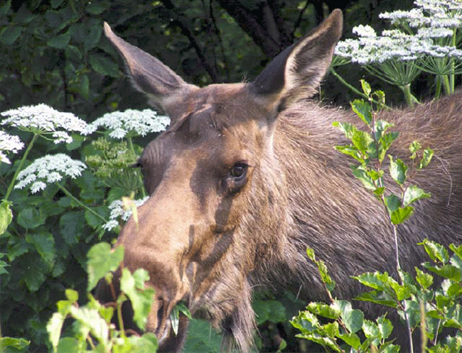
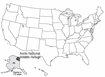
The Arctic National Wildlife Refuge (ANWR) sprawls across the North Slope of Alaska, from the Brooks Range to the coast of the Arctic Ocean, and is nearly as large as the state of Maine. ANWR is home to grizzly and polar bears, wolves loping across the tundra, moose and caribou, uncounted waterfowl, and snowy owls ghosting on white wings.
And beneath it, there probably is oil. The nearby Alaska Pipeline has pumped billions and billions of dollars worth of petroleum south from regions near the North Slope. But as that Prudhoe Bay oil runs out, the pipeline may soon be left empty--a very expensive conduit with nothing to carry. Similarity of geology suggests that ANWR also has oil to fill the pipeline, and to fuel automobiles in the U.S., or China, or somewhere. Not a lot of oil—maybe 10 billion barrels, according to the USGS. That is just over two years of U.S. oil imports at recent rates, not much more than one year of total U.S. oil use, and not exactly “energy independence,” but at $100 per barrel, it represents something like $1 trillion. The argument between wilderness and development has been going on for years, and is not ending soon; the recent emphasis on "fracking" for oil and gas in the lower-48 has temporarily shifted press attention away from the Arctic, industry interest in the north remains strong.
Fossil Fuels
Plants have an amazing ability. They take carbon dioxide (CO2) and water (H2O) and use energy from the sun to turn them into more plant material (which has an average chemical composition fairly similar to CH2O), releasing oxygen (O2) in the process. An approximate formula for photosynthesis is:
CO2+H2O+energy→CH2O+O2
Most of the rest of us—animals, fungi, many bacteria, as well as forest fires—run this reaction backwards, combining plant material with oxygen to release energy, carbon dioxide, and water. Done rapidly, this is “burning” in a fire; done slowly, it is still burning of a sort, which you might call "respiration." Plants usually include a bit of nitrogen that we didn't write in the simplified formula above, and animals often use the plant material with its nitrogen to make proteins that make animals, but after the animals die, they are almost always "burned" by bacteria or fungi or other animals that eat them to release the energy.
But, what happens if dead materials end up in a place without oxygen? It turns out that a lot of burning can be done by replacing oxygen with other things such as sulfate, but if these run out too, burning is no longer possible. Then, fossil fuels—coal, oil, and natural gas—become possible.
Coal is formed when bacteria break down dead plants. When there is no free oxygen in the air or water, bacteria remove the oxygen and hydrogen that are included in the plant material, leaving mostly carbon and forming a brown material called peat. When peat is buried by more sediment, heating and pressing drive off more and more of the little remaining oxygen and hydrogen, thus forming coal. Brown coal (lignite) has not been cooked much; it is common in the western United States. “Normal” or bituminous coal, formed from lignite by heat and pressure, is common in many places including western Pennsylvania. (This is a Penn State class, so we do keep track of Pennsylvania!) In a few places including eastern Pennsylvania, closer to the center of the old Appalachian Mountains, the bituminous coal was cooked to metamorphic anthracite coal. Peat is found with loose sediment, lignite with not-too-hard sedimentary rock, bituminous with harder sedimentary rock, and anthracite with metamorphic rock.
Oil is something like coal, but it is formed from dead algae buried in mud, usually from marine settings but sometimes from lakes. Algae start with more hydrogen and less oxygen than wood, so they produce a different fossil fuel. Heat breaks down the algae to release liquid oil. More heat breaks down the oil and makes natural gas, which is primarily methane (CH4). Some natural gas also is made at low temperatures by bacteria. While the heat is making oil and gas, the mud is being squeezed to make shale. Pennsylvania contains some oil and natural gas, and the first oil well in the world was drilled in western Pennsylvania. Humans had used petroleum before, but from natural seeps rather than wells. The push for petroleum that led to the first oil well was fueled by a looming shortage of whale oil, as the demand for that product far exceeded the ability of the oceans to grow the whales that produced the whale oil that was used to light homes on dark nights.
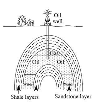
Oil and gas are low in density, float on water, and so tend to rise through water-filled pores in rocks and escape at natural seeps on land or beneath the sea. In some places such as off the U.S. Gulf of Mexico coast, biological communities have been found living on oil seeps on the sea floor. (Oil is natural, and nature uses oil in small quantities. But if a supertanker wrecks or an oil well blows out, nature cannot use all that oil at once, and problems result.) Because of the tendency for oil to escape, a large accumulation of oil can form only if there is a trap of some sort. Many different types of traps exist. For example, fluids do not pass through shale easily because it has only tiny spaces; if shale lying above sandstone is folded a little, oil and gas may be trapped in the sandstone layer, as shown in the figure.
At present rates of use, and at costs vaguely similar to what we see today, the oil and gas will last for most of a century, and the coal for a few centuries. If we were willing to pay more for gasoline, say $50 per gallon, more fossil fuels would be available. Although the store of fossil fuels is certainly limited, there is a rather large quantity. Until very recently, U.S. production had been dropping, causing us to import most of our oil from other countries, although as noted in the next section, "fracking" is affecting this. World production will probably peak in the next few decades (and some experts have suggested a peak within a few years). Demand for fossil fuels is rising rapidly, particularly in China and India as they industrialize. Shortages of fossil fuels, and worries about such shortages, already cause political problems; some observers believe that such worries are one reason the U.S. government spends so much on military preparedness.
Marcellus: Millions or Mayhem?
In Pennsylvania and some nearby states, there is much interest now in the natural gas being produced by "fracking" the Marcellus Shale, while Texas is fracking the Barnett Shale, North Dakota is fracking the Bakken Shale, and others are coming into play or being considered, in the U.S. and overseas. When a deep ocean ran out of oxygen back in the geologic past, mud and organic material accumulated on the sea floor, and these became black shales over time. Burial and heating broke down some of the organic material to make oil and gas, and some of that escaped from the shale, either leaking out at the sea floor or being trapped in special places that we have drilled into to get the fossil fuels.
But, a lot of organic material remains in the black shales, stuck between the very tiny clay particles that make up the shale, and not able to get out. People have learned how to drill into such layers, and then turn the drill to go along the layer. After a long hole is made, water and sand and various chemicals are pumped into the hole at very high pressure, breaking the rocks and then squirting into the new fractures to hold them open, in a process called “fracking.” Gas then leaks out along the fractures and up the hole, where it is collected and used by people.
In the big picture, this doesn’t make a lot of difference—the estimates of the total amount of fossil fuel that might be available have included the Marcellus gas since before the technology for recovering the gas became commercial, under the assumption that eventually we would figure out how to recover that gas. But, right now, there is much more gas on the market than there was a few years ago, and some oil is coming this way, some people are getting jobs or checks from gas companies for access to the land, other people are worried about the effects of the gas on the environment, and there is a lot of heated discussion going on. If you want to learn more about this particular issue, see the Enrichment.
Cost-Benefit Analysis
Let’s be honest. We use fossil fuels for good reasons. Most of our energy is obtained from fossil fuels. We run washing machines, rather than hand-scrubbing our clothes, primarily with fossil-fuel energy. Most of us are freed from the manual labor of hoeing and shoveling to grow our food because fossil-fueled tractors plow and plant and cultivate and harvest. Many of us have been freed from freezing to death in the winter, or perishing of heat stroke in the summer, or dying because we can’t get to the hospital in an emergency, because of fossil fuels. Humans have so far largely avoided the Malthusian trap of having lots of kids who have lots of kids until we exceed our food supply and then starve, primarily through being clever and through using cheap energy. Our energy use in the U.S. is equivalent to each of us having more than 100 people working to take care of us.
For humans, and for the few types of domesticated animals that have benefited from our use of fossil fuels (pigs, rice, chickens and soybeans, for example), there is little question that fossil fuels have been good. For other species on Earth, our use of fossil fuels to tame much of the planet has been less beneficial. How much easier did trains make it for humans to travel west to shoot bison? How much easier is it to cut a tree with a chain saw than with a stone hatchet? However, this is complicated by the fact that we have let some trees grow back, and we quit burning whales (or whale oil) to light evenings because we switched to burning the long-dead algae and trees that are fossil fuel.
There clearly are other costs of fossil-fuel use. Marks of oil exploration on the tundra may last for decades or longer. Acid rain from coal-fired power plants has killed the trout in headwaters streams on the Laurel Ridge of central Pennsylvania, and in some other places. Smog is not good for us, and shortens our lives. However, our lifespan continues to lengthen, so the dangers of smog and other “modern” hazards, such as industrial chemicals and radiation, are less than the advantages of the technologies that gave us all of these things. In fact, our biggest dangers are probably infectious diseases (evolution of new nasties), each other (automobile accidents, murders, and wars) and ourselves (smoking and drinking and eating too much, while exercising too little) rather than the technological things or natural disasters so many people worry about.
The Greenhouse Effect
If not for the greenhouse effect, we humans probably would not be here. The Earth’s atmosphere allows the shortwave radiation (what we usually call "sunlight") coming from the sun to pass through to the Earth’s surface, without much interference. (There is a little interference. Among other things, blue light is scattered off air molecules a bit more than red light is, so the blue light bounces around in the atmosphere and reaches our eyes from all directions in the sky, whereas the red comes more directly from the sun, which is why the sky is blue.) The windows in a greenhouse similarly allow sunlight to enter easily.
But, the sunlight heats the Earth or the inside of a greenhouse, which then radiate longwave radiation back upwards. As we saw way back at the Redwoods, the total energy reaching the planet on average exactly equals the total energy leaving, but the arriving energy is mostly shortwave electromagnetic radiation (light that we can see) while the leaving energy is mostly longwave electromagnetic radiation (infrared radiation that we cannot see without special sensors). The windows of a greenhouse do not allow longwave radiation to pass through easily; some gets through, but some is trapped.
When the sun rises after a cold night, energy enters a greenhouse but has trouble leaving, and the extra energy warms the greenhouse. Warming makes the floor of the greenhouse emit more longwave radiation, forcing some through the glass until a new balance is reached between incoming and outgoing radiation, but with the greenhouse at a higher temperature than would occur without the windows of the greenhouse. Some gases in the atmosphere act in the same way as windows on the greenhouse, intercepting some of the outgoing longwave radiation and keeping that energy in the Earth system. Water vapor contributes the most to the greenhouse effect, but carbon dioxide, methane, and others also matter. Without these greenhouse gases in the atmosphere, the Earth would be mostly frozen. (For a brief meteorological perspective on greenhouses, see the Enrichment, which also explains why water vapor is a “slave” to the other greenhouse gases, so that carbon dioxide is more important for changing the climate.)
Human-Caused Greenhouse Warming
Human activities are increasing the concentrations of several greenhouse gases in the atmosphere. Carbon dioxide, from burning of fossil fuels, burning of forests, and a few other sources, is the greenhouse gas we hear the most about. Refrigerants (chlorofluorocarbons and related compounds) also are potent greenhouse gases, and are increasing in the atmosphere. Those refrigerants that are especially damaging to the ozone layer that protects us from harmful very-shortwave (ultraviolet) radiation are being phased out, but the less-ozone-damaging replacements are still greenhouse gases. Methane, produced in cow guts, landfills, rice paddies, and other places where carbon breaks down in the absence of abundant oxygen, also has been increasing. Eventually, the huge carbon-dioxide source and the long time that carbon dioxide survives in the atmosphere mean that carbon dioxide will dominate global warming.
The world is warming. Of this there is almost no question—thermometers, including thermometers far from cities and in weather balloons and on satellites, in the ground and in the ocean, analyzed by government and university scientists in many different countries, including with industrial funding, show that warming is occurring. So do the temperature-sensitive types of snow and ice (NOT the top of Antarctica at -40, which won't melt even with a fairly large warming, but we see reductions in the seasonal river and lake ice, seasonally and "permanently" frozen ground, springtime snow, mountain glaciers and more). The great majority of significant changes in where plants and animals live, and when during the year they do things, are in the direction expected from warming.
Furthermore, there is high confidence that the warming is from the carbon dioxide. The physics of warming from rising carbon dioxide is unavoidable. Must of this was actually worked out by the Air Force after World War II. They were not doing global warming, but instead were worrying about such things as the appropriate sensors on heat-seeking missiles to shoot down enemy bombers. Use the wrong sensor, and you can't "see" the target because carbon dioxide is in the way. And carbon dioxide interacts with infrared radiation going from Earth to space in the same way. Satellites confirm this every day. Scientists have worked very hard to find some other explanation of the warming, but if anything, the sun has dimmed a little over the last 30 years, while volcanic eruptions have thrown up particles that blocked the sun a bit, we have put up particles from smokestacks that help the volcanoes in blocking the sun and causing cooling, we have replaced dark forest with more-reflective crops to cause a little cooling, and nature has not done anything with cosmic rays or space dust or anything else that would explain what is happening. Indeed, we see the warming from rising greenhouse gases despite the other influences primarily pushing towards cooling; really, the best answer to "How much of the warming did human-released greenhouse-gases cause?" is "More than all of it, because other things have reduced the warming." Finally, the "fingerprint" of the warming (for example, warming down here but cooling high in the stratosphere) is just what is expected from the effects of greenhouse gases, and completely unlike the pattern expected from changes in the sun, volcanoes, El Niño, or other natural fluctuations. Computer models of the climate system, when forced with the known natural causes of climate change such as changes in the sun and volcanoes, do a pretty good job of simulating the climate changes that happened before greenhouse gases had risen much but do a lousy job of simulating recent changes; adding greenhouse-gas effects causes the models to simulate what happened quite accurately.
Even prominent “skeptics” have now publicly admitted the high probability that humans are warming the world. (One of the well-known, often-seen-on-Fox-News skeptics directly stated this during a public debate with Dr. Alley a few years ago.) If you follow the news, you know that there is a lot of argument about how large the warming will be and whether it will be good or bad, although scientific consensus is very strong that the warming will be large compared to recent natural changes, and will be more bad than good for humans and other living things.
Some of the argument involves feedbacks. Feedbacks are “extra” processes in a “system” such as the Earth’s climate. If you force a system to change by doing something to it, many other things may then change. Some of these will amplify what you just did, making the changes bigger than you could have accomplished by yourself; these are positive feedbacks. Others will oppose what you just did, making the changes smaller than what you initially forced; these are negative feedbacks.
You, for example, have all sorts of negative feedbacks built in. If you are placed in a warmer room (the forcing), your body will begin to warm up. But then a negative feedback kicks in—you start to sweat, and that cools you off. Your body temperature doesn’t change nearly as much as the temperature outside of you changed. But, if you have certain diseases, they may fool your body so that its negative feedbacks are reduced and may even become positive feedbacks. Fever is usually a good thing, helping the body fight invading germs more effectively, but people die of fever when the feedbacks become positive and the body “burns itself up.” If you’re in a canoe with a really enthusiastic golden retriever, you may try to lean as the dog leaps about in such a way as to stabilize the canoe—you are providing a negative feedback on the tipping. But if the dog tips the canoe, and the ice chest falls to the low side, the ice chest is acting as a positive feedback to amplify the dog’s motion and tip the canoe further. If you lose your balance when the dog lunges to the side, you may suddenly fall toward the dog, providing another positive feedback and perhaps flipping the canoe.
The Earth certainly has positive and negative feedbacks. The easiest stabilizing one is the very fast change in radiation—a warmer place glows more brightly and sends more heat toward space, tending to cool the hotter places faster. Other than this almost-instantaneous change, most of the feedbacks over times that matter to us (years through millennia) are positive, amplifying changes; over still-longer times (say, millions of years), the feedbacks tend to be negative, stabilizing the climate. Climate changes over years or centuries thus can be almost as large as climate changes over millions or billions of years.
Put some extra carbon dioxide in the air and the climate will become warmer, speeding the rock-weathering chemical reactions that remove the carbon dioxide to produce dissolved ions that are used to make shells, removing the extra carbon dioxide. This negative feedback, which was explained by Penn State’s famous professor Jim Kasting and coworkers, stabilizes the Earth’s climate. Given too much atmospheric carbon dioxide, the excess is removed through warming-enhanced weathering; if too little, low temperatures slow weathering and allow carbon dioxide released by volcanoes from subducted shells to build up in the atmosphere. However, this takes hundreds of thousands of years or longer to act; over mere centuries, increased weathering will have little effect on the carbon dioxide we release, much of which will stay up for centuries, millennia or longer.
If we put carbon dioxide into the air and warm the Earth a little, several positive feedbacks begin to function. Warmer air can “hold” more water vapor (the saturation vapor pressure roughly doubles for a 10oC or 18oF warming), and water vapor is an important greenhouse gas, so warming causes more warming. Some of the shortwave radiation from the sun that hits the Earth bounces right back to space without first warming the Earth. This occurs especially over snow and ice, which have very high albedo or reflectivity. But, warming the Earth removes some snow and ice, which then allows more of the shortwave radiation to be absorbed, which warms the Earth more—a positive feedback.
Clouds reflect some sunlight (so cloudy days are cool), but clouds also interfere with outgoing longwave radiation (so cloudy nights are warm). The largest uncertainties in predicting how much warming will result from a given amount of fossil-fuel burning are probably related to how clouds will change, and whether these changes will produce positive or negative feedbacks. However, these uncertainties are not nearly large enough to affect the conclusion that future warming from fossil-fuel burning is highly likely.
We clearly wish to predict the future. If burning of fossil fuels, combined with bovine belches and leaky refrigerators, are going to cause too many problems, we might want to change our ways now. To predict the future, we need to do experiments. But, we have only one world. We cannot look at many different futures of one world, nor do we wish to wait many decades for the experiments to end. The solution we use is to build little worlds in computers, and run the experiments on those.
Geologists are important in this effort in two ways: we help find out how the world works, so that the right things can be put in the computers. The computer models always will be simpler than the real world, so careful choices must be made about what to put in. And, we provide data against which the models can be tested. You wouldn’t trust a model that had never been tested, but you wouldn’t want to wait a whole lifetime for a test. If the models can successfully simulate very different, warmer and colder climates of the past, then the models are probably pretty good. So we need to know about climates of the past.
The computer models of today actually are doing very well at “retrodicting” climate, predicting things that already happened. Modelers set up the configuration of ice sheets and ocean and continental positions and orbits and solar brightness, then model the climate and see if the computer results can match the climate that is recorded by the fossils and other climatic indicators in the rock record without “cheating” (so you can’t go in and tweak a lot of things to make the model match the data and then claim that the model is great—the models actually do work on past climates without such cheating). The models are also doing quite well at predicting the patterns of change we have observed with instruments over the last decades. Predictions made by modelers over the last decades are really occurring now. (For a little more on this, see the Enrichment, which also gives a bit more on why each doubling of CO2 has about the same effect on temperature, as covered next.)
Models predict that the world will warm about 3oC or just over 5oF for a doubling of CO2. The full warming will be delayed a few decades behind the rise in CO2, because the air can’t warm all the way until the ocean and ground have warmed and some ice has melted, which takes a while. The global warming to date, somewhere between 1oF and 1oC, is similar to the typical temperature variability at most places, so you really have to be paying attention to know that anything is changing. If we proceed to burn all the fossil fuels, something like an 8-fold increase above “natural” levels is possible over the next few centuries, or a warming of about 9oC or over 16oF, large enough that no one would have any doubt about the change. As noted in the Enrichment, uncertainty in the models is about 50%—the models project that the warming may be only about half this much, or more than one-and-a-half times this much, if we continue with business as usual and octuple CO2. However, because data on past climates are very difficult to explain if the models showing smaller changes are correct but are easy to explain if the models showing mid-range or large changes are correct, the low-end changes are less likely than the high-end changes.
So What?
Few people care about the temperature, and many care about what the temperature means for humans and other living things. Impacts are harder to estimate, both because of the additional uncertainties involved in turning temperature change into economic change, and because of the involvement of human values. For example, if warming causes species to become extinct, but those species were not economically important, how bad is that? You will find really strong differences of opinion across the political spectrum in the U.S. and the world.
Some disagreement is expected. Many places are already too hot for comfortable human habitation; making them hotter will not be good. Other places are too cold for comfortable human habitation today, so warming them might be good for humans there, unless you melt their ice and flood the coasts. Warming may remove one of the barriers that help keep malaria and other tropical diseases from spreading into today’s temperate zones, which is not good. Sea-level rise from warming is almost inevitable, as glaciers melt and the warming causes the ocean water to expand. Drying of the great grain-growing regions of the world during summers is likely. As a crude summary, most models indicate that human-induced warming will make our lives harder. People in the developed world are likely to cope; some in the developing world will cope, and others may fail (and die). A little warming is likely to hurt most of the world’s people (who live in too-warm places) but help most of the world’s economy (which is concentrated in fewer people in colder climates); too much warming then hurts everyone. A lot of loud radio commentators focus on the slight possibility of good outcomes, but ignore the possibility of disaster. (For a bit more on this, see the Enrichment.) Many professionals in the field note the benefits of caution—slow the ship in the fog until you have time to see how many icebergs are ahead, while starting to turn now to avoid the icebergs we already see.
Much of the argument focuses on economic concepts such as discount rates. Economically, something in the future is worth less than something today because of uncertainty (an apple in 30 years may do me little good, because I may be dead). If one uses this sort of reasoning, then any environmental change that takes more than a few decades to occur is of little concern—we humans will just deal with it when the time comes, using the great economic engine we’ve built.
But some people argue that intergenerational transfers should be treated differently—“we” humans who will “deal with” the changes will be our grandchildren, not us. Do we have the right to give them a greatly altered (probably degraded) Earth? Thus far, classical economic reasoning is “winning” in the real world, but the best science says that humanity will be better off if the reality of climate change is included in the decision-making.
Serious scholarship shows that, with a few decades of real investment in science and engineering, abundant energy can be provided while controlling greenhouse gases for a cost of roughly 1% of the world economy. That is in line with the costs of other clean-ups—sewers and garbage and catalytic converters and others. That is much smaller than most recent estimates of the coming damages from global warming if we do nothing. That also is a whole lot of money—roughly $400 billion per year now. Depending on one’s politics, the clean-up of greenhouse gases can be presented as a money-making prospect, as a low-cost obligation to the future, or as frighteningly expensive. Eventually, the switch away from fossil fuels must be made, because the fossil fuels are finite. And one can argue that $400 billion per year is a potential future industry that merits a real investment in research now. If we move away from fossil fuels, good jobs will be lost in fossil-fuel industries, but most studies point to a gain of more jobs in other fields. Note the problem, though—people in the industry who are worried about losing their jobs know who they are, and vote. People who will get the new jobs are students now, and don't know about the new jobs. So, there is some learning to be done.
Textbook 12.2: Yellowstone
Island Biogeography, Yellowstone and the Next Mass Extinction?
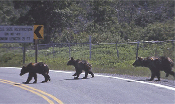
Most of the national parks were established to preserve geological features. A few parks, such as Sequoia and Redwood, were established for biological reasons. Increasingly, however, the national parks are visited, used, preserved, and managed for biodiversity. We humans continue to spread. More and more land is brought under cultivation. More of the produce of the sea is netted and served to humans. Some estimates are that we and our immediate friends—cats and corn and cows—now use about half of everything that the world makes available for us and everything else. And, with about 7 billion of us here now, heading for 9 or 10 billion, and with a couple of billion of us not using much but hoping to use more, all humans taken together may double what we're using. Ultimately, this leads to extinctions and loss of biodiversity.

This is a geology class, and biodiversity is a bit far-afield, but we have time for a quick detour. We saw that there have been mass extinctions in the past—times when many living types became extinct in a short interval. There is a real chance that a geologist far in the future would place our current time as the latest mass extinction, the end of the Cenozoic, and the start of the Anthropocene.
Early humans were surprisingly hard on biodiversity. Wherever humans arrived with their efficient tool kits—in Australia, New Zealand, other islands, the Americas—extinctions of large animals followed. Direct human hunting, or competition from the rats, pigs, dogs, and others that arrived with the humans, likely contributed.
Some people don’t like the idea that early humans were hard on biodiversity. Many people, including good scientists, have argued that the extinctions of large animals in the Americas were caused by climate change, which happened to occur at about the same time as human arrivals in some places. Dr. Alley has listened to talks in which data he helped produce were used to argue that the climate changes were so large and rapid that they must have been responsible. But, the work by Dr. Alley and others showed that dozens of such abrupt climate changes occurred, and the extinctions did not occur until the humans arrived. It is hard to imagine that a couple of dozen abrupt climate changes happened without killing off many species, and that just when fluted-point spears showed up in the rib-cages of mammoths, the next abrupt climate change was solely responsible for killing the mammoths, and humans did not play a role.
But, the earlier extinctions were mostly of large creatures. Since the industrial revolution, “modern” humans have contributed to extinctions of various creatures. And, the rate of extinction may pick up soon as we increasingly occupy the planet. To see why, let’s take a little detour into island biogeography.
Island Biogeography
If you were to visit a lot of islands that are more-or-less the same distance from the mainland, and count the number of species on each island and measure its area, you would find that the bigger islands have more species. Roughly, an island with ten times the area as another will have twice as many species. If you visited islands of about the same size at different distances from the mainland, you would find that those closer to the mainland have more species.
At least some of what controls these observations is not too difficult to understand. If you have a small island, it can hold only a few individuals of a species. From year to year, populations go up and down depending on food supply, predators, and other things. With a small population, a small drop can hit the absorbing boundary of zero individuals and cause extinction, but a large population can survive a small drop. So, extinction is more likely on a smaller island, and smaller islands have fewer species. The mainland is there to supply new individuals to islands to replace those that die, and repopulation is easier for islands closer to the mainland, so those islands closer to the mainland have more species.
These patterns of island biogeography are well-established. Studies of repopulation of islands sterilized by volcanic explosions, and even of very tiny islands that were deliberately depopulated and then allowed to come “back to life,” have shown that this is the way the world works naturally.
Now, think about Yellowstone. Originally, the boundaries drawn for the park separated wilderness inside from wilderness outside. Today, as shown in the satellite photo, some of the park boundaries are easy to see from space because loggers outside the park work right up to the boundaries. Yellowstone remains connected to other wilderness regions in other directions; it is not an island (yet).
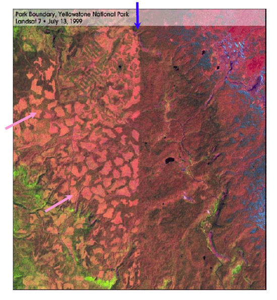
But what if Yellowstone were an “island,” as some other parks are or soon will be? Suppose a park becomes surrounded by farmland, which is used to feed humans and keep us alive. Farmland does not support a lot of wild orchids or wolves. Farmland is impoverished in biodiversity, with just a few species, carefully selected to feed us. A park surrounded by farmland is an island, because many species have great difficulty crossing the farmland, just as many species have difficulty crossing the ocean. And, from the well-established principles of island biogeography, isolation of a parkland from other wilderness will cause extinctions in the park. Perhaps more worrisome, if the only remaining wilderness is in parks, there is no longer a “mainland” to replace species lost to local extinction on the island—extinction in the park is then extinction from the world.
We know that as climate changed in the past, plants, and animals migrated long distances to stay with their preferred climate. As the climate changes in the future, migration will be required, but may be impossible if the parks become isolated.
So, Who Cares?
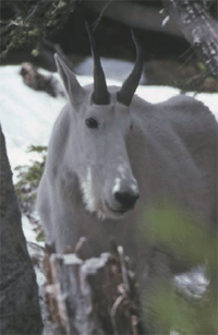
One can ask whether biodiversity is worth preserving. This is proving to be a difficult topic, and one that will be discussed much in the future. Certainly, many of our medicines have come from plants, and if many plants become extinct before we can study them carefully, we are likely to lose many possible medicines. Engineers and designers are increasingly using “biomimetic” techniques—mimicking nature. Evolution has worked over vast times to select the most successful biological patterns, and we can learn from them, if they are here to be learned from.
More-diverse ecosystems seem to be more productive (if you have hot-loving and cold-loving and wet-loving and dry-loving types in a region, then something will grow well no matter what weather arrives; if you have only one type, and the weather is bad, so is the crop), so if producing more is good, biodiversity seems good. But, the difference is not huge.
Living things have frequently served as “canaries in coal mines”. Miners would take a canary along in the mine, not only for companionship, but because the birds were more sensitive to bad air than were people, and a sick or dead bird would warn miners to get out before the miners became sick or dead. Birds of prey served that function for us with DDT. This chemical was going to free us of pests, increase crops, wipe out diseases—until the falcons, hawks, eagles, and other predatory birds started disappearing. A little DDT on a plant led to more DDT in an insect that ate lots of plants, and still more DDT in a bird that ate a lot of those insects, and became so concentrated in a falcon that ate the birds that the falcon’s eggs broke, and young ones couldn’t be raised. It became clear that such “bioconcentration” threatened us with problems as well—the other living things gave us a warning. Loss of biodiversity means loss of warning sensors.
And, many people like diversity (look at the money spent on zoos, and the interest in charismatic macrofauna in parks). Further, some people see a moral issue—do we really have the right to terminate the existence of other living things?
Some planners today are trying to establish corridors connecting wilderness areas, so that the parks do not become islands and lose species. How successful this plan will be remains to be seen. The “simple” answer is that, to maintain many species on Earth, we have to maintain much wilderness. And that in turn has implications for how we humans choose to behave.
Virtual Field Trips
Join Dr. Alley and his team as they take you on "virtual tours" of National Parks and other locations that illustrate some of the key ideas and concepts being covered in Unit 12.
Virtual Field Trip #1: The Arctic National Wildlife Refuge (ANWR): Where Caribou Meet Oil Conduits
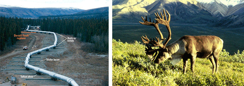
Source. USGS, http://geology.usgs.gov
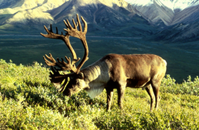

Source. Right: U.S. Fish and Wildlife Service, Arctic National Wildlife Refuge. Left: hosted on website of Vermont Senator Patrick Leahy.
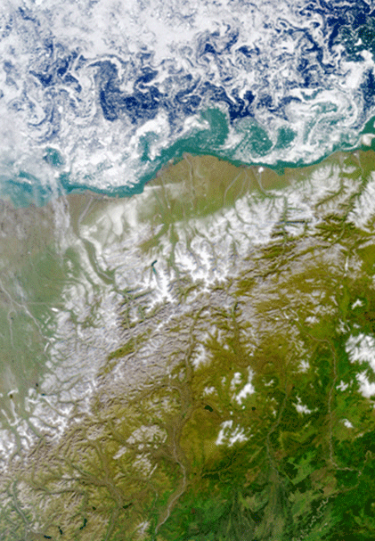
Source. NASA, http://www.nasa.gov/vision/earth/environment/frozen_north.html
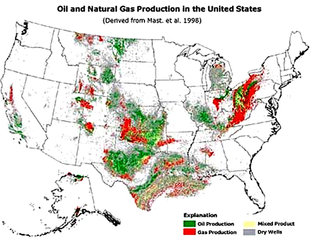
Source. USGS http://geology.usgs.gov
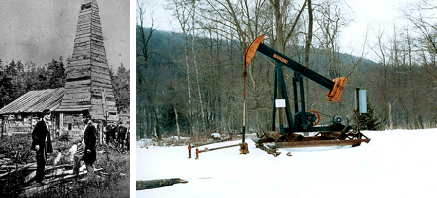
Source. Left: eia, U.S. Energy Information Administration. Right: U.S. Immigration and Customs Enforcement, https://www.ice.gov/doclib/news/library/reports/cornerstone/cornerstone2...
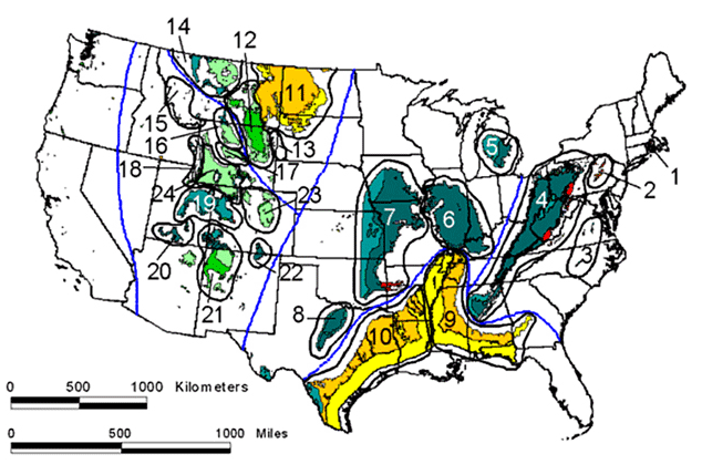
The map shows that only certain areas produce coal, with no coal from most of the country. Lignite is especially common in the west and south, bituminous in the west and Appalachians, and a little anthracite in the parts of the Appalachians that were heated most strongly during mountain building, in Pennsylvania, West Virginia and Virginia, and also Arkansas and Oklahoma.
Source. USGS
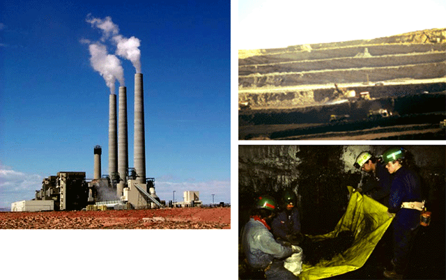
Source. USGS Circular 1143, Coal – A Complex Natural Resource, above by J.C. Willett, right R.W. Stanton, Upper right P.D. Warwick
Source, USGS Circular 1143, Coal – A Complex Natural Resource, upper left by S. G. Neuzil, lower left by C.B. Cecil, right by P.D. Warwick
Source. Left. US Bureau of Reclamation, photograph from Colorado, 1914, Right four images. From Warwick, Peter D., in preparation, Geologic Assessment of Coal in the Gulf Coastal Plain: U.S. Geologic Survey Professional Paper 1625E, DC-ROM.
Image 1: The builders of the Alska pipeline (upper left) for carrying oil had to worry about impacts on critters including caribou, and about geological issues such as earthqakes (the bend in the pipeline shown is part of the engineering to allow the pipeline to shake but not break in a quake.
Image 2: Oil and gas aren’t quite as photogenic as mountains or canyons. Here are a few pictures from ANWR, and some shots showing oil wells, coal mines, and the occurrence of oil, gas, and coal in the U.S. You might want to know that, with heating, plants turn into peat and then into lignite and into bituminous or into anthracite, and that western PA has bituminous and eastern PA has anthracite, and that making oil too hot produces natural gas so western PA has oil, but eastern PA doesn’t.
Image 3: he Arctic National Wildlife Refuge (above) and its caribou (right). Source. Right: U.S. Fish and Wildlife Service, Arctic National Wildlife Refuge. Left: hosted on website of Vermont Senator Patrick Leahy.
Image 4: Satellite image showing ANWR. To the north (top of picture) sea ice floats in the Beaufort Sea. Below, rivers drain from snow-covered mountains. Source. NASA, http://www.nasa.gov/vision/earth/environment/frozen_north.html
Image 5: Slightly fuzzy USGS map of oil (green), gas (red), and a lot of dry holes (gray) for the U.S. Alaska is reduced to fit; ANWR is at the far north (top) of Alaska. The map shows that oil and gas are produced in only certain areas, with much of the country not having any resource, and that oil companies have drilled many, many holes that did not produce commercially useful quantities of oil or gas. Source. USGS http://geology.usgs.gov
Image 6: (left) Historical photo of the world’s first oil well, Drake Well Museum, Titusville, PA. (right) Modern Pennsylvania oil well. This happens to be a well that was seized by Immigration and Customs Enforcement (ICE) of the U.S. Government as part of investigation of drug crimes. Source. Left: eia, U.S. Energy Information Administration. Right: U.S. Immigration and Customs Enforcement, https://www.ice.gov/doclib/news/library/reports/cornerstone/cornerstone2...
Image 7: USGS map of coal resources in the contiguous U.S. The numbers and blue lines refer to different coal regions used in USGS studies. 1-3 on the far right are anthracite, 4-8 and 12-23 (shown in green and blue) are bituminous (of various grades; greener colors are closer to lignite, and the red bits in 4 and 7 are close to anthracite), and regions 9-11shown in yellow and orange are lignite. The map shows that only certain areas produce coal, with no coal from most of the country. Lignite is especially common in the west and south, bituminous in the west and Appalachians, and a little anthracite in the parts of the Appalachians that were heated most strongly during mountain building, in Pennsylvania, West Virginia and Virginia, and also Arkansas and Oklahoma. Source. USGS
Image 8: Left: coal-fired Navajo power plant near Page, AZ. Upper right: Mining lignite-to-bituminous coal, WY. Lower right: Scientific sampling of Lower Freeport Coal, Indiana County, PA. Source. USGS Circular 1143, Coal – A Complex Natural Resource, above by J.C. Willett, right R.W. Stanton, Upper right P.D. Warwick
Image 9: Slightly-low-resolution photos of peat from Indonesia (upper left), lignite from Texas (upper right; the darker beds are coal, and the lighter beds are volcanic ash) and bituminous from West Virginia (bottom left; bituminous usually is blacker, but it has been weathered here). Source, USGS Circular 1143, Coal – A Complex Natural Resource, upper left by S. G. Neuzil, lower left by C.B. Cecil, right by P.D. Warwick
Image 10: Draglines (left and top center) are huge motorized shovels that are often used to remove unwanted rock above coal in surface (“strip”) mines, such as the Gulf Coast lignite mine shown in the right-hand four pictures, where volcanic-ash interbeds separate the coal beds, with a fossil palm leaf (upper right). Source. Left. US Bureau of Reclamation, photograph from Colorado, 1914, Right four images. From Warwick, Peter D., in preparation, Geologic Assessment of Coal in the Gulf Coastal Plain: U.S. Geologic Survey Professional Paper 1625E, DC-ROM.
Virtual Field Trip #2: Charismatic Macro Fauna
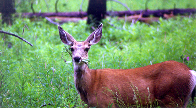
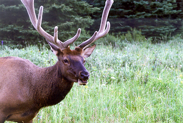
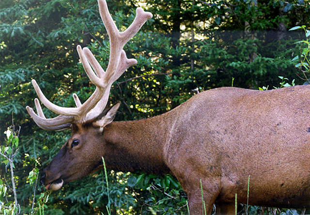
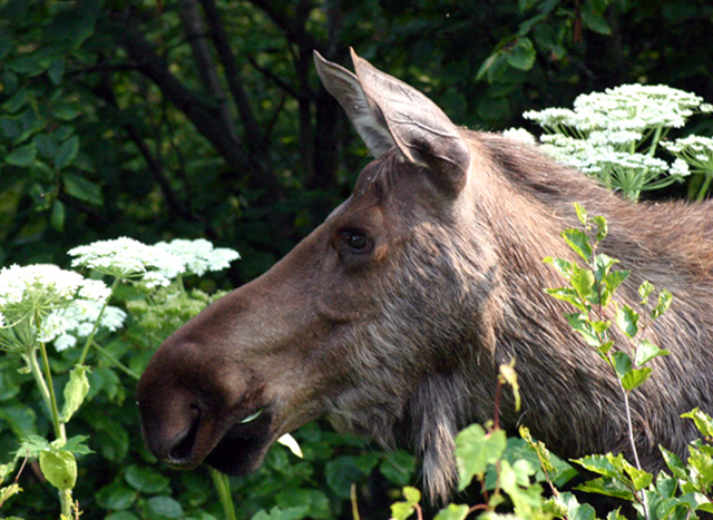
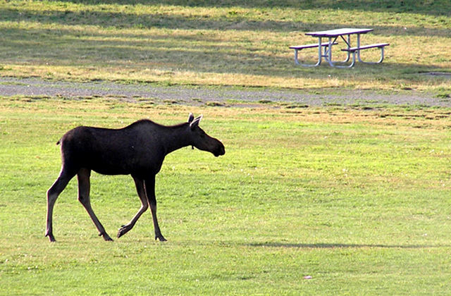
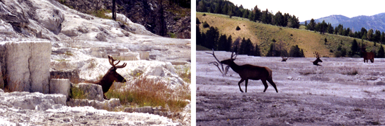
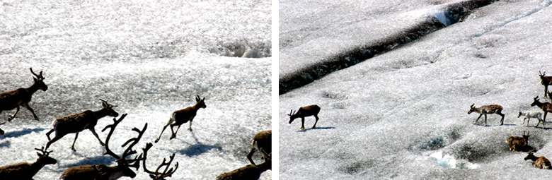
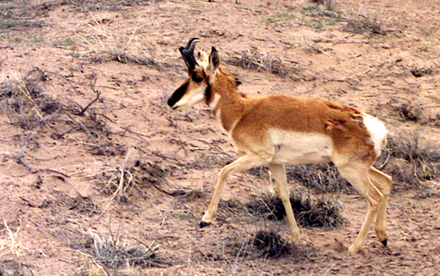
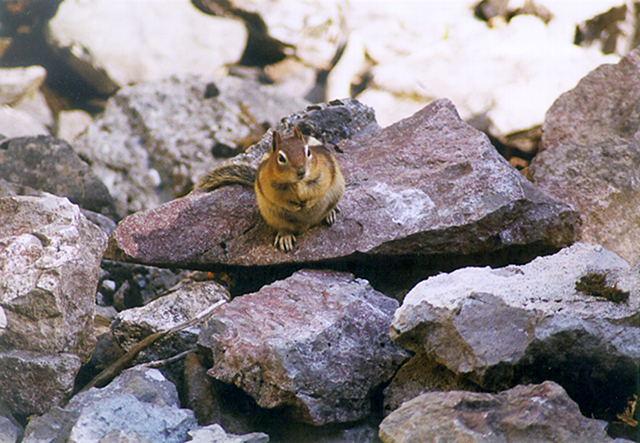


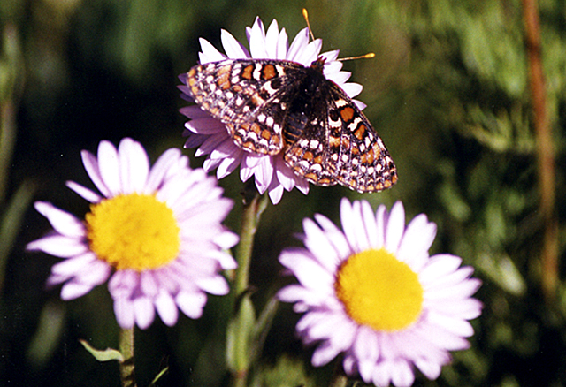


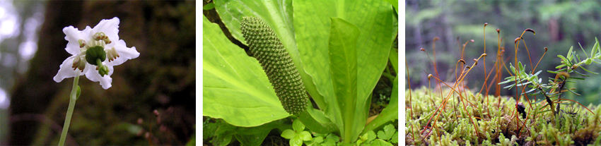
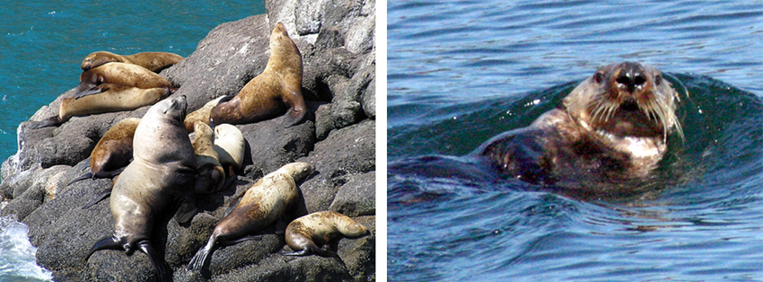
Image 1: Charismatic macrofauna--big attractive animals--are one of the major attractions at national parks. In much of the world, competition for resources between large animals and humans is greatly endangering the animals; however, big animals in the U.S. and Canada, such as this bighorn sheep in the Canadian Rockies, are actually doing quite well. This slide show is mostly for fun, but the point--that humans endanger the biodiversity from which we benefit--is important. All photos by R., C., J. or K. Alley.
Image 2: A century ago, deer were largely eliminated from Pennsylvania and most of the eastern U.S., while mountain lions and some other large animals were completely eliminated, so we might be careful before feeling smug about more-recent successes. This is a mule deer in Banff National Park, Alberta, Canada.
Image 3: The eastern subspecies of elk is extinct. Elk from Yellowstone and elsewhere were transplanted to Pennsylvania and other eastern localities in this century. This elk is in Banff National Park, Alberta, Canada.
Image 4: Another view of a big Banff bull elk.
Image 5: Moose, Captain Cook State Recreation Area, Alaska
Image 6: Moose in town, Anchorage, Alaska. Humans and wildlife are interacting more and more, because we keep moving into their habitat.
Image 7: Elk at Yellowstone National Park rest on the upper surface of Mammoth Hot Springs. The open setting discourages the bugs that torment the elk.
Image 8: Caribou, south Greenland, doing the same thing as the elk in the previous picture--dodging bugs.
Image 9: Pronghorn, Petrified Forest National Park.
Image 10: Not quite so large… a golden-mantled ground squirrel, Yoho National Park, Canada.
Image 11: Bald eagle, Sitka, Alaska
Image 12: Harlequin duck (left), tufted puffin (right), Seward, Alaska.
Image 13: Metalmark butterfly, Paintbrush Trail, Manning Provincial Park, British Columbia, Canada
Image 14: Blueberry (upper left), yellow salmonberry (lower left), red salmonberry (upper right), and bunchberry flower (lower right), Sitka, AK
Image 15: Devil’s club (Oplopanax horridus), Sitka, Alaska. Many plants have external defenses, but almost all have internal defenses, chemicals to help keep them from being eaten. The native peoples of the Alaskan coast have long used devil’s club as a medicine--what works for the plant also works for humans. Many of our medicines have come from plants, and many more will.
Image 16: Wax flower (left), skunk cabbage (middle), and club moss (right), Sitka, Alaska. Biodiversity really is beautiful.
Image 17: Steller sea lions (left) and See otter (right), Seldovia, Alaska
Virtual Field Trip #3: Global Warming
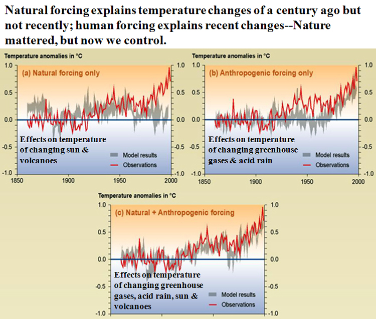
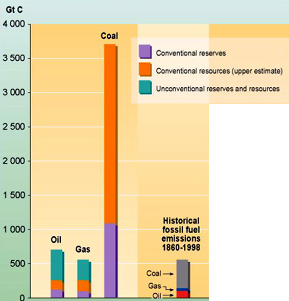
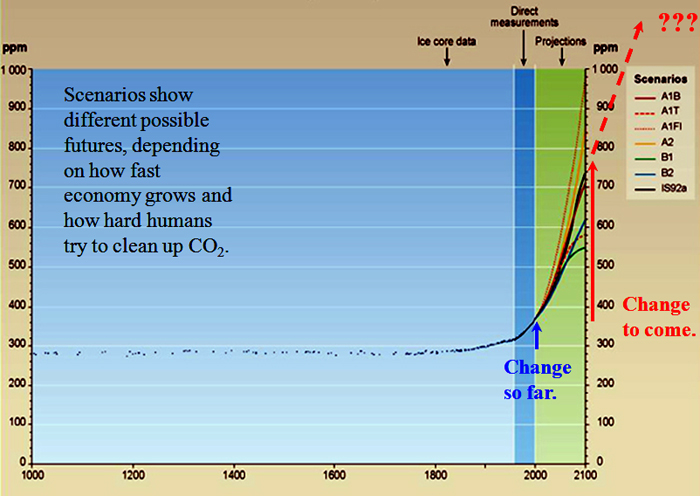
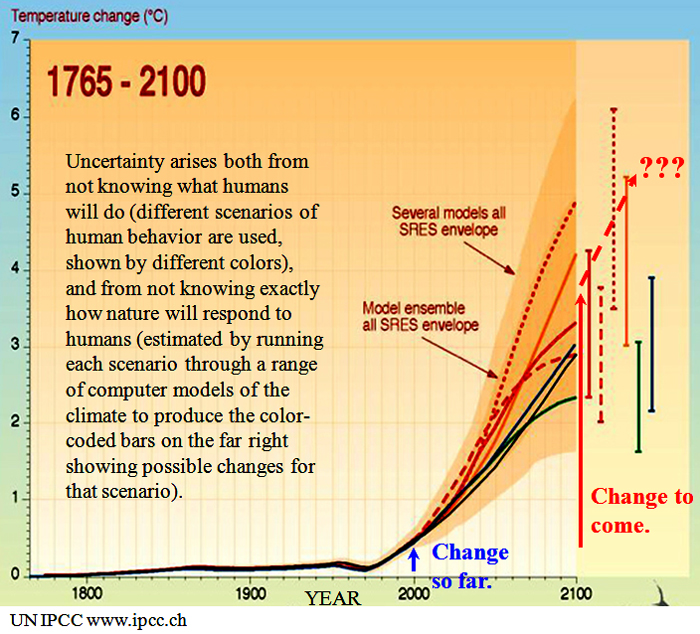
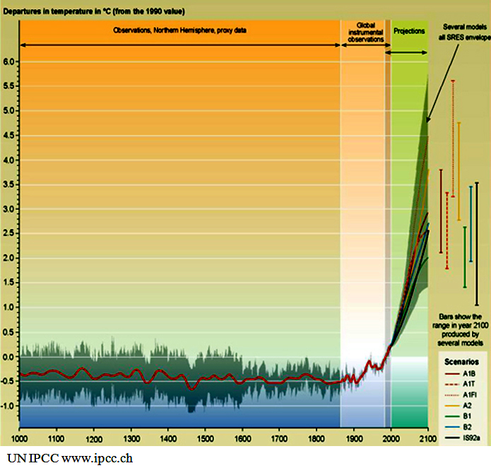
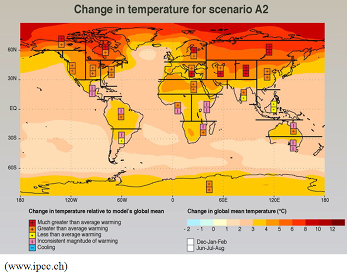
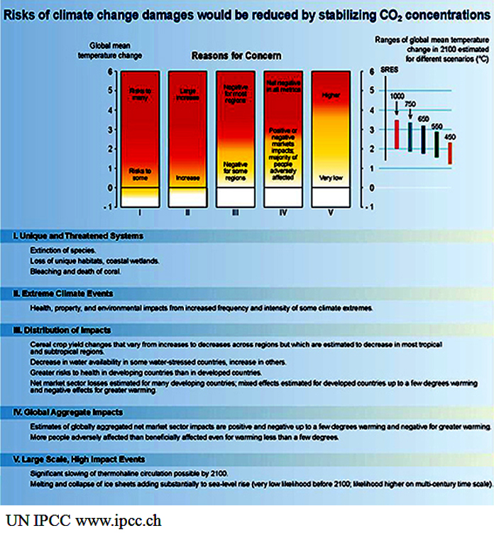
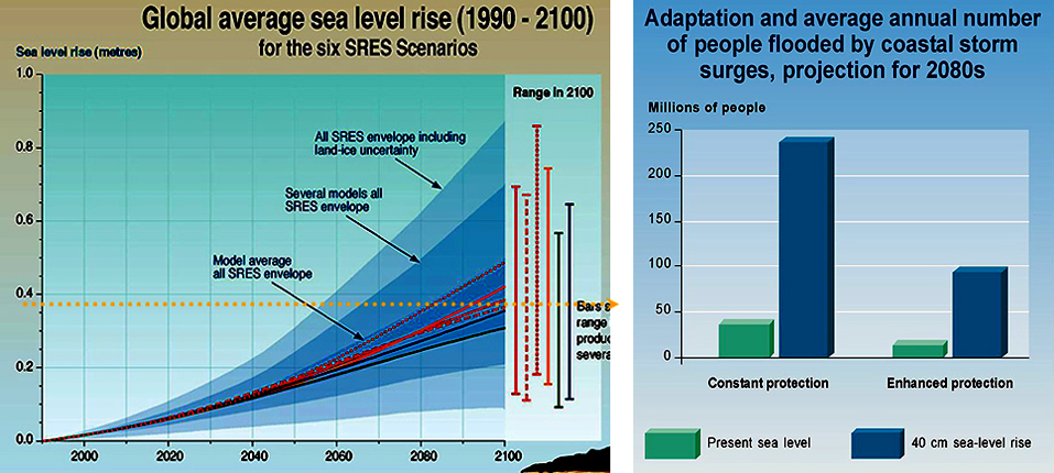
Image 1: This slide show summarizes the scientific consensus on human-caused climate change, as embodied in the United Nations-sponsored Intergovernmental Panel on Climate Change 2001 Report (www.ipc.ch), the source of the figures shown (annotations added for this class). The skinny version is, whith high confidence: 1.We are changing atmosphere, especially by burning fossil fuels; 2. That is changing the climate, primarily by warming; 3. The changes so far have been tiny compared to the changes that will come if we follow business as usual; 4. Changes will cuase winners and losers, with losers far outnumbering winners if warming is large; 5. Sea-label rise, summer grian-belt drying, and stronger storms are among the alrge impacts expected.
Image 2: The following are some additional points on Global Warming. In the past, environmental problems invariably generated much noise and denial and claims of huge costs to clean up, until people invented better ways, after which we solved the problems, people made money, and the cleanups became part of the economy. Plausible estimates say completely cleaning up CO2 today would be very expensive, but could be done ater a few decades of serious research and development for something like 1% of the economy. That is in line with costs of other cleanups (sewers, janitors, garbage trucks, atalytic converters...), and, it is a lot of money. Slowing down emissions a bit now might buy time to avoid problems until the new technolgies are in place. We will switch energy sources (fossil fuels are finite), will we switch before or after changing the world, and , who will get rich?
Image 3: http://www.ipcc.ch (link is external) UN IPCC The rise in the greenhouse gases carbon dioxide, methane, and nitrous oxide over last millennium, and rise and fall in acid-rain sulfate over last 600 years, from ice-core data (sulfate and dots on gas graphs) and instrumental records (lines for gases). Changes are clearly human-caused.
Image 4: Instrumental record (from thermometers) of global average temperature from 1860-2000. Corrections have been made for the heating effect of cities, so this shows real warming. Instrumental record (red) and proxy-data record (tree-rings, etc., blue with uncertainty in gray) of global average temperature over last 1000 years. Details of proxy interpretation are still debated, but other approaches give similar results.
Image 5: (www.ipcc.ch)UN IPCC Each panel shows measured global-average temperature 1860-2000 (red line) and a model reconstruction with uncertainty (gray band). Natural causes (more sun, fewer volcanoes) started warming (upper left) but switched to cooling; human causes (greenhouse gases, plus acid rain blocking sun) cooled in 1950s, now warming strongly (upper right and bottom).
Image 6: How much more fossil fuel is there? We’re sure of reserves; we think we have resources, and unconventional reserves. Resources include oil shale, tar sands and such. Most of the fossil fuels have not been burned yet, but we’re burning them much faster now than we have in the past.
Image 7: Past changes in CO2 levels are small compared to the change that is coming. CO2 is still likely to be going up in 2100, and the world doesn’t end then (you may live past 2100…).
Image 8: Past temperature change is small compared to the expected change for all scenarios and climate models tested. Change so far has been small enough that only those really paying attention have noticed; future change is expected to be much greater. All projections show temperatures rising beyond the year 2100, which is not the end of time.
Image 9: Projected warming in the greenhouse future, compared to changes over the last millennium. Again, all the projection curves are rising as they cross the year 2100, and the world does not end in 2100.
Image 10: Warming of mean-annual temperature by the year 2100, in degrees Celsius. (To get Fahrenheit, multiply by 1.8; the largest warmings in the Arctic are almost 10oC or 18oF.) Scenario A2 is one in which the economy does pretty well, and we don’t try very hard to clean up, giving warming toward the upper end of the scenarios tested by the UN IPCC.
Image 11: Experts were asked how much warming would worry them about various things. White means few were worried, and red means most were worried. Even a little warming endangers rare species (category I)--they need to move as climate changes, but humans in the way may block migration. Much warming is required before most experts are worried about ice-sheet or thermohaline-circulation collapse (category V), but beyond 2100, such warming becomes increasingly likely unless actions are taken. How the economy grows, and how we try to clean up, determine how hot it gets, as shown on the right for the year 2100--burn-it-all makes enough warming to be worried about most things by then; slow-down-some leaves a little safety zone. UN IPCC.
Image 12: (left) Projected sea-level rise for a range of human-behavior scenarios and from a range of models, to the year 2100. Rise over the last few years seems to have been faster than any of these projections. Projected change is from warming-caused ocean-water expansion and melting of mountain glaciers. (right) Number of people likely to be flooded by coastal storm surges (blue bars) after a 40-cm (16-inch) sea-level rise (the yellow dotted line on the left) (includes population growth to the year 2080), versus without sea-level rise (green), assuming either modern sea-walls, etc., or efforts to build more sea-walls, etc. Loss of the Greenland ice sheet would raise sea level over 7 m or 23 feet, and Antarctica almost ten times more than that. UN IPCC
Want to see more?
Join Dr. Alley in this optional video (no, it won’t be on the quiz) to learn about formation of Fossil Fuels, in Barataria Reserve, Jean Lafitte National Historical Park and Preserve, Louisiana, from the PBS television special Earth: The Operators’ Manual.
GeoMations
This last GeoMation of the semester is a short piece about people, environmental and habitat change, and their effects on biodiversity. We hope this adds a bit of insight to Unit 12 for you, and we wish you success as you wrap up the end of the semester!
Biodiversity
Two identical terrariums, and in each of these terrariums, you have the rare and beautiful geosite daisy that is so endangered, and it's such a great thing to have. And all the people come from around to look at them. The difference is in the upper terrarium, it is divided into two by an unbreachable purple glass wall. Now, what's going to happen?
Well, as you might imagine, things are not perfect in terrarium land, and the blight comes. And the blight kills off one of your geosite daisies in each of the terrariums. But if you're down here, you're not worried, because you can grow this beautiful daisy, and it will grow back.
And it has its poesy, and it just gets grown back when, oh my goodness, the rust comes, and it wipes out one of the daisies in each of the terrariums. And if you're down below, you're still not worried, because it can grow back. And pretty soon, you have a beautiful display. But if you're up above, you're really worried, because now you're extinct.
Now, suppose that instead of this being worried geosite daisies in our terrariums that we were worried about Glacier National Park seen in a map and Yellowstone National Park seen in a map down here. And at the present time, Glacier and Yellowstone are connected by corridors that are essentially wilderness running down the Rocky Mountains.
What is going to happen if we lose those corridors of wilderness that connect the two and turn them into islands? And the simple answer is you don't lose everything, but you probably do lose some of the things that live in both of the parks, just as for the terrariums you get extinction.
Video Lecture
The Unit 12 lecture features Dr. Richard Alley.
We're coming to the end. We're going to talk today about biodiversity and climate change, look to the future, and we need to do a little review, and you're going to be a expert on the geology of the national parks and a whole bunch of other things. Today, we're going to start with solar power. As you probably know, I am sun-powered, and I'm happy about that. And so, we're going to look briefly through that and why I can say we're sun-powered. Then we're going to look a little bit at how ancient sun is powering us, and then we'll ask something about how that makes charismatic macrofauna important in the national parks.
So, let's start with this. And as you probably know, it's green in many places right now outside. And the green stuff is plants, and the plants are doing maybe the most important thing for us. And what is a plant doing? The job of a plant is to take carbon dioxide-- and you probably know that scientists like to abbreviate things so that we can talk faster, and so, people often call carbon dioxide CO2. And the plant also takes water, and if you-- I'm sorry. I will pull myself together here very quickly. I'm sorry. Now you can see what we're writing.
And so, the job of a plant is to take carbon dioxide, which is CO2, and to take water, which we abbreviate as H2O. And the plant is sitting there, and it's adding the sun's energy. If you put the plant in a dark place and wait, it dies. And what does it do? It makes more plant. And so, this is a formula for how things work. And if you prefer, a plant is something vaguely like this. Now, in point of fact, if you go look in the plant and you try to find that molecule, you won't find it. But if you sort of boil down plant and take a little bit of nitrogen out, you'll end up with something like that. And the plant is sitting there making oxygen. And so, that will also be O2. And so, if you wanted to write a formula for what goes on out there in the sun and the green and so on, it is carbon dioxide, water, and sun's energy making more plant and making oxygen.
Now, our job is to take plant and to scarf it down for lunch. And then we run this backwards. And so, our job-- we, and bacteria, and fungi, and forest fires-- run this backwards. And so, our job is to get the plant, we take a little of the plant and we turn it into us. But mostly, we take the plant and we turn it into energy so we can do fun stuff. And so, this is how things work, and things are very tightly balanced. Virtually everything that grows gets burned, because it's way too valuable not to. And so if you see something die out there, immediately something is burning it. And whether it's a forest fire or whether it's a fungus or whether it's a bacterium or whether it's something else coming along and scarfing it down and eating it, almost everything gets burned. If you go down to the ocean and you watch the algae die and sink to the bottom, they fall in the mud. If you look in the mud, there's all kinds of stuff crawling around in there trying to eat the organic stuff, to eat the plant and burn it to get energy.
However, occasionally, there is a little bit of leakage. Occasionally, something escapes. And so, if you bury plant-- fancy technology here, if you bury plant and you bury it in a place that there isn't much oxygen-- so, you notice that we sort of breathe the oxygen to run this backwards. If you bury plant where oxygen is scarce, actually, all sorts of other things happen. If you're down at the ocean, why, things will use sulfate to burn rather than oxygen, and you'll end up with black mud of sulfite and stinky stuff and so on, but eventually, you start running out of things you can use to burn. And so, you bury the plant without oxygen, and it will avoid burning for a while.
OK, so it avoids being burned. And if you then take that and heat it and maybe squeeze it a little bit, you get what we call a fossil fuel. So, you heat a little, and it will get cooked. It will change a bit. Some of the molecules will break down. And you end up with what we call a fossil fuel. And it's really almost that simple until you get into it and the organic chemistry of this. It's just absolutely fascinating. And so, there's lots of people study that.
Now, there are various types of fossil fuels, and if we had a real expert in here, they'd say, whoa, you're oversimplifying just a bit. But let's say that you're down at the ocean and there's lots of algae. There's a big bloom, and you get all the slime, and it sinks to the bottom, and it gets in the mud, and then you heat that. And so, we start off with algae and we bury that without oxygen. What do we get? The first thing is that there's bacteria down there, and the bacteria break it down, and they commit acts of bacterial flatulence, and so, they make natural gas. And so, the first thing that happens is you get gas, and the gas is usually coming from bacteria. So, they're down there farting away, and they're making gas.
What happens next is that as it warms up, you get warmer and warmer. So, we're going to warm it going this way. So, let's say we're going warmer this way. It gets too hot for the bacteria, they become unhappy. But what you do do is you start breaking down the [UNINTELLIGIBLE] cells, and you end up with what we call oil. And that is very useful for us. We don't have to go kill whales to get oil. So, we have light at night, we can pump it out of the ground, and so that's a nice thing. If it gets really, really hot, the oil breaks down. Your engine gets too hot, you start breaking down the oil unless you have really expensive additives in there. And so, when it gets too hot, the oil breaks down, and actually, you get more gas. So, bacteria make gas, and actually great heat makes gas. And so, these are the big fossil fuels, and we're doing a huge amount of burning of these fossil fuels.
If you start with wood instead of with algae, you probably know that algae is sort of slimy and wood is sort of chunky, and so, you're going to get something different. And so, the usual story we tell is you start with wood and you start heating it, you end up with a material that we call peat. Now, this is not identical to the peat moss you buy at the store, but it's something that you sort of recognize. It's organic stuff, it's sort of brown and chunky, and you'll recognize it. So, again, we're going here from colder to warmer. So, we're headed to the warmer direction here. You squeeze it a little bit, you heat it a little bit, you leave it for a while, and you may end up with peat, but it hasn't changed very much.
And then as we go along, you end up making something that we call lignite, or brown coal. So, now we're getting up into coal, and the lowest level thing, the least heating and so on that you end up with would be lignite. And when you go beyond lignite, then you get to stuff that is mined, say, in Western Pennsylvania, which is bituminous coal. So, bitumen, you can see in there, so, bituminous. And then, if you really heat things and squeeze them a lot, you end up with what we call anthracite. And in Pennsylvania, the anthracite belt is in the East, where things have been squeezed and heated a lot. This is the coal path here, as opposed to the oil path here.
Now if you were to ask, what would you find this in? If you find peat, what is around it? And what you'd find around peat you'd call sediment. It isn't really a rock yet. It hasn't been cemented enough to be a rock. And you'll find the peat sitting around with a sediment of some sort. By the time you get to lignite, you'd call it a rock. You'd say, this has been squeezed and heated and cemented enough that it really sort of looks like a rock, but it would be pretty soft. And by the time you get up to bituminous, you'd say, well, this is still a sedimentary rock, but now it's a pretty hard one. So these are sedimentary rocks around the coal in here. And by the time you get up to anthracite, you'd say, whoa, this is metamorphic rock. We're past sedimentary at this point. And so anthracite you'd find is a metamorphic rock.
I'll show you a map in just a minute of where you find these different things. In Pennsylvania, where I happen to live, you find the sedimentary rocks, the bituminous, out in Western Pennsylvania, and you find the anthracite, the metamorphic rocks, over in Eastern Pennsylvania, near the heart of the old Appalachians, where they got cooked a lot. So, the Eastern Pennsylvania is out here. In the same way, in Pennsylvania, you can find a little bit of bacterial gas in various places, but you'll find the oil mostly out in Western Pennsylvania, and you'll just get nothing but gas left as you go east, because the oil has been broken down because it got cooked too much.
So, those are the fossil fuels. The oil, the natural gas, we're using pretty fast. We may have at current rates of use and at prices that are not grotesquely higher than what we have now, we have a century or less of them to go. And so, if we look at these fossil fuels at this point in the game, for oil and gas at current use rate-- at the current rate of use-- and at prices that are sort of like what we have today-- so, sort of recognizable prices-- we have maybe a century of oil and gas and a few centuries of coal.
Now, this clearly depends on the price. And when I grew up in Central Ohio, in Columbus, we were on the Ohio Shale. The Ohio Shale's a black shale, and if you dig up some stuff that's been buried and break it open, you smell a little bit of oil and gas in there. There's a little organic in that. If gas and oil were worth $1,000 a gallon, you'd just strip mine Columbus. Who cares? Just take it right through, or dig underneath it, or something. So, there's a little more out there if the price goes up immensely, but I don't think we really expect that anyone is going to pay $1,000 a gallon for gasoline. So, sort of at the price we recognize, this looks like about where we're going with these things, that they will run out at some point, and not too far out in the future.
Now this gives rise to all sorts of interesting questions. And so, let's take a brief look at the place where one of these questions is playing out. We're going to take a very brief visit to the Arctic National Wildlife Refuge. As you know, there is a fair amount of oil and gas in Alaska, and people are very interested in going up and drilling for more of it. And there's other people that say, well, if you do that, you're going to-- we won't have it in the future when we really need it, and you're going to stir up the wildlife. And so, this was set aside as a national park, a National Wildlife Refuge, and so, we shouldn't screw with it.
And so, there's a big debate has been going on. Should we be going up and drilling in the Arctic National Wildlife Refuge? And here's a picture of the Arctic National Wildlife Refuge, which is sitting down here, and we'll get our pen back so, I can scribble on things. And so, here is a picture of a caribou sitting in the Arctic National Wildlife Refuge, it is way up north in Alaska. It's a very interesting, very pretty place. The oil from that would feed into the Great Alaska Pipeline. And there's a picture of the Alaska Pipeline on here for you. They spent an immense amount of money building that pipeline, and they're not getting enough oil to keep it full anymore, and so, they'd really like to drill more so they can get more out of their investment in the pipeline. And so, there is a lot of interest in going and drilling under that caribou to get the oil that will feed into the pipeline that will make people money and give them power and do the nice things-- we're using power to keep the room nice and to light the room. So, we like this.
So, here's some pictures of the Arctic National Wildlife Refuge. There's usually a lot of argument about the health of the caribou. Caribou probably can put up with a number of things, but there are issues in there about how healthy they'll be and whether they get disturbed by drilling and oil pumping. I have to admit, I've been to Alaska a few times. I've done research in Alaska. I've never been to the National Wildlife Refuge, and I really want to go. The pictures of it are just phenomenal. So, if you get a chance, it's a cool place.
This is a picture of the Arctic National Wildlife Refuge from space. Up here there are various-- this is actually ocean up here, and in it, there's sea ice. The ocean freezes in the winter and it has ice that floats around on top of it. And this is land down here. And here's a big river that is charging north and putting out onto it. And the mountains down here, the greener stuff down in here, shows where the mountains are, and the glaciers have carved down into the valleys. It's a wonderful place. And underneath this, in the sedimentary rocks, there's almost certainly oil, probably something vaguely in the neighborhood of 10 billion barrels, is one of these estimates.
Very briefly, the Arctic National Wildlife Refuge is over here. And so, the North Slope of Alaska up there on the Arctic Ocean in Alaska, where people want to go drilling, is over there. There isn't huge amounts of oil known elsewhere in Alaska. It's a little too beat up and cooked. What one can see in oil and natural gas, the greens on here are oil and the reds are gas. And so, if one goes to Pennsylvania, you have a lot of oil. And then as you go to hotter rocks, you start getting into gas, and then you just run out. This has been too cooked to have anything in it.
And you'll see various other places where people have produced. There is undoubtedly some more stuff offshore in places. There's been production in California, a lot of things up and down the Rockies. The Gulf Coast is a big gooey pile of mud that's just full of stuff, And so, there has been an immense amount of production down along the Gulf Coast. And so, this is where, in the United States, oil and gas come from. Production in the US has peaked, it's headed down. We're slowly running out of it, we sort of know where it is.
First oil well, Pennsylvania. There's still some here, there's not huge amounts coming out any more. It was an energy crisis. People were lighting their homes with whale oil. And more people, more lighting, the same number of whales, fewer whales, this doesn't work forever. People had used oil from seeps. They know it would burn, but [INAUDIBLE] Pennsylvania, the Drake Well in Titusville, and suddenly, you have energy. And you don't have to go wipe out the whales because you could use oil energy, and that's a really great thing. It really was.
This is where coal comes from, various kinds. And you'll see it's sort of the same places that oil comes from, not identically, but sort of the same places that coal comes from. And there's coal in many other countries around the world. China has an immense amount of coal, for example.
So, let's pop back over and write a couple of things here for just a minute, and then we will go back to that picture. The business of drilling in the Arctic National Wildlife Refuge, it's worth a mention of what's involved here. So, the Arctic National Wildlife Refuge, do you drill there? It is set aside for the people, it is set aside for the wildlife, it's set aside for the enjoyment, and there's something valuable underneath it. How valuable? Estimates run about 10 billion barrels of oil. They don't know this. They haven't gone up and drilled it yet, but it's a pretty educated guess. It's a pretty educated guess.
Now, what does that mean? If you are looking at the big picture of energy in the US, that is two years of imports. So, in terms of, do we go to the Arctic National Wildlife Refuge and solve our energy problem? Is it the environmentalists, they're saving the caribou, and they're wiping us out, and the world is terrible because we're not going up there-- oh come on. Two years of imports. It'd take, you know, 20, 30, 40 years to get that oil out. You'd not even notice it. It doesn't matter in the big picture of how we fuel the country.
On the other hand, at $75 a barrel, that is $750 billion. And where I come from, that's a big number. And some of this would go to Alaskans, some of this would go to shareholders. There's a lot of money there. This is money that would not be shipped somewhere else, it would stay in the country, or a lot of it would. And so, when you get into debates like this, it's a very interesting problem as to how you do this and is it a good thing or a bad thing? So, something to think about. You don't solve the problem there, but you might.
Now, there's another thing that we should chat about. We saw those maps of oil and gas. We know we're burning a lot of oil and gas. When you burn oil and gas, it makes CO2. We saw way back that fossil fuel is just carbon that hasn't been burned. And we take that carbon, we add oxygen to it, and we make CO2 and water, and we get the energy out, and that's a good thing for us. And the water just goes up in the sky and it rains out and goes back to the ocean, it's no problem. It goes in a big hurry. But the carbon dioxide that we burn goes back in the atmosphere and it stays for a long time. So, in getting energy from fossil fuels, we saw already that what we're doing is putting CO2 into the atmosphere where it will stay.
Now, the amount of that is surprisingly large. If you go to the gas station and you fill up the tank, it's about 100 pounds of gasoline. If you actually had to bring all those gallons of gasoline home in gallon jugs, it'd be a different world. But you just put them in the car and you drive away. So, you get 100 pounds of gasoline. You burn it, and you add oxygen, and the oxygen weighs more than the gasoline, and so you make 300 pounds of CO2 for each tank. And so, a typical commuter is sort of doing 300 pounds a week. And then that wafts away into the atmosphere.
Suppose for a moment that instead of the CO2 wafting away into the atmosphere, that it came out of the tailpipe as horse ploppies. You possibly remember that way back, people used to have horses, and you'd drive your horse down the street, and the horse would go [MAKES NOISE], and you'd know that there were horses on the street. Well suppose, rather than the CO2 just drifting away into the air where we can't see it, suppose it came out as horse ploppies. It's a pound a mile for a typical car. Just imagine rush hour. [MAKES CAR NOISES] It would cover every road in America an inch deep every year. Just don't even think about jogging. Don't even think about jet airplanes. It would be just truly amazing.
And so, we are making lots of CO2. We are taking 500 million years worth of fossil fuels and we're burning them in 500 years. And so, what's going on here is it sort of took 500 million years to make most of these fossil fuels. Older rocks in that are almost all cooked. They've almost all lost their fossil fuel. So, nature has been putting stuff down and taking it out for longer than that, but most of the fossil fuels are from the last 500 million years to make these. And we're going to burn them in 500, and so we're sort of a million times faster than nature. And eventually, nature will take down what we do to it, but it will take a long time. And so, right now, we humans are putting a lot of fossil fuel CO2 into the atmosphere, and we're putting there a lot faster than nature can take it down. And that's very clear. So, we are raising CO2. And we're raising CO2 big time. It is a large deal.
So, let me now talk about what that might mean, and let me show you a couple of pictures. This one may be the most important one, but we'll show three here. This is the global warming story. This is a story which is very well-established. The science behind this is really good. This is getting to the pound on the table, you should believe this. It's still not revealed truth, this is still science, but it's really good science.
What we know, first of all, is that the planet has been warming over the last century and a bit more. And so, in these, all three of these plots have a red line, and I'm going to point at the red line here and draw a little arrow so you see the red line. The red line is the history of temperature on the surface of the planet. We can only sort of look back to 1860 or so and know this from thermometers. Older than that, we have to use indirect means, because there weren't enough thermometers around the planet to know the globally averaged temperature. This is not the temperature in cities, because cities make things a little hotter. This is the globally averaged temperature.
And what you see if you follow the red line from 1860 way back up to 2000 on the right-- this has now been updated a little bit, but I don't have the new slide yet-- what you'll see as you follow the red line is it has jumped and bumped and wiggled, but it's gone up. This is from thermometers, it's from thermometers away from cities. The satellites measure this, the balloons measure this. The ground is warming, the ocean is warming, the glaciers are melting. Even where the glaciers are getting more snow, they're melting. There's really no doubt anymore in science that there's warming going on. The size so far is really small. It's less than a degree, or about a degree, and so it's not a big deal yet. But the temperature has been going up.
So then the question is, is nature doing this or are humans doing this? And so, the gray curve over here in this plot where I'm scribbling, the gray curve sitting there is a model output. You take a model that includes how the world works and you tell the model what nature has done. Every time there's a big volcano, it throws stuff up in the stratosphere and it blocks the sun for a couple years, and it gets cold. And so, in fact, there were times that it's observed that it was sort of cold, and that cold-- right down below that arrow that I'm trying to draw there-- that cold was from a volcano. There was a big volcano blocking the sun, and there's a few others marching along there.
In addition, very clearly, if the brightness of the sun changes, it will matter. And we know for the last couple of sunspot cycles, we've have satellites up in space and they're watching the sun, and when the sunspots change, so does the brightness of the sun. Older than that, we don't have satellites, but we know how many sunspots there were. And so, you take the satellite sunspot relations and you run them back in time, and so you can tell the model what nature was doing. You can put in orbits, but it takes 10,000 years for the orbits to matter much, and so orbits bring you Ice Ages and get rid of them, but they don't matter much over 100 years.
So, you get the model and you tell it everything you know about nature, and then you ask the model, what should nature have done? What should the history of temperature be? And the gray curve is what the model says with the uncertainties given. 100 years ago, it was cold because of nature. Big volcanoes, dim sun. Sometimes, the volcanoes and the sun go together, and sometimes they go apart, and it happened 100 years ago they were together, and it started to warm into the early part of the 20th century, because the sun brightened and the volcanoes quieted down. The later part of the 20th century, there's been some volcanoes. The sun isn't doing much. And so, in fact, the later part of the 20th century, nature is saying, don't do much. But the temperatures are going up. So, 100 years ago, the temperature was doing what nature said. And recently, the temperature is not doing what nature says.
Now next, let's go over and let's try to tell the model what humans have been doing, what anthropogenic forcing is. Now, we put up greenhouse gases. We know the physics. 100 years ago, people knew the physics. You put that greenhouse gas up there, it's there. Some of it goes in the ocean, some of it goes in the plants, most of it's hanging up there. And it makes it warmer. And it makes it warmer for plain physics. It's as easy as putting a blanket on a bed making you warmer at night. And so, you know the physics. That part is good. And so, the greenhouse gas is out there, but we also have acid rain. And acid rain does the volcano job. You put more stuff up and it blocks some of the sun. So, the pieces that go up block sun, the invisible gases trap sun. And so, we end up with both warming and cooling.
Right after World War II, we had really filthy, dirty smokestacks, we had a lot of acid rain. And in fact, there's a little bit of cooling that went on. And the little bit of cooling is because the dirty smokestacks were beating out the CO2 from the tailpipes. And so, we actually had some cooling. And then more recently, you put up dirty smokestack stuff, it falls down in two weeks, and the CO2 is staying up there for hundreds or thousands of years. And so, more recently, you get the CO2 winning.
Now in the third plot shown there, we show what nature has said and what humans have said. So, you take the model, you tell it about nature, you tell it about humans. The red curve is what happened, and the gray curve is what the model thinks that humans and nature have done together. And what I see is that when you tell the model about nature and humans, it matches. Early on, the world was doing what nature said. And as the humans have yelled louder and louder, as we've had more of these tailpipe gases building up up there, our voice is coming above the voice of nature, and now the temperature is doing mostly what humans say. Nature's still there, volcanoes still matter. But with very high confidence now, what is going on is mostly a human influence.
Now, the change in CO2 so far-- this is a record we started 1,000 years ago. This is from some friends of mine who work on ice cores. And you take the bubbles and you break them, and you have the ages from counting of annual layers. And so, we know what the CO2 concentration was of the air. And 1,000 years ago, it was at some level, and 800 years ago, it was at a level, and 400 years ago, it was at the same level. And then we start burning, and right now, we have come up to about here. The change so far in CO2 is not terribly big. The ice core data are on here, and the instrumental record, the measurements directly in laboratories, are on here. And you'll notice that they agree really, really well. No one's pulling your leg.
As you go into the future here, there's various possibilities. Does the economy grow a lot or does the economy tank? Do people try to clean up or do people just burn it like crazy? And so, these lines off in the green part over here-- all the lines up there-- are different possible futures that people have envisioned for how CO2 goes. Things to note. In every single one of these futures that people have envisioned, 100 years from now, there's a lot more CO2 than there is now. The change so far is little. The change that's coming is big.
In every one of these futures, it's still going up when it goes across the year 2100. The world does not end in 2100. You may live through 2100. Your children will. And so, this is still headed up. If we burn all the fossil fuels, this number right at the top here is 1,000. We can certainly go above 1,000. We may go above 2,000. We may push up to 2,400 or so. And so, if we burn all the fossil fuels, we're so far off of this plot that we just don't know how to show it to you. We'd have to do some very different things. The change so far is a little tiny thing. The change that will come if we keep burning like crazy is a big thing.
Now, this is the temperature. So far, the warming is something like a degree. The change so far is way down here at the bottom. It's something like a degree. That is smaller than natural variability. It's really easy for my neighbor to get up in the morning on a cold day and say, oh, love that global warming, don't you? It's not very big yet. These are various futures. There's uncertainty about things we don't know about nature, and there are things we don't know about nature. There's uncertainty about the things we don't know about what humans will do. That's the biggest source. Most of the uncertainty is in the humans, not in the nature.
Things to notice. The change so far is tiny. The change to come in every future envisioned is huge. In every one of these, the temperature is still going up when you go across 2100. You're going to see that, probably. Your kids will. If we go all the way, we go way the heck up. If we get there, it's a very different world. We start talking about melting Greenland, we start talking about melting part of Antarctica, we start talking about raising sea level 50 feet, we start talking about New Orleans type floods for all the coasts of the world over the next centuries. These are possibilities. They're things that people are investigating. The stories are not all in, we're not sure what that future holds.
But we know that we can just sort of see the things that are happening right now. And we know that with very high confidence, what is coming if we do burn it all-- if we go out there and crank all these fossil fuels into the atmosphere in a hurry-- are going to be really big differences. And so, if we can synopsize, this is still science. It's not revealed truth. Am I absolutely 100% percent, guarantee you, sell-it-all positive of this? No. Is this good science? Yes, this is very good science. And so, it is good science. And the good science says that we have just started on a global warming path that if we follow it all the way, if we go all the way, it will be a very different world.
And it will be for your great grand-kids and their great grand-kids. This is not something that comes immediately, but it's something that comes. And the confidence in this is very high. The economic analyses that are walking out of this say it is a world that we will not be happy with. It's not the end of humanity. Humans are the greatest weed that was ever invented. We always figure something out. But the analyses looking far enough out say that we will be very unhappy if we do this. And so, that's fairly clear. And so, the best estimate now is that the losers will far outnumber the winners as we look far out.
There are also very credible estimates that if a lot of bright people got busy now looking at alternative energy, looking at CO2 capture and sequestration looking for solutions, that in a few decades, this is solvable for something like 1% of the economy. And so, there are lots of bright people that say, hey, there is a solution out there. There is a doable solution. It can be gotten, and it can be gotten for a price which is within the realm of plausibility. And so, reasonable estimates say that something like 1% of the economy could cure this after a few decades of good research. Right now, we couldn't do it. We don't know how to do it. But they say that it is possible if people get busy now looking for solutions to do it.
Now, how you look at 1% of the economy? I don't know. It's $250 billion a year. That's a lot of money. It's a lot less than we spend on cleaning up after ourselves now. We have we have sewers. We pay plumbers. We don't just poop on our neighbors. We don't dump it out the window in the morning. And so, if you add up all costs that we spend on cleanups now, this is not totally out of line with that sort of thing. And so, how you look at that is it's not huge compared to cleanup costs already. It is huge if you look at government programs. It's something like $250 billion a year, and that's real money. And it may be a piece of an industry that-- there might be jobs there. So, it's jobs, it's new industry, it's all sorts of ideas. It's smart people inventing better ways to do things. So, there's some fairly interesting stuff that's hanging out there.
I do a lot of work on this, Sridhar does a lot of work on this. We're sort of the ice side of that. But I've had the remarkable good fortune to have breakfast with Al Gore when he was vice president. I've had the remarkable good fortune to testify to a committee chaired by Senator John McCain. So, I've chatted with people on both sides of the aisle on this. I personally believe that we can think our way out of the problem, and I personally believe that if we don't think our way out of the problem, that our great grand-kids are going to be really, really unhappy with us.
Trying to figure out who's going to be unhappy with whom when is a hard game. And so, you're not going to be asked on a final exam to please parrot back my particular opinion. But I spend a lot of time looking at this, at the things that could happen, and I think it would be wise for smart people now to be looking for solutions because eventually, we run out of oil, we need solutions. And the question is, do we burn it all and change the world and then find the solutions, or do we start looking now? And I personally have tremendous faith in you as students that we can find our way out of this, but I'd really like to see somebody telling you that that's a good way to go, that you can make a living there, that maybe the government will help pay for your education so you can do good things that way. And I would be much happier with the world if we were doing that.
Now, we're going to go to one additional brief topic, and then we will pretty much be run through here. This topic is some of the impacts of climate change, some of the impacts of humans, and what this does to biodiversity. This is a moose. There's a happy moose. People go to the parks, and most of the parks are made for geology, and most of the people go for biology. The rangers call this charismatic macrofauna. A moose is a charismatic macrofauna. They're really wonderful. This is a moose slightly out of place. This is actually in Anchorage, Alaska, and the moose is wandering through town, but they're still neat looking things. It's fun to have biology, it's fun to have these things out there.
These are elk. This is in Yellowstone. Actually, the elk are on top of Mammoth Hot Springs right here. And they go out there, as near as we can figure out, to get away from the bugs. Bugs don't like to fly far away from cover because then they get scarfed down by swallows. And so, if you're in the middle of nowhere, there's no bugs out there, and so, it's a fine place to go to get away from the bugs. And then you go back and eat for a little while, and then you go out here and get away from the bugs.
This is the Greenland Ice Sheet. We are a couple of miles in on ice. We're flying over. And what do you see? You see caribou out on the ice sheet. What are they doing there? Same thing, they're getting away from the bugs. You don't really like bugs out there. And so, this is up towards the National Park in Greenland, we're a little outside of it. So, that's sort of cool. That's charismatic macrofauna. You look at the racks on some of these guys. This one down here is just amazing. Just beautiful, beautiful creatures.
This is not quite such a beautiful creature, but maybe a cuter one. This is a golden mantled ground squirrel. So, I don't know if this is a charismatic macrofauna or a charismatic mini-fauna, but at any rate, there's fauna out there. And it's very clear that this matters to park visitors. It's very clear that this matters to people. And so, let us finish up with a word on biodiversity. When the parks were founded, the people went out in howling wilderness where there's these vast tracts that just look biologically the same, and they drew a box around a pretty piece of geology, and they said, that's a national park.
Then what happened is that people started using the land that wasn't protected. And they hunted, they just about killed off the bison and Yellowstone saved them for us. People start plowing, people start doing all sorts of things. And so, slowly, we're turning the parks into islands. Slowly-- actually, fairly rapidly-- we're turning the parks into islands. You can look at a satellite photo of many of the parks, and on the satellite photo, you can draw the boundary because you can see the human use comes right up to the boundary and then it stops. And in fact, in the website, there's a picture of Yellowstone that shows this. And so what happened then is most of the parks were founded for geological reasons, but the parks are clearly key for biology, for biodiversity.
Now, we humans like biodiversity, and it's still not absolutely clear why. It's pretty. It's fun. We learn things, we cure diseases using stuff that comes from plants. We can watch-- the falcons were a good warning that DDT was going to get us if we went too far. And so, biodiversity serves as the canary in the coal mine. And so, you look at this and sort of biodiversity is fun, it's pretty, we enjoy it. Biodiversity is clearly useful to us. If you extinguish the plant before you find the wonderful miracle drug in it, why, you sort of screwed up. A great number of our medicines initially came from plants of one sort or another. And so, there's food, there is medicine, there's all sorts of things that we're learning from biodiversity.
It's also useful sort of as the canary in the coal mine, the tracker of environmental issues, sensitive things get sick before we do and we watch them. And so, it's warnings of problems. The miners would take the canary down, they liked the canary, but if the canary croaked, they knew they'd better get out of there because they're next. And so, warnings of problems is there. It's fairly clear that diverse ecosystems are more productive. And so, if you like lots of stuff to eat, you like lots of things to grow, you want to keep an eye on diversity. So, diversity tends to promote productivity in ecosystems as well as in social settings. Diversity promotes productivity. Interesting result from recent ecology work. And so, there's a number of things, and we like it. It's pretty.
It also may be a moral issue. Can you look that moose in the eye and say, I am more important than you are, bang. People do. But do we have a right to extinguish other species, or is there a morality thing hanging around there? So, there may be morals sitting here in biodiversity as well.
Now, humans have been really tough on biodiversity. It's now plenty of evidence that our ancestors were not completely in harmony with every piece of nature. There's long histories of as you see humans arriving in a new area, that there is an extension that followed very closely thereafter. Whether we did it directly or whether the rats and the dogs and the pigs that came with us did it is not quite as clear, but it's reasonably clear that as humans have showed up, things have gone down. And so, humans, we're sort of headed for the next mass extinction if we keep on this path. And so, humans are hard on biodiversity, and they have been.
It's an interesting thing that fossil fuels so far have probably been good for this in some ways, because when the settlers got to Pennsylvania and they started making iron here, they cut every tree in the state except for little slivers there was a law fight about. They basically cut every tree in the state and they burned it. Once you have oil, once you have coal, you don't have to cut every tree in the state. And trees are good for diversity. And so, we chased most of the critters out of Pennsylvania. And now we've let it grow back, and a lot of the critters have come back, and it's because we're not having to cut the trees to burn them.
So, there's an interesting problem here. But there is a global warming issue that's coming up with biodiversity in the fairly near future. And this has to do with islands, actually. So, if you go and look, what you'll find is big islands have lots of species. Small islands have few species. There's several explanations. A big part of the explanation is if you're a little island, there's only a few critters there. And if two of them kill each other, if they both get a disease and they die, they're gone. That's it. If there's a big island, there's lots of critters. And some of them over there get the disease, the ones over here might not. And then the ones over here can repopulate over there. And so, when you get a small island, you don't have room for very many. The small islands give you small populations. And the small populations means that it's easy to be extinguished. It's easy to be wiped out because there just aren't very many of them there. So easy to kill all.
So, what happens? We make Yellowstone, we make Glacier. Yellowstone and Glacier are initially connected. They're in this vast wilderness and they're all connected. What happens if we isolate them? What happens if between Glacier and Yellowstone, we put nothing but humans? They're islands now. Because if you're an orchid, if you're a soil bacterium, if you're a little golden mantled ground squirrel, can you really run across 1,000 miles of parking lots or wheat fields or something to get to the other one? No. Human environments are not terribly friendly at that point.
And so, essentially, by changing the land tremendously, by building cities, by building roads, by building farm fields that we spray with poisons or so on, essentially what we do is we turn the parks into islands. And so, essentially, humans are steadily isolating the parks in seas of human controlled land. We'll put "seas" in quotes, a sea of wheat, a sea of blacktop, human controlled land. And the unfortunate reason all of that is that even if we stay out of the park, even if we don't go in, by making the island smaller, we will cause extinctions in the parks eventually. And if we're counting on the park to maintain our biodiversity, then we lose things.
And so, there's big issues that are coming, and these then get compound with global warming. Because if you warm the world, the critters want to migrate. They're living down south, they want to go up north. OK, it's fine. They migrated in the past when the climate changed, who cares, OK. It's harder to migrate if when you step out, you get shot or you get poisoned or you die on the way across the parking lot, or you get run over. It's very hard to migrate. So, climate change then will force migrations across places they can't migrate. There's a sea in the way. There's a cornfield in the way. So, changing climate is going to force migrations so that critters can stay with the climate that they like.
So, changing climate forces migrations and you start to ask, can you get from island to island? And yeah, if you're a wolf, you might run across the road without getting run over, but how does an orchid get there? And we're in the way. And so, there are many people now who are saying, hey. It isn't enough to have an island. Shouldn't we keep Yellowstone connected to Glacier? Shouldn't we connect them on up to Alaska so that things have an outlet, they can get from here to there, and we don't turn the parks into islands. Because if we turn the parks into islands, eventually we will lose some of the things that live there. And our scientific confidence in that is also very high. There's ways to do this, there's ways to be smart. But if we don't do the smart things, we will lose things that we like with very high confidence.
Want another look?
Check out the Unit 12 Presentation (the PowerPoint presentation used in the online lecture).
Optional Enrichment Article 1
The So-Called Greenhouse Effect
As an aside, some of our friends over in meteorology are not happy that the effect of CO2 on climate is called the “greenhouse effect.” They fully understand that CO2 does warm the planet, and they know that the glass of a greenhouse affects radiation in much the same way that CO2 in the atmosphere does—the shortwave radiation from the sun comes through glass or CO2 more easily than the longwave radiation from the Earth goes out through glass or CO2. But, the meteorologists note that this effect of glass on radiation is not the only reason why a greenhouse is warm, nor is this the major reason. Greenhouses also are warmer than their surroundings because the glass blocks the convection currents that take much of the sun’s heat away from the ground outside of greenhouses. Some meteorologists have even suggested renaming the atmospheric phenomenon to avoid possible confusion. But, the “greenhouse effect” is catchier than “the effect that warms the Earth through modulation of radiation balance, akin to the radiative effect that contributes to but does not dominate daytime warming of greenhouses.” Maybe our meteorological friends would be wise to “chill out” on this one. Notice that this little discussion about terminology in no way affects the reality that more CO2 in the atmosphere warms the planet—nature works, regardless of what words we use to describe it.
How Much CO2 to Warm?
Many different models have been constructed of the Earth’s climate system, ranging from attempts by large teams to include essentially all Earth-system processes into models that tax the world’s largest computers, to small-group or individual-scientist efforts to build fast and flexible models that allow exploration of uncertainties in many parameters. Across a range of models, the equilibrium warming from a doubling of CO2 is often stated to be between about 2oC (maybe as low as 1.5oC) and 4.5oC, with a central value near 3oC (and with the most recent results pointing to a bit above 3oC). Comparisons to the past, for both the last century and for much longer times, largely exclude the low end of that range—models that change global average temperature near 1.5oC for a doubling of CO2 are not able to accurately simulate the changes of the past, whereas models with larger temperature change in response to CO2 do better in simulating past changes. Based on the paleoclimatic record, warming of near 3oC or more for a doubling of CO2 seems reasonable, and values above 4.5oC cannot be totally excluded.
Why Not Water Vapor?
Water vapor is the most important greenhouse gas in terms of the warming being provided now, but we usually don’t talk about water vapor with global warming. Why not? Simply, water vapor is almost entirely a slave to other things. Put some more CO2 up in the atmosphere, and the atmospheric concentration of CO2 remains high for centuries or millennia or longer before chemical processes remove it. Put more water vapor up, and in just over a week, on average, that water has rained out. The burning of fossil fuels makes equal numbers of water-vapor and CO2 molecules, but because the water vapor stays up less than two weeks and the CO2 perhaps 2000 years, our effect on the atmospheric concentration is more than 100,000 times larger for CO2 than for water vapor. We can change CO2 fairly easily (and are doing so!), but we can’t put up water vapor fast enough to make much of a difference, nor can most other natural processes affect global water-vapor loading very much. However, changes in the atmosphere’s water-vapor content are easily caused by changes in temperature.
Remember from back at the Redwoods that cooling reduces the equilibrium water-vapor pressure or “water-holding capacity of the air” (by about 7% per degree Celsius of cooling). Remember that as full-of-water air came in from the Pacific and was forced up over Redwood National Park and then Yosemite and Sequoia National Parks, the air cooled by about 0.6oC/100 m, raining on the way. The temperature at the top of the Sierra was controlled by the height of the Sierra and the temperature of the air before the rise began, and the amount of water left in the air at the top was controlled by the temperature at the top. The air then goes down over Death Valley, and the water-vapor content of the air there depends on the temperature at the top of the Sierra.
So, if the temperature is increased over the Pacific by an increase in CO2, the water-vapor content and its greenhouse effect are increased over the Pacific, going up the Sierra, going back down over Death Valley, and on to the Atlantic or Gulf of Mexico. Water vapor acts as a positive feedback—warming increases the water-vapor content of the atmosphere, causing more warming.
You can find lots of climate-change skeptics or contrarians or denialists who love to point out that water vapor is the big greenhouse gas, CO2 less so, so the scientists must be out to lunch by focusing on the small one and not the big one. Sounds sensible, right? But, it is totally stupid or deliberately misleading, or somewhere in-between. If we pulled all the water vapor out of the air, more would evaporate in a week or so. Pull all the CO2 out of the air, and the cooling would remove a lot of water vapor, with a rather high chance that the whole Earth would freeze over into a snowball. Thus, although water vapor gives us more warming than CO2, you can argue that the CO2 is more important overall.
Why All the Noise?
Environmental problems seem to follow a fairly predictable path. First, someone has a good idea. Refrigerators and air conditioners and freezers are useful, but if you use ammonia in the pipes and you’re in the way when a pipe breaks, you might die, so chlorofluorocarbons were a great idea. Then, scientists discover an unintended consequence—the chlorofluorocarbons might break down ozone and allow harmful ultraviolet rays to give living things “super-sunburns,” causing cancer and other problems. There follows a period when the scientists work to improve their understanding.
But, there also follows a lot of yelling and not-entirely-scientific discussion. Some people fear that they are going to lose their jobs, or lose a lot of money, and these people respond to the scientists by arguing that there is no problem, that the problem that does not exist must be caused by nature rather than humans, and that this natural problem that does not exist would cost way too much to clean up. A very common approach is to attempt to convince the public, or policymakers, that scientists are still having a big debate, even if they are not. It is fairly easy to find a few skeptics, fund them and promote their statements, and to “cherry-pick” favorable results from the scientific literature and present them out of context.
Politics often feeds into this. Usually, if a problem is identified that affects a lot of people, the government ends up dealing with the problem. You are not allowed to tear out your sewer or septic system, poop in a pot, and dump it over the fence into my yard. Nor are you allowed to smoke in many public places now, or a number of other things, and these are laws that are passed by and enforced by the government. So, if you don’t much like government, you may not want the government trying to clean up a problem. And, if you can keep the argument focused on whether or not the science is good, rather than on possible wise responses to the problem, there is little danger that the government will do anything—we usually don't do much about a problem until we agree that there is a problem.
The press makes all of this worse, attempting to maintain "balance" by presenting both sides of a “scientific dispute,” even if one side is being manufactured and does not have much scientific basis of its own. Recent scholarship has demonstrated clearly that a reader of the mainstream press in the U.S. would have a very skewed view of the degree of scientific agreement over global warming, for example—many press outlets present a conflict that really doesn’t exist.
But, some forward-looking people also see the problem as a possibility—a new invention may make a lot of money. And, history indicates that problems usually are followed fairly quickly by new inventions, the cost of dealing with the problem typically is much less than previously stated (often about 10% of the previously stated cost), the cleanup becomes part of the economy, and life goes on. (Imagine life without toilets and sewers…)
The twin energy problems—finding replacements for the finite fossil fuels, and doing, so before the world is changed too much in bad ways—are arguably the biggest environmental problems we have ever faced, but they can be solved. Because of the huge size, the solutions will take longer, and more inventions will be required than for the ozone hole or DDT or lead in gasoline. The scholarship is clear that the sooner we start, the better off humanity will be.
Optional Enrichment Article 2
A Bit More on the Marcellus
A Caution
In Pennsylvania, as this is being rewritten (autumn of the year 2017), the Marcellus Shale is the center of a “fracking” industry to extract gas and sell it. Some jobs have been created, and some economic activity. Some people have received money because gas companies paid for the right to extract the gas. Other people who did not own the mineral rights of their land are rather unhappy that the money from the gas on their land is going to someone else.
The issues related to the Marcellus have been contentious for a decade, and it remains virtually impossible to write anything that is not: i) quickly out of date, and ii) likely to make a lot of people mad. But, we cannot ignore the big issues, so here is a little more background.
Some History
The estimates of available fossil fuels that you see in various publications may be very different things. Textbooks often list the total amount that is considered to be available if we continue inventing new technologies and pushing the price slowly higher. This is a fuzzy number—how high can the price go before alternatives are cheaper and we quit trying for fossil fuels? But, this sort of calculation has long assumed that we would go after the gas in the Marcellus and other shales, and the oil in oil shales, and tar sands, and more.
Other numbers on fossil-fuel reserves are much smaller because they count only the nearly-ready-to-pump-out-of-the-ground fuels or some other similar definition. Over the last few years, a lot of gas in the Marcellus and other such black shales has moved from the “available in theory” to “available in practice” column, which has changed a lot of business balance sheets. You will see estimates, often communicated by industry, that the Marcellus and other such deposits contain "100 years of gas," although other estimates (including from the government) have been lower, including 25 years of gas. But, gas is supplying a little over one-quarter of U.S. energy use, so an all-gas system might last 6 to 25 years based on those estimates. That is lots of energy, lots of money, but not even vaguely close to a long-term, sustainable energy solution.
Some Geologic History
When conditions are right, organic materials accumulate in sea-floor muds. Gases dissolve more easily in colder waters (heating a carbonated beverage drives off the fizz). So, when the climate has been hotter in geologic history, there has been a tendency to have less oxygen in the ocean and lakes. Extra fertilizer at the surface may favor the growth of so many plants that the oxygen in the deeper water is used up in “burning” the plants after they die and sink, before the dead plants are used up. Low oxygen in deep water is also favored by restricted ocean basins that prevent vigorous currents to supply newly oxygenated waters. The still conditions of a deep, restricted ocean basin mean that mud isn’t washed away, but that no big chunks such as sand or gravel are washed in. So, an organic-rich mud forms in such places, especially during hot-climate, well-fertilized times.
Eventually, this is a stabilizing feedback on Earth’s climate—when high CO2 makes the climate hot, CO2 is removed from the air by being converted to plants that are buried in these muds. In just a few hundred thousand years, this can make a big difference to how much CO2 is in the air, especially because a hot climate can also remove a good bit of atmospheric CO2 by rock weathering in a few hundred thousand years. Nature thus will remove the CO2 that we are putting up now, and if you have a few hundred thousand years to wait, our CO2 is no big deal. If you care about your great-great-great-great grandchildren, though, these natural processes just aren’t fast enough to help much.
Anyway, the muds in the low-oxygen ocean or lake basins are often black, partly from the organic material, and a lot from having iron sulfide and other black stuff that forms in low-oxygen environments (add oxygen, and the iron in iron sulfide rusts and turns red). As more mud accumulates on top, the black muds get hotter from the heat of the Earth, and the mud slowly is squeezed and recrystallized to make a rock called shale. Shale is the commonest sedimentary rock, and there is a lot of black shale on Earth.
The heating also changes the organic material, making oil and gas. Most oil, and a lot of gas are formed in this way.
However, the spaces between clay particles in the mud/shale are tiny, and even tiny gas molecules and the smallest of oil molecules have trouble moving rapidly through. As more oil and gas are produced, the pressure inside rises (splitting molecules off dead things tends to increase the total volume taken up by the organic materials). Eventually, this opens cracks and allows the oil and gas to leak out. As noted in the main text, most of the leaking oil and gas escape, slowly, to the Earth’s surface, where they are broken down by bacteria or other living things that use the stored chemical energy in the fossil fuels. A little of the leaking oil and gas are trapped in special geologic places on the way, and oil companies have gotten very good at finding those places, drilling into them, and recovering the oil and gas.
Much of the organic material remains in the black shales, though, unable to make its own fractures and escape.
Some Fracking History
Oil companies have been “fracking” for a long time. Suppose that oil and gas leaked from a black shale into one of the special reservoirs that oil companies like to drill into, arriving in just a million years. That is fast compared to many geologic processes, but if it took the oil company another million years to get the oil out of the rock, the oil company would be very unhappy. So, for rocks that allow oil and gas to move slowly, but that contain a lot of oil and gas, the oil companies learned to make fractures that let the fossil fuels move faster.
one of history’s fascinating stories, the actor John Wilkes Booth, before he shot President Lincoln, was an investor in a Pennsylvania oil well. With much of his money committed, and the well yielding slowly, Booth and his co-investors decided to “shoot” the well, exploding gunpowder to fracture the rocks and yield more oil. Instead, they destroyed the well. Now much poorer, Booth switched his focus and soon thereafter shot President Lincoln. But, a new invention, the Roberts Torpedo, from a Union soldier who saw an exploding Confederate shell fracture dirt, soon made shooting wells much safer and more widespread.
Imagine you’re working for the gas company. If you blow up a balloon too vigorously, it breaks. Pump too much air into the bicycle tire, and it may rupture. This is the basis for fracking rocks. Drill a hole to the rocks you want to break. Put in some sort of plug with a tube or pipe going through (so that when you “blow up the balloon” on the other side of the plug, the pressure is pushing against the rock down there and not squirting out of the hole up here). Then, pump water through the pipe into the space below the seal, and pump hard enough that you really raise the pressure, “break the balloon” by cracking or fracturing the rocks. Release the pressure, and oil and gas can leak out of the new cracks to your hole, and up the hole to the surface, perhaps aided by a well pump that you use. (Companies that generate geothermal power also may “frack” to make spaces for hot water to move easily.)
Notice, though, that if you pry open a crack, and then quit prying, nature may squeeze it back closed. But, if you put some sand in below the plug, when the rocks break, the sand can squirt into the cracks and keep them from closing. A crack that is twice as wide carries eight times more fluid, all else equal, so this can make a big difference.
In addition to the sand, you might add something to keep microbes from growing in your new cracks, eating your valuable methane and clogging the cracks with dead-bug “gunk.” And, you might want to add some surfactants. For example, many antacids include a chemical (simethicone) that reduces surface tension so that small bubbles in the stomach can combine into larger ones that can be moved along more easily; chemicals to do the same job may be added to fracking fluids, for the same reason. You might even think of other things to add.
Once you have this fluid, some of it will stay in the cracks you make. And, the fracking is generally way down, so it is very unlikely that the cracks will reach all the way to the surface, or to the shallow level of water wells. But, some of the fracking fluids must come back up the hole to get out of the way so your gas can come out. You may recycle this “flowback,” or dump it in the creek or at the sewage treatment plant, or pump it into even deeper wells somewhere just to get it out of the way. Deep disposal and recycling have largely replaced earlier techniques. But, in Oklahoma and elsewhere, when some of this fluid was pumped into deep wells, it seems to have triggered earthquakes. (The quakes happened where and when the pumping was going on, not huge quakes but big enough to crack plaster and otherwise damage houses.)
A gas well used in fracking must be drilled through shallow and intermediate depths on the way to the shale to be fracked. The plan is to seal the well so that there are no leaks of gas or other fluids into those shallow and intermediate depths where people may have water wells. But, if the sealing isn’t done properly, it could leak. Leaks of that sort from gas and oil wells have been reported, but there aren’t a lot of public data on just how often, and just how large the leaks are. The mix of chemicals may be a trade secret, so people worry may not even know exactly what is there to leak.
Some Global-Warming Considerations
Regardless of what your politician or pundit may have said, the science really does give us high confidence that a long-term shift away from fossil fuels is economically beneficial to avoid the damages of changing climate. Natural gas produces more energy from the same number of carbon molecules than coal (or oil from tar sands), so if natural gas is used in place of coal, this can reduce warming. However, if natural gas is used in addition to coal, then it increases warming.
And, there is a qualification. If you let natural gas (which is almost entirely methane) leak into the air without burning it, the methane is a greenhouse gas. Per molecule at current levels, methane causes more warming than CO2, and after a decade or so the methane is oxidized to CO2 and then stays up typically for additional centuries. So, if natural-gas production is too leaky, that may be even worse than coal in terms of causing warming; leakage also wastes money for the gas companies.
A Bit on Policy
In Pennsylvania over the last few years, the public discussion included everything above, but especially focused on jobs and the economy and taxation. Every major gas-producing state in the US except Pennsylvania had taxes or fees that provided notable funds to the public coffers, with Pennsylvania having only a relatively quite small local impact fee. Those who favored the no-taxes approach in Pennsylvania typically have argued that taxes might drive away the gas companies. Supporters of taxing have often noted that no gas company would be stupid enough to come into Pennsylvania assuming the no-tax position was guaranteed for the long term. The companies can look across the nation, see that every gas-producing state except Pennsylvania had levied taxes, and that Pennsylvania had budget problems that could be eased by levying taxes, and it seems reasonable that a planner for a company would run the numbers assuming that Pennsylvania would follow all the other states.
However, once a company decided to enter the state, a good business person would note that production achieved before any taxes were levied would be more valuable. This might justify hiring more workers and otherwise working faster, which would stimulate the economy but provide less long-term stability. It also might justify cutting some corners, allowing more leakage or otherwise adopting less-efficient but faster approaches. Reliable studies balancing these issues have been lagging behind the pace of development.
A Resource Curse?
Lurking behind all of this discussion is something that economists argue about a lot, called the “Resource Curse.” With certain notable exceptions, countries that rely heavily on the extraction of concentrated valuable resources (diamonds or oil, for example) have often had less economic growth than might be expected based on the size of the economic input from the resource, and many residents of western democracies do not like the social conditions in such resource-producing states. (You can think of the leading oil exporters in recent years, including Saudi Arabia, Russia, Norway, Iran, United Arab Emirates, Venezuela, Kuwait, Nigeria, and Algeria, and decide whether this “academic” view of the resource-reliant economies seems accurate, nearly accurate with maybe a few exceptions, or really wrong.) Mere production of fossil fuel is not seen as an economically bad thing by the economists who have recognized the resource curse; the worry is attached to reliance on the money from the valuable resource (the US is a major oil producer, but oil production is not a dominant part of our economy). There are many ideas on why the resource curse exists (and a few experts who still deny that it exists); perhaps the most common idea is that if people put effort into controlling the temporary resource rather than building a sustainable society, they end up with a poorer place to live.
The observation of the author is that there has been rather little public discussion in Pennsylvania on whether reliance on a soon-to-be-depleted natural resource is the best way forward for the Commonwealth.
The author will also state that he isn’t coming out for or against Marcellus Shale gas development, that it may ultimately turn out to be more “good” than “bad,” or the other way around. Furthermore, even if the author did take a side, almost no one would care. The development has been going fast, many people love it, and many people don’t.
A Rocking Review
Rollin' to the Future
We really are throwing wads of money at people to get energy from oil wells that really are starting to run dry, and burning oil really does make carbon dioxide that really does have a warming influence on the climate. If we keep doing what we're doing, we have high scientific confidence that the fossil fuels will run out, but not before the exhaust changes a lot of things on the planet. The short-term solutions may involve conservation, or nuclear energy, or capturing carbon dioxide and putting it back in the ground, or other ideas. Or we could just barge ahead and hope for the best. The long-term solution is highly likely to involve the sun, through photovoltaics, or wind, or biomass, or other things. Fossil fuels are just stored energy from the sun—think of them as a great battery, charged up over a few hundred millions of years, that we are discharging over a few hundred years, and we can already see the bulb on the flashlight starting to dim. Creedence Clearwater Revival watched the "big wheels keep on turning" in the John Fogerty song Proud Mary; in this parody, we review the ways to keep the big wheels turn without making our lives a lot harder.
PRESENTER: (SINGING) Left a bad job in the cornfield, hoeing out the weeds 12 hours a day. You may never lose one minute of sleeping, 'cause you think there are tractors and trucks on the way. The big wheels keep on turnin', but it's dead algae that they're burnin'. They're rollin', rollin', rollin' on the oil fields.
If you turn on the light switch, you expect electrons coming your way. Lignite or bituminous or anthracite burnin', livin' on stored sunshine from a long-ago day. The big wheels keep on turnin', but it's dead trees that they're burnin' when they're rollin', rollin', rollin' on the coal fields.
If you go down to the oil fields, bet you're gonna find some wells are runnin' dry. Cleanin' up the coal mines isn't always easy. Even all those coal seams will run out by and by. The big wheels keep on turnin', but it's your paycheck that they're burnin'. They're rollin', rollin', rollin' a scarce resource.
If you look up at the sky now, then you're gonna see where all those burned things go. CO2 is rising, and it's not surprisin', temperature is climbin', and we're meltin' the snow. The big wheels keep on turnin', but the climate knows we're burnin'. Rollin', rollin', rollin' up the damage.
If you look up at the sun now, so much energy there if we can learn what to do. Many billion years of power for each and every hour, clean and fresh and odor-free, sustainable too. The big wheels can keep on turnin', when it's sunshine that they're burnin' when we're rollin', rollin', rollin' to the future. I said rollin', rollin', rollin' to the future.
Jedediah Was a Spotted Owl
Climate changes driven by fossil-fuel burning may trigger extinctions and reduce biodiversity. But, if we cut down forests and burn trees rather than burning fossil fuels, extinctions may occur that way, too. Most of the logging in the Pacific Northwest is for lumber rather than for fuel, but the trees are cut down just the same. Hoyt Axton wrote Joy to the World (Jeremiah was a Bullfrog), Three Dog Night made it famous, and countless DJs have used it to get the wedding party lurching about the dance floor at the reception. In this parody, we visit the raptor center at Penn State's Shaver's Creek Environmental Center, to discuss the impacts of deforestation on spotted owls, and the general issues of biodiversity.
DR. RICHARD B. ALLEY: We're at Shaver's Creek Environmental Center at the Raptor Center of Penn State, and this is a barred owl that Janet is holding while we listen to the eagles scream in the background.
The barred owl is native to the east, named for the bars on it. And this is an owl that has sort of figured out people. It can live in the edge of suburbia. It still needs nature, but it can put up with some of us.
As a very close cousin who lives in the Pacific Northwest, the Northern Spotted Owl, who has not figured out people. That Northern Spotted Owl needs vast tracts of undisturbed old growth forest to survive. When we cut that into islands, we log away some of it and make little islands. This one actually will replace the Northern Spotted Owl, and by disturbing things, we're starting to get rid of a species.
[MUSIC PLAYING]
Jedediah was a spotted owl, nesting in an old-growth tree. Needed lots of forest for to find his food, but we logged it into islands, you see. So he lost his family.
Singing small supports few. Large can grow more. If we isolate our national parks, it's true, some species going out of the door. Extinction's going to follow for sure.
A diverse ecosystem's more productive and stable, it warns us when things are going wrong. It may have new foods that we can use on the table, and medicines to help us along, cures to keep us singing our song.
Now we use half of all that's here, and we may double, and each want more. If we don't find a better way the outcome is clear, lots of species going out of the door. Extinction's going to follow for sure.
If we want a diverse world, there's so much we can do. Be smarter in feeding and fueling our lives. Connect the parks for the wild things who will really please our grandkids, too.
For extinction is the end. Or we can leave them living free. So many wise things we can do, my friend, for them and for you and me. For biodiversity.
Jeremiah is a bullfrog, he's a good friend of mine. Hope that our grandkids' grandkids know his unless we're smart, it's the end of the line. But if we're smart, we can make it fine.
Singing joy to the World. All the boys and girls, now. There's room for the fishes in the deep blue sea, to live here with you and with me. Lots of biodiversity. I'm singing biodiversity.
Chaos and Phil the Groundhog (and weather, climate and global warming)
Many people, including US senators, have offered the opinion that our inability to forecast weather more than a week or two in advance means that we cannot forecast climate years ahead. This seems sensible, but is actually really wrong. And, anyone who understands the game of Wheel of Fortune knows why. Here’s a musical explanation, prepared for Groundhog Day 2015, when Dr. Alley was inducted into the Punxsutawney Weather Discovery Center Hall of Fame.
A parody of "Rhythm of the Rain" by John Claude Gummoe (The Cascades), and of Wheel of Furtune.
As the wheel of fortune wheel is spinnin, slowin down, you can predict it just before it stops.
Where it's gonna end, whether a smile or frown, but for no more than a few seconds tops. But you know before the spin, the million-dollar pie is skinnier than all the rest. You can predict it will be rare as a few weeks go by, confident you'll pass the test. The game is chaotic, so you cannot know too far in the future just how it will go. But the wheels deterministic, as the averages show, through the years.
The weather follows rules that we now know quite well, the physics cannot go away, but too far in the future and you cannot tell what will happen on a single day. Because no data can be perfect, we can never know, everything, exactly, everywhere. Tomorrow's forecast is quite good, but the uncertainties grow till we can't tell what will occur then, there.
But this chaos doesn't mean that anything goes. Brazil's hot rainforests won't get Antarctic snows, the climatic averages show how the wind blows (in your ear).
If they widen the million wedge, the chances would rise that any spin would hit it square. You still could not predict one spin but no surprise, more millions would be spun up there.
If the sun brightens up or less reflects back out or there's an increase in greenhouse gas, that turns up the thermostat, there is no doubt, and climate change will come to pass. And history, physics, data, models show, our co2 warms the surface here below, so we're heating the climate as our emissions grow through the years.
But climate averages the weather, you still have to spin and see just where the pointer stops. Sometimes you lose and other times you win, some lovely days and yes, some flops.
On February 2nd of another year, the faithful sun will surely rise, but will it bring shadows on a morning clear or diffused light under cloudy skies? Phil, please tell us what will March 1st bring, sleet, snow, tornados, a warm day in spring? You're just as good for that as a computer thing… and you're cuter!
Phil please tell us what will March 1st bring, sleet, snow, tornadoes, a warm day in spring? You're just as good for that as the computer thing … and you're cuter!
Wrap Up
Review the Unit 12 Introduction
You have reached the end of Unit 12! Double-check the list of requirements on the Unit 12 Introduction page and the Course Calendar to make sure you have completed all of the activities listed there.
Unit 12 Overview
Review of the main topics and ideas you encountered in Unit 12.
Fuelish
- Plants turn carbon dioxide, water and sun’s energy into more plants and oxygen.
- Other life forms “burn” plant with oxygen to get that energy.
- If buried without oxygen, plant isn't burned, and heating makes fossil fuel.
- Woody plants-->peat (in sediment; Bear Meadows) -->lignite (in sedimentary rock)-->bituminous (in harder sedimentary rock, western PA) --> anthracite (in metamorphic rock, eastern PA).
- Algae-->gas from bacteria (Bear Meadows)-->oil (with gas) (western PA)-->gas (eastern PA) (float up and escape to be burned unless trapped by geology).
Take It to the Limit
- Fossil fuels are NOT infinite:
- nature really is efficient at recycling;
- oil & coal companies good, found the easy stuff;
- not a lot set aside (ANWR oil estimated to equal only just over 2 years of US imports).
- World oil production peak likely in next decades
- at vaguely recognizable prices and current demand, probably close to a century of oil and gas, a few centuries of coal;
- but demand rising rapidly, so less time.
You’re in the Greenhouse Now
- some gases let visible light through (sun) but partly block infrared (return from Earth);
- makes planet warmer than otherwise, so we “glow” brighter to force energy past the gases;
- we are increasing these gases (esp. carbon dioxide) a lot, and they will stay up for centuries, millennia or longer.
With High Confidence
- Our greenhouse gases will warm world, amplified by feedbacks such as melting of reflective ice increasing warming (maybe 16oF over centuries if we really burn fossil fuels, vs. barely-noticeable 1oF so far);
- positive and negative impacts on us, but mostly negative for warming more than a few degrees:
- sea-level rise from ice melt, expanding ocean;
- summertime drying of grain belts;
- not-nice tropical heat.
Making Money
- We have to switch from fossil fuels; will we do so before or after we change the world?
- Reasonable estimates say switch needs few decades of serious research and 1% of economy:
- this is in line with other clean-up costs now;
- this is something like $400 billion per year now.
- Not a lot of scientific disagreement on these points,
- but much political, social, economic disagreement (which is completely expected, and in line with previous environmental issues).
Lions and Tigers and Bears?
- Why save biodiversity--medicines, other useful things from living types; more-diverse ecosystems produce more; living types “canaries in coal mine” to warn us of trouble; ethics
- Early and modern humans hard on biodiversity--next mass extinction?
- Smaller islands have fewer species (easier to eliminate smaller population), so isolating patches of wilderness in separate national parks will lose species in those parks.
- Climate change will complicate, forcing migration when there may not be migration pathways.
Reminder - Exercise #6 is due this week. Check the Course Calendar for the specific due date.
Supplemental Materials
Following are some supplementary materials for Unit 12. While you are not required to review these, you may find them interesting and possibly even helpful in preparing for the quiz!
- Website: Arctic National Wildlife Refuge
Comments or Questions?
Please feel free to send an email to ALL of the teachers and TA's through Canvas conversations with any questions. Failure to email ALL teachers and TA's may result in a delayed or missed response. See "How to send email in GEOSC 10" for instructions
Course Review
Course Review
Into the Sunset
We’ve been through a lot—a tour of some of the finest places in the world, and a “tour” of the science of the Earth. What should you have learned from all of this?
First, science is a successful human activity that allows us to do things we want by first learning how things work. Scientists come up with ideas, and then try very hard to prove those ideas wrong. Situations are found in which a new idea makes predictions that differ from those of old ideas. These situations are then created (experiments), and the outcomes show which idea predicts better. An idea that makes wrong predictions many times is discarded; an idea that makes correct predictions many times is accepted tentatively. It may be right, or just a good approximation, or just lucky. If we behave as if the ideas that make accurate predictions are in fact true, we are able to do things successfully. Many people believe that this shows that the successful ideas are in fact true, or at least close to being true, but there is no way to prove this.
Geology is the science of the Earth. Geologists study the materials that make up the Earth, and the processes that happen to them or have happened to them in the past. Much of geology is highly practical: finding oil, clean water, metals, and other valuable things in the Earth; warning people of geological hazards such as landslides, earthquakes, and volcanoes. Some of geology will become important; geologists are helping in writing the “operator’s manual for the Earth” to help us and the Earth live in harmony in the future. Some of geology is just plain fun—learning about the dinosaurs, for example. Much of geology is fundamental, and contributes to all of these.
The Earth formed about 4.6 billion years ago. It has a layered structure, with a mostly-iron core (which is solid in the middle but liquid outside of that), with a silicate mantle (but, as silicates go, with relatively much iron, magnesium, and calcium and relatively low silica), and a thin silicate crust on top that is rich in silica, sodium, potassium, and aluminum.
Crudely, the heat of the Earth drives processes that build mountains, and the heat of the sun drives processes that tear the mountains down. Inside the Earth, radioactive decay makes heat, with a little help from other processes. Heating rocks softens them and reduces their density. The heating of rocks from below causes convection cells. Columns of hot rock rise from deep in the Earth, perhaps from the core-mantle boundary, to feed hot spots that erupt basaltic lava (higher in silica than the mantle) and produce volcanic chains such as Hawaii. Where a hot spot exists under a continent, the basaltic lava may melt some continental rock to become silica-rich and explosive, as at Yellowstone.
Most of the heat loss from the Earth is through roll-shaped convection cells higher in the Earth’s mantle. These reach into the upper mantle; the very upper mantle and the crust make the cold and brittle lithosphere, which floats on the softer rocks deeper in the mantle. Where the convection cells rise and spread, the rocks above are raised high and split apart. Basaltic lava leaks up through the cracks and hardens, making sea floor at spreading ridges in the oceans. Where a spreading ridge passes under a continent, the ridge splits the continent to form fault-block, pull-apart mountains separated by deep valleys, including the Sierra Nevada and Death Valley.
Ocean lithosphere initially is warm, but cools and becomes denser with time. Eventually, it sinks back into the mantle at a subduction zone. The downbending at a subduction zone makes a deep trench in the ocean. Sediments may almost completely fill a trench near a continent, but trenches lacking abundant sediments are the deepest places in the oceans. Sediments scraped off a downgoing slab may pile up to make coastal mountains, such as those of Olympic National Park. Some sediments go down with the subducting slab, but are heated as they go down, and eventually melt to make andesitic lavas, higher in silica and lower in density than the basaltic sea floor. These feed explosive, steep stratovolcanoes such as Mt. St. Helens and Mt. Rainier. Sometimes, such stratovolcanoes form offshore rather than on the land, giving island arcs. When such an island arc, or another continent, reaches a subduction zone, the silica-rich rocks are too low-density to sink. The collision of an island arc or a continent with another continent is called obduction, and forms folded and thrust-faulted mountains such as the Appalachians, including the Smoky Mountains and Mt. Nittany.
Above all of this activity, the Earth is wrapped in a thin layer of air and water and ice that erupted from volcanoes over time. The sun heats the air, causing convection cells. Convecting air cools by rising and expanding, or by radiation, and this cooling causes rain and snow.
Rocks at the surface of the Earth often formed in the Earth under different conditions and are unstable at the Earth’s surface. Physical processes break these rocks into smaller pieces, and chemical processes change the minerals in the rocks to other types. Silicate rocks release ions that wash to the sea, and clays, quartz sand and rust that mix with organic materials (worm poop, etc.) to form soil. If loose soil and rock are too steep and wet, they slide or creep downhill in mass movements.
Rain that reaches the surface of the Earth is mostly returned to the atmosphere after being used by plants, with most of the remainder soaking into spaces in the ground to form groundwater. Groundwater eventually returns to the surface to feed streams; we humans intercept this flow in the ground with wells. Pollution of this groundwater is a common problem, and very difficult to clean up.
The rocks and water that are moved across or beneath the surface of the Earth feed streams. The characteristics of streams—whether wide and braided or deep and meandering, for example—depend on the debris supply as well as the water supply. If humans interrupt the usual pattern of water and sediment transport, we usually cause other changes (erosion, sedimentation, subsidence, etc.) that cause problems for us.
Glaciers are really cold-weather streams. Glaciers move water and rock from place to place on the Earth, and typically are more effective at moving rocks than are other mechanisms of sediment transport such as mass movement, streams, and wind. Glaciers have grown and shrunk many times over the last million years, covering as much as 1/3 of the modern land surface. The Earth’s surface in those formerly-glaciated regions is still dominated by features left by the glaciers. Many of our most beautiful landscapes, including Glacier and Yosemite, center on the works of glaciers.
Mass movement, streams, and glaciers wear down the mountains. These processes also deposit sediments. The types of sediments, their fossils, and other features contain a history of events at the Earth’s surface. Reading this history, we find that the Earth is very old. Annual layers in the very youngest deposits, including trees and ice sheets, record more than 100,000 years. Rocks beneath the trees and ice sheets contain evidence of old seas and deserts and mountains, which early geologists realized had required more than about 100 million years to form. Radioactive clocks tell how long the time gaps were in the sedimentary record and how much time was required to make the oldest rocks, revealing that the Earth is about 4.6 billion years old.
The fossils in the rocks show that offspring differ from their parents slightly; these differences affect ability to survive to have offspring, and the genetic basis of these differences is passed on to offspring in greater or lesser degree. Over long times, accumulation of these differences has led to changes in the types of living things on Earth (evolution by natural selection). At some times, catastrophic events such as meteorite impacts have caused mass extinctions; at other times extinction has been a gradual process.
In the geologic record, recent times would look like a mass extinction. Humans are using more and more of the Earth’s resources. Because these resources are not available to other species, individuals and entire species have disappeared. Humans are also changing the climate, and spreading pollutants across the globe. These changes are not yet catastrophic, and may never be, but humans will need to reduce our impact in the future if we wish to prevent more extinctions and possible catastrophic harm to ourselves. This must be accomplished through some combination of controlling our numbers, or controlling our impact per person.
Science has proven, over and over again, to be the best tool humans have ever developed for learning enough about the world that we can keep ourselves sufficiently fed, clothed, free of disease, and otherwise healthy so that we can worry about the big questions of what we are here for and how we get along with each other and stay happy. Geology is an important piece of the big picture of science. National parks have proven, over and over again, to be beautiful, enjoyable preserves of our shared natural and human heritage. It is our fondest hope that you will have a happy and prosperous future, that you will appreciate and perhaps even contribute to the benefits of science, including geology, that you will enjoy using the benefits of science to contemplate big questions, and that you will do some of your contemplation in your national parks. Pleasant journeys!!!
Be sure to check out the video review on the next page as well!
Video Review
The final lecture is a course review and it features Dr. Richard Alley.
Well, it's just about time to run. We have been through a lot together. We've been to some of the most beautiful places in the world. We've talked to some of the most interesting people. We've seen wonderful things. You've had a chance to learn how the world works in a really fundamental way. We have crossed over a whole lot of the Earth sciences in a very short period of time.
And now you're going to go off and take that knowledge, and I hope you're going to go on a road trip, you're going to go see something really tremendous, go to some of these national parks, learn some of the things in real life that you've seen in our slides, and have a great time. I hope you know that Sridhar and I are really excited about this subject, that we really believe it matters to you. You don't have these little things that occasionally there's a little grading, occasionally there's a little exam. And so, we thought it would be useful to walk through a little bit of a review with you.
And so, I'm going to start you off on some reviewing things here. This is actually a picture that I took in Alaska of some stuff that was scraped off of an ongoing subduction zone slab. And then, there's been landslides. And there's been glacier erosion. And there's a whole bunch of beautiful things in this national park shown right here on the glacier bay.
And to make it easier, I hope, I'm going to try to sing you the course. I'm going to walk us through a couple of verses, sort of the first half of the course, what Sridhar taught and a little of what I did. Then we'll stop, and we'll write some overheads. And then, I'll sing you through the rest of the course, the stuff that I did. I'm throwing in a little more than we did in the course. One song we could do the whole course and a little extra. And then, we'll stop and write some more things. And then, I will bid you a pleasant good life and hope that we'll meet somewhere in a park down the road.
And so, will walk you through a little singing here. And so, I'm going to try desperately to sing this somewhere vaguely in tune and see what we come up with. The chorus is an opinion, OK. I'm giving you science in here, but when we get down into the chorus, this is an opinion. You don't have to parrot back what I say but I really believe this. So, let's see if we can get somewhere interesting here and see what we can do.
[SINGING] Mountains scrape the rainfall from out the azure sky, and they send it down the river so the valleys aren't dry. They send the silt that grows the crops that feed the folks in town, but in doing this must wear the mountains down. And deep within the planet, 200 miles below all the stately majesty the mantle currents flow. Upon their backs, the continents go slowly drifting by and they raise the mountains back up to the sky. And we're learning how to live with our mother on this fruitful globe beneath the playful sun. The tale is ours to tell if we learn our lesson well. We can prosper, if we don't, our best is done.
Now we'll get you one more verse because Sridhar did a lot of this with you. I hope you remember--
[SINGING] Earthquakes and volcanoes ride the currents of the deep. They're the growing pains of mountains and they keep the rivers steep. They tell us where they'll happen and they even tell us when. If we listen, we'll be ready there and then. The rocks that make the mountains and the muds beneath the sea and the fossils pressed inside them tell of Earth's deep history. Formation and bombardment, blazing heat, and bitter cold, smoothed by living as the new builds on the old. And we're learning how to live with our mother on this fruitful globe underneath the playful sun. The tale is ours to tell if we learn our lesson well. We can prosper, if we don't, our best is done.
So there is about half of the course in a very short order. And I'm going to try to flip over just a little bit. And we're going to change speakers on you. We have this wonderful AV set up from the really good-- Work? And I think we actually will have made this work. And so, now let's see if we can do a little bit of review on things that we've looked at. So, we'll switch over here, and now this is going to be more familiar.
In the course we started sort of back at the beginning. We said, hey, the universe is older than the Earth is. There were some stars. They blew up. They made very interesting things that floated around in the solar nebula. And, eventually, it all fell together to make the Earth. And so, the Earth formed by stuff falling down, under gravity stuff fell together. You know this is really technical. I hope you're with me on this.
So, stuff fell in from here. And when stuff falls together it gets hot. And there was a lot of radioactivity then. And so, the stuff got hot. And so, it heated. And the heat, mostly from radioactivity, and the heat led to melting. And the melting led to separation into layers. And this one you sort of remember, if you've ever driven in the north in the winter, and you drive along and, you get snow and ice on the bottom of the car. And there's rocks in it, and there's salt in it, and there's little dead squirrel parts in it and all that kind of stuff. And you drive in the garage, and it melts, it separates.
And so, in the same way, as the planet melted, it separated into layers, a dense core in the middle, a little scuzz that floats on top that is the crust in the atmosphere, and a big thick mantle in between. So, we looked at the different layers. And then, we said, OK, there is still radioactivity, and that is still making it hot. And so, there's some heat left from a long ago, but mostly there's radioactivity which makes it hot. And when you make things hot, whether it be the Hershey bar in your pocket or whether it be the center of the Earth, they get soft. And so, it makes it hot, and the hot makes it soft, and the soft makes it flow.
And, in fact, down there stirring in the mantle, the mantle currents flow, they have convection cells down there. And so, we have convection down deep in the mantle moving things around. And you may remember that convection sort of looks like this. And on top of that there are big slabs of rock. And on top of that is your house, big house. So, you can possibly remember going over some of this a little bit back.
And so, we have soft flowing down below, and we have hard breaking up above. And we live on the hard breaking so we sort of talk about the hard breaking most of the time rather than the soft flowing. Because we're sort of us-centric most of the time. So, when we looked at this we found that the upper layers of the planet are broken into a few big chunks which we call plates. And so, there are plates that are rafting around on the convection cells.
And you know that if you're on a raft going down the river, if you sit in the middle of the raft, it's sort of boring And if you hang your fingers over the edge they'll get nibbled on by the catfish, or they'll get crushed when you run into another raft. The action is at the edge. That's the bumpering sort of happens.
And so, we looked at the interactions of these plates at their edges. And we said there's really sort of three things they can do. They can slide past each other. They're not coming towards or away, they're just sliding past. And we said in a slide past sort of world you don't get a lot of mountain building but you do get earthquakes. And so slide past you can get quakes.
And the example that we talked about, there aren't many national parks devoted to sliding past. And the reason is it doesn't make big pretty valleys, and it doesn't make big pretty mountains. But the San Andreas fault that tries to knock down LA and San Francisco is a good slide past boundary. And so, we talked about the San Andreas as the big fault that is a slide past in the west. And it serves as a good example of this.
We get national parks at the other two kinds of boundaries. We looked at pull apart boundaries. In fact we started, way back when, at a pull apart boundary. That was Death Valley. And Death Valley, remember, is sort of unzipping California, moving away from the mainland a little bit, not as fast as they think they are but nonetheless they are. And south from there we went out into the Gulf of California, which was unzipping, and out into the great mid-ocean ridges that are unzipping.
And so. what we found at pull apart boundaries is if you start one in a continent you get pull apart faults, you get earthquakes, you get Death Valley. And if it keeps unzipping the rift valleys of Death Valley will make sea floor. And so, eventually, you get sea floor. And we saw that a little bit of melted rock leaks up the crack. You get a little basalt coming up the cracks.
And so, you get basaltic volcanoes that are leaking up from the mantle. And they cool and harden and make the sea floor. And then, there's sea floor spreading. Stuff is moving away from the center of this as things leak up.
And so, you may possibly remember diagrams that sort of look something like this with this going this way, and this going this way, and a red volcano, let's make a red volcano, a red volcano coming up like this from below, and this stuff freezing. And so, they're very interesting boundaries. There's fun stuff that happens at them. And they do give us some national parks.
The biggest deal for getting national parks turns out to be at the pushed together boundaries. And so, we have pushed together boundaries. And this one, there's a couple types. And you will possibly recall that when old sea floor gets really cold it gets dense enough to sink back into the mantle. And so, old cold sea floor will sink into the mantle. And when that happens, you get what we call a subduction zone. So, this is at a subduction zone. And in this subduction zone, we had all kinds of national parks.
We had stuff scraped off the down going slab. And when you scrape stuff off you get the hills of San Francisco, you get the hills that the redwoods are growing on, you get Olympic National Park. So, there's a huge number of fun things that happened out there. So, we have scrape off, and scrape off gives us Olympic. And that was a really fun national park to visit. I hope you remember that one. It was a pretty one.
And we also have a little bit of sediment and water go down. So a little of the sediment doesn't get scraped off, it goes down. Sediment goes all the way down, and water goes down. And what we found is that, when you put water in the system, water lowers the melting point. And so you're taking this slab down. There's friction. There's heating. And you do some melting down there.
And that melting is a very special melt. It has water in it and, it has a lot of silica in it. And so, this makes melt. And the melt comes up, but the melt has water in it. And when the water gets up to the surface either it sort of bubbles off nicely and you get really slow gooey lava flows, or it bubbles off not nicely and you get things that blast into the stratosphere and change the climate and kill everybody around. And you make strato volcanoes, and you make all sorts of interesting things.
So this gave us andesite as the rock. And this was one with more silica than basalt. You sweated the andesite out of the basalt essentially. And you get strato volcanoes. And the strato volcanoes, you will remember, are things such as Mount St. Helens or Crater Lake. And Crater Lake is a big hole. That mountain is spread out across the badlands and out across Yellowstone, and it's spread around the world. And so, we had Mount St. Helens, and we had Crater Lake and other sorts of interesting things that were sitting there like that.
We also know that there are earthquakes at subduction zones. Most of them are the same as other kinds of earthquakes, it sticks and it slips and it sticks and it slips. And there may be some really deep ones that if you squeeze the down going rock it just sort of collapses or implodes. And so, we saw there are earthquakes.
And at subduction zones the earthquakes include normal, or stick slip sort of motion, elastic rebound. We talked about there where they get stuck. They're like a rubber band, and then, boom, they let go. And then there were special implosion earthquakes as the stuff was going way down to great depth, and it's getting squeezed and squeezed and squeezed. And finally, it just caves in. So, we'll call those implosion quakes.
So, there is all kinds of activity going on at subduction zones. There are trenches off shore. And there's volcanic arcs. And so, we have trenches, and we have arcs, volcanic arcs. The Cascades are a wonderful example. The Ring of Fire, the whole Ring of Fire is basically this. So, if you're a Johnny Cash fan, you may remember the Ring of Fire, the Ring of Fire, anyway.
So, that was subduction, pushed together with one side going under the other. We also noted that there is a different kind of pushed together. As long as one side says, yeah, I'll go under, you over, it's fine. They come together, and one goes under. But what happens when two of them come together and no one will go down. They're both too buoyant. They stay on top. And then you get a big collision.
And so, we noted that there is pushed together obduction. Obduction is against, obdurate, obstinate, ob is running up against. And so, pushed together obductions and this is the big collision. Neither side goes down, so neither side down, and so things run into each other. And they get squeezed and squoozed and folded and bent, and you get this kind of stuff going on, whee, and it's a real mess.
The Appalachians are an obduction, the Himalaya today, the biggest mountain ranges are this. And so the Great Smokies are a wonderful example of what happens in obduction. And the Himalaya today are the same thing. And there are many other examples. Around the Urals are another example and so on.
And so, you get pushed together faults. You get folds. So, you end up with pushed together faulting and folding. You get earthquakes, all sorts of things happening, faults, folds, quakes, lots of activity.
A thing that often happens, if you take something that's long and skinny, and you squeeze it, it gets short and fat. And the mountains go up, but the root goes down. And so, we talked about how as you squeeze things in obduction it makes a big root. And the bottom of that root gets really hot. And then erosion takes the top off, and the bottom of the root bobs up. And it brings very interesting metamorphic rocks, and it brings ores and gems and all sorts of stuff from up there.
And so, the collision thickens the rock. And the mountains get a root. And so, you might look at it as something like this, if one side is coming in, and the other side is coming in, and they're headed towards each other, and then you have a giant collision, what do you end up with? So, this is, at some time, this is early, and then when you see this later, what do you end up with? You end up with the top that's been pushed up and the bottom has been pushed way down. In fact, it goes farther down than it comes up.
And so, you thicken it, and you get a mountain, and you get a root. And then when you come in and erode the top, the bottom bobs up. And that brings hot stuff up to the surface. And so, erosion brings rocks from way down, allows the root to bob up the way an iceberg bobs up if you cut the top off. And it brings very interesting things from depth to the surface. And so, you can find rocks that are right at the surface that have been way the heck down earlier.
And that was sort of our complete picture of the big stuff. Now there's volcanoes, and there's earthquakes, and there's tsunamis and all kinds of dangerous things that go with this. And we talked about those a little bit. We also talked about one other thing that was floating around here which is, this was the interactions of the plates.
But the mantle is still down there churning away deeper. And occasionally there are these things called hot spots. And the hot spots are coming from below the plates. They're coming from way down. They're like giant thunderstorms or giant atom bomb explosions that are coming from below, and they're pushing up. And they will poke through the plates. So, we also noted that there are hot spots, hot spots, and they come from below the plates. They may come from the core mantle boundary, probably some of them are deep and some of them are not quite so deep.
Normally they're sort of like sea floor rocks. They're basalt. They erupt quietly at volcanoes. So, they usually make quiet basaltic volcanoes. And quiet means that it'll throw a rock a mile but it won't throw it 100 miles, so, quiet basaltic volcanoes. You still don't want to go have your picnic right next to one unless you're fairly careful.
The best example of this is the hot spot of Hawaii, the giant island of Hawaii. The volcanoes there have all come from a hot spot feeding up from below. It makes a mountain. The mountain drifts away on the moving plate. It makes a new mountain. It drifts away and so on. And so, Hawaii is the best example of this.
Occasionally a hot spot comes up below a continent. And in trying to wiggle its way through the continent made of all that andesite with all that silica, it gains silica. And as it gains silica it may get water, and then it becomes explosive. And so, Yellowstone is also a hot spot. But Yellowstone, when it blows up, blows up really big. And so, occasionally, a hot spot will get wet and silica rich coming through a continent. It gets water and silica from a continent and silica as it's trying to come through.
Usually, you're out in the ocean because there is mostly ocean, but if you're coming through the continent when you get the silica in the water, then you blow up. And Yellowstone is the best example of such a hot spot that we have today. It may not come from as deep, but there's this long trail, the craters of the moon is out along the trail. And the pot is still under there, it's sort of under the northeast part of the park. And it's still simmering under there getting ready to have the next big one.
So, that is sort of how you make mountains. That's all the big stuff drifting around, that's sort of the whole story of what we did so far. The next thing we did is to say, OK, mountains are not forever. You put one up and something's going to beat up on it eventually. And so, we said, hey, what beats on it? We have the sun.
The Earth's heat comes mostly from radioactivity. The climate's heat comes mostly from the sun. And so, we said sun drives climate. And climate makes rain and snow. And we talked a little bit about how lifting air cools it and makes rain so that you can have the redwoods. So, lifting cools air because it expands and it's doing work. And that cooling makes rain. And that rain can give you things such as the redwoods which we enjoy or I hope you enjoy. I love going to the redwoods. So, that was very nice.
But rain also beats up on rocks. You put water in the cracks, it freezes, it expands. You put water through the air, and it picks up a little bit of acid. You put acid on the rock, and it changes it chemically. And so, the rain, and snow, and temperature, and all the stuff of weather, changing temperature, and what have you, ends up giving us beat up rocks. It changes rocks. And we call those changes weathering because they're done by weather. This is really not rocket science.
So, there's changes in the rock, there's physical and chemical changes. And what they do is they make little pieces or they make stuff that dissolves and washes away. And so, we looked at this is to give little pieces. The little pieces give you soil. You can grow crops because things get broken up like this. And they give you things that dissolve and wash away. And the little pieces sit around for a while in that soil and it's good. But then they sort of slide downhill. And that's mass movement. And if your house is on top of that when it happens or your house gets buried by that, then that's bad.
And so, eventually, you get gravity pulls the little pieces down. And so, we called this mass wasting because it's mass and then you're sort of wasting it, you're not keeping it on your hill or your farm. And so, mass wasting is moving things down. And more or less naturally new little pieces are made about as fast as the old ones slide off.
And the sliding off may be very slow, soil creep, a rock at a time or a hill at a time or something like that. It can be really fast, a whole mountainside falls off, and it buries the town, and it kills everybody, and it's not good, and you call it a landslide or something like that. But this goes from a fraction of an inch a year to 100 miles, 200, 300 miles an hour or more. So, there's this great, great range of things. And, eventually, you get to the bottom of the hill but there's a stream there or a glacier. And so, eventually, the mass wasting feeds rivers.
And we looked a lot at the very clear thing that a river is not a water pipe. It is a water and sediment pipe. It has to move the water it receives, but it also has to move the rocks that are sliding into it or are falling into it or creeping into it. And if you tweak with a river it makes a difference.
You put a dam across the river and make a lake, the lake fills with rocks. And the river below the dam comes out clean, and it picks up more rocks so it erodes. And so, you go down the Grand Canyon and the sand bars are washing away because the dam's trapping the sediment, the clean water comes out, it picks up more rocks. And so, the rivers move rocks as well as water.
And you forget that at your peril. Some people have forgotten that on occasion, and then they've ended up being very unhappy about that. And so, if you build a dam to make a reservoir, the lake fills with rocks. It may take a while. It may be very fast. Some of them, in one landslide comes in and boom it's full already, and it's not good with much. And the clean water that comes out tends to wash away sand below. And so, clean water coming out will pick up more rocks.
And so, there is a lot of effort going on in the Grand Canyon now. How do we get the sandbars back? Because the sandbars are where the cottonwood root that grow up that the birds live in, you need these for the ecosystem. It's really hard if you're a deer to stand on the rock wall and get a drink. You sort of want a sandbar there. And so, because the dam is trapping the sand, the river comes out below the dam, it washes the sandbars out of the Grand Canyon, and so, that's a big deal.
Now if you get cold, you don't get rivers, you get glaciers. And they pretty much do the same job. They move rocks and they move water from high to low. And so, the river is taking the rocks and the water downhill, and the glacier is taking the rocks and the water downhill, too.
There are some differences. Glaciers do get to the ocean in Antarctica. They do get to the ocean in Greenland. They don't get to the ocean in many other places.
Let me back up for just a second. Sorry, I should have made a point about New Orleans. So, back up for a moment. If you go back to rivers, when you make a pile of rocks and mud it's sort of squishy. And so, when the river, when the Mississippi, gets down to the ocean it makes a big pile of mud. And so, New Orleans is sitting on some miles of mud.
The deepest piece of the Mississippi Delta is about seven miles thick. And so, when the river reaches the ocean, it may make a big pile of mud called the delta unless it all washes away. If the river is really weak and the ocean's really strong, it just washes it all away to the beaches. But if the river's strong and the ocean's weak, you get a big pile of mud.
So, it makes a mud pile, and we call that mud pile a delta. And the delta of the Mississippi is very deep, and it's very long, and it sinks under its own weight. You make mud and watch it and it sort of goes squoosh. And so the mud squooshes. And if you put a city on top of that, this is a technical term too, mud squishes, you put a city on that, it squishes too.
And so, for years we taught students about what was going to happen in New Orleans. Everybody knew it. It was getting lower and lower and lower as the mud squished. And everybody knew that eventually the hurricane was going to get it. It did.
And now, they're taking your tax dollars and they're rebuilding it so it can happen all over again. And then you can pay for it again. And so, New Orleans has been sinking, sinking New Orleans, and it will sink more. And if they raise it up, that will buy time. It's only sinking sort of that much per year.
But, eventually, it gets there as the mud squishes. There's some other things going on down there as well. You pump oil and gas out from underneath and it squishes some more and you've loaded up. And so, there's all sorts of things there.
So, that was back to rivers. Now let's go around and go back to glaciers. Glaciers are the cold rivers. They grab stuff. They move it down. They go from where there's snow to where there's melt. And there are lots of places across 1/3 of the world that had glaciers fairly recently. And so when we go looking at glaciers what we find is that they have been a lot bigger and a lot smaller. We have ice ages. So we see the history of ice ages.
And the ice ages were paced by the Earth's orbit. The Earth's orbit has wiggles. The spin axis, if this is the North Pole, the spin axis is tilted over a little bit. And it wiggles, it goes a little farther over and a little less over. And if you can think of my bald spot up here as being the North Pole if it stuck straight up and the sun was shining in on my nose, the North Pole would never get a sunburn. Because it's tipped over it gets a sunburn, and if it tips over more, it gets more of a sunburn. It doesn't change the amount of sun reaching the planet, but it changes whether it's on my nose that's getting sunburned or it's on my bald spot.
And so this and a couple of other wobbles, this one and this one, end up changing the sunshine, and those have paced ice ages. And so changes in the orbit paced ice ages. These things take tens of thousands of years. They don't matter for next year. They don't matter for next century. They do matter for 100,000 years from now. And so this is slow, over tens of thousands of years.
It was a very interesting thing, though, that if my bald spot is getting more sun, my nose isn't. And there's some wiggles that mean when my bald spot is getting more sun that the south pole is not getting more sun. But what's happened is the whole world has an ice age together, and the whole world comes out of an ice age together. And the remarkable, remarkable result has been that as the sun changes in the north, it changes dust [? fluxes ?] to the ocean and some other things and that has affected CO2.
And so what we've actually been able to see, and this is a very interesting, very useful result, is that the north, where most of the land is, has controlled the world when it comes to ice ages. So the world has gone with northern sun, has followed sun in the north. The south is coldest when it gets the most sun. And the reason is that northern sun controlled CO2. And CO2 controlled the world's climate.
Now how did that work? We told you a story in the textbook which isn't complete. The ocean is blue and it's not green because there aren't a lot of plants in some places. And there aren't a lot of plants because there isn't enough fertilizer. And sometimes the fertilizer is iron. And dust supplies iron. And when there's an ice age in the north, there's lots of dust supplying iron to fertilize the ocean to grow plants, which take CO2 and make plant which get eaten by animals, get pooped into the deep ocean, and that lowers CO2 in the atmosphere.
And that's part of the story, but that's not the whole story. Don't get too excited about that particular one. The point is is that northern sun has controlled CO2, CO2 controlled the world climate. And this is one of many indications as we look at history to say, hey, CO2 matters. If you tweak CO2, you're going to know about it someday.
So, we looked about that far. And at that point, Sridhar bid you a cheerful good day, and he passed things over to me to chat with you. And so, at that point I'm going to stop for a moment. I'm going to try to switch from one microphone to another. I'm going to try to switch to our words here and give you the rest of the story, the rest of the song.
This will include some things that are extra that we haven't talked about in class. But just give me a moment here. The magic of technology, the guys that set this up are really good, in case you're curious, wonderful people working for Penn State, the e-Education Institute and other places here. And so, if we can get back on tune. I'm terrible on tune.
[SINGING] A little sun and water and CO2 can grow. Oxygen up in the sky, and plants down here below. We burn the plants with oxygen, for sunlight's energy, add nitrogen to plants, that's you and me. All the plants have been recycled through four billion years. Just a little bit was buried deep but nothing disappears. Wheels of industry are driven by this fossil fuel. CO2 may blow the planets cool. And we're learning how to live with our mother on this fruitful globe beneath the faithful sun. The tale is ours to tell if we learn our lesson well. We can prosper, if we don't, our best is done. Computer chips begin their lives as sand upon the shore, the gold that makes the contacts: humans' sweat and ancient ore.
And I will give you the other words that I'm sorry there, yep, there we go.
[SINGING] The salmon and the brown bear are the plankton of the wave. Together we can waste or we can save. She gives enough for all of us to live in harmony, from the tundra to the prairie to the forest to the sea. Pachyderms and people, clams and cedars, moose and mice. We can learn to get along or pay the price. And we're learning how to live with our mother on this fruitful globe beneath the glowing sun. The tale is ours to tell if we learn our lesson well. We can prosper, if we don't our best is done. The tale is ours to tell, let us learn our lesson well. So we prosper and our best is still to come.
So there's a little editorializing at the end there which I know that you are not responsible for. We will switch mikes. And I think we're now on and ready to roll. We'll go back to the writing on things and something maybe I'm a little more familiar with here and see if we can roll through the rest. We're getting closer and closer to recent times. So I'm not going to put quite as much detail on that because you probably are more familiar with it at this point.
What we did next was to notice that that sediment goes down to the beach. And so we chatted a little bit about beaches which are a lot of fun. And we noted that a beach is really sort of a river. There's water moving along it, and it's carrying sediment from here, from the river, down to fall into deep water, to go in the subduction zone, and come back out. And so we looked at beaches as sort of being like rivers in terms of getting sediment from somewhere, sediment from the river, and taking it somewhere dumping it into deep water. And so this is the sediment from the river and to deep water.
And while it's in transport, we enjoy it because we like to go down and see it. If it loses more than it gains, the beach gets narrow. And when the beach gets narrow, the waves come over and they tear apart your house. And so, if it too much loss or too little gain, then you get erosion. The waves are coming across the beach because there isn't enough beach there. As we build dams on rivers, we promote beach erosion. The rising of the sea levels at the end of the last ice age traps sediment way up in bays. It gives you beach erosion.
A lot of things-- the sea level is also rising, and that's drowning the beach, and that narrows the beach, and then you get beach erosion. And that may be the biggest factor right now is that sea level is rising because mountain glaciers are melting, and the ocean is warming and expanding, and sea level is rising, and that in turn gives you narrower beaches because you're flooding things. And as you get a narrower beach, you get erosion of the beach. And about 3/4 of the coast of the US are being pushed back inland right now because of various things but sea level rise may be the biggest one going on there.
So then we said, fine, that closes a loop. We had our subduction zone. We made mountains. We washed them or glaciered them down along the rivers. We took them to the beach. We go along the beach. They fall in deep ocean. What happens? They go down this subduction zone, or they get squeezed in an obduction zone, and you get mountains again.
And so this ended up, once you get to deep water, the sediment can end up either in a subduction zone or eventually getting squeezed in an obduction zone. And after you have been subducted or obducted it goes back to mountains and you can start over again, which is really sort of cool. A lot of these things work, and they work very nicely.
Then we said, fine, while we're waiting for the sediments to all get subducted or obducted, can we learn anything from them? Is there's something interesting going on in here? And so at this point in the game we started looking at those sediments, the mud in the lake, the mud next to the beach, in various places.
And we noted something, that when we look at sediment, we can do a couple things with the sediment. We can tell the environment in which it was deposited. Is this deposit from a lake? Is it from a river? Is it from deep ocean? Is it from a desert? And so it reveals the environment in which it formed.
And this is based on fossils, and it's based on the characteristic of the sediment itself. Glaciers make different things than wind dust. And so the sediment reveals the environment. It also gives us clues to time. And we looked first at relative time, which one came first, which one came later. So we looked at relative age, older or younger.
And we found that we could put things in order. It has to be there before you can cut it, the younger ones are on top. And if they get flipped upside down we saw that we could tell that nature had flipped it over.
And so we looked a good bit at up indicators. And if you didn't get that, it's a cool thing, it'd be nice to know. So we looked at up indicators, the things that will tell you whether nature actually went and turned something upside down by folding it. So whether you had a layer and then, whoa, it got rolled over, and some of it was upside down. We happen to know that there was something on top. And if you find that something that was on top on the bottom it got turned over.
And so it was almost as simple as that. And we looked at mud cracks and other things like that. And so we found that we could tell histories, what happened at a place when. Because if you can tell who's first, who's later, and what the environment was, this is a history.
We then looked at age real seriously. We said, OK, we know older and younger. Can we put years on it? And so we looked at age, and we looked for the number of years. And we did that in three ways. First we counted annual layers. And this takes a lot of pain and agony, and being really careful that you're not fooling yourself, and cross checking, and comparing the written histories and all sorts of things like that.
And what we found is it's simply counting three rings, simply counting lake sediments, simply counting ice core layers. There are more annual layers than all of recorded history. And so the first thing was that there's more years in sediments than all of recorded history. And that is in the mud. That's in the trees. That's in the ice.
We're not even down in the rocks yet. There's a lot of rocks down there. So then we started looking at the rocks. And we found that they are not catastrophes in general. We sort of recognize them. They're from rivers and lakes and sand dunes and things like this. And we tried to add up how much time was in the rocks. And we found an immense amount of time, more than 100 million years, probably a lot more than 100 million years.
So we did these uniformitarian things where we said, at sort of vaguely modern rates, how long to make this? And we saw vast deep time in the rocks. Deep time is a term we love. It just mean old, old, old, old, old. So to explain the rocks we see, no one has come up with any plausible explanation that does not involve deep time.
Then we finally looked at the radioactive clocks. And we were able to put number of years on this. And so we finally ended up using radioactive clocks to get real numbers. And we found the world that's about 4.6 billion years old. And we've sort of recognized it for the last half billion or so. And so this went to really old.
So we came up with something that looked vaguely like this. There's a lot of stories out there, a lot of changes have happened. You could take another course and actually learn more about the details of this history. We did not have time to tell the whole story.
One thing that we did note is that in this story if you put the rocks in order, if you date them, you find that it puts the fossils in order. And so what we saw was a canal engineer who had noted that ordering the rocks orders the fossils, puts them in order from oldest to youngest. And this immediately suggested evolution. It doesn't require it.
Then we found that people learned mechanisms. We can't conceive of how evolution could not occur given the age of the Earth and given what we know about genetics. And we found the record of that in transitional fossils. And so this ordering of the fossils, the law of faunal succession, plus the mechanism and the transitional forms led us to evolution. And it is a very well founded scientific theory. There's no serious problems floating around here with this.
It is something that matters day to day, if you're worried about disease organisms. Because it takes lots, and lots, and lots, and lots, and lots of generations to see much change. If you're looking for change in big critters that reproduce slowly, you have to look at fossils. Because big critters don't breed fast enough to have enough generations to make enough change that you could see it in your lifetime.
On the other hand, if you're interested in some disease that's inside of you and is reproducing like crazy, they can change fast enough that you really need help to keep them in control. And if you don't have that help then periodically lots of people die. And so we saw that evolution is a practical thing. It's something that when you start talking about disease organisms, it is so fast that we really have to know about it. When you start talking about big critters it is so slow that you don't see much change over a human lifetime. So we saw sort of hundreds or thousands of generations to make much change, more generations to see even a little bit of change.
And what that means is sort of two-fold which is, again, when you're looking at disease organisms, you better know evolution or somebody that you know better know it. And so, for diseases, this is fast compared to us. The diseases are outracing us, and we have to really work hard to keep up with them. So this is faster than us. For other things, if you kill off the big critters, if you have a mass extinction, suppose that we didn't have national parks, suppose we didn't save the big critters, evolution will make new ones. But it will take millions of years.
And so essentially, if we lose the biodiversity we have, will nature bring it back? Yes. Will nature bring it back fast enough that it will help us? No, it is very, very slow compared to us. And so for sort of big critters it is very slow compared to human time spans.
So we got through evolution just fine. Then we had a quick look at fossil fuels and biodiversity. And we noted that, yes, there are fossil fuels out there. You can make a lot of money digging them up or pumping them up and selling them to other people. But we noted that eventually the fossil fuels will run out. And so the fossil fuels are large but finite.
We noted that if we burn them all there is very high scientific confidence that we will change the world, big time. So burning all will lead to big changes. And this is very strongly believed scientifically. The evidence for this is very strong. There's no serious argument about this to be honest.
And among those changes will be impacts on biodiversity. If you have Yellowstone and then just people all around it and the critters in Yellowstone need to migrate and they can't get out of there, they're likely to be fairly unhappy. And so this has impacts on biodiversity. And that's where we ended up last time, and so I won't go into great detail on that. But this is something that matters. That gets us to the end.
I hope you know they Sridhar and I and the wonderful people, Eric and others who have helped put this together for you, care very deeply about this. We actually believe in the future. We believe in students. We believe in the inherent cleverness of people. We think that you're going to solve the problems. We think you're going to keep the national parks happy and healthy. We have every intention when we're old of not being feeble and being out in Yellowstone in September, and we hope to see you there. It's going to be a great thing to go do that.
I think we're worried, I know I personally am worried, if we don't use your cleverness, if we don't keep an eye on the future, there's so many of us now that we really can screw it up. And it is possible. Right now people have tried very hard to sort of weigh how much are humans using, and how much do we leave for the elk, how much do we leave for the orchids. And in round numbers now humans and our immediate friends, cats and cows and soybeans and corn, are sort of using half of everything that the world makes available. And we're leaving half to everything else.
And if we keep on the track we're on right now we humans will double our numbers. Now if we double our numbers and keep using as much as we're using right now that means we will be using all. And that in turn means it may be very difficult if you're not a cat, a cow, a corn, or a soybean, or a human. We think you'll figure this out. But we're reasonably confident that if you go blindly into the future and say somebody else will fix it, that it won't get figured out.
Now this is editorial. You don't have to do what I say. I'm not going to tell that you have to put this on a final exam so you can pass. We're staying with science on the science class. But we put our lives into this. We care about it very deeply. And so I hope you will forgive me for five minutes or three minutes of actually selling what I believe.
And what I believe is that this matters, that you matter, and that we need to keep an eye on the future. Because if we don't we'll be very unhappy. And if we do our best is still to come. And so I thank you for joining us for a semester. And I hope to see you at the bottom of the canyon or next to Old Faithful sometime down the road. Thank you and take care of yourselves.
Want another look?
Check out the Course Review - Unit 13 Presentation (the PowerPoint presentation used in the online lecture.)
You can also review with Dr. Alley's final Rocking Review.
4.6 billion years, as the story starts before our new crowd'll shuffle in; the ones who can learn from the scary parts, and enjoy that the ball's still in spin. Falling meteorites hit with energy bringing radioactivity. And the melt from that heat, gave us layers, discrete the core, mantle crust, air and sea. Then a Mars-sized one blasted the moon out to make tides, and to shine down on us from on high.
Sings us a song, you're the GeoMan. What was, and what is, and will be, On this blue-green ball spinning as fast as we can, with rocks, water, air, you and me.
No living thing softened that Hadean scene. No oxygen blew through the sky. 'Til photosynthetic bacteria, blue-green gave us something to breathe by and by. That oxygen changed the Earth's chemistry, and broke down so much greenhouse gas that the new O2 breeze gave a Snowball deep-freeze 'til volcanic CO2 made it pass. Now, while Venus melts lead, and Mars shivers This ball that we love is fine-tuned in-between.
Sings us a song, you're the GeoMan. What was, and what is, and will be, On this blue-green ball spinning as fast as we can, with rocks, water, air, you and me.
Precambrian microbes, then trilobites in Paleozoic warm seas led to sauropod - Tyrannosaurus fights across Mesozoic countries. 'Til one fateful day of the meteorite, just 65 million years past, in that fire-ice hell the great dinosaurs fell, while a few mammals weathered the blast. And the jobs that the dionos left open have slowly been filled by those mammals' offspring.
Sings us a song, you're the GeoMan. What was, and what is, and will be, On this blue-green ball spinning as fast as we can, with rocks, water, air, you and me.
There's a pretty good crowd here on Saturday. Procreation for mammals a thrill. Cenozoic's long scene becomes Anthropocene, and we wonder if we have the will. 4.6 billion years of just nature, Then 6 billion of us join the mix (2012 update -7 billion and counting). Some are thinking quite clear, but some smell like a beer and there's lots of things here we should fix. But as long as the ball keeps on spinning, and as long as the music keeps playing, we're in.
Sings us a song, you're the GeoMan. What was, and what is, and will be, On this blue-green ball spinning as fast as we can, with rocks, water, air, you and me.
Acknowledgments
Building a real online course takes a community. The primary author of GEOSC 10 is Richard B. Alley, and I’d like to thank a whole lot of other people who have worked very hard to make the course a reality. In no special order, here are a few of the key folks.
The transition from all-paper to online content was made in concert with the College of Earth and Mineral Sciences' CAUSE trip to the Grand Canyon and surrounding national parks during 2004. Eric Spielvogel was the primary architect and guiding force of that trip, and was aided by Anna Brendle with the enthusiastic support of Dutton e-Education Institute director David DiBiase and help from Annie Taylor. WPSU contributed a lot of resources. Topher Yorks filmed the whole thing and kept us in batteries, good music, and goodwill, Tom Keiter and Joe Myers really bolstered filming during part of the trip, and the WPSU management (including Ted Krichels, Jeff Preston, and Tracy Vosburgh) supported the effort. The CAUSE students were Sam Ascah, Risa Goren, Raya Guruswami, Ryan Hanrahan, Dave Janesko, Kym Kline, Lainie McGuiney, Irene Mckenna, Amish Shah, Steph Shepherd, Sameer Safaya, Sheri Shannon, and Dave Witmer, TV stars and stars in and out of class. Dave Witmer really worked to get the “GeoClips” in order after the course ended.
Sridhar Anandakrishnan was the other prof on the trip, is the other prof in the course, and is the best rubber-duck herder ever. His contributions are woven seamlessly through the course in so many ways, and it would not be what it is without him.
At the Dutton e-Education Institute, Eric Spielvogel has been responsible for filming, course planning, course building, HTML programming, and a great range of additional things from the very beginning—you’ll find his handiwork throughout. Annie Taylor and Jennifer Babb have made the course work, solved the myriad technical problems, planned, and upgraded. David DiBiase has been a continuing guide and supporter. Marty Gutowski and Dave Babb have helped out, too.
Cindy Alley has done the textbook publishing, the figures in the textbook, the geovisualization of the rock videos, a lot of the filming of rock videos and various other parts of the course, as well as putting up with a lot of complaining over the years. Eric Spielvogel started the rock-video filming, including bringing his truly artistic eye to the effort. Additional help for the rock videos has come from Janet Alley, Karen Alley, Adam Jones, Amanda Jones, Carl Pillot, Will Ross, and WPSU. Flash animations in the exercises were supported by the Penn State Blended Learning Initiative, with Dean Blackstock’s animation and help from Mark DeLuca.
Much of the work of the course is done by the Teaching Assistants. We have had great ones. The course dates back to 1996 and began the transition to electronic in the fall of 2005. There have literally been dozens of TA's that have contributed to this course. I wish I could list them all, but the list is just too long.
The externally funded research that Sridhar and I conduct informs the teaching we do. Although we have not been funded directly to build the course, our funding agencies encourage education and outreach, and we are grateful for that. Our research has especially been funded by the US National Science Foundation, primarily through their Office of Polar Programs. We have also received support from NASA, and from the Comer Science and Education Foundation. Supplying this material to so many students, and making this material available to the public, is a way to pay back our funding agencies for support that ultimately originated with the public.
Some “Greatest Hits”:
The CAUSE effort and the development of GEOSC 10 have been rather prominently featured in various Penn State efforts and more broadly. At the Outreach Conference “Engaging Faculty: Public Service Media as Service Learning” in 2004, the effort was described in talks by Sridhar Anandakrishnan, David DiBiase and Eric Spielvogel as well as by me. CAUSE student Stephanie Shepherd and I described our efforts to the Partners of the Penn State Trustees. The work was featured prominently in my College of Earth and Mineral Sciences (EMS) G. Montgomery and Marion Mitchell Innovative Teaching Award (“Rocking the Parks: Big Canyons, Big Craziness, and a Big Team Innovating in General Education”). Similarly, GEOSC 10 and CAUSE figured prominently in my Eisenhower Teaching Award from Penn State. The film of the CAUSE trip won an Emmy Award, has been shown on WPSU many times, and in the EMS museum many more times. Shorter versions were shown to the New Student Convocation at University Park for at least two years, to incoming Schreyer Honors Scholars, in the University President's State of the University address, and in the Road Scholars orientation for new faculty at Penn State. We were also featured on the cover of the EMS undergraduate recruiting packet. In addition to offering GEOSC 10 to students across the Penn State system, our materials have been incorporated in locally taught courses at Penn State’s Dubois, Delaware County, and Lehigh Valley campuses, and are being used in university education outside of Pennsylvania. Dispatches from the CAUSE trip were highlighted on Penn State’s website, and a discussion on Deep Time with Eric Spielvogel was featured at Research Penn State. We’re happy that thousands of students have learned lots from GEOSC 10 while providing high ratings on Student Educational Experience Questionnaires. With many more people studying our materials outside of the normal classroom (including more than 5000 views of the YouTube spinoff of our Rock Videos as of the end of 2008), we’re even happier.
Want to see more?
Here are some optional vTrips you might also want to explore! (No, these won't be on the quiz!)
Canyonlands National Park
(Provided by UCGS)
Mammoth Cave National Park
(Provided by UCGS)
Jean Lafitte National Historical Park and Preserve
(Provided by National Park Service)