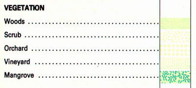
Data produced by assigning observations into unranked categories are said to be nominal level measurements. Nominal categories can be differentiated and grouped into categories, but cannot logically be ranked from high to low (unless they are associated with preferences or other exogenous value systems). For example, one can classify the land cover at a certain location as woods, scrub, orchard, vineyard, or mangrove. One cannot say, however, that a location classified as "woods" is twice as vegetated as another location classified "scrub." The phenomenon "vegetation" is a set of categories, not range of numerical values, and the categories are not ranked. That is, "woods" is in no way greater than "mangrove," unless the measurement is supplemented by a preference or priority.
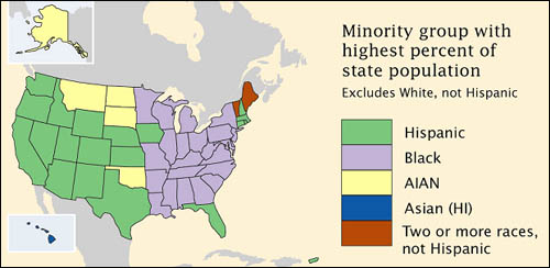
Although census data originate as counts, much of what is counted is individuals' membership in nominal categories. Race, ethnicity, marital status, mode of transportation to work (car, bus, subway, railroad...), type of heating fuel (gas, fuel oil, coal, electricity...), all are measured as numbers of observations assigned to unranked categories. For example, the map below in Figure 3.9.2, which appears in the Census Bureau's first atlas of the 2000 census, highlights the minority groups with the largest percentage of population in each U.S. state. Colors were chosen to differentiate the groups, but not to imply any quantitative ordering.