Try This!
Geocoding in a GIS
Part 3 of 3 in the TIGER/Line Shapefile Try This! series is not interactive, but instead illustrates how the address ranges encoded in TIGER/Line Shapefiles can be used to pinpoint (more or less!) the geographic locations of street addresses in the U.S.
The process of geocoding a location within a GIS begins with a line dataset (shapefile) with the necessary address range attributes. The following image is an example of the attribute table of a TIGER/Line shapefile.
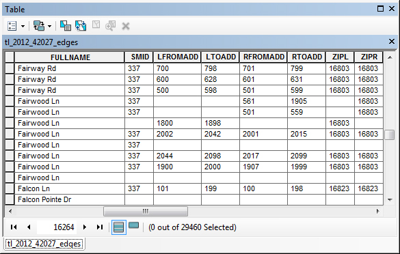
This shapefile contains over 29,000 road segments in total. Note the names of some of the attributes:
- FULLNAME - The street name of the road segment
- LFROMADD - The address number at the beginning of the road segment on the left side of the street
- LTOADD - The address number at the end of the road segment on the left side of the street
- RFROMADD - The address number at the beginning of the road segment on the right side of the street
- RTOADD - The address number at the end of the road segment on the right side of the street
- ZIPL - The ZIP code area that is present to the left side of the road segment
- ZIPR - The ZIP code area that is present to the right side of the street
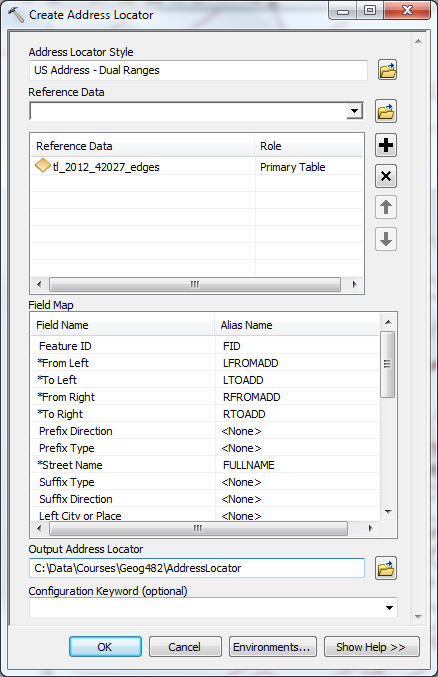
Next, the GIS software needs to know which of these attributes contains each piece of the necessary address range information. Some shapefiles use different names for their attributes, so the GIS can't always know which attribute contains the Right-Side-From-Address information, for example. In ArcGIS, for example, something called a Locator is configured that maps the attributes in the shapefile to the corresponding piece of necessary address information. The image below illustrates what this mapping looks like:
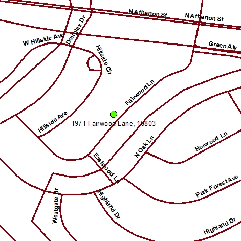
We are now ready to find a location by searching for a street address! Let's geocode the location for "1971 Fairwood Lane, 16803".
When an address is specified, the GIS queries the attribute table to find rows with a matching street name in the correct ZIP code. Also, the particular segment of the street that contains the address number is identified. Figure 4.8.3 shows the corresponding selection in the attribute table:
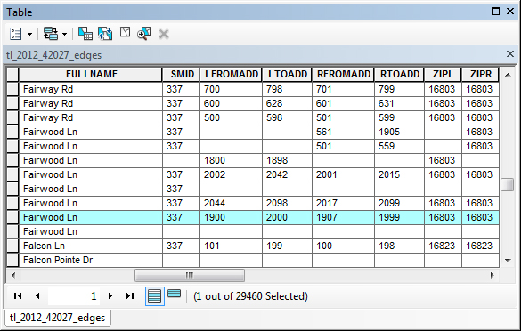
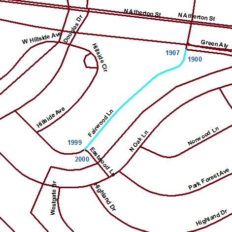
Figure 4.8.4 shows the corresponding road segment highlighted on a map. The To and From address values for the road segment have been added so you can see the range of addresses.
Finally, the GIS interpolates where along the road segment the value of 1971 occurs and places it on the appropriate side of the street based on the even/odd values indicated in the attribute table. Figure 4.8.5 shows the final result of the geocoding process:
The accuracy of a geocoded location is dependent on a number of factors, including the quality of the line work in a shapefile, the accuracy of the address range attributes of each road segment, and the interpolation performed by the software. As you may see in the following section, different geocoding services may provide different location results due to the particular data and procedures used.