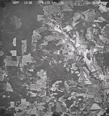
Not counting human vision, aerial photography is the earliest remote sensing technology. A Parisian photographer allegedly took the first air photo from a balloon in 1858. If you are (or were) a photographer who uses film cameras, you probably know that photographic films are made up of layers. One or more layers consist of emulsions of light-sensitive silver halide crystals. The black and white film used most often for aerial photography consists of a single layer of silver crystals that are sensitive to the entire visible band of the electromagnetic spectrum. Data produced from photographic film and digital sensors that are sensitive to the entire visible band are called panchromatic.
When exposed to light, silver halide crystals are reduced to black metallic silver. The more light a crystal absorbs, the darker it becomes when the film is developed. A black and white panchromatic photo thus represents the intensities of visible electromagnetic energy recorded across the surface of the film at the moment of exposure. You can think of a silver halide crystal as a physical analog for a pixel in a digital image.

Experienced film photographers know to use high-speed film to capture an image in a low-light setting. They also know that faster films tend to produce grainier images. This is because fast films contain larger silver halide grains, which are more sensitive to light than smaller grains. Films used for aerial photography must be fast enough to capture sharp images from aircraft moving at hundreds of feet per second, but not so fast as to produce images so grainy that they mask important details. Thus, the grain size of a photographic film is a physical analog for the spatial resolution of a digital image. Cowen and Jensen (1998) estimated the spatial resolution of a high-resolution aerial photograph to be about 0.3-0.5 meters (30-50 cm). Since then, the resolution that can be achieved by digital aerial imaging has increased to as great as 0.05 meters (5 cm). For applications in which maximum spatial and temporal resolutions are needed, aerial (as opposed to satellite) imaging still has its advantages.
Earlier in the text, you learned (or perhaps you already knew) that the U.S. National Agricultural Imagery Program (NAIP) flies much of the lower 48 states every year. Organizations that need more timely imagery typically hire private aerial survey firms to fly custom photography missions. Most organizations would prefer to have image data in digital form, if possible, since digital image processing (including geometric and radiometric correction) is more efficient than comparable darkroom methods, and because most users want to combine imagery with other data layers in GIS databases. Digital image data are becoming a cost-effective alternative for many applications as the spatial and radiometric resolution of digital sensors increases.