Try This!
This activity involves using the USGS EarthExplorer system to find Landsat data that corresponds with the scene of the Denver, Colorado area illustrated earlier. At the end of the experiment, you can search for data in your own area of interest.
EarthExplorer is a Web application that enables users to find, preview, and download or order digital data published by the U.S. Geological Survey. In addition to Landsat MSS, TM, and ETM+ data, AVHRR, DOQ, aerial photography, and other data are also available from the site.
Begin by pointing your browser to EarthExplorer. (Clicking on this link opens a separate window featuring the EarthExplorer website. You may enlarge the window and work within it, or if you prefer, open a separate browser and type in the EarthExplorer Web address.)
- You don't have to register to use EarthExplorer, unless you want to download data.
- In order to uncompress the data files that you might choose to download, you will need an application that is capable of uncompressing a .tar.gz file. One such application is 7-Zip. You can download 7-Zip here.
1. Enter your search criteria
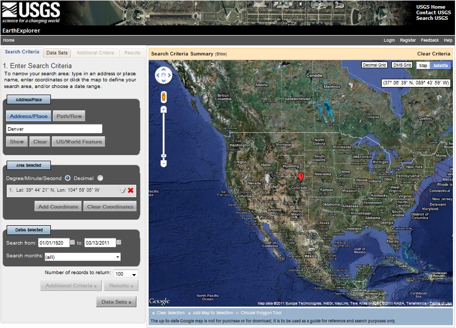
- Enter Address/Place name: Denver on the first tab Search Criteria.
- Click the Address/Place name Show button.
- "Denver, CO, USA" is returned (as are several other matches on the "Denver" string), along with latitude and longitude coordinates needed to perform a spatial search of EarthExplorer's database. Click on the Denver, CO, USA choice from the list. It may take several seconds, but the display on the left will change to show only the location coordinates for Denver, CO, and a location marker will appear on the map. See below.
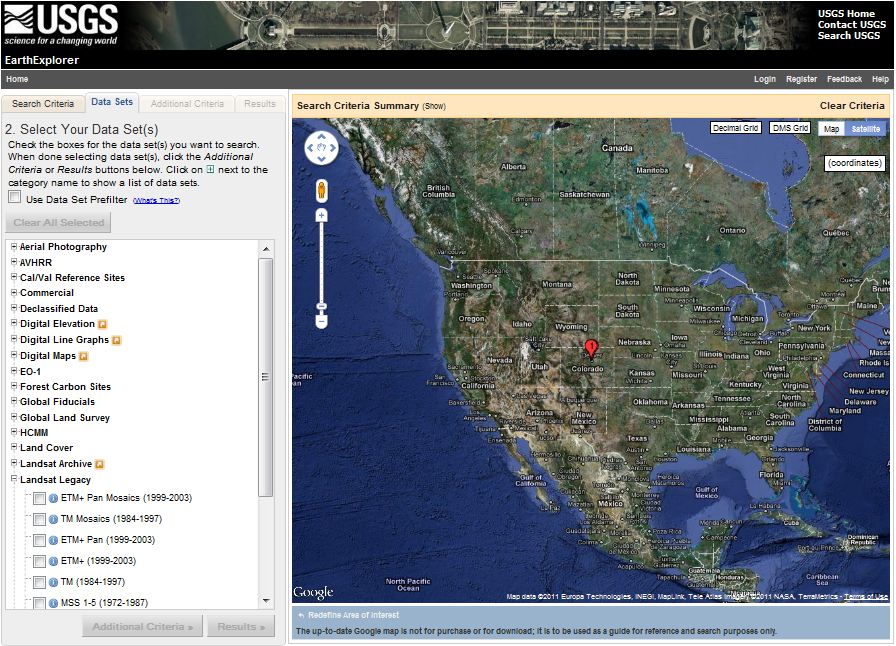
2. Select your Data Set(s) Our objective is to find the Landsat ETM+ data that is illustrated, band by band, in the previous page.
- In the frame in the left side of the window, click on the second tab Data Sets
- Mark the checkbox to select ETM+ (1999-2003) under Landsat Legacy.
3. View your Results
- The list of Results will show up on the fourth tab.
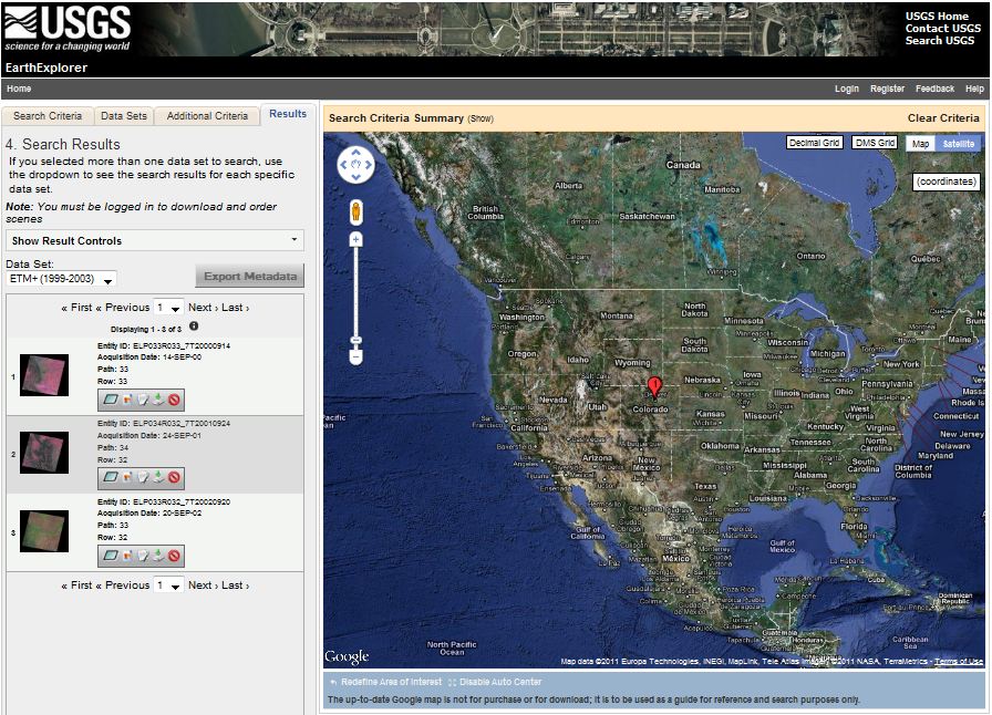
- Click the image icon for one of the results to show a full display of that result, including attribute information.
- Click the "Show Browse Overlay" icon or the "Show Footprint" icon to bring up and overlay or footprint over the Google map.
- Click "Download" to dowload a specific result. (NOTE: You will need to login or register and then login to the USGS to download data.)
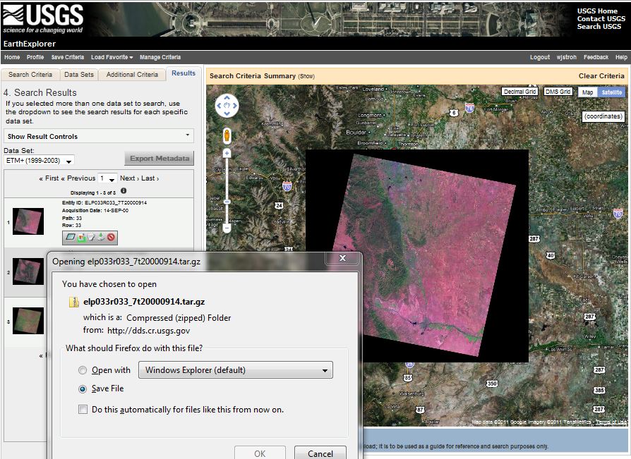
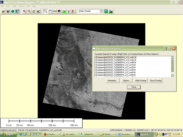
Downloaded data arrives on your desktop in a double-compressed archive format. For instance, the archive I downloaded is named "elp033r033_7t20000914.tar.gz" To open and view the data in Global Mapper, I had to first extract the .tar archive from the .gz archive, then extract .tif files from the .tar archive. I used the 7-Zip application, that I mentioned above, to extract the files: right-click on an archive, then choose 7-Zip > Extract files.... The screen capture below shows one of the eight Landsat images (corresponding to the eight ETM+ bands) in Global Mapper.
Use EarthExplorer to find Landsat data for your own area of interest.
- Use the Redefine Criteria link at the bottom of the Results page to begin a new search. Try searching for your hometown or a place you've always wanted to visit.