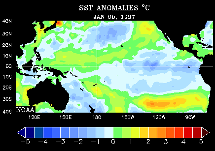
Remotely sensed data play crucial roles in global change research. One example is data produced by radar altimetry, which are used to monitor the global climatological phenomenon called El Niño. El Niño is the colloquial name for a periodic weakening of the trade winds and warming of the surface layers of the eastern and central equatorial Pacific Ocean. El Niño events occur irregularly at intervals of 2-7 years, and typically last 12-18 months. Poorly understood teleconnections between the ocean and the atmosphere result in altered regional precipitation patterns that sometimes include severe floods. The animation below illustrates the changes in sea surface temperatures that accompanied the 1997-98 El Niño event.
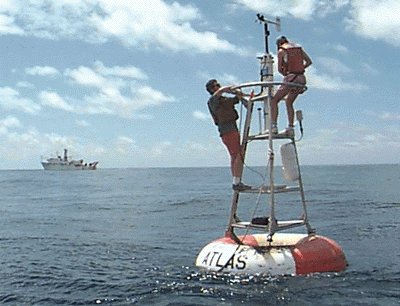
Active remote sensing provides an alternative to the expensive and tedious business of measuring sea surface temperatures directly at many locations throughout the Pacific Ocean.
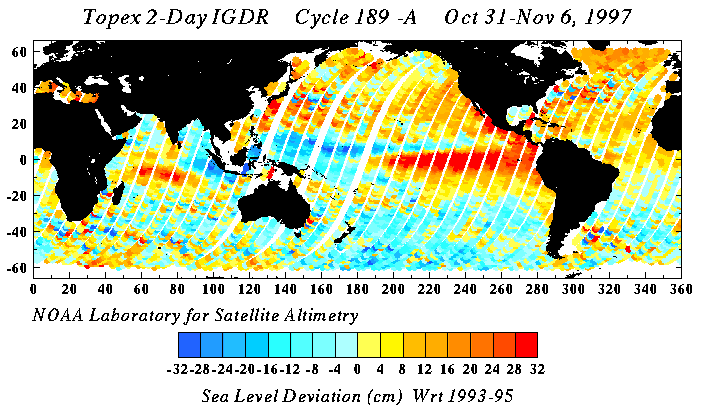
From 1992 through 2005, the TOPEX/POSEIDON radar altimeter measured heights of the ocean surface with centimeter accuracy. The sensor transmitted and received longwave energy at 6 km intervals along ground tracks spaced 315 km apart. The satellite that carried the sensor completed a polar orbit every 112 minutes at an altitude of 1,335 km, passing over the same point every 10 days. Sea level deviations (differences between the geoid and measured sea level) were determined from measurements of the height of the ocean surface relative to the sensor, which is calculated from the time difference between the transmission and return of signals reflected from the ocean surface. Sea surface temperature can be inferred from deviations of sea surface heights relative to long-term mean values.