Chapter 5 Overview
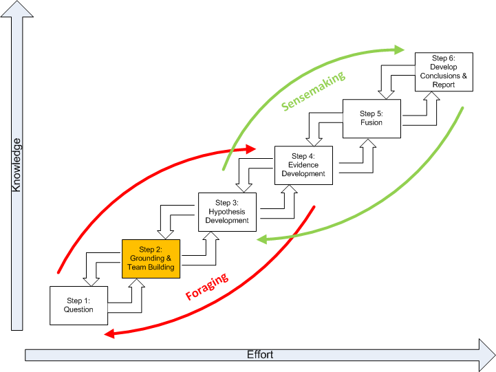
This chapter discusses the second step of the SGAM, highlighted below in gold, Grounding in the Problem and Team Building.
Obviously, an analyst must have a base of knowledge to work with before starting analysis. The significance of geospatial information is always a joint function of the nature of the information and the context in which it is interpreted. When dealing with a new and unfamiliar subject, the uncritical and relatively non-selective accumulation and review of information is an appropriate first step. This is a process of absorbing geospatial information, not analyzing it. Another view of this process is as a problem reduction effort. In this view, a problem is decomposed into a structured set of subproblems. Each subproblem is subject to further decomposition until the subproblems produced are investigatable with given techniques.
Developing an understanding of the analytic problem domain is often referred to as “grounding.” Why ground yourself in the problem? It should be a frightening prospect for a geospatial analyst to develop intelligence without a firm understanding of an analytic problem domain. Grounding is an act of information foraging ,which is a tradeoff among three kinds of processes. Analysts tended to begin with a broad set of documents and then proceeded to narrow that set down into successively smaller, higher-precision sets of data before reading and analyzing the documents. Generally, there are three processes that tradeoff against one another under deadline or data overload constraints:
- Exploring or monitoring more of the space, and by this means increasing the amount of new geospatial information brought into the analysis process. In geospatial terms, this corresponds to increasing geospatial data and information relating to the question being interpreted. There are generally three major categories of results from this search ( according to Kludas, 2007 [1]):
- Skimmed results- many diverse and relevant items
- Chorus of results- many similar and relevant items
- Dark Horse results- an unusually accurate single source
- Enriching (or narrowing) the set of items that have been collected for analysis. This is a process in which smaller, higher-precision sets of documents are created. This is, to a great extent, a problem reduction effort where the problem is decomposed into a structured set of subproblems. Each subproblem is subject to further decomposition until the subproblems produced are investigatable with given techniques.
- Exploiting the items in the set, by which we mean more thorough reading of documents, using geospatial visualization tools (such as GIS) to extract information, generate inferences, notice patterns, etc.
Grounding is the foundation of future hypotheses. In a practical sense, grounding is the confirmation and discovery of geospatial information about the problem. Grounding is related to the problem of how patterns get their meaning. In Geospatial Intelligence, grounding is developing the ability to see a pattern by the inner eye. This is to say, patterns on maps and images only acquire meaning when they are observed by a recipient that is self aware. The analyst needs an explicit theoretical and methodological grounding in the problem with special attention to the contexts in which the patterns occur. This allows knowledge to be focused as specifically as possible to the context of the problem. In recent years, the confirmation and discovery of geospatial information and a “knowledge team” have become inseparable because of the:
- complexity of space-time problems;
- requirement for multidisciplinary input;
- need to share more information more quickly;
- growing dispersion of expertise, and;
- need to identify and evaluate the validity of alternative models.