Many digital data products have been derived from the USGS topographic map series. The simplest of such products are Digital Raster Graphics (DRGs). DRGs are scanned raster images of USGS 1:24,000 topographic maps. DRGs are useful as backdrops over which other digital data may be superimposed. For example, the accuracy of a vector file containing lines that represent lakes, rivers, and streams could be checked for completeness and accuracy by plotting it over a DRG.
DRGs are created by scanning paper maps at 250 pixels per inch resolution. Since at 1:24,000 1 inch on the map represents 2,000 feet on the ground, each DRG pixel corresponds to an area about 8 feet (2.4 meters) on a side. Each pixel is associated with a single attribute: a number from 0 to 12. The numbers stand for the 13 standard DRG colors.
Like the paper maps from which they are scanned, DRGs comply with National Map Accuracy Standards. A subset of the more than 50,000 DRGs that cover the lower 48 states have been sampled and tested for completeness and positional accuracy.
DRGs conform to the Universal Transverse Mercator projection used in the local UTM zone. The scanned images are transformed to the UTM projection by matching the positions of 16 control points. Like topographic quadrangle maps, all DRGs within one UTM zone can be fit together to form a mosaic after the map "collars" are removed.
Check out USA Topo Maps, a web map that provides a seamless digital compilation of USGS topographic maps for the entire United States. This is a multi-scale web map hosted in ArcGIS Online. As you zoom in, you'll view different scales of digitized topographic maps. The largest-scale images are built from USGS DRGs.
Try This!
Explore a DRG with Global Mapper
You can use a free software application called Global Mapper to investigate the characteristics of a USGS Digital Raster Graphic. Originally developed by the staff of the USGS Mapping Division at Rolla, Missouri as a data viewer for USGS data, Global Mapper has since been commercialized but is available in a free trial version. The instructions below will guide you through the process of installing the software and opening the DRG data.
Note: Global Mapper is a Windows application and will not run under the Macintosh operating system.
Global Mapper Installation Instructions
Skip this step if you already downloaded and installed Global Mapper.
- Navigate to globalmapper.com or search the Internet for “Global Mapper”
- Download the trial version of the software.
- Double-click on the setup file you downloaded to install the program.
- Launch Global Mapper.
Downloading and exploring DRG data in Global Mapper
- First, create a directory called "USGS Data" on your hard disk, where you can file your materials.
- Download the DRG.zip data archive. The ZIP archive is 2.7 Mb in size and will take approximately 35 seconds to download via high-speed DSL or cable, or about 9 minutes and 35 seconds via 56 Kbps modem.
- Now, decompress the archive into a directory on your hard disk.
- Open the ZIP archive you downloaded.
- Extract all files in the ZIP archive into a known subdirectory.
- Open your DRG in Global Mapper.
- Choose File > Open Data File(s)..., then navigate to the subdirectory into which you extracted the DRG files.
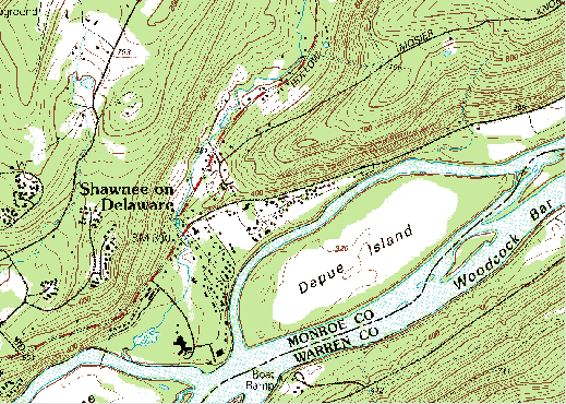
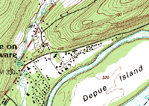
- Open the file 'bushkill_pa.tif'
- Notice that as you glide the magnifying glass cursor over the DRG, the UTM (NAD 27) and geographic coordinates of the cursor's position change in the lower right-hand corner of the window. This tells you that the DRG is in fact georeferenced.
- Experiment with Global Mapper’s tools. Use the Zoom and Pan tools to magnify and scroll across the DRG. The Full View button (the one with the house icon) refreshes the initial full view of the data set.
- The Measure tool (ruler icon) allows you to not only measure distance as the crow flies but also to see the area enclosed by a series of line segments drawn by repeated mouse clicks. Note again the location information that is given to you near the bottom of the application window.
Certain tools, e.g., the 3D Path Profile/Line of Sight tool, are not functional in the free (unregistered) version of Global Mapper.
- To view an excerpt from the DRG metadata, navigate to Tools > Control Center, then click the Metadata button.