Climate
Climate
The climate of a particular coastal area plays a significant role with regard to the biological activity, weathering, and severity of storms that can impact the coast. Read on to learn about the way these factors influence coastlines.
Biological Activity
Biological Activity
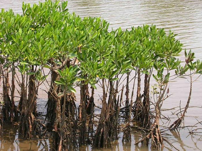
Warm, low-latitude climates encourage the growth of lush vegetation in comparison to relatively colder, high latitude climates. For example, in warm coastal climates, thick, extensive platforms of mangrove forests or salt-tolerant grasses can develop if the substrate is suitable for the development of good root zones, and the plants are not exposed to high-energy waves or tidal conditions that can uproot them. Although a wide range of coastal plant species exists even within high-latitude coasts, the species that occupy warm climates will tend to be more organically productive with longer growing seasons.
Along coasts where vegetation is highly productive, this vegetation can constitute a significant contributor to the coastal sediment budget. When plants of the coastal zone die, the fragments of the plant, also known as organic detritus, can accumulate and help incrementally add elevation to the land surface. In some coastal areas, this process of accumulating organic debris derived from the plants has been suggested to be a major contributor to the health of coastal marshes and their ability to maintain a suitable elevation above sea level as sea level rises.
Vegetation plays another important role along some coasts because extensive root systems help to stabilize environments such as coastal marshes and dunes and can reduce the amount of wave and wind erosion that can take place. The presence of extensive coastal plant communities also can help reduce the destructive power of storm surges and tsunamis to inland areas and coastal infrastructure because the plants act to buffer the energy of these phenomena to the more inland areas.
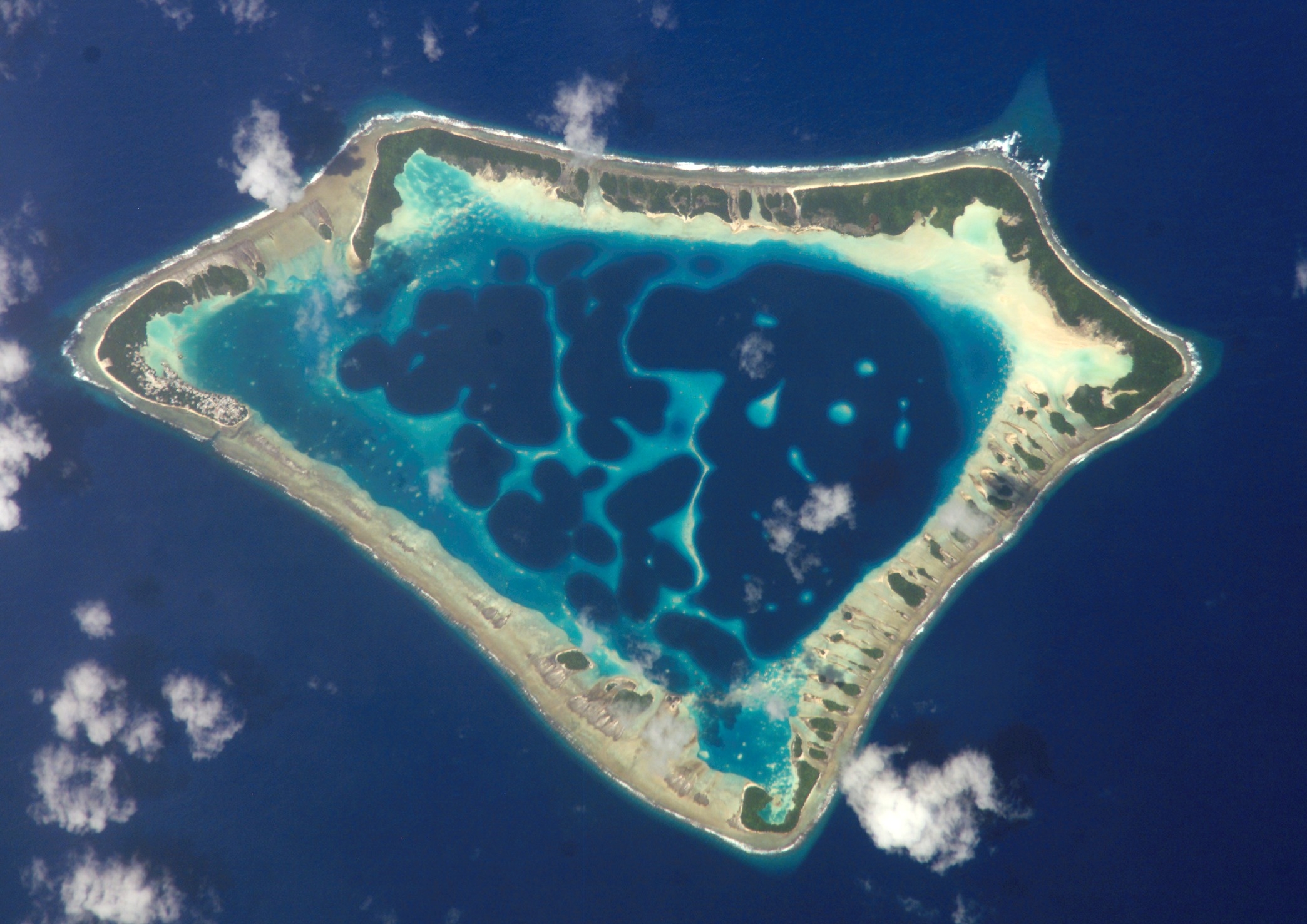
Some coasts are also fringed by coral reefs. The most extensive and largest reefs are located in warm ocean waters because corals are temperature-dependent, with optimal growth of most coral reefs taking place in low-latitude climates where ocean waters are warm. Corals produce their hard structure out of the mineral calcium carbonate, as do shelled organisms such as clams, oysters, and snails. All of these organisms can be broken apart or fragmented by marine currents and ultimately contribute sediment to a coast. In some areas of the world, the beaches wholly consist of broken coral and shells.

Weathering
Weathering
Weathering is a term that is used to describe the breakdown of solid rock into particles of sediment such as boulders, sand, silt, and mud, as well as ions that are dissolved in water. Two types of weathering processes are recognized: physical weathering and chemical weathering. Physical weathering refers specifically to the reduction of a volume of rock and or individual particles of sediment into progressively smaller and smaller sedimentary particles through mechanical processes. These mechanical processes include fracturing and disintegration by freezing and thawing, transport by glaciers, or even rolling along a shoreline by waves. Chemical weathering, on the other hand, refers to the chemical breakdown of minerals in rocks and the production of new minerals from the dissolved ions. Most chemical reactions proceed fastest when temperatures are elevated and also when there is an abundance of water. In warm wet climates, chemical weathering proceeds fastest, so one would expect that the same rock would chemically weather much faster in a tropical rain forest rather than on an arctic tundra. It is also important to note that because of the nature of chemical reactions in warm, humid climates, there is a more significant production of very fine sediment.
Recommended reading for weathering
- Wikipedia article: Weathering [6]: This article gives an explanation of chemical weathering.
- Watch an informative video on chemical weathering.
Video: Chemical Weathering-Hommocks Earth Science Department (4:04)
Storms
Storms
Large storms in coastal settings typically produce strong winds that can create larger than normal waves. Increased wave heights, and thus the energy associated with the waves, can very quickly change the overall morphology of coastal environments that are exposed to the storm. Even relatively smaller-scale storms, such as thunderstorms, can, with strong enough winds, create substantial changes to a beach or other environments within the coastal zone if they occur with a high frequency during the course of several days or weeks.
Wind can also modify coastal environments. For example, strong winds steadily blowing across a fine-grained beach and dune system for several days can lead to the transport of some of that sand from the beach and dunes and its deposition elsewhere. As a result, environments exposed to strong winds during the course of several days can be reduced in elevation through a process known as deflation.
There is a wide range of scale when it comes to discussing storms. Although capable of inducing change, it is not the random small-scale thunderstorm or even weeks of continuous thunderstorms that cause the most modification to coasts. The most powerful storms to potentially impact a coast are tropical cyclones. We will introduce these systems in the following, but also exploring them in more depth in Modules 5 and 6.
Tropical Cyclones
Tropical cyclones are low-pressure rotating weather systems that are created in the atmosphere by the transfer of heat from the ocean basins to the atmosphere. These low latitude systems (23.5 N and S of the equator) spin clockwise in the Southern Hemisphere and counterclockwise in the Northern Hemisphere and are referred to by different names depending on the ocean basin. In the Atlantic Ocean, they are known as tropical storms and hurricanes when the wind speed exceeds 119 km/hr (75 miles/hr), whereas, in the western Pacific Ocean, they are referred to as tropical cyclones and typhoons respectively. In both cases, tropical cyclones have the capability to generate very large, high, waves that have the potential to devastate the natural environments of a coastal zone and any human infrastructure that is present where the storms make landfall. Another critically important component to understand about tropical cyclones is the storm surges, or elevated levels of sea level, that occur as these low-pressure systems move through an ocean basin. Very large storm surges can be created depending upon the morphology of the coast, the gradient and width of the neighboring continental shelf, the strength of the storm, and the rate of forward motion of the storm. For example, a storm surge in excess of 7 m (25 feet) was created along parts of the northern Gulf of Mexico shore by Hurricane Katrina in 2005 and resulted in inland flooding several kilometers from the non-storm-surge shoreline. We will explore these systems in detail in Modules 5 and 6.
Extratropical Storms and Fronts
North of the Tropic of Cancer (23.5 N latitude) and south of the Tropic of Capricorn (23.5 S latitude), extratropical storms and weather fronts dominate as the major storm impact to coastal zones in these regions. Although not capable of packing the full magnitude of punch that a hurricane can produce, some storms outside of the tropics can produce wind speeds equivalent to those of weak hurricanes, resulting in very large waves and storm surges along coastal environments.
Northeasters
Along the east coast of North America, the classic example of an extratropical storm system is the Northeaster, which is a storm that tracks from the Midwest of the United States, northeast along the east coast of the United States and into Maritime Canada before being turned eastward into the northern Atlantic basin. The term Northeaster derives from the fact that the winds of these storms are from the northeast within this irregularly shaped but counterclockwise rotating storm system. They occur between late fall through spring when cold arctic air moving southeast comes in contact with warmer air moving north from more southerly latitudes to create a low-pressure system with a cold center (in contrast to a hurricane with a warm center). Although not as strong as hurricanes, northeasters are larger in diameter and can impact three to four times as much shoreline as a very large hurricane. Further, their frequency of occurrence is higher for the east coast of North America with 20 to 40 annually, although only several of these generate severe offshore wave heights greater than 5 meters (16 feet).
Recommended reading for Northeasters
- Wikipedia article: Nor'easter formation: [7] This article provides details of Nor'easter formation.
- USGS article on Northeasters [8]: This article provides a brief description of northeasters.
Fronts
There are numerous other types of weather systems that can affect coastal zones. The most common along the northern Gulf of Mexico is what is known as a front. A front is a zone between two air masses with different temperatures, different levels of humidity, and densities. In the winter, low humidity cold air systems sweep southward across North America and encounter more humid, warmer air over the Gulf of Mexico. A strong southerly flow (winds blowing from south to north) persists along the northern Gulf in the days prior to the arrival of the cold front. These sustained winds blow as much as 30 to 50 km/hr and can generate large waves in the Gulf of Mexico that then travel northward and impact the shore, leading to erosion, deposition, and overall modification of the pre-frontal morphology. As the front passes, the wind direction shifts to blowing from the north, bringing much colder and dryer air. These north winds can similarly reach sustained speeds in excess of 30 km/hr persisting for a couple of days. Because these winds are from the north, they can generate large waves in the bays on the north side of the shorelines and have been shown to be very effective at eroding the marsh and other features on the north-facing shorelines of barrier islands and marsh platforms.