Fritz Kessler, Instructor
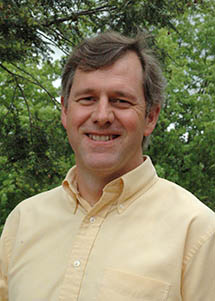
I'm Fritz Kessler, one of the instructors for this course. Here is a little bit of my career history for you to digest.
I began my career in geography at Ohio University (a small state school located in Athens, OH) as a math major. During the summer between my junior and senior years I took an elective course in physical geography. During the first day's lecture the professor described "human" and "physical" as the two spheres of geography. He then added a side-bar comment that geographers also make maps. I was intrigued. After talking with the department's cartography professor later that day I switched majors to geography specializing in cartography. After graduation I worked for the US Geological Survey (USGS) as a Cartographic Technician creating maps and illustrations for various USGS publications. Desirous to advance my cartographic knowledge, I returned to academia and received my MS degree from Penn State. Here, I developed an expert system designed to assist in the selection of an appropriate map projection. My next career stop was a Systems Analyst for Intergraph Corporation in Huntsville, AL. I decided to return to map making and took a position with R. R. Donnelley and Sons in a small cartographic shop in Lancaster, PA. Eventually, I enrolled in a Ph.D. program at the University of Kansas where I studied cartography and geographic visualization.
My professional academic career started as a faculty member at Frostburg State University (FSU) in August 1999. Located in Frostburg, MD, FSU is a very small state school in Western Maryland. While at FSU I taught courses in cartography, cartometrics, surveying, GIS, research methods, statistics, and other geographically related topics. I began teaching part-time through Penn State's World Campus in 2007 where I offered a course in datums, map projections, and coordinate systems. This course is still offered today as GEOG 897K: Map Projections for GIS Professionals. In June of 2015, I resigned my position at FSU and accepted an offer to join Penn State full-time. In addition to GEOG 586, my teaching responsibilities focus on cartography courses (both online and resident students).
I have amassed a solid research and publication record focusing mostly cartographically related topics. Specific research focus includes map projections, cartographic design, and history of cartography. I take on an active role in two cartographic societies: North American Cartographic Information Society (NACIS) and Cartography and Geographic Information Science (CaGIS).
Thank you for joining the course and good luck!
Meet Fritz Kessler, instructor of GEOG 597 (1:16 minutes).
FRITZ KESSLER: Hello. I'm Professor Fritz Kessler. I'm one of the MGIS faculty that teach a variety of online courses through the MGIS program. I also teach a mix of residential courses through the geography department. Most of my course topics deal with cartography and spatial statistics. I came about to these topics of interest because of my mathematical background during my undergraduate schooling. I gravitated towards geography because I found out that cartography was inherently mathematical. And one of the topics in particular, map projections, is very mathematical, and there was a natural inkling for me to take up cartography because of that mathematical association. When I'm not doing cartography or researching cartography or teaching, I like to play the banjo. I play a lot of bluegrass bands and festivals and so forth. I also play guitar and mandolin. I look forward to meeting you in a future course. And if you have any questions or reach out to me, I'd be most welcome to hear from you. Thank you.
Beth King, Instructor
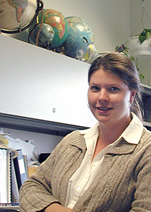
I am a Senior Lecturer and the Assistant Program Manager for Online Geospatial Education in the Dutton e-Education Institute. I have been teaching for Penn State since 2000. Half of my time is spent teaching and half of my time is working with current and prospective students. Prior to coming to Penn State, I worked for a GIS group in an engineering firm as a project manager for water/wastewater GIS conversion and E911 projects.
Meet Beth King, instructor of GEOG 597 (1:31 minutes)
BETH KING: Hi. I'm Beth King. I'm a faculty member in our Online Geospatial Education programs. Prior to coming to Penn State, I worked in the GIS group of an engineering firm. In our programs, I teach some of the introductory GIS classes. I also co-teach our study abroad class in the MGIS program. I'm the assistant program manager in our master's program. And so, I help our master's students stay in touch with their advisors and help them to schedule classes. So, I might be in touch with you that way.
I'm standing in front of the Nittany Lion Shrine, which is one of the most iconic landmarks at Penn State. When our online students come to campus for graduation, they often come and get a picture with the Lion Shrine. Across the street, which you can't see, is Rec Hall. That's another landmark at Penn State. It's been here since 1929. It's where the Nittany Lion Wrestling Team wrestles. And I'm a pretty avid Penn State wrestling fan.
Another personal thing about me is that I'm on the board for a nonprofit group that helps aspiring Zambian teachers. So we provide full scholarships to students in Zambia who often can't pay for college themselves. So that's a passionate thing of mine, and we're going to be traveling back to Zambia soon, which is one of my favorite places on earth.
I hope to be in touch with you at some point. If I don't see you in class, I hope I'll have some conversations with you about our master's program.