Lesson 6: GEOINT and National Security
6.1 Overview
This lesson serves two purposes. First, it completes the discussion of national security aspects of geospatial intelligence by focusing on the evolution of military applications of geographic technology. Second, it allows us to critically examine so called "revolutions in military affairs" or RMAs and consider how they do or do not impact GEOINT.
Geographic techniques have supported warfare since shortly after Cain slew Abel and mapped out his next moves. Cartographers provided increasingly sophisticated maps to support military activities, while military demand spurred the development of the discipline. This symbiotic relationship between geographic techniques and military activities was very evident in the development of the sub-disciplines and technologies of remote sensing and global positioning systems. It is somewhat less evident in the development of Geographic Information Systems (or is it?)
To get ready for this topic, watch the following video from the Geospatial Revolution Series.
Video: Geospatial Revolution / Episode Three, Chapter Two: Waging Modern War (4:18)
MIKE LEE: Geospatial intelligence, to the war fighter, is everything-- being able to lay the maps down to get you spatially oriented and then layering imagery on the top of it in a digital world so that you can see where you are and what you're doing.
LAWRIE JORDAN: With all this technology available to everyone, the real enemy is time.
OFFICER: That's a direct order. Do it now.
MIKE LEE: We have to turn inside the enemy's decision cycle. We have to be able to make the right decision faster than he does.
LETITIA LONG: If you're going to use precision-guided munitions, you need very precise coordinates.
LAWRIE JORDAN: We cannot have collateral damage to anything that's important, safe, and precious.
LETITIA LONG: We use geospatial information for route planning. Special forces need to know the best way to get into a compound and get out.
SOLDIER: There you go. Just lay it down.
MICHAEL A. HARPER: The Buckeye Program collects, processes, and disseminates high resolution terrain data. We use an electro-optical camera along with a lidar sensor. We fly it over major routes to extract detailed features of what they're going to encounter on their operation. So how high are the walls? How wide is the road? What's the depth of the ditches?
LETITIA LONG: Where are they going to land their helicopters, so they're not seen, so they're not heard? We try to give them multiple routes. Is the terrain flat so that they can land easily? We're looking for emplacements of IEDs.
[INTERPOSING VOICES]
[EXPLOSIONS AND GUNFIRE]
LAWRIE JORDAN: Improvised explosive devices, IEDs, are very difficult to detect.
MICHAEL A. HARPER: We might fly a sensor down a road at one date and time-- get a view of what that surface looks like-- and then the next day or even hours later, fly over that same route and then see what's been disturbed, where have IEDs been planted. You can monitor an area continuously to see who planted it, where did they leave from, how'd they get there.
LETITIA LONG: You have to understand the hearts and minds. Often, what is important to the people relates to the earth, and the earth's feature, and the geography of the earth.
MAN: [SPEAKING ARABIC]
MICHAEL A. HARPER: The importance of human geography and human terrain is really in a soldier understanding that aspect of his environment-- understanding the culture that he's operating in.
MAN: [SPEAKING ARABIC]
ELIZABETH LYON: Different aspects of society, culture, economic systems-- all of these pieces translate onto the physical geography.
MAN: [SPEAKING ARABIC]
ELIZABETH LYON: We look at languages that are spoken in one neighborhood versus another neighborhood. Understanding an education level-- we put it onto a map to help explain the complexities. Really fine-grained details, depending on what the commander needs.
EDWARD COPE: How can we understand what's important to them so that we're not just doing things that we think are important, but may be totally inconsistent with their value systems? That's the biggest challenge.
MICHAEL A. HARPER: We're putting them in harm's way. We owe it to our soldiers to provide them with the best information that all of this technology is capable of providing.
The American Association of Geographers [5] commissioned two books to celebrate the centennial of the organization in 2004. These books were given as gifts to each of the 5,000 participants in that year's annual meeting in Philadelphia, PA. You will be asked to read a chapter of one of these books, Geotechology, the U.S. Military, and War. This chapter is based entirely on open-source documents. The sections on current national technical systems were based on open-source information from the Federation of American Scientists. Some of the GEOINT practitioners may roll their eyes at inaccuracies. If there are any--do not tell us. For our purposes, this is the best information we have and all we need to know.
The chapter is a history of the evolution of geographic technologies and their contributions to military activities. The chapter also contends that geographic technologies fundamentally underpin the so-called "Revolution in Military Affairs" (RMA). This is a very debatable point, and we will have some fun doing just that. The RMA concept is somewhat out of favor in military academic circles, but a different major discussion addressed the related concept of "Network Centric Warfare (NCW)." I will ask you to consider whether the NCW is still worth discussing, and how it relates to geospatial intelligence. We will also look at an alternative view provided by P.W. Singer in Wired for War that posits the RMA is really all about robots. We will then look at the current discussion about the role of artificial intelligence coupled with ground, air, and sea "killer robots" and the role GEOINT might play.
Our final topic on future applications of GEOINT is actually up to the students. This topic will provide an opportunity for you to educate me and your classmates on future applications based on your research and experience. We are at a transitional point in history with the end of OIF and OEF, and apparently a return to competition and potential conflict with near-peer competitors such as Russia and China (or proxies such as Ukraine, Israel, and Taiwan). Consider how all of this will affect Geospatial Intelligence, and how this course should reflect those potential changes. We look forward to your feedback on this to help us with future revisions to keep this course current.
Lesson Objectives
At the end of this lesson, you will be able to:
- analyze the evolution of military applications of GIS&T from 19th Century to the present (including cartography, remote sensing, GIS, GPS, and simulations/modeling);
- critique the idea that GIS&T underpins the so-called "Revolution in Military Affairs" as articulated by Schneider;
- analyze network centric warfare, military robotics, and the application of military AI (to include the Replicator Initiative) and evaluate and explain the role of GEOINT in the future;
- speculate on future applications of geospatial intelligence for national security.
Questions?
If you have any questions now or at any point during this week, please feel free to post them to the GEOG 882 - General Discussion Forum in Canvas.
6.2 Checklist
Lesson 6 will take us one week to complete. Please refer to the Calendar in Canvas for specific time frames and due dates. Specific directions for the assignments below can be found within this lesson.
Complete the following steps to complete Lesson 6:
- Work through Lesson 6 in this website.
- Read:
- "Geotechnology, the US Military, and War [6]" in Geography and Technology (Pages 401-427) (PSU Login required)*
- "The Big Cebrowski and the Real RMA: Thinking About Revolutionary Changes in Technologies" in Wired for War (Chapter 10, Pages 179-204) (located in Canvas)*
-
"The State of Artificial Intelligence and Machine Learning (AI/ML) in the GEOINT Community and Beyond" from the US Geospatial Intelligence Foundation (USGIF) (located in Canvas)*
-
"What is Network-Centric Warfare?" from Naval Post. (located in Canvas)*
-
"Human intel vs. technology." from The Washington Times. (located in Canvas)*
-
"Battle Networks and the Future Force, Part 2: Operational Challenges and Acquisition Opportunities." from CSIS Briefs. (located in Canvas)*
-
"Unpacking the Replicator Initiative at the Defense News Conference" from U.S. Department of Defense. (located in Canvas)*
- View all videos unless noted as optional
- Participate in Lesson 6 - GRADED Discussion Forum (#2).
* Students who register for this Penn State course gain access to assignments and instructor feedback, and earn academic credit. Information about Penn State's Online Geospatial Education programs is available at the Geospatial Education Program Office [7].
6.3 Evolution of Military GIS and T
Before we get too deeply into the topic at hand, consider viewing the following videos about the history of remote sensing. The videos were produced by the American Society for Photogrammetry and Remote Sensing (ASPRS) in celebration of their 75th anniversary and in preparation for a full length documentary on Remote Sensing. The videos are also available on YouTube at: The American Society for Photogrammetry and Remote Sensing [8].
Video: Evolution of Analog to Digital Mapping (3:41)
[MUSIC PLAYING]
ROY MULLEN: Early map preparation was all by foot.
WILLIAM A. RADLINSKI: You had to go and walk the land.
ALFRED O. QUINN: Well, I'd never heard of photogrammetry before.
MORRIS THOMPSON: What is a stereoplotting instrument?
ROY MULLEN: Oh, there were many things--
WILLIAM A. RADLINSKI: State-of-the-art cameras.
ROY MULLEN: Various multiplex systems.
ALFRED O. QUINN: The Fairchild system--
FREDERICK DOYLE: The Kelsh plotter projector photographed from a glass plate. We went from optical systems to mechanical systems.
MARILYN O'CUILINN: With every generation, the resolution got better and the geometric fidelity of the lenses got better.
WILLIAM A. RADLINSKI: We got into space imagery early on.
MARILYN O'CUILINN: There were the analytical stereoplotters.
ROY MULLEN: Computers came along as a tool for design.
MARILYN O'CUILINN: And then forward image motion compensation. We went to softcopy photogrammetry.
ROY MULLEN: And digital orthophotography.
MARILYN O'CUILINN: And then, of course, the digital cameras.
JACK DANGERMOND: This database wasn't about money or about people. It was about geographic information systems.
ROY MULLEN: Because of the ability to digitize directly, photogrammetry, as we knew it, reached its apex of evolution.
MARILYN O'CUILINN: 20 years ago, you would've seen monster pieces of metal.
WILLIAM A. RADLINSKI: In the world today, it's almost obsolete. Anybody can get a map just by turning on his computer and googling it.
ROY MULLEN: You put it into your GPS systems that use a base map. It's universally used throughout the world now.
MARILYN O'CUILINN: And the appetite for that sort of digital data is almost insatiable.
[MUSIC PLAYING]
Knowledge Check
Prepare for the quiz by answering the following questions.
Video: Aerial Survey Pioneers (2:56)
[TYPEWRITER KEYS CLACKING]
JIM LIVING: Back in 1923, Talbert Abrams bought an airplane, and he was barnstorming. And he found out that people would pay him more to take pictures of their farms and buildings than they would to go for a ride in the airplane. It was people like him that started this whole industry.
MO WEINBERG: Map makers, topographers from the four different sections of the country would bring about a revolution in mapping
MORRIS THOMPSON: They were in an airplane, open cockpit, no shelter. After you get the aerial photos, what do you do with them?
MARILYN O'CUILINN: They saw the possibilities of mapping from the air.
WILLIAM A. RADLINSKI: Most of the farmers didn't know how many acres they had, so we would determine which acreage was tillable, and that was called "mapping."
ALFRED O. QUINN: I tried to get mathematics with Professor Earl Church, but the only course that I could get with him was one known as photogrammetry.
DON LAUER: I had a plan to play for the army all-star basketball team, but Bob had a vision. He convinced me to go to graduate school. Profound experience.
MORRIS THOMPSON: I only know of one person around here who would still remember so much detail. And he wasn't there when it began, and I was.
[AIRPLANE ENGINES]
[MUSIC PLAYING]
Knowledge Check
Prepare for the quiz by answering the following questions.
Video: Geospatial Intelligence in WWII (1:58)
MARILYN O'CUILINN: Photogrammetry started with the military.
MORRIS THOMPSON: We had a combined TVA-USGS force. When the war started in Europe, we got to wondering about who is next.
MO WEINBERG: Map making was turned over to the Army map service, so that we would map for them.
MORRIS THOMPSON: And where do you suppose we started? China, Japan. Where? Upstate New York.
VIRGINIA LONG: They thought the Germans would invade the United States by way of the Saint Lawrence Waterway.
MORRIS THOMPSON: But that's just the beginning.
WILLIAM A. RADLINSKI: We landed in Normandy and went all the way across Europe, going with the front line. We provided topographic maps for the infantry and to the artillery.
ALFRED O. QUINN: After Pearl Harbor, we computed targets for the Naval bombardment prior to an invasion, so that ships could fire at coordinates.
FREDERICK DOYLE: We made target charts and bomb damage assessment charts for the B29 raids on Japan.
MORRIS THOMPSON: I remember there was one place we were mapping, and then came the news that there's nothing left of it. We were mapping Hiroshima.
ALFRED O. QUINN: Without maps, we'd have been lost in WW II.
Knowledge Check
Prepare for the quiz by answering the following questions.
Video: The Role of Women in the History of Photogrammetry (1:38)
FRANKLIN D. ROOSEVELT: I ask that the Congress declare a state of war.
ALFRED O. QUINN: A lot of our men, of course, were drafted. And so, we went recruiting young ladies.
GWENDOLYN GILL: Mr. Quinn asked if I was interested in the job. I accepted it immediately. I was real glad to get a job with TVA.
VIRGINIA LONG: I was fresh out of college when I was assigned to maps and surveys.
MARGARET DELAYNEY: We did parcels of property land somewhere. It was hush-hush, because we weren't supposed to know what this was.
LOUISE EDWARDS: But when you saw a map that you were compiling in the newspapers, you had a pretty good idea.
MORRIS THOMPSON: They took to it. They learned quickly. Their drafting was nicer than ours.
ALFRED O. QUINN: They had greater patience than most men. They were well-adapted to the photogrammetric equipment.
SID IZLAR: And I said, I'd love to get in the multiplex, because all these girls they were hiring were making more money than I was.
MARILYN O'CUILINN: In ASPRS, being a woman was not much of a barrier.
If you look around now at the USGS, and the civilian side, it's truly becoming one world and this is part of it.
Knowledge Check
Prepare for the quiz by answering the following questions.
Video: Photogrammetry in Space Exploration (2:00)
[MUSIC PLAYING]
FREDRICK DOYLE: Nowadays, sophisticated programs are used to make the maps. It's not the challenge it was when I was working on it. We were making the maps of the moon. I was in charge of the cameras on the Apollo spacecraft. We established 14,000 points. We had used photographs from four different missions. It was an enormous job.
We made a whole series of maps for the ground crews-- what they would see at each station, digital maps and perspective views. A very fancy package.
JACK SCHMITT: Oh, shoot.
EUGENE CERNAN: Oh, you won't believe it.
FREDRICK DOYLE: But when they unloaded the roving vehicle, they broke one of the fenders.
EUGENE CERNAN: Oh, there goes a fender.
FREDRICK DOYLE: They decided to patch the fender.
HOUSTON: OK, we'll need to tape it.
FREDRICK DOYLE: They took our set of maps and duct tape.
EUGENE CERNAN: How do you want those things taped together?
HOUSTON: Allow about an inch of overlap, and tape both sides of them.
FREDRICK DOYLE: So they didn't use them at all on the terrain. When we got back, they said, well, those were the most valuable maps we had ever made.
[LAUGHTER]
ROY MULLEN: There may be one map the saves an untold number of lives. It's intangible what value that is. But think about what was avoided by having had that map to begin with.
ALFRED O. QUINN: The use of digital map data in all kinds of investigations, plans, developments-- I think the whole thing is going to continue.
MARILYN O'CUILINN: It's very exciting to watch the progression, because it does touch so many aspects of our lives.
[MUSIC PLAYING]
Knowledge Check
Prepare for the quiz by answering the following questions.
Lowenthal's text he taught us about the evolution of the US intelligence community and made mention of the role of IMINT. Military applications of geographic techniques can be traced much farther back into history.
Required Reading
Read pages 401-419 of "Geotechnology, the US Military and War" in Geography and Technology - edited by Stanley D. Brunn, Susan L. Cutter, and JW Harrington Jr. Dordrect: Kluwer Academic Publishers. Registered students can access this reading in Lesson 6 in Canvas.
As you read, do some critical thinking and ask yourself the following questions.
- Corson and Palka are not geographic techniques specialist or geospatial intelligence professionals. Why would they be asked to write such a chapter for an American Association of Geographers centennial celebration book entitled Geography and Technology?
- The authors focus on the US military. What additions would there have been had they included the contributions and experiences of other countries? Why did they limit themselves to the US experience?
- The authors are both military academics. What might this chapter have looked like had someone with a different background and cultural filter written it (e.g., a civilian academic remote sensing specialist, a human geographer, an NGA analyst)?
- This chapter was written in 2002 and revised in 2003 for a 2004 publication. What should be added to bring the chapter up to date?
6.4 GIS and T and the "RMA"
Required Reading
Read pages 419-427 of "Geotechnology, the US Military and War" in Geography and Technology.
Read pages 179-204 "The Big Cebrowski and the Real RMA: Thinking About Revolutionary Changes in Technologies" in P.W. Singer's Wired for War.
Registered students can access these readings in Lesson 6 in Canvas.
As you read the chapter by Corson and Palka, do some critical thinking and ask yourself:
- Corson and Palka use limited definitions of the RMA based on Schneider’s approach. Given Singer's approach and other definitions of the RMA, do Corson and Palka's contentions still stand up?
- Corson and Palka are both geographers, writing in a geography book. Singer is a journalist. How might different authors from different communities have envisioned the underpinnings of the RMA? In terms of power relationships, how does the contention that the RMA is underpinned by geographic techniques bolster the discipline of geography and GIS&T, while potentially disadvantaging other disciplines?
- Do you agree with the author’s contentions? Why or why not?
The literature suggests that so-called Revolutions in Military Affairs (RMA) have occurred in the past with the advent of technologies such as gunpowder, railroads, the aircraft carrier, and nuclear weapons. This literature goes on to suggest that a new RMA is emerging, predicated on the idea that a rapid pace of technological innovation is altering the nature of modern warfare and the basic foundations of security. Barry Schneider of the Air War College identifies four new warfare applications that represent this RMA: long range precision strike, information warfare, dominating maneuver, and space warfare. All of these warfare applications are enabled by or associated with "information dominance," also known as "dominant battlespace awareness." The authors of the reading contend that both of those concepts are fundamentally based on geography and geographic technologies.
P.W. Singer, in his New York Times bestselling book Wired for War, contends that the real RMA is the revolution in robotics and the potential implications not only for warfare, but for society and the human species itself. I highly recommend the whole book as it is brilliantly written and really funny (Jon Stewart of The Daily Show noted it "Blew my f***ing mind...This book is awesome"). As you cannot read the whole book here, you will read chapter 10 entitled "The Big Cebrowski and the Real RMA: Thinking About Revolutionary Changes in Technologies."
6.5 Network Centric Warfare
We may or may not be in the midst of a RMA, but Network Centric Warfare (NCW) is a key capability (and vulnerability) for modern armed forces. Below are a few short readings and videos. The first addresses the nature of Network Centric Warfare; the second is a promotional video for Rafael’s “Fire Weaver” battlefield networking system. As critical thinkers, we need to consider multiple sides of issues. The article by Major General (RET) Robert H. Scales from 2005 challenges all the claims about network centric warfare in an urban insurgent environment such as Iraq. The article from the Center for Strategic and International Studies focuses on vulnerabilities of network centric forces and how resilience strategies can mitigate such vulnerabilities. The optional video from the Disruption Network Lab looks at the ethical issues of NCW and poses ethical questions and if the whole concept is really benefitting humanity.
As you read the following articles and watch the videos, do some critical thinking and:
- evaluate the arguments for and against the importance of NCW;
- analyze how the arguments stack up against your experience with NCW;
- analyze how all this talk of NCW impacts the field of geospatial intelligence, and specifically the role, mission, political position, and funding of the NGA.
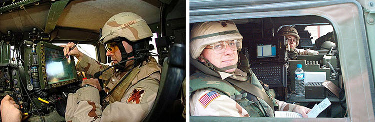
Right: Major Allan Foskett, Chief of Highway Traffic, and SGT Juan Franco of the 450th Movement Control Battalion are shown preparing to enter Iraq
Blue Force Tracker allows Soldiers to maintain situational awareness on the battlefield by knowing their own location, the location of friendly forces (the blue forces), plotting enemy locations, and communicating this all over a network to maintain a common operating picture or COP. The system uses digital maps, remotely sensed imagery, and global positioning system data that are all geospatial intelligence products or techniques.
In the image on the right, MAJ Foskett has his Movement Tracking System (MTS) up. MTS is a satellite based system with a digital map that can be zoomed in and out. A global positioning system transmits the unit location to other users, and the system overlays all or selected users on the digital map. The system also allows for text messaging via satellite, thus overcoming the limitations of terrestrial radio systems. MTS allowed the 450th Movement Control Battalion to maintain in-transit visibility of critical logistics convoys, and to communicate over long distances. Highway Regulating Teams patrolling the main supply route often were able to call in medical evacuation helicopters for units out of radio contact, thus saving many lives. SGT Franco is a digital graphic designer. He took locational data obtained by GPS equipped Highway Regulation Teams and produced a simplified strip map of all the theater logistics nodes in Kuwait and Iraq. His map was widely reproduced and distributed. The map enabled both military and contracted logisticians to support the force.

Read
What is Network-Centric Warfare? [15]
McConoly, R. (2021, June 21). What is Network-Centric Warfare?. Naval Post. https://navalpost.com/what-is-network-centric-warfare/ [15]
Now watch with a critical eye this advertisement from defense contractor Rafael for their Fire Weaver system.
Video: FIRE WEAVER™ - A networked combat system (urban scenario) (4:33)
[Music]
As we all know, today's battlefields are more challenging than ever. We are required to fight in complex urban areas amongst civilian populations and to handle time-critical targets.
The biggest challenge is to close the sensor shooter loops in a very short time, accurately, effectively and efficiently. Today, we at Rafael are proud to present the revolutionary solution to these challenges. Fire Weaver, the world's most mature network detect system. See how in real-time action, the sensors detect and identify the targets.
Fire Weaver selects the optimal shooters and marks the targets to the shooter's site. As a result, all the attack processes are completed simultaneously in an unprecedentedly short time, as we are seeing different shooters from different locations simultaneously neutralizing different targets within a few seconds. This can only be achieved today with Fire Weaver.
Now, let's understand step by step how Fire Weaver actually works. As we see, all the forces are connected through a radio network.
[Music]
The attack process begins with a variety of sensors gathering information in the battlefield. The sensor identifies the target, classifies it and disseminates it through the system.
In the same way, all the other sensors detect and classify the information and disseminate it through the net to all the connected participants.
[Music]
Thanks to Rafael's advanced Computer Vision Technologies, each participant receives very accurate augmentation symbols, so they all see the same targets regardless of their position.
Once the sensors detect and classify the targets, the Fire Weaver core, the brain of the system, goes immediately into action. It calculates all the data and within seconds it chooses the optimal shooter for each target based on such parameters as location, line of sight effectiveness and current ammo status. All that in accordance to the Fire policy. The process can be performed automatically or controlled according to the commander's decision.
As you see, the target is sent from the sensor to the shooter, who sees the target from his point of view on his sight.
The targets are neutralized simultaneously in a very short time with maximum precision, while minimizing damage and avoiding friendly.
Fire Weaver system enables other shooters to neutralize further targets. According to the same operational process, Fire Weaver uses three targeting languages, geocordinate Laser Designation, and Electro Optical Pixel. The system has already been tested in the field, including many to many and live fire scenarios. For the first time, With Fire Weaver, the sensor to shooter loop is closed in seconds instead of minutes.
[Music]
Now read this commentary by retired Major General Robert Scales. His perspective derives from operations in Iraq in 2003-2004. Are his observations in this 2005 article still applicable today?
Read
Human Intel vs. Technology [16]
Scales. R.H. (2005, February 2). Human intel vs. technology. The Washington Times. https://www.washingtontimes.com/news/2005/feb/2/20050202-102009-9150r/ [16]
Read
Battle Networks and the Future Force, Part 2: Operational Challenges and Acquisition Opportunities [17]
Harrison, T. ( 2021, November). Battle Networks and the Future Force, Part 2: Operational Challenges and Acquisition Opportunities. CSIS Briefs. https://www.csis.org/analysis/battle-networks-and-future-force-0 [17]
Government and military practitioners tend to take a very technical/operational approach to NCW. Seldom do they ask “just because we can do it, should we do it?” This optional video takes a critical look at NCW and includes presentations by expert whistleblowers.
The Keynote address in the following optional video was given by Lisa Ling (Whistleblower, Former Technical Sergeant, US Air Force Drone Surveillance Programme, US) and Cian Westmoreland (Whistleblower, Former US Air Force Drone Technician, US). It was moderated by Daniel Eriksson (CEO of Transparency International, SE/DE). Distribution Network Lab describes the video like this in the video description.
"This keynote presentation introduces what Lisa Ling and Cian Westmoreland have come to call the “Kill Cloud,” a rapidly growing networked infrastructure of global reach with the primary intent of dominating every spectrum of warfare. There is a need for a critical analysis of how the “Kill Cloud” operates, from its ideological underpinnings, its ambitions, to the technological approach being pursued to achieve global military dominance over all battlespace dimensions including, space, cyberspace, and the electromagnetic spectrum itself. Modern network centric warfare has been hidden behind the captivating image of the drone, yet these systems are vastly more complex, insidious, ubiquitous, and inaccurate than the public is aware, and its colonial underpinnings continue to bring endless war to societies across the globe. The Kill Cloud has emerged as an immense and evolving system of systems hastening the expansion of the Global War on Terror. This talk pays close attention to the US military drone programme’s contribution to the framing and evolution of modern network centric war. This Kill Cloud has far-reaching consequences beyond those of what have been traditionally considered in warfare. Read the full chapter in the book Whistleblowing for Change."
Optional Video
KEYNOTE: The Kill Cloud: Real World Implications of Network Centric Warfare (1 hour, 39 minutes)
Go to Keynote Transcript [18]
6.6 Warfare, GEOINT, and AI
So far in this lesson we have examined the relationship between geography and military technology from the 19th Century, and the idea of revolutions in military affairs or RMA’s from the ideas of Schnieder through Cerbowski to Singer. Whether or not it is a RMA, the application of artificial intelligence is the current focus (as of late 2023) of military thinkers.
The PBS News Hour video explores how AI is changing the battlefield in Ukraine (as of 2023) while also addressing ethical and legal issues associated with autonomous lethal AI weapons. The second video addresses (as of 2023) the Pentagon’s “Replicator” plan to field thousands of networked, AI enabled systems to deter the People’s Republic of China from aggression in the South China Sea and against Tawain. The associated transcript Is Deputy Secretary of Defense Kathleen Hicks announcing the Replicator initiative. The last reading from the US Geospatial Intelligence Foundation ties all of this talk about AI to how the geospatial community can contribute to Replicator, NCW, and the future of America’s military capability.
Video: How militaries are using artificial intelligence on and off the battlefield (6:14)
Search in video JOHN YANG: Artificial intelligence has been a crucial tool for many nation's militaries for years. Now the war in Ukraine is driving innovation. And as that conflict drags on, AI is rolling it is likely to grow. Ali Rogin looks at how militaries are using AI today, and ahead to how it might be used in the future.
ALI ROGIN: More artificial intelligence on the battlefield carries great potential, but also higher risk. Right now, Congress is pressing the Pentagon through legislation to invest further and move faster on AI to avoid falling behind on this nimble but critical technology. Paul Scharre is the Vice President and Director of Studies at the Center for a New American Security. He's also a former Army Ranger, Pentagon official and the author of "Four Battlegrounds: Power in the Age of Artificial Intelligence." Paul, thank you so much for joining us. Artificial Intelligence is already used to some extent on the battlefield, but we're not talking about completely autonomous technology, what is available currently, what are warfighters already using? And then where do you see the technology going in the near future?
PAUL SCHARRE, Vice President, Center For A New American Security: That's right, we're already seeing AI being used on the battlefield in Ukraine. Now, humans are still in control of the fighting. But one of the things that AI is doing is helping to process information faster. AI is being used to sift through satellite images and drone video feeds, and that helps militaries then better understand what's happening on the battlefield, make decisions faster, and then target the enemy faster and more accurately.
ALI ROGIN: So what happens when we do consider having humans not be at all in control when these systems are fully automated? What are the pros and cons of that?
PAUL SCHARRE: Well, we're already seeing drones being used in Ukraine that have all of the components needed to build fully autonomous weapons that can go out over the battlefield, find their own targets, and then all on their own attack those targets without any further human intervention. And that raises very challenging legal, and moral and ethical questions about human control over the use of force of war.
ALI ROGIN: Now we're seeing Ukraine sort of lead the conversation in the application of using these fully autonomous devices. Do you think we're going to see more of that? And is there concern about how they might be used by differently by state actors and non-state actors like terrorist organizations?
PAUL SCHARRE: Well, war is an accelerant of innovation. So the longer that this war goes on, the more that we're going to see more innovation on the battlefield. We're already seeing innovative uses of drones and counter drone technologies, things like electronic warfare systems that can target drone operators, and then call it artillery strikes on the drone operator. And that kind of technology pushes militaries towards more autonomy, but it's not just confined to nation states. ISIS actually had a pretty sophisticated drone army a few years ago, and they were carrying out drone attacks against Iraqi troops are pretty effective.
ALI ROGIN: And now we've talked about how AI is used in weapons, but how about systems off the battlefield?
PAUL SCHARRE: Well, most of what militaries do is not actually right at the tip of the spear fighting. It's logistics, personnel, maintenance, it's moving people pulling things from one place to another, on a day to day basis, it looks a lot like what Walmart or Amazon do. It's what happens at the end, it's different. And so AI has advantages and all of those other non-combat functions that are critical how to how militaries operate. And if militaries can make their maintenance and logistics, and personnel and finance functions, just 10 percent better, that's going to have huge impacts for militaries on ultimately, their capability at the military's edge on the battlefield.
ALI ROGIN: Now, some of what we're seeing in Ukraine is employing commercially available technology that can simply be purchased for a couple $1,000. How is the U.S. Department of Defense, dealing with keeping up with that sort of competition that exists? How is that playing out?
PAUL SCHARRE: Well, they're not keeping up. That's the short version, they're woefully behind because the culture is so radically different. And the bottom line is, you can't buy AI the same way that you might buy an aircraft carrier. The military is moving too slow. It's mired in cumbersome bureaucracy. And the leadership of the Pentagon has tried to shake things up. They had a major reorganization last year of the people working AI and data and software inside the Defense Department. But we haven't seen a lot of changes since then. And so the Pentagon is going to have to find ways to cut through the red tape and move faster if they're going to stay on top of this very important technology.
ALI ROGIN: And Paul, lastly, on the global level, as this technology continues to proliferate, some countries are calling for the establishment of some general rules of the road. What does that conversation look like? What are some of the contours of that debate?
PAUL SCHARRE: Well, we've certainly seen debates over the last several years, all the way back to 2014. About lethal autonomous weapons, there's a pretty wide range of views on this. And the United States, as well as other countries like Russia, have said that we have existing rules, we have the laws of war. The laws of war apply to autonomous weapons, just like any other weapon, and we need to focus on adhering to those and making sure that any use of these weapons is consistent with the law of war.
ALI ROGIN: And what about the other side of that, those who say we need additional rules and that the existing rules don't fully apply here?
PAUL SCHARRE: That's right. So there's about 30 countries that have said that they'd like to see a preemptive, legally binding treaty that would ban autonomous weapons before they can be built. But right now, none of the leading military powers of robotics developers are part of that group. And so it hasn't yet had the political heft to get to a treaty. That could change as we see the technology advance. And as we see, of course, more broadly, concerns about AI growth (ph), as we're seeing AI technology advanced and there's more calls for global regulation of AI.
ALI ROGIN: Paul Scharre with the Center for a New American Security. Thank you so much for joining us.
PAUL SCHARRE: Thank you. Thanks for having me. 16:39 NOW PLAYING The future of war
Optional Additional Resources
- DOD Artificial Intelligence Strategy Review presentation by the DOD (2019). (located in Canvas)*
- Military Applications of Artificial Intelligence: Ethical Considerations in an Uncertain World 2020 report published by the Rand Corporation. (located in Canvas)*
Both of these optional resources are available to registered students in the Lesson 6 Canvas module.
In August 2023 Deputy Secretary of Defense Kathleen Hicks announced the Replicator Initiative to create thousands of low cost land, sea, and air drones to counter China’s advantage in mass in the South China Sea and Taiwan Straits.
Video: Pentagon 'replicator' initiative: US military plans to thwart China with 1,000 war drones (01:47)
Susan Tehrani: Well, it seems like the future of battlefield is here. We're talking about drones. These are being effectively used in the war in Ukraine. And now the Pentagon has announced a new initiative to use this technology. According to a Wall Street Journal report, the US Department of Defense is considering the development of a vast network of artificial intelligence powered technology, drones, and autonomous systems.
These will be developed within the next two years to counter threats from China. The report added that the Deputy Secretary of Defense, Kathleen Hicks, will sketch out some of the air, land, and sea capabilities that the Pentagon is looking to develop. Last week as well, reports came about Pentagon's new initiative, which they dubbed as Replicators. Pentagon intends to field thousands of drones within the next two years for possible conflicts in the Taiwan Strait.
These low cost and mass deployed unmanned systems could put pressure on Beijing. And according to Hicks, replicator is meant to help us overcome Beijing's biggest advantage mass, which basically means more ships, more missiles, and more people. The Deputy Secretary of Defense further added that with deployment of these drones, it will become difficult for Beijing to attack them. It will be harder to hit and harder to beat. Funding for Replicator would come from existing funds and costs hundreds of millions. The latest Pentagon budget request includes $1.8 billion for artificial intelligence for fiscal year 2024.

Read
Here is Deputy Secretary of Defense Hick’s speech about the Replicator iniative. [25]
Hicks' Remarks: Unpacking the Replicator Initiative at the Defense News Conference (As Delivered). (2023, Sept. 6) U.S. Department of Defense. https://www.defense.gov/News/Speeches/Speech/Article/3517213/deputy-secr... [25]
Required Reading
The State of Artificial Intelligence and Machine Learning (AI/ML) in the GEOINT Community and Beyond [26] published in September 2021.
Now you get to geek out a little bit while reading the white paper, consider joining or following USGIF. They host excellent professional conferences with great presentations by leaders from DOD, NGA, industry, academia, and other agencies. They also have a scholarship program that has benefitted many Penn State students.
According to their website About - USGIF [27] :
The United States Geospatial Intelligence Foundation (USGIF) is a 501(c)(3) nonprofit educational foundation dedicated to promoting the geospatial intelligence tradecraft and developing a stronger GEOINT Community with government, industry, academia, professional organizations, and individuals who develop and apply geospatial intelligence to address national security challenges. USGIF achieves its mission through various programs and events and by building the community, advancing the tradecraft, and accelerating innovation.
6.7 Future GEOINT Applications
This topic is up to you, the students. Please do some thinking and a little research to identify and consider future applications of geospatial intelligence in the national security arena. Future applications of geospatial intelligence will be one of our major discussion questions in this week's Graded Discussion Forum (#2). You might also give some thought to the current issues in the news surrounding cybersecurity and the leaking of government sensitive and public sensitive data from organizations such as the National Security Agency (NSA). As this debate continues, what are some of the legal and societal ramifications of needing to collect geospatial intelligence data while protecting citizens' basic freedoms in a democracy?
6.8 Summary and Final Tasks
Summary
This lesson ends our study of national security applications of GEOINT. The lesson and our reading assignments covered:
- Evolution of Military GIS&T
- GIS&T and the "RMA"
- Network Centric Warfare
- Artificial Intelligence and future GEOINT Applications
Geographic techniques have played an important role in military history, and military requirements have spurred rapid advances in geographic techniques. Geospatial intelligence is an evolving INT that leverages these techniques in support of policy makers and Warfighters. It will be interesting to see how the evolving concepts of the RMA and NCW, as well as new technologies and applications such as unmanned vehicles integrated with artificial intelligence, will interact with geospatial intelligence. Some of you in this class will be future leaders and decision-makers involved in this process.
Deliverable: Lesson 6 - GRADED Discussion Forum (#2)
Return to Lesson 6 in Canvas. Look for the Lesson 6 - GRADED Discussion Forum (#2), where you will find the four topics for this assignment separated out in their own discussion forums. The minimum requirement is that each of you post one primary response to TOPIC 1, one primary response to TOPIC 2a or TOPIC 2b, one primary response to TOPIC 3. Your thoughts about TOPIC 4 are welcome yet optional. You must then comment on at least THREE of your classmates' posts. (Six total posts - three primary posts and three comments.)
Remember to analyze the questions to determine specified and implied requirements, explicitly demonstrate your higher order and critical thinking skills, show me you read the required readings, and that you did some research if required. I challenge you to try and see beyond your cultural filters (which are sometimes blinders) and view these issues from a higher level or different perspective.
Note: Please post your primary response to the questions by Sunday evening to allow time for everyone to post comments by Tuesday night.
Before you move on to Lesson 7, double-check the Lesson 6 Checklist [28] to make sure you have completed all of the required activities for this lesson.
Looking Ahead
Next week, we start Part Three of the course on Disaster Management. This might be a new subject for many of you, and it is an important topic for all citizens. You also get a change of pace on your deliverable. After you have completed the brief lesson introduction in Canvas, you will leverage the resources of the Federal Emergency Management Agency (FEMA) to become National Incident Management System (NIMS) certified. The FEMA website provides free training and certification to government officials, first responders, and concerned citizens. Knowledge of NIMS will help you speak the same language of disaster and facilitate interagency cooperation for those of you in the field. The next lesson will address:
- the basic concepts of disaster management;
- the hierarchy of disaster responders, roles of the major agencies/organizations, and the capabilities and limitations of different types of organizations;
- the fundamentals of emergency management;
- the National Incident Management System (NIMS);
- the Geospatial Concept of Operations (GeoCONOPS).
Before moving on, you have to complete Lesson 6 - GRADED Discussion Forum (#2).
Good Luck!