Lesson 8: Disaster Management Part 2
8.1 Overview
This lesson continues our three-week examination of homeland security, emergency preparedness, and disaster management. The last lesson introduced you to the basic concepts of emergency management and allowed you to become certified in the National Incident Management System and the Geospatial Concept of Operations. This lesson will introduce you to the background and importance of the "All Hazard" approach to the study of hazards, risk, and vulnerability. We will also look at federal disaster planning by examining the National Preparedness System, FEMA's geospatial support activities, and support provided by the Department of Defense in domestic emergency planning and response.
Lesson Objectives
At the end of this lesson, you will be able to:
- evaluate the pros and cons of a policy that would make Geographic Science and Technology the “linchpin” of the US Emergency Management System and conclude with a solid approve/disapprove recommendation that logically derives from your analysis;
- defend your own analysis using your higher order and critical thinking skills;
- write a graduate level political analysis paper.
Assignment Preview
A heads up- your deliverable this week is a policy analysis paper for the Secretary of Homeland Security. You must recommend whether the Secretary should approve/disapprove a policy to make GIScience the linchpin of the US Emergency Management System. The lesson and the readings provide information that will support your paper. A word to the wise: your ability to think critically and address the following topics will bolster your recommendation in your political analysis paper. Have a thorough understanding of:
- Cutter's concept of an "All Hazards" approach to disaster management;
- federal disaster preparedness and response efforts;
- the capabilities and limitations of geospatial intelligence in support of the disaster management process;
- how geospatial intelligence can be of value to the first responder and provide examples;
- the practice of geospatial intelligence for disaster management and other national security applications.
Questions?
If you have any questions now or at any point during this week, please feel free to post them to the GEOG 882 - General Discussion Forum in Canvas.
8.2 Checklist
Lesson 8 will take us one week to complete. Please refer to the Calendar in Canvas for specific time frames and due dates. Specific directions for the assignments below can be found within this lesson.
Complete the following steps to complete Lesson 8:
- Work through Lesson 8 in this website.
- Read (the following are available in Canvas):
- "National Response Framework [1]" from FEMA (Scan)
- "The Role of Vulnerability Science in Disaster Preparedness and Response [2]" from Susan Cutter's testimony, beginning on page 13 of the report.
- "The Executive Summary" from the National Infrastructure Protection Plan 2013. [3]
- "GIS: a common operational picture for public safety and emergency management [4]" from J. Perdikaris's paper, WIT Press.
- Chapter 1 in Tomaszewski, Brian (2020) GIS for Disaster Management [5]. Routledge, Taylor & Francis Group.
- "Emergency and Disaster Management" [6] from the ESRI emergency management website.
- View Episode One Chapter Four of the Geospatial Revolution Series.
- Research the pros and cons of a policy that would make Geographic Science and Technology the “linchpin” of the US Emergency Management System
- Write your paper in accordance with the assignment and technical instructions and save using the correct file name convention.
- Submit Lesson 8 - GRADED Paper (#2)
8.3 The "All Hazards Approach"
Historically, geographers and other scholars tend to think in terms of "natural hazards" such as floods, tornadoes, hurricanes, and earthquakes, and "technological hazards" such as nuclear power plant accidents, chemical spills, or the consequences of a terrorist attack. Geographers have used geographic information science techniques to assist in preventing, planning for, responding to, and recovering from these natural and technological hazards since the advent of cartography.
Dr. Cutter, her faculty colleagues, and her entourage of graduate students from the University of South Carolina have done cutting edge work on the integration of geographic information science and hazards research.
Much of Dr. Cutter's work focused on issues of social justice. While many disasters are natural in origin, the risk to different communities varies based on how vulnerable they are to the effects of the hazard. In many cases, communities increase their vulnerability and risk by making questionable choices about what they build and where they build it. Consider these examples:
- houses built in flood plains or on geologic faults,
- communities built on barrier islands susceptible to the winds and storm surge of hurricanes,
- neighborhoods built near toxic industrial facilities,
- the clearing of wetlands for development,
- the construction of whole neighborhoods in a city nine feet below sea level.
In many cases, there are issues of race, class, gender, and age that increase or decrease both the vulnerability of populations to these risks and the ability of affected groups to recover from a disaster. Wealthy, predominantly white people, for example, can afford to live on barrier islands vulnerable to hurricanes because they can afford the risk of losing their home and have government subsidized flood insurance to rebuild their homes should they be damaged or destroyed. On the other hand, many poor, predominantly minority families (many with a single mother as head of household) have no choice but to live in areas of high risk to both technological and natural hazards. Thus, there is the significant issue of social justice that must be addressed when studying the geography of hazards, risks, and vulnerability. The social justice issue is also a significant factor for emergency management professionals as they plan to prevent and mitigate hazards and respond to and recover from disasters.
Susan Cutter was among the first scholars to recognize the intimate relationship between natural hazards and technological hazards. She identified early on that many disasters originating with a natural event would create a greater hazard as technological disasters occurred in response to the original natural disaster. A classic example would be a hurricane that causes massive damage through wind and storm surge, to include flooding the local wastewater treatment plant and destroying and exposing toxic wastes from industrial storage facilities. Think of the 2011 nuclear disaster in Fukushima, Japan caused by a tsunami. These human engineered hazards thus create a spiraling cascade of hazards, exponentially increasing the risk to affected populations. The social justice issue arises again as economically poorer populations (often minorities) often live in closer proximity to the technological hazards and have fewer resources to utilize to evacuate or safely shelter in place. This phenomenon was locally evident in every hurricane to hit the southeastern United States, and only became nationally evident during Hurricane Katrina. The recognition in academic and governmental circles of the synergy between natural and technological hazards resulted in what is now referred to as "The All Hazards Approach." This approach now dominates thinking in the emergency management community about how to prepare, respond, and recover from emergencies. In academic circles, this approach is often referred to as the "Cutter School."
Dr. Cutter's 25 years of scholarship were collected in a volume entitled Hazards, Vulnerability, and Environmental Justice, published in 2006 by Stylus Publishing.
The publisher describes the book this way:
In a world of increasingly prominent hazards and disasters, from those with their genesis in natural events such as the South Asian tsunami, to human-induced atrocities and terrorist attacks, and the profound effects of climate change, this collection provides a timely assessment of these critical themes. Presenting the top selections from Susan L. Cutter's twenty-five years of scholarship on hazards, vulnerability, and environmental justice, this collection brings together powerful and difficult-to-find literature, framed by a fresh introduction that maps out the terrain and draws out the salient themes and conclusions. This essential collection is ideal for academics and students studying hazards, risk, disasters, and environmental justice across a range of disciplines.
Susan L. Cutter is a Carolina Distinguished Professor of Geography and Director of the Hazards and Vulnerability Research Institute at the University of South Carolina. She was formerly President of the Association of American Geographers. Cutter was interviewed in 2014, and discussed the use of GIS in emergency management and the ‘why of the where’ when working with maps (How GIS Can Aid Emergency Management [7]).
Dr. Cutter had the opportunity to testify to the Research Subcommittee of the U.S. House of Representative's Committee on Science on "The Role of Vulnerability Science in Disaster Preparedness and Response" on 10 November 2005 in the wake of Hurricane Katrina. You now have the opportunity to read her testimony.
Required Reading
Read Dr. Cutter's testimony to the Research Subcommittee of the U.S. House of Representative’s Committee on Science "The Role of Vulnerability Science in Disaster Preparedness and Response." The reading can be accessed from the Lesson 8 Checklist [8]. Registered students can access a PDF of the reading in Lesson 8 in Canvas.
As you read Dr. Cutter's testimony, do some critical thinking and ask yourself:
- Dr. Cutter conducted research in the Katrina damage zone shortly after the Hurricane. She was interviewed on National Public Radio and was highly critical of the governmental response. Given her research interests, academic position, and recent experience, what was her agenda in testifying before the US Congress?
- Dr. Cutter is a geographer, an expert in the geography of hazards, risks, and vulnerability, and an important player in the emerging interdisciplinary field of "Vulnerability Science." What other disciplines might have a contribution to make to vulnerability science? How might scholars from those other disciplines have testified differently to congress?
- Dr. Cutter implicitly includes the contribution of GIScience in her testimony, and the contribution is explicit in her examples. How can GIScience contribute to reducing risk and vulnerability? Does geospatial intelligence have a role here, and, if so, in what way?
- Based on what we have studied, much of the application of GIScience to emergency management is applied geospatial intelligence. Why do academics like Dr. Cutter never make reference to geospatial intelligence in their work or public statements? Why do they seldom make reference to the NGA or other Department of Defense elements?
8.4 Federal Disaster Preparedness

Read
The terrorist attacks of September 11, 2001 prompted new thinking about disaster preparedness and response within the US federal government. With the passage of the Homeland Security Act in 2002, the Department of Homeland Security was created from all or part of 22 federal organizations as a Cabinet-level department to coordinate and unify national homeland security efforts. Thus homeland security was to encompass the preparation, protection, and response to an entire range of threats ranging from terrorism to natural disasters.
Subsequently in 2011, President Obama issued Presidential Policy Directive/PPD-8 [9] regarding national preparedness, which is intended to strengthen the security and resilience of the U.S.
Please read the following top three sections from the Presidential Policy Directive 8 to understand its purpose and scope: this includes the National Preparedness Goal, and the National Preparedness System.
Presidential Policy Directive/PPD-8 [10]
Obama, B. (2011, March 30). Presidential Policy Directive/PPD-8. Naval Post. https://www.dhs.gov/presidential-policy-directive-8-national-preparedness [11]
The National Response Framework
The National Response Framework is an essential component of the National Preparedness System outlined in PPD-8. It is designed to be an all discipline, all hazards plan applicable to all members of the government and private sector involved in any way with domestic emergency preparedness and response. It provides context for how the whole community works together and how response efforts relate to other parts of national preparedness. A working knowledge of the NRF is essential for all federal workers potentially involved in this area, as well as for state and local emergency management professionals, non-governmental organization leaders, and concerned citizens. As you review the NRF and subsequently the National Infrastructure Protection Plan, consider how geospatial intelligence capabilities might contribute to these efforts.
Required Reading
Scan through the sections of the National Response Framework. The reading can be accessed from the Lesson 8 Checklist [8]. Registered students can access a PDF of the reading in Lesson 8 in Canvas.
The National Infrastructure Protection Plan
The September 11 attacks also focused attention on the vulnerability of critical infrastructure and key resources (CI/KR) in the US to terrorist attack or exploitation. Critical infrastructure and key resources are those that are essential to national security, safety, and economic well being. The fear is that attacks on CI/KR could impact the ability of government and the economy to function and threaten the American way of life. Consider the far ranging damage to the national economy from the September 11 attacks. Not only did New York City sustain massive physical, psychological, and economic damage, but the damage to the national economy as evidenced by reduced air travel was substantial. The vulnerability of transportation systems, hazardous material facilities, and public water and food supplies are all areas of concern. Because of this, Presidential Policy Directive/PPD-21 [12] was issued. This directive focuses on strengthening and maintaining secure, functioning, and resilient critical infrastructure. One of the requirements of PPD-21 is to prepare a National Infrastructure Protection Plan (NIPP). The NIPP outlines how government and the private sector work together to manage risks and achieve security and resilience.
Required Reading
Read the Executive Summary and scan the other sections of the National Infrastructure Protection Plan. The reading can be accessed from the Lesson 8 Checklist [8]. Registered students can access a PDF of the reading in Lesson 8 in Canvas.
Homeland Security versus Homeland Defense
The Department of Homeland Security (DHS) is responsible for a wide array of tasks that constitute "homeland security." The Department of Defense has its own mission of "homeland defense." To accomplish the homeland defense mission, DOD established US Northern Command (USNORTHCOM), headquartered at Peterson Air Force Base in Colorado. Given the traditional US commitment to civilian control over the military, and legitimate concerns about military activities at home impinging on civil rights, how should homeland security and homeland defense relate?
Optional Reading
For those students who are particularly interested or involved in this topic, you may want to look at the following Joint Publications:
Homeland security is defined in the National Strategy for Homeland Security as, "a concerted national effort to prevent terrorist attacks within the United States, reduce America's vulnerability to terrorism, and minimize the damage and recover from attacks that do occur." Notice that this definition explicitly covers only terrorism and not natural or technological hazards. (This is one of the complaints about having FEMA under DHS. DHS is too focused on terrorism, even though disasters take more lives and cause more damage.) Thus it is the Department of Homeland Security's primary mission to prevent terrorist attacks within the US, and the Attorney General is responsible for investigating and prosecuting the perpetrators of terrorist attacks.
Homeland defense is defined as, "the protection of US sovereignty, territory, domestic population, and critical defense infrastructure against external threats and aggression, or other threats as directed by the President." The Department of Defense is responsible for homeland defense. However, we know that the DOD has an enormous budget and substantial capabilities to assist in domestic disaster response. Witness the resources brought to bear by LTG Raymond Honore, "The Rag'in Cajun" and his federal military task force during the response to Hurricane Katrina.
The Department of Defense is allowed to support civil authorities in domestic emergencies when authorized by the President. Defense support to civil authorities, usually referred to as "civil support," is any DOD support for domestic emergencies and designated law enforcement activities. Examples include federal troops restoring order during the Los Angeles Riots and DOD support for Hurricane Katrina. Civil support can include military forces, DOD civilian and contract personnel, and DOD agency and component assets.
As we will see in the next lesson, DOD agencies such as the National Geospatial Intelligence Agency provide essential geospatial intelligence support to FEMA and state and local agencies. The issue of classified sources and methods poses issues for such cooperation, as does the predominant military focus and culture of NGA. We will examine in the next lesson how NGA attempts to overcome these challenges.
A word of clarification is in order concerning the National Guard versus federal forces. National Guard forces (Army and Air National Guard) are organized by state and territories and are normally under the control of the state governor. This status is known as Title 32 after that section of the US Code that authorizes this arrangement. While in Title 32 status, Guardsmen serve at the direction of the governor and may carry out civil law enforcement functions such as crowd control and prevention of looting. National Guard units can be federalized by order of the President and used domestically or deployed overseas (e.g. Iraq and Afghanistan). The National Guard, along with the federal Army, Navy, Air Force, and Marine Reserves constitute the Reserve Component. Federal forces are organized under Title 10 of the US Code. When Guard units are federalized, they operate under Title 10. An important point is that Title 10 forces are prohibited from conducting civil law enforcement activities under Title 18, known as The Posse Comitatus Act of 1878. The exception to this law is in the event the President invokes the Insurrection Act, which allows him or her to order federal forces to restore order. Note that the US Coast Guard in peacetime is subordinate to the Department of Homeland Security and may become subordinate to DOD in time of war (e.g. World War II).
8.5 GIScience and Emergency Management
Geographic Information Science has proven its worth in numerous domestic emergencies, ranging from fires in California, Canada and Maui to Hurricanes Katrina, Maria and Harvey a local fire to Hurricane Katrina. Nearly every county and municipality in the US has an Emergency 911 system, which is a geographic information system optimized to route emergency assets to respond to incidents via the most efficient route. Digital cartography, remotely sensed imagery, and global positioning systems are all essential supporting technologies.
Ask Yourself
You will review several readings that highlight the contributions of geospatial technologies. As you read these works, do some critical thinking and ask yourself:
- What is the affiliation of the authors and what is their underlying agenda?
- When was the article written, and are there new developments and experiences that cast new light on the author's contentions?
- What experiences do you have that cause you to agree or disagree with the authors' contentions?
- The authors typically extol the virtues and capabilities of geospatial techniques for solving all problems. What are the limitations of geospatial techniques in emergency preparedness and response, and how can we overcome them?
As related by Tomaszewski, in his 2020 book Geographic Information Systems (GIS) for Disaster Management 2nd Edition, GIS plays an active role in each phase of the disaster cycle, from planning and preparedness, to response, to recovery, to mitigation. Per Tomaszewski, "Regardless of how GIS is utilized, one theme that emerges from any use of GIS within any disaster cycle phase, that GIS serves an information management role within disaster management activities" (p. 114).
Required Reading
Chapter 1: A Survey of GIS for Disaster Management in Tomaszewski’s 2020 textbook Geographic Information Systems (GIS) for Disaster Management, 2nd Edition.
The reading can be accessed from the Lesson 8 Checklist [8]. Registered students can access a PDF of the reading in Lesson 8 in Canvas. This resource is useful for your second paper.
Geospatial technologies have also been critical in responding to international disasters such as the Haitian Earthquake and the Japanese Tsunami and subsequent nuclear catastrophes. Review Episode One, Chapter Four of the Geospatial Revolution Series for a powerful example.
Video: Geospatial Revolution / Episode One, Chapter Four: Why We Need It (5:18)
Environmental Systems Research Institute [17] (Esri) contends that GIS is the linchpin technology for emergency management that brings practitioners together, reduces or removes data and organizational stovepipes, facilitates communications, and ultimately improves planning and response.
Required Reading
Explore the ESRI emergency management website: Emergency and Disaster Management [6]. The reading can be accessed from the Lesson 8 Checklist [8]. This resource can help you with your second paper.
As learned in the previous section regarding GeoCONOPS, geospatial technology and products play key roles in the preparation for and response to disasters. One online resource for public and government agencies that provides geospatial tools and data is the GeoPlatform. Through GeoPlatform, users have access to:
- a one-stop shop to deliver trusted, nationally consistent data and services;
- authoritative data to support informed decision-making;
- problem-solving applications and services that are built once and can be used many times across multiple Federal agencies and other organizations;
- a shared infrastructure to host data and applications;
- a national and Federal focal point where governmental, academic, private, and public data and applications can be visualized together to inform and address national and regional issues.
Additional information can be found at GeoPlatform [18].
The Federal Emergency Management Agency is responsible for coordinating the federal response to disasters. A geospatial tool provided by FEMA for disaster mitigation and response is HAZUS. See the below block for additional information regarding HAZUS [19].
Hazus is a nationally applicable standardized methodology that contains models for estimating potential losses from earthquakes, floods, and hurricanes. Hazus uses Geographic Information Systems (GIS) technology to estimate physical, economic and social impacts of disasters. It graphically illustrates the limits of identified high-risk locations due to earthquakes, hurricanes, and floods. Users can then visualize the spatial relationships between populations and other more permanently fixed geographic assets or resources for the specific hazard being modeled, a crucial function in the pre-disaster planning process.
Hazus is used for mitigation and recovery, as well as preparedness and response. Government planners, GIS specialists and emergency managers use Hazus to determine losses and the most beneficial mitigation approaches to take to minimize them. Hazus can be used in the assessment step in the mitigation planning process, which is the foundation for a community's long-term strategy to reduce disaster losses and break the cycle of disaster damage, reconstruction and repeated damage. Being ready will aid in recovery after a natural disaster.
Consider the following paper on "GIS: a common operational picture for public safety and emergency management." Read this assignment closely as it plays a key role in the reflection paper assignment.
Required Reading
Read the paper on "GIS: a common operational picture for public safety and emergency management." The reading can be accessed off of the Lesson 8 Checklist [8] page. Registered students can access a PDF of the reading in Lesson 8 in Canvas.
The advent of the Internet has revolutionized how geospatial products are disseminated to users. Products such as Google Earth make remotely sensed data available to the masses, while apps such as Google Maps make optimized route selection analysis available to average motorists. Internet dissemination methods have enormous potential in making geospatial information rapidly available to government officials and first responders across jurisdictional lines.
8.6 Paper Number 2- Policy Analysis Paper
Introduction
Esri and others in the geospatial community contend that GIScience should be the linchpin of homeland security and emergency preparedness that allows emergency management professionals and other governmental leaders to break out of their stovepipes, share information, and ultimately improve their communications and cooperation through a "Common Operational Picture" or COP. Susan Cutter similarly believes that geographers using geospatial techniques as part of "vulnerability science" should play a key role in emergency preparedness and response.
Scenario
For this assignment, your instructor is the Secretary of Homeland Security. You are an analyst in the Department of Homeland Security. You have a great opportunity to demonstrate your analytical and explanation skills to your supervisor, and to gain the notice of the Secretary of DHS. You can also kill your career by screwing this up—so no pressure.
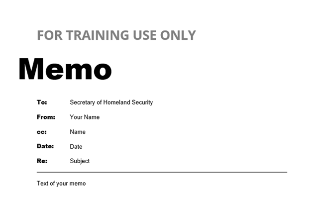
The Secretary has an important policy decision to make. Should they approve or disapprove a policy that would make Geographic Information Science and Technology the “linchpin” of the US Emergency Management System. Your job is to do the analysis and present the Secretary with a policy paper that analyzes and evaluates the pros and cons of such a policy and conclude with a solid approve/disapprove recommendation that logically derives from your analysis. You must demonstrate your higher order and critical thinking skills. Note that you are an objective analyst with no pre-conceived conclusion. Your analysis must rely on evidence, data, and citations from reputable sources. No one cares about your personal opinion.
Assignment Details
Your assignment is to write a policy analysis paper, in the form of a memo, of 1000 words (plus or minus 10%), which is about four double-spaced pages in a 12-point font.
Your paper should utilize all of the content included in Lesson 3 [20] and be:
- concise (1000 words plus/minus 10%)
- well organized
- uses one-inch margins and Times Roman or Arial font
- uses correct citations and bibliographic references
- is generally correct in terms of spelling, grammar, punctuation
- properly formatted memo: includes "FOR TRAINING USE ONLY" in large, BOLD capital letters in the header and footer. If you feel the need to put a classification, ensure it is UNCLASSIFIED for Training Use Only.
-
Writing Guideline Refresher
Your paper should follow the guidelines you learned in Lesson 3. In order to do well, I recommend reviewing my feedback on paper #1. It is likely there are comments that will help inform your successful completion of this assignment.
Submission
Please submit your policy analysis paper in Microsoft Word Format using the following file naming convention: Lastname_Firstname_Paper_2.doc
Grading
Please see Canvas for the Lesson 8 - GRADED Paper (#2) Rubric that will be used to assess your work.
-
8.7 Summary and Final Tasks
Completion of this lesson increased your understanding of:
- Cutter's concept of the "All Hazards" approach to disaster management;
- social justice issues in the disaster management process;
- federal disaster planning and response efforts, including the NRF and NIPP, as well as the roles of DHS in Homeland Security and DOD in Homeland Defense and Civil Support;
- the capabilities and limitations of geospatial intelligence and geographic information science in support of the disaster management process;
- how geospatial intelligence can be of value to the first responder;
- how geospatial intelligence for disaster management compares with other national security applications.
Deliverable: Lesson 8 - GRADED Paper #2
When you have completed your paper, return to Canvas. Look for the Lesson 8 - GRADED Paper (#2) link where you will submit your paper. You will find directions for submitting your papers when you enter the link.
Before you move on to Lesson 9, double-check the Lesson 8 Checklist [8] to make sure you have completed all of the required activities for this lesson.
Looking Ahead
Next week we'll learn about one of FEMA's most catastrophic disasters - Hurricane Katrina - and how that has reshaped the way we do emergency management now. Lesson 9 is a case study of Hurricane Katrina capped off by your third discussion forum. It should be quite interesting as several of you might have been involved in Katrina. In our next lesson, we are going to consider:
- the use of intelligence and especially geospatial intelligence in the planning for, and response to, Hurricane Katrina;
- a synthesis of the ideas of previous lessons to critique the role of intelligence and especially geo-spatial intelligence in relation to Hurricane Katrina;
- the social justice implications for geospatial intelligence applications in Hurricane Katrina;
- future applications of geospatial intelligence for disaster management.