LiDAR Volcano Visualization
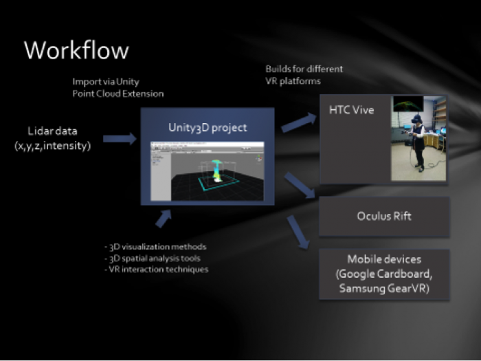
The second example we’d like you to explore is from a project in collaboration with geosciences professor Peter La Femina. Pete is a volcanologist and has a repertoire of fascination journeys. Sometimes he is in the position to take students along, but this is not always the case. Virtual field trips have always been a dream of geography but so far they have never fully taken off. We are working on changing the acceptance of virtual field trips by implementing a VR experience that will allow students to explore the insight of a volcano. This is also an example of a workflow as discussed in lesson 2. Pete took a drone equipped with both LiDAR and photo cameras with him to Iceland and visited the volcano Thrinukagigur on Iceland. If you are interested, there is a lot more information on this Inside the Volcano, a famous volcano website. The volcano is reasonable dormant such that it is safe to fly, for example, a drone into it (you can actually visit the volcano).
Video: LiDAR Volcano Visualization (00:30) This video is not narrated.