
Participatory Planning Process
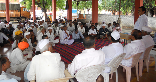
Bringing together a diverse set of stakeholders can prove challenging – especially for discussion of politically charged issues such as sea level rise. Participatory planning is one approach for bringing diverse and marginalized groups into the planning process while also avoiding conflict. The participatory planning approach emphasizes the participation of local stakeholders – that is, those people who live and work in the communities that will be directly affected by the adaptation or mitigation measures under discussion. Participatory planning empowers local stakeholders by directly involving them in the planning process. Planning workshops are led by skilled facilitators who design the meetings so that all people present have a voice by encouraging all the stakeholders to participate in brainstorming, investigating, and analyzing options for preparing for sea level rise (or other hazards). Stakeholders are generally asked to break into small groups to discuss these options before sharing their ideas about them with the facilitators and other groups. Stakeholders may then use cost-benefit analysis to choose which of these options are most suitable for their community.
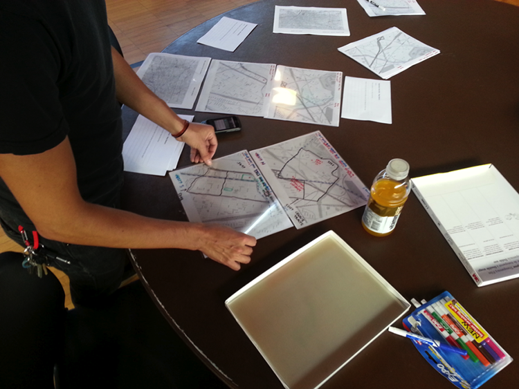
For hazards such as sea level rise that have a strong spatial component, participatory planning exercises typically use interactive mapping tools, such as the NOAA Sea Level Rise Viewer, to help stakeholders better understand both the hazard and the options for addressing it. In participatory mapping, stakeholders interact with maps with information relevant to the planning task. Interactive, digital mapping tools are valuable for illustrating what the mapped area might look like under different hazard scenarios and planning options. Stakeholders then use these maps to explore these scenarios and options. Stakeholders may have the opportunity to annotate maps with questions, concerns, and other notes about how each combination of scenarios and options might affect a particular stakeholder or area of the community, and tp share these ideas with facilitators and other stakeholders. These maps will often show: which areas of the community are susceptible to flooding under different amounts of sea level rise (either on its own or in combination with storm surge); and how planning options (such as building a seawall or restoring wetlands) may mitigate this flooding. These interactive sea level rise maps are then used to determine where in the community these adaptation strategies and options are most needed or appropriate.
Considering Views of Vulnerable Stakeholders
Coastal communities often find that decisions about what people and places to protect first are particularly challenging. As discussed in Module 11, vulnerability provides one way to prioritize protection for different areas. By using the vulnerability scoping diagram (VSD; see Module 11) in participatory planning exercises, communities can encourage stakeholders to brainstorm components and measures for the three dimensions of vulnerability (exposure, sensitivity, and adaptive capacity). Completing the VSD in a public forum can help stakeholders and discussion leaders to better understand which dimensions and components of vulnerability different community members and experts believe are most important; measures for these most-important components can then be mapped to indicate areas that are most in need of protection. For example, if a participatory VSD indicates that community members see the exposure of low-lying areas to sea level rise-enhanced storm surge and sensitivity of low-income groups as the two most important components of vulnerability, then elevation and census data can be used to identify areas that are low-lying and have a high percentage of persons in poverty. These areas would then be given first priority when considering strategies for preparing for sea level rise and related coastal hazards.