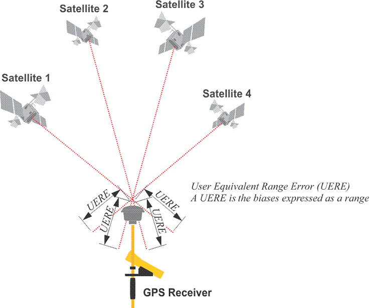
The summary of the total error budget affecting a pseudorange from the user's point of view is called the user equivalent range error, UERE. This expression, often used in satellite surveying literature, is the square root of the sum of the squares of the individual biases. See figure above. The UERE is the ranging error between a satellite and the user’s receiver. It can be shown as a distance that includes both the signal in space ranging error called URE (User Range Error) and the user equipment error (UEE).
Some of the biases that make up the UERE such as those attributable to the atmosphere dion , dtrop and satellite orbits dρ increase and decrease with the length of the baselines between receivers. Differential correction techniques can often limit the effect of these errors. Others included in the UERE, such as those due to receiver noise, ερ and εφ, multipath, εmρ and εmφ, do not increase and decrease with the length of the baselines between receivers.