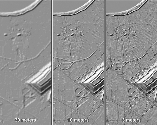
Elevation Data Product Types
A terrain surface can be characterized in many ways depending on the interest and perspective of the end user. This unit provides definitions for the types of terrain models most commonly encountered for mapping and GIS applications.
Digital Elevation Model (DEM)
A digital elevation model (DEM) contains elevations at points arranged in a raster data structure, a regularly spaced x, y grid, where the intervals of Δx and Δy are normally in linear units (feet or meters) or geographic units (degrees or fractions of degrees of latitude or longitude). The z-values in a DEM represent the height of the terrain, relative to a specific vertical datum and void of vegetation or manmade structures such as buildings, bridges, walls, et cetera. The elevation of lakes and rivers in a DEM implies the height of the water surface based on the elevation of the exposed shoreline. The observations, or direct measurements, of elevation that comprise the DEM are almost never actually captured on a regular grid; therefore, the elevation for any given point in the grid is normally interpolated from other forms of source data. Lidar, for example, yields a dense set of irregularly spaced points; interpolation to a grid requires using one of many possible interpolation algorithms, which produce varying results. Linear features, such as streams, drainage ditches, ridges, and roads, are often lost in a DEM if the grid spacing is larger than the dimensions of the feature. Furthermore, in a DEM, it is unlikely that the sharp edge of the feature will be represented correctly in the terrain model. The DEM, because it is a raster data structure similar to a digital image, is an efficient format for storage, analysis, rendering, and visualization.
Digital Terrain Model (DTM)
A digital terrain model (DTM) data structure is also made up of x,y points with z-values representing elevations, but unlike the DEM, these may be irregularly or randomly spaced mass points. Direct observations of elevation at a particular location can be incorporated without interpolation, and the density of points can be adjusted so as best to characterize the actual terrain. Fewer points can describe very flat or evenly sloping ground; more points can be captured to describe very complicated terrain. In addition to mass points, the DTM data structure often incorporates breaklines (further defined below) to retain abrupt linear features in the model. A DTM is often more expensive and time-consuming to collect than a DEM, but is considered technically superior for most engineering analyses because it retains natural features of the terrain.
Digital Surface Model (DSM)
A digital surface model (DSM) includes features above the ground, such as buildings and vegetation, and is used to distinguish a bare-earth elevation model from a non-bare-earth elevation model. The term DSM is generally applied regardless of whether the data are in gridded format (as in the DEM defined above) or mass point format (as in the DTM defined above).
Triangulated Irregular Network (TIN)
A triangulated irregular network (TIN) represents terrain with adjacent, non-overlapping triangular surfaces. A TIN is a vector data structure generated from the mass points and breaklines in a DTM. TINs also preserve abrupt linear features and are excellent for calculations of slope, aspect, and surface area and for automated generation of topographic contours, which are all important functions to the flood study engineering. Storage formats for TINs are more complex than either DEMs or DTMs, because the relationship of elevation points and triangular surfaces must be preserved within the data structure.
Breaklines
Breaklines are linear data structures that represent a distinct or abrupt change in the terrain. They comprise a series of vertices with z-values (elevations) attached. Breaklines contained in a DTM will be forced as edges in a TIN model. Breaklines are usually stored in separate files, as lines with 3-dimensional vertices, in a variety of common CAD or GIS file formats.
Contours
Contours are isolines of elevation; they are the traditional method for representing a three-dimensional surface on a two-dimensional map. They are excellent for human interpretation, but inferior to DEMs, DTMs, and TINs for computer display and analysis. Historically, contours were drawn by hand and smoothed to produce a cartographically pleasing product. Now, automated methods for producing contours from TINs or DEMs are available, but the final product contains no new information and adds little value to an engineering analysis. Contours are usually stored as two-dimensional lines, with an attribute or label containing the appropriate elevation value.
Elevation Data Product Specifications
Data product specifications for terrain models normally include a vertical accuracy requirement and some indication of the desired density of x, y, z points used to create the terrain models. For a DEM, the post-spacing is defined by the distance between points on the elevation grid. As with imagery, it makes little sense to define a DEM post spacing that is denser than the nominal point spacing of the source data. Based on the end user application, the data acquisition specification should ensure that the nominal point spacing, or ground sample distance, exceeds the post spacing required for the final deliverable product.
Specifications for breaklines usually adhere to the same vertical accuracy requirement defined for the mass points, and, in addition, stipulate which linear features are to be collected (i.e., road centerlines and/or edges, water body centerlines and/or edges, berms, levees, retaining walls, etc.).
Contour data products are specified by the desired contour interval; for example, a 5-foot contour dataset would contain a set of isolines at elevations of 0 feet, 5 feet, 10 feet, 15 feet, etc. The contour interval is usually chosen to represent as much terrain detail as possible without making the map or visual display overly crowded or cluttered; flatter areas will usually have smaller contour intervals, and hilly areas will usually be represented with larger contour intervals. If the terrain over the study area varies greatly, it may be difficult to arrive at one optimal contour interval for the entire project.