Module 7: Acquiring and Integrating GPS Data
A. Position Finding and GPS
A position derived from a set of GPS satellites is a position found from space, not a position on the surface of the Earth. Once a position is found relative to the satellites it is to be determined where that position intersects the surface of the Earth. Therefore, GPS locational data are not free of the model of the Earth's surface used to locate the intersection.
Finding the position from space:
The GPS unit calculates the distance from the satellite based on the length of time the signal took to reach the unit. This distance describes a sphere around the satellite. Do this for at least two more satellites. The three spheres described will intersect. The intersection contains a volume, not an area. The hand-held unit's position lies somewhere within that volume. This volume is in reality very small, but you can get the idea from the following figure. When the surface of the Earth is added, it contacts the volume at only one of two points, one of which can be rejected because it is improbable (because it will be under the surface of the Earth or floating slightly above it).
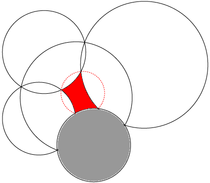
Figure 7.1: Finding the Intersection Point
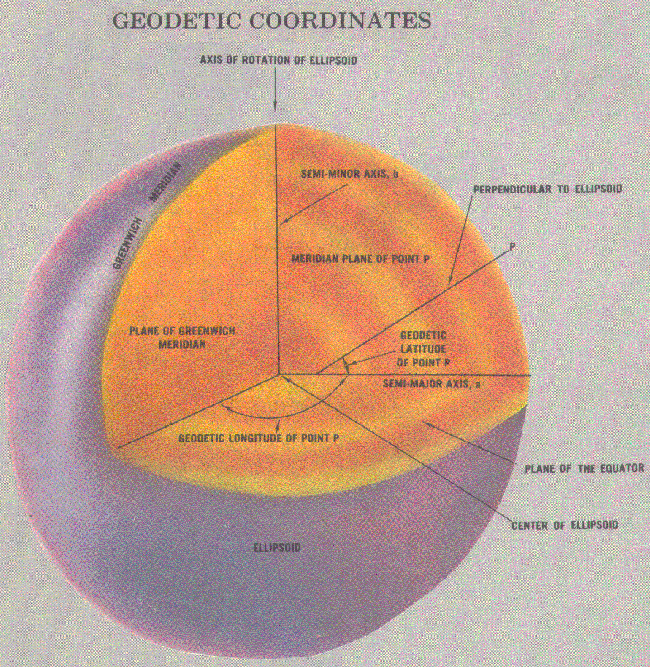
The point of intersection (the place where the dotted red line joins the Gray Earth) depends on the location of the surface of the Earth. We think of Latitude and Longitude as being absolute based on the angle from the center of the Earth. Of course the Earth is not spherical, but even so, we know that the coordinate pair describes a single location based on how the oblate sphere is modelled according to the size of the semi-minor and semi-major axes.
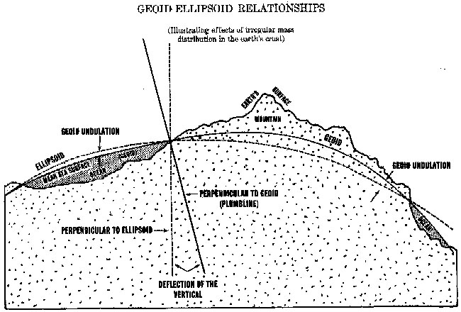
Geodetics not Geometry
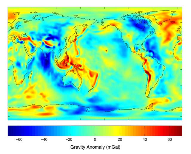
However, satellites do not rotate around the geometric center of the Earth. Instead, it is obvious, that they circle about the center of gravity of the Earth. Now, the gravity of the Earth is far from even with changes being caused by elevated areas like the Tibetan Plateau, low spots like deep abyssal trenches and plains, and by differences in density. Similarly, a plumbline does not point to the center of the Earth but to its center of gravity, and it might be influenced, very slightly, by proximity to mountains.
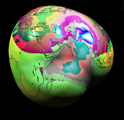
(Image from http://jpl.nasa.gov/images/grace/watkins-bumpyearth-browse.jpg)
Geodetics Required for GPS Satellite Navigation
Now, the Geoid is the model of the surface of Earth that models the effects of gravity. There is not just one model of geoids, there are hundreds of them. Some seek to model the whole Earth and others model a local area. Local models are more accurate over the area they were intended to represent but may become quite erroneous when they are used outside of their intended area, e.g. NAD 1927. GPS units default to a very good model for the whole world: World Geodetic Survey Standard (WGS) 1984. However, a latitude longitude pair of coordinates has no meaning to a GPS unless the determining Geodetic model is also recorded. SO GPS data is really a tuple of three attributes, and not two, as is often recorded. This become critical when you need to re-navigate to a location.
Very nice sites related to these subjects:
GPS Operation
http://www.colorado.edu/geography/gcraft/notes/gps/gps_f.html
Geodetics
Comprehensive List of Datums
http://www.colorado.edu/geography/gcraft/notes/datum/edlist.html