Overview
In my opinion, there is an interesting paradox with geospatial analysis and crisis management - we continually develop new and improved methods for handling disaster situations, but our increasingly complicated societies, economies, and infrastructures increase the challenges associated with disasters. People and their environments are more interconnected than ever, and spatial data science and related technologies are in many cases the most appropriate mechanism for analyzing and rectifying emergency situations.
There are four key phases of emergency management: vulnerability assessment, preparedness, response, and recovery. In subsequent lessons, we will explore each of those topics in detail. Later, we will work together to research and apply methods from spatial data science to emergency management contexts, and we will explore how geospatial perspectives and technologies have been used in a variety of ways in recent disasters.
Each week, you will learn about an emerging technology trend and how it relates to geospatial analysis and crisis management. One of my goals is to make sure you learn about and consider new trends and themes in technology, and imagine how those advances can and will impact Spatial Data Science for Emergency Management in the future. The geospatial planning activities you participate in now should take into account new types of technologies that will be commonplace in the next 5-10 years.
Example - Changing approaches to rapid damage assessment after a disaster
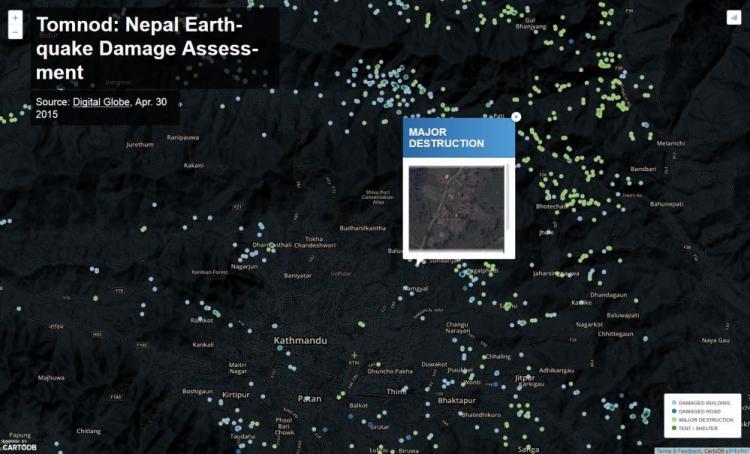
Crowdsourcing approaches for damage assessment have been popular, with micro-tasking platforms like Tomnod used to leverage digital volunteers, as shown here for the 2015 Nepal Earthquake. Volunteers look at images of structures and rate the level of damage.


What You Will Learn
By the successful completion of this lesson, you should be able to:
- articulate the role of spatial data science, including geospatial perspectives and technologies, in emergency management;
- evaluate and discuss how recent technology trends in geospatial interaction relate to emergency management;
- understand the final project assignment for this class and brainstorm some ideas;
- discuss the role of spatial data science in emergency management with your classmates.
What You Will Do
Lesson 1 is one week in length. To finish this lesson, you must complete the activities listed below.
| To Read |
|
|---|---|
| To Do |
|
Please refer to the Course Calendar for specific due dates.
Questions?
If you have questions about the content or lesson activities, please post them to the General Questions and Discussion forum in Canvas. While you are there, feel free to post your own responses if you, too, are able to help a classmate. If your question is of a personal nature, please email me directly through Canvas.