Section Three: Share Your Results on Google Earth
You would like to share the results of shadow volumes over the imagery. One way is to use Google Earth. It has both the imagery and 3D building models and is a good way to present your results.
Step 1: Download and install Google Earth
If you already have Google Earth skip this step. Otherwise, go through the following process:
- Open your web browser. Go to Google Earth.
- Click Earth Versions.
- Choose Google Earth Pro on Desktop.
- Click download Google Earth Pro.
- Install Google Earth Pro.
Step 2: Exporting to KML
KML (Keyhole Markup Language) is an XML based file format that is used in Earth browsers such as Google Earth and Google Maps. Consider you would like to share shadow surface in the morning, at noon and before sunset to demonstrate the shaded surface during the day. To do so, you will select the time of the day you are interested in and you will convert the Layer to KML.
- Open UniversityParkCampus_Lesson6_Shadow Project in ArcGIS Pro.
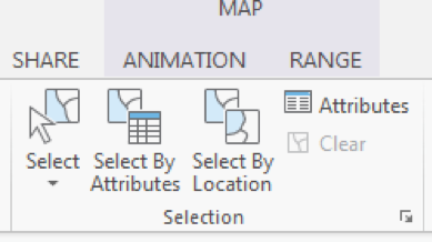
- On the top ribbon, click Select by Attributes.
 Credit: 2016 ArcGIS
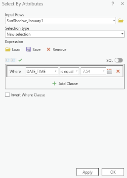
 - A Geoprocessing Pane on the right-hand side of the interface will open. Select SunShadow_January1. Add a clause that DATE_TIME value is equal to 8.36 am. Click Run.
 Credit: ArcGIS, 2021
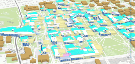
 - You can see selected shadow volumes highlighted in blue.
 Credit: ArcGIS, 2021
 - On the top ribbon, click Analysis. Select Tools in the Geoprocessing group.
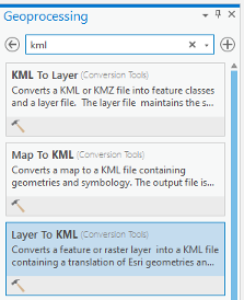
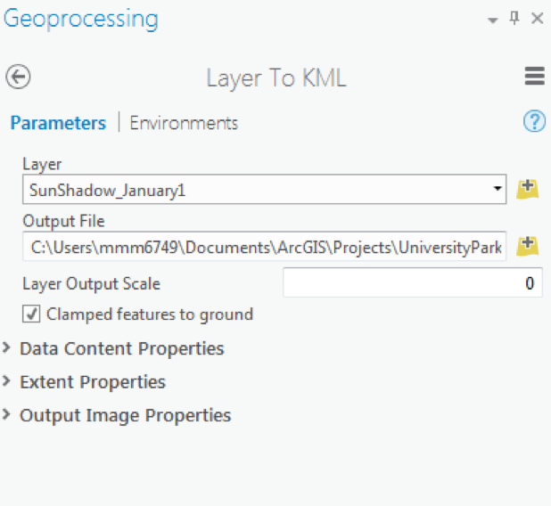
- In the Geoprocessing Pane on the right-hand side of the interface, search KML. Select Layer to KML (Conversion Tools).
 Credit: ArcGIS, 2021
 - The input Layer will be SunShadow_January1. Only selected areas will be converted.
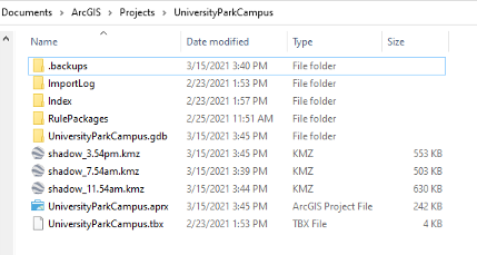
- Select the output folder and name the output Shadow_7.54am.
- Option Clamped features to the ground create shadow surface on the ground. Make sure it is checked. Click Run.
 Credit: 2016 ArcGIS
 - This tool creates a KMZ file which might be confusing. We talked about KML and now the result is KMZ. A KMZ is a compressed KML. KMZ is smaller in size and easier to upload to the web. It contains the same data in KML format. You can unzip the file and see the KML inside the KMZ file.
 Credit: ArcGIS, 2021
 - Repeat this process for 11:54 am and 3.54 pm shadow volumes.
Step 3: Opening KMl/ KMZ in Google Earth
In this step, you will open three KMZ files you have created in Google Earth. Since Google Earth is free to use, then you can share your Google Earth file with anyone.
- Open Google Earth (Pro).
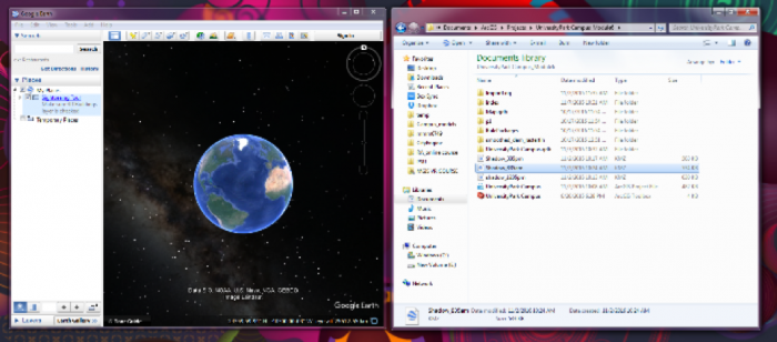
- Open a file explorer or windows explorer and navigate to the place you saved your KMZ files.
 Credit: 2021 Google Earth
 - Move and resize the windows explorer and Google Earth, to see both at the same time next to each other. Drag and drop Shadow_7.54am into Google Earth.
 Credit: 2021 Google Earth
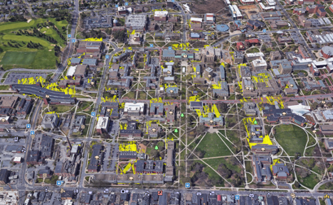
 - In the Google Earth interface, you will be directed to University Park Campus and you can see that Shadow_7.54am is added as a layer to Places Pane.
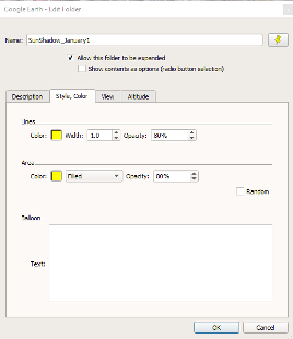
 Credit: 2021 Google Earth
 - Right Click on Shadow_7.54am and click properties. Go to the Style, Color tab. Change both Lines and Area to yellow with 60% opacity. Click Ok.
 Credit: 2021 Google Earth
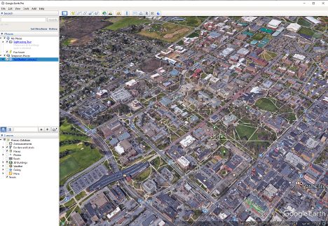
 - Use the navigation tool on the up right-hand of the interface to move around and rotate the map.
 Credit: 2021 Google Earth
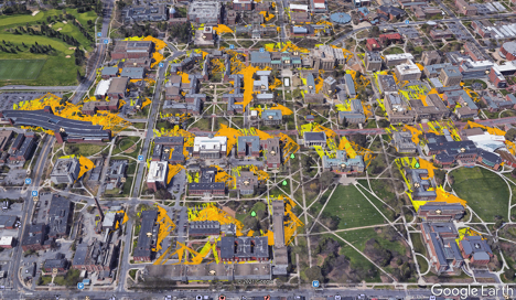
 - Drag and drop Layer Shadow_11.54am to Google Earth. Go to the Style, Color tab. Change both Lines and Area to orange with 80% opacity. Click Ok.
 Credit: 2016 Google Earth
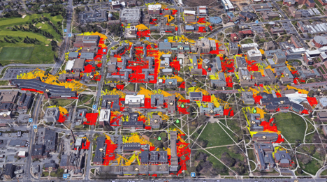
 - Drag and drop Layer Shadow_3.54m to Google Earth. Go to the Style, Color tab. Change both Lines and Area to red with 80% opacity. Click Ok.
 Credit: 2021 Google Earth
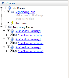
 - You can uncheck any of the shadow layers, just to see a shadow surface in a particular time. Zoom in to Old Main and see how the shadow surface changes during the day.
- On the Places Pane, right-click Temporary Places. Click Save Places As. Name the file "UniversityParkCampus_Shadow.kmz" and save it to your desired place. This is a file that you can share with anyone and they can promptly open it on Google Earth.
 Credit: 2021 Google Earth
Submit your file
Upload "UniversityParkCampus_Shadow.kmz" to Lesson 6 Assignment: Google Earth (2).
Guidelines and Grading Rubric
| Criteria | Full Credit | Half Credit | No Credit |
|---|---|---|---|
| Create a KMZ file | 4 pts | 2 pts | 0 pts |
| The KMZ file has all three shadows | 4 pts | 2 pts | 0 pts |