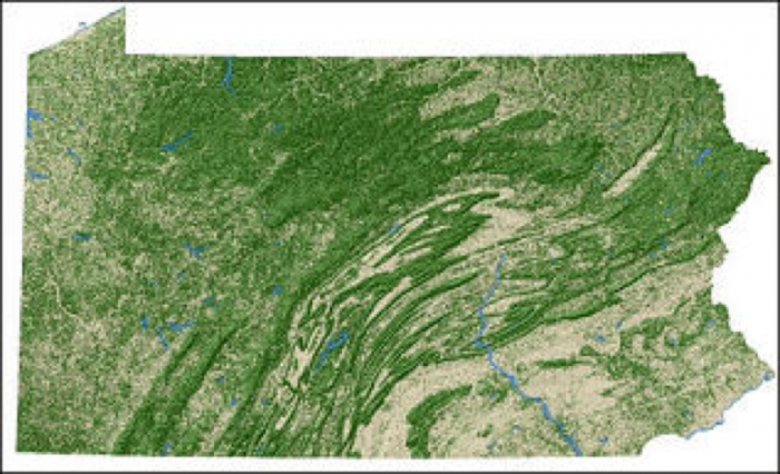
Surface Impacts
As we mentioned earlier, any type of project that requires land such as a housing development, shopping center, industrial complex, agricultural farm, wind farm, or a shale energy development site has a footprint that will require some type of land disturbance. The extent of the land disturbance, as well as the type of change in land use, largely dictate how much of an impact a project has. For instance, a shale well pad installed in the forest likely has more of an impact than the same well pad in a farm field, largely as a result of the need to cut down many trees, habitat impacts, and more soil disturbance in the forested area. The same could be said of a new housing development or a wind farm in a forested area versus agricultural land. The satellite image of Pennsylvania below shows the forested regions of Pennsylvania, which is about 60 percent forest. Note that much of the forested area occurs on ridge tops and associated slopes, with much of the forest occurring in northern Pennsylvania.
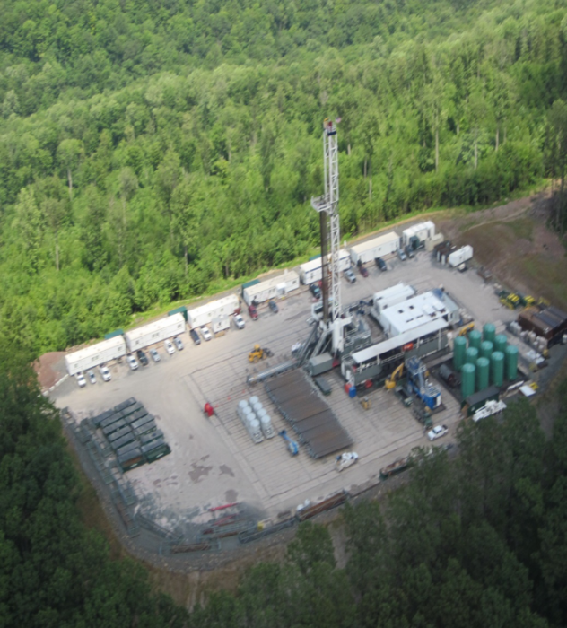
Approximately 50% of shale well drilling occurs in forested areas, with the example well pad photo below showing the stark contrast between the well pad and surrounding forest.
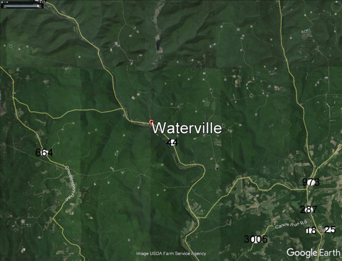
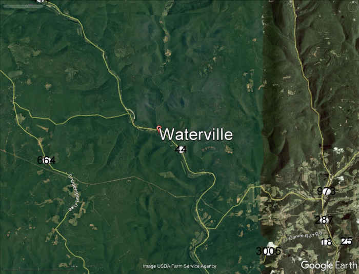
Satellite imagery of an area from different time periods can be very useful to assess the amount of land disturbance that has occurred. The Google earth images below show an area of the Tiadaghton State Forest in northern Lycoming County in 2006 (before drilling) and 2016 (after drilling). Note the prevalence of well pads, access roads, and pipeline right-of-ways in the 2016 imagery. Recent research (Langois, 2017) demonstrated that this area had lost about 4% of its interior forest due to shale drilling, with approximately 51% of land disturbance due to pipelines, 30% due to well pads and water impoundments, 16% due to new or expanded roads, and 3% due to miscellaneous features.
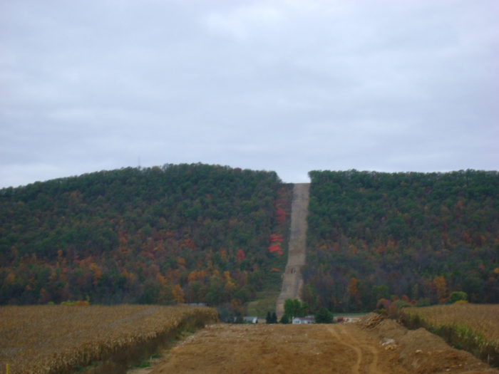
It is not surprising that pipelines cause the most land disturbance, although their right-of-ways are relatively narrow (50-250 feet wide) they tend to be tens or hundreds of miles long and each well pad has gathering lines so you have a spiderweb of pipelines that result in forests being cleared. The picture below shows a pipeline that runs thru both a field and a forested area to allow a comparison of the land surface changes.
It is critical to minimize land disturbance impacts through proper land use planning in order to prevent forest fragmentation, wildlife habitat impacts, and erosion and sedimentation issues. Proper planning may include looking as soil types, surface slope, and proximity to environmentally sensitive areas to determine the best locations to develop shale energy while minimizing the environmental impacts associated with land disturbance. In order to get a well pad and associated wells permitted in Pennsylvania (and most other states), a company will need to demonstrate that their 5+ acre well site will be built to minimize impacts to soils, waterways, wildlife habitat, cultural features, and recreational areas. While regulations and policy do help to minimize these impacts, ultimately the wells will be placed somewhere, leaving behind a footprint that may last for decades. The environmental footprint of energy is not unique to oil and gas wells. As you saw in The Nature Conservancy report, wind power has a footprint, as does solar energy, so finding the energy source with the lowest surface footprint should be an important factor to consider when looking for additional energy sources. The homework assignment for this lesson will consider the relative footprints of shale gas and wind power.