Regional Aquifer Systems: Examples
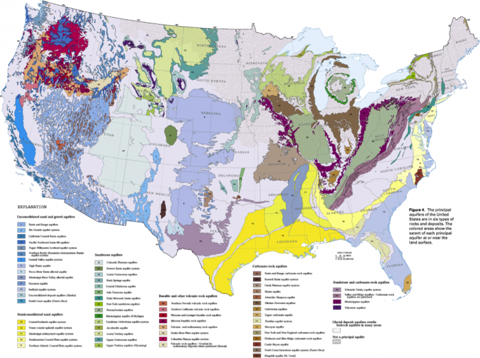
Ground water flow systems extend over a wide range of scales, from small perched aquifers that may supply water for a single-family, to regional rock formations that span thousands of km and cross several states (Figure 18). These regional systems supply water for irrigation and domestic uses in many areas, especially in semi-arid and arid parts of the American West and coastal population centers along the East coast (remember Module 1, figures 10-12?). These regional systems commonly consist of several layered sedimentary formations and may extend to several kilometers in depth. The U.S. Geological Survey has compiled detailed studies of regional aquifer systems across the U.S., with useful information about climate, recharge, subsurface geology, use, and problems related to water quality or quantity (a list and links for each of the principal regional aquifers in the U.S can be found at USGS Groundwater Information. A detailed atlas with information about the major aquifer systems in particular regions of the U.S. can be viewed at USGS Ground Water Atlas of the United States. In this module, we will focus on a few example regional aquifer systems of particular relevance to the Northeastern and mid-Atlantic U.S. and the Central Valley of CA.