When Disaster Strikes, What's Next?
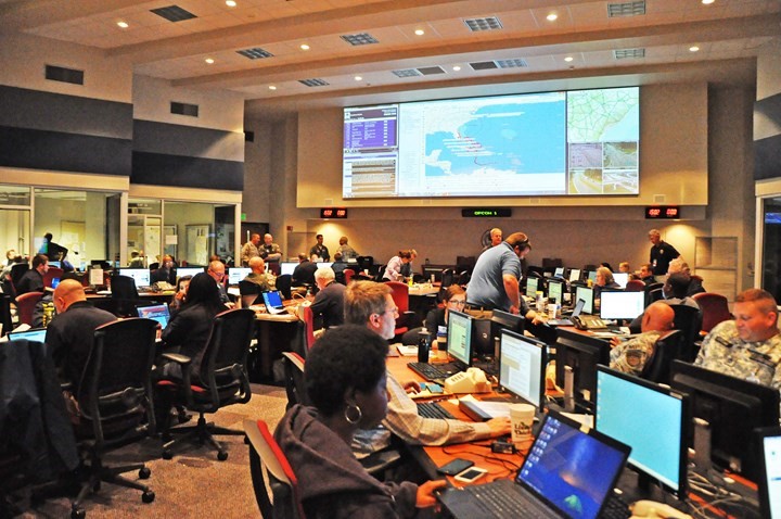
In the wake of a serious disaster, geospatial analysts along with other emergency managers are expected to provide a wide array of information with short deadlines for a variety of important tasks. First, it is essential for everyone involved to have a clear sense of the current situation (situation awareness) and to receive updates on the situational picture as time progresses. This can be a serious challenge because often a disaster can impact the types of data that are available. Also, consider the extreme case of the EOC for New York on 9/11 which was located at 7 World Trade Center, and its state-of-the-art equipment and data were destroyed as a result of the attacks.
For Further Reading - Optional
You can read more here on how GIS resources were developed on an ad hoc basis during the 9/11 crisis. It is interesting to contrast these activities with what is possible now, over 20 years later! In particular, think about the crowdsourcing and crisis mapping efforts you read about in the Digital Humanitarians chapters.
Any geospatial plan for responding to an emergency or crisis should consider several key questions:
- Are there backup sources for equipment and data?
- Is there an alternate site where personnel can gather in the event that the primary EOC is taken out by the disaster?
- What are the basic geospatial-dependent products you must be able to provide to support fundamental response efforts?
- What are the plans for dealing with power and communication (Internet) outages, especially when current and emerging geospatial applications are dependent on these?
Even contemporary web-based geospatial systems present possible challenges in a real crisis situation. While cloud-hosted solutions can help avoid the risks associated with data storage in a single EOC, many disasters make Internet access difficult or impossible. We will consider this issue in more detail later.
Who Needs Help, And Where is the Help?
The most pressing need facing geospatial managers during the immediate aftermath of a disaster is to estimate the impact of the disaster on the local population to determine where first responders should focus their rescue efforts. This problem requires an awareness of the scale and scope of the disaster as well as the ability to know where response resources are located, what their capabilities are, and what routes are available for them to take to those who need their help.
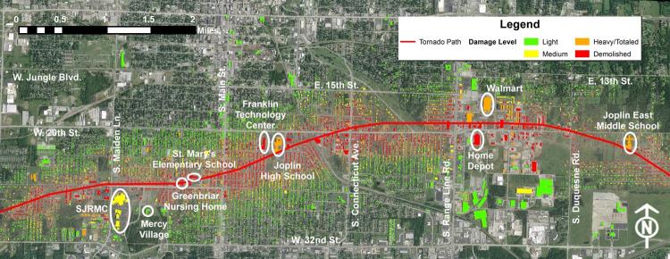
As an example, consider the May 22, 2011 tornado that went through Joplin, Missouri. The map above shows locations of key facilities and estimated building damage levels. Developing an understanding of the scope of damage during and immediately following an event is a key goal for geospatial analysis. Spatial data on the location and functions of key facilities can be developed as part of mitigation and preparedness.
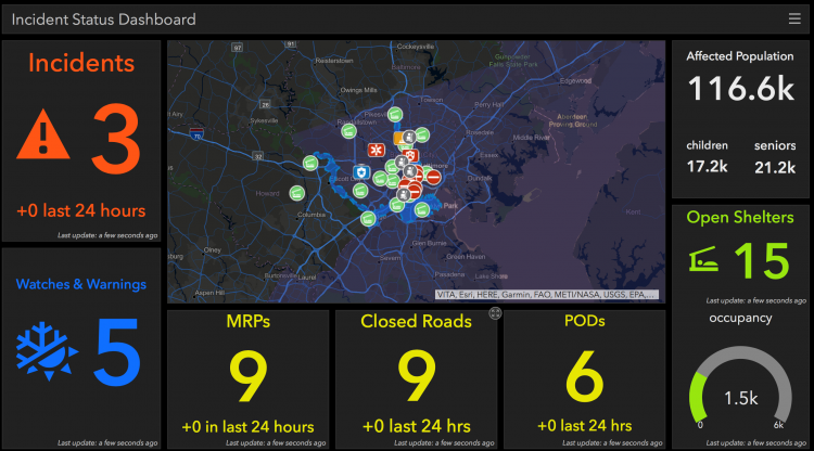
Later in this lesson, we will consider these issues in greater detail when we look at (near) real-time mapping and spatial analytics. The data and tools to support emergency management are changing rapidly and are much more advanced than they were just a few years ago.
On the next page, you'll find your reading assignment for this week, where we'll delve deeper into how GIS and other spatial tools are used during response activities, including a focus on the limitations of GIS systems in response situations.