Evaluation
As our analysts evaluate the data available, they conclude these types of offensive missiles typically carry nuclear weapons. This means the Soviets have likely installed offensive nuclear weapons only 90 miles off the coast of the US capable of hitting Washington, D.C., and other targets on the Eastern Seaboard with less than ten minutes warning.
This information was critical to US President John F. Kennedy’s decision to blockade Cuba, and brought the world to the brink of nuclear war during the Cuban Missile Crisis.
It was aerial imagery and interpretation that later assured President Kennedy that the Soviets had kept their word and removed the weapons from Cuba, thus averting a catastrophic war.
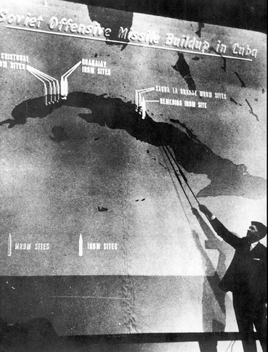
Note the air photos by themselves were just pictures. It took trained air photo interpreters using their foundational and higher order thinking skills and critical thinking to make the photos understandable and useful to policy makers and the public. The photos with associated interpretation were key evidence to make President Kennedy’s claims and actions credible.
A learner at this stage in their development can be observed demonstrating their ability to:
- compare and discriminate between ideas
- assess value of theories, presentations
- make choices based on reasoned argument
- verify value of evidence
- recognize subjectivity
Verbs that demonstrate evaluation:
assess, decide, rank, grade, test, measure, recommend, convince, select, judge, explain, discriminate, support, conclude, compare, summarize
References
Nathan, J.A. (2000). Anatomy of the Cuban Missile Crisis. New York: Bloomsbury Publishing PLC.