Open Data Standards
Open Data Types
Open data are any data that are free and accessible to the user, without restrictions on access or rights of use. The open data standards are set by the Open Geospatial Consortium (OGC), which was founded in 1994 in response to government and industry demand to solve the issue of spatial data sharing and interoperability.
Open Data relies on the FAIR (Findable, Accessible, Interoperable, and Reusable) principles, which aims to make data reusable and accessible.
Some of the key OGC standards are briefly outlined here:
- Simple Feature - this is one of the OGC's earliest standards. It defines what a geographic feature is (at a minimum a point, line or polygon) and then sets out a common format for text and binary representations of geographic features. The "simple" refers to the lack of topology in the data structure, often called spaghetti data. This standard promotes interoperability as, if one program exports its data in either Well-Known Text (WKT) or Well-Known Binary (WKB), then it is easy for another program to read in the same data and know what it meansGeographic Markup Language (GML) is an extension of XML schema (or grammar) for the expression of geographical features. It is used as an interoperability format for features that are too complex to express using the Simple feature standard. It is used particularly by Web Feature Service (WFS).
- KML - was developed as a competitor to the OGC's GML, but it is now one of the more well known of the OGC's standards. It was originally developed by Keyhole (that's the K) and then popularized by Google's Google Earth application. It was donated to the OGC in 2007 to be developed as an open standard for 2 and 3D map annotation.
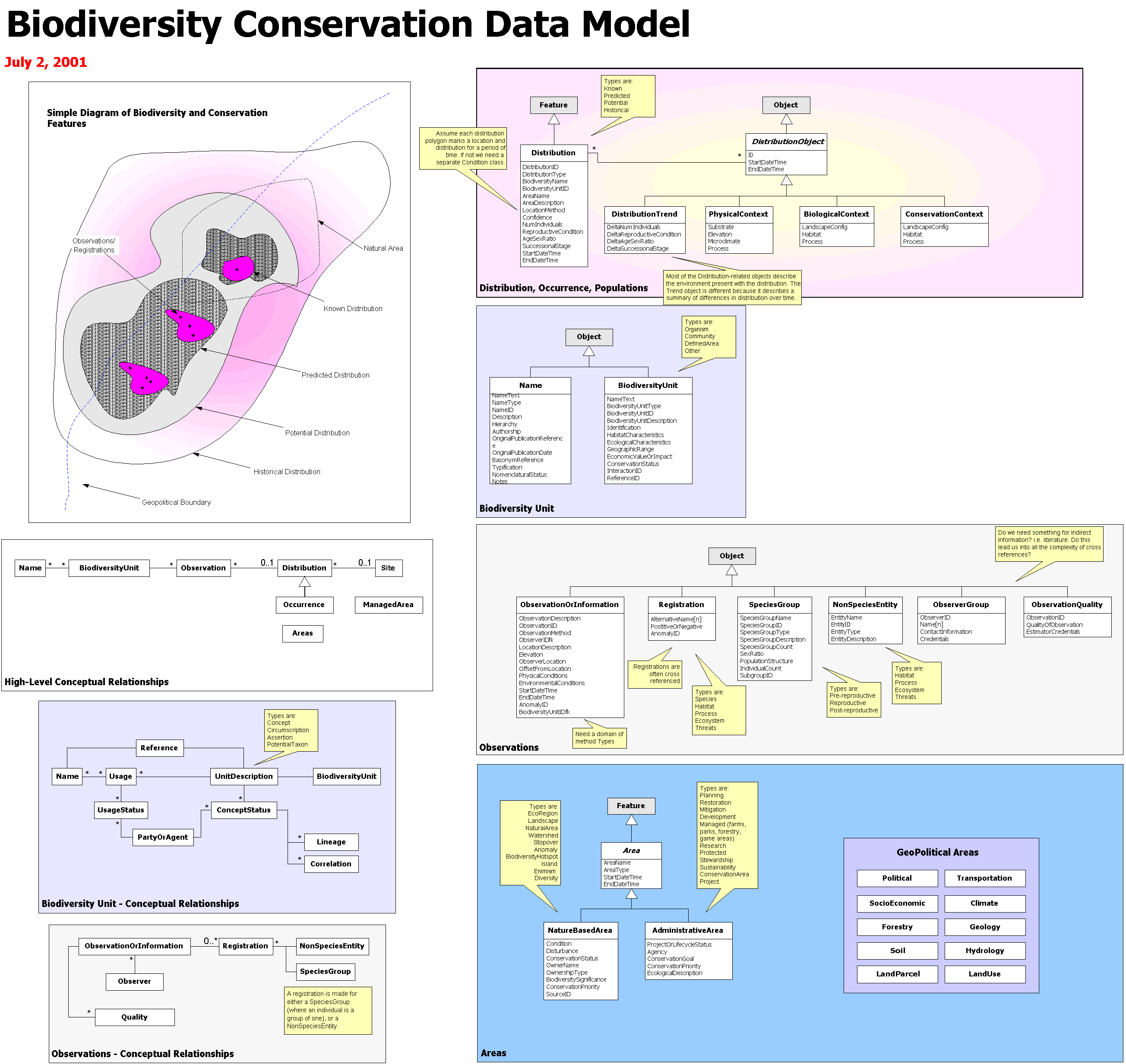
- UML- This is an open and standardized way of representing programming and modeling entities, their properties and their relationships, and formulating their parameters and actions. It can be used to diagram out a programming task and some types of the software can write part of the code. It is related to Esri Model Builder and to their Model Diagrams, e.g. Esri Biodiversity Conservation.
- Web Mapping Service (WMS) - WMS was one of the first OGC standards and set the basis for all web mapping for many years.
- Web Feature Service (WFS) - this is the standard that a service has to conform to if you want to serve geographic features over the web.
- Web Coverage Service (WCS) - the WCS standard defines an interface and operations to access geographic coverages (rasters) over the web.