So far, we’ve brought in web services from a few different servers in order to get a multidimensional picture of conditions around Mount Rainier. In many cases, you might want to add your own data to supplement whatever web services you find. Suppose you’re going to be hiking on a section of the Wonderland Trail, which encircles Mount Rainier. Let’s add this trail to our map by uploading a shapefile directly to our map in ArcGIS Online. This dataset was adapted from a file geodatabase feature class downloaded from the Washington State Recreation and Conservation Office public download page.
The functionality to add a shapefile directly from a .zip file is not yet supported in the new (current) version of the ArcGIS Online Map Viewer, so to perform this function we need to temporarily switch back to the Map Viewer Classic.
- In arcgis.com, open your Hiking Conditions map from the previous section of the lesson.
- If you haven't already, Save your map before proceeding.
- Click the Classic Map Viewer link at the upper-right of the window to change to the previous version of the Viewer, which supports the ability to add data directly from a file.
- Click Add > Add Layer From File.
- Browse to wonderland.zip, select the Keep Original Features option, and click Import Layer. Notice all the different data formats you can import.
This is just a zipped shapefile. After the layer imports, you’ll be prompted to define the symbol. You can style the layer based on some attribute or just define a single symbol to be used. - From the Choose an attribute to show dropdown, choose Show location only.
- In the Select a drawing style area, click the Options button and choose to symbolize your trail using a thick brightly colored line. Then click Done or OK to save your changes.
Your map will look sort of like this, although it will probably have more snow on it.
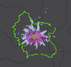 Figure 7.3: Map with trail
 - Save your web map again.
Your data is saved inside the web map rather than being published as a regular, individual layer in your ArcGIS Online content. This works fine for small datasets that need to be used on a limited basis. However, there may be other situations where you want the data to be available to multiple web maps, or at multiple offices. In such a situation, you can publish the data as a service running directly on ArcGIS Online (with no ArcGIS Server needed). We will do this in the next section of the lesson.