Transforming 2D Data to 3D Assets
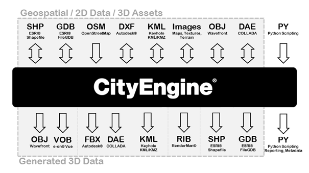
CityEngine is suitable for transforming 2D GIS data to 3D cities. GIS data such as points, lines and polygons can be used to create 3D models. The current version of CityEngine connects to ArcGIS through data exchange. However, it is not tightly integrated into the ArcGIS system yet. The created 3D models can be exported to other software for analysis or editing such as ArcGIS, Maya, 3ds Max, Google Earth, the Web (see Lesson 7) or Unity (as we’ll explore in Lessons 8 and 9) (CityEngine Frequently Asked Questions). The following figure shows different data formats of input and output to and from CityEngine. CityEngine does not support automatic creation of 3D city models. The platforms that support automatic creation of 3D models in urban environments, use oblique imagery or LiDAR data to reconstruct volumes and building shapes based on point clouds and aerial imagery. However, the main strength of CityEngine is data creation, the use of other datasets such as geodatabases and export capabilities. A single procedural rule can be used to generate many 3D models. GIS data feature attributes can be used to add more accuracy to the model. Instances of such attributes are building height, number of floors, roof type, and roof materials.