Identification
Digital Orthophoto Quads (DOQs) are raster images of rectified aerial photographs. They are widely used as sources for editing and revising vector topographic data. For example, the vector roads data maintained by businesses like NAVTEQ and Tele Atlas, as well as local and state government agencies, can be plotted over DOQs, then edited to reflect changes shown in the orthoimage.
Most DOQs are produced by electronically scanning, then rectifying, black-and-white vertical aerial photographs. DOQ may also be produced from natural-color or near-infrared false-color photos, however, and from digital imagery. The variations in photo scale caused by relief displacement in the original images are removed by warping the image to compensate for the terrain elevations within the scene. Like USGS topographic maps, scale is uniform across each DOQ.
Most DOQs cover 3.75' of longitude by 3.75' of latitude. A set of four DOQs corresponds to each 7.5' quadrangle. (For this reason, DOQs are sometimes called DOQQs--Digital Orthophoto Quarter Quadrangles.) For its National Map, USGS has edge-matched DOQs into seamless data layers, by year of acquisition.
Data Quality
Like other USGS data products, DOQs conform to National Map Accuracy Standards. Since the scale of the series is 1:12,000, the standards warrant that 90 percent of well-defined points appear within 33.3 feet (10.1 meters) of their actual positions. One of the main sources of error is the rectification process, during which the image is warped such that each of a minimum of 3 control points matches its known location.
Spatial Reference Information
All DOQs are cast on the Universal Transverse Mercator projection used in the local UTM zone. Horizontal positions are specified relative to the North American Datum of 1983, which is based on the GRS 80 ellipsoid.
Entities and Attributes
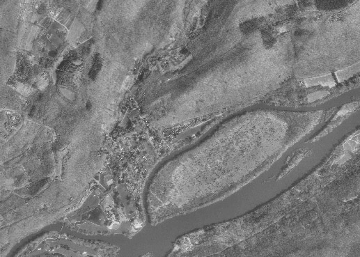
The fundamental geometric element of a DOQ is the picture element (pixel). Each pixel in a DOQ corresponds to one square meter on the ground. Pixels in black-and-white DOQs are associated with a single attribute: a number from 0 to 255, where 0 stands for black, 255 stands for white, and the numbers in between represent levels of gray.
DOQs exceed the scanned topographic maps shown in Digital Raster Graphics (DRGs) in both pixel resolution and attribute resolution. DOQs are therefore much larger files than DRGs. Even though an individual DOQ file covers only one-quarter of the area of a topographic quadrangle (3.75 minutes square), it requires up to 55 Mb of digital storage. Because they cover only 25 percent of the area of topographic quadrangles, DOQs are also known as Digital Orthophoto Quarter Quadrangles (DOQQs).
Distribution
USGS DOQ files are in the public domain, and can be used for any purpose without restriction. They are available for free download from the USGS, or from various state and regional data clearinghouses as well as from the geoCOMMUNITY site. Digital orthoimagery data at 1-foot and 1-meter spatial resolution, collected from multiple sources, are available for user-specified areas, and even higher resolution imagery (HRO) data sets for certain areas are available from the National Map Viewer site.
To investigate DOQ data in greater depth, including links to a complete sample metadata document, visit Birthplace of the DOQ. FGDC's Content Standard for Digital Orthoimagery is published here.
Try This!
Explore DOQs with Global Mapper
Now it's time to use Global Mapper again, this time to investigate the characteristics of a set of USGS Digital Orthophoto (Quarter) Quadrangles. The instructions below assume that you have already installed the Global Mapper software on your computer. (If you haven't, return to Global Mapper installation instructions presented earlier in Chapter 6).
Note: Global Mapper is a Windows application and will not run under the Macintosh operating system.
- First, download one or more DOQ data archives. Each compressed DOQ is over 37 Mb in size and will take about 8 minutes to download via high speed DSL or cable, or over two hours via 56 Kbps modem.
- Next, decompress each archive into a directory on your hard disk.
- Open an archive (e.g., "DOQ_nw.zip").
- Create a subdirectory called "DOQ" within the directory in which you save data.
- Extract all files in the ZIP archive into your new subdirectory.
- Launch Global Mapper.
- Open a Digital Orthophoto (Quarter) Quadrangle by choosing File > Open Data File(s)..., then navigate to the subdirectory into which you extracted the DOQ data, then open the file 'bushkill_pa_nw.tif'.
- The trial version of Global Mapper allows you to open and view up to four files at once. Note that you can turn layers on and off, and even adjust their transparency at Tools > Control Center. You might find it interesting to open and compare the DOQ and DRG layers.
- Use the Zoom and Pan tools to magnify and scroll across the DOQ. The "Full View" button (house icon) refreshes the initial full view of the dataset.
- To view an excerpt of the DOQ metadata, navigate to Tools > Control Center, then click the Metadata button.