Block I
| Demonstrated GPS |
|---|
|
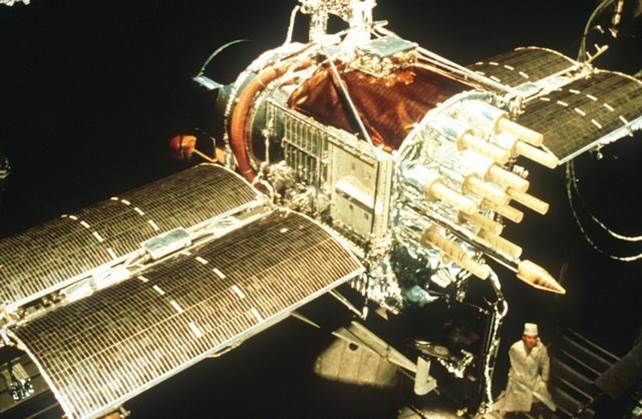
The 11 GPS satellites launched from Vandenberg Air Force Base between 1978 and 1985 were known as Block I satellites. The last Block I satellite was retired in late 1995. Ten of the satellites built by Rockwell International achieved orbit on Atlas F rockets. There was one launch failure. All were prototype satellites built to validate the concept of GPS positioning. This test constellation of Block I satellites was inclined by 63° to the equator instead of the current specification of 55°. They could be maneuvered by hydrazine thrusters operated by the control stations.
The first GPS satellite was launched February 22, 1978 and was known as Navstar 1. An unfortunate complication is that this satellite was also known as PRN 4 just as Navstar 2 was known as PRN 7. The Navstar number, or Mission number includes the Block name and the order of launch, for example I-1, meaning the first satellite of Block I. and the PRN number refers to the weekly segment of the P code that has been assigned to the satellite, and there are still more identifiers. Each GPS satellite has a Space Vehicle number, an Interrange Operation Number, a NASA catalog number, and an orbital position number as well. However, in most literature, and to the GPS receivers themselves, the PRN number is the most important.
Continuing the discussion of the space segment, here is the Block 1 satellite. These were the first launched. There are none of them functional today. But they certainly did an extraordinary job in getting the system started. It was an experimental system at that time. But it certainly has worked out well.
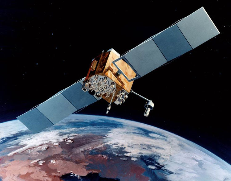
The Block I satellites weigh 845 kg in final orbit. They were powered by three rechargeable nickel-cadmium batteries and 7.25 square meters of single-degree solar panels. These experimental satellites served to point the way for some of the improvements found in subsequent generations. For example, even with the back-up systems of rubidium and cesium oscillators onboard each satellite, the clocks proved to be the weakest components. The satellites, themselves, could only store sufficient information for 3½ days of independent operation. And the uploads from the control segment were not secure; they were not encrypted. Still, all 11 achieved orbit, except Navstar 7. The design life for these satellites was 4½ years, but their actual average lifetime was 8.76 years. That is something that continues. The GPS satellites have mostly outlived their design life. There are no Block I satellites operating today.
Block II
| Some of the iMprovements over Block I |
|---|
|
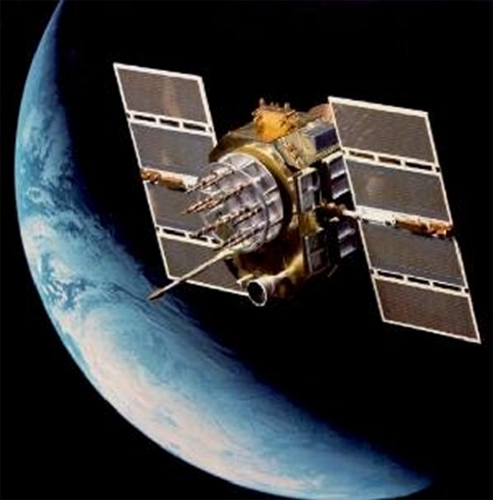
The next generation of GPS satellites are known as Block II satellites. The first left Cape Canaveral on February 14, 1989, almost 14 years after the first GPS satellite was launched. It was about twice as heavy as the first Block I satellite and was expected to have a design life of 7½ years with a Mean Mission Duration, MMD of 6 years. The Block II satellites could operate up to 14 days without an upload from the control segment and their uploads were encrypted. The satellites themselves were radiation hardened, and their signals were subject to selective availability.
These satellites were built by Rockwell International. Block II included the launch of 9 satellites between 1989 and 1990. None of the Block II satellites are in the constellation today. the last was decommissioned in 2007
Block IIA
| Some of the iMprovements over Block II |
|---|
|
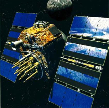
The launch of the Block IIA satellites began in 1990. 19 Block IIA satellites, with several navigational improvements, were launched between 1990 and 1997. Block IIA satellites could store more of the Navigation message than the Block II satellites, and could, therefore, operate without contact with the Control Segment for 6 months. However, if that were actually done, their broadcast ephemeris and clock correction would have degraded. None of the Block IIA satellites are in the constellation today.
Block IIR
| Some of the iMprovements over Block IIA |
|---|
|
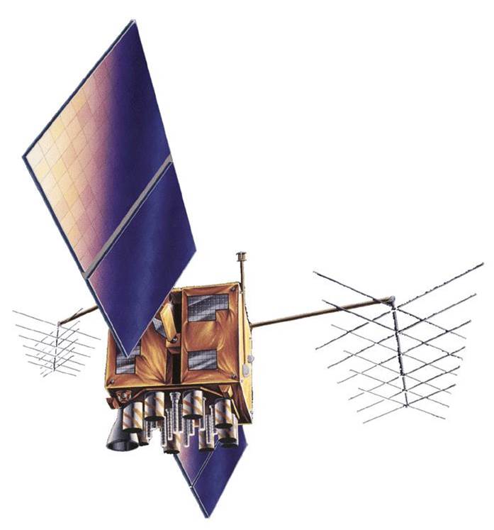
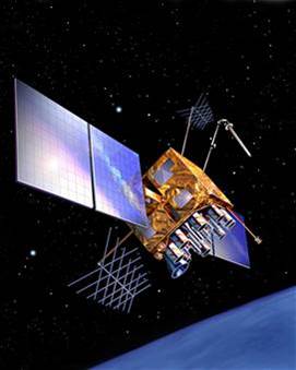
The first launch of the next Block, Block IIR satellites in January of 1997 was unsuccessful. The following launch in July of 1997 succeeded. The third generation of GPS satellites is known as Block IIR satellites, the R stands for replenishment. There are two significant advancements in these satellites. The Block IIR satellites have enhanced autonomous navigation capability because of their use of intersatellite linkage (called AutoNav). This involves their use of reprogrammable processors onboard to do their own fixes in flight. There are Block IIR satellites in the constellation today.
Block IIR-M
| Some of the iMprovements over Block IIR |
|---|
|
In September of 2005, the first of the next improved block, called Block IIR-M was launched. These are IIR satellites that were modified before they were launched. The modifications upgraded these satellites so that they radiate two new codes; a new military code, the M code, a new civilian code, the L2C code, and demonstrate a new carrier, L5. There are Block IIR-M satellites in the constellation today.
Block IIF
| Some of the iMprovements over Block IIR-M |
|---|
|
The L2C signal and the third civilian carrier will be very helpful because, as you know, ionosphere modeling is an important part of error management in GPS. We can model it to some good degree with two carriers. Three will obviously make that modeling even better.
Block IIF is the most recent group of GPS satellites launched and the first of them reached orbit in May of 2010. There has been steady and continuous improvement in the GPS satellite constellation from the beginning.
The first Block IIF satellite was launched in the summer of 2010. Their design life is 12 to 15 years. Block IIF satellites have faster processors and more memory onboard. They broadcast all of the previously mentioned signals including the L5 carrier, This signal was demonstrated on the Block IIR-M and is available from all of the Block IIF satellites. The Block IIF satellites replaced the Block IIA satellites as they aged. Their onboard navigation data units (NDU) support the creation of new navigation messages with improved broadcast ephemeris and clock corrections. Like the Block IIR satellites, the Block IIF can be reprogrammed on orbit.
Block III

| Some of the iMprovements over Block IIF |
|---|
|
