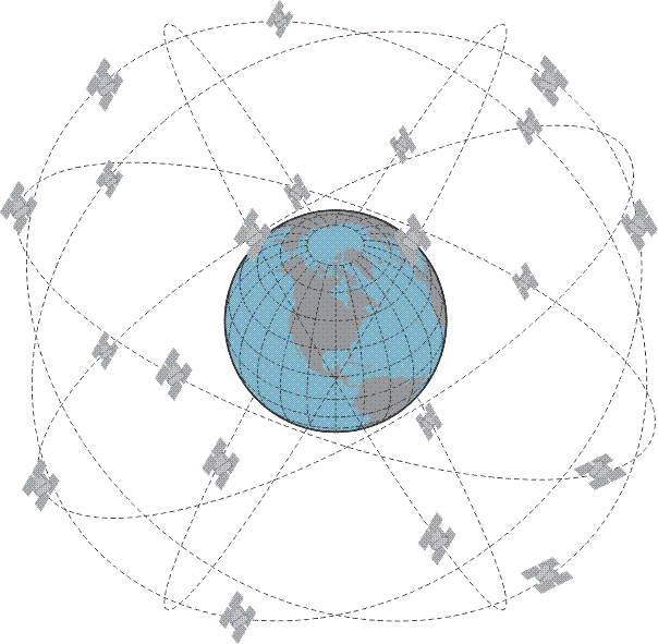
The configuration of the GPS Space Segment is well known. The satellites are on orbit at a nominal height of about 20,000 km above the Earth. There are three carriers L1 (1575.42 MHz), L2 (1227.60 MHz), and L5 (1176.42 MHz). A minimum of 24 GPS satellites ensure 24-hour worldwide coverage, but there are more than that minimum on orbit. There are a few spares on hand in space. The redundancy is prudent because GPS is critical to positioning, navigation and timing. It is also critical to the smooth functioning of financial transactions, air traffic, ATMs, cell phones, and modern life in general around the world. This very criticality requires continuous modernization.
GPS was put in place with amazing speed considering the technological hurdles and reached its Fully Operational Capability (FOC) on July 17, 1995. The oldest satellites in the current constellation were launched in the late 1990s. If you imagine using a personal computer of that vintage today, it is not surprising that there are plans in place to alter the system substantially. In 2000, U.S. Congress authorized the GPS III effort. The project involves new ground stations and satellites, additional civilian and military navigation signals, and improved availability. This chapter is about some of the changes in the modernized GPS, its inclusion in the Global Navigation Satellite System and more. Block I GPS SatelliteBlocks I and II GPS Satellitesthe design life has obviously been exceeded in most cases, Block IIA satellites do wear out. Block IIR GPS Satellite.