Introduction
The world is a complex network of nodes and connections. Ideas, goods (tangible or intangible), money, matériel, and (dis)information move between people and across space. Sometimes people carry these with them from place to place; other times they move through cyberspace. While it is tempting to focus solely on the way these things flow, it is imperative also to recognize the importance of where things originate and where they culminate. The conditions at either end of a connection — that is, what it is like at the place where something emerges or where it goes — provide context that is crucial for understanding and predicting political and social movements, insurgency, and the needs of people before, during, and after emergencies.
Place, connection, flow — all of these are geographic concerns.
This lesson is designed to introduce you to geography (and specifically cultural geography) as a discipline. As a foundational lesson, it focuses on three core concepts in geography (space, place, and scale) that will enable you to understand and develop a geographic perspective. It will also discuss what we mean by culture, and how culture and geography are related.
Finally, this lesson also introduces you to ArcGIS Online and StoryMaps, two powerful visual-spatial tools that are useful for analyzing and presenting information to a wide range of audiences. You will use this technology to complete an exercise that will demonstrate the importance of scale as an analytical framework for understanding a complex real-world issue, using real data.
We encourage you to carefully read the examples and do the other exercises strewn throughout the lesson, as they will reinforce your understanding of the concepts and enable you to use them to assess, critique, and predict phenomena in the world.
Learning Goals and Objectives:
Upon completion of this lesson, you will be able to:
- Evaluate the role and importance of space and place in everyday life.
- Assess the role and function of scale in analyzing real-world phenomena.
- Appraise culture as a factor in lived experience.
- Produce a simple visual to present spatial information.
Note: You might have already seen the following message in the orientation material. If you have already successfully logged into our ArcGIS Online Organization, you can proceed to the next page.
Special Task
At the end of this lesson, you will complete a StoryMap exercise using Penn State's ArcGIS Online Organization. Please make sure you have access to the system by using the following link, Penn State's ArcGIS Online Organization, and logging in with your Penn State UserID (abc123@psu.edu) and password.
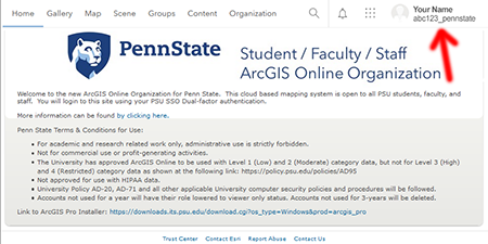
After successfully logging in, you should see the following page with your name and ID in the upper right corner.
Contact the instructor if you have any problems logging in.
Note: Please log into the ArcGIS Online system as soon as you can so we can give you access to the files you will need for the first mapping exercise.
Questions?
If you have any questions now or at any point during this week, please feel free to post them to the GEOG 571 - General Discussion Forum. (That forum can be accessed at any time in Canvas by opening the Lesson 0: Welcome to GEOG 571 module in Canvas.)