Space is the primary concept used in geography. To define it briefly, it is “an areal extent on the earth's surface, in and around which all humans exist and their activities occur” (Fellmann et al., 2013, p. 487). Thrift (2009) posits an admittedly rough typology of space—with the caveat that space is far more complex than this typology suggests—that consists of empirical space, flow space, image space, and place space.
While flow space, image space, and place space are important, empirical space is perhaps the most fundamental form of space. Empirical space is the measurable, volumetric construction of space that we invoke when we measure distances between points on a map, estimate how much paint we need to cover the walls of a room, or what size truck we should rent to haul our possessions to a new home.
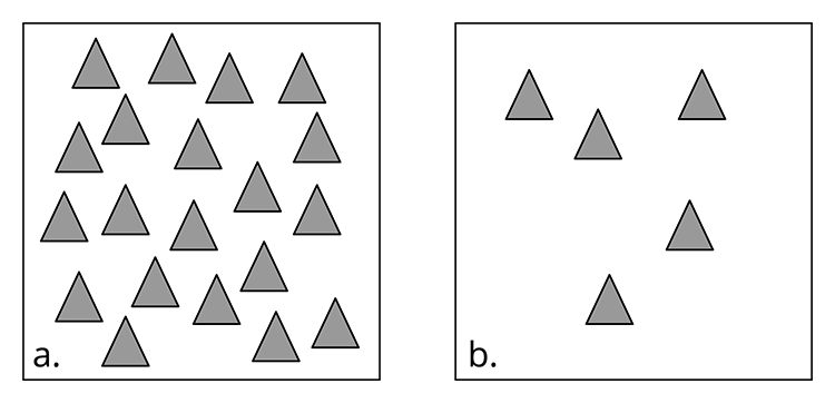
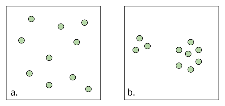
Conceptually, empirical space enables us to talk about the spatial distribution of phenomena in the world. In human geography, this means that we are generally concerned with the distribution of people, but we may also be concerned with resources, human activity, beliefs or ideas, businesses, and so on. We can think of spatial distribution as having three qualities: density, concentration, and pattern.
Density is the frequency with which something occurs in space; measured in terms of how many things (e.g., people, houses, trees, etc.) appear per unit of area (e.g., square miles, square kilometers, acres, etc.).

Example
New York City has a population density of roughly 27,755 people per square mile, while Minneapolis has a population density of roughly 7,956 people per square mile; thus New York City has a greater population density than Minneapolis.
Concentration is the extent of a feature's spread over space. Things can be close together (clustered) or far apart (dispersed).

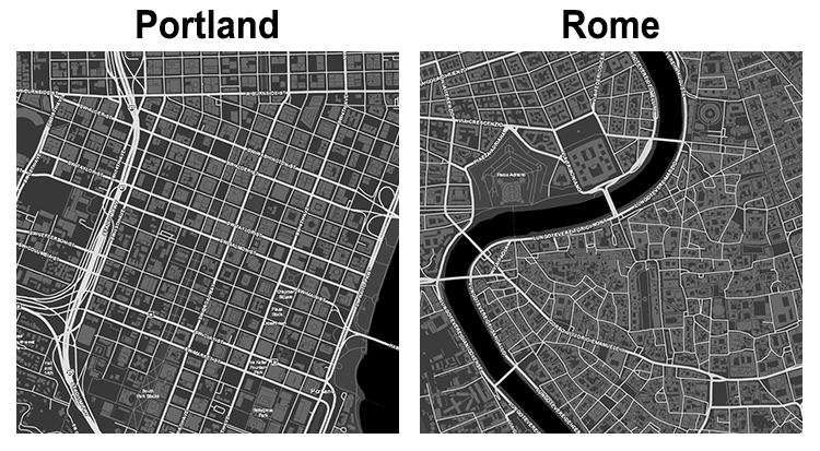
Finally, pattern is the arrangement of objects in space. Patterns can be regular (geometric) or irregular.

Example
Compare sections of the street plans for Portland, Oregon, United States, and Rome, Italy. Although not perfectly regular, we can easily characterize sections of Portland as following a grid pattern. Rome, by contrast, appears to be a mix of canted grids on the periphery and irregular and meandering streets in the center. The consistency of Portland’s street plan reflects its more recent creation; the mixed approach in Rome reflects several centuries of changing urban planning practices.
Read:
Note: Registered students can access the readings in Canvas by clicking on the Library Resources link. **
** The list of the Lesson 1 readings might not be available on the Library Resources page during the Orientation week.