City Profile: New Orleans, Louisiana, USA
Background Information
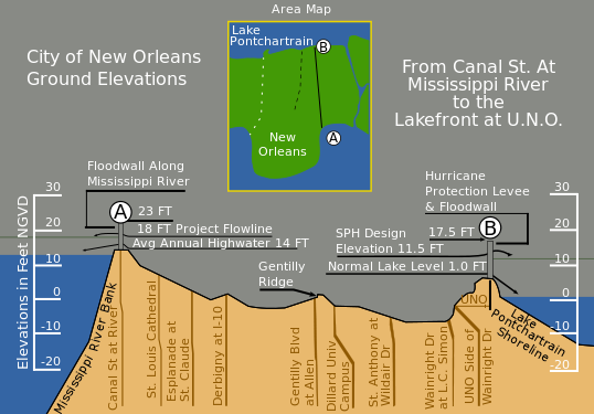
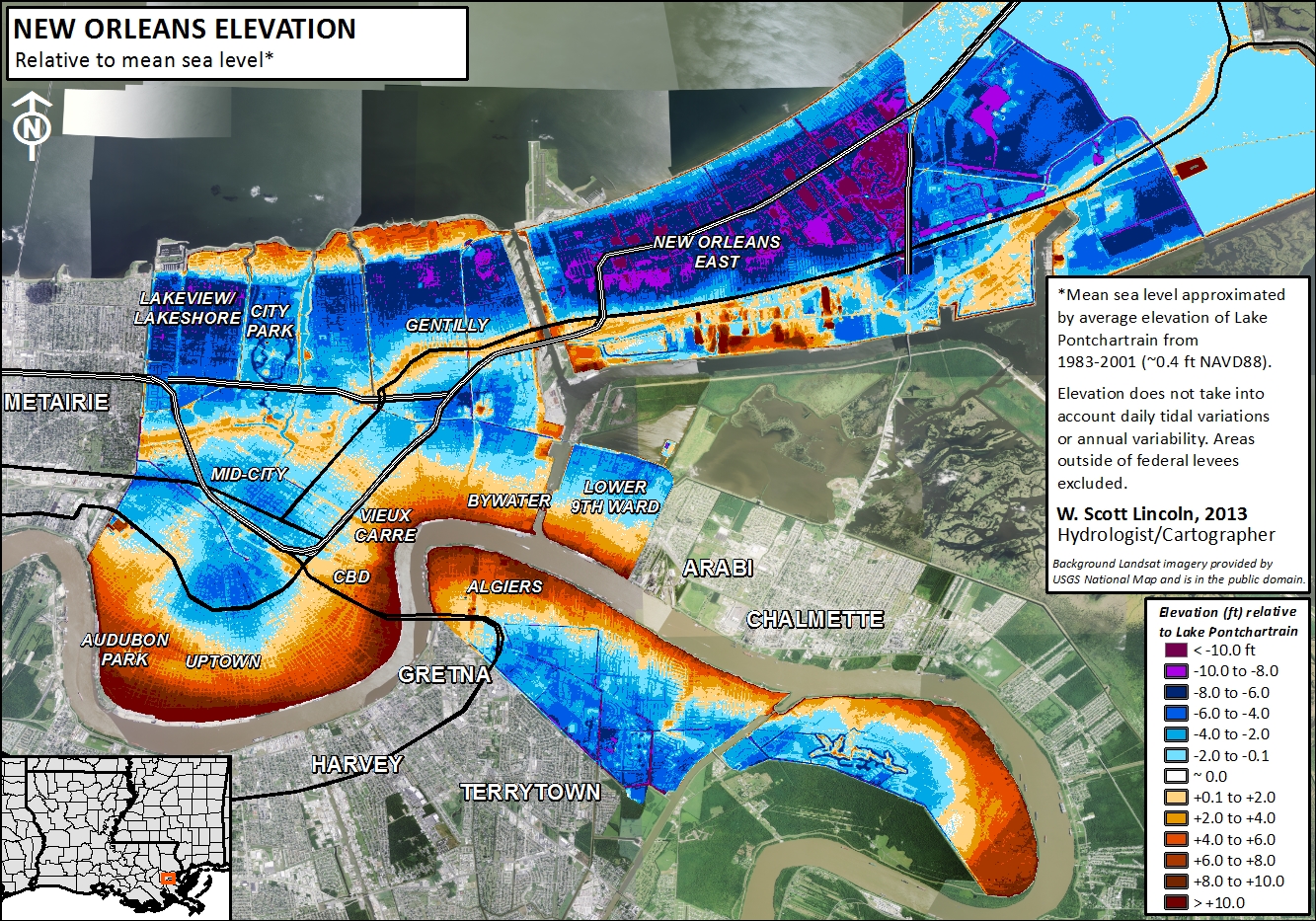
New Orleans was established more than 300 years ago on the banks of the lower Mississippi River for strategic and commercial reasons. The northern perimeter of this port city is the south shore of Lake Pontchartrain, a 629 square mile bay open to the Gulf of Mexico. The city is surrounded on all sides by water and wetlands. Its growth to the currently occupied area was facilitated by draining the low-lying swamps and marshes between the Mississippi River and Lake Pontchartrain. Stormwater must be pumped out of the city with every rainstorm. The city’s relationship with water is currently defined by its complete enclosure within flood protection levees. The older levees protect the city from Mississippi River floods, while newer levees protect the city from inundation by hurricane storm surges from the Gulf of Mexico. The drainage and dewatering of the delta sediment on which New Orleans sits have caused compaction and subsidence so that the elevation of many areas of New Orleans is now below sea level.
The hurricane protection levee system (see image below) failed in 2005 when Hurricane Katrina’s storm surge breached it in many places. This resulted in the flooding of 80% of the city, filling the shallow bowl of low-lying land with salty water.
The population of New Orleans before Hurricane Katrina was 454,865. The 2012 census estimates the population to 369,250, or 76% of the 2000 population (nola.com). Therefore, New Orleans is a smaller city than before Katrina in terms of the number of residents. The demographic and other changes in New Orleans since Hurricane Katrina are complex. Although parts of the city still remain relatively unrecovered since the storm, other areas have made great improvements economically and in other ways (see the article from the Times-Picayune linked below).
Of the four coastal cities featured here, New Orleans is the only U.S. city, and it is the only one of the cities to weather a recent major disaster related to coastal hazards. It has received billions of dollars in recovery funds and undergone a major rebuilding of its flood defenses since 2005. These important factors should be taken into account as you analyze the coastal cities on the list and their vulnerability to coastal hazards. Another important consideration is the fact that the massive hurricane protection system of levees, flood walls and gates or the Hurricane and Storm Damage Risk Reduction System (HSDRRS) that was breached in Hurricane Katrina in 2005 has been repaired and received significant upgrades to the tune of $14 billion. If the World Bank study, completed in 2005, was repeated in 2015, New Orleans may have received a lower ranking, in spite of its location.
