No doubt you're familiar with one or more popular online mapping services. How well do they do at geocoding the location of a postal address? You can try it out for yourself at several Web-based mapping services, including MapQuest.com (Mapquest), Microsoft's Bing Maps (Bing Maps), and similar user-created tools like GPS Visualizer (GPSVisualizer.com). Other services, such as the Federal Financial Institutions Examination Council (FFIEC)’s geocoding system (FFIEC Geocoding System) provide census information instead of latitude and longitude. Try using the FFIEC’s system and view related census information for your area.
Let's compare the geocoding capabilities of MapQuest.com to locate the address on an actual map. Figure 6.9 displays a recent screen capture of an address lookup.
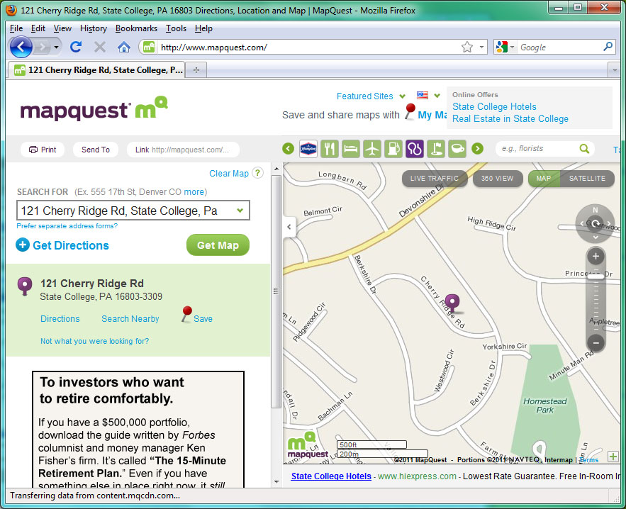
The MapQuest.com map generated in 2011 places the address close to its actual location. Below, Figure 6.10 shows a similar MapQuest product created back in 1998, when this course was first being developed. On the older map, the same address is plotted on the opposite side of the street. What do you suppose is wrong with the address range attribute in that case? Also, note the shapes of the streets and the differences in map design.
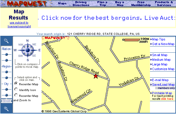
It is likely that the older map relied on pre-modernization TIGER data from 1990 for the street shapes. MapQuest, like many other commercial navigation services, now uses detailed street data purchased from NAVTEQ (Navteq.com).
The point of this section is to show that geocoding with address ranges involves a process of estimation. The Census Bureau's TIGER/Line Shapefiles, like the commercial street databases produced by Tele Atlas, Navigation Technologies, and other private firms, represents streets as vector line segments. The vector segments are associated with address range attributes, one for the left side of the street, one for the right side. The geocoding process takes a street address as input, finds the line segment that represents the specified street, checks the address ranges to determine the correct side of the street, then estimates a location at the appropriate point between the minimum and maximum address for that segment and assigns an estimated latitude/longitude coordinate to that location. For example, if the minimum address is 401, and the maximum is 421, a geocoding algorithm would locate address 411 at the midpoint of the street segment. This estimation process is approximate and some addresses will not be located correctly as explained in the Google Earth help system explanation of what they call “address interpolation,” see: Google Earth Support.
Practice Quiz
Registered Penn State students should return now take the self-assessment quiz about Topology & Geocoding.
You may take practice quizzes as many times as you wish. They are not scored and do not affect your grade in any way.