And so... where to put a new school, and what should be its district?!
The headline above summarizes the last part of the project. Based on the analyses already carried out, and any other analyses required to support your answer, locate a new high school in Centre County.
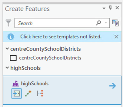
As a minimum, you should use the editing tools (Edit – Create, Figure 7.12) to add a school to the highSchools layer and create a map of the new school and what the new school's associated district would be. You should insert this map, together with a description of how you arrived at it, into your Project 7 write-up. Note that school districts are always made up of a contiguous collection of townships and/or boroughs, and that the centreCountyCivilDivisions layer shows these.
Deliverable
Insert into your Project 7 write-up a map and other details of your proposal for a new high school and associated district. Include an estimate of the number of school-aged children in each zone, arguments for and against the particular location, and a map showing the new district boundaries you are proposing, possible problems with your analysis, maps, and explanations of any analysis carried out to support your decision-making. You should also calculate the road travel cost-weighted distance allocation zone associated with each school and show your results in a map (or maps).