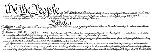
A thematic map is a graphic display that shows the geographic distribution of a particular attribute, or relationships among a few selected attributes. Some of the richest sources of attribute data are national censuses. In the United States, a periodic count of the entire population is required by the U.S. Constitution. Article 1, Section 2, ratified in 1787, states that Representatives and direct taxes shall be apportioned among the several states which may be included within this union, according to their respective numbers ... The actual Enumeration shall be made [every] ten years, in such manner as [the Congress] shall by law direct." The U.S. Census Bureau is the government agency charged with carrying out the decennial census.
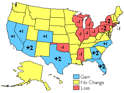
The results of the U.S. decennial census determine states' portions of the 435 total seats in the U.S. House of Representatives. The map below shows states that lost and gained seats as a result of the reapportionment that followed the 2000 census. Congressional voting district boundaries must be redrawn within the states that gained and lost seats, a process called redistricting. Constitutional rules and legal precedents require that voting districts contain equal populations (within about 1 percent). In addition, districts must be drawn so as to provide equal opportunities for representation of racial and ethnic groups that have been discriminated against in the past.
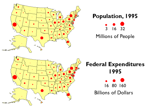
Besides reapportionment and redistricting, U.S. census counts also affect the flow of billions of dollars of federal expenditures, including contracts and federal aid, to states and municipalities. In 1995, for example, some $70 billion of Medicaid funds were distributed according to a formula that compared state and national per capita income. $18 billion worth of highway planning and construction funds were allotted to states according to their shares of urban and rural population. And $6 billion of Aid to Families with Dependent Children was distributed to help children of poor families do better in school. The two thematic maps below (Figure 3.3.3) illustrate the strong relationship between population counts and the distribution of federal tax dollars.
The Census Bureau's mandate is to provide the population data needed to support governmental operations including reapportionment, redistricting, and allocation of federal expenditures. Its mission, to be "the preeminent collector and provider of timely, relevant, and quality data about the people and economy of the United States," is broader, however. To fulfill this mission, the Census Bureau needs to count more than just numbers of people, and it does.