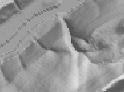
You can see individual pixels in the zoomed image of a 7.5-minute DEM below. I used dlgv32 Pro's "Gradient Shader" to produce the image. Each pixel represents one elevation point. The pixels are shaded through 256 levels of gray. Dark pixels represent low elevations, light pixels represent high ones.

It's also possible to assign gray values to pixels in ways that make it appear that the DEM is illuminated from above. The image below, which shows the same portion of the Bushkill DEM as the image above, illustrates the effect, which is called terrain shading, hill shading, or shaded relief.
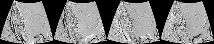
The appearance of a shaded terrain image depends on several parameters, including vertical exaggeration. Compare the four terrain images of North America shown below, in which elevations are exaggerated 5 times, 10 times, 20 times, and 40 times respectively.
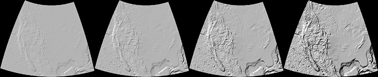
Another influential parameter is the angle of illumination. Compare terrain images that have been illuminated from the northeast, southeast, southwest, and northwest. Does the terrain appear to be inverted in one or more of the images? To minimize the possibility of terrain inversion, it is conventional to illuminate terrain from the northwest.